Chapter III: Investigation
Table of Contents
- Chapter III: Investigation
- Investigation
Investigation
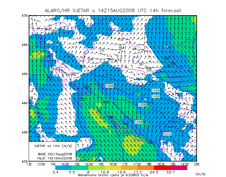
From the analysis and model data presented it can be assumed that the passage of a convective cloud had something to do with meteotsunami development. Since the meteotsunami, as mentioned in the introduction is caused by the traveling small-scale atmospheric disturbance it is clear that the general synoptic situation could not be the cause of the wave development. There must be a mechanism producing a small scale pressure or wind disturbance that can then, assuming that it propagates with the right speed and towards a bay or an inlet, cause meteotsunami development. The mechanism of development may have something to do with the convective cloud aloft, since the strong vertical motion necessary have pressure change in the lower levels as consequence. If we assume that the pressure (or wind) disturbance has formed due to the processes within the convective system, we still need an information about the speed of the system and it's direction. For the case of Mali Lošinj meteotsunami this has been derived using the nowcasting tools based on satellite data.
In the image below IR satellite image overlayed with atmospheric motion vectors is shown.
The southern part of the system was moving towards the island Lošinj. As the speed is not clearly readable from that image, here is the image with velocities in which the speed is more clearly seen:
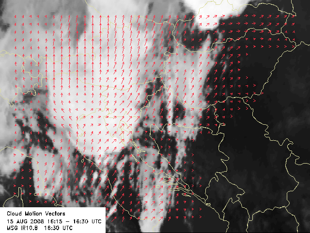
In the time preceding the inundation of the harbor, the velocity of the system moving towards the island Lošinj was between 20 and 25 m/s.