Transverse cloud bands
Transverse cloud bands are often seen as substructures in high level cirrus cloud bands accompanying the subtropical jet stream. These fiber-like cloud bands are oriented perpendicular to the subtropical jet axis and consist of thin ice clouds. While the transverse cloud bands typically show lengths of dozens to hundreds of kilometers, the main cirrus cloud band can be 2000 km long or more (figures 1 and 2). The typical orientation of the subtropical jet cloud band is southwest to northeast. Similar to the polar front jet streak, the subtropical jet streak is also accompanied by a black stripe in WV imagery. In contrast to the polar front jet, the subtropical jet stream is restricted to temperature and WV gradients in the upper troposphere.
a) 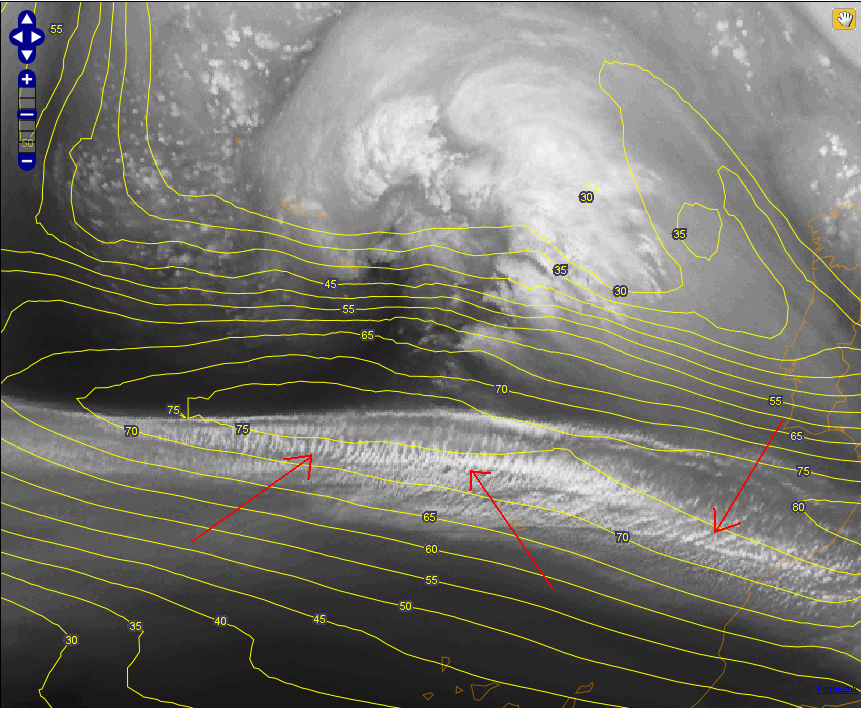 |
b) 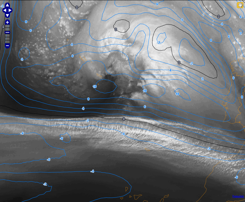 |
Figure 1a and 1b: Transverse cloud bands (red arrow) within a cirrus cloud band over the Atlantic in WV 6.2 µm imagery. Left image with isotachs at 300 hPa, right image with shear vorticity at the same level.
In satellite images, these transverse cloud bands have a similar appearance to lee waves at the lee of mountain ranges, but while the first can be detected in the WV channels, the latter usually cannot be seen in WV images as they are located in lower tropospheric regions.
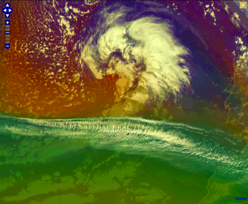
Figure 2: Same region as in figure 1 but in Air Mass RGB
The SEVIRI Air Mass RGB differentiates between cold and warm air masses. The green component shows the difference between MSG channels 9.7 and 10.8 microns. Channel 9.7 is responsive to ozone concentration in the lower stratosphere. In a warm air mass the tropopause is higher than in a cold air mass, and consequently the ozone concentration in the upper troposphere is smaller. This results in a more greenish colour than in a cold air mass, which appears in blue. In this image from 2 April 2013 at 06:00 UTC, there is a sharp boundary between warm and cold air masses. The jet core is running nicely along the border between the warm green and the cold reddish-bluish air masses. The reddish area north of the jet marks a dry zone with descending stratospheric air at the rear side of a cold front. For more information on the Air Mass RGB see chapter 9.