Chapter VI: Summary
Table of Contents
- Suggested procedure for nowcasting icing
- Exercise
Chapter VI
Suggested procedure for nowcasting icing
Icing as such can observed only by flying through an icing cloud. A forecaster on duty can suspect icing in stratiform clouds indirectly by checking the following points:
Satellite images
- Are there icing clouds in automated interpretation products (ICLD etc.)?
- Are there stratiform cold water clouds in Meteosat 24hMicrophysics (yellow and/or greenish) and HRVFog (whitish pink) combinations?
- Are there stratiform cold water clouds in AVHRR images (light yellow in 124-VIS-combination, light red in 345-IR-combination)?
Soundings
- Are there 100 % humid layers with temperatures between 0…-15°C in nearby soundings?
If the answer is yes to any of the above questions, icing is possible.
Radar
- Are there strong echoes in CAPPI radar images among weaker ones in stratiform clouds?
- Are the strong echoes on the same height as the humid layer in soundings?
- Is the area of strong echoes classified as wet snow in hydrometeor classification etc. product?
If the answer is yes to all of the above questions, icing is likely.
The strength of the icing is not straightforward, because what big jets feel as light icing, may be severe icing for small aircrafts. Therefore, the nowcasted/forecasted icing class is only suggestive. Some hints, however, can be reduced from the observations:
- in 24hMicrophysical the yellow clouds are thicker and consist or bigger water drops, indicating stronger icing, whereas greenish clouds with smaller water drops indicate lighter icing
- with regard to soundings, the temperature range 0...-12 °C is favourable for strongest icing
Exercise
In this exercise your task is to find possible icing conditions in a part of Northern Europe on the 7th of January 2011 around 00 UTC. The exercise contains four parts: knowledge of cloud phases, soundings, satellite images and radar images.
The synoptical situation on the 7th January 2011 at 00 UTC is such that a warm occlusion reaching from Northern Sweden through Western Finland to the Baltic Countries is moving slowly northwards:
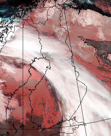
Fig. 6.1. AVHRR 345-combination on 7th January 2011 at 00.31 UTC.
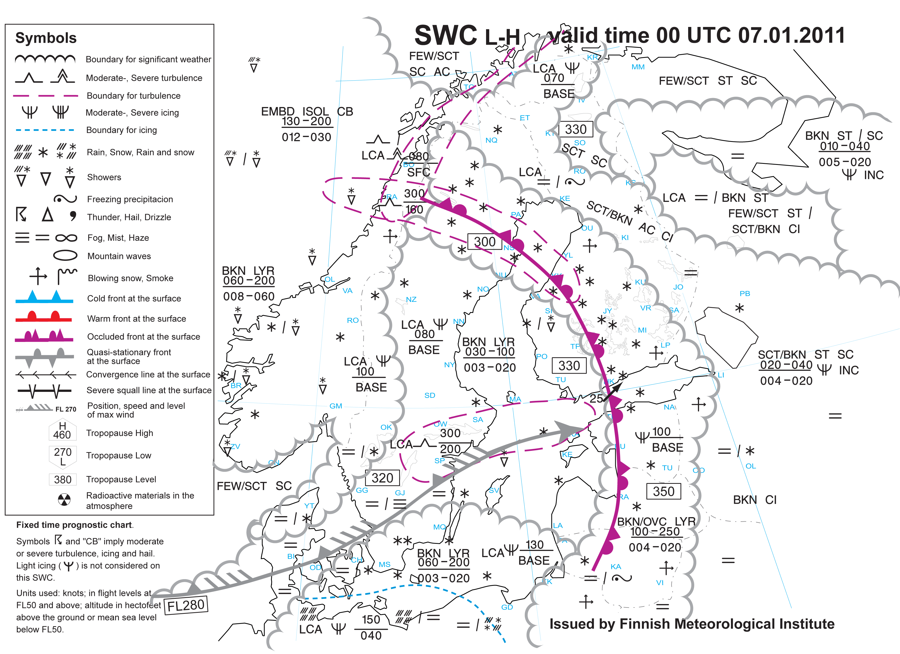
Fig. 6.2. Significant weather chart 7th January 2011 for 00 UTC.
1. Knowledge of the cloud phases
In this exercise you define different types of clouds by sorting them according to the temperature and dew point depression.
2. Soundings
In this exercise you will examine the cloudiness in five places. From the IR image in fig. 6.3. you can roughly see the height of the clouds, but the soundings reveal the cloudiness in more detail. The locations of the soundings are marked with a red cicrle. When you click over a circle, the corresponding sounding appears.
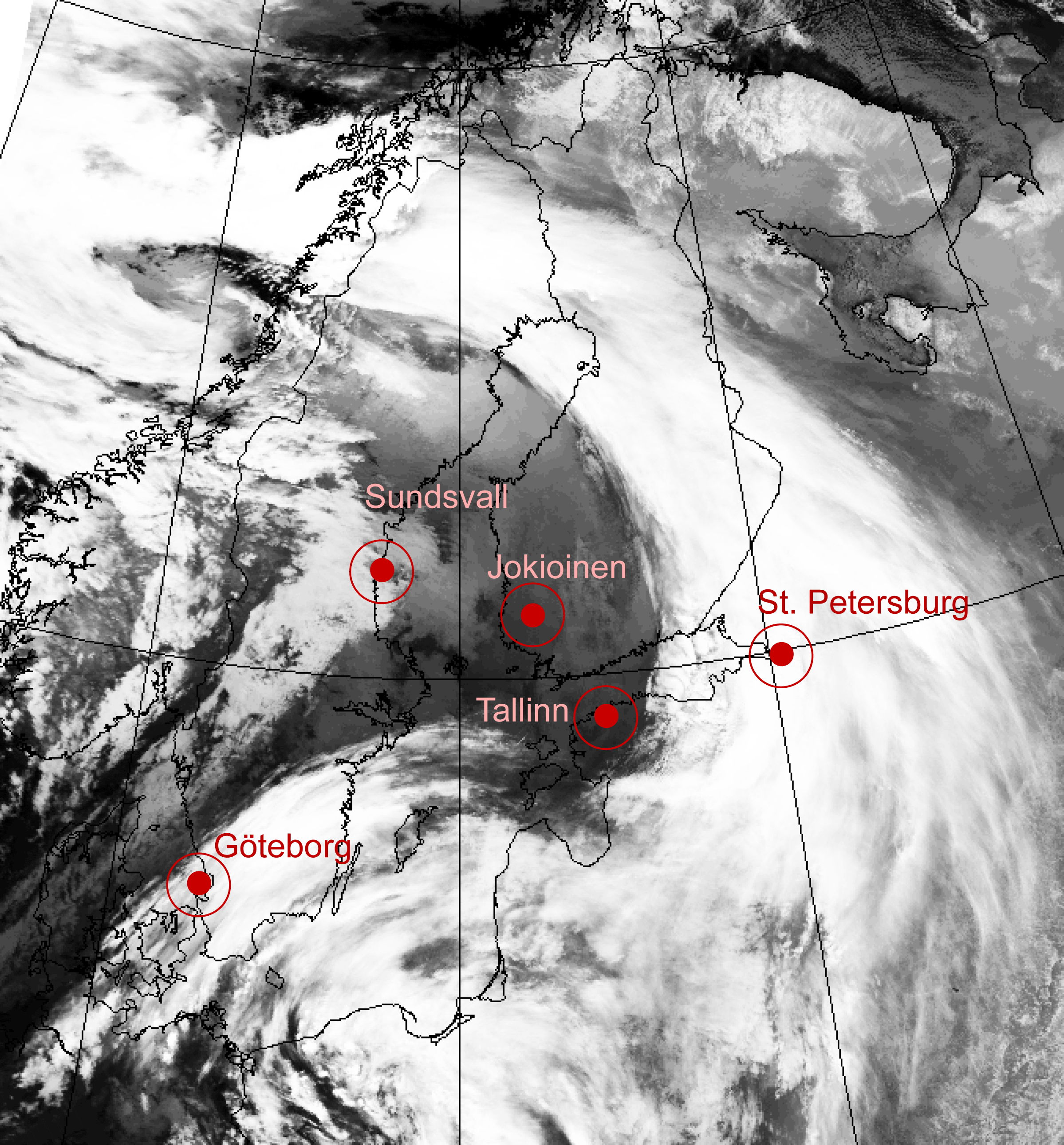
Fig. 6.3. Sounding locations. Click on the location to see the radiosounding.
Fill in the following tables with the help of the data revealed from the soundings. Generally, the classification of clouds according to their height depends on the latitude, clouds generally forming at lower levels in high latitudes than lower ones, but in this case a rule of thumb would be as follows:
- low clouds: ground 850 hPa
- middle clouds: 850 600 hPa
- high clouds: higher than 600 hPa
Determine the heights of the clouds in hPa's; if there are non, choose 'no cloud' in the drop-down box. When you have finished a sounding, click the 'Check' button on the right-hand side:
Now look at the temperatures of the clouds found in the previous task and observe the following table:
Look at the temperatures of the clouds and try to figure types of clouds that are present on each location:
Now, check out the third table saying in which locations icing is probable, and what are the cloud base and top heights (in hPa) and their temperatures (in Celsius degrees):
3. Satellite images
In the following image you can observe clouds with different water phases. Select the correct answers.
4. Radar images
In this image, which is a combination of several radars, you see the CAPPI echoes and the locations of the Ikaalinen and Anjalankoski radars. After that, there are CAPPI and HCLASS images from both radars. With this information, you should choose the areas where supercooled water might be present.
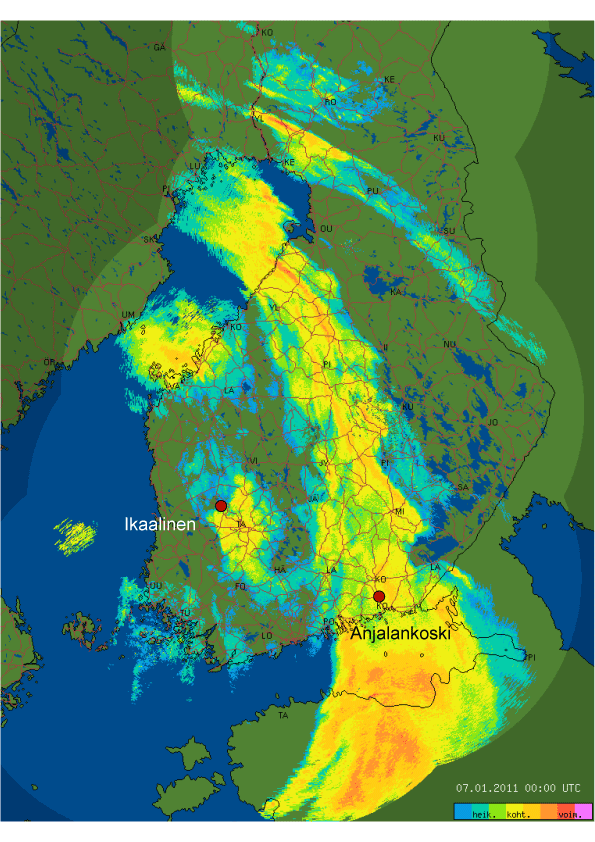
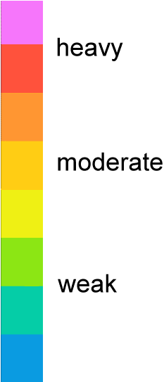
Fig.6.7. Combination image of Finnish radars 7th Jan. 2011 00.00 UTC, with color scale
Now, select the SuperCooled Rain Drop mark (SCRD) over those areas where you would expect supercooled rain drops.