Weather Events
| Parameter | Description |
| Precipitation |
|
| Temperature |
|
| Wind (incl. gusts) |
|
| Other relevant information |
|
|
|
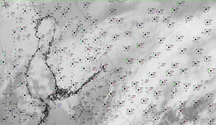
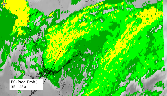
27 October 2019, 12UTC: IR + synoptic measurements (above) + probability of moderate rain (Precipitting clouds PC - NWCSAF)
Note: for a larger SYNOP image click this link.
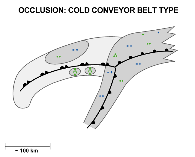
The synoptic measurements correspond very well to the schematic representing the ideal situation. Many stations report precipitation, but the higher intensity can be found more in the CF-WF area than in the occlusion spiral. Showery precipitation and Cb reports are associated with the ccb spiral closest to the CF-WF boundary and less intensive rain is associated with the southwestern part of the occlusion spiral. This corresponds to the values of PC (probability of moderate precipitation) which are low but have higher values in this area
|
|
|
|
27 October 2019, 12 UTC
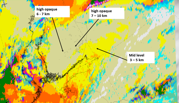
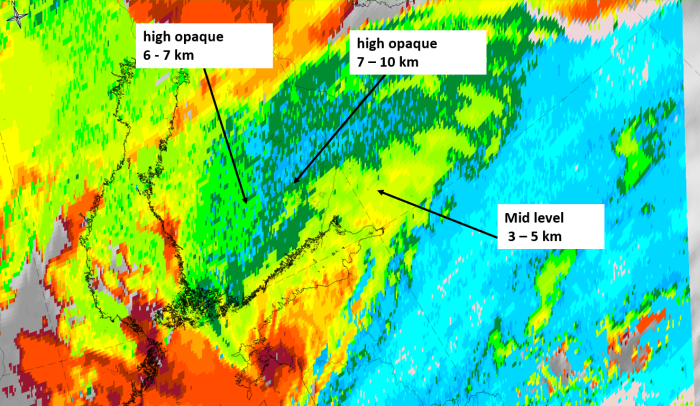
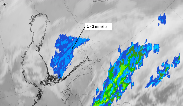
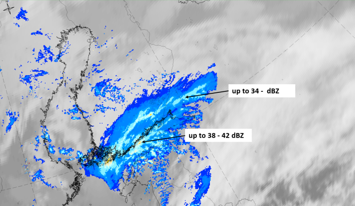
1st row: Cloud Type (CT NWCSAF) (above) + Cloud Top Height (CTTH - NWCSAF) (below); 2nd row: Convective Rainfall Rate (CRR NWCSAF) (above) + Radar intensities from Opera radar system (below).
For identifying values for Cloud type (CT), Cloud type height (CTTH), precipitating clouds (PC), and Opera radar for any pixel in the images look into the legends. (link).