Key Parameters
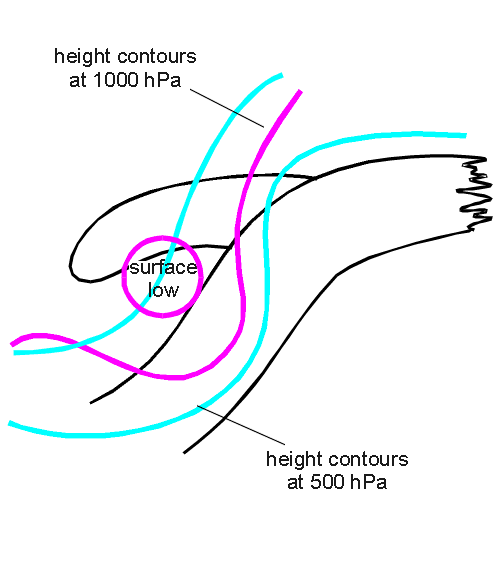
- Absolute topography at 500 and 1000 hPa:
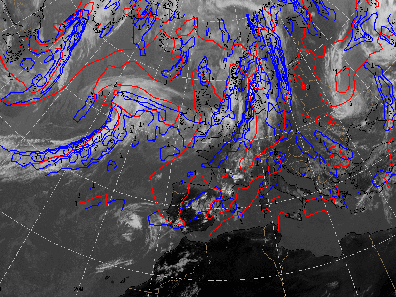
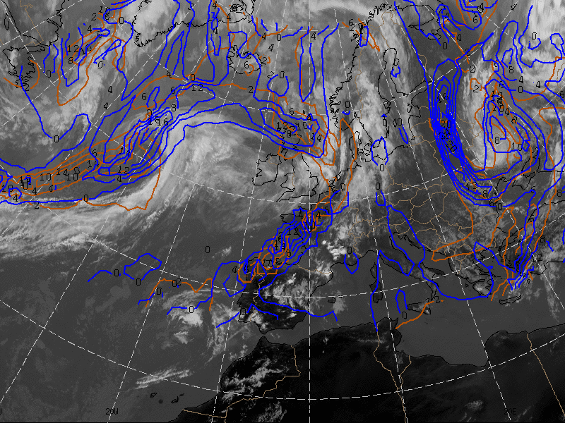
The absolute topography at 1000 hPa is characterized by a low in the height field in the centre of the cloud spiral. At 500 hPa in the initial stages an upper level trough exists, which develops into an upper level low during a later stage of development. This is a main difference from the Warm Conveyor Belt Occlusion type where a closed cyclonic circulation already exists very early on (see Occlusion: Warm Conveyor Belt Type ). Consequently the Cold Conveyor Belt Type often changes to a Warm Conveyor Belt Type later on. - Equivalent thickness:
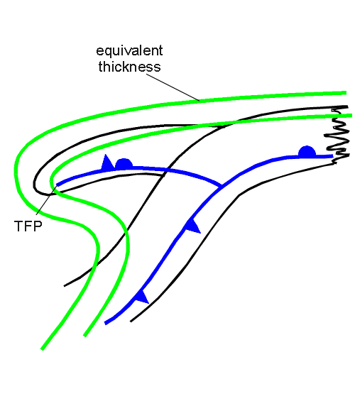
A prominent feature is the ridge of the equivalent thickness which is the consequence of the lifted warm air. In the case of well developed deep lows even a spiral structure of the ridge can be observed. But there are also situations which deviate from the distinct ridge structure. Well developed forms of Warm Front Occlusions and Cold Front Occlusions may lead to a more pronounced thickness gradient in the area of the Occlusion. This can be observed much better in the vertical cross section (see Typical appearance in vertical cross section). - Thermal front parameter (TFP):
The thermal front parameter mostly can be found close to the rear area of the cloud spiral. But the very existence of a front parameter depends on the existence of a pronounced temperature gradient. - Temperature advection:
The whole cloudiness of the Occlusion is under the influence of warm advection. The warm advection maximum can be found in the centre of the cloud spiral, mostly close to the point of the Occlusion. The zero line of the temperature advection follows the rearward edge of the Occlusion cloud spiral - Zero line of the shear vorticity at 300 hPa:
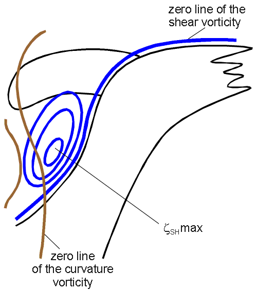
The zero line of the shear vorticity, which also indicates the jet axis, crosses the cloud spiral at the point of the Occlusion. - Isotachs at 300 hPa:
The jet axis crosses the frontal cloud band in the area of the point of the Occlusion as described above. If a well developed jet streak exists, the cold conveyor belt cloud spiral is situated within the area of the left exit region of this jet streak; consequently in the satellite image cellular structured colder cloud tops can be observed (see Cloud structure in satellite image). - Vorticity advection at 500 hPa and 300 hPa:
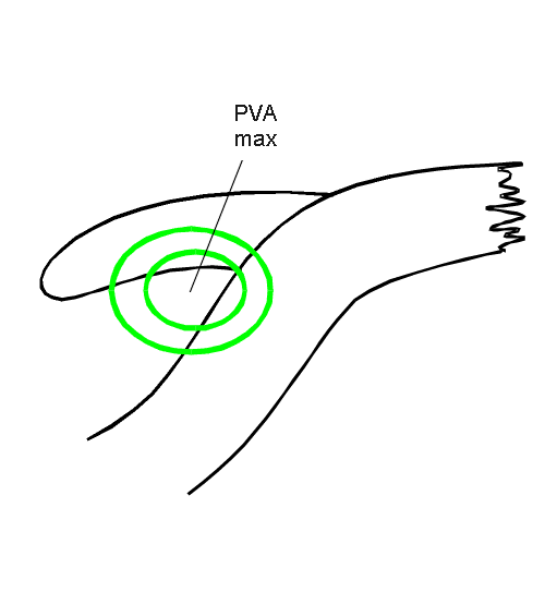
The cloud spiral of the occlusion is in general superimposed by PVA in the mid-levels and upper levels of the troposphere. As upper level troughs are involved, PVA is caused by both curvature and shear. But as described above the zero line of shear vorticity crosses the cloud spiral. The PVA maximum is very often situated within the left exit region of a jet streak (see Meteorological physical background and Weather events). There is a difference from the Warm Conveyor Belt Type of Occlusion, where curvature vorticity plays the dominant role (see Occlusion: Warm Conveyor Belt Type ).
In this case (21 June 2005) most of the numerical model fields fit quite well to the satellite image.
|
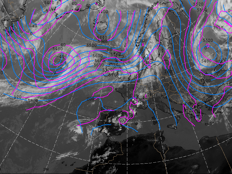
21 June 2005/12.00 UTC - Meteosat 8 IR 10.8 image; magenta: height contours 1000 hPa, cyan: height contours 500 hPa
|
|
|
|
|
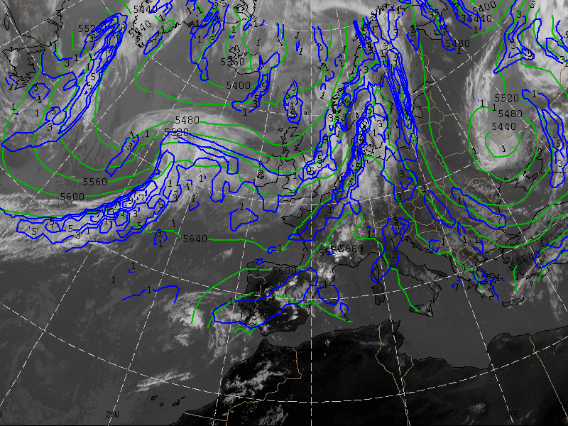
21 June 2005/12.00 UTC - Meteosat 8 IR 10.8 image; blue: thermal front parameter 500/850 hPa, green: equivalent thickness 500/1000 hPa
|
|
|
|
|
21 June 2005/12.00 UTC - Meteosat 8 IR 10.8 image; blue: thermal front parameter 500/850 hPa, red: warm advection 500/1000 hPa
|
|

|
|
|
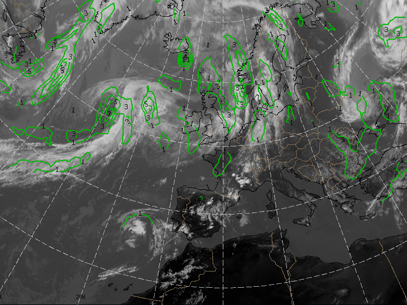
21 June 2005/12.00 UTC - Meteosat 8 IR 10.8 image; green: positive vorticity advection (PVA) 500 hPa
|
|
|
|
|
21 June 2005/12.00 UTC - Meteosat 8 IR 10.8 image; yellow: isotachs 300 hPa, black: zero line of shear vorticity 300 hPa, red: positive vorticity advection (PVA) 300 hPa
|
|

|

|
|
21 June 2005/12.00 UTC - Meteosat 8 IR 10.8 image; blue: shear vorticity 300 hPa, brown: curvature vorticity 300 hPa
|
|
|
|