Diagnosis of precipitation patterns with help of relative streams and NORDRAD radar
|
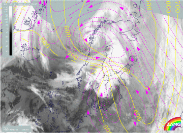
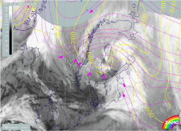
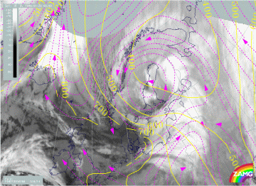
29 January 1998/18.00 UTC - Meteosat IR image; magenta: relative streams 282K - system velocity 332° 15 m/s, yellow: isobars
|
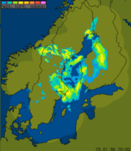
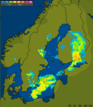
29 January 1998/18.00 UTC - Nordic radar network (NORDRAD) image; blue to magenta: light and heavy precipitation
|
Relative streams do not show very classical frontal situations for 18.00 UTC on 29 January (left image). The apparent warm conveyor belt over the Baltic Sea, south Sweden and south Finland contains a very intensive rising branch witin the cloud shield and Lee Cloudiness. The resulting precipitation can be noticed over east Sweden. The relative stream from behind the front shows sinking motion over cold air cloudiness (this area is not fully covered by the radar network), but rising motion over the Cold Front up to the higher cloudiness over central and northern parts of Finland. The precipitating areas in central parts of Sweden are connected to this rising relative air stream; note also the presence of intensive convective cells there associated with previously introduced PVA maxima at 500 and 300 hPa (compare PVA and Jet streak diagnosis). The precipitation over central parts of Finland also fits nicely with the maximum of warm advection and PVA maxima at 500 hPa.
|
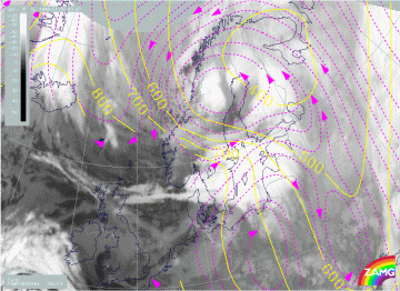
30 January 1998/00.00 UTC - Meteosat IR image; magenta: relative streams 284K - system velocity 325° 13 m/s, yellow: isobars
|
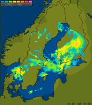
30 January 1998/00.00 UTC - Nordic radar network (NORDRAD) image; blue to magenta: light and heavy precipitation
|
The 00.00 UTC image for 30 January (right image) shows the intesification of snowfall over Finland. Moderate to heavy precipitation associated with the Occlusion is quite extensive in southern and central parts of Finland. Images with better resolution (not shown here) show clearly some precipitation bands oriented along the Occlusion front (south-west - north-east) with locally heavy snowfall. A typical form of Occlusion spiral is beginning to be visible also on radar images over the Bay of Bothnia.
Relative streamlines (left image) also show clearly the rising motion over south and central Finland fitting well with the radar image. Sinking motion takes place over Norway, which explains the gradual dissolution of the EC (Comma) cloudiness over north Sweden.
|
30 January 1998/06.00 UTC - Nordic radar network (NORDRAD) image; blue to magenta: light and heavy precipitation
|
|
The 06.00 UTC image for 30 January shows the intensive area of precipitation over south-east Finland, whereas in west Finland there is almost no snowfall for the time being. The snowfall in east Finland is associated with a rising branch of the relative stream at lower levels (below, left image bottom) representing the cold conveyor belt. The relative stream suggests that intensive rising motion would be present over west Finland (around 63N/24E). This vertical motion cannot be verified with radar.
|
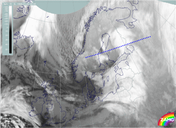
30 January 1998/06.00 UTC - Meteosat IR image; position of vertical cross section indicated
|
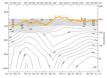
30 January 1998/06.00 UTC - Vertical cross section; black: isentropes (ThetaE), orange thin: IR pixel values, orange thick: WV pixel
values
|
|
30 January 1998/06.00 UTC - Meteosat IR image; magenta: relative streams 274K - system velocity 318° 14 m/s, yellow: isobars
|
30 January 1998/06.00 UTC - Meteosat IR image; magenta: relative streams 288K - system velocity 318° 14 m/s, yellow: isobars
|
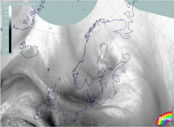
On higher isentropic surfaces (right image bottom) the classical frontal situation can be noticed: a Warm Conveyor Belt is over Poland, the Baltic States and White Russia. It is strongly rising there and connected with the high cloud shield. The relative stream connected with the dry intrusion from the north-west is also clearly seen. Since this relative stream transports very dry air from the north-west (compare image below), the slight rising of the air is not capable of causing any precipitation at the rear of the front over south and west Finland.
|
30 January 1998/06.00 UTC - Meteosat WV image
|
|
The EC/Comma cloudiness is located over east Sweden and there are still some snow showers associated with it. On Quark between Sweden and Finland the first sign of new convective development is seen as a narrow and south-west - north-east oriented line of precipitation.
