Synoptic Situation
A loop of false-coloured Meteosat 9 IR10.8 data shows the approaching cold front, moving over western and central Europe to the Alps, where pre-frontal convection developed. The flow over Slovenia was south-westerly. The reasons for the extreme precipitation in very short time were the following:
- continuous flow of moist air from SW,
- strong instability and
- wind shear in the lower atmosphere.
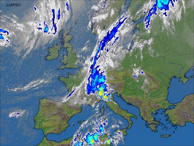
18 September 2007; 00 UTC
|
|
The movement of the system and the development of the convective cells can be seen in the relevant radar images.
The vertical structure of the atmosphere is illustrated by the Udine temp at 00 UTC.
Basic synoptic parameters
IR images, Geopotential height and Relative Humidity at 700 hPaCloud configuration in satellite images combined with the fields of geopotential height and relative humidity at 700 hPa are shown here in 6-hourly sequence.
IR images and Geopotential height at 500 hPa
Situation in the upper levels is shown by 500 hPa height, temperature and wind in 6-hourly sequence.
Summary
Synoptic analysis showed that in this case the prefrontal convection was so strong and intense, that it caused the precipitation amount which was the highest ever measured in Slovenia, causing the flash floods in the affected areas. In the NWP fields there was no strong indication that the event will be so extreme, although the warnings for precipitation of more than 100 mm/day were issued one day in advance. In this respect the nowcasting tools and indications of severity of the case are of high importance.