Authors
Environmental Agency of the Republic of Slovenia (EARS)
Mateja Iršič Žibert
Janko Merše
DHMZ, Croatia
Introduction
This case-study presents the analysis of catastrophic flash floods in Slovenia that
occurred on 18 September 2007. Flooding caused five casualties and huge material damage, estimated to more than 150 milion Euro.
NWP models forecasted precipitation amounts of up to 100 mm/24h. That was the reason that the forecaster issued a warning for the precipitation rate of more that 100 mm/day, but the real values were much higher. Besides analysing synoptic and mesoscale conditions, that caused the extreme amount of precipitation, the objective of this study is also to show how nowcasting material can help a forecaster to issue additional warnings when a dangerous event becomes extreme.
Synoptic analysis shows that on the day of the catastrophy the area of low pressure was situated over the Northern Europe. A cold front was approaching the Alps and over Slovenia a series of prefrontal convective developments took place. In many regions in Slovenia precipitation values were extreme(>100 mm/day), with the maximum precipitation of 304 mm/24h officially measured in Kneške Ravne. Some of the private automatic stations measured even up to 485 mm/12h. The flooded areas over Slovenia are indicated in the image below and there are also some photos of the floodings and damage during and after the flash floods.
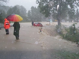 18 September 2007, Bohinj, Slovenia |
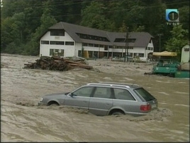 18 September 2007, Komenda, Slovenia |
 18 September 2007, Zelezniki, Slovenia |
The maximum
precipitation of 303 mm in 24 hours was measured in NE part of
Slovenia. The return periods for 24h precipitation rate were in many
places more than 200 years.
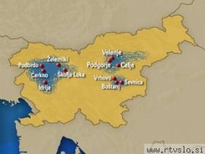 Damage areas over Slovenia,(c)RTVSLO |
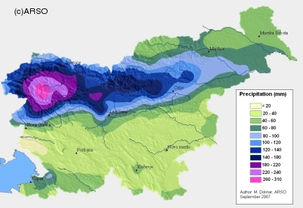 24h Precipitaion Rate (M. Dolinar) |
In the following chapters the process will be presented by means of satellite and radar images, nowcasting data and relevant parameter fields. The explanation of physical processes behind the development will be given.