Cloud Structure In Satellite Images
In the satellite image a synoptic scale cloud shield which lies in front of a cold front represent a Warm Front Shield, which comprises the area of the warm front and the warm sector.
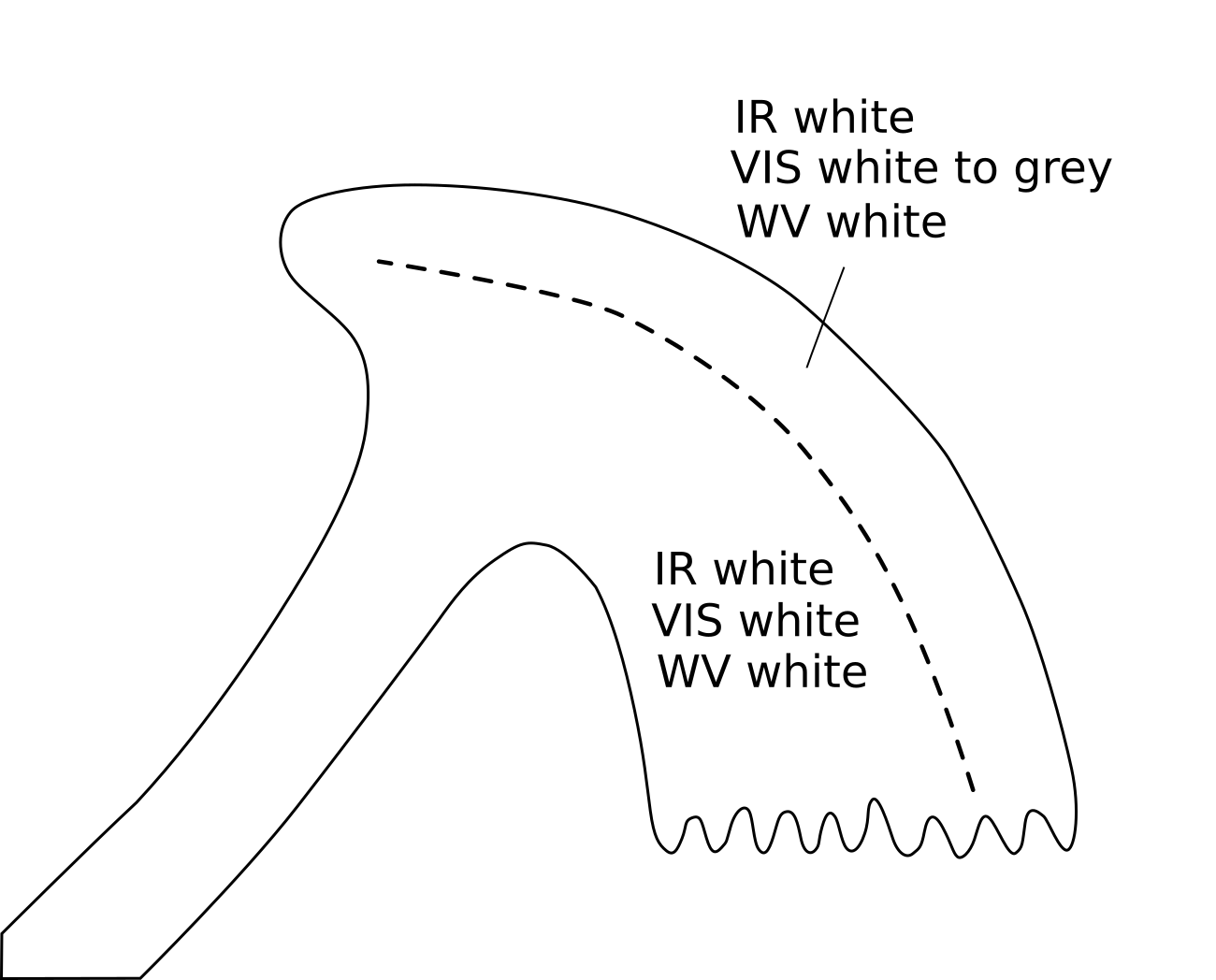
Appearance in the basic channels:
- In the VIS image the grey shades are generally white within the warm sector (in a well developed case) and near the surface warm front,while the grey shades become gradually more and more grey towards the forward cloud edge (see Warm Front Band).
- In the IR image the grey shades of the cloud shield are usually white, indicating cold cloud tops. However, very often they show substructures, which differ from case to case.
- The pixel values are high (bright) in the WV image within the area of the cloud shield.
- At the leading edge of the cloud shield the WV image shows that along the jet axis a sharp gradient from white to black exists, indicating dry air at the cyclonic jet side (see Warm Front Band).
In contrast to the warm front band (see Warm Front Band - Cloud structure in satellite image) the warm sector of the warm front shield is overcast with clouds within the ascending warm conveyor belt, which can (in a well developed case) extend through a substantially deep layer of the troposphere.
Appearance in the basic RGBs:
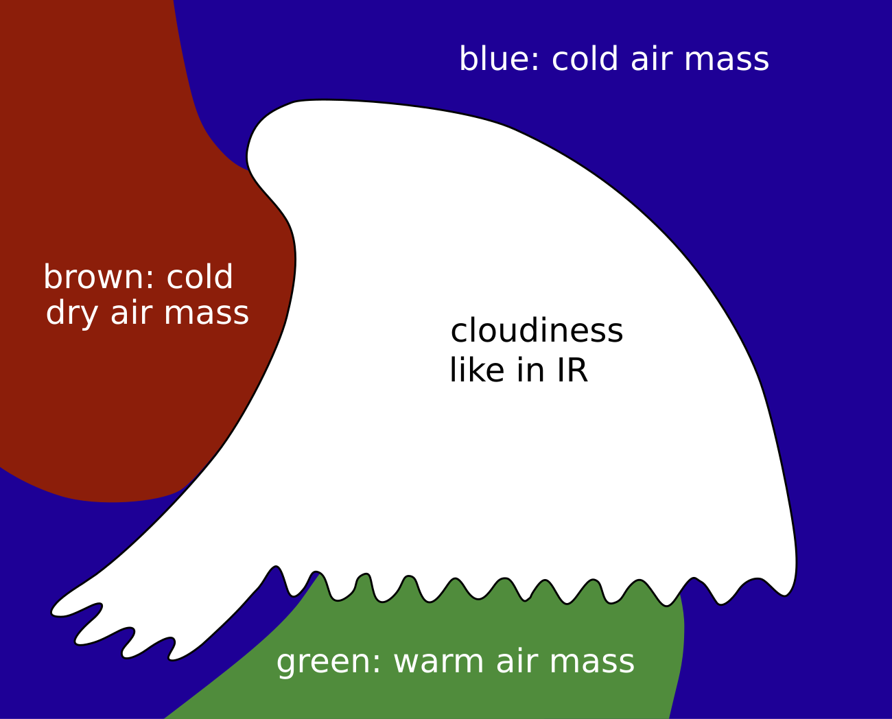
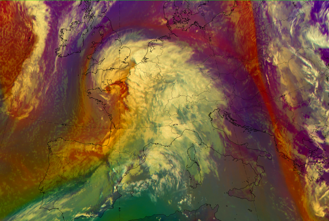
Airmass RGB
Usually, in front of the WF shield, dark blue colours indicate cold air masses. The warm front shield is part of the warm sector. to the S/SW of this cloud shield, the colours are usually greenish, representing warm air masses. Surrounding blue colours, partly even within the WF shield, belong to the colder airmass on which the warmer air is being uplifted. Another contributing factor is of high upper level humidity.
The clouds of the warm front shield are very similar to their appearance in the IR image.
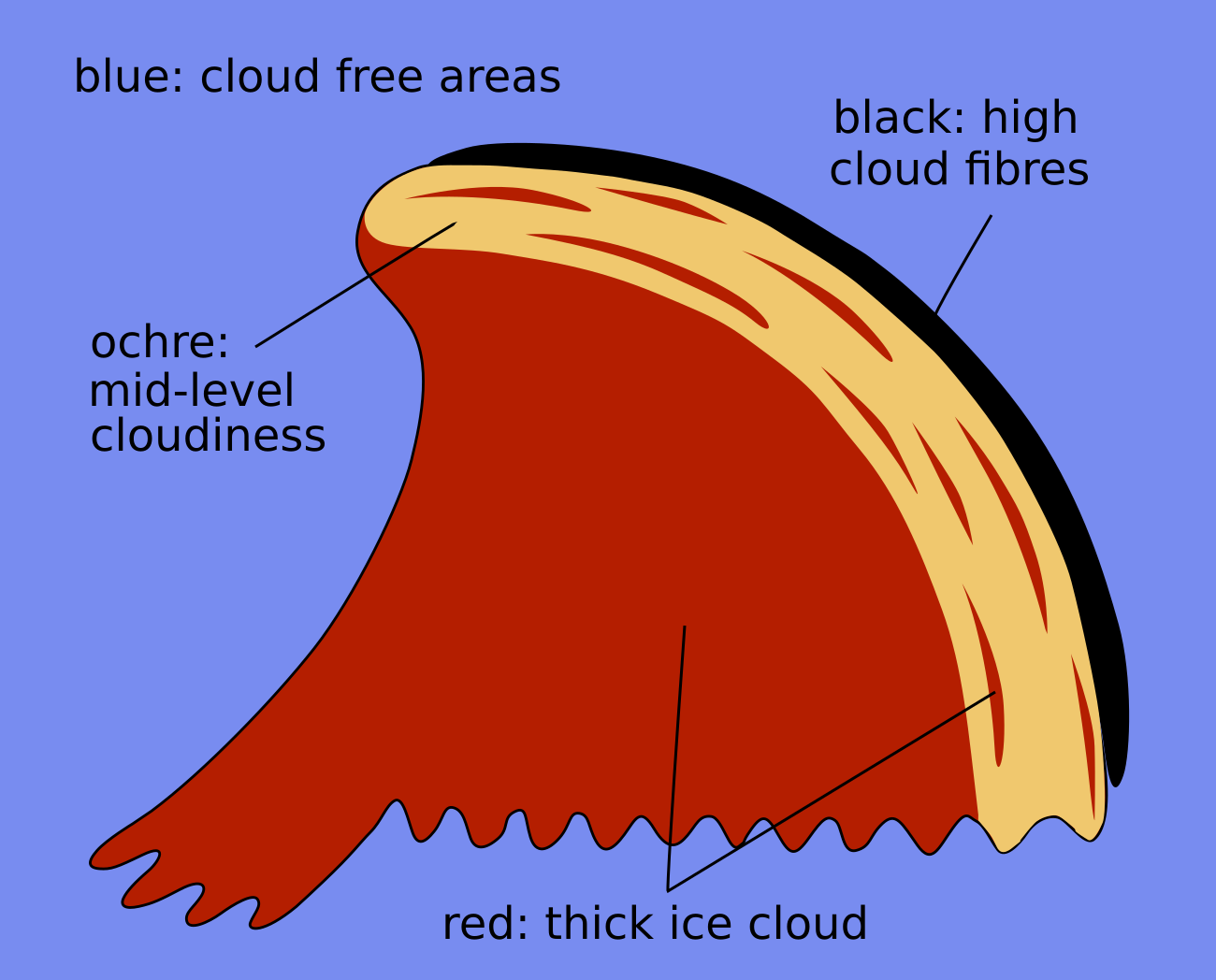
Dust RGB
Blue to pinkish-blue colours can be seen where there is cloud-free region of land or sea. However, they are usually other cloud patches and configurations existing in front of the cloud shield. They are typically lower, especially in winter time when fog and stratus fields exist. These cloud configurations appear in different shades of ochre.
The colours of the warm front shield are dependent on the thickness of the cloud layer. Thicker areas appear dark red, indicating thick ice cloud. Lower cloud layers appear in yellow to ochre. Quite often the leading edge of the warm front cloud band is accompanied by a black fibres which strech along the jet axis there.
 |
 |
Legend: Schematics for basic RGBs; Left: airmass RGB; right: dust RGB.
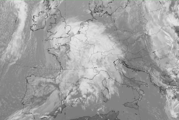
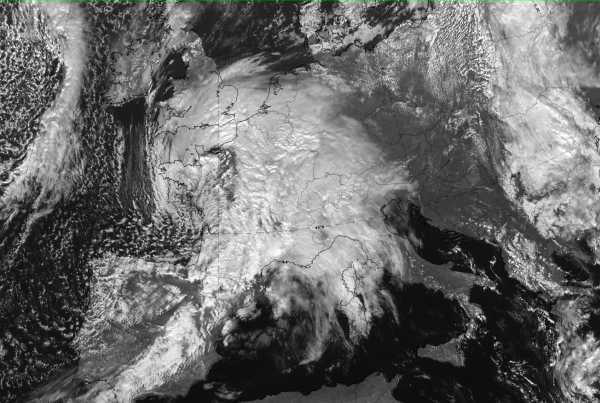
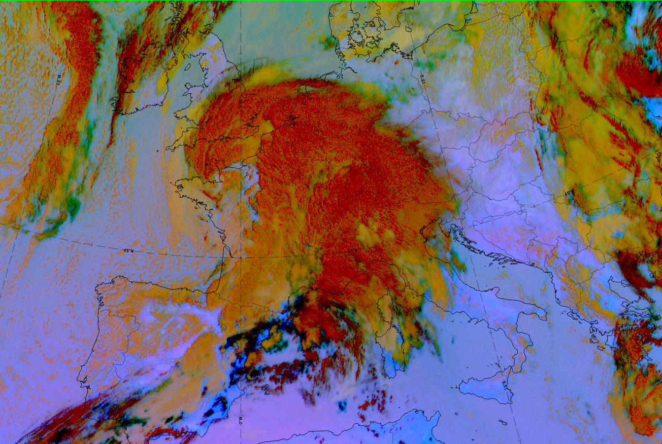
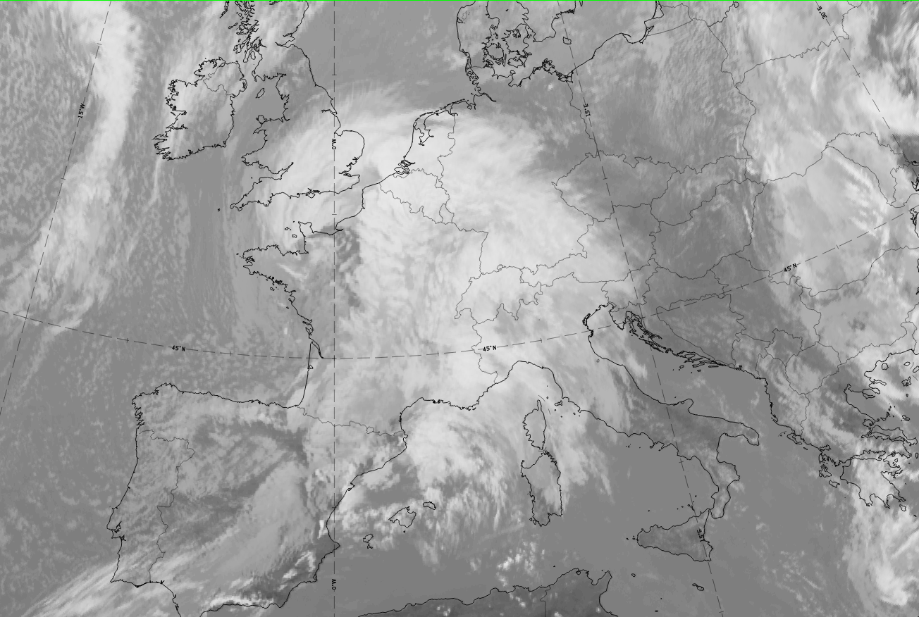
The case of 5 March 2020 at 12 UTC shows a CF extending from Spain to Belgium. The cloud mass of a WF shield can be seen to the east over Germany, Switzerland, Austria, Italy and South-France. Many of the typical structures and grey shades mentioned above can be detected.
|
|
|
|


Legend:5 March 2020 at 12UTC: 1st row: IR (above) + HRV (below); 2nd row: WV (above) + Airmass RGB (below); 3rd row: Dust RGB + image gallery.
*Note: click on the Dust RGB image to access image gallery (navigate using arrows on keyboard).
| IR | Bright and structured. |
| HRV | Bright and structured with darker grey shades on the leading edge, over Germany. |
| WV | Light grey area of high humidity with some structures from embedded clouds; a dark stripe exists east of the WF shield cloud. |
| Airmass RGB | The dark-blue colours represent a cold airmass which exists to the east of the WF shield cloud. At the same time, cloud-free areas both within and to the south of the WF shield are indicated with greenish colours, signifying warm air masses. |
| Dust RGB | Ochre colours are commonly found in the southern and south-western parts of the WF shield and represent the mid-level cloud; dark-red colours indicate the thick ice cloud which is located more to the eastern and north-eastern parts. |