Weather Events
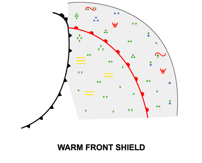
Warm Front Shields are associated with multi-layered cloud features, with abundant low and mid level clouds in the warm sector. Moderate to heavy precipitation can be found well ahead of the surface front, but after the passage of the front in the warm sector, slight to moderate precipitation is still possible.
| Parameter | Description |
| Precipitation |
|
| Temperature |
|
| Wind (incl. gusts) |
|
| Other relevant information |
|
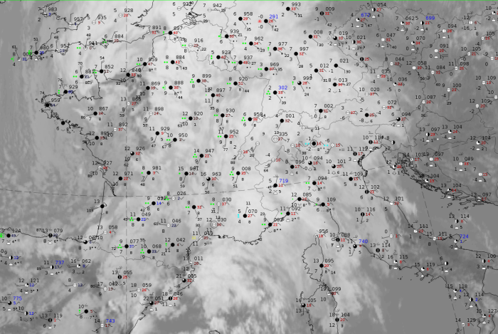
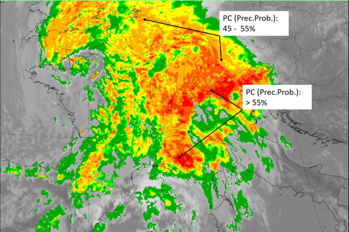
For a demonstration of the typically associated weather events, the case of 5 March 2020 at 12 UTC is used as a representative sample.
|
|
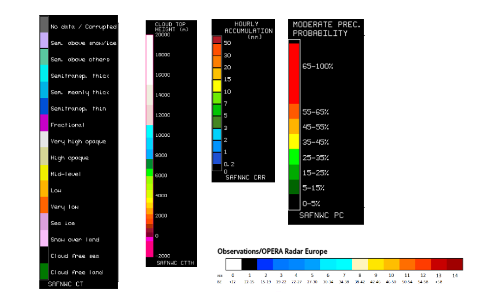
Legend:
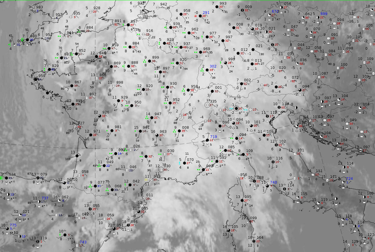
5 March 2020 at 12UTC: IR + synoptic measurements (above) + probability of moderate rain (Precipitting clouds PC - NWCSAF).
Note: for a larger SYNOP image click this link.
The biggest part of the WF shield over France and Western Germany shows wide-spread precipitation. To the east, over Eastern Germany and Austria there is no precipitation reported. In both the measurements and the precipitation probabilities from the NWCSAF, the enhancement of precipitation at the windward side of the Alps is obvious.
|
|
|
|
5 March 2020 at 12 UTC
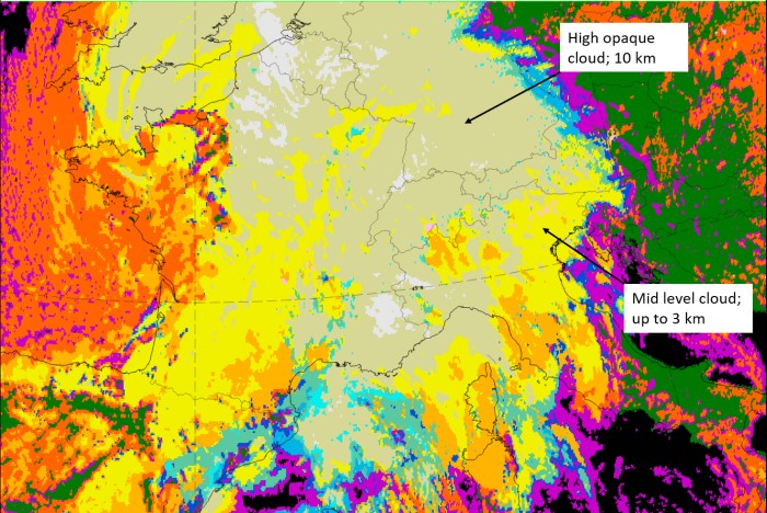
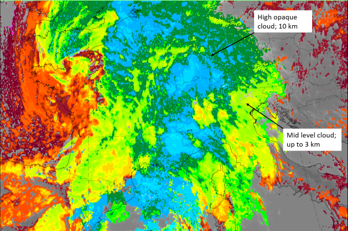
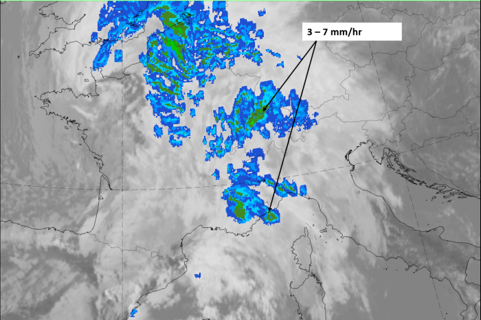
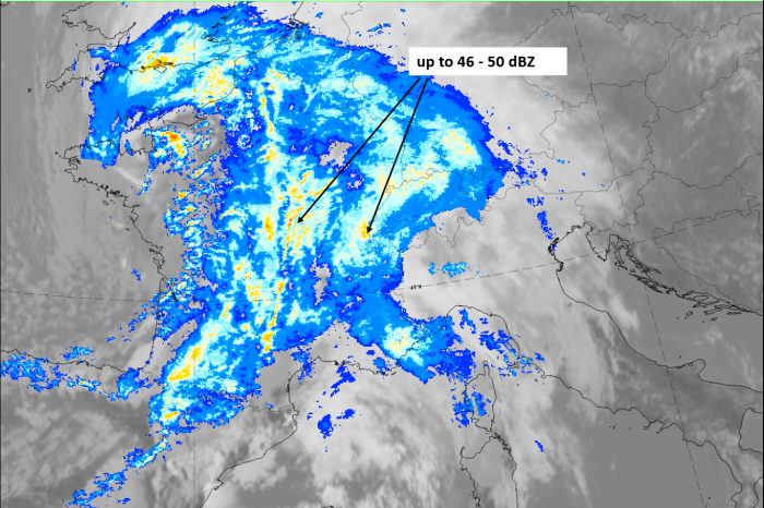
1st row: Cloud Type (CT NWCSAF) (above) + Cloud Top Height (CTTH - NWCSAF) (below); 2nd row: Convective Rainfall Rate (CRR NWCSAF) (above) + Radar intensities from Opera radar system (below).
For identifying values for Cloud type (CT), Cloud type height (CTTH), precipitating clouds (PC), and Opera radar for any pixel in the images look into the legends. (link).