Weather Events
This CM represents a meso-scale modification of the CM "Cold Front" or "Occlusion" during its passage over a mountain range. The most striking facts are the completely opposite weather events on the windward and on the lee side.
| Parameter | Description |
| Precipitation |
Windward side:
|
| Temperature |
Windward side:
|
| Wind |
Windward side:
|
| Cloud |
Windward side:
|
| Other relevant information |
|
|
27 January 2008/00.00 UTC - Meteosat 9 IR10.8 image; weather events (green: rain and showers, blue: drizzle, cyan: snow, red:
thunderstorm, yellow: fog, black: no precipitation)
|
|
|
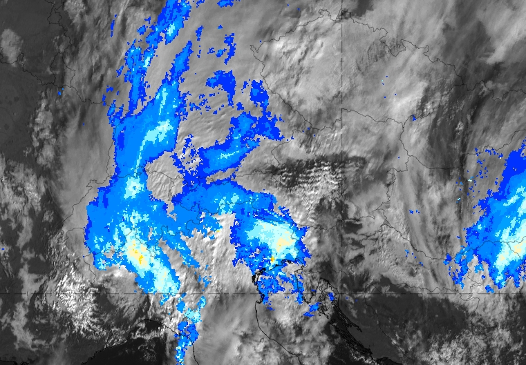
The Precipitating Clouds product (example from 07 November 2018, 12 UTC) can be used to indicate the potential for rain on the windward side of the mountain. Depending on different factors, this signal can be weaker or very strong. Intensifying factors include a very humid airmass, ascent from a low level with a low lifting condensation level and a high mountain barrier. Note: Not every foehn event is necessarily connected to precipitation on the windward side!
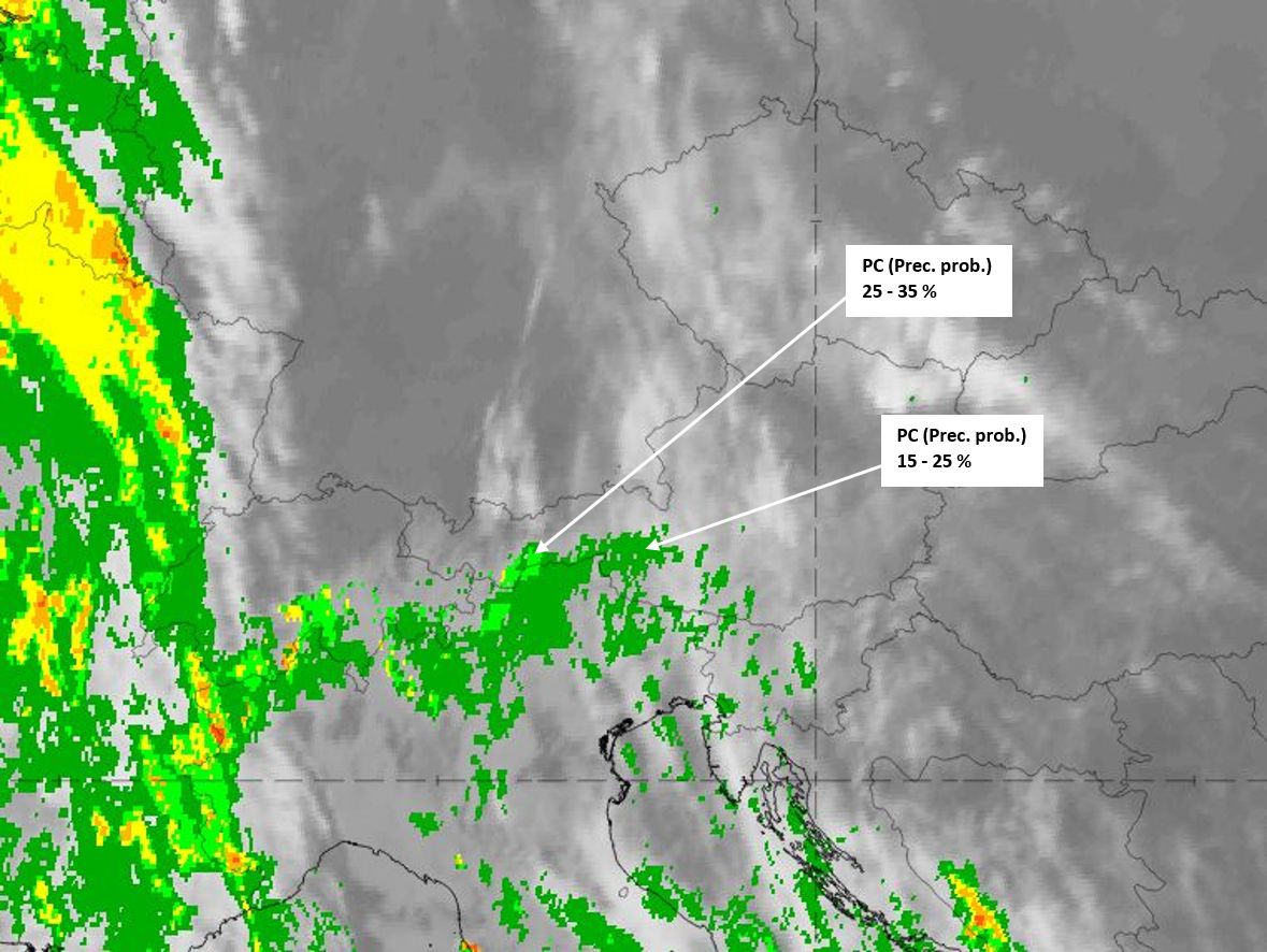
Precipitating Clouds product from 07 November 2018, 12 UTC. Air stream from the south.
The Cloud Type product reveals the division between low clouds on the windward side of the barrier (yellow to orange or red) and high (partly semitransparent) clouds on the lee side (blue shades). In some cases, there is a gap between the two cloud fields, due to the downward motion of the air (cloud-free area: green colour). More precise altitude information can be extracted from the Cloud Top Height product. The example shown is from 07 November 2018, 12 UTC.
|
|
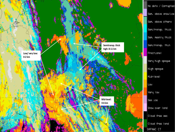
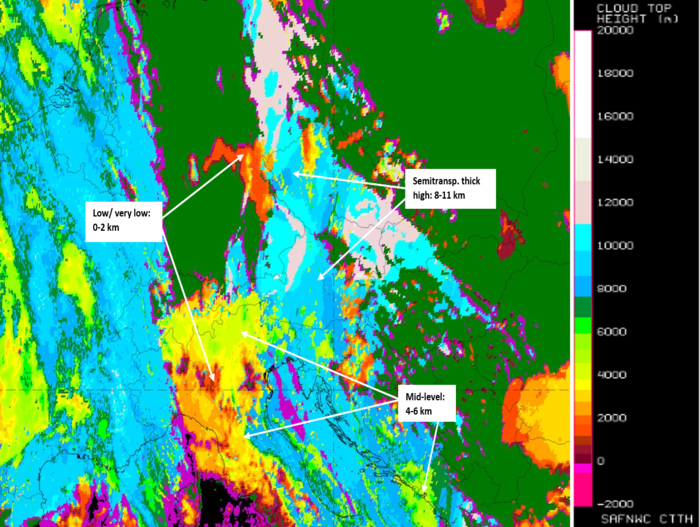
Cloud Type product (left) and Cloud Top Height product (right) from 07 November 2018, 12 UTC.
Not every case of (southerly) foehn wind causes precipitation on the windward side of the mountain barrier. The example below (from 08 November 2019, 09 UTC), however, shows not only the fragile wavy structure downstream (HRVIS image) but also a more intense backscatter signal from rain south of the Alps (windward side).
Opera Radar Image and MSG HRVIS (background) from 08 November 2019, 09 UTC.