Key Parameters
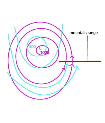
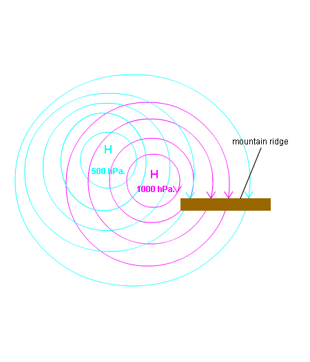
- Height contours at 1000 and 500 hPa:
Well developed low to the W to NW (in the case of south Foehn) of the mountain range; closed low at all layers and with vertical axis; - Equivalent thickness:
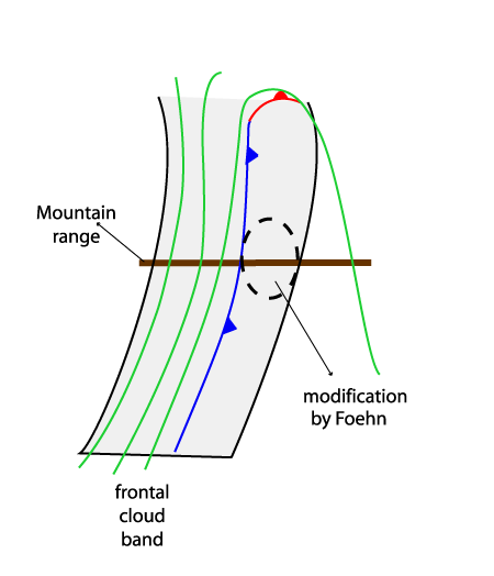
The corresponding frontal cloud band is associated with a zone of high gradient of thickness; as the mesoscale features linked to the Foehn process appear in the leading part of the frontal cloud, the modifications often appear already in the thickness ridge; - Thermal front parameter (TFP):
The corresponding frontal cloud band is accompanied by a TFP; the location of the TFP, in relation to the frontal cloud band, is dependent upon the synoptic situation; as the mesoscale features linked to Foehn appear in the leading part of the frontal cloud the modifications appear either within or in front of the TFP - Wind direction at 850 - 500 hPa:
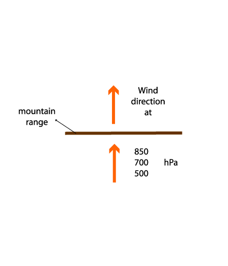
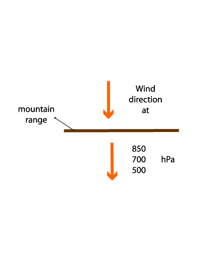
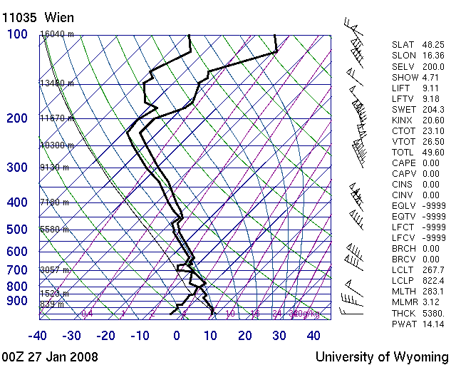
There is a strong stream over a thick layer perpendicular to the mountain chain; - Radio soundings: humidity + temperature:
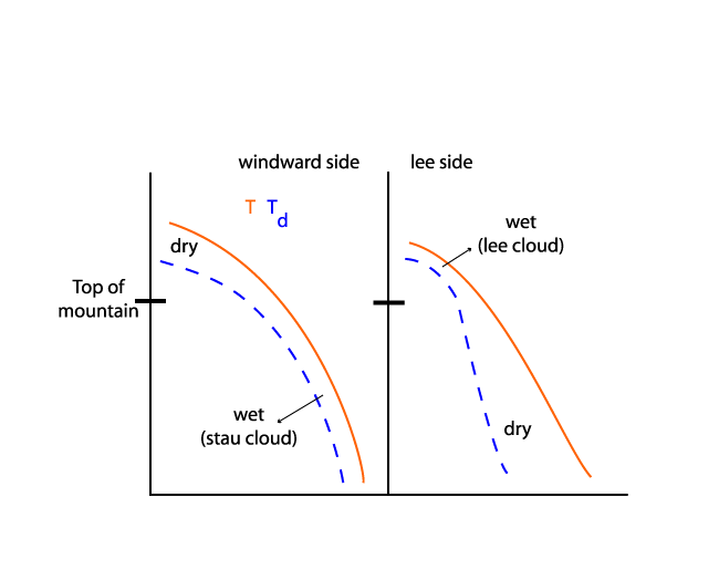
Radio soundings on the windward side show a thick wet layer reaching nearly up to the tops of the mountains; to the lee side of the mountain chain they show a dry layer from the surface up to middle levels and a wet layer in middle to high layers; the latter represents the high Lee Cloud.
South Foehn
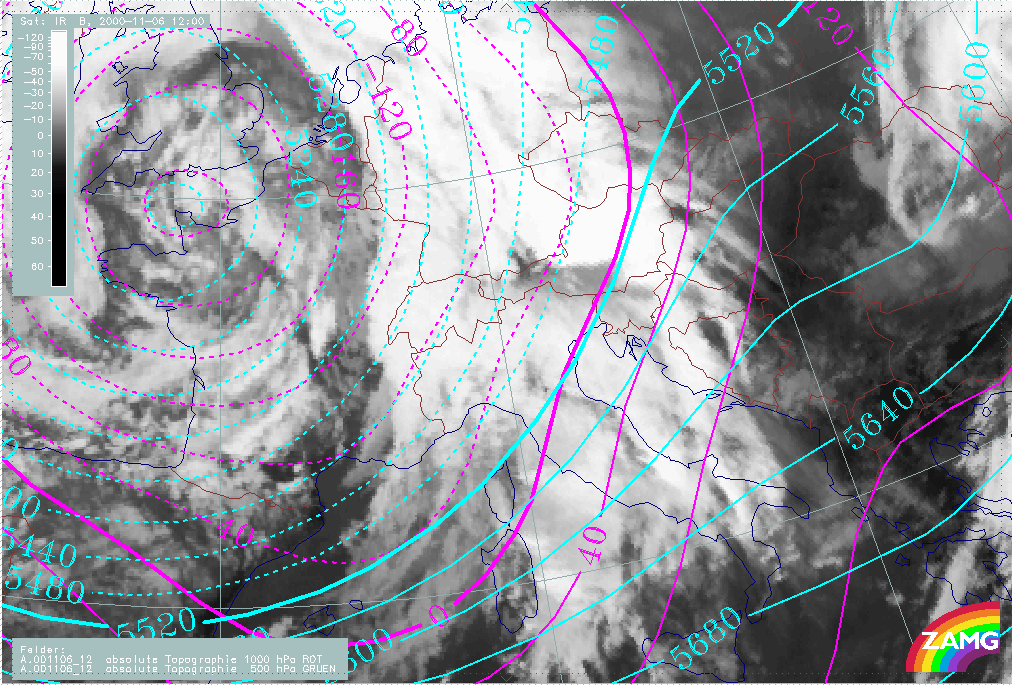
Height contours at 1000 and 500 hPa
|
|
06 November 2000/12.00 UTC - Meteosat IR image; magenta: height contours 1000 hPa, cyan: height contours 500 hPa
|
|
|
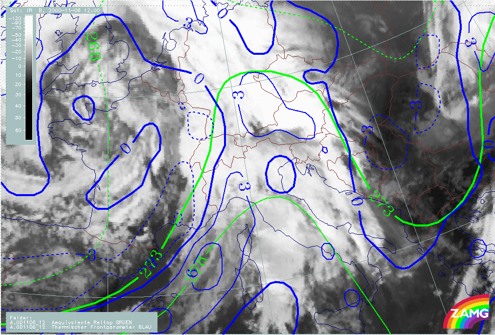
Equivalent thickness and Thermal Front Parameter (TFP)
|
|
06 November 2000/12.00 UTC - Meteosat IR image; green: equivalent thickness, blue: thermal front parameter
|
|
|
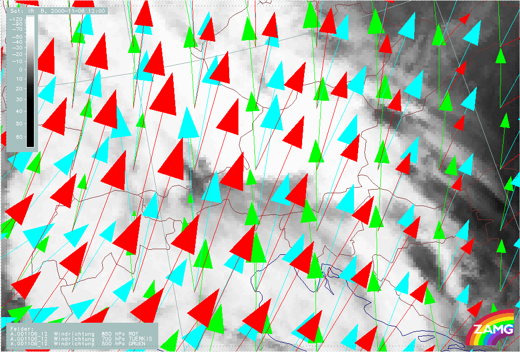
Wind direction at 850 - 500 hPa
|
|
06 November 2000/12.00 UTC - Meteosat IR image; green: wind direction 850 hPa, red: wind direction 500 hPa, yellow: wind direction
300 hPa
|
|
|
North Foehn
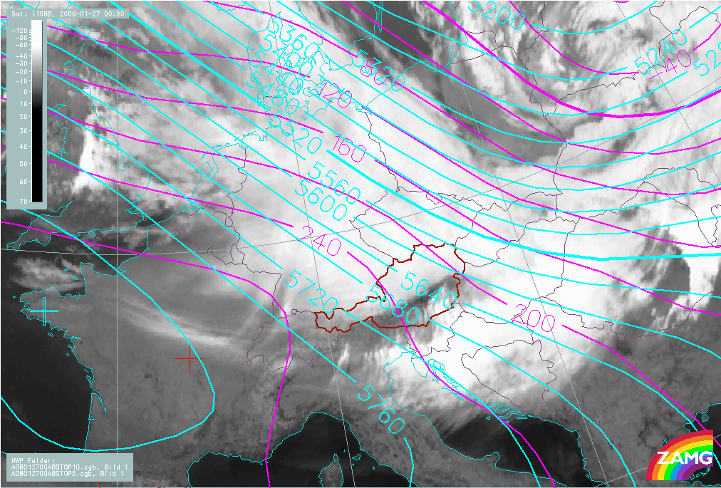
Height contours at 1000 and 500 hPa
|
|
27 January 2008/00.00 UTC - Meteosat 9 IR10.8 image; magenta: height contours 1000 hPa, cyan: height contours 500 hPa
|
|
|
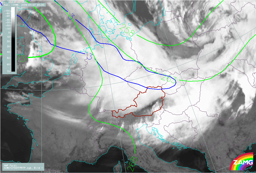
Equivalent thickness and Thermal Front Parameter (TFP)
|
|
27 January 2008/00.00 UTC - Meteosat 9 IR10.8 image; green: equivalent thickness, blue: thermal front parameter
|

|
|
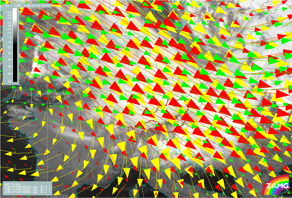
Wind direction at 850 - 500 hPa
|
|
27 January 2008/00.00 UTC - Meteosat 9 IR10.8 image; green: wind direction 850 hPa, red: wind direction 500 hPa, yellow: wind
direction 300 hPa
|
|
|
Radio Soundings: humidity + temperature
|
|
|
|
|
|

|
|
North side of Alps (Barrage side): 27 January 2008/00.00 UTC - Radio sounding Vienna; black solid: temperature and dewpoint
temperature
|
South side of Alps (Lee side): 27 January 2008/00.00 UTC - Radio sounding Zagreb; black solid: temperature and dewpoint temperature
|