Cloud Structure In Satellite Images
Foehn is a special weather situation which appears on the lee side of a mountain chain in the situation where an air stream is crossing it perpendicularly. It is a weather situation characterised by very strong, dry and warm winds. There are also features in satellite imagery connected to these processes which appear as typical modifications of pre-frontal and frontal clouds. Four case studies stemming from half a year are investigated in detail in this chapter; all from the Alpine region.
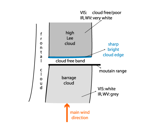
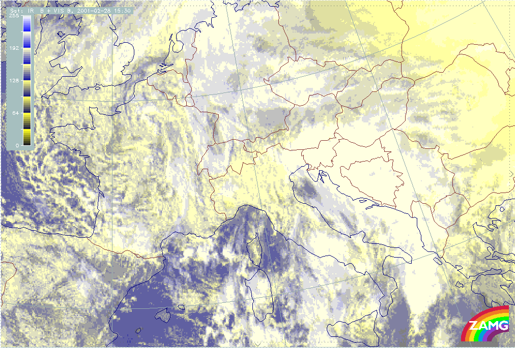
- The satellite images shows a Cold Front, Warm Front or Occlusion cloud band crossing mountain ranges
- During the passage a typical modification of the leading parts of the frontal cloud takes place
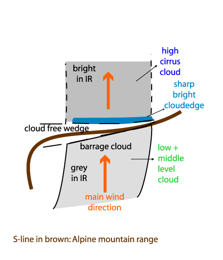
- In the IR10.8 image:
- Darker grey shades develop on the windward side connected to the Barrage cloud
- A cloud free wedge/band develops within the mountain area; sometimes some Orographic Convergence Lines, in the form of dark grey cells/lines can be seen in the cloud free area;
- Very bright cloud with a sharp boundary at the "outermost" mountain range extends downstream; this is high Lee Cloud;
- Lee Cloud sometimes becomes detached in due course.
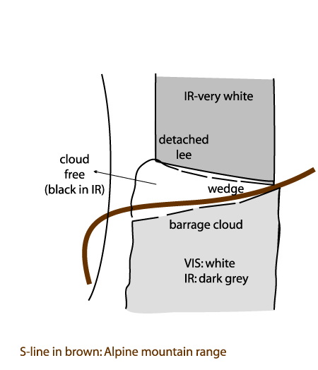
- In the VIS0.6/HRVIS image
- A bright cloud field appears on the windward side representing Barrage cloud
- A cloud free wedge/band develops within the mountain area; sometimes some Orographic Convergence Lines, in the form of white cells/lines can be seen in the cloud free area.
- On the lee side different types of clouds are possible:
- No clouds or only sporadic small scale low cloud on the lee side with some fibrous cloud superimposed where there is high Lee Cloud;
- Dense frontal cloudiness (white to light grey) with smooth structures where the high Lee Cloud is superimposed upon lower cloud.
- In the WV7.3 image:
- The WV7.3 image shows the same features as the IR10.8 image.
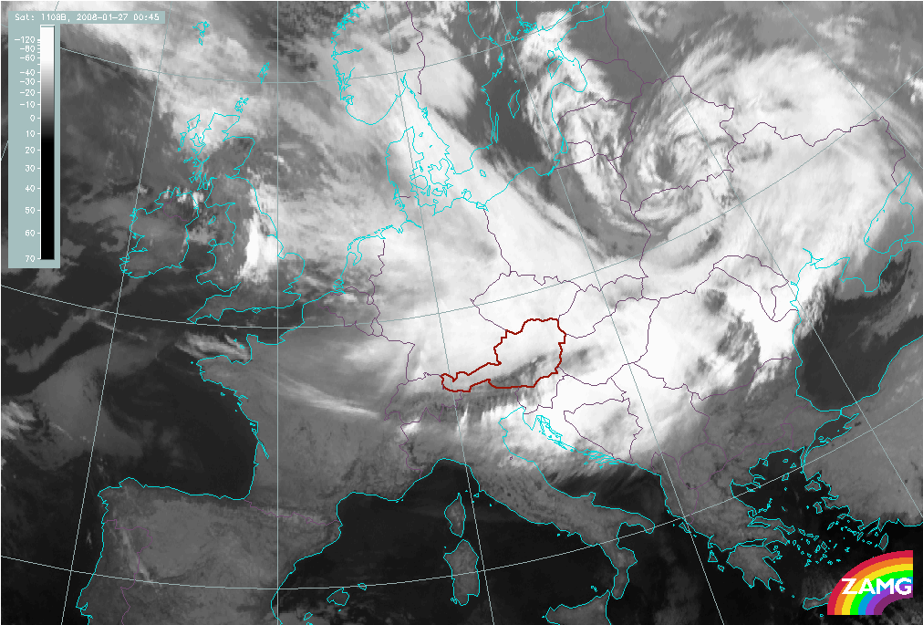
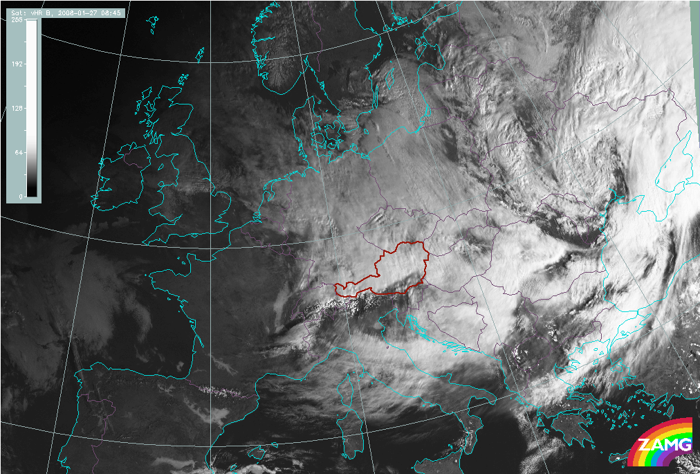
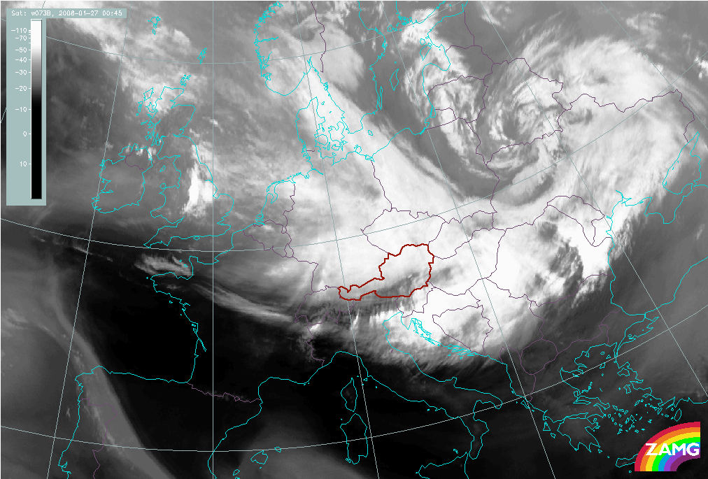
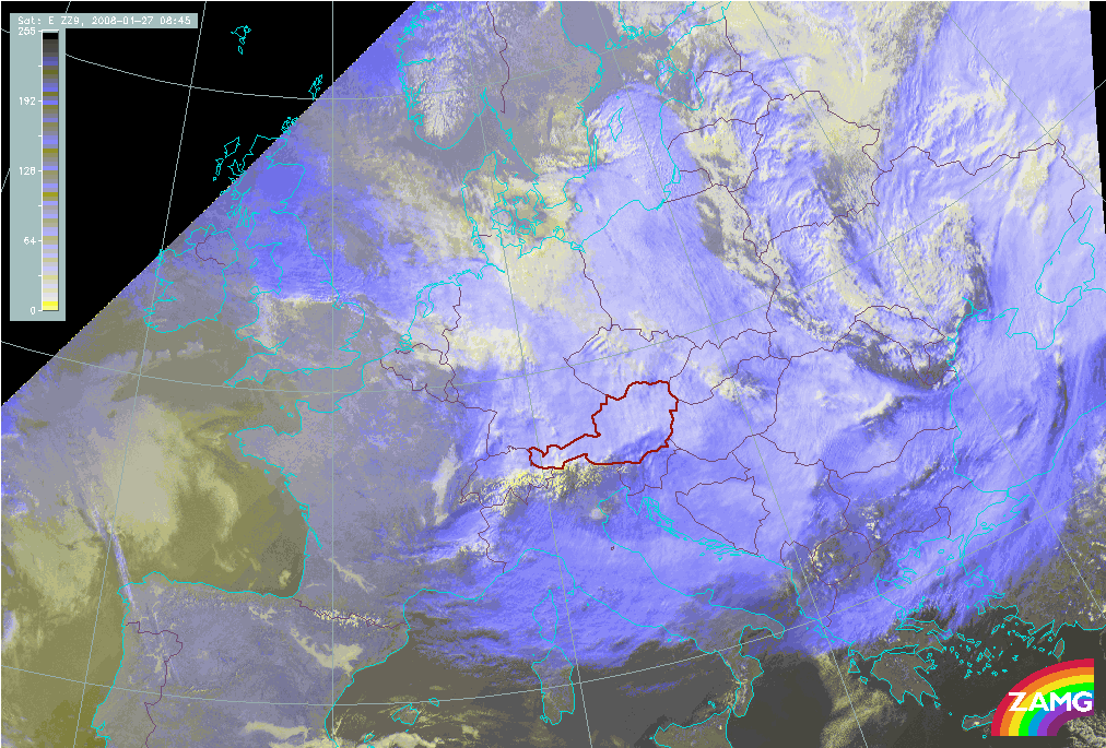
The channels used for the images below show very well many of the features summarised above: the different grey shades (in the VIS0.6 and IR10.8 image) of the cloud on the windward and lee side (in this case S and N of the Alps); the generally cloud free band within the mountain chain; the similarity between IR10.8 and WV7.3 image.
|
27 January 2008/00.30 UTC - Meteosat 9 IR10.8 image
|
27 January 2008/08.45 UTC - Meteosat 9 HRVIS image
|
|
|
|
|
|
27 January 2008/00.30 UTC - Meteosat 9 WV7.3 image
|
27 January 2008/08.45 UTC - Meteosat 9 HRVIS RGB (HRVIS; HRVIS; IR10.8) image
|
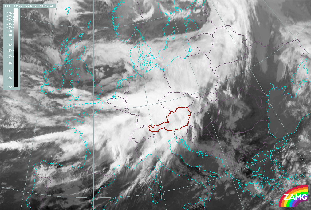
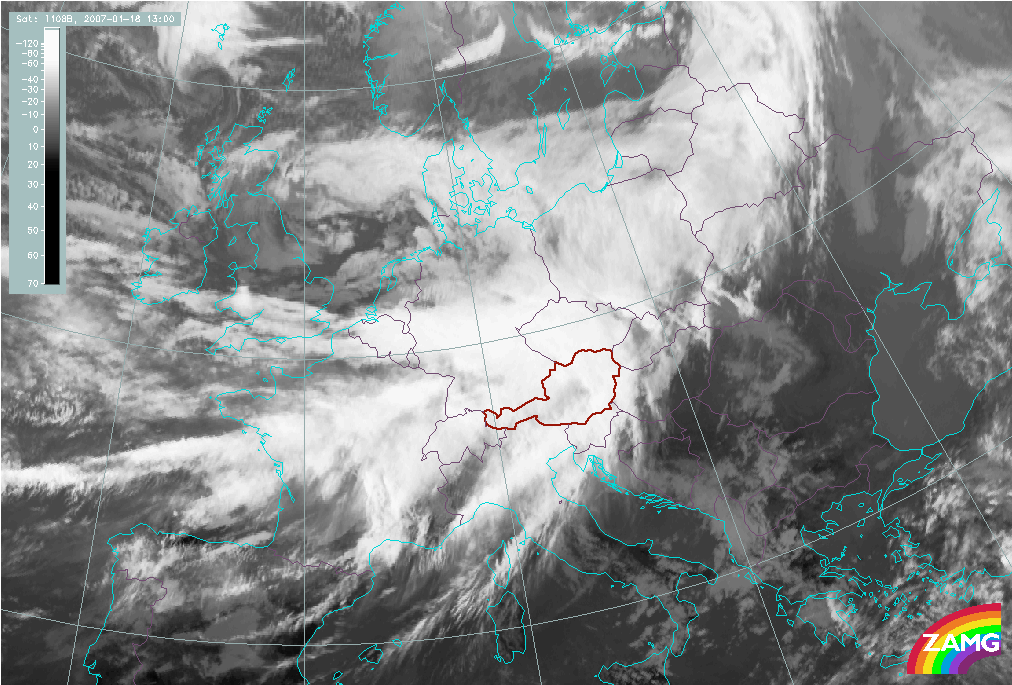
Foehn in the Alps
As has just been demonstrated in the North Foehn example above, one mountain range which frequently produces Foehn events is the Alps. Intensive Foehn appears north/south of the Alps when there is a distinct southerly/northerly stream ahead of a frontal cloud band approaching from the W; under such circumstances a life cycle can be observed:
- Approach of a (broad) multilevel frontal cloud band from the W to SW sector; Foehn substructures appear when the frontal cloud band reaches the W. Alps and Switzerland;
- Lowering of the cloud tops S of the Alps;
- Development of a cloud free wedge extending from Switzerland to E. Austria;
- Development of the high Lee Cloud especially over E. Switzerland and Austria extending downstream into Germany;
- Development of a cloud free (very dark in IR) small scale area N of the Alps over W. Austria and Bavaria;
- This development takes place at the same time as the separation of Lee Cloud;
- W-E movement of all these features as the front moves east.
|
|
|
|
|
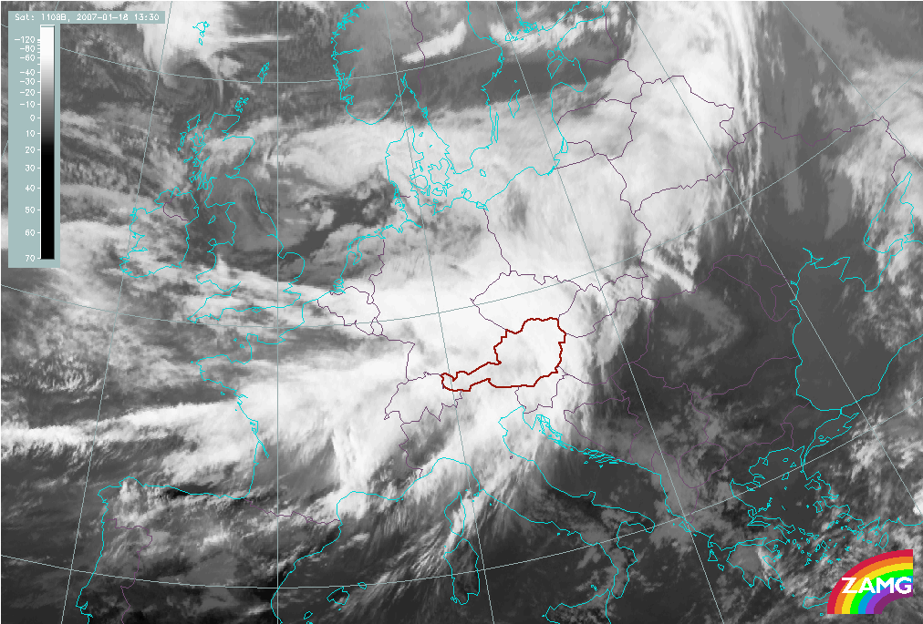
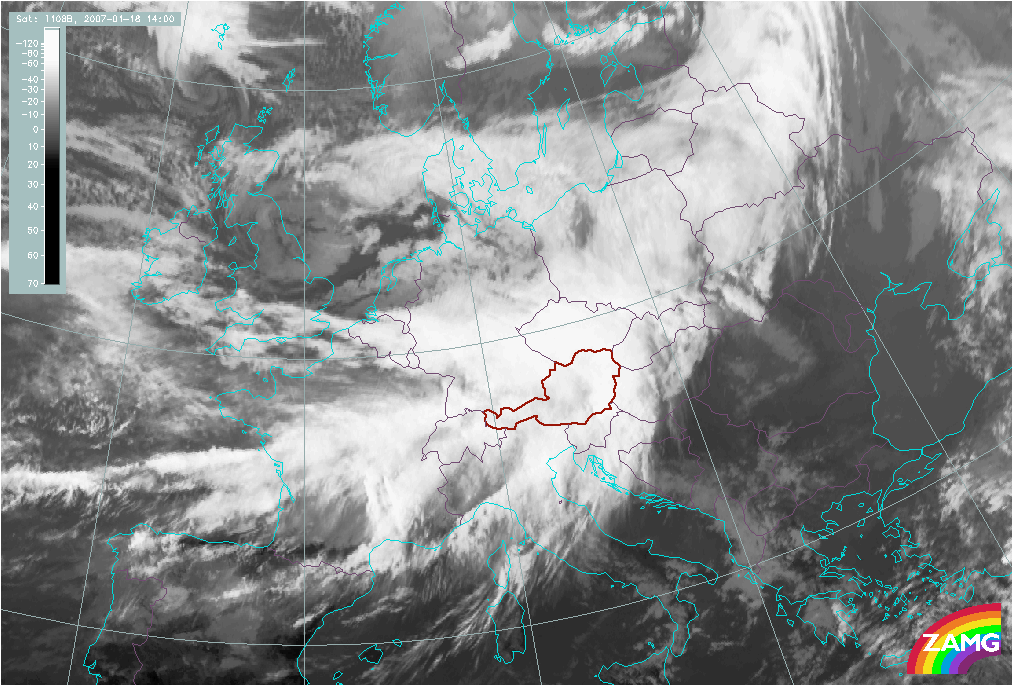
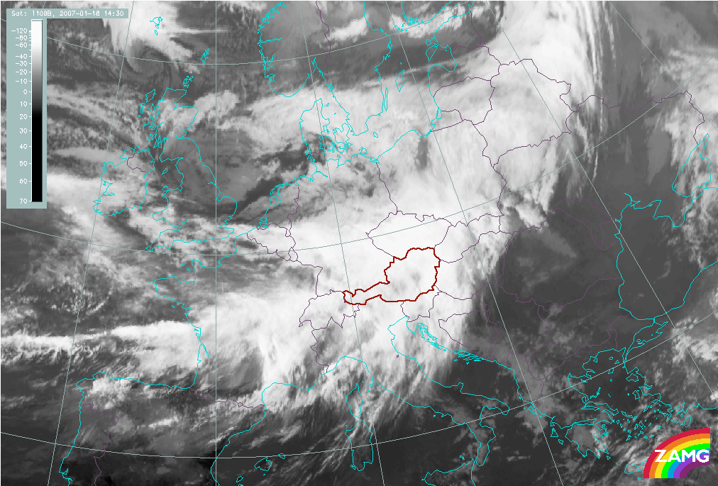
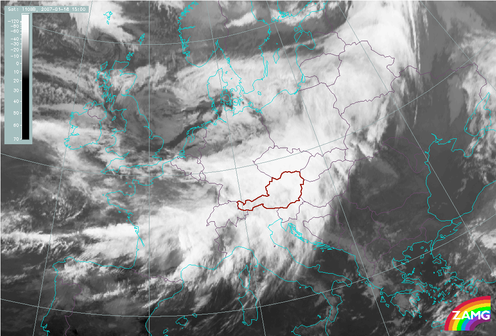
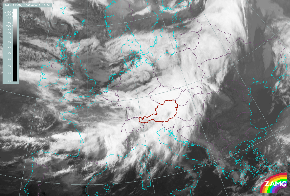
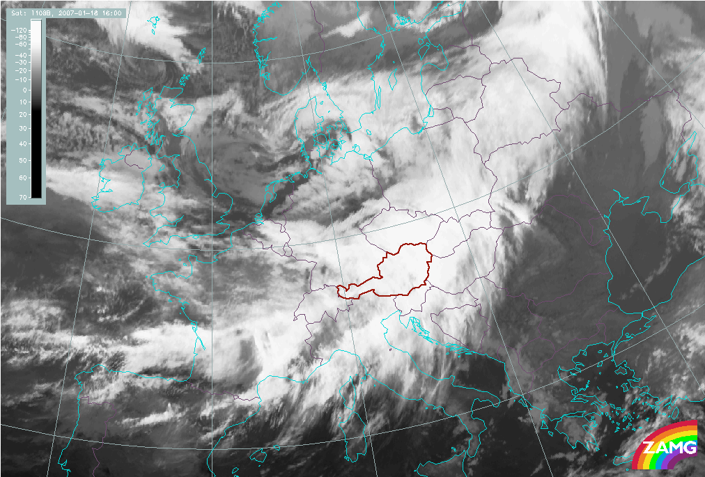
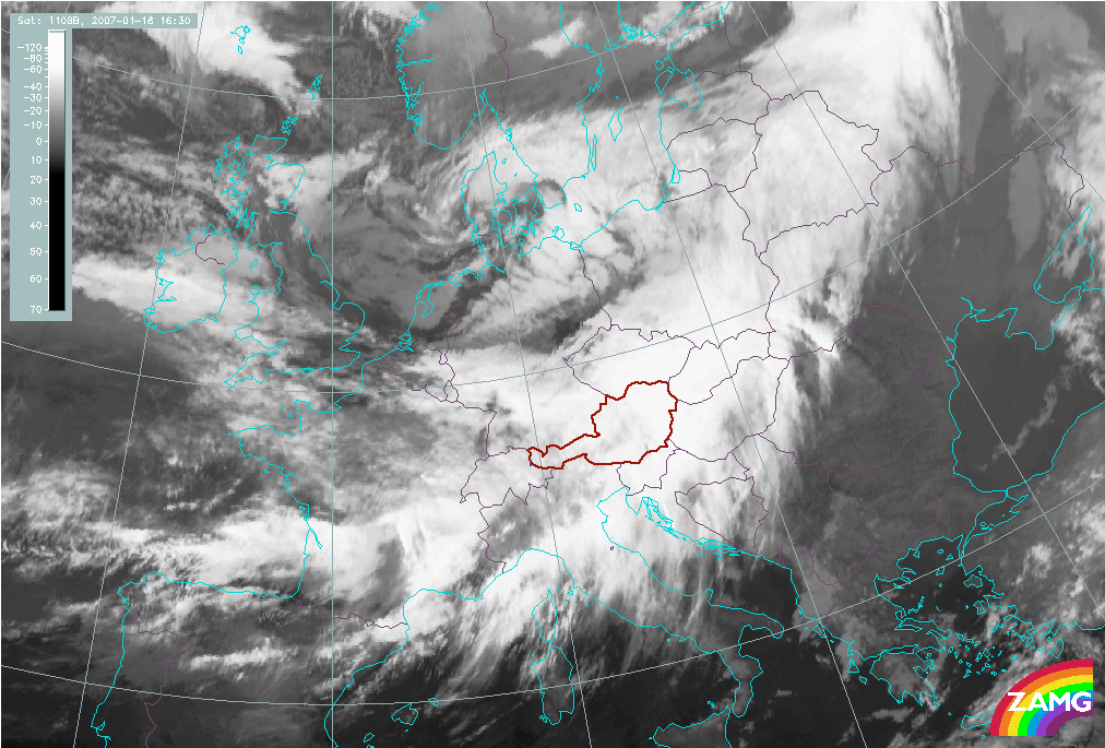
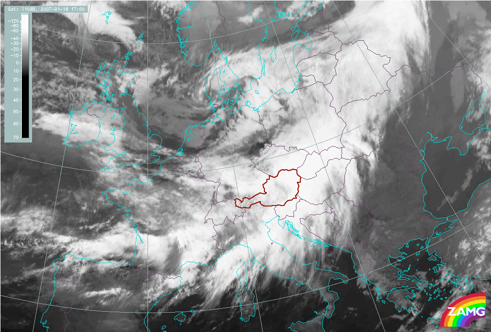
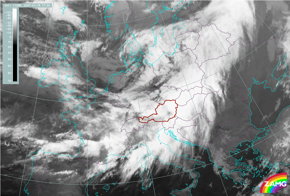
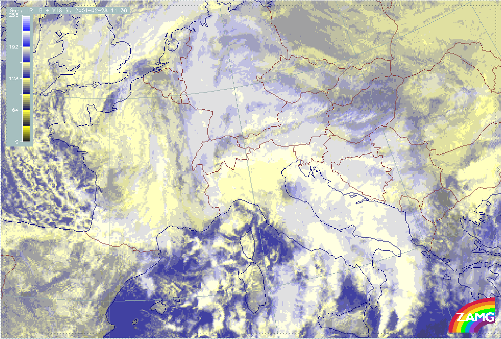
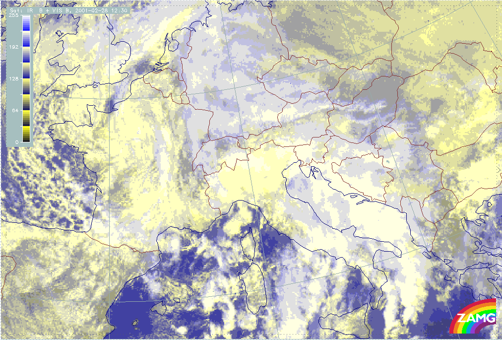
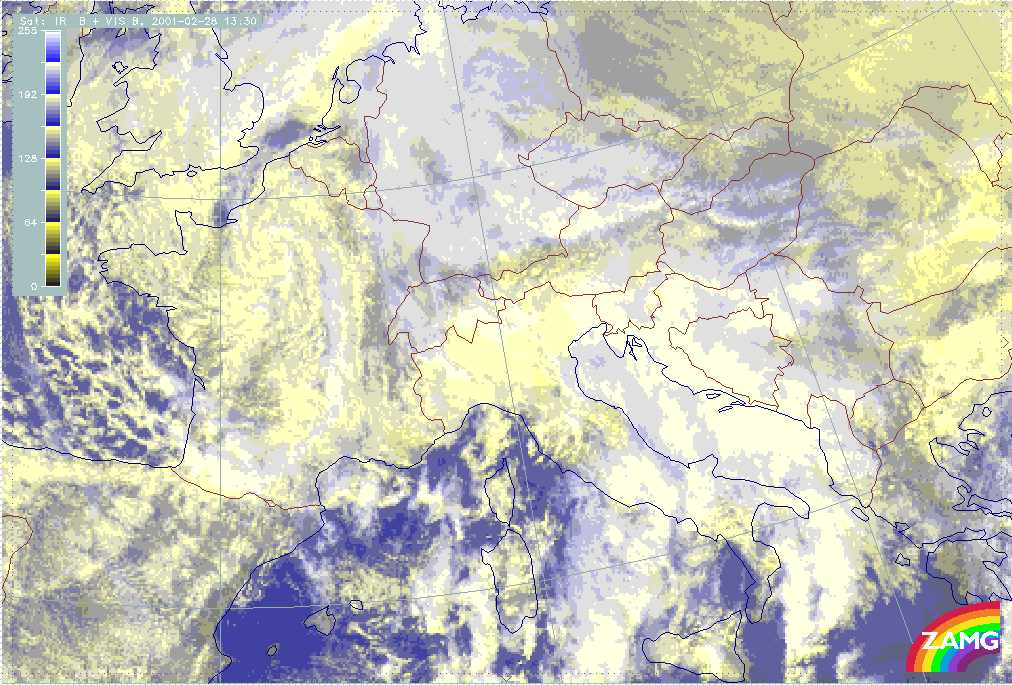
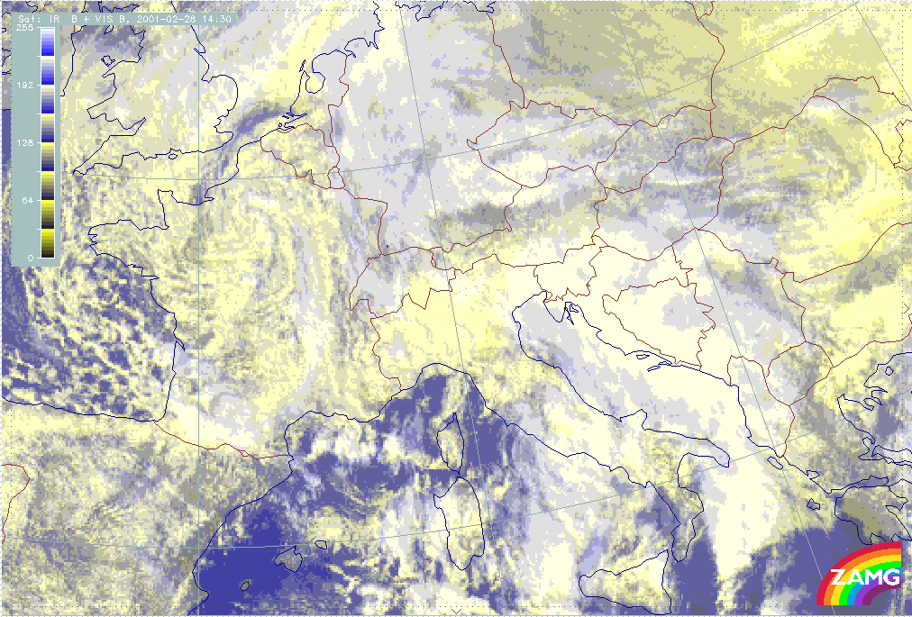
The IR image loop shown below is typical of a case where the mesoscale changes appearing within the multi-layered frontal cloud band are very distinct in the IR. The lowering of the cloud tops south of the Alps can be seen as well as the development of a cloud free band over the mountain chain combined with the development of high Lee Cloud to the north. A bit later an even darker small scale area develops over W. Austria moving eastward.
|
06 November 2000/06.00 UTC - Meteosat IR image; 06.00 - 17.00 UTC hourly image Loop
|
|

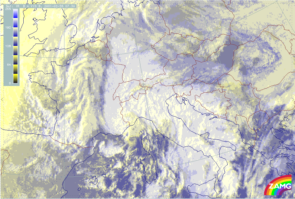
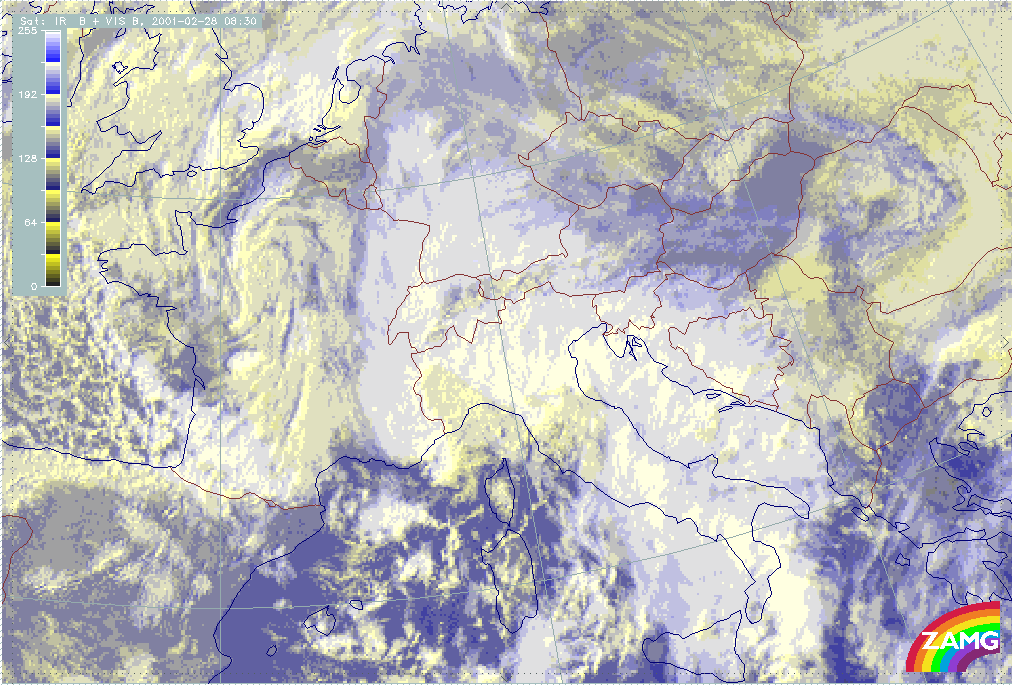
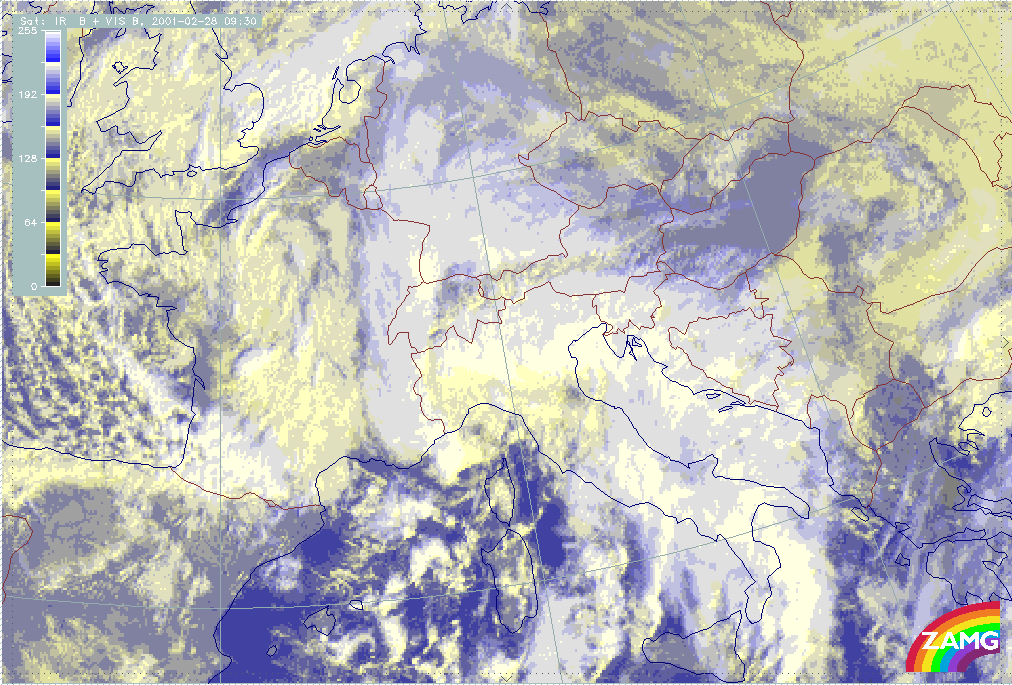
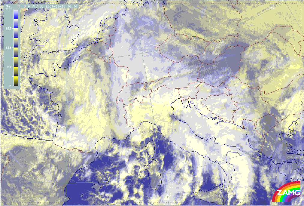
A VIS/IR combination loop shows similar changes and allows the evaluation of the two channels in combination. Very pronounced is the yellow area S of the Alps representing the Stau Cloud and the more bluish colours N of the Alps representing high Lee Cloud. The development of the cloud free wedge within the mountains as well as the development of a small scale cloud free area can also be observed. In the end phases the eastward shift of this cloud free area and the simultaneous detachment of the Lee Cloud are the most pronounced features.
|
28 February 2000/07.30 UTC - Meteosat VIS + IR image; 07.30 - 15.30 UTC hourly image Loop
|
|
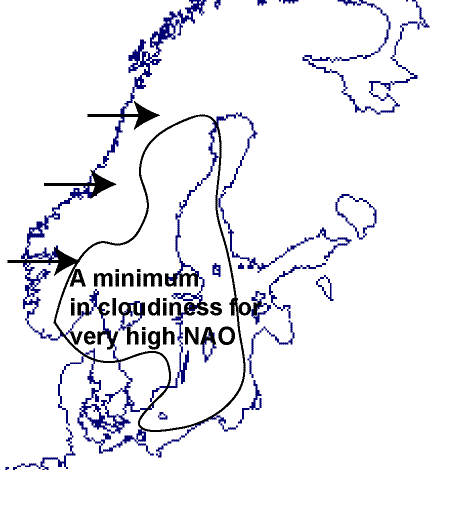
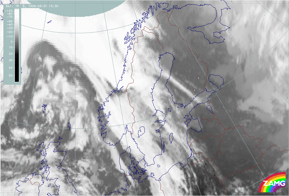
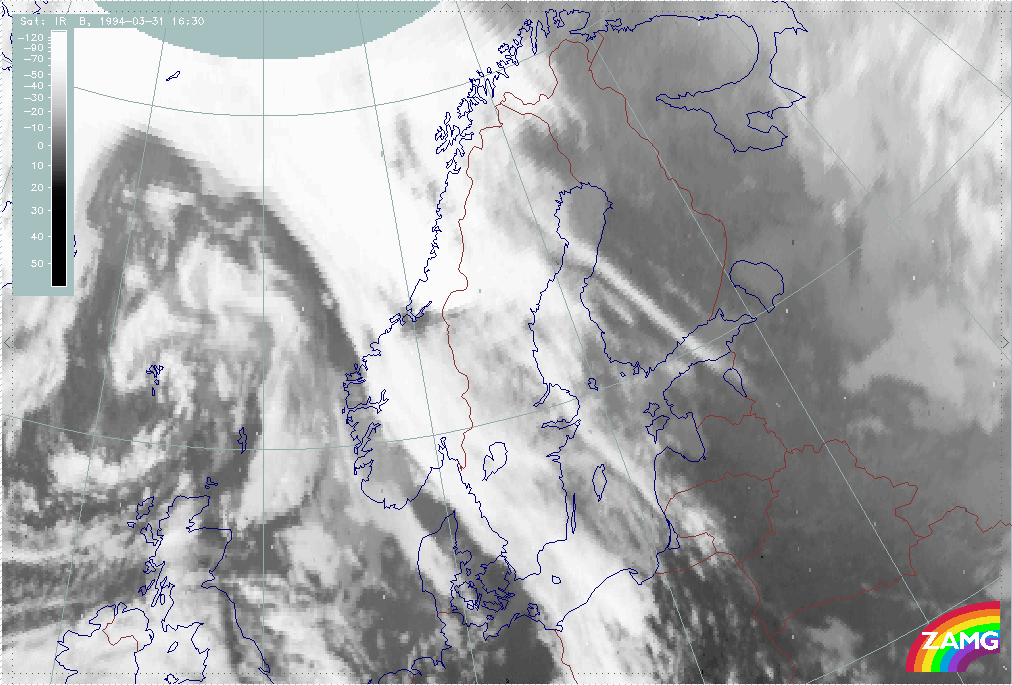
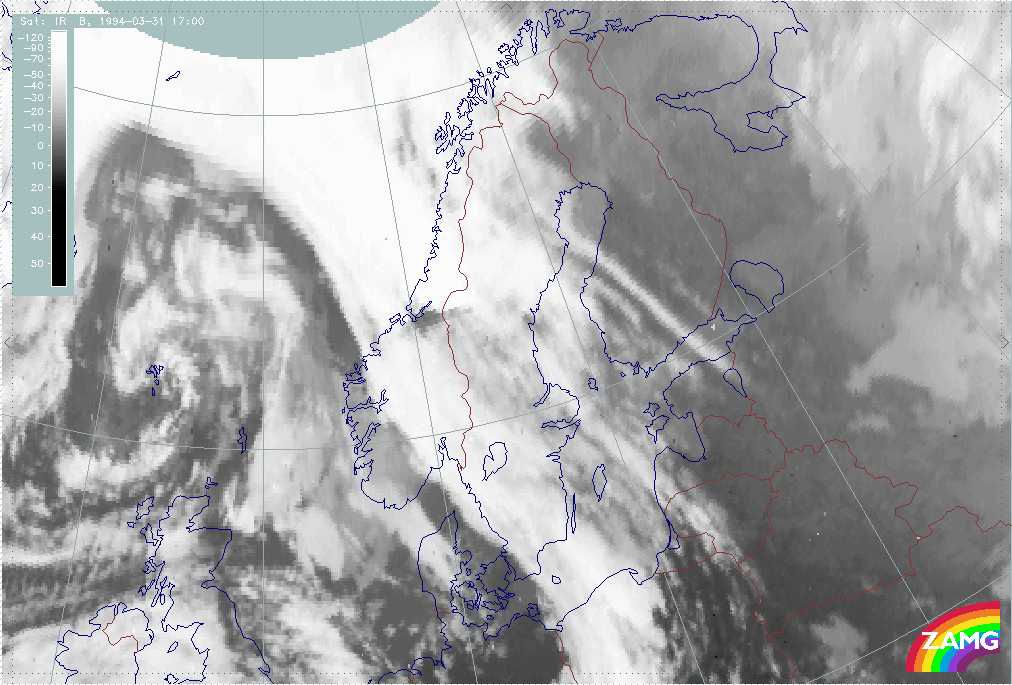
Another area in Europe where Foehn events can be observed are the Scandinavian mountains.
Foehn in the Scandinavian mountains
The Foehn events (with wind having a distinct westerly component) of the Scandinavian mountains are characterized by:
- an aggregation of low and middle level clouds (barrage cloud) on the windward side of the mountain chain
- upper-level Lee Cloudiness on the lee side of the mountains in the south and central parts of Scandinavia
However, these cloud configurations are regularly disturbed by other effects, such as the complex land-sea distribution. Also, due to the rather rare nature of the foehn phenomenon, its contribution to the average distribution of cloudiness in the region is not apparent.
There is a distinct seasonal variation in the cloudiness: In summer the mountain chain creates convective cloudiness which tends to mask the cases with pure Foehn clouds on the windward-leeward side of the mountains.
In winter, however, the effects of the mountains can be seen even in average cloudiness maps. During strong westerly flow a distinct minimum in cloudiness can be seen to the lee of the mountains. The image below roughly delineates the area with minimum cloudiness in a winter period with very high NAO (North-Atlantic Oscillation) index values. Very high NAO index values indicate strong westerly flow.
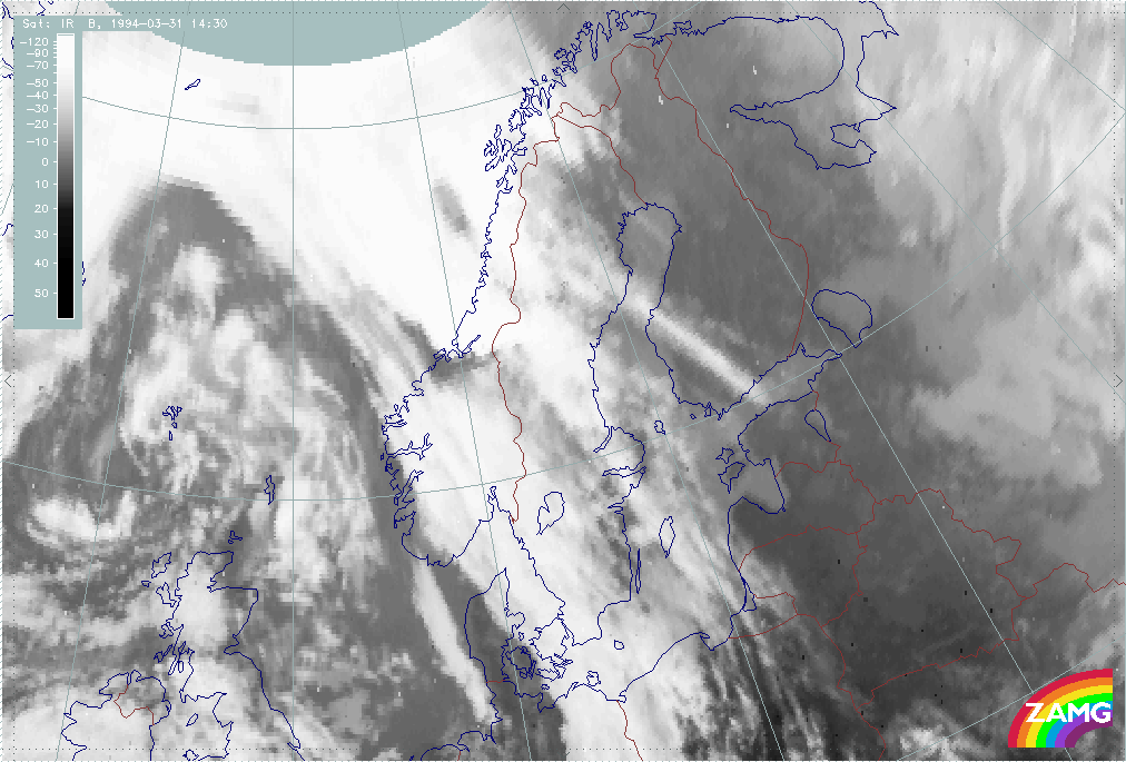
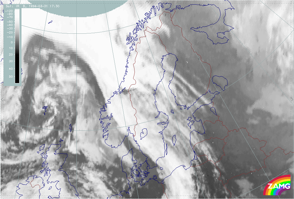
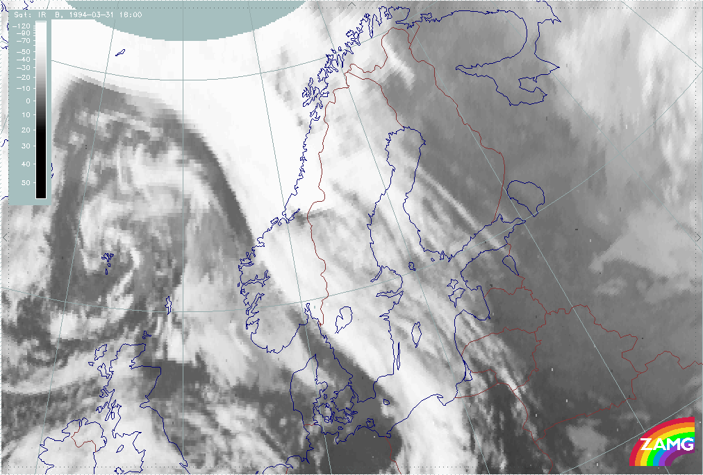
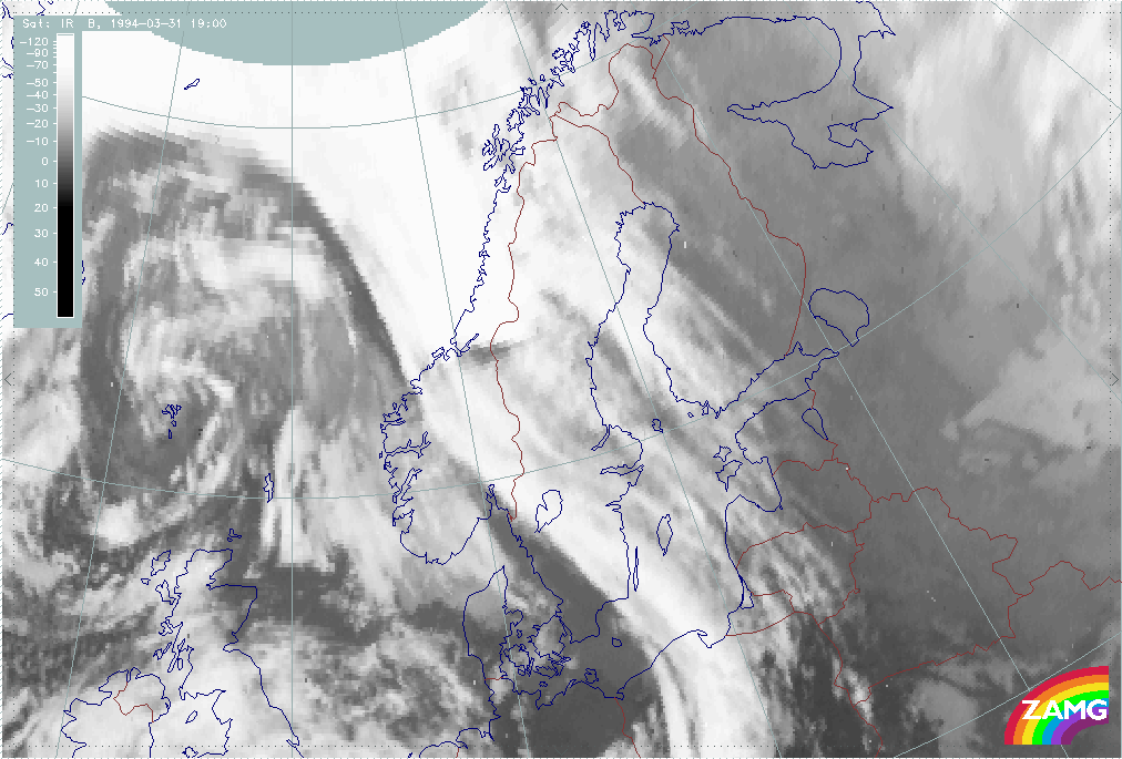
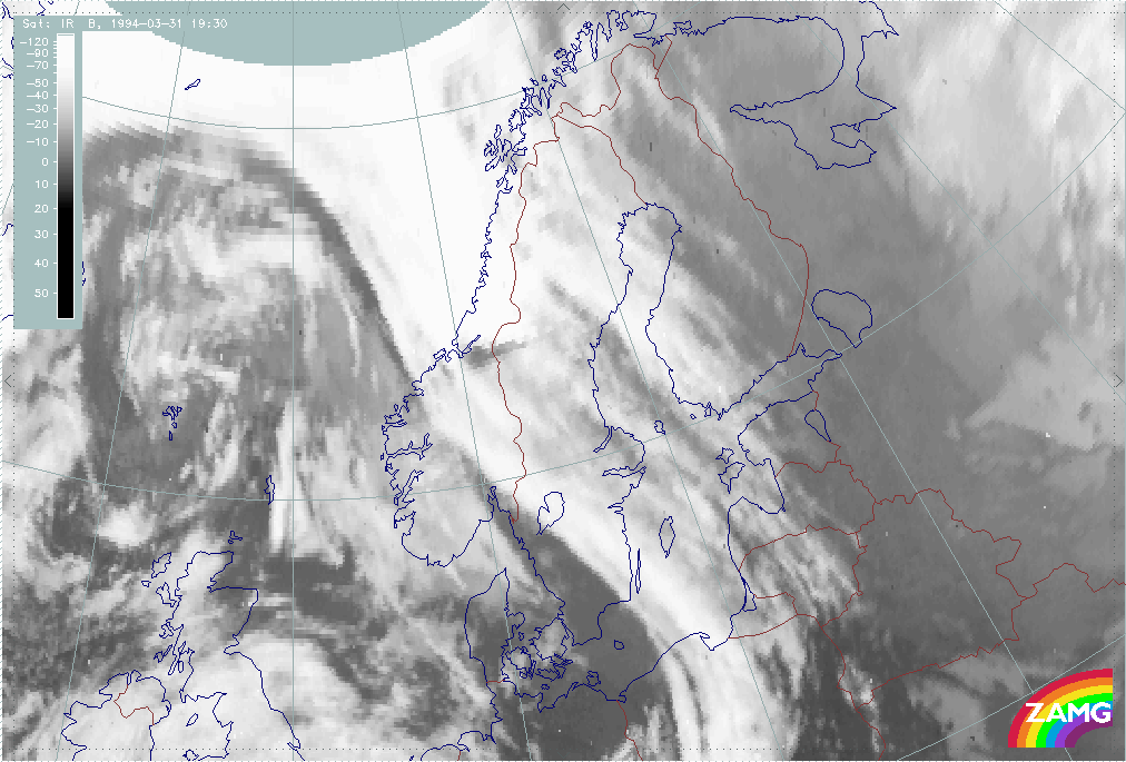
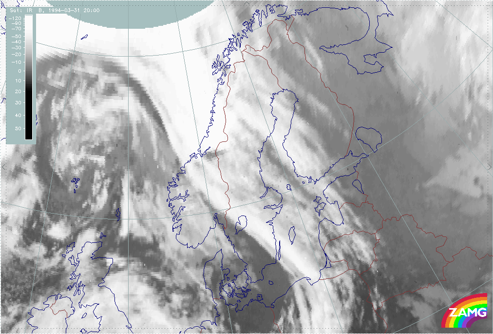
Strong Foehn winds are produced in both westerly and southerly flows. These incidents are characterized by a deep low pressure system located near Scotland or the North Sea, and with the surface flow being mainly from southeast. Strong Foehn processes caused by the mountain range Breheimen - Dovre - Sylene in Southern Norway can lead to local, strong down slope winds. In these cases the satellite IR imagery shows a characteristic dry slot in the frontal zone and a sharp-edged lee-side Cirrus sheet east of the dry slot. As in the Alpine Foehn, a narrow cloud-free area at the top of the mountain range can be seen.
|
31 March 1994/14.30 UTC - Meteosat IR image; 14.30 - 20.00 UTC half-hourly image Loop
|
|
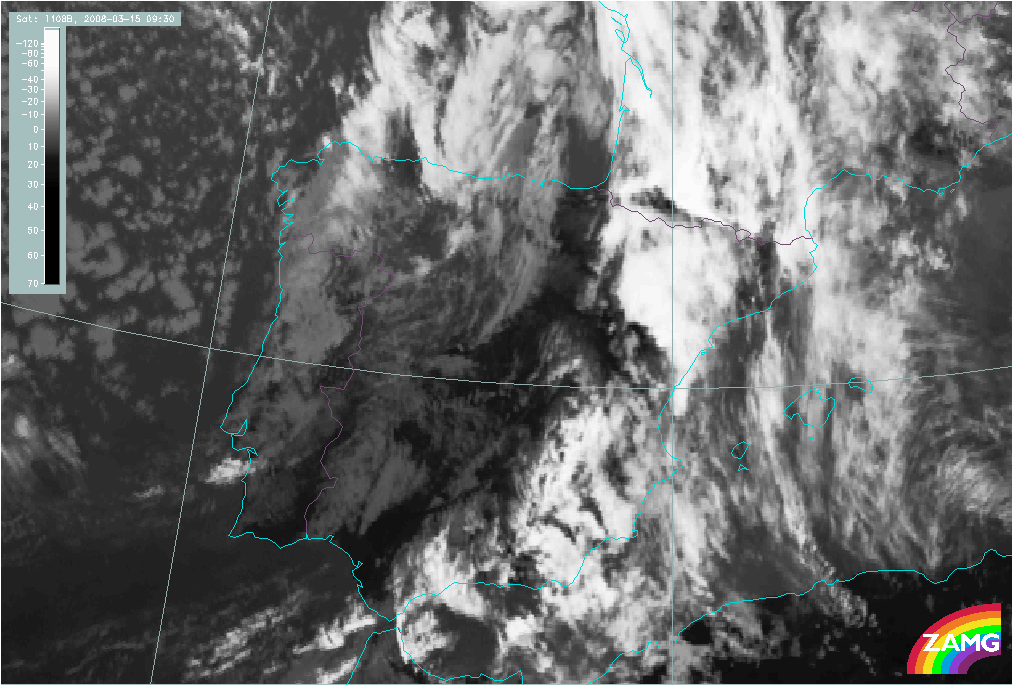
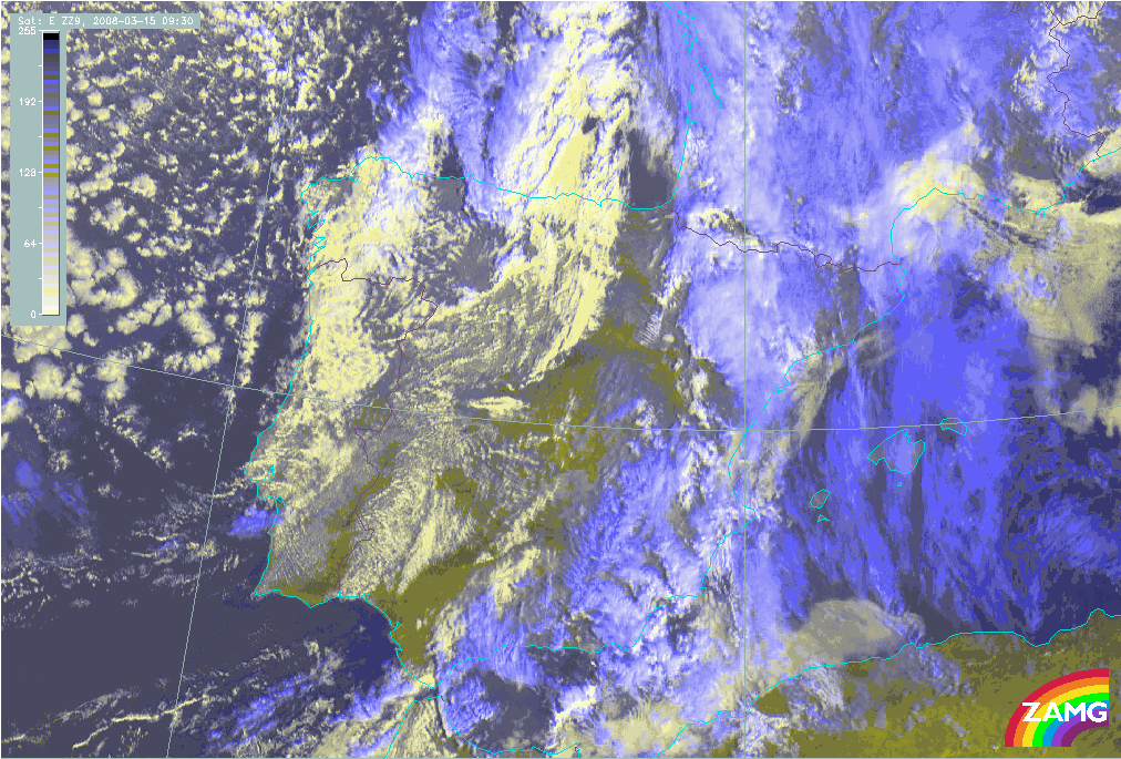
Another area where Foehn effects are frequently seen in satellite images is the Spanish N coast and the Pyrenean mountains.
Foehn at the mountain ridges in N. Spain
|
15 March 2008/09.30 UTC - Meteosat 9 IR10.8 image
|
15 March 2008/09.30 UTC - Meteosat 9 HRVIS RGB (HRVIS, HRVIS, IR10.,8) image
|
|
|
The images above show some of the typical Foehn features: within the southerly stream ahead of an approaching frontal cloud band high clouds (blue in the HRVIS RGB image) can be seen at the mountain ranges along the N. coast as well as along the Pyrenees while high Lee Cloud (blue in the IR+VIS image) extends from the highest mountain chains northward into France and the Bay of Biscay. A distinct Foehn window is seen in both images just north of the mountain ridge.
List of Foehn or Foehn-like winds and their local names:
| Andes | Puelche |
| Argentinia, Andes | Zonda |
| Austria, Carinthia | Jochwind, Jauk |
| Canary Islands, Central Massive | Levanto |
| Central Asia, Mongolia | Ebe |
| Dinarian Mountains | Livas |
| Faeroe Islands | Glaves |
| France, Alps, N - Foehn | Bise (noir) |
| Greece, Gulf of Saloniki | Vardarac |
| Gulf of Arden | Belat |
| India, S of Himalaya | Bhoot |
| Indonesia, Celebes | Gending |
| Lee of Rocky Mountains | Chinook |
| New Guinea, during E - Monsoon | Wambra |
| New Zealand, Southern Island | Northwester |
| Oman, Hajr Mountains, during SW - Monsoon | Muscat |
| Poland, S - Foehn of the Tatra | Halny Wiatr |
| Romania, Southern Carpatian Mts. | Talmesch |
| Romania, Eastern Carpatian Mts. | Austru |
| Serbia, from Kosovo - Mts. in the S | Kossava |
| Sicily, Nebrodi Mts. | Scirocco |
| Spain, Central Sierras | Matacabras |
| Sri Lanka, during SW - Monsoon | Kachchan |
| Sumatra, during SW- Monsoon | Bohorok |
| USA, California | Santa Ana |
Appearance in the basic channels:
|
|
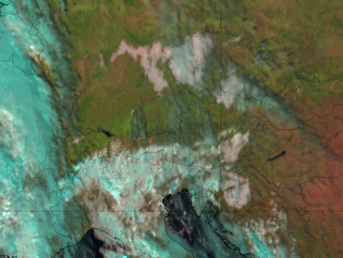
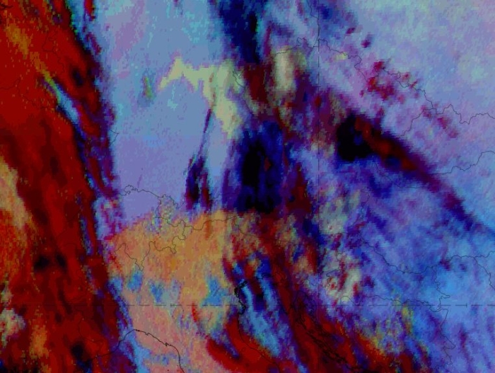
Day Natural Colour RGB and 24-hour Microphysics RGB on 07 November 2018, 12 UTC. Air stream from the south.
To observe all important cloud features during a typical foehn case, it is crucial to find RGB images that cover low to mid-level clouds and high cirrus clouds, and that distinguish between clouds and cloud-free land. For example, the Day Natural Colour RGB is easy to interpret and provides a good first glance as to where low water clouds (bright, whitish) and thick ice clouds (cyan, turquoise) are present. It also distinguishes different surface features where no clouds are present. In the case shown, it depicts the low to mid-level water clouds south of the main Alpine ridge very well, but high cirrus clouds are hard to identify and usage is only possible during daytime.
The 24-hour Microphysics RGB, however, is able to distinguish between many cloud types during the day and night. It can show not only low to mid-level cloudiness (yellow to orange, sometimes even reddish when larger droplets are included) on the windward side of the mountain, but also high cirrus clouds (dark blue to black) on the lee side. Usually there is a sharp border between the clouds on the windward side and the cloud-free zone on the lee side; sometimes clouds on the two sides are separated by a gap. This cloud free area can also be seen quite well with the 24-h Microphysics RGB.
Note: As an alternative to the 24-hour Microphysics RGB, the Dust RGB shows a very similar picture, as both are based on the same channels (with different temperature ranges and gamma corrections).
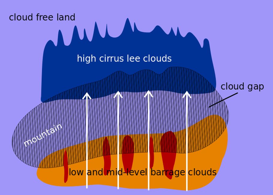
Schematic 24h Mirophys. RGB