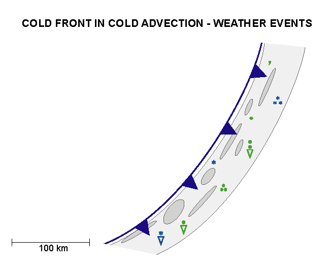
Weather Events
| Parameter | Description |
| Precipitation |
|
| Temperature |
|
| Wind (incl. gusts) |
|
| Other relevant information |
|
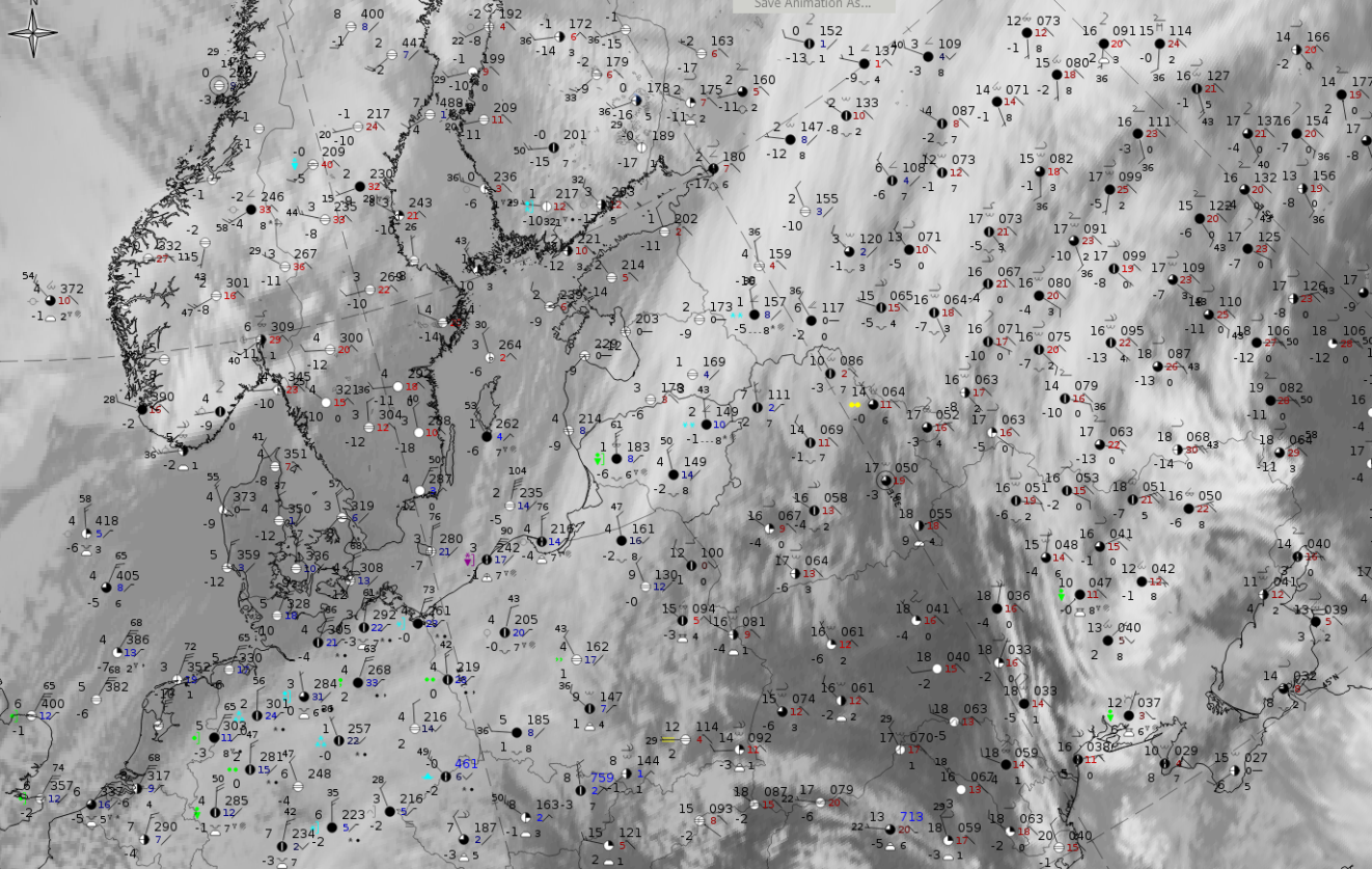
These features are best illustrated using data from 29 March 2020 at 12 when an example of a CF in CA occurred over the north-eastern part of Europe, extending from Poland where cloudiness is low to mid-level, across the Baltic States into Russia where also thicker ice clouds are also superimposed.
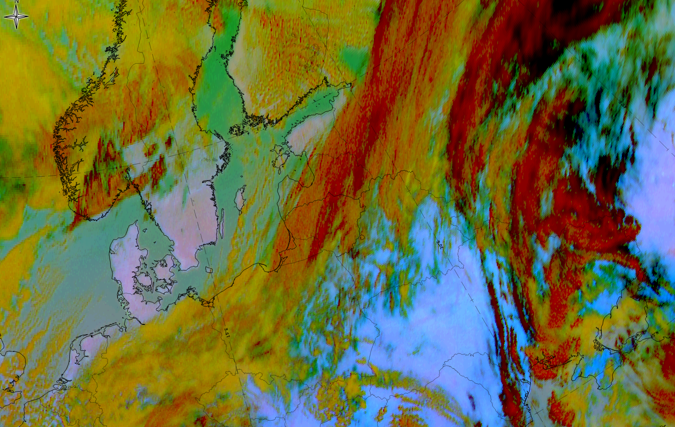
29 March 2020, 12 UTC; Dust RGB
|
|
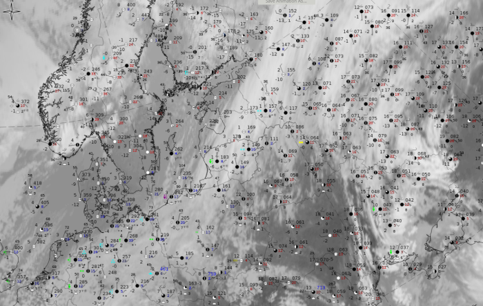
29 March 2020, 12UTC: IR + synoptic measurements (above) + probability of moderate rain (Precipitting clouds PC - NWCSAF).
Note: for a larger SYNOP image click this link.
Weather stations in the cloud band mostly reported only low to mid-level cloudiness and one report at the leading edge contains a Cb. Mostly there is low probability of moderate rain, only in the few ochre areas does it rise to values of 45 - 50%.
|
|
|
|
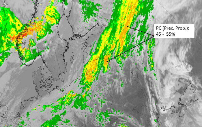
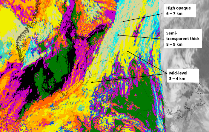
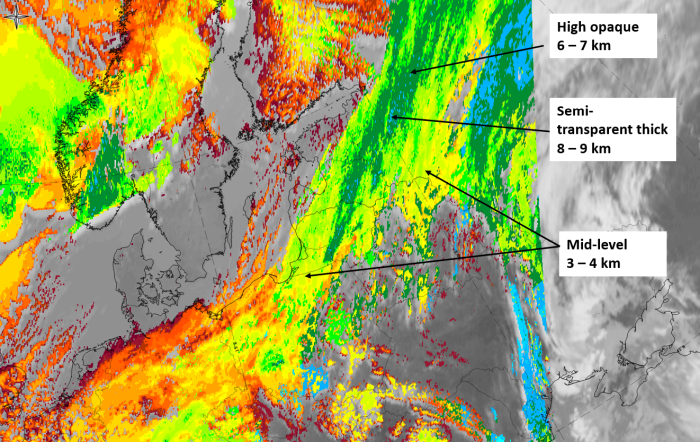
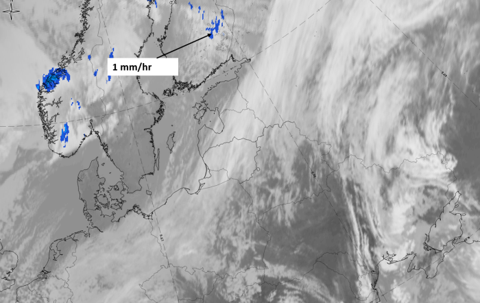
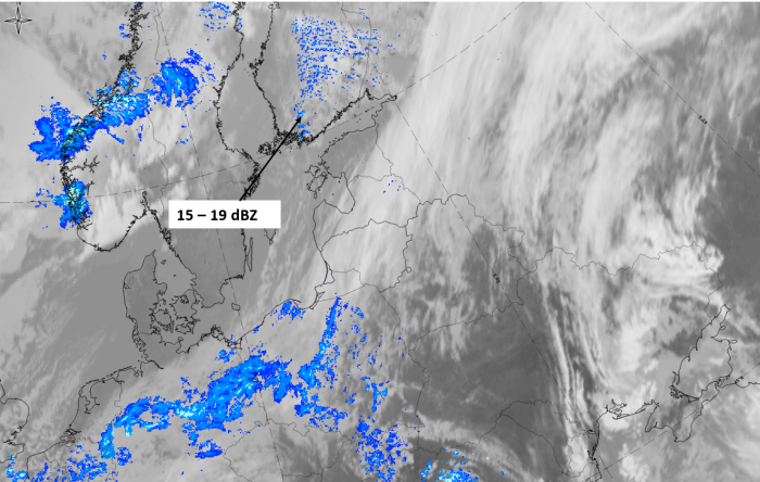
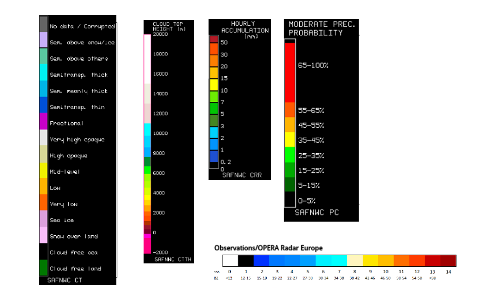
29 March 2020, 12 UTC, IR; superimposed:
1st row: Cloud Type (CT NWCSAF) (above) + Cloud Top Height (CTTH - NWCSAF) (below); 2nd row: Convective Rainfall Rate (CRR NWCSAF) (above) + Radar intensities from Opera radar system (below).
For identifying values for Cloud type (CT), Cloud type height (CTTH), precipitating clouds (PC), and Opera radar for any pixel in the images look into the legends. (link)