Cloud Structure In Satellite Images
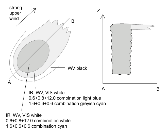
In the satellite images an MCS appears like a mesoscale cloud cluster, which has a circular or oval shape depending on the strength of the upper level wind.
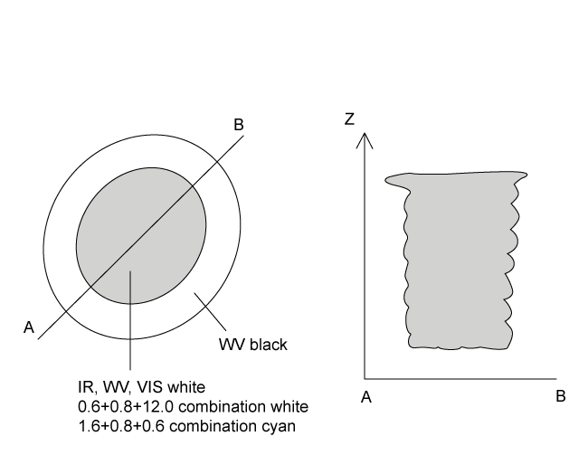
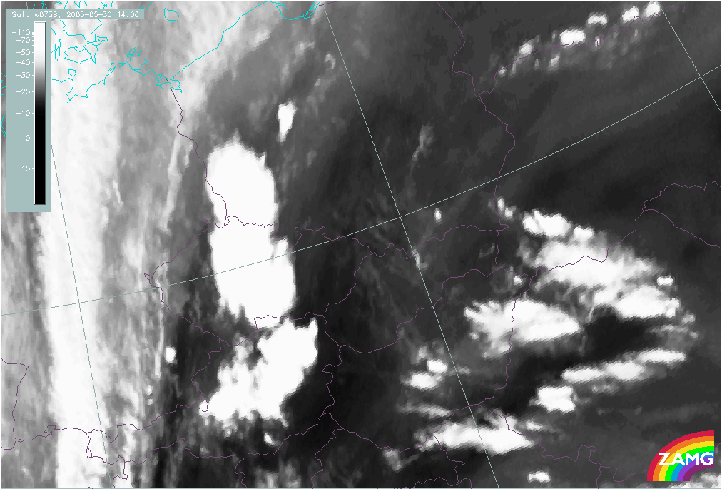
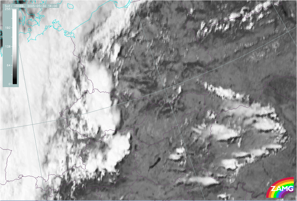
- In IR, WV and VIS images MCS are characterized by high pixel values (white) in the active part, indicating cloudiness which extends through the whole troposphere.
- The upstream edges of the cloud cluster are generally very sharp. In situations with strong upper level winds, the high cloud is transported downstream leading to an extended white cloud shield in the IR but a fibrous grey texture in the VIS image. The brightest areas can be found in the active part upstream.
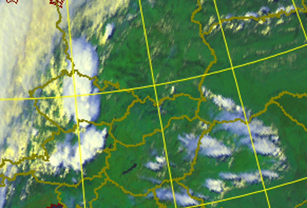
- In the 0.6+0.8+12.0 combination the active thundercloud is white, while the thinner edges of the anvil are light blue.
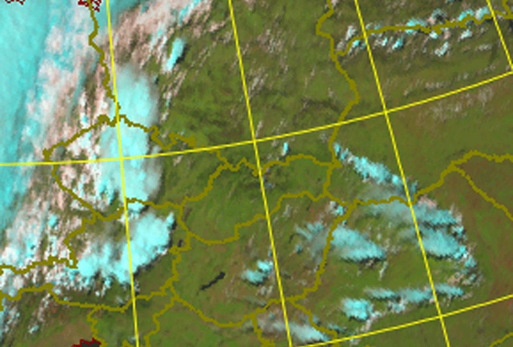
- In the 1.6+0.8+0.6 combination the active thundercloud is cyan, and the anvil can be separated as a little more greyish.
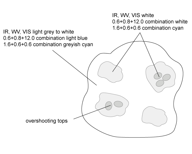
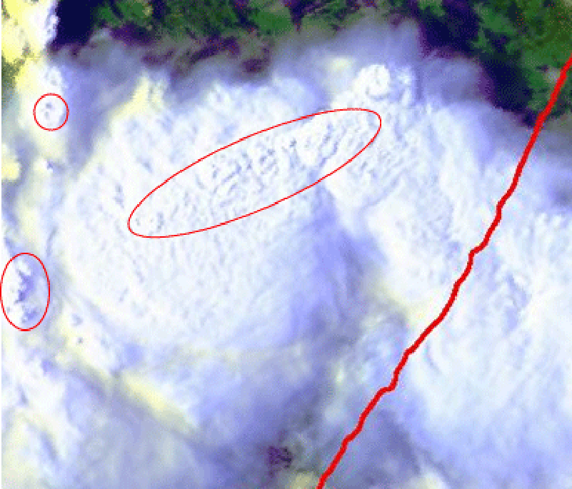
- In AVHRR imagery the brightest individual cells embedded in a Multi Cell Storm can be detected better than in Meteosat 8 images. Also the overshooting tops of strongest cells embedded in the cirrus anvil can be often be distinguished.
|
|
|
|
|
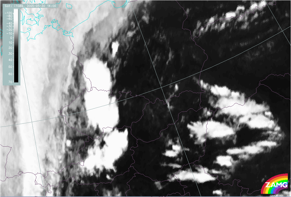
30 May 2005/14.00 UTC - Meteosat 8 IR 10.8 image
|
30 May 2005/14.00 UTC - Meteosat 8 WV 6.2 image
|
|
|
|
|
|
30 May 2005/14.00 UTC - Meteosat 8 VIS 0.8 image
|
30 May 2005/14.00 UTC - METEOSAT 8 RGB image (0.6, 0.8 and 12.0)
|
|
30 May 2005/14.00 UTC - Meteosat 8 RGB image (1.6, 0.8 and 0.6)
|
05 July 2002/15.35 UTC - NOAA AVHRR RGB image (0.6, 0.8 and 12.0); overshooting tops indicated
|
|
|