Key Parameters
For nearly all conceptual models the "key parameters" are parameters derived from numerical models. In the case of convective development the key parameters are relevant observations and additional artificial satellite images. The following material is used:
- Satellite imagery with an appropriate cold cloud top enhancement:
- Typical circular and oval shape of the MCS
- Cloud top temperature below -32°C: in the case of circular type for an area with diameter of 100-500 km and in the case of oval type for a major axis of 200-900 km
- Weather reports:
- Thunder
- Showers
- Lightning Reports
- Radio Soundings
- Wind Profile
- Stability
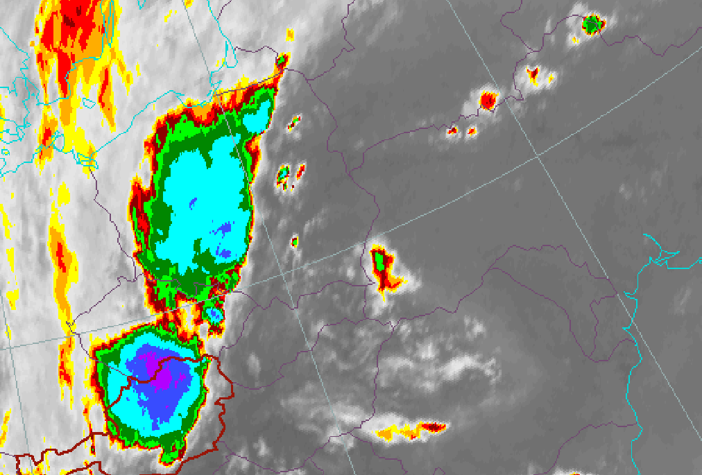
Cold cloud top enhancement
|
|
30 May 2005/15.00 UTC - Meteosat 8 IR 10,8 enhanced image
|
|
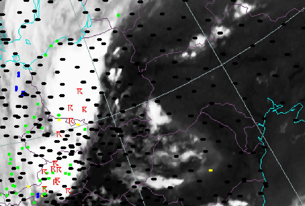
Weather reports
|
|
30 May 2005/18.00 UTC - Meteosat 8 IR 10,8 image; weather events (green: rain and showers, blue: drizzle, red: thunderstorm with
precipitation, orange: hail, black: no precipitation)
|
|
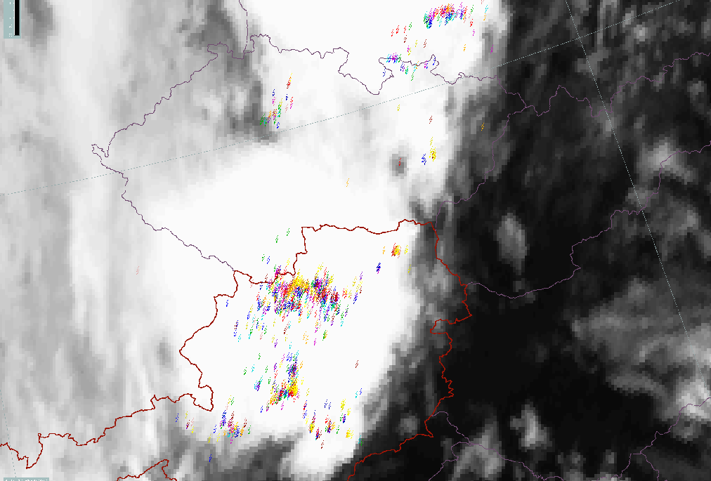
Lightning Reports
|
|
30 May 2005/18.00 UTC - Meteosat 8 IR 10,8 image; Lightning interval (yellow: 0-5 min, orange: 5-10 min, red: 10-15 min, magenta:
15-20 min, blue: 20-25 min, green: 25-30 min)
|
|
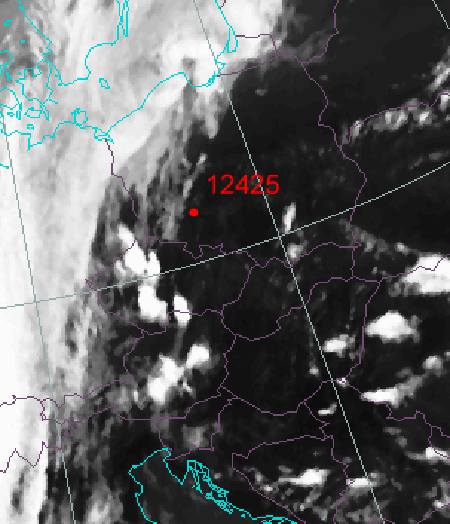
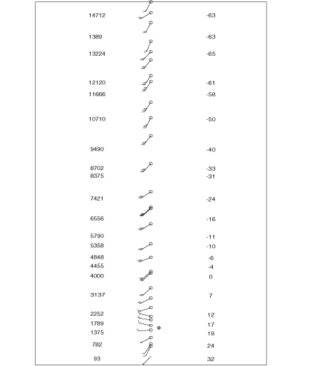
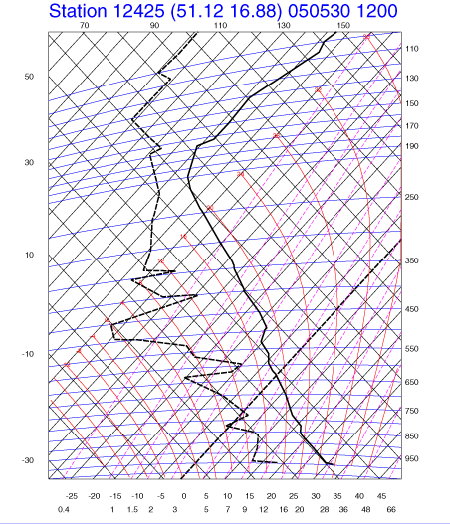
Radio Soundings
|
30 May 2005/12 UTC - Meteosat 8 IR 10,8 image; position of Wroclaw sounding station indicated
|
30 May 2005/12.00 UTC - Radio sounding Wroclaw; Wind direction and speed
|
|
|
|
|
|
30 May 2005/12.00 UTC - Radio sounding Wroclaw; thick solid: temperature, black dashed: dew point
|
|
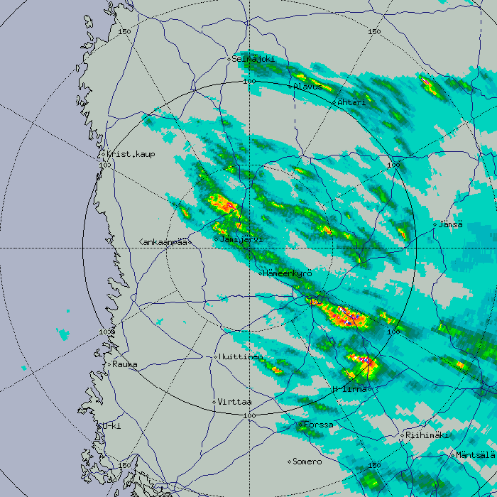
Radar
Radar is a significant tool for observing convective clouds (see Meteorological physical background). Even small scale features within the MCSs at different heights can be observed. Although this manual concentrates on satellite imagery, the following paragraphs provide an introduction to different radar reflectivity products. More details may be found in relevant radar literature.
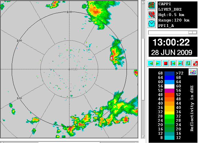
Constant Altitude Plan Position Indication (CAPPI)
- Constant altitude data is picked and interpolated from different elevation scans
- Beyond a certain distance, the lowest available data is selected
- Avoids somewhat the PPI problems: ground clutter near the radar nd overshooting of the beam far from radar
|
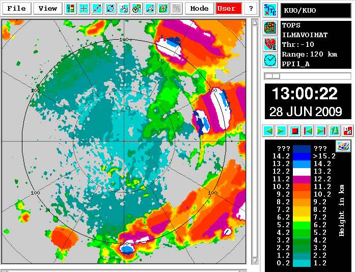
Tops
- Tool for following the development of a convective system
- Used together with the temperature profile
- When tops reach the value of -15°C, precipitation begins
- When tops reach the value of -25°C, the chance of thunder is considerable
|
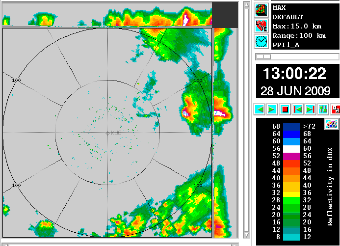
MAX
- Tool for identifying the strongest cells in a multicell system
- High dBz values at high altitudes (e.g. +30 dBz at 5 kilometres) almost certainly relate to hail or wet hail, and indicate strong updrafts
- The side panels provide more accurate information about the position of cells
|
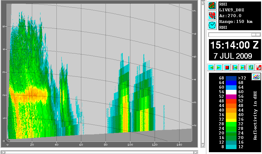
Range Height Indicator (RHI) and Cross Section (XSECT):
- A cross section is a tool for studying the vertical structure and to identify possibly hail-generating cells
- Weaker intensities in the thinner parts of the anvil (below -10 dBz) can only be detected close to the radar
- The bright band (maximum reflectivity layer due to melting snow) can be detected even in convective rain in spite of strong vertical movements, which make it weaker than in stratiform rain
- Even if the radar system is not performing RHI scans, one can usually make cross sections (XSECT) of the same data which is used e.g. for MAX products. XSECT is used like RHI, but it usually has worse vertical resolution.
|
RHI
|
XSECT
|
|
|
Accumulated precipitation for N hours (RAINN product)
- Generated from CAPPI products
- Points out the areas of maximum precipitation
- Outstanding resolution in space and time
- The accuracy of an individual measurement is only about 50%, because far from the radar the measurement volume is quite large and well above the ground
- Good accuracy is gained when the rain amounts are summarized over a longer period from the whole radar network with some corrections in the overlapping areas
|
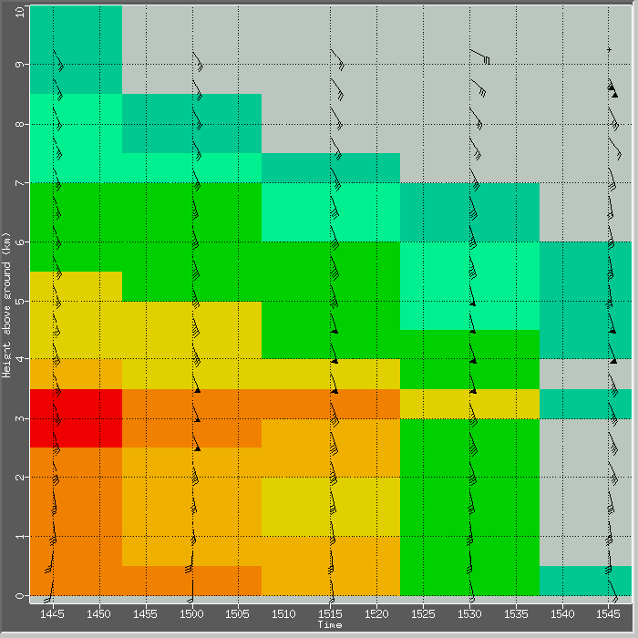
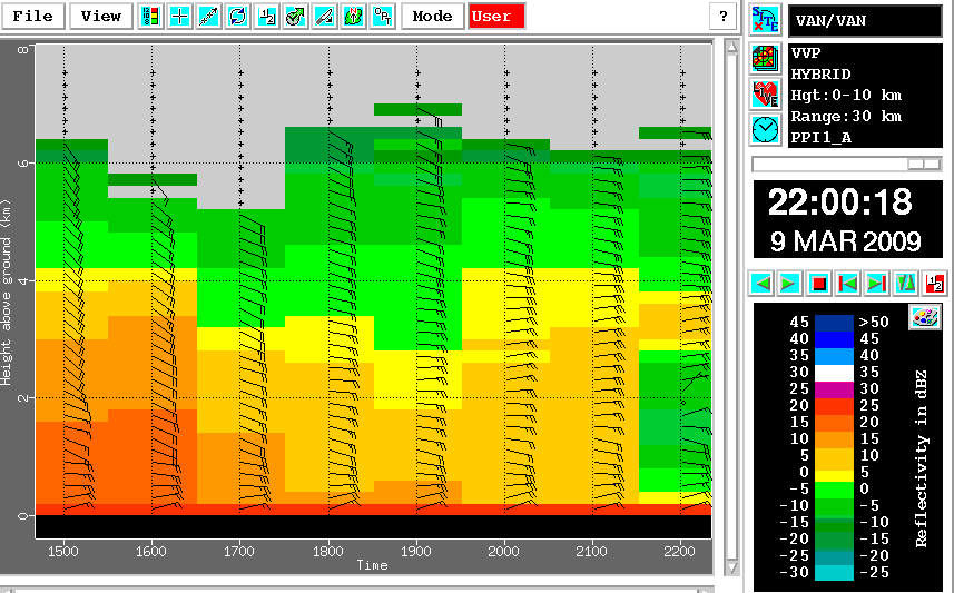
Time - Height cross section of Volume Velocity Processing wind profiles (THVVP - time series of wind profiles)
- The best mesoscale tool for studying changes in wind shear, given enough time resolution (typically a new sounding every 15 or 30 minutes)
- Radar winds represent an average of a larger volume, e.g. in this case a cylinder 40 kilometres in radius, 200 metres thick
- If the wind field is not linear, the average through such a volume can be erroneous
|