Table of Contents
Cloud Structure In Satellite Images
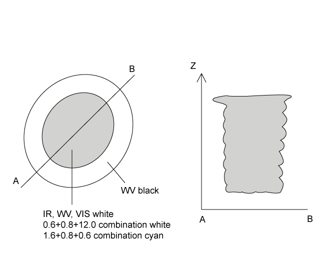
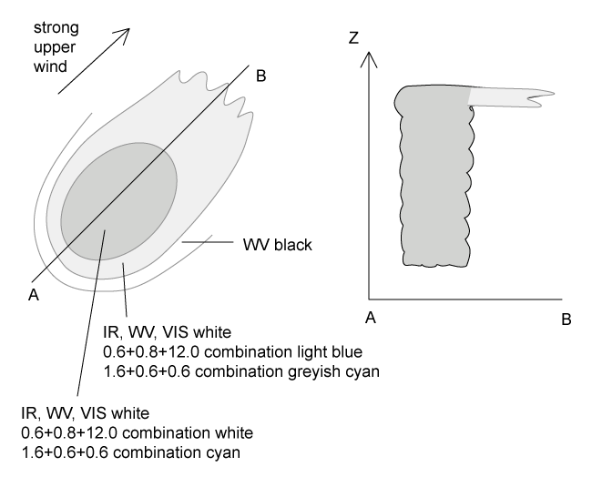
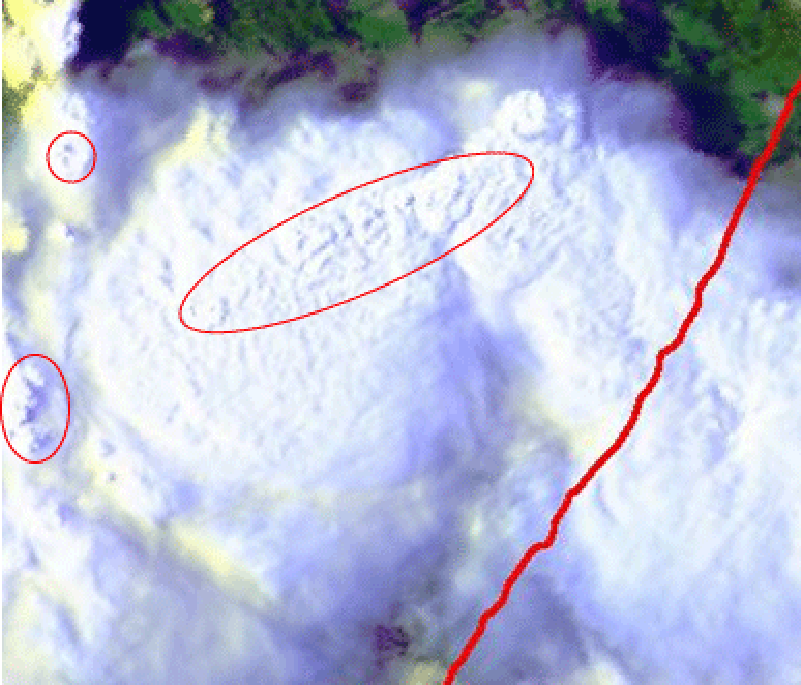
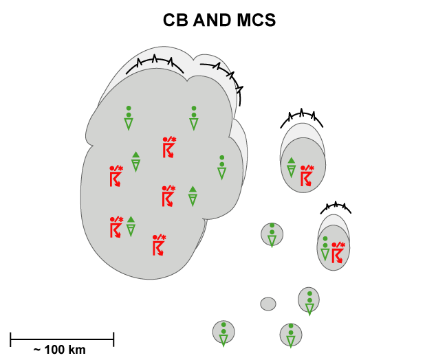
In the satellite images an MCS appears like a mesoscale cloud cluster, which has a circular or oval shape depending on the strength of the upper level wind.
- In IR, WV and VIS images MCS are characterized by high pixel values (white) in the active part, indicating cloudiness which extends through the whole troposphere.
- The upstream edges of the cloud cluster are generally very sharp. In situations with strong upper level winds, the high cloud is transported downstream leading to an extended white cloud shield in the IR but a fibrous grey texture in the VIS image. The brightest areas can be found in the active part upstream.
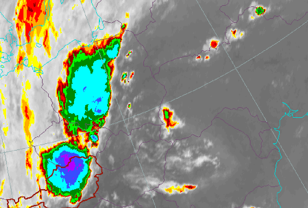
- In the 0.6+0.8+12.0 combination the active thundercloud is white, while the thinner edges of the anvil are light blue.
- In the 1.6+0.8+0.6 combination the active thundercloud is cyan, and the anvil can be separated as a little more greyish.
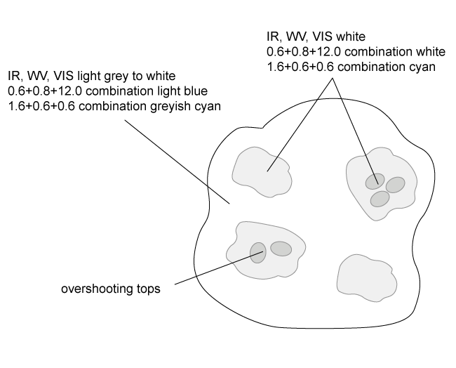
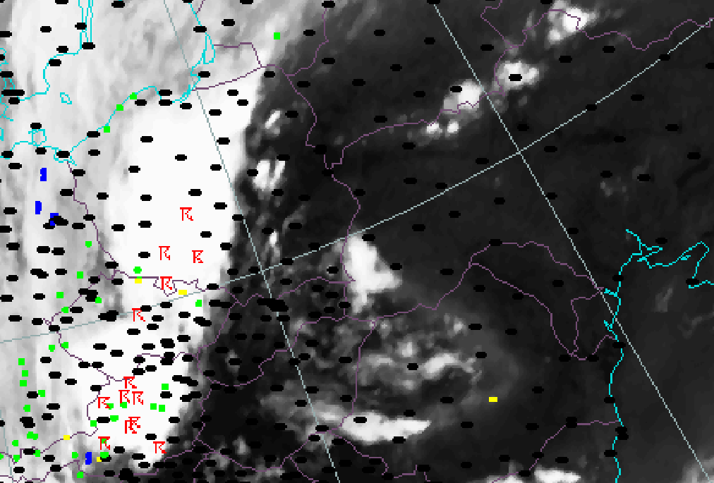
- In AVHRR imagery the brightest individual cells embedded in a Multi Cell Storm can be detected better than in Meteosat 8 images. Also the overshooting tops of strongest cells embedded in the cirrus anvil can be often be distinguished.
|
|
|
|
|
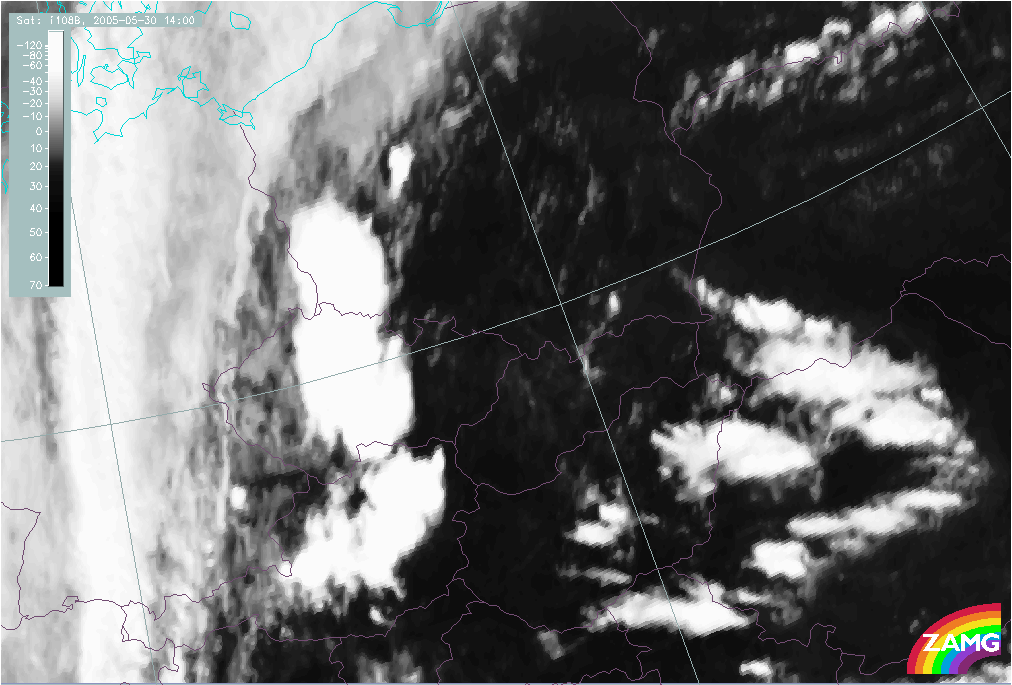
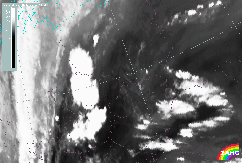
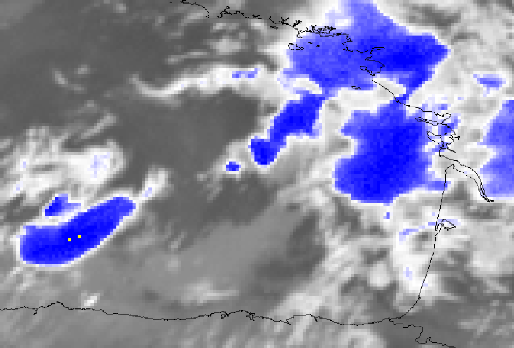
30 May 2005/14.00 UTC - Meteosat 8 IR 10.8 image
|
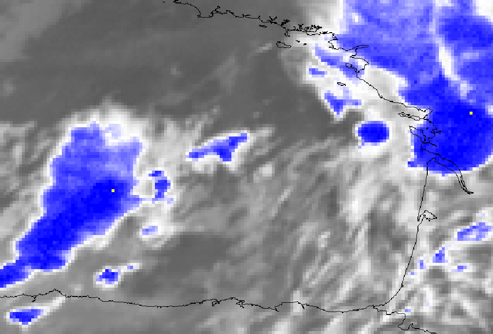
30 May 2005/14.00 UTC - Meteosat 8 WV 6.2 image
|
|
|
|
|
|
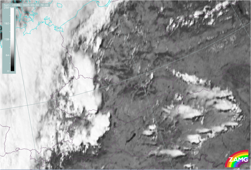
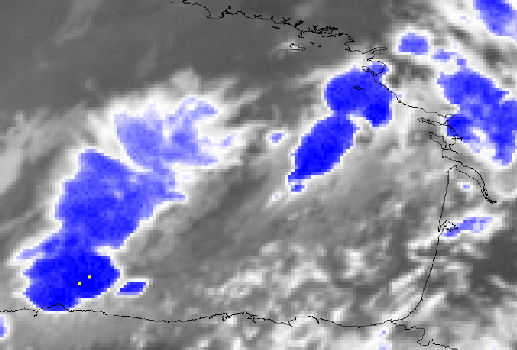
30 May 2005/14.00 UTC - Meteosat 8 VIS 0.8 image
|
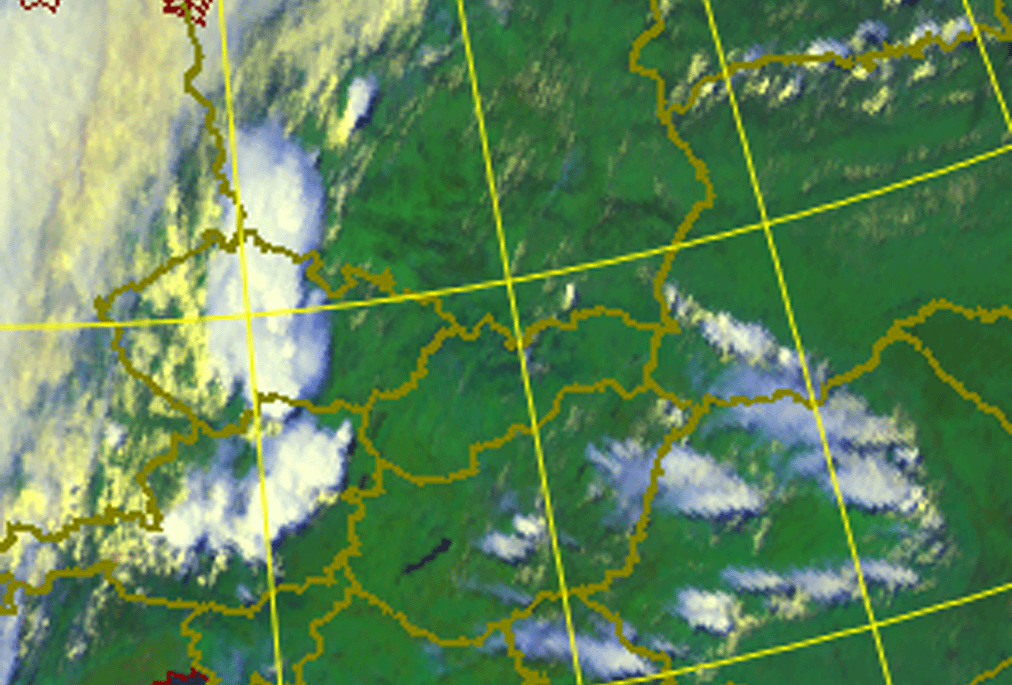
30 May 2005/14.00 UTC - METEOSAT 8 RGB image (0.6, 0.8 and 12.0)
|
|
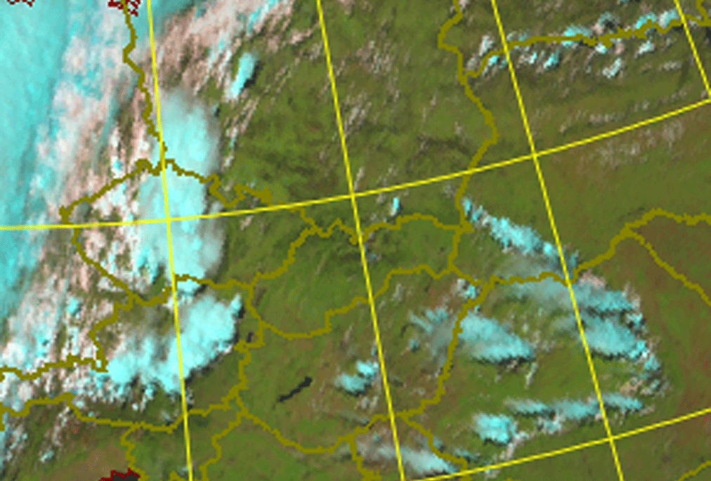
30 May 2005/14.00 UTC - Meteosat 8 RGB image (1.6, 0.8 and 0.6)
|
05 July 2002/15.35 UTC - NOAA AVHRR RGB image (0.6, 0.8 and 12.0); overshooting tops indicated
|
|
|
Meteorological Physical Background
Cbs and MCSs form in strong convective processes. These processes and the parameters which describe them are discussed in detail in the Basics chapter "Numerical parameters for small scale convective cloud systems" (see Basics ).
The structures described below have been derived from radar observations, as satellite images cannot resolve small-scale single storms or substructures of MCSs.
The life cycle of a single cell
The life cycle of a single cell can be separated into three stages:
- Developing stage
- Mature stage
- Dissipating stage
Developing stage
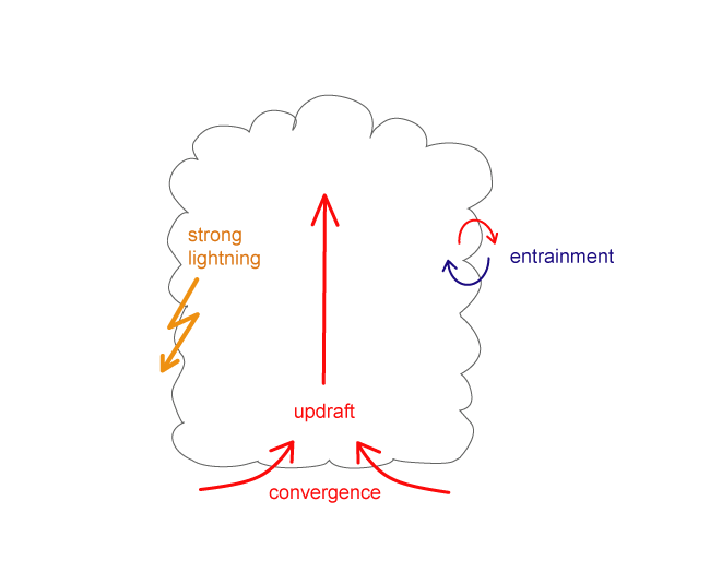
The following features characterize the developing of a single cell:
- The developing stage lasts 5 to 10 minutes
- A distinct single updraft is prevailing
- The diameter of the cell is between 2 and 8 km
- Entrainment at the cloud edges causes the reduction of water vapour content, resulting in the evaporation of water droplets. This causes cooling and consequently reduction of buoyant energy. A supply of humidity from lower levels supports further growth of the developing cell.
- In the end of this stage lightning is most intense
Mature stage
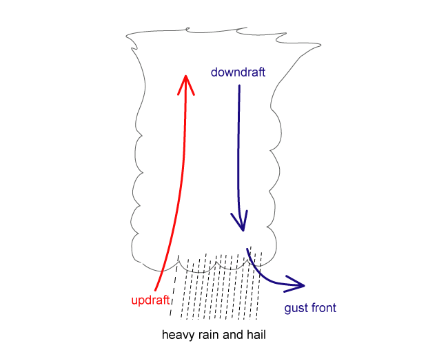
The following features characterize the mature stage of a single cell:
- The mature stage lasts 25 to 30 minutes
- Downdrafts develop and are accelerated as a consequence of cooling by the evaporation of cloud droplets
- Hail stones are no longer kept aloft by the updraft and fall
- The updraft starts to weaken because the warm humid air below the cell is replaced by cool air from the downbursts
- The downdraft initiates successive developments of new cells which can be observed as gust fronts
- Rain and hail are most intense; hail with a diameter over 5 cm develops in the updrafts of the order 30-40 m/s
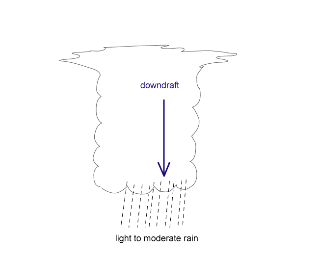
Dissipating stage
- Downdrafts kill the updraft and the Cb dissipates
The role of vertical wind shear
The life time and intensity of a Cb and MCS depend upon the vertical wind shear:
- The shear perpendicular to the convective line supports updraft
- Most important is the shear in the lowest layer reaching from the surface up to 2-3 km
- Cells developing within strong vertical shear have long lifetime and severe weather
- Most intense thunderstorms develop when there is change both in speed and direction of the wind
Multi-cell storms
Multi-cell storms develop from a single cell:
- The single cell produces a gust front around it; the gust front lifts the air to the level of free convection (LFC), and new cells (daughter cells) form
- New cell growth is favoured on the downwind side of the moving single cell where the lift is the greatest
- Daughter cells develop mostly in the right leading side of the mother cell (so called "right movers"), but they can also develop in the left side (so called "left mover"). They can be distinguished from the structure of the vertical wind shear.
- Left movers move faster than mean low level flow, whereas right movers move slower than it
- Tornadoes are uncommon in left movers
- The diameter of the daughter cells is 3-5 km, and the distance to the centre of the thunderstorm is approximately 30 km.
- The mother cell and daughter cells form together a Multi-Cell Storm. New cells develop ahead of the leading edge of the storm while older cells dissolve in the rear parts
- Daughter cells develop more rapidly than the mother cell, because entrainment is not slowing the process on the rear side. If the sequence of successive cells is short enough, the Multi-Cell Storm can turn into a Super Cell Storm.
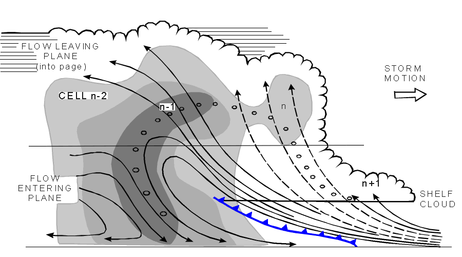
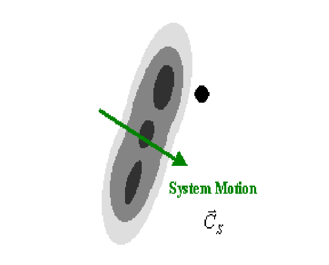
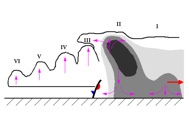
The diagram above (adapted from Browning et al., 1976; Greyshades represent radar reflectivities of 35, 45 and 50 dBz) shows a typical cross section through a Multi-Cell Storm. There are four successive cells in different stages of development, each of which takes about 15 minutes:
- Cell n-2 is already in dissipating stage
- Cell n-1 is in mature stage and forms the centre of the storm
- Cell n (a daughter cell) is in developing stage
- A shelf cloud n+1 with a crisp, flat base indicating an active updraft forms ahead of cell n
During the warm season, MCS triggering peaks at around 2 pm (local solar time) due to the heating in the lower levels of the atmosphere. However, in Europe, where MCS last in average 5.5 hours, 20% of MCS triggering happens during the night (between 10 pm and 9 am), when other lifting mechanisms are expected to play a key role, as low level convergence, mid-level cold pools or out-flows of pre-existing MCSs.
In the European region, details on MCS Climatologies based on satellite or radar data can be found, eg., for Switzerland (Schiesser et al, 1995), Spain (AEMET, 1999) and Finland (Punkka et al, 2009; Saarikalle, 2009). A wider (satellite derived) MCS climatology covering western Europe (including surrounding Atlantic coasts), western Mediterranean Sea and northern Africa is presented in Morel and Senesi (2002b).
A particular mechanism under which convective cells (embedded in a certain flow) form approximately in the same location as pre-existing cells during several hours - train effect - is investigated in the special investigation chapter.
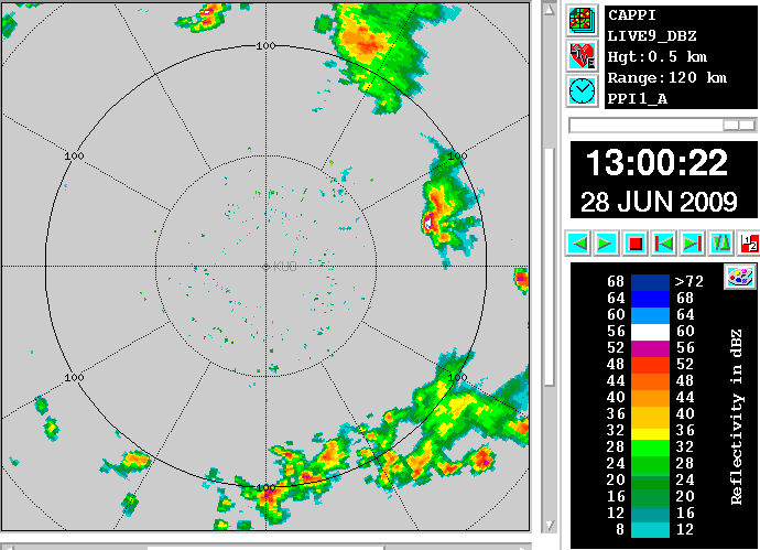
Observations and verification by radar
See chapter Key parameters for typical radar products. In CAPPI products the following features typical for MCSs can be seen, although they are not very clear in every case (depending also on the position of the radar compared with the convective system).
Bow echo:
- Bow or hook shaped strong (>40 dBz) echo area
- Very strong echoes surrounded by weaker ones within the echo area
- Begins as a straight line, develops into a bow shape and finally into a Comma shape
- Lasts for a few hours
- The region near the centre of the bow is ahead of strong surface winds, thought to be associated with a rear inflow jet entering the MCS
Gust front:
- Occurs ahead of the leading edge of the reflectivity pattern
- Clear air echoes coming from insects and debris
Side-lobe echoes:
- Often seen in radar displays of storms producing hail
- Running parallel to the distance marker (from the radar position)
- Are reflections from strong cumulonimbus, created by side-lobes of the antenna beam
Key Parameters
For nearly all conceptual models the "key parameters" are parameters derived from numerical models. In the case of convective development the key parameters are relevant observations and additional artificial satellite images. The following material is used:
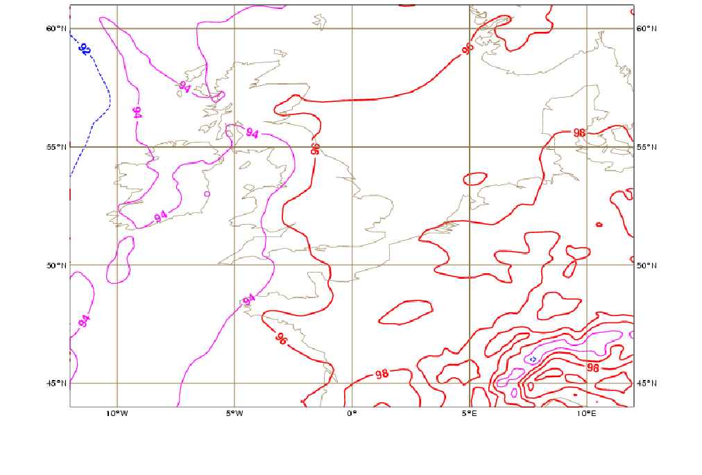
- Satellite imagery with an appropriate cold cloud top enhancement:
- Typical circular and oval shape of the MCS
- Cloud top temperature below -32°C: in the case of circular type for an area with diameter of 100-500 km and in the case of oval type for a major axis of 200-900 km
- Weather reports:
- Thunder
- Showers
- Lightning Reports
- Radio Soundings
- Wind Profile
- Stability
Cold cloud top enhancement
|
|
30 May 2005/15.00 UTC - Meteosat 8 IR 10,8 enhanced image
|
|
Weather reports
|
|
30 May 2005/18.00 UTC - Meteosat 8 IR 10,8 image; weather events (green: rain and showers, blue: drizzle, red: thunderstorm with
precipitation, orange: hail, black: no precipitation)
|

|
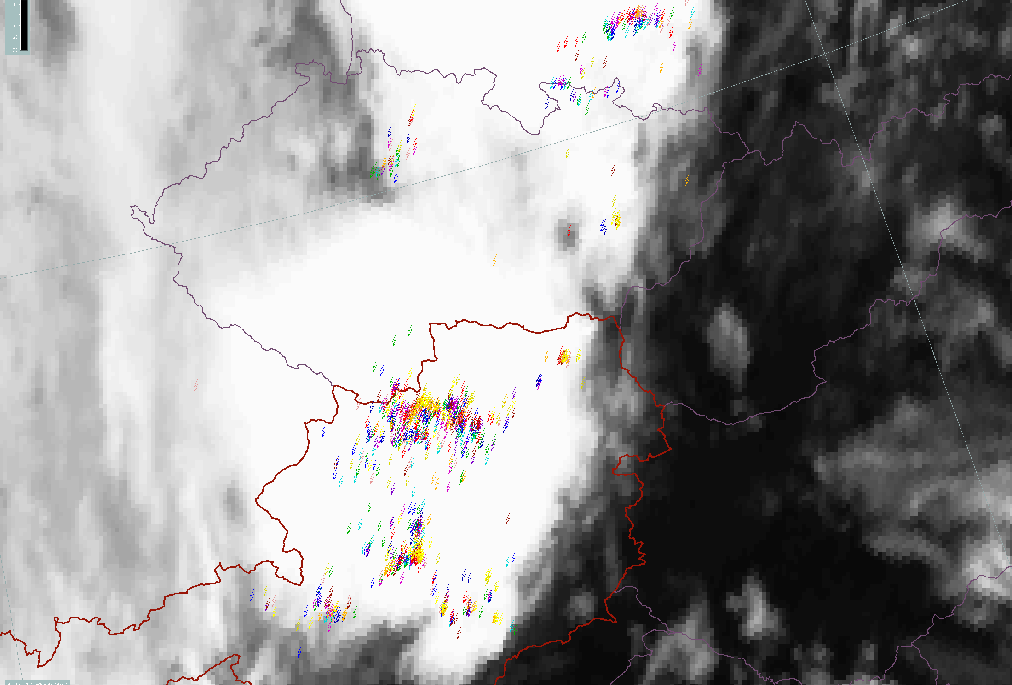
Lightning Reports
|
|
30 May 2005/18.00 UTC - Meteosat 8 IR 10,8 image; Lightning interval (yellow: 0-5 min, orange: 5-10 min, red: 10-15 min, magenta:
15-20 min, blue: 20-25 min, green: 25-30 min)
|
|
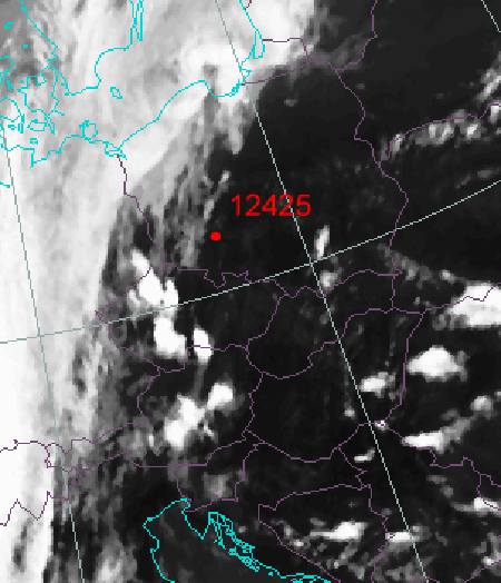
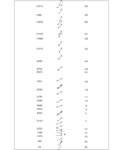
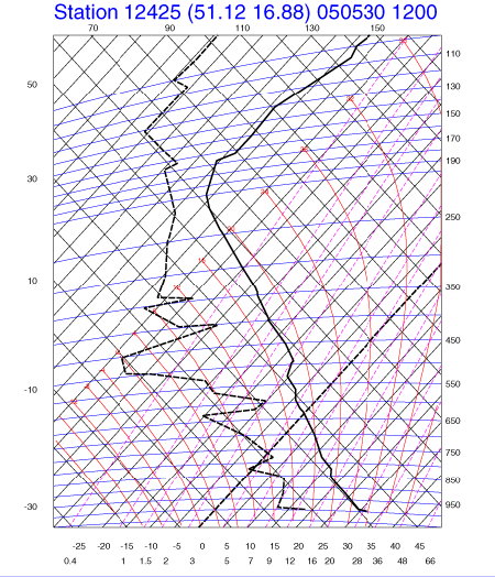
Radio Soundings
|
30 May 2005/12 UTC - Meteosat 8 IR 10,8 image; position of Wroclaw sounding station indicated
|
30 May 2005/12.00 UTC - Radio sounding Wroclaw; Wind direction and speed
|
|
|
|
|
|
30 May 2005/12.00 UTC - Radio sounding Wroclaw; thick solid: temperature, black dashed: dew point
|
|
Radar
Radar is a significant tool for observing convective clouds (see Meteorological physical background). Even small scale features within the MCSs at different heights can be observed. Although this manual concentrates on satellite imagery, the following paragraphs provide an introduction to different radar reflectivity products. More details may be found in relevant radar literature.
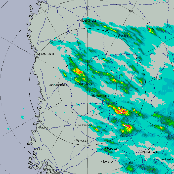
Constant Altitude Plan Position Indication (CAPPI)
- Constant altitude data is picked and interpolated from different elevation scans
- Beyond a certain distance, the lowest available data is selected
- Avoids somewhat the PPI problems: ground clutter near the radar nd overshooting of the beam far from radar
|
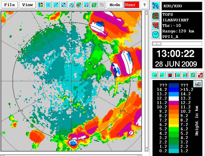
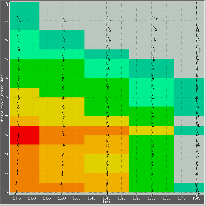
Tops
- Tool for following the development of a convective system
- Used together with the temperature profile
- When tops reach the value of -15°C, precipitation begins
- When tops reach the value of -25°C, the chance of thunder is considerable
|
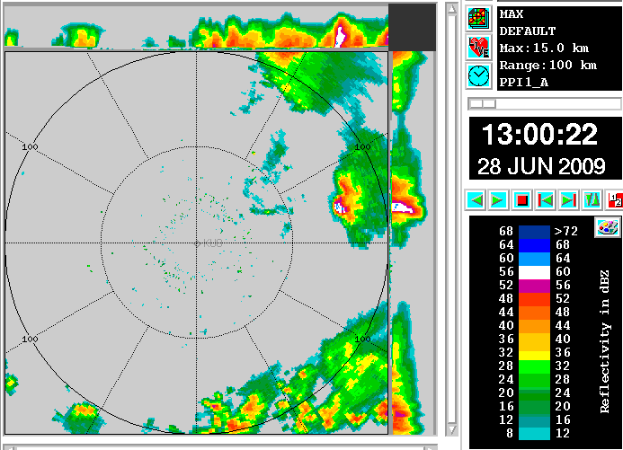
MAX
- Tool for identifying the strongest cells in a multicell system
- High dBz values at high altitudes (e.g. +30 dBz at 5 kilometres) almost certainly relate to hail or wet hail, and indicate strong updrafts
- The side panels provide more accurate information about the position of cells
|
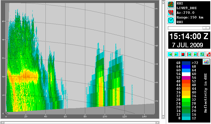
Range Height Indicator (RHI) and Cross Section (XSECT):
- A cross section is a tool for studying the vertical structure and to identify possibly hail-generating cells
- Weaker intensities in the thinner parts of the anvil (below -10 dBz) can only be detected close to the radar
- The bright band (maximum reflectivity layer due to melting snow) can be detected even in convective rain in spite of strong vertical movements, which make it weaker than in stratiform rain
- Even if the radar system is not performing RHI scans, one can usually make cross sections (XSECT) of the same data which is used e.g. for MAX products. XSECT is used like RHI, but it usually has worse vertical resolution.
|
RHI
|
XSECT
|
|
|
Accumulated precipitation for N hours (RAINN product)
- Generated from CAPPI products
- Points out the areas of maximum precipitation
- Outstanding resolution in space and time
- The accuracy of an individual measurement is only about 50%, because far from the radar the measurement volume is quite large and well above the ground
- Good accuracy is gained when the rain amounts are summarized over a longer period from the whole radar network with some corrections in the overlapping areas
|
Time - Height cross section of Volume Velocity Processing wind profiles (THVVP - time series of wind profiles)
- The best mesoscale tool for studying changes in wind shear, given enough time resolution (typically a new sounding every 15 or 30 minutes)
- Radar winds represent an average of a larger volume, e.g. in this case a cylinder 40 kilometres in radius, 200 metres thick
- If the wind field is not linear, the average through such a volume can be erroneous
|
Typical Appearance In Vertical Cross Sections
Cbs and MCSs are small scale or mesoscale CMs and, as such, are embedded within spatial vertical cross sections which tend to characterize the more general convective environment rather than the convective cell itself. The vertical structure within the convective cell is described in detail in the Basic chapter "Numerical parameters for small scale convective cloud systems" (see Basics ).
For more information about the vertical structure of a typical convective environment see chapters Convective Cloud Features In Typical Synoptic Environments:
Weather Events
| Parameter | Description |
| Precipitation |
|
| Temperature |
|
| Wind (incl. gusts) |
|
| Other relevant information |
|
|
|
30 May 2005/18.00 UTC - Meteosat 8 IR 10,8 image; weather events (green: rain and showers, blue: drizzle, cyan: snow, purple:
freezing rain, red: thunderstorm with precipitation, orange: hail, black: no actual precipitation or thunderstorm with
precipitation)
|
|
|
References
General Meteorology and Basics
- BROWNING K. A. (1985): Conceptual models of precipitation systems; Quart. J. R. Meteor. Soc., Vol. 114, p. 293 - 319
- BROWNING K. A. (1986): Conceptual models of precipitation systems; Weather&Forecasting, Vol. 1, p. 23 - 41
- CONWAY B. J., GERARD L., LABROUSSE J., LILJAS E., SENESI S., SUNDE J. AND ZWATZ-MEISE V. (1996): COST78 Meteorology - Nowcasting, a survey of current knowledge, techniques and practice - Phase 1 report, Office for official publications of the European Communities
- HOSKINS B. J., MCINTYRE M. E. and ROBERTSON A. L. W. (1985): On the use and significance of isentropic potential vorticity maps; Quart. J. R. Meteor. Soc., Vol. 111, p. 877 - 946
- KURZ M. (1990): Synoptische Meteorologie - Leitfäden für die Ausbildung im Deutschen Wetterdienst; 2. Auflage, Selbstverlag des Deutschen Wetterdienstes
- LILJEQUIST G. H. and CEHAK K. (1984): Allgemeine Meteorologie, 3. Auflage, Braunschweig, Vieweg
- ZWATZ-MEISE V. and MAHRINGER G. (1990): SATMOD: An interactive system combining satellite images and model output parameters; Weather&Forecasting, Vol. 5, p. 233 - 246
General Satellite Meteorology
- BADER M. J., FORBES G. S., GRANT J. R., LILLEY R. B. E. and WATERS A. J. (1995): Images in weather forecasting - A practical guide for interpreting satellite and radar imagery; Cambridge University Press
- ZWATZ-MEISE V. (1987): Satellitenmeteorologie; Springer Verlag, Berlin - Heidelberg - New York - London - Paris - Tokyo
Specific Satellite Meteorology
- AEMET (1999): Modelos conceptuales a mesoscala. Sistemas Convectivos de Mesoscala. Biblioteca de Modulos TEMPO. Version 2.0. April (in spanish).
- BROWNING K. A. and GOLDING B. W. (1994): Mesoscale effects of a dry intrusion within a vigorous cyclone; JCMM - internal report 29
- DOSWELL, C. A., CIMMS, N. OK: Severe Convection: Hail, Wind and Tornadoes. Lecture in the course Mesoscale Structure of Cyclones, Sardinia, June 2004
- MARTIN J. E., LOCATELLI J. D. and HOBBS P. V. (1992): The synoptic evolution of a deep tropospheric frontal circulation and attendant cyclogenesis; 5th Conference on Mesoscale Processes, Atlanta, Georgia, 5 - 10 January 1992
- MOREL C and SENESI S. (2002a): A climatology of mesoscale convective systems over Europe using satellite infrared imagery. I: Methodology. Quart. J. R. Meteor. Soc., Vol. 128, pp 1953-1971.
- MOREL C and SENESI S. (2002b): A climatology of mesoscale convective systems over Europe using satellite infrared imagery. II: Characteristics of European mesoscale convective systems. Quart. J. R. Meteor. Soc., Vol. 128, pp 1973-1995.
- PUNKAA A. - J., FMI: Vaarallinen Konvektio, Lecture in Training Course for Meteorologists, Helsinki, Finland, May 2003
- PUNKAA A. -J., SCHULTZ D., BISTER M. (2009): High-latitude Mesoscale Convective Systems: An 8-yr climatology of summertime MCSs in Finland. 5th European Conference on Severe Storms, Landshut, Germany, 12-16 October.
- SAARIKALLE E. (2009): Heavy rain events in Finland 2000-2008. M.S. Thesis - Meteorology. University of Helsinki. Department of Physics.
- SCHIESSER H. H., HOUZE JR R. A. and HUNTRIESER H. (1993): The Mesoscale Structure of Severe Precipitation Systems in Switzerland. Mon. Wea. Rev., 123, 2070-2097, July.
- Comet MetEd pages https://www.meted.ucar.edu/index.php
Special Investigation: The Train Effect Or Train Mechanism
Introduction
A special case of convective development is the so-called train effect or train mechanism, in which many intense convective cells form over the same place in a short period of time. This regime produces large amounts of rainfall, therefore being frequently related to flash flood events.
Meteorological Physical Background
The key for understanding why convective systems may produce large precipitation amounts over a certain place is determined by comparing the system motion with the system structure as explained below.
|
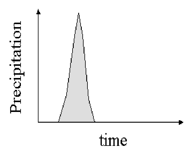
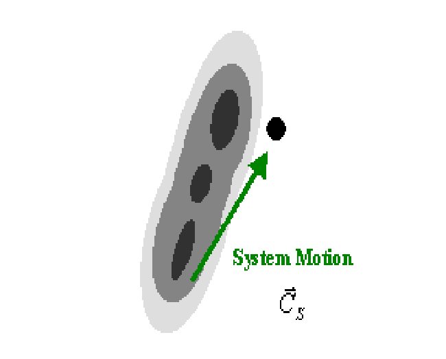
Consider a convective line structure (shades indicate radar reflectivity) moving across a specific location (circle) with a motion (C⃗S) nearly normal to the line. |
|
The total rainfall amount at the referred location (shaded area in the graphic) is relatively small. |
|
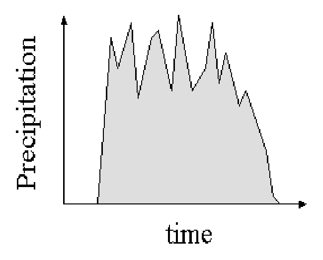
Now consider the same line structure, passing over the same location, but with its motion with a small normal component to the convective line. In this case the single convective structures embedded in the line will consecutively pass over the same spot. |
|
Precipitation plot will reflect this feature, showing consecutive peaks of precipitation during a longer period, therefore with large amounts of total precipitation. |
|
Adapted from Doswell et al (1996).
|
|
It is now important to distinguish between system motion and cell motion - system motion represents the movement of the system as whole and cell motion represents the movement of individual cells within the same system (or group of cells as in the case of a MCS or MCC). While cell motion is easily detected following the movement of convective cells in successive satellite or radar images, system motion may be somewhat trickier. For determining system motion from satellite or radar imagery, forecasters need not focus on the movement of single cells (or group of cells) but analyze instead the position of the convective system as a whole for a few hours.
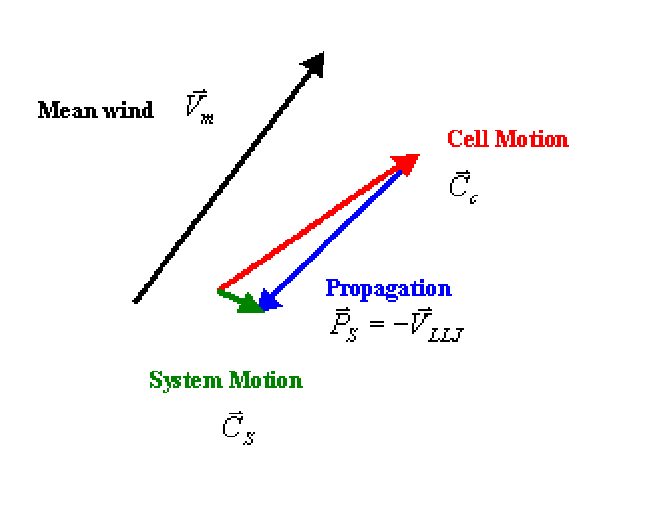
Cell Motion
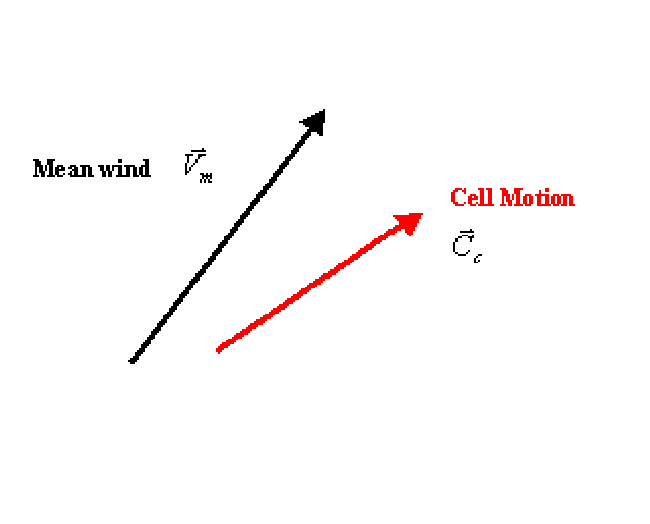
Cell motion (C⃗c) is generally related to the mean wind in a certain tropospheric layer in which cloud systems are embedded. In the example below, cell motion vector is to the right of mean wind vector, which therefore classifies the cell as a right mover. Some studies for MCS and MCC show that cell motion has a higher correlation with wind at 700 hPa.
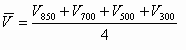
The estimation of mean wind is obtained from averaging wind vectors in a representative layer, which naturally should vary from case to case. If the cloud layer is well represented by the 850-300 hPa layer, then mean wind can be determined by an average at that layer:
Propagation of the system and System Motion
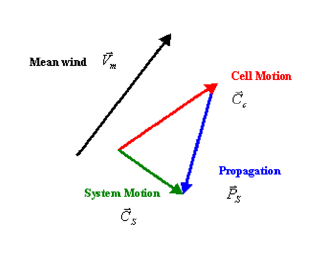
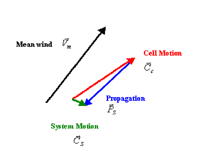
At the end, system motion is what matters to define small or large precipitation amounts in a specific location. System motion ( C⃗S) results from combining cell motion (C⃗c) with the propagation of the system as a whole defined by vector P⃗S.
|
If the propagation vector P⃗S differs considerably in azimuth from cell motion C⃗c (as shown left), then the system motion vector C⃗S acts in such a way that the system moves to its right during the life-time, affecting different areas. |
|
On the other hand, if the propagation vector P⃗S practically off-sets cell motion C⃗c (that is, it has almost the same intensity but an opposite direction), then system motion vector C⃗S is such that the system can be considered quasi-stationary. |
|
Adapted from Corfidi et al (1996) and Doswell et al (1996).
|
|
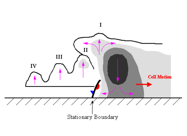
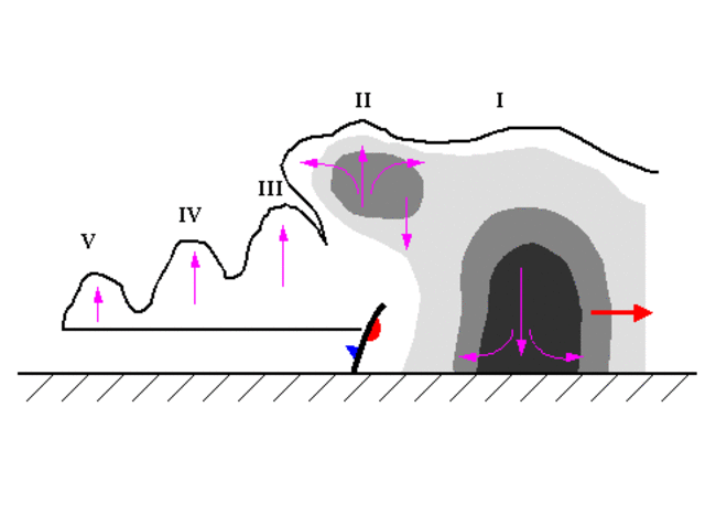
Let us now consider 3 steps in the development of an MCS in which cell motion and propagation have opposite directions (expanding the scheme showed in Multi-cell storms - see Meteorological Physical Background ).
|
Step 1 - Cell I is forming over the position of a low level outflow boundary (plotted for the sake of simplicity as a stationary front) with a strong updraft above and divergence in the upper troposphere. |
|
Step 2 - Cell I is moving eastward and cell II is now forming over the same stationary boundary. The outflow from cell I interacts positively, reinforcing the updraft of cell II |
|
Step 3 - A third cell (cell III) is now building over the same location, but this time at the expense of cell II outflow. This confirms a westward propagation with eastward cell motion, resulting in a train effect. |
|
Adapted from Doswell et al (1996); grey shades represent radar reflectivities of 10, 30 and 50 dBZ).
|
|
In fact, propagation can be affected by other factors not directly related to the convective storm. Examples of such factors are fronts or sea-breeze fronts. When these processes act as stationary boundaries for the convective system, the development of new cells will therefore fit the train effect. Note that in literature, the train effect has been analyzed together with up-wind development (back-building) and down-wind development.
From stated above, it is easy to conclude that knowing the propagation vector in an operational basis would be the key tool to detect quasi-stationary convective systems, that is, to forecast heavy rainfall and the probability of occurrence of flash flood events. Unfortunately, the determination of the propagation vector is still not completely clear. Corfidi et al (1996) suggested that the speed and direction of the low-level jet (LLJ) could be indicative of the propagation.
AEMET (1999), in a study for MCSs in Iberian Peninsula area, also suggest a simple approximation in which propagation could be retrieved from wind at 850 hPa, that is P⃗S = - V⃗850
In latter studies, Corfidi (1998, 2003) updates the results referring that propagation for MCS does not necessarily occurs most rapidly in the direction of the LLJ, but rather in the direction of the largest system relative low-level convergence - this direction may or may not be the direction of the LLJ.
In the second case, when convergence is maximized in a direction away from the LLJ (for instance due to the existence of gust fronts under conditionally unstable environments), the system motion can be very different from the one predicted by the original technique. In this up-dated technique, the propagation vector P⃗S may be called Storm Relative Inflow (SRI) vector. The resulting system motion C⃗S can be very large (downwind propagation), therefore not fitting a train effect scenario.
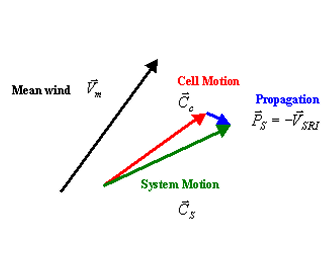
Note that the author suggests that the propagation for this up-dated technique matches the system motion vector obtained using the original technique.
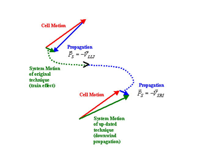
This may seem surprising, but this suggestion is based on the fact that the system motion obtained using the original technique can be considered as the vector difference between two flows: i) the gust front (considered to be moving at the speed of the mean cloud layer wind) and ii) the low-level flow (considered to be represented by the low-level jet).
Finally, note that the mechanism of training has also been found to happen in systems similar in nature to a MCS but that do not meet the size criteria; these systems, referred to as sub-MCS, are related to moderate precipitation events (Saarikale, 2009).
Cloud Structure in Satellite Images
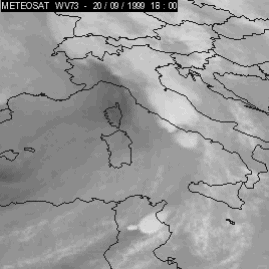
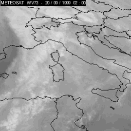
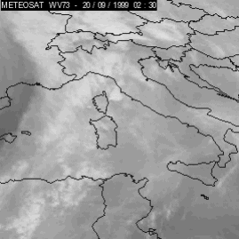
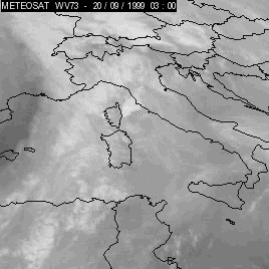
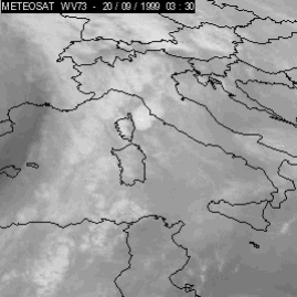
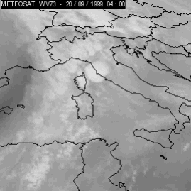
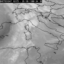
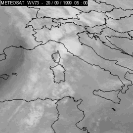
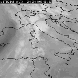
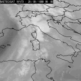
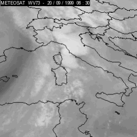
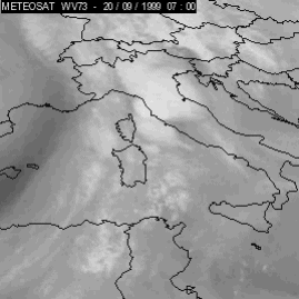
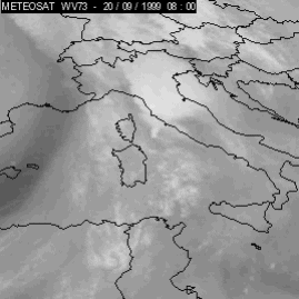
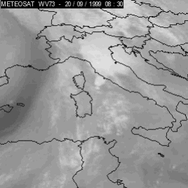
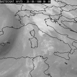
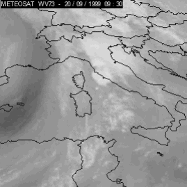
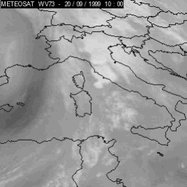
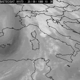
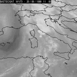
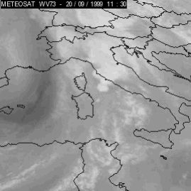
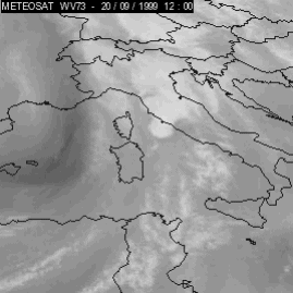
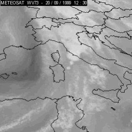
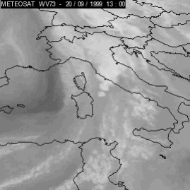
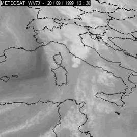
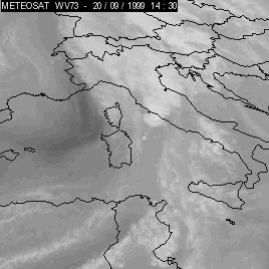
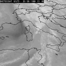
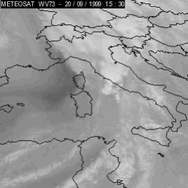
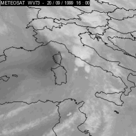
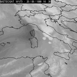
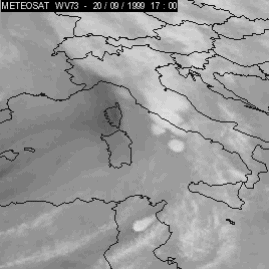
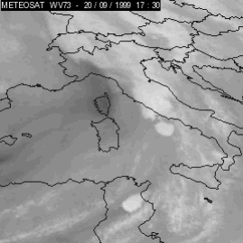
Train effect is clearly seen in satellite images making use of animations of several hours. In the animation shown below (left) for an event on 20 September 1999, the 30 minutes time resolution WV channel of Meteosat 7 can be followed between 02.00 UTC and 18.00 UTC. During the 16 hours you can see the convective area as whole moving southeastwards, with many convective systems forming over the Tyrrhenian sea.
|
20 September 1999/18.00 UTC - Meteosat 7 WV image
|
20 September 1999/02.00 UTC - Meteosat 7 WV image; 20 September 02.00 - 18.00 UTC half-hourly image loop
|
|
|

|
|
|
20 September 1999/14.00 UTC - Meteosat 7 WV image
|
20 September 1999/07.30 UTC - Meteosat 7 WV image; 20 September 07.30 - 14.00 UTC half-hourly image loop
|
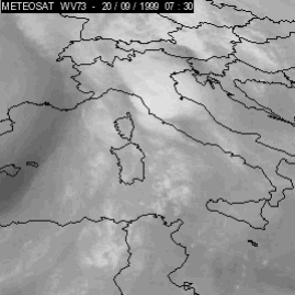
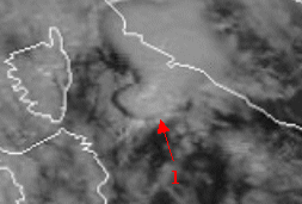
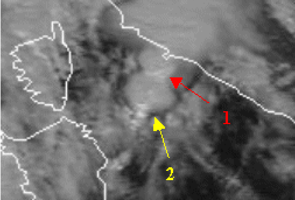
If focusing on a narrower period of time - from 07.30 to 14.00 UTC (right animation above), one can see that the convective systems are forming over the same area, as plotted below left at 10.00 UTC (cell 1 - fully developed) and below right at 11.30 UTC (cell 1 moved northeastward and a new fully developed cell - cell 2 - formed in the same area where cell 1 was 90 minutes earlier).
|
20 September 1999/10.00 UTC - Meteosat 7 VIS Image
|
20 September 1999/11.30 UTC Meteosat 7 VIS Image
|
|
|
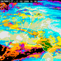
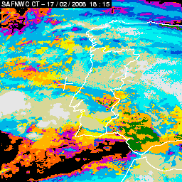
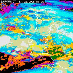
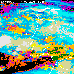
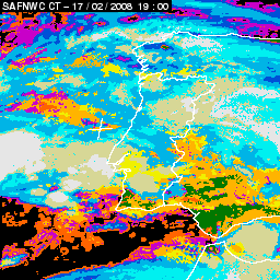
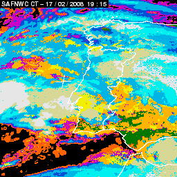
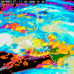
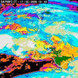
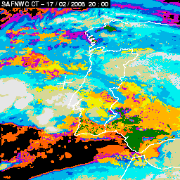
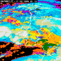
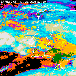
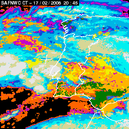
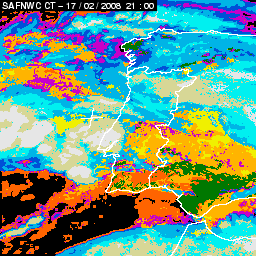
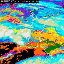
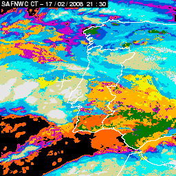
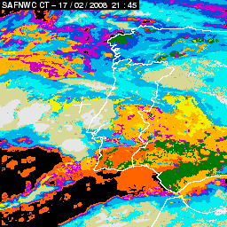
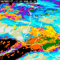
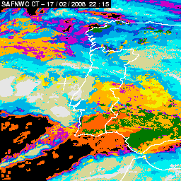
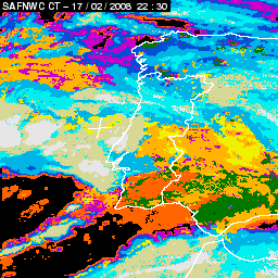
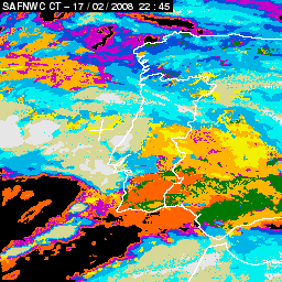
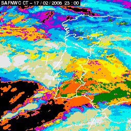
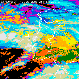
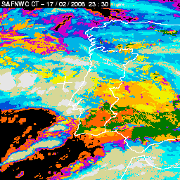
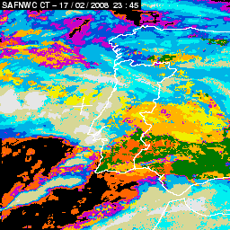
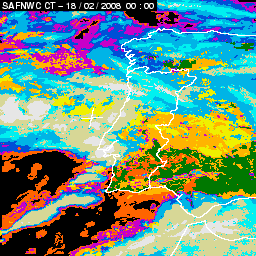
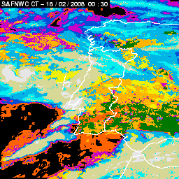
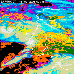
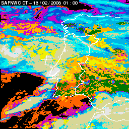
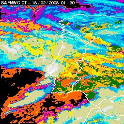
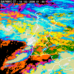
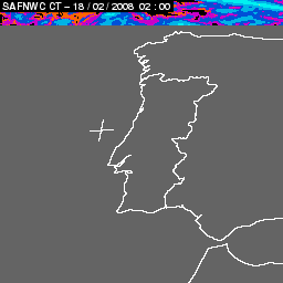
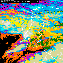
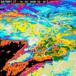
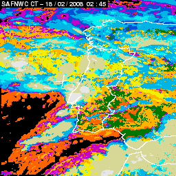
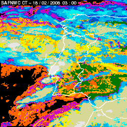
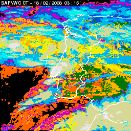
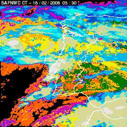
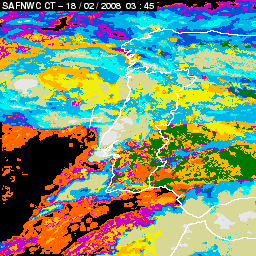
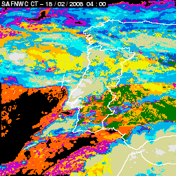
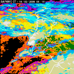
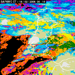
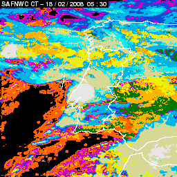
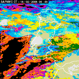
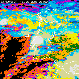
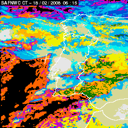
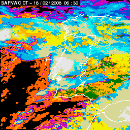
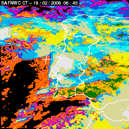
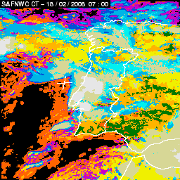
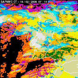
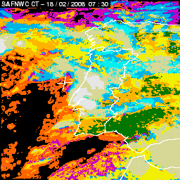
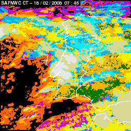
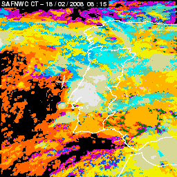
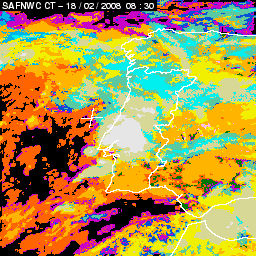
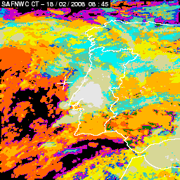
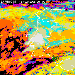
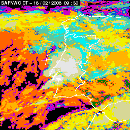
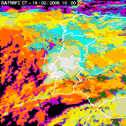
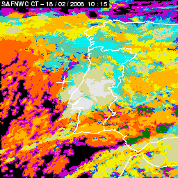
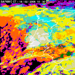
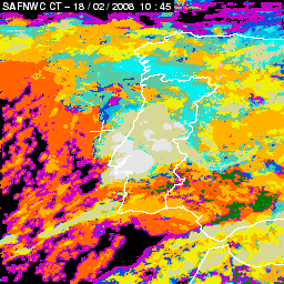
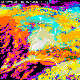
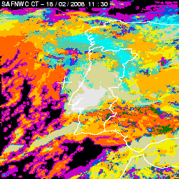
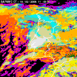
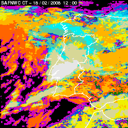
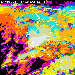
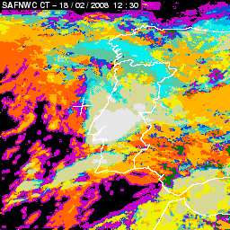
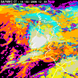
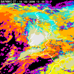
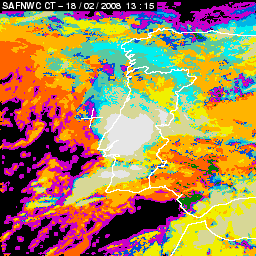
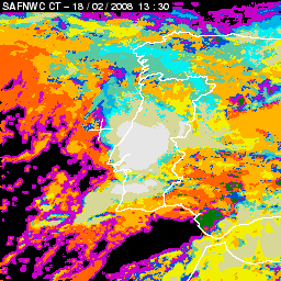
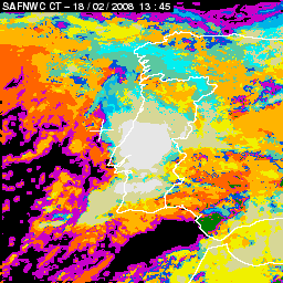
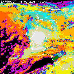
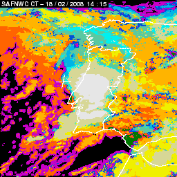
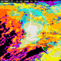
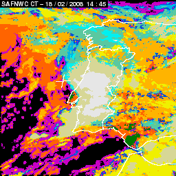
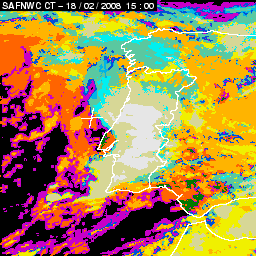
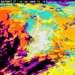
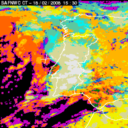
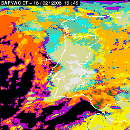
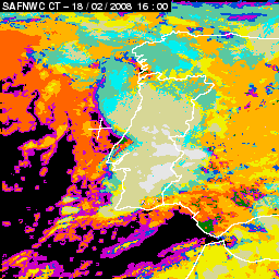
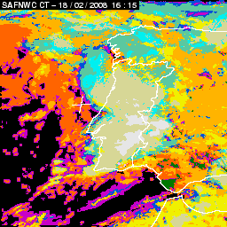
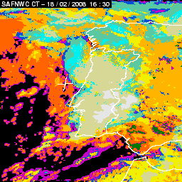
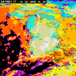
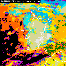
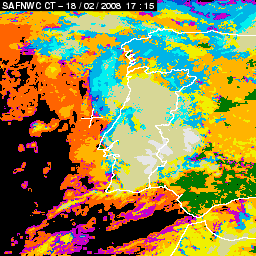
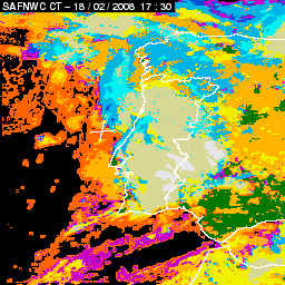
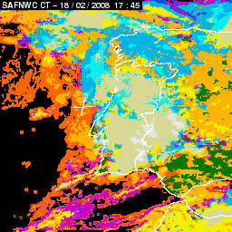
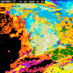
Two recent situations of train effect observed by MSG are shown below. The first happened in Portugal on 17 to 18 February 2008 producing severe flash floods (with maximum precipitation amounts of 99.7 mm in 6 hours and 153.6 mm in 24 hours in Lisbon). The 24 hour animation of the cloud type product from SAF Nowcasting shows several convective systems forming over Lisbon area during night and early morning on the 18th and also during morning to the southeast of Lisbon, in a similar pattern as the case over the Tyrrhenian sea.
|
17 February 2008/18.00 UTC - Cloud Type Product; 17 February 18.00 - 18 February 18.00 UTC quarter-hourly image loop
|
|
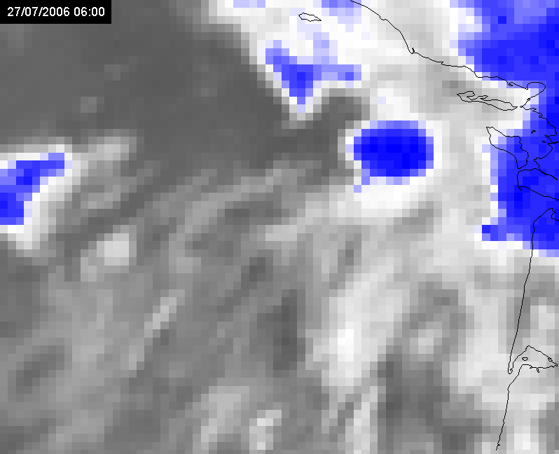
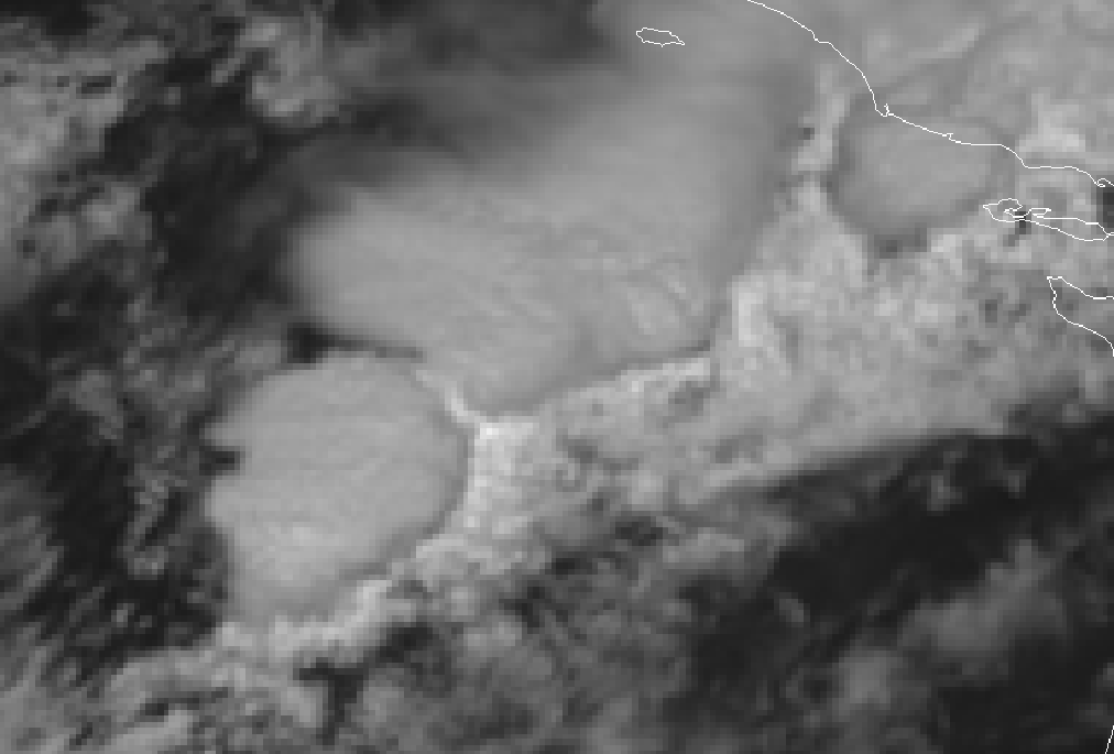
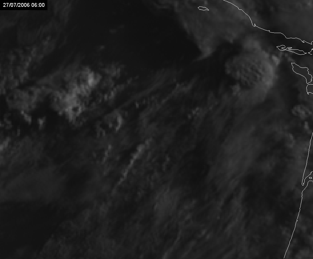
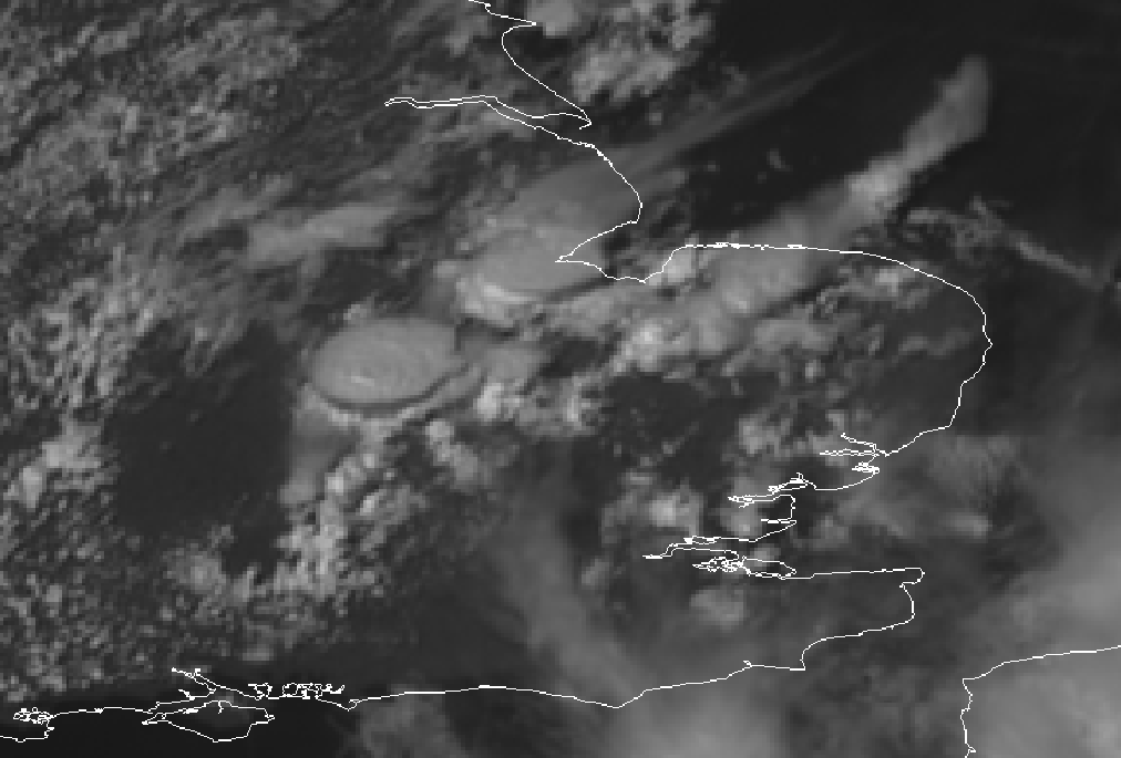
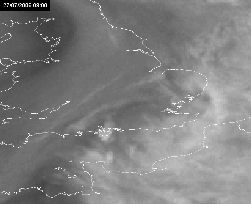
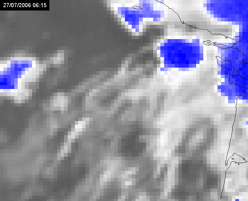
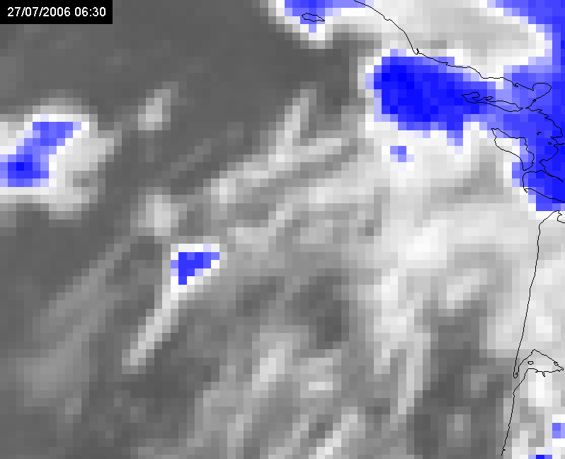
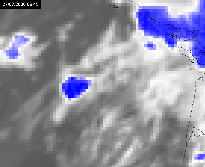
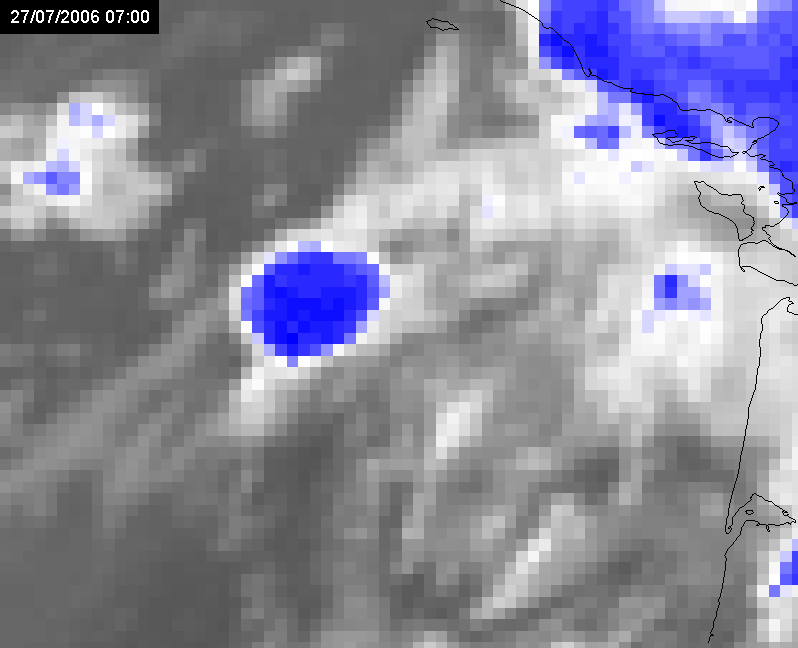
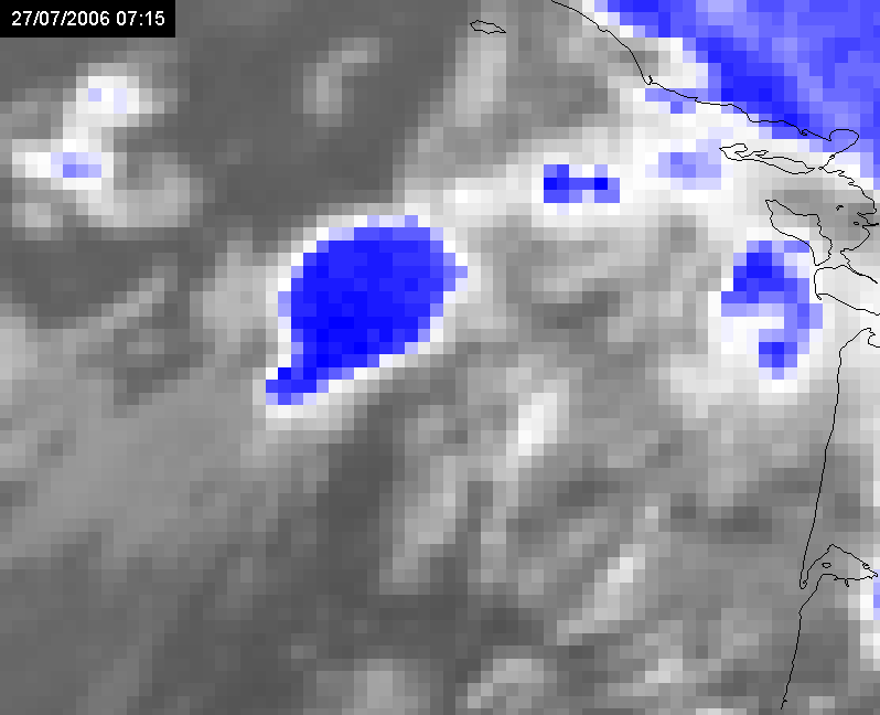
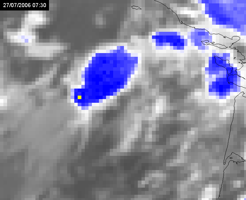
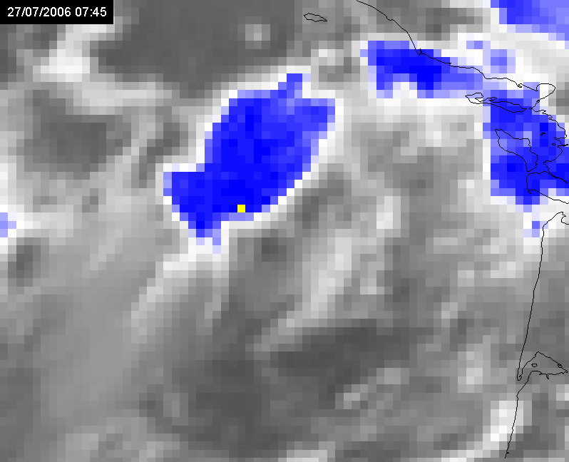
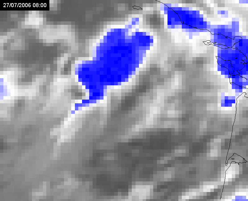
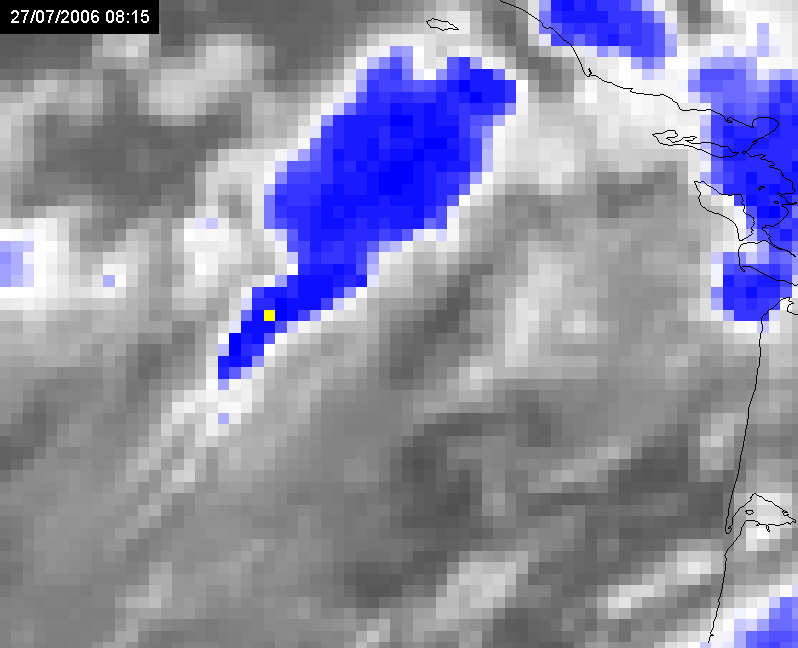
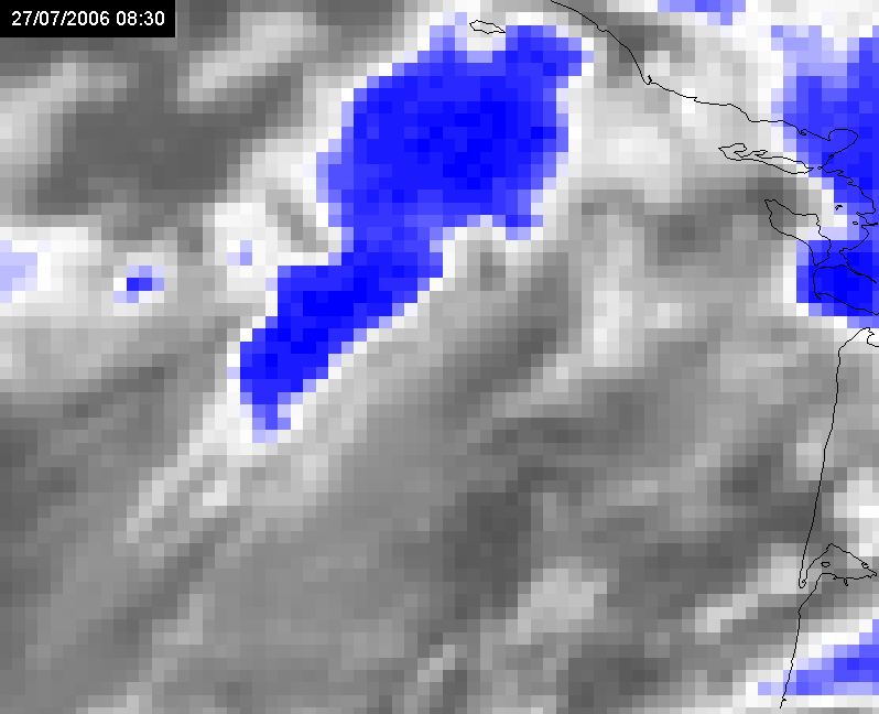
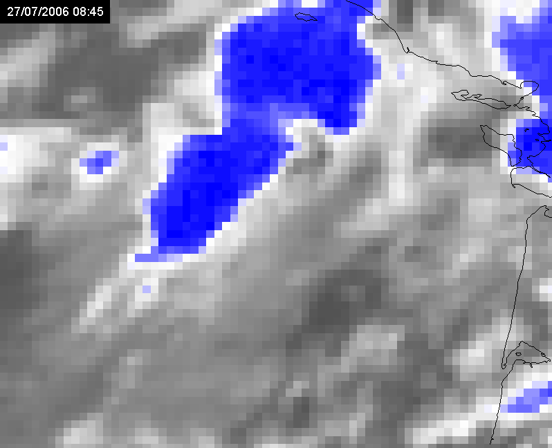
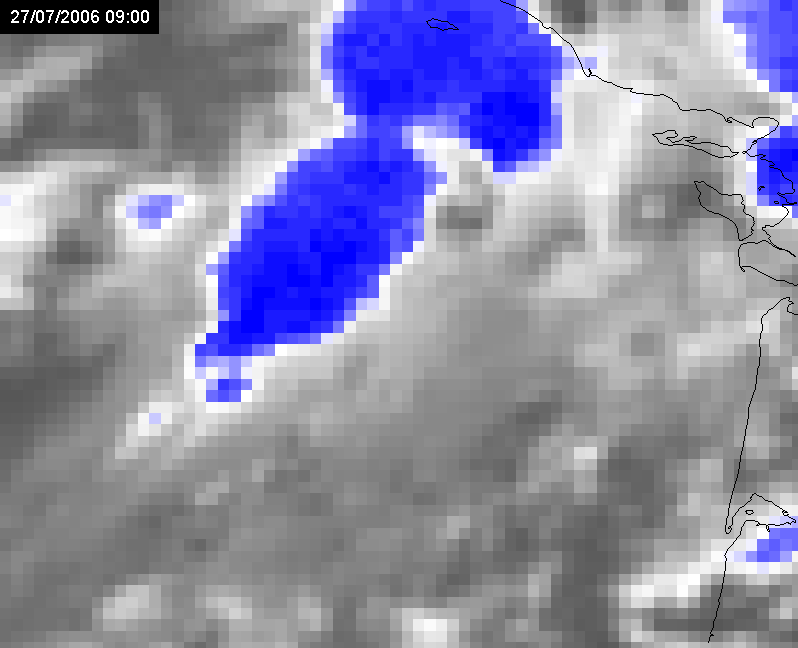
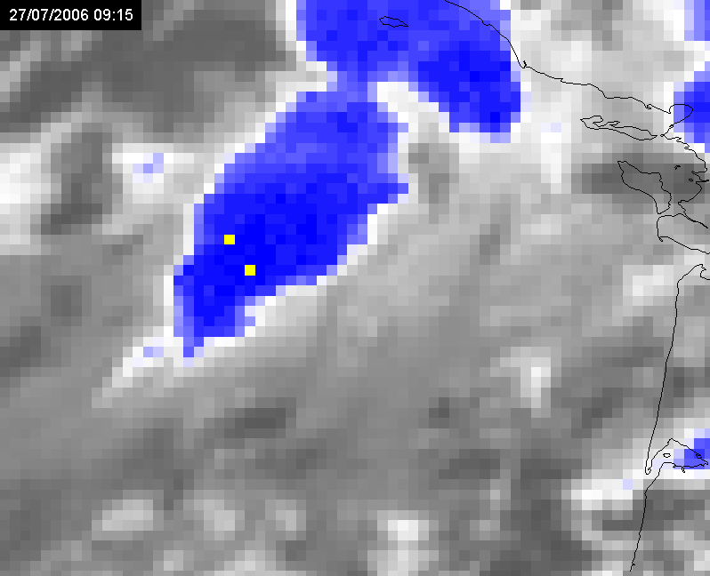
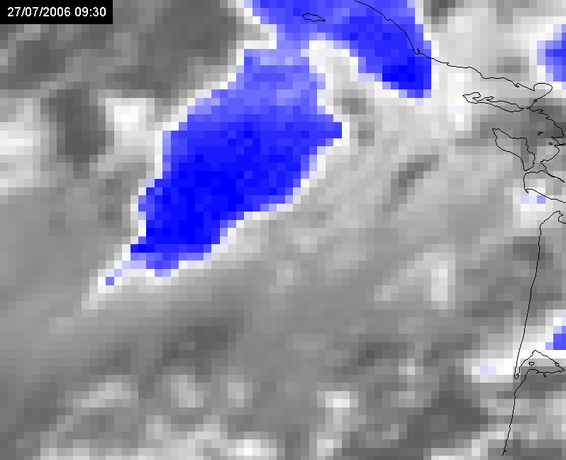
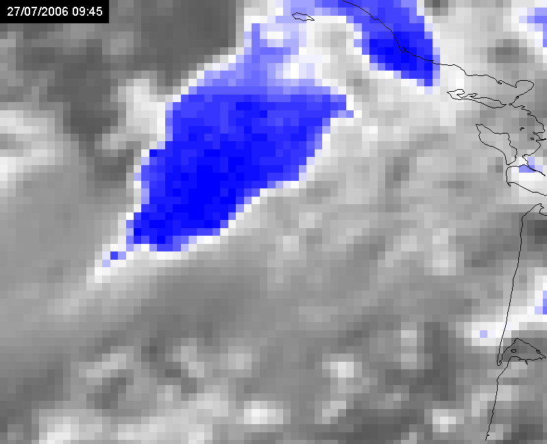
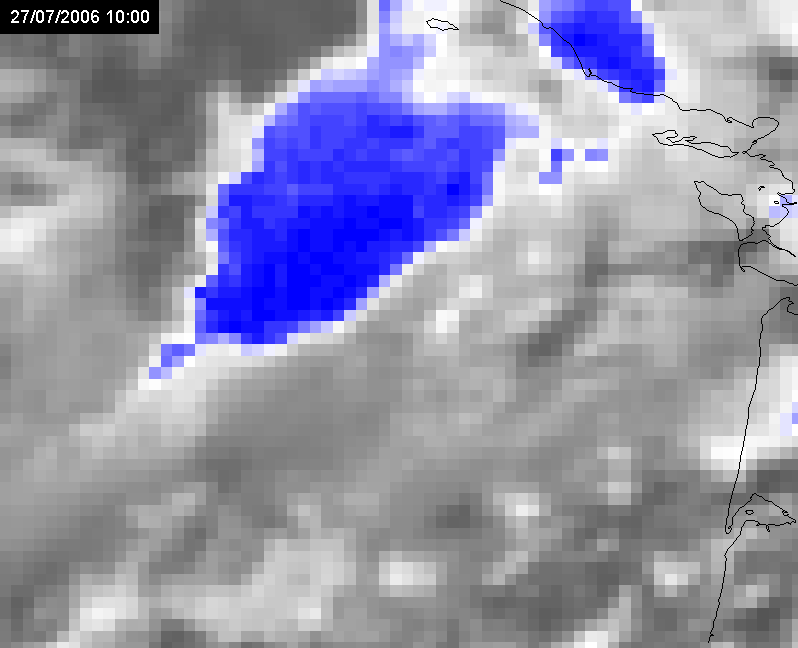
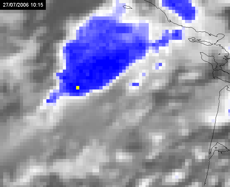
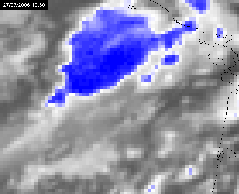
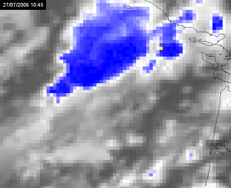
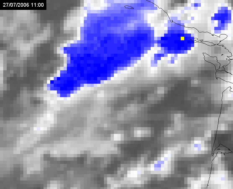
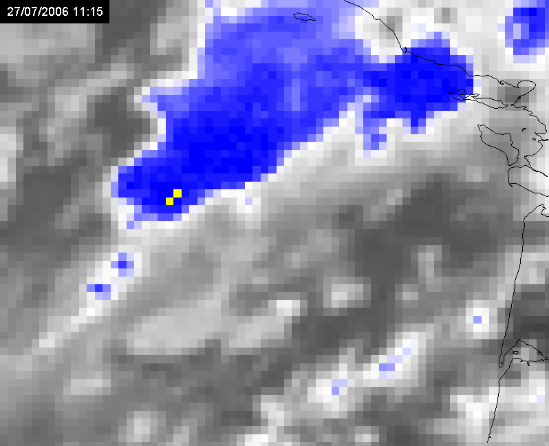
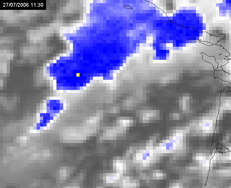
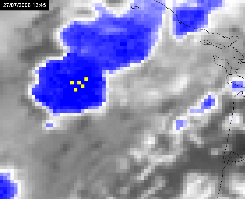
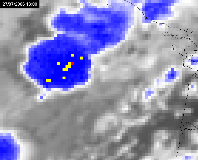
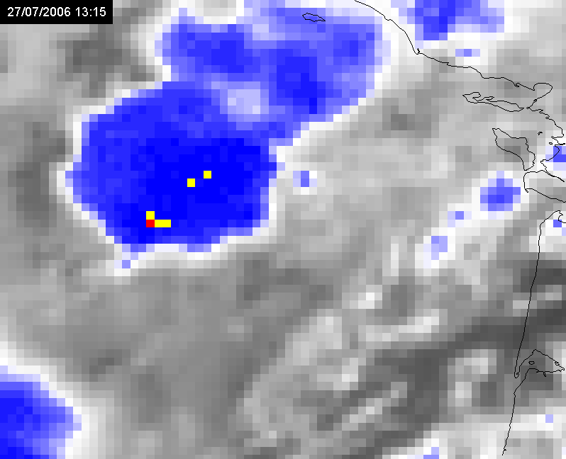
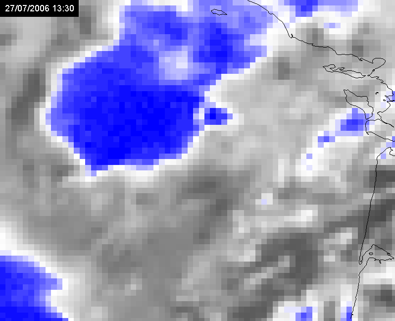
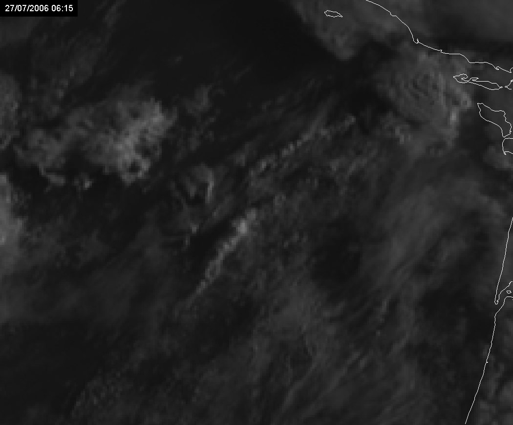
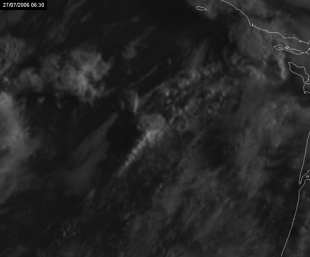
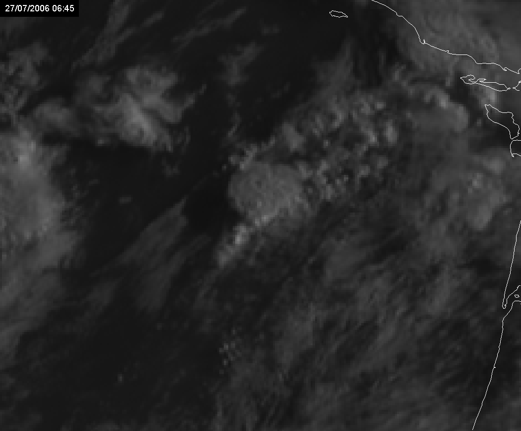
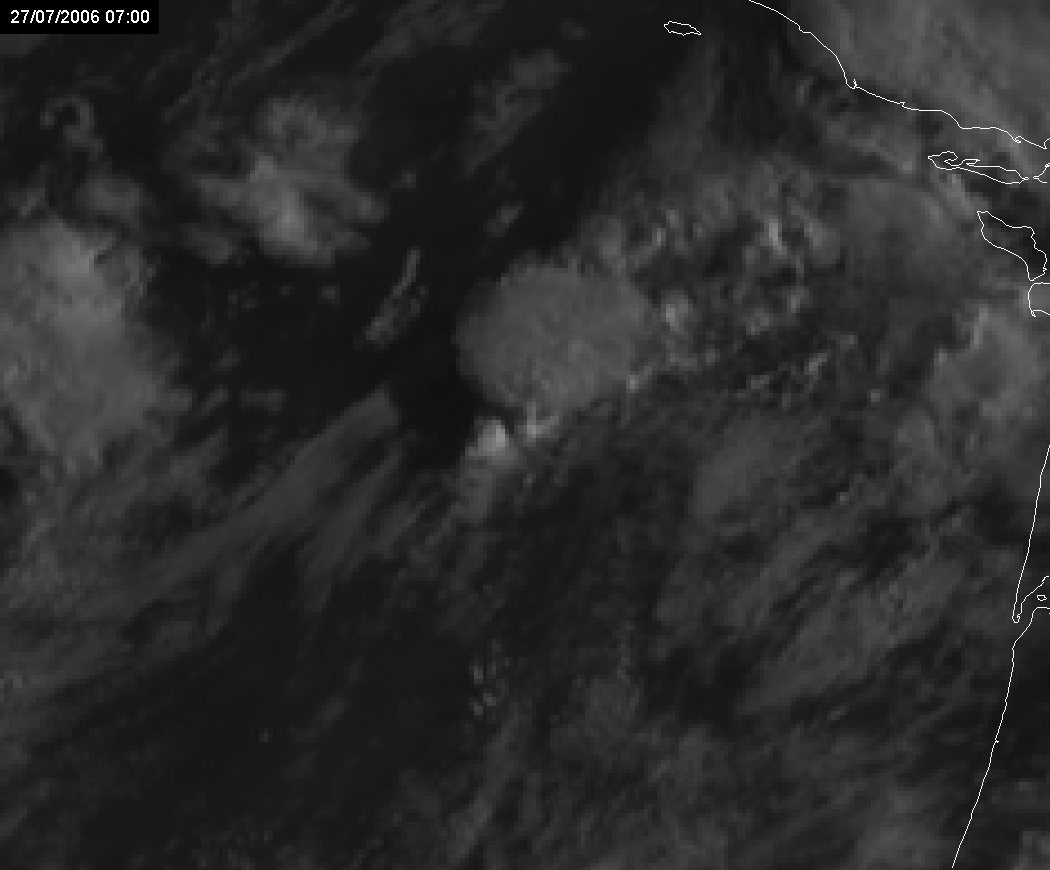
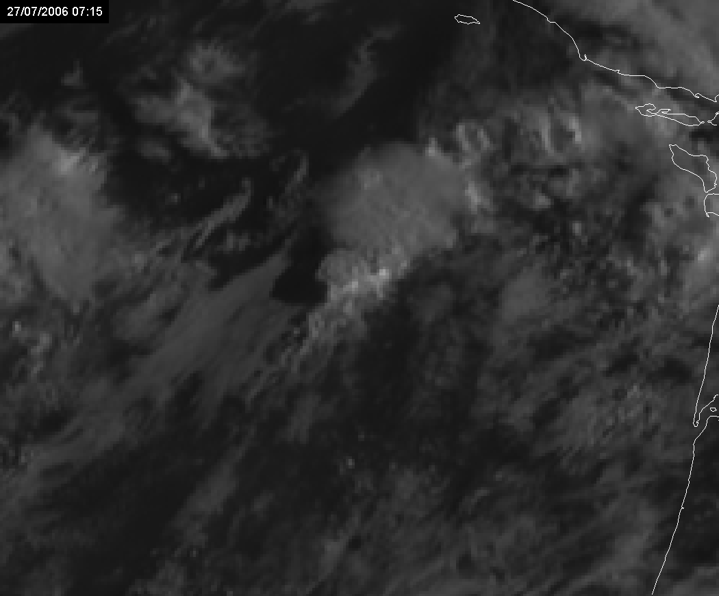
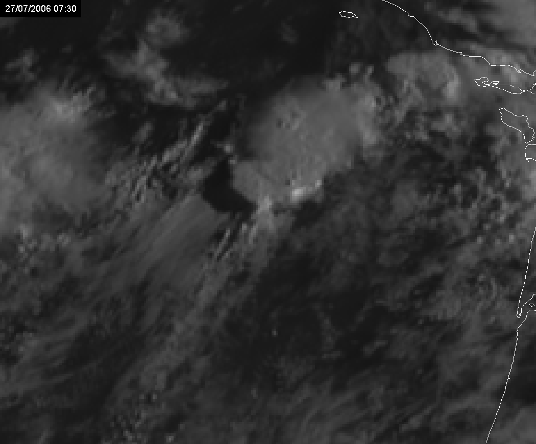
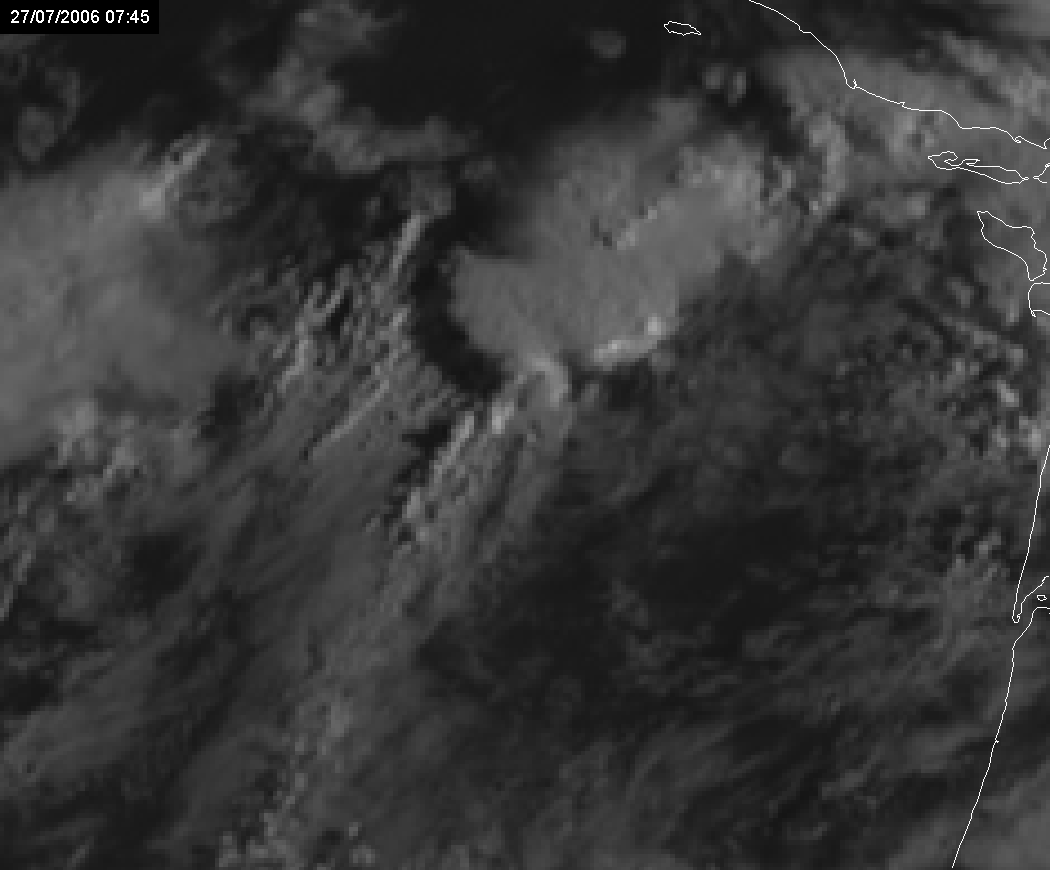
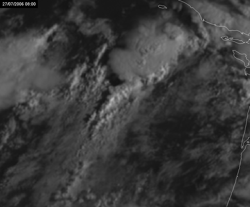
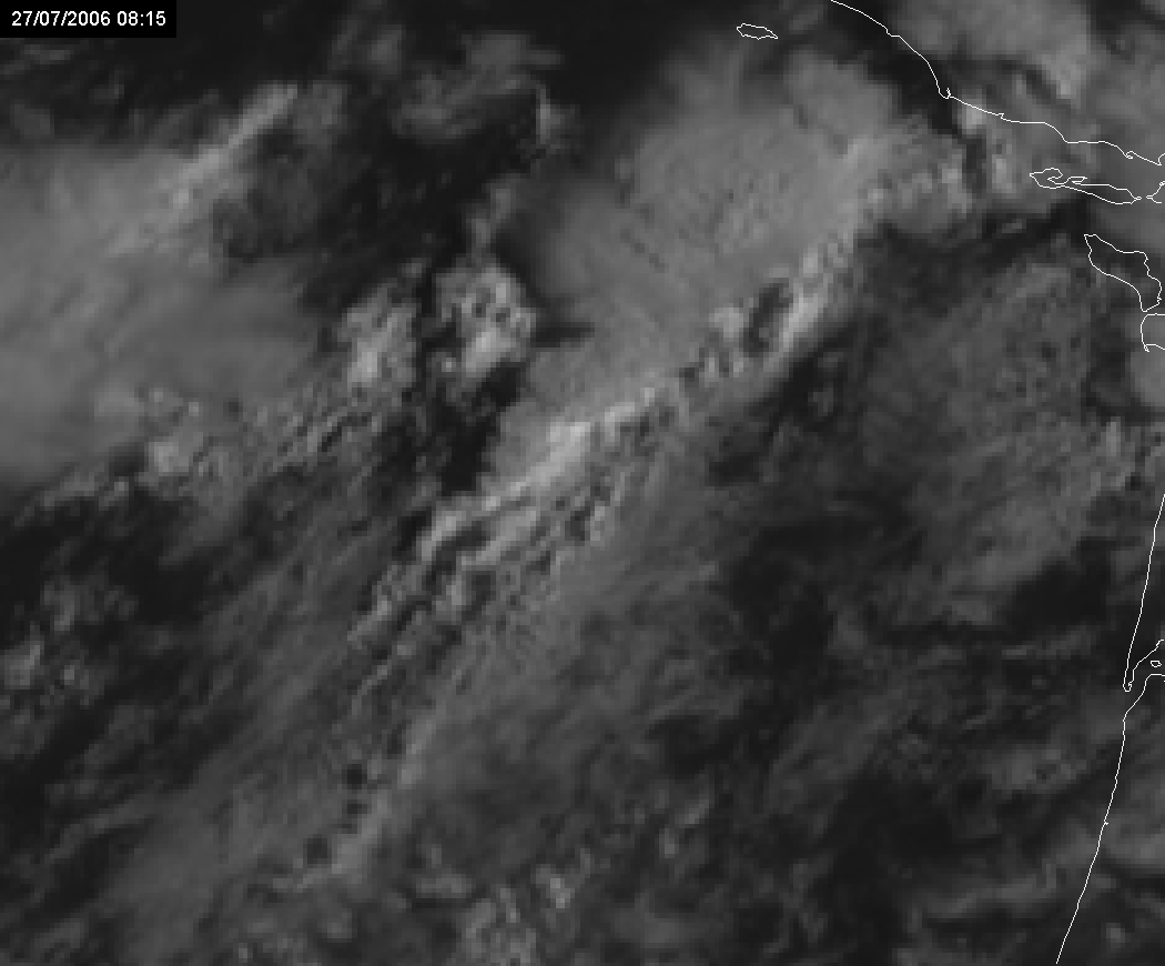
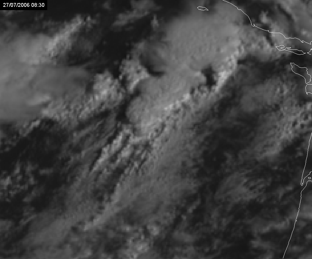
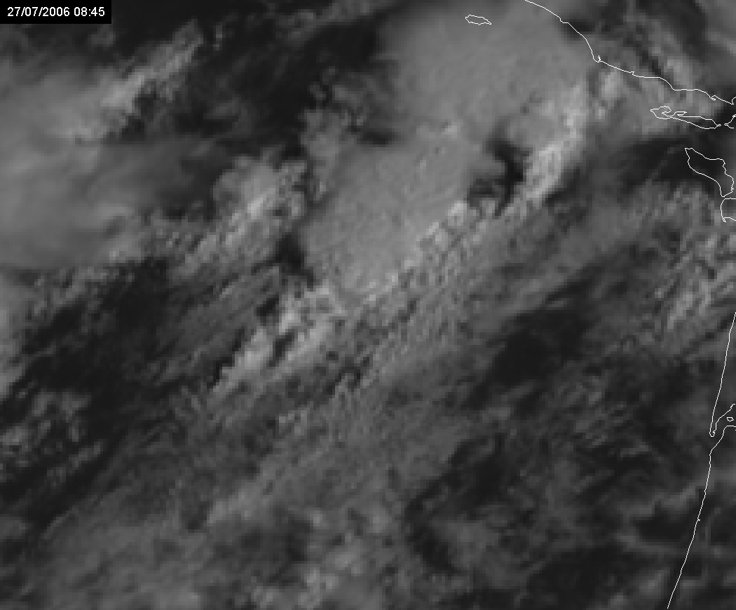
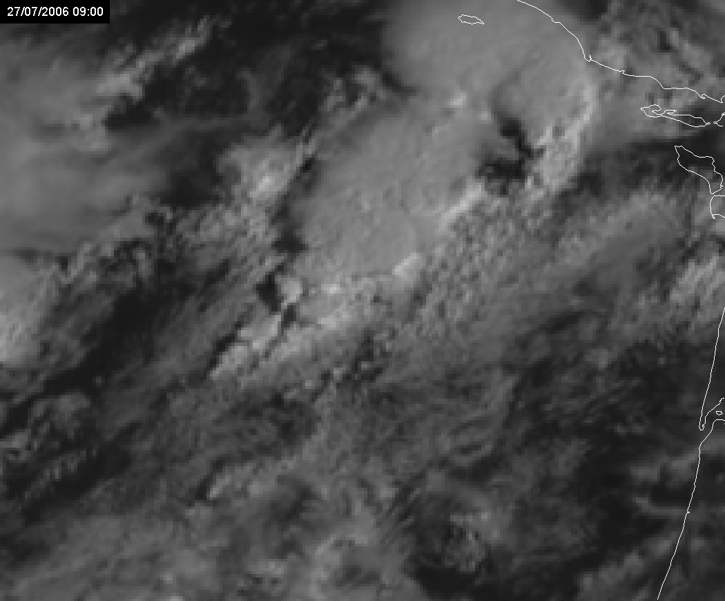
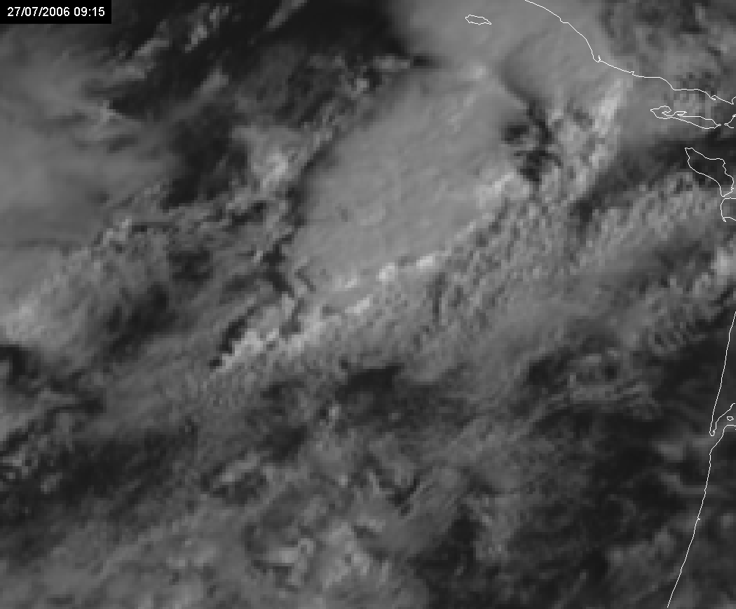
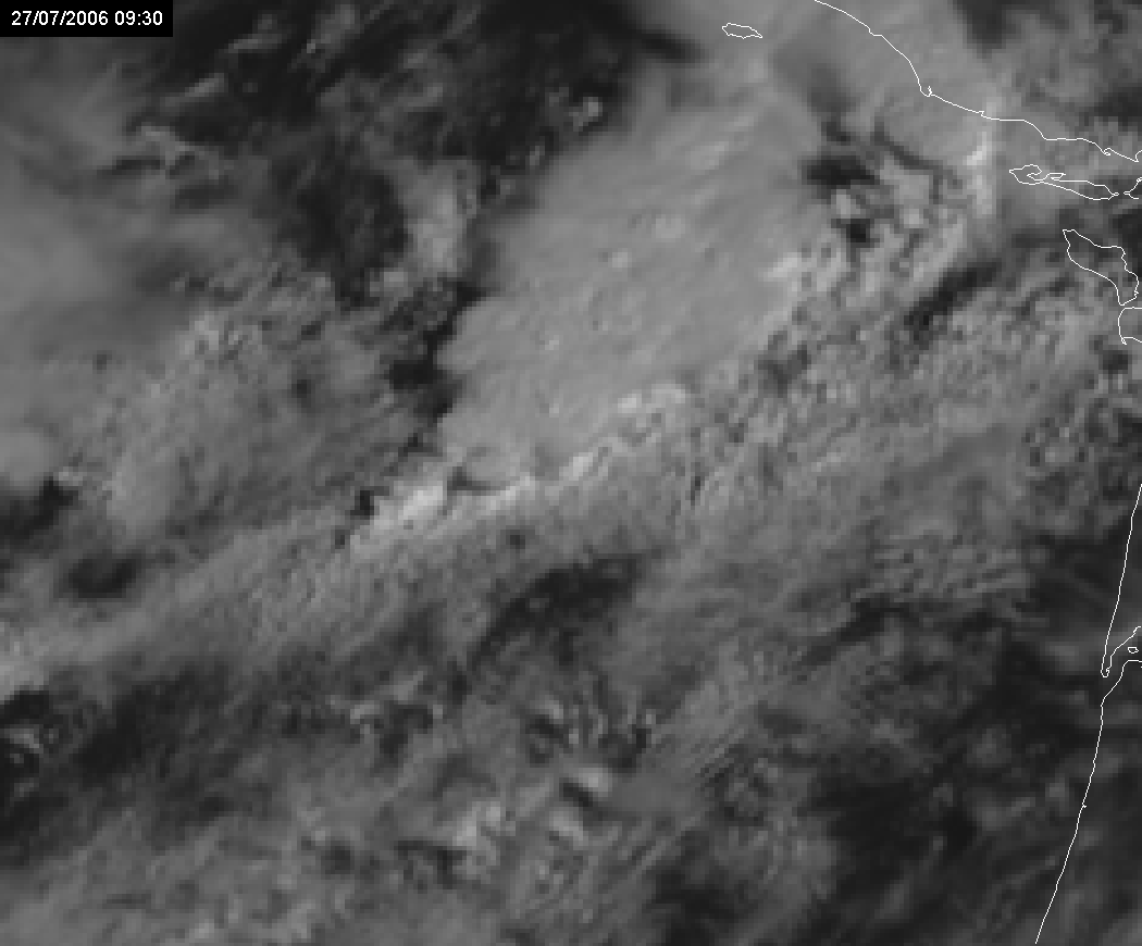
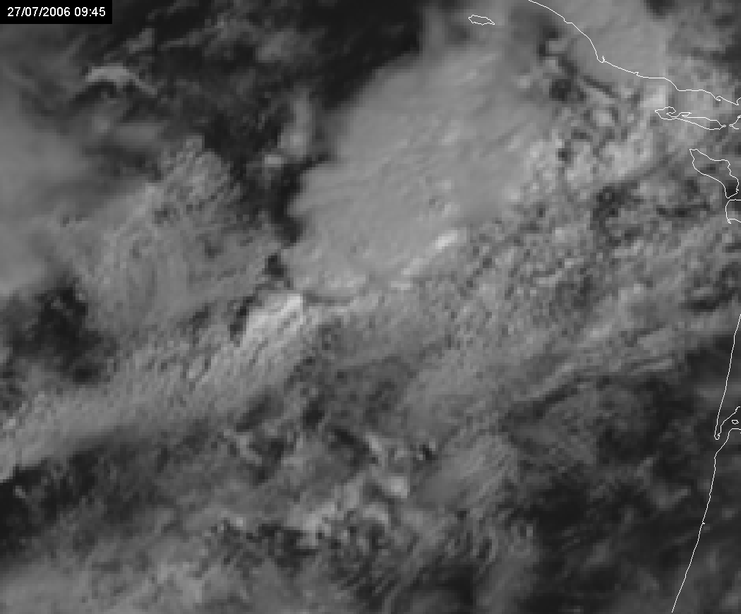
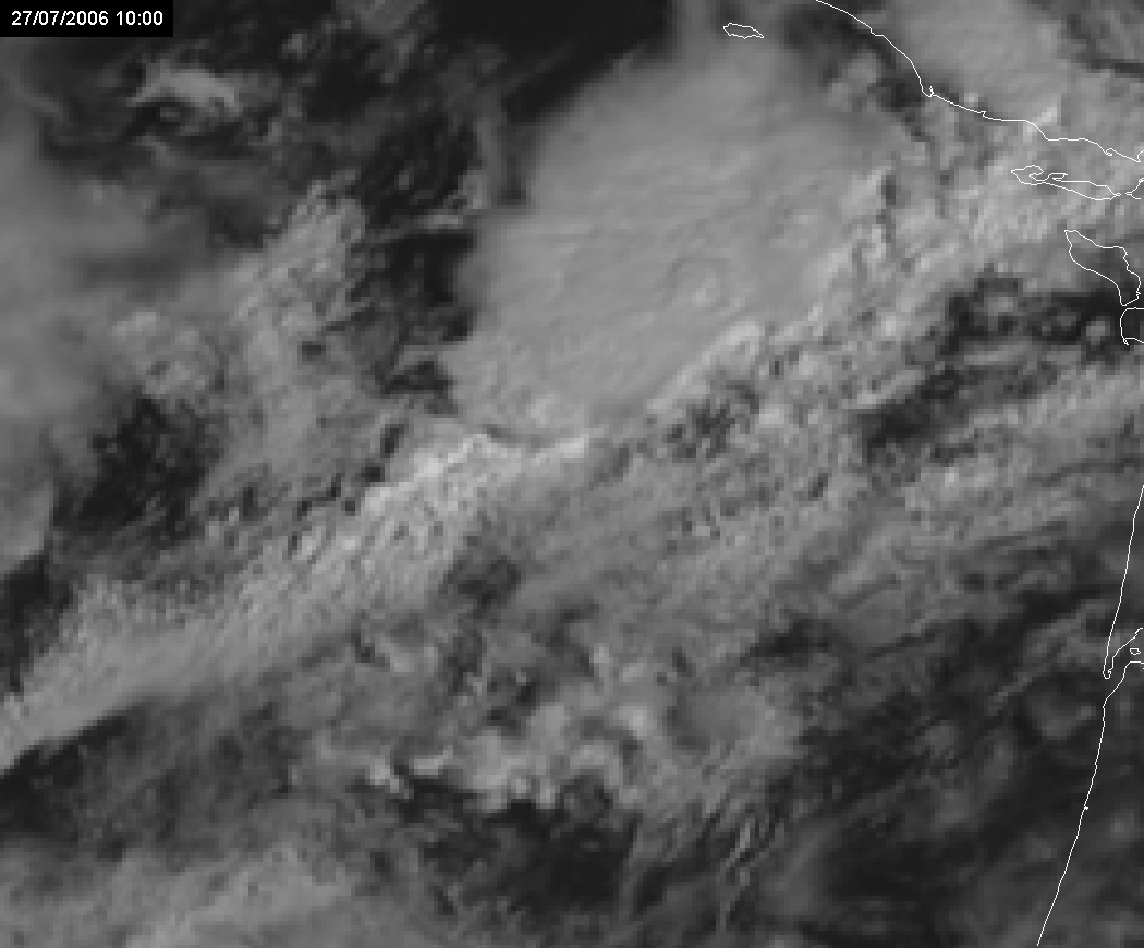
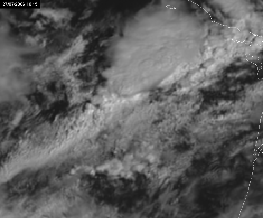
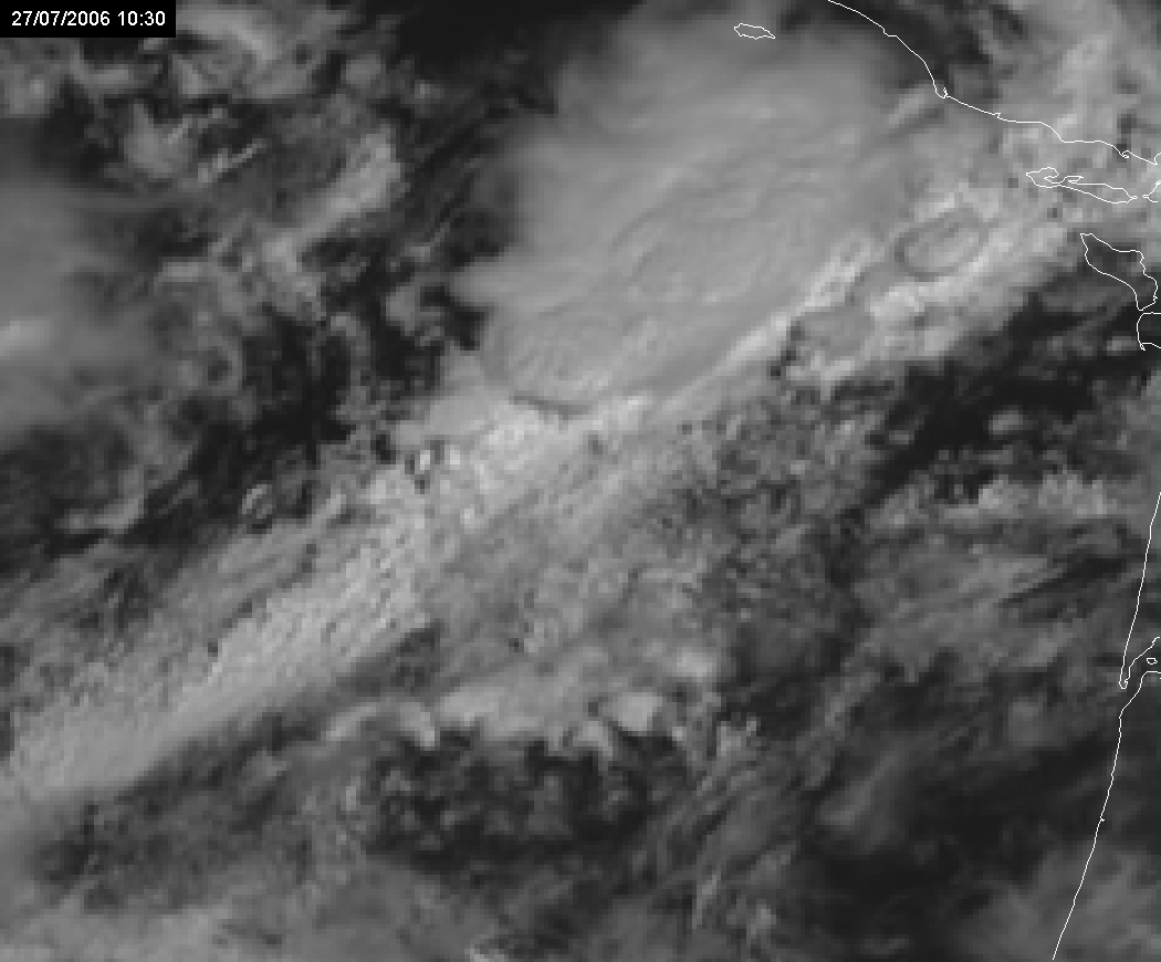
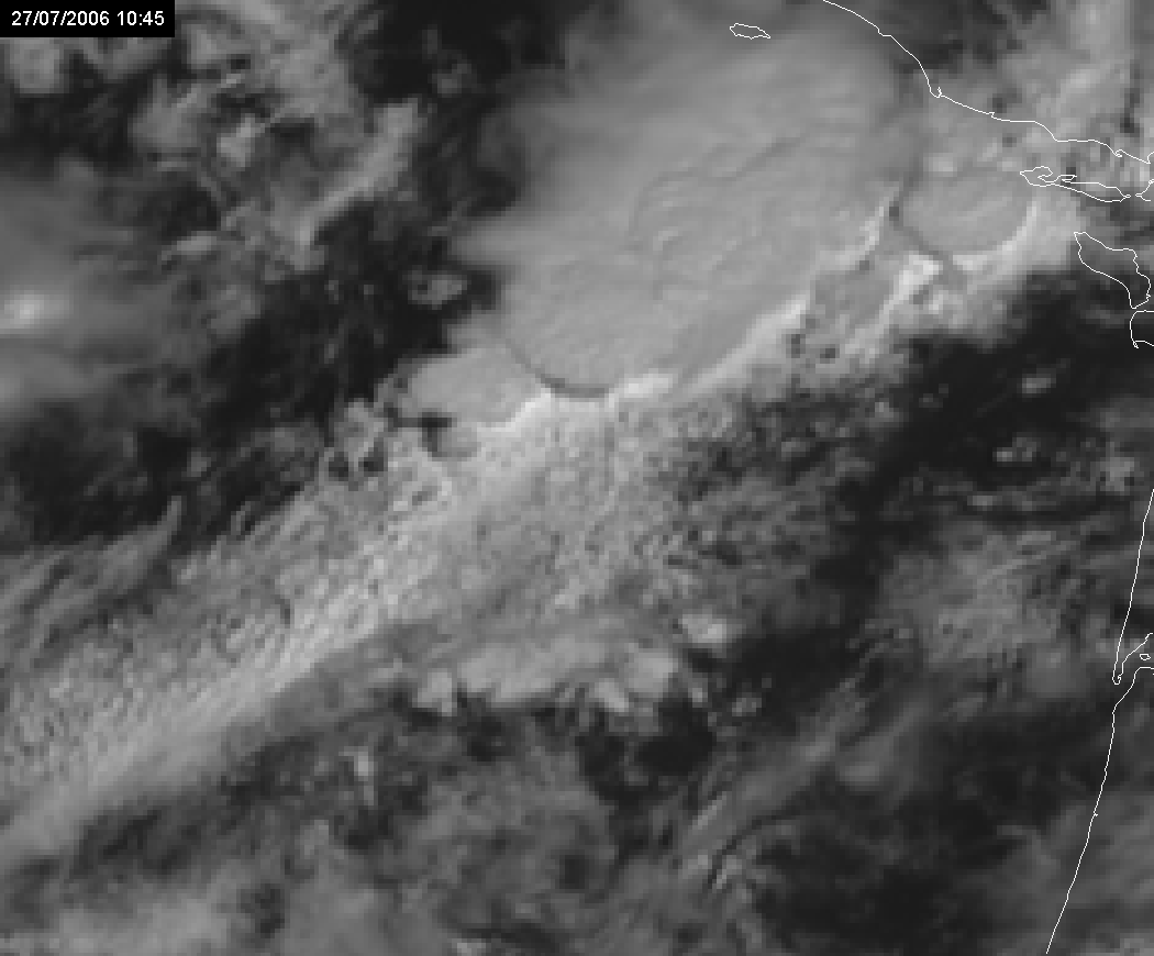
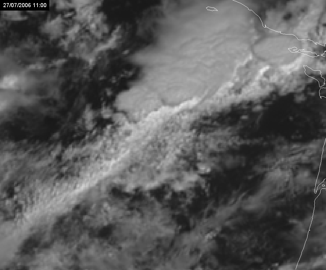
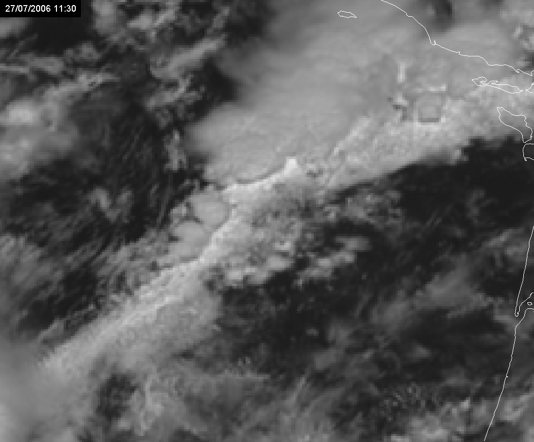
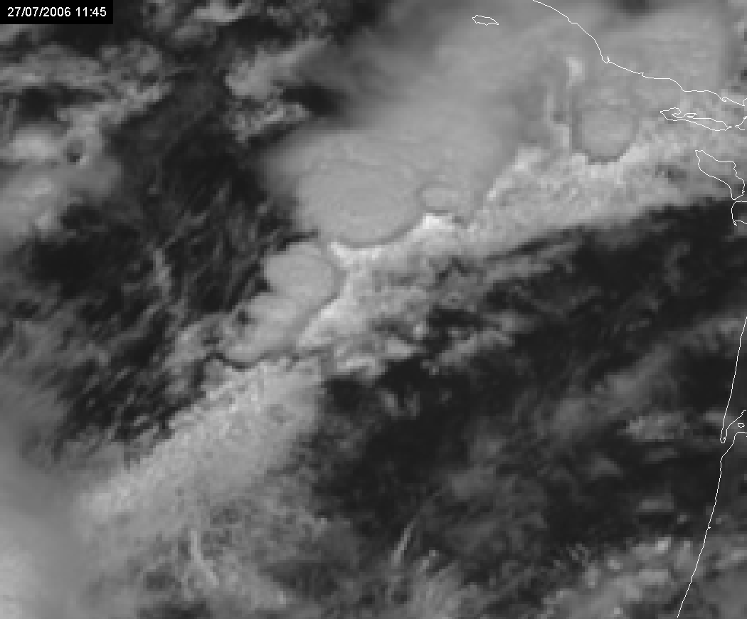
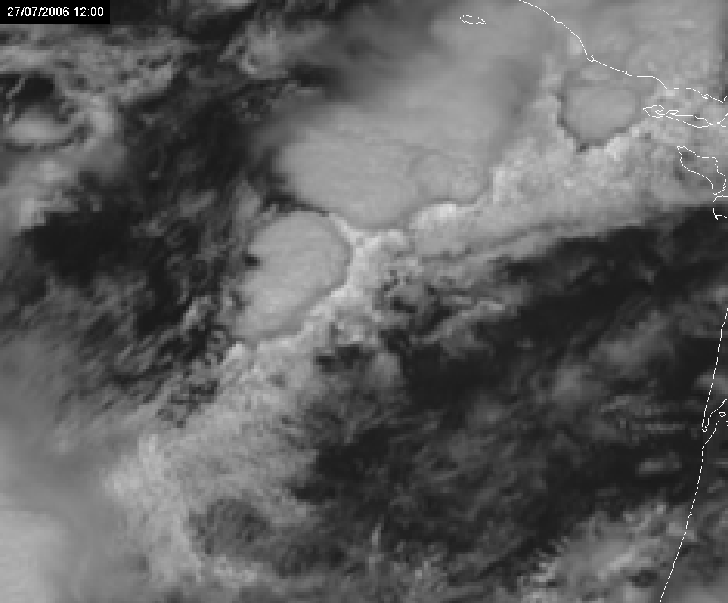
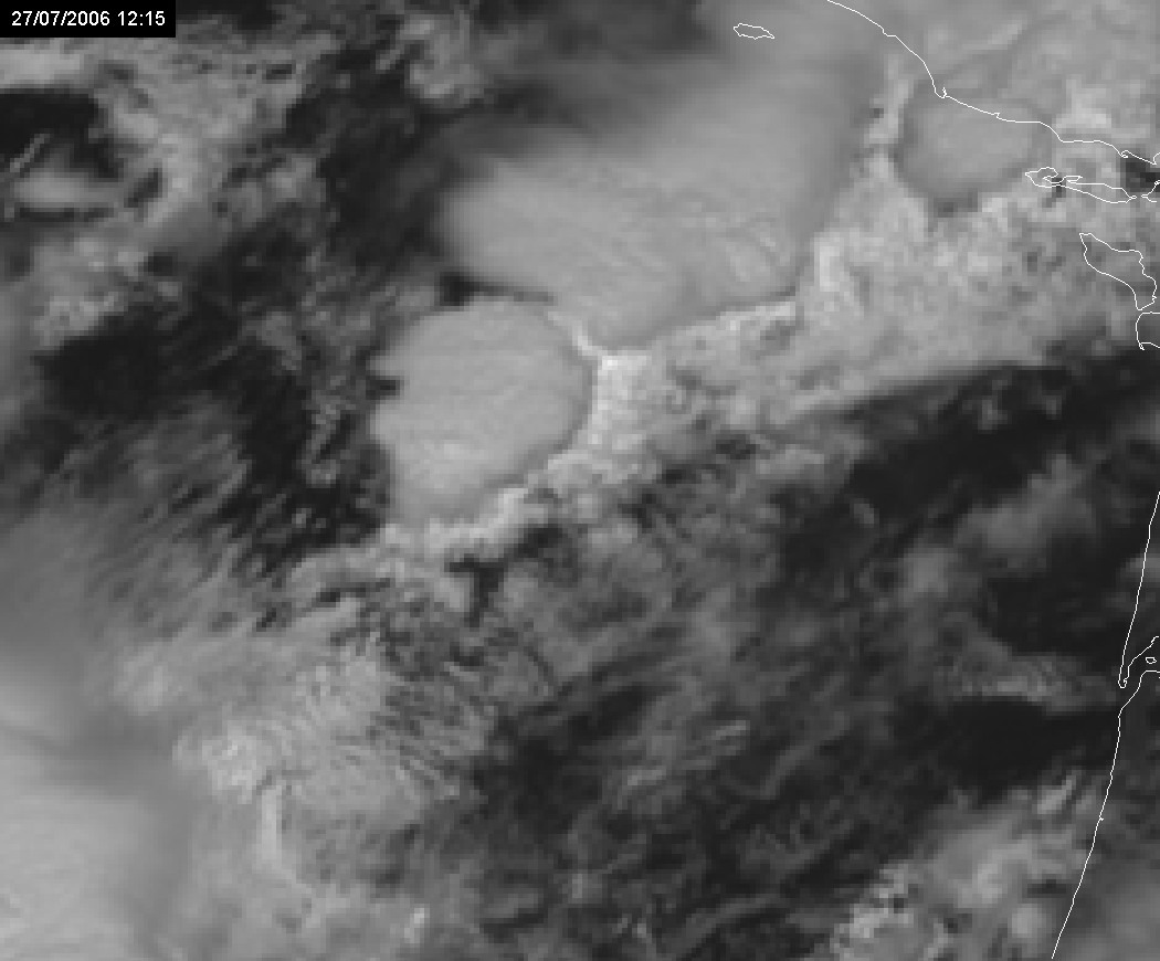
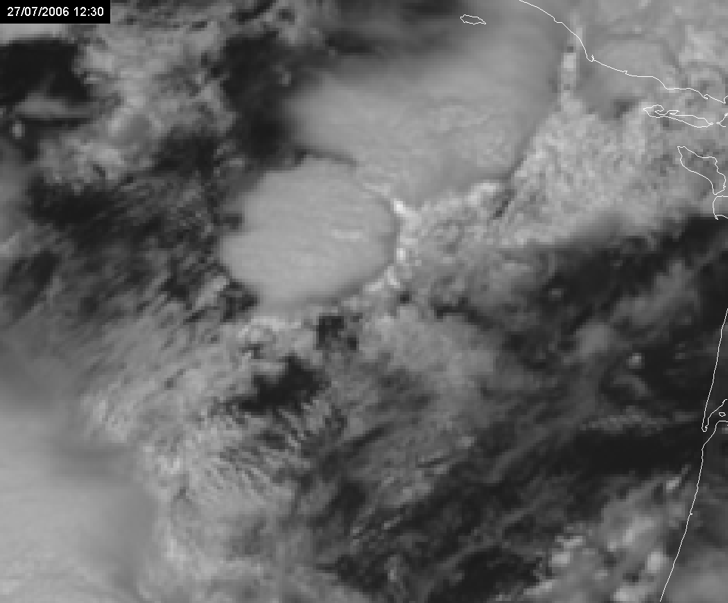
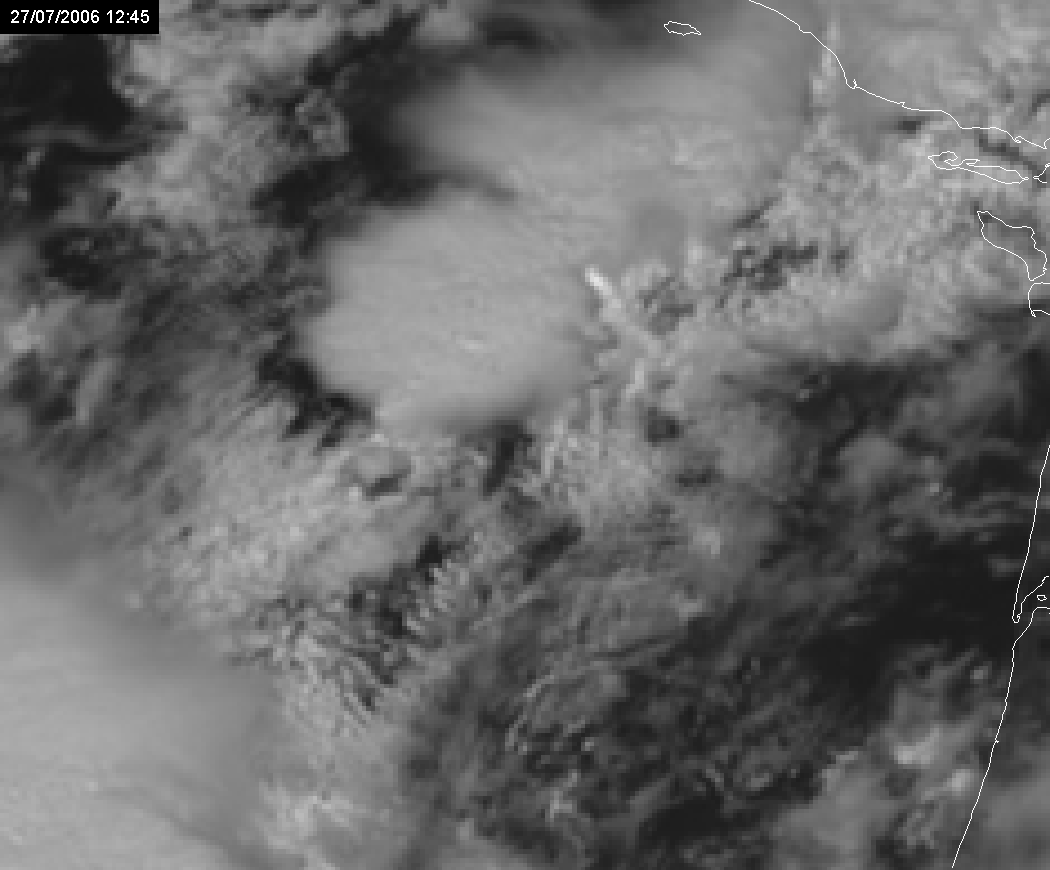
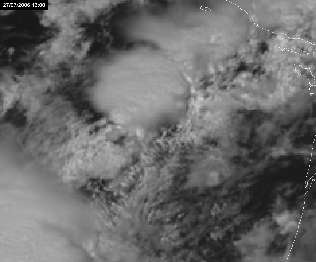
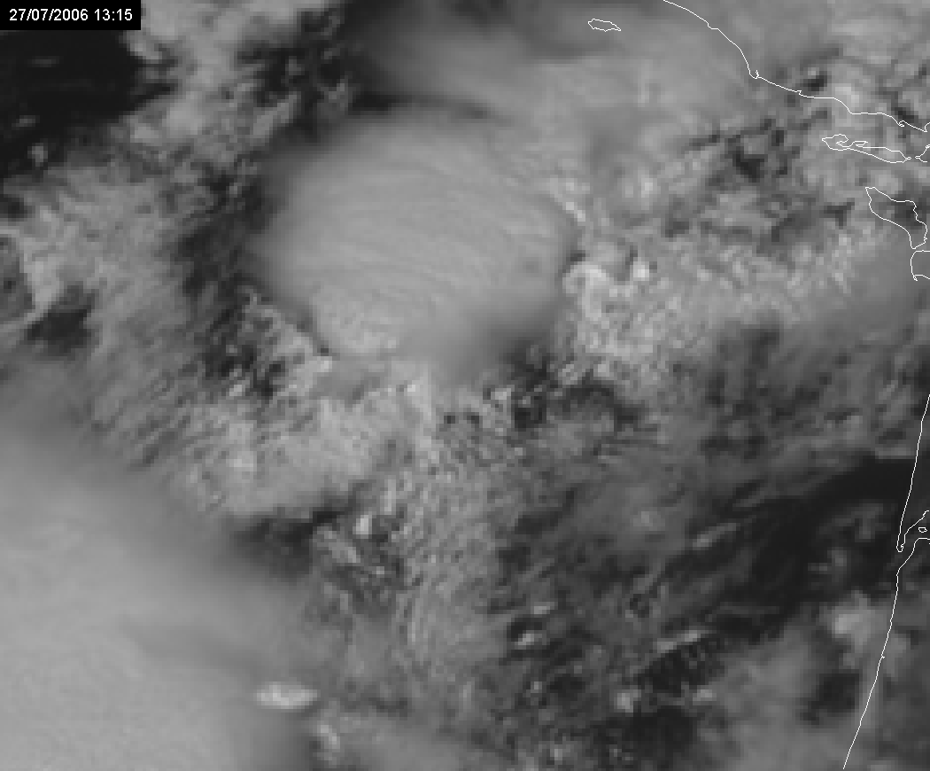
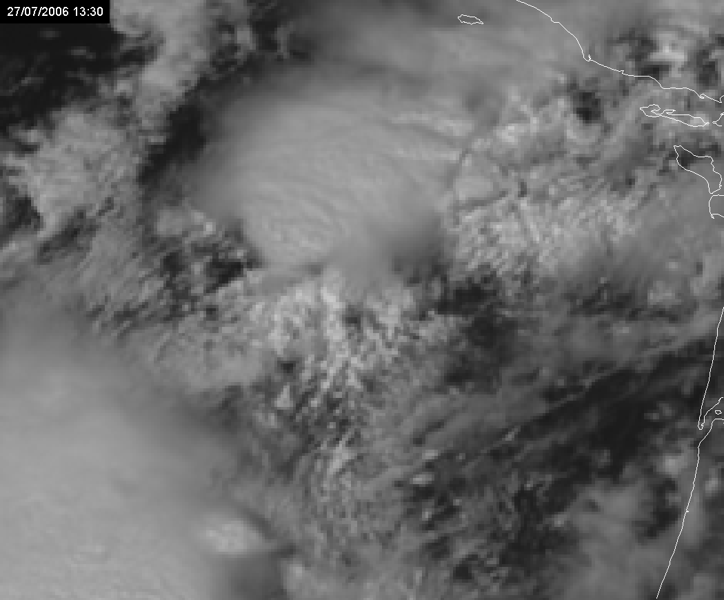
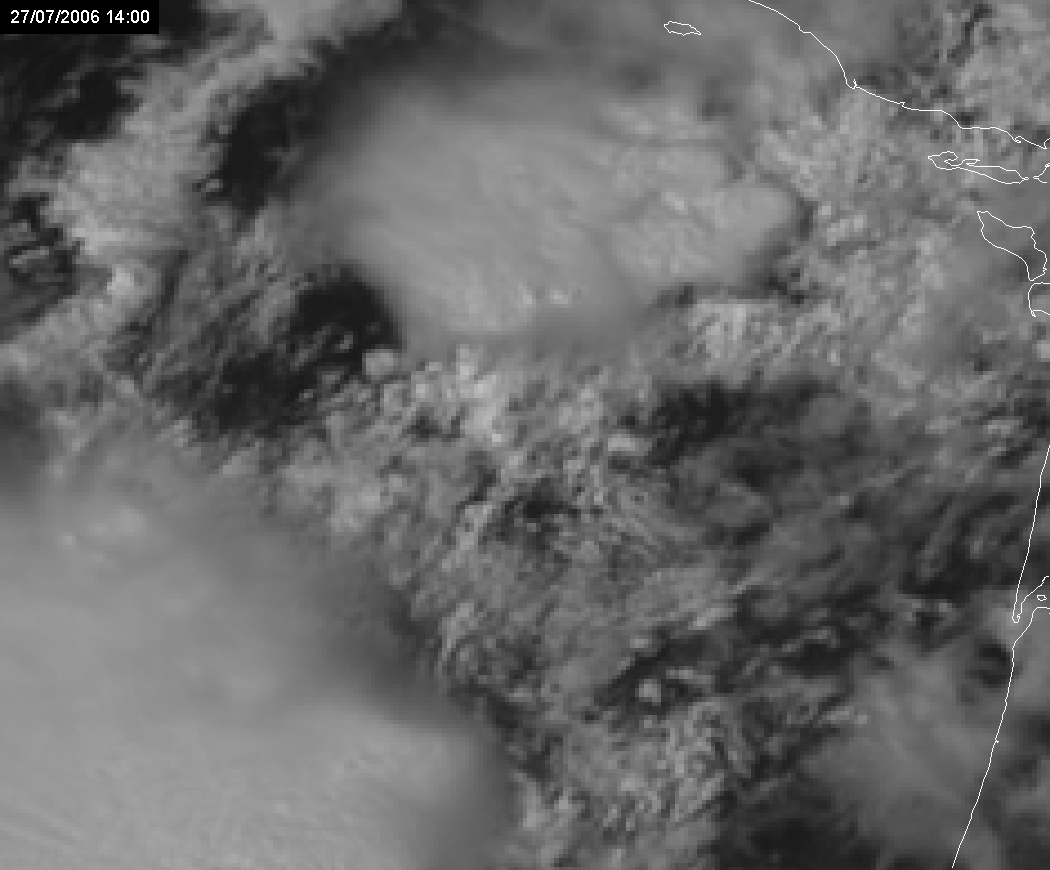
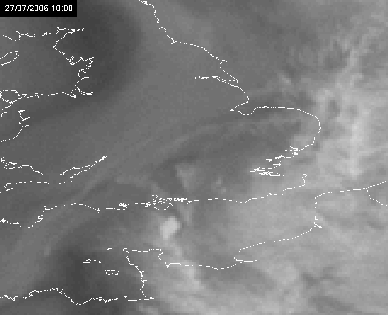
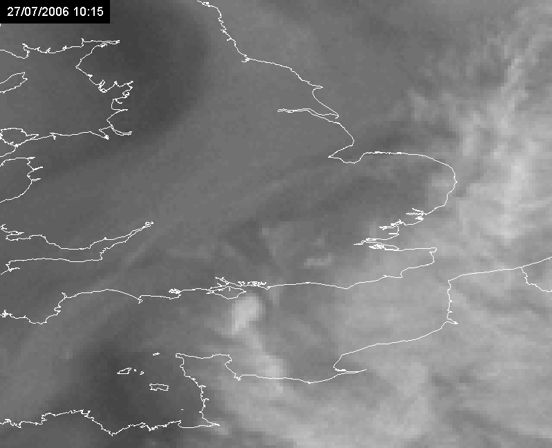
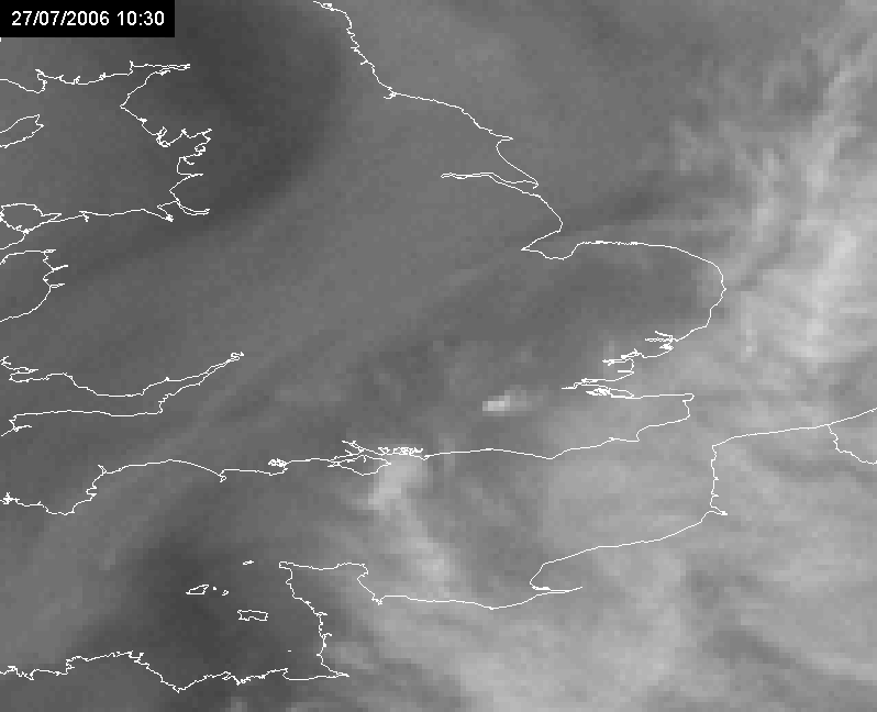
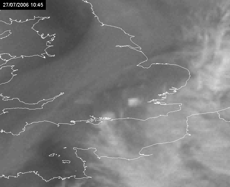
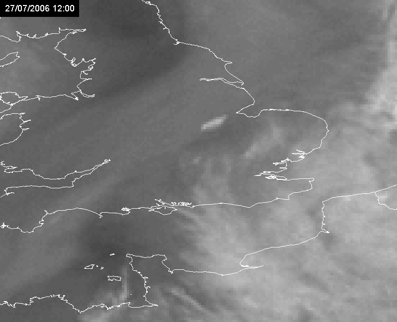
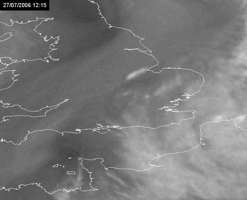
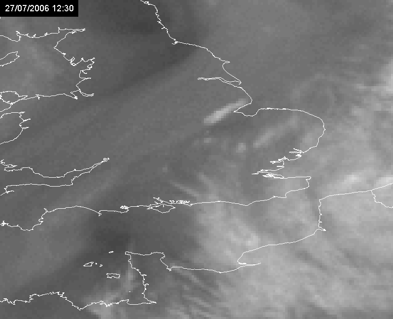
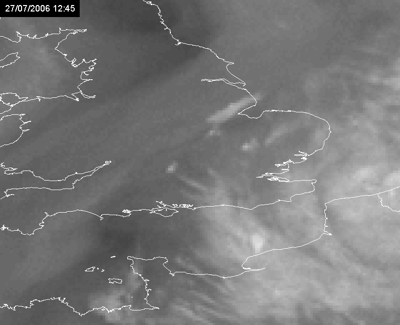
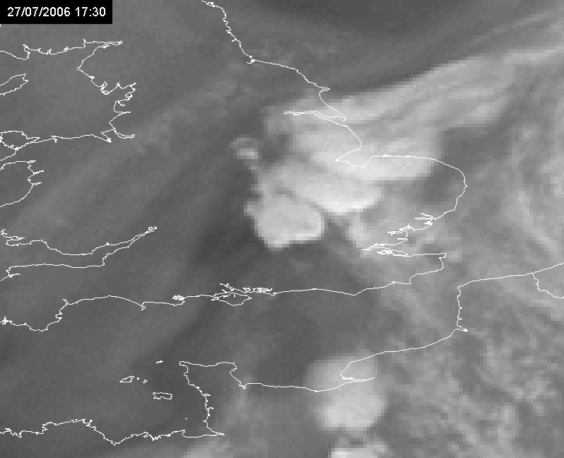
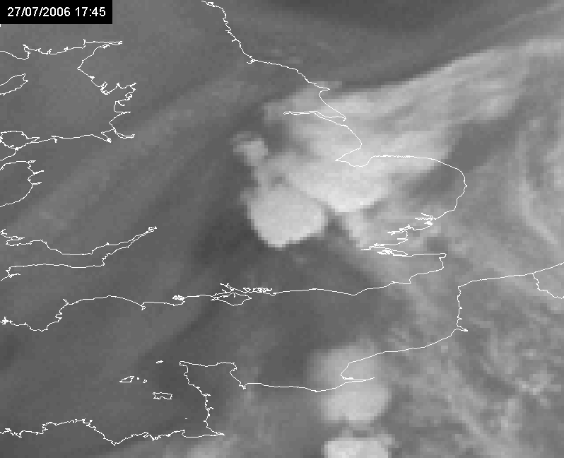
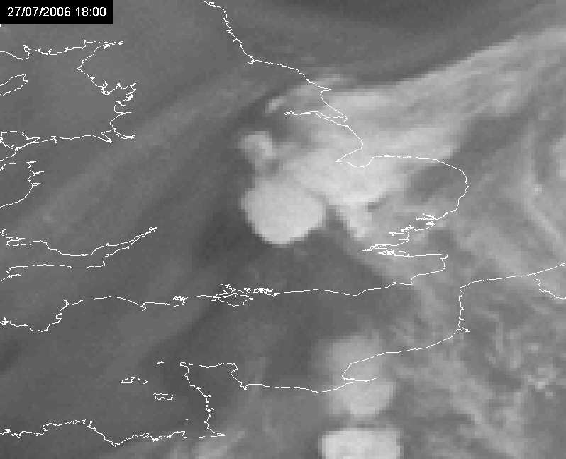
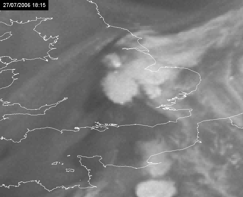
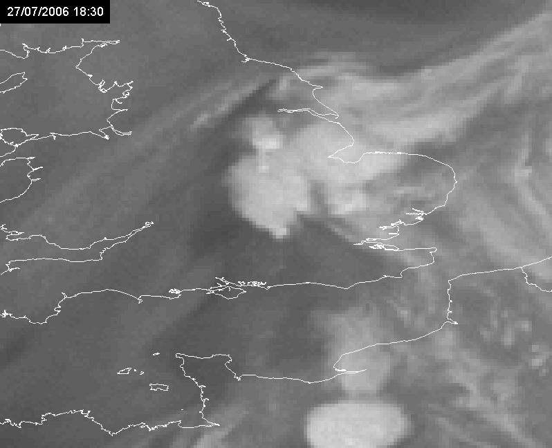
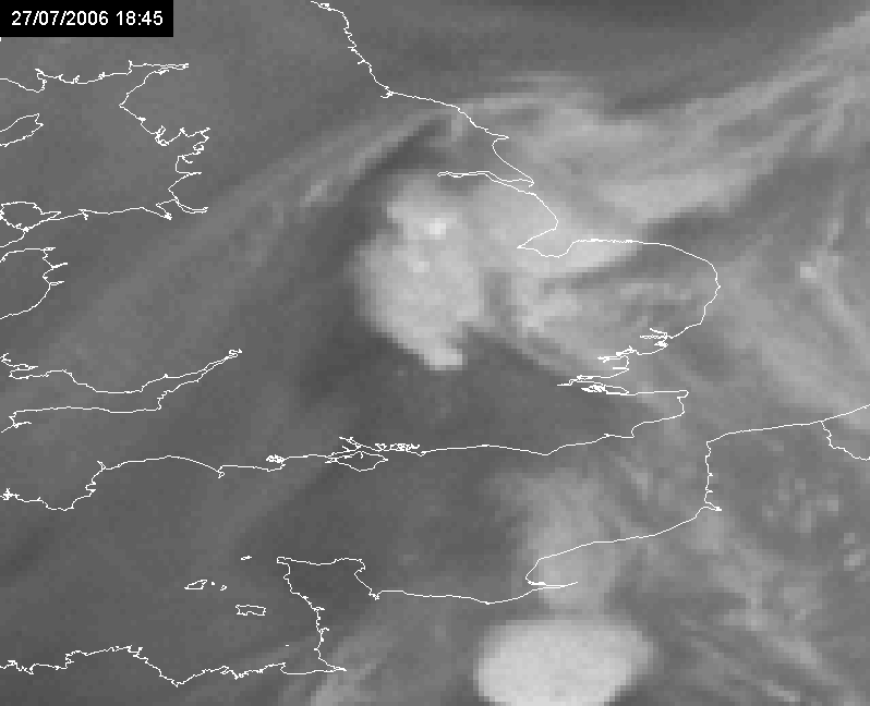
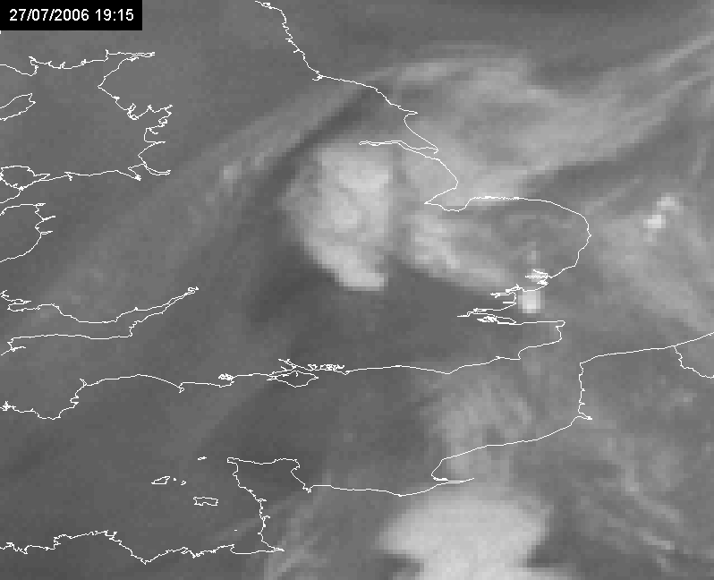
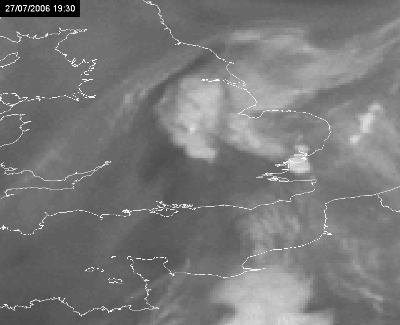
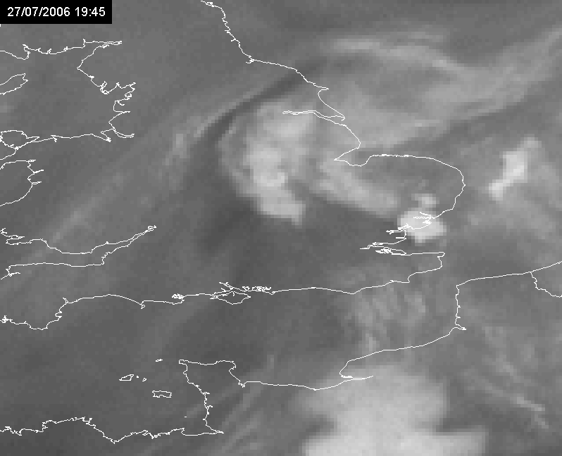
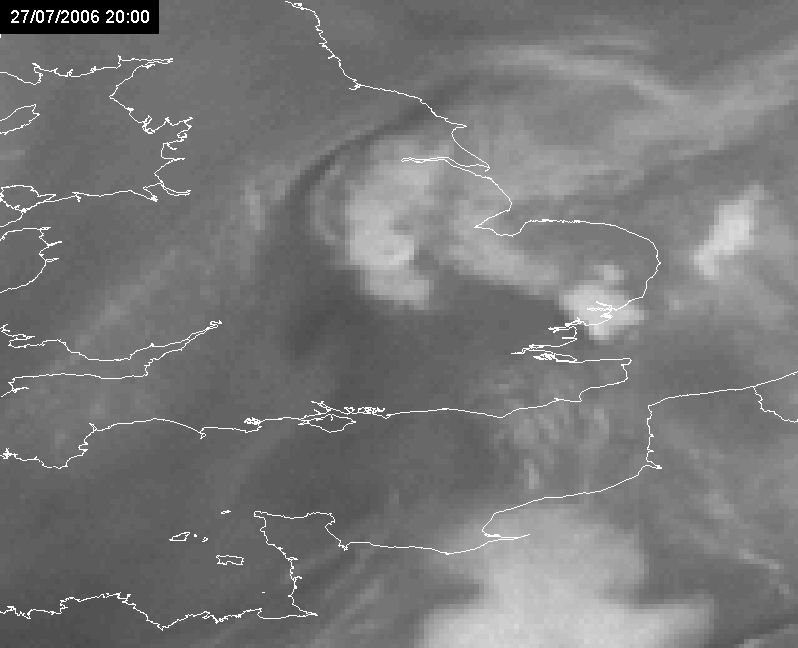
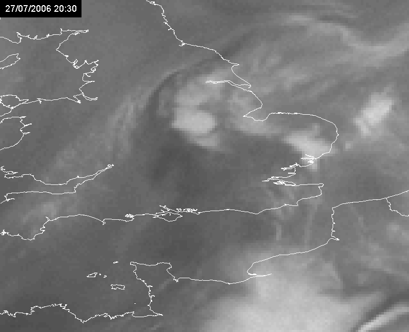
The second corresponds to an event over the Gulf of Biscay, west of Nantes on 27 July 2006. Besides the train effect easily detected in the animation above over the Gulf Biscay (shown below), there was also another similar situation over southeastern UK on the same day (analyzed later). In the remaining of this special investigation, the focus will be made on the events with MSG data.
|
27 July 2006/06.00 UTC - Meteosat 8 IR10.8-WV6.2 difference image (overshooting tops in yellow or red); 27 July 06.00 - 14.00 UTC
quarter-hourly image loop
|
|
Key Parameters
Note that in many studies the synthesis of key parameters for large-scale patterns or vertical profiles are simply summarized for flash flood events, with no special focus on the train effect. Although, this special investigation is being focused on the train effect, the following description broadens the scope of analysis for operational application, taking into consideration that according to Doswell et al (1996) virtually all flash floods are produced by MCSs.
Also note that train effect results generally in the production of some convective systems over the same area for up to around 4-5 hours. In a longer range (10-12 hours) the area where the train effect occurs usually tends to move slowly southeastward, starting to affect neighboring areas, as shown above. Therefore, key parameters in model analysis with 6 hours difference can very often depict slightly different affected areas.
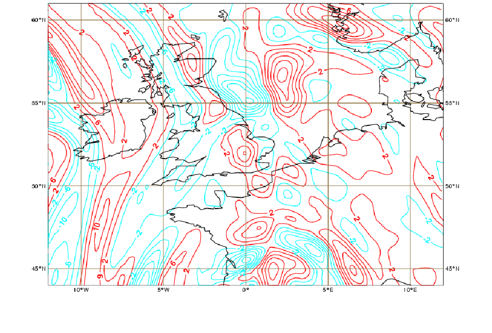
850-500 hPa Thickness Diffluence
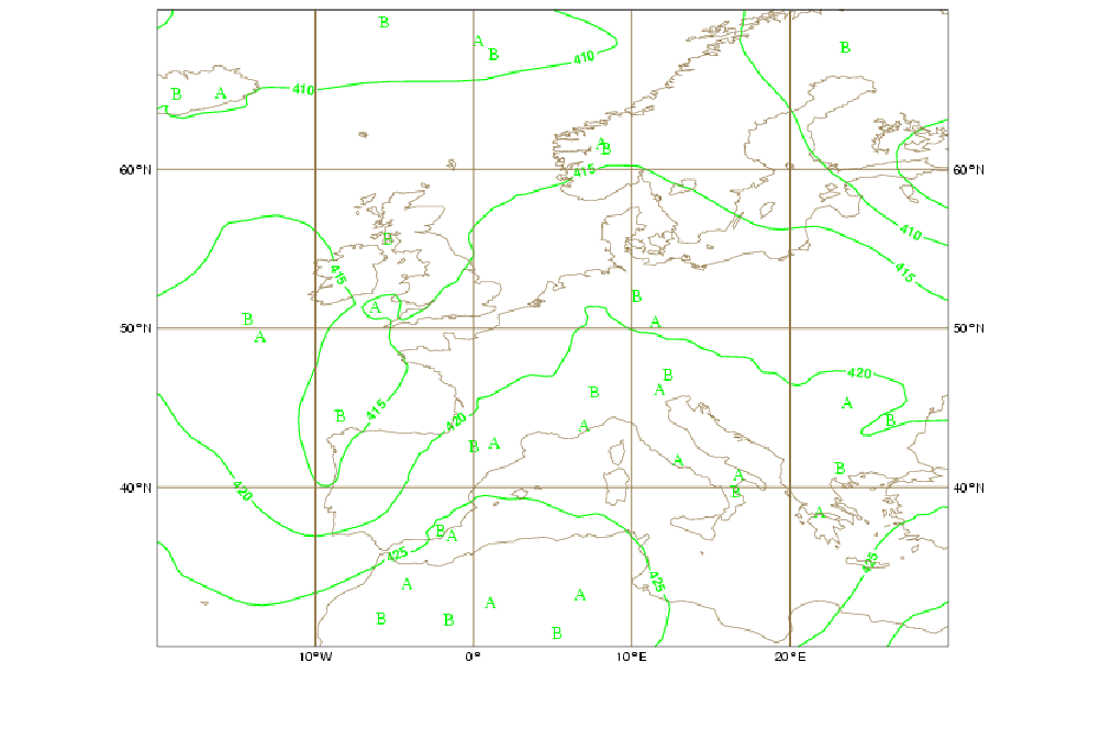
The major convective rainfall events are generally found in areas of diffluence of the thickness parameter, which determine regions of low-level convergence or upper-level diffluence. Naturally this is a large-scale parameter and provides a general indication of the location for convection. If the pattern of thickness diffluence remains relatively stationary with time, the possibility for train effect should be in the forecaster's mind and included in his/her nowcasting activities with satellite or radar imagery.
The case below shows diffluence and convective activity in the air mass RGB in northern Spain, Gulf of Biscay, France and southern UK at 06 and 12 UTC on 27 July 2006.
|
27 July 2006/06.00 UTC - 500-850 hPa Thickness
|
27 July 2006/12.00 UTC - 500-850 hPa Thickness
|
|
|
|
|
|
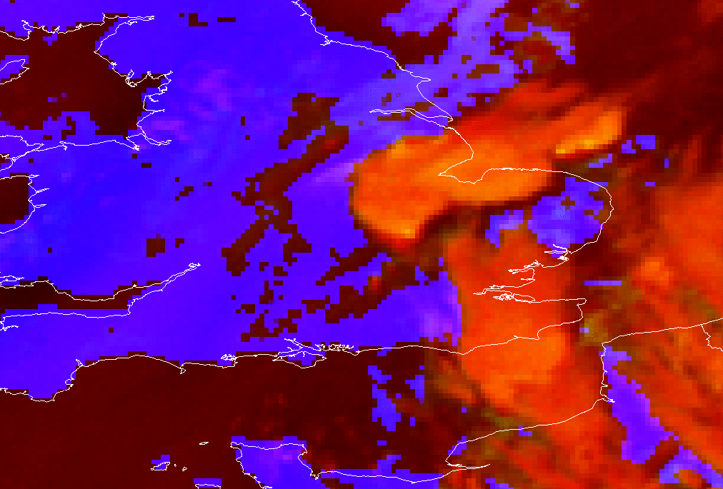
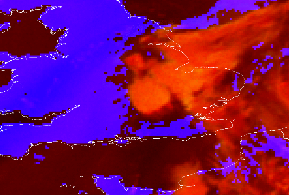
27 July 2006/06.00 UTC - Meteosat 8 air mass RGB (WV6.2-WV7.3; IR9.7-IR10.8; WV6.2i) image
|
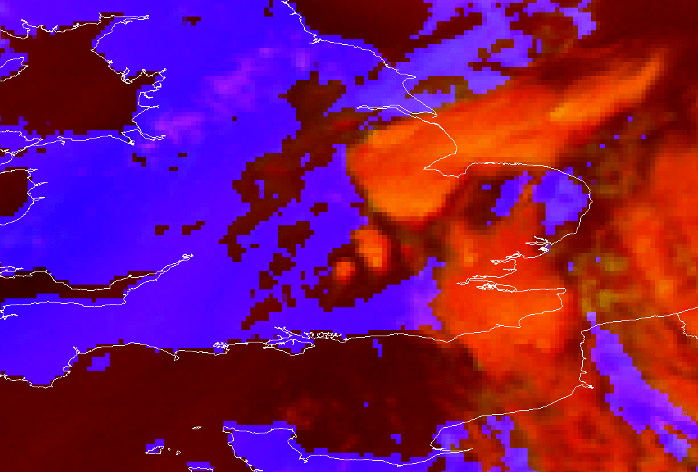
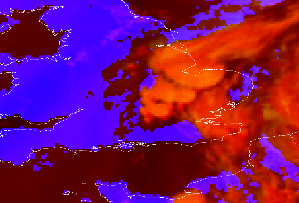
27 July 2006/12.00 UTC - Meteosat 8 air mass RGB (WV6.2-WV7.3; IR9.7-IR10.8; WV6.2i) image
|
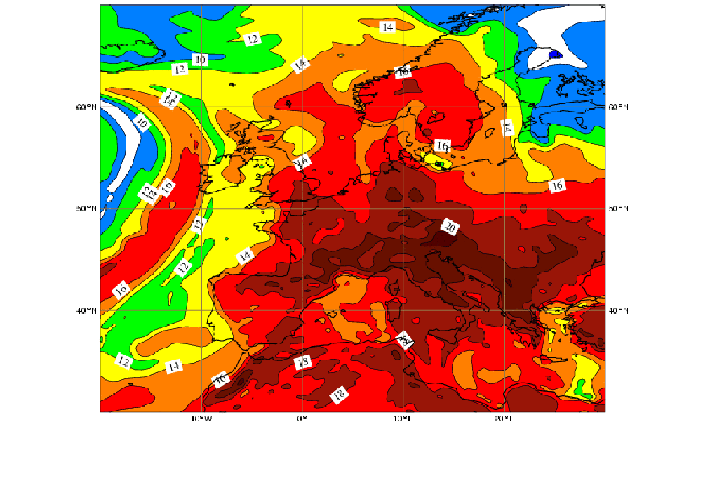
850hPa Wet Bulb Potential Temperature (Theta W)
Many train effect cases with potential for flash floods happen in "warm" months, within the influence of tropical air masses, both over a ridge or close to a gradient of the wet bulb potential temperature field. This last situation also fits some train effect cases happening during "cold" months. The example presented above shows both cases:
Case 1:
|
27 July 2006/06.00 UTC - Wet Bulb Potential Temperature 850 hPa
|
27 July 2006/03.00 UTC Meteosat 8 IR10.8-WV6.2 difference image (overshooting tops in yellow)
|
|
|
|
|
|
27 July 2006/06.00 UTC Meteosat 8 IR10.8-WV6.2 difference image (overshooting tops in yellow)
|
27 July 2006/09.00 UTC Meteosat 8 IR10.8-WV6.2 difference image (overshooting tops in yellow)
|
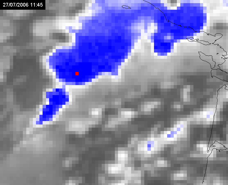
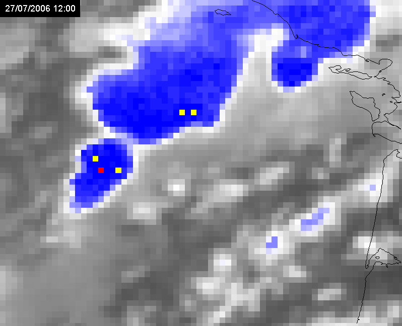
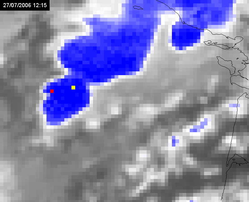
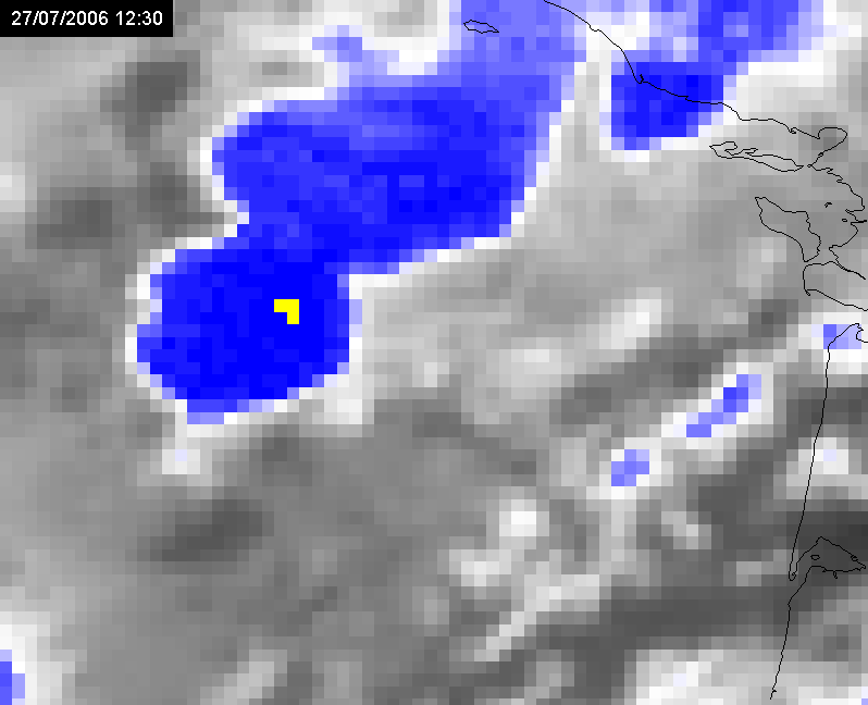
In mid-day successive formation of different convective systems was happening over a particular location in the Gulf of Biscay area, having the train effect ended here in the evening with a total duration of around 18 hours.
|
27 July 2006/10.15 UTC - Meteosat 8 HRV image
|
27 July 2006/12.15 UTC - Meteosat 8 HRV image
|
|
|
|
27 July 2006/06.00 UTC - Meteosat 8 HRV image; 27 July 06.00 - 14.00 UTC quarter-hourly image loop
|
27 July 2006/06.00 UTC - Meteosat 8 IR10.8-WV6.2 difference image (overshooting tops in yellow or red); 27 July 06.00 - 14.00 UTC
quarter-hourly image loop
|
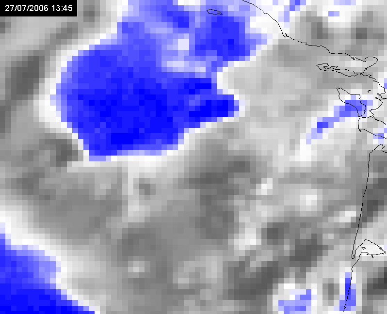
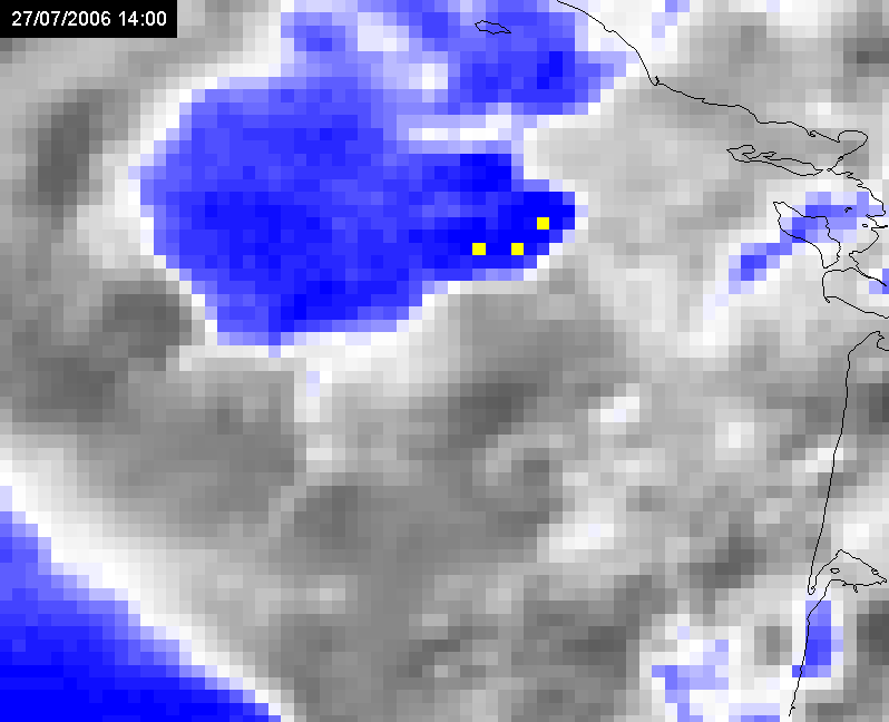
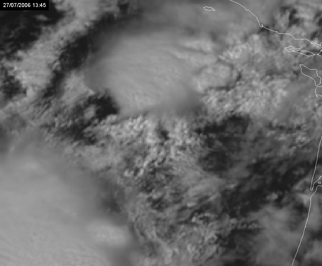
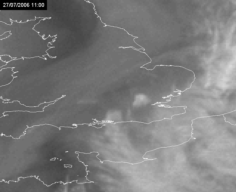
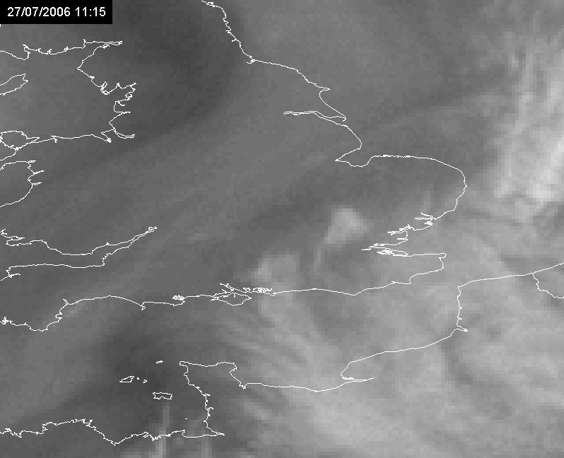
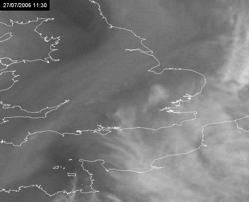
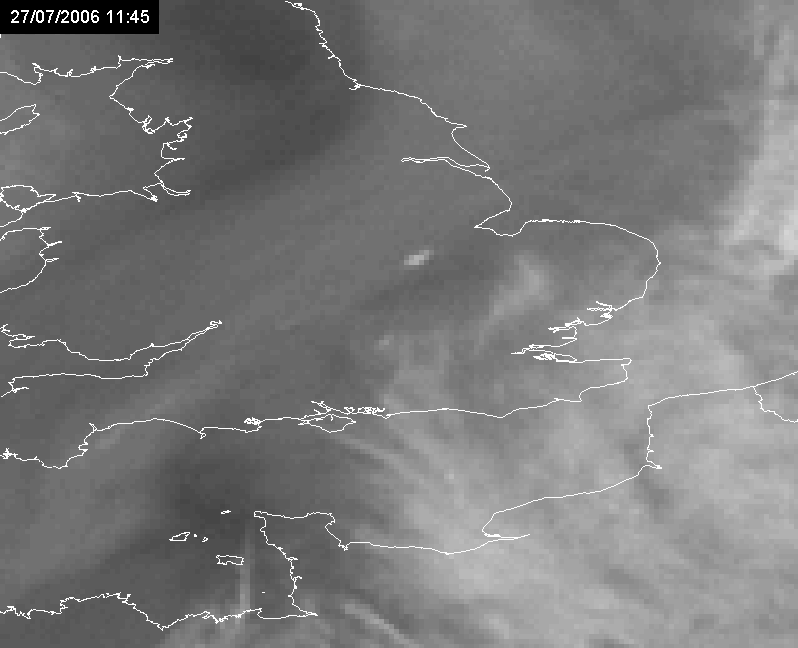
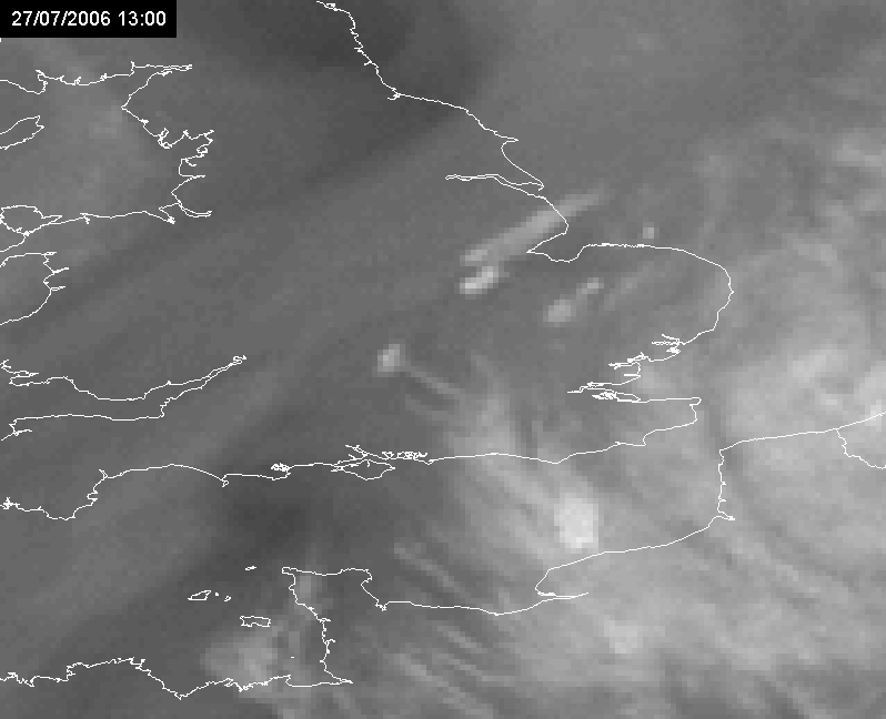
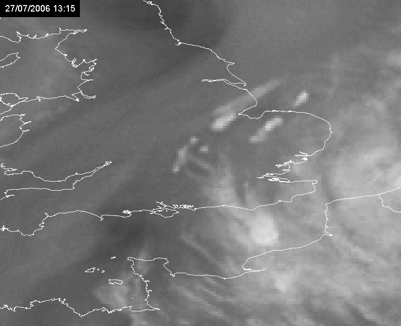
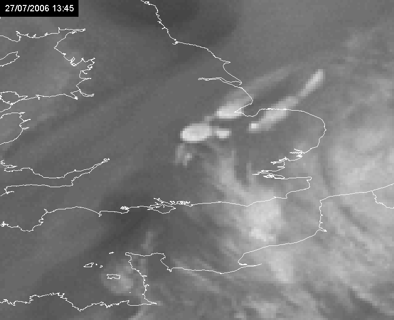
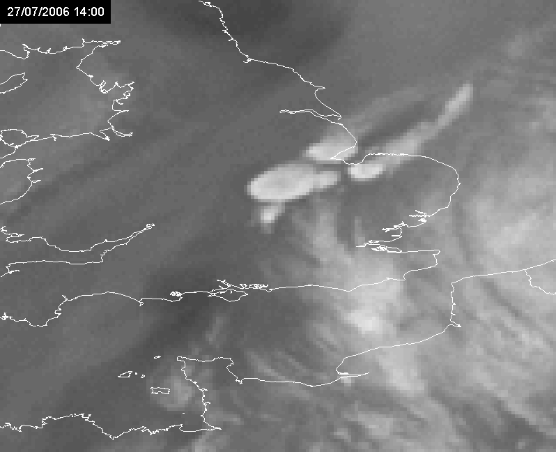
Case 2:
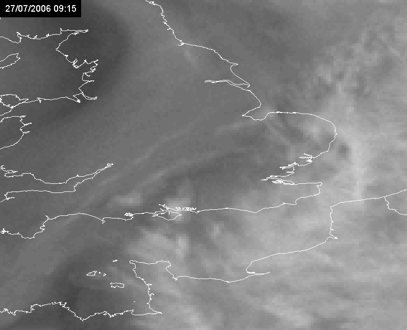
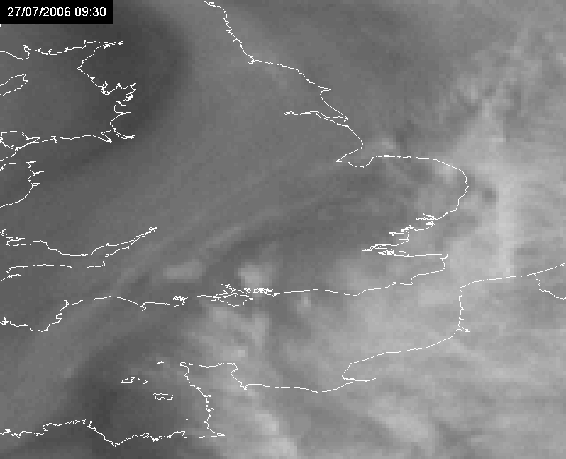
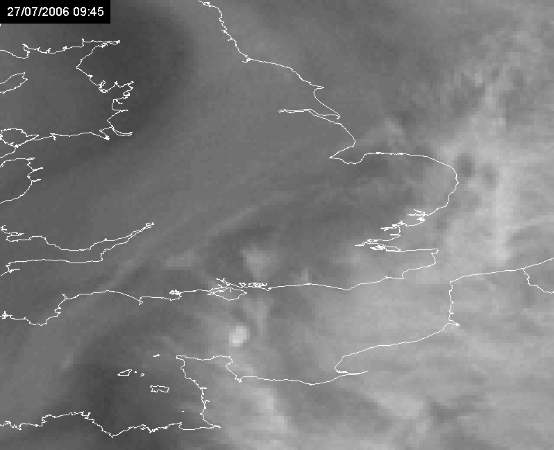
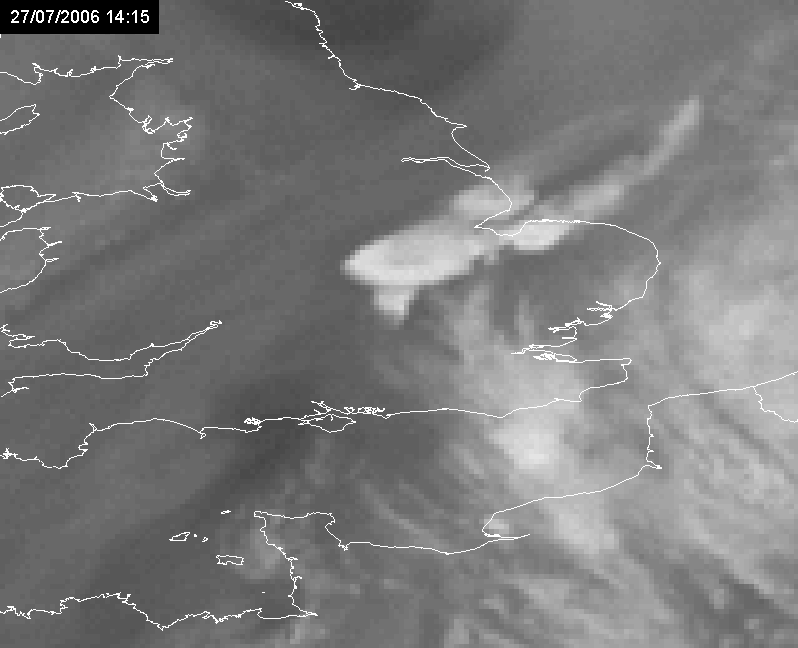
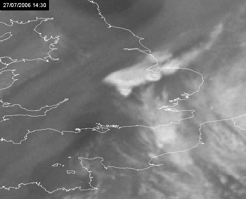
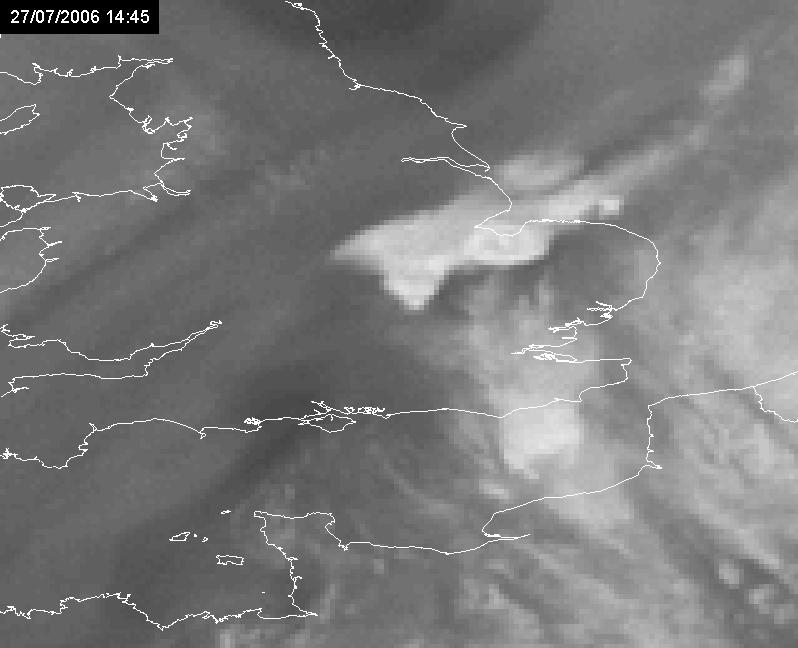
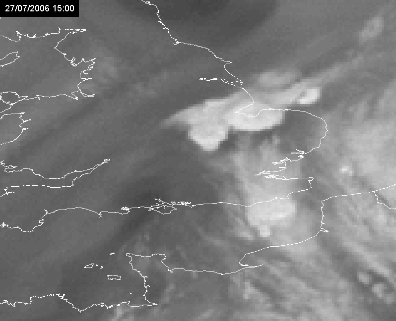
From midday onwards during the same day, a formation of different convective systems over south UK, in an area between Leicester, Oxford and Cambridge, also fitted the train effect, but in this case a ridge (check the 18°C isotherm) is stretching from France into the UK.
|
27 July 2006/12.00 UTC - Wet Bulb Potential Temperature 850 hPa
|
|
|
|
|
|
|
27 July 2006/13.45 UTC Meteosat 8 HRV image
|
27 July 2006/14.30 UTC Meteosat 8 HRV image
|
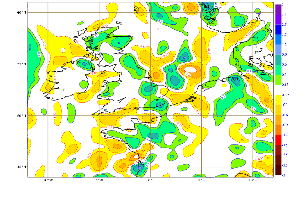
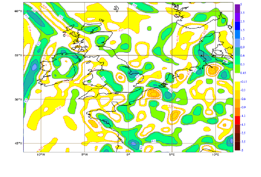
Specific humidity convergence at 1000 hPa
An important key parameter to consider from NWP outputs is the specific humidity convergence at 1000 hPa, which shall have local maxima in the train area. It might be expected that this field depicts other local maxima where the forecaster on duty sees no convective development. Naturally, it is a nowcasting task for the forecaster to find which model proposals for convection are likely to develop in the near future, also taking into consideration expected deviations between the atmospheric models and the atmosphere itself.
Naturally, if only convergence at 1000 hPa is available (and not specific humidity convergence), this can also be an alert, but note that moisture inflow is in fact one of the main ingredients to convection.
|
27 July 2006/12.00 UTC - Specific Humidity Convergence 1000 hPa (in 10^-5 g/Kg/s). Greenish and bluish colors represent humidity
convergence; yellowish and reddish colors represent humidity divergence.
|
27 July 2006/18.00 UTC - Specific Humidity Convergence 1000 hPa (in 10^-5 g/Kg/s). Greenish and bluish colors represent humidity
convergence; yellowish and reddish colors represent humidity divergence.
|
|
|
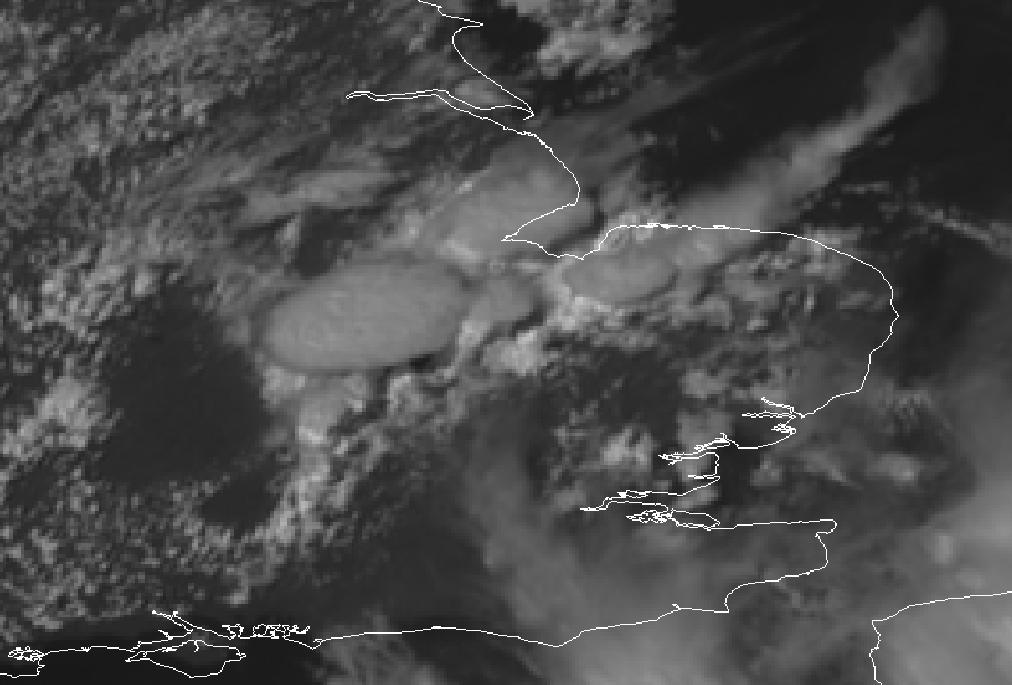
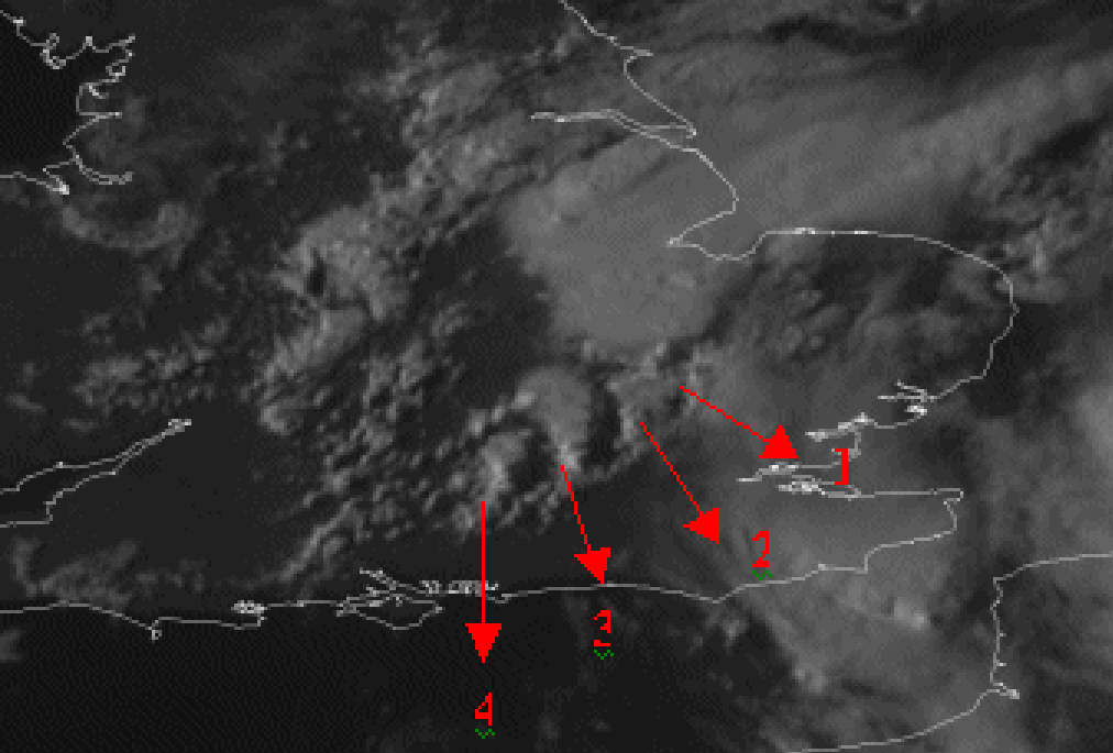
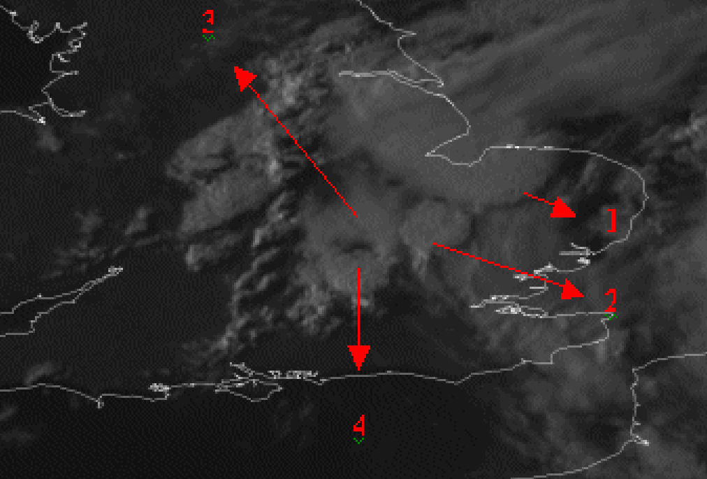
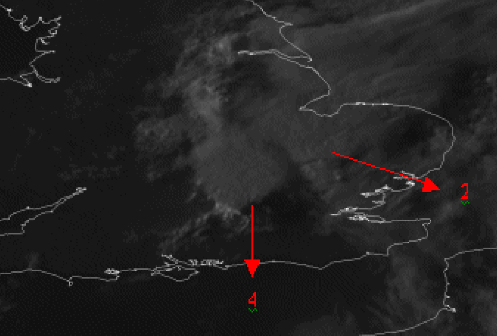
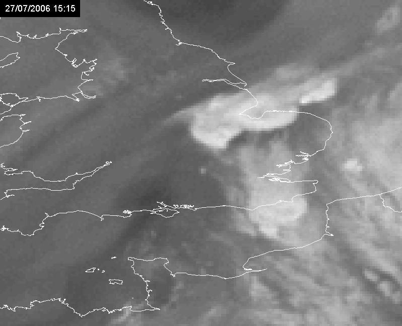
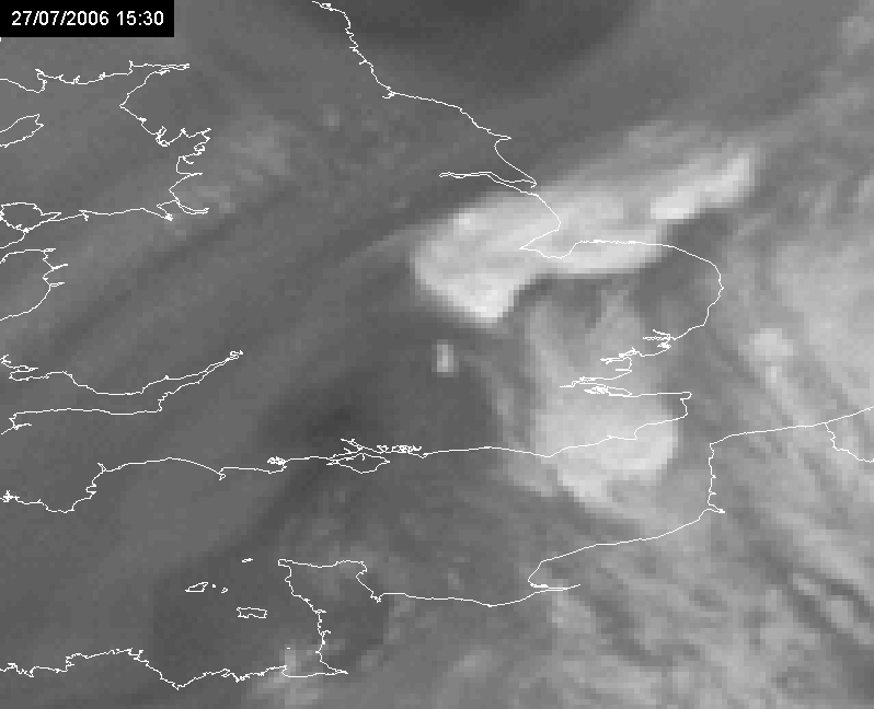
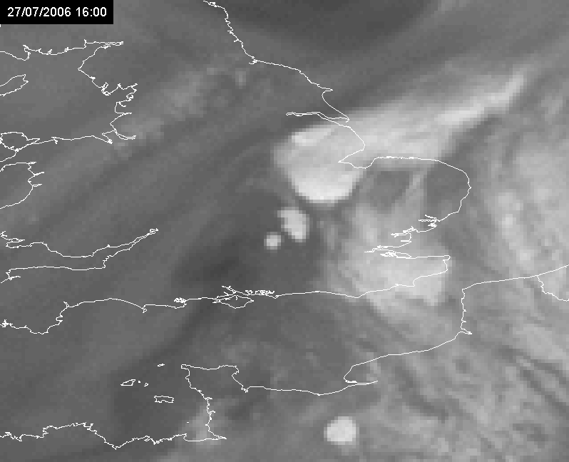
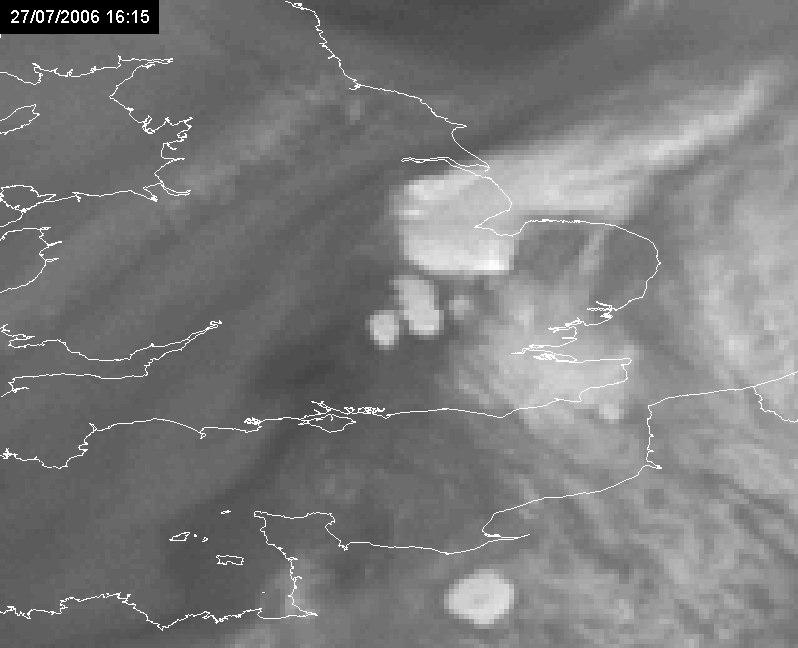
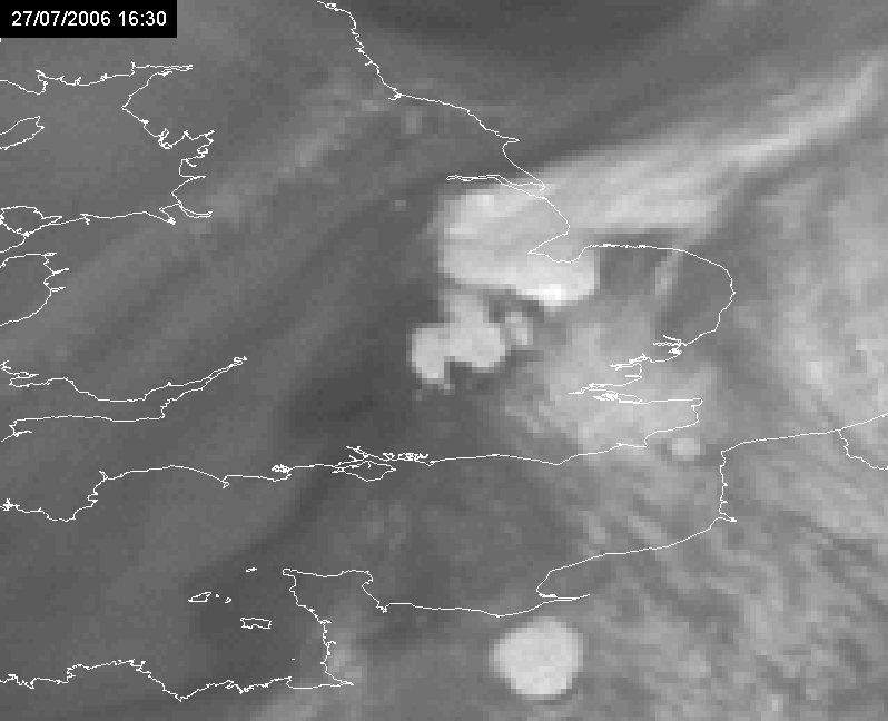
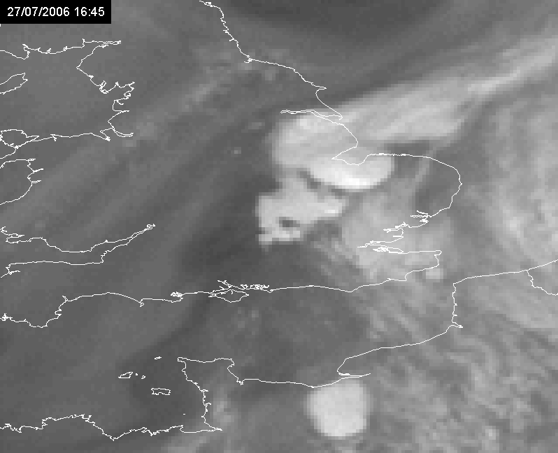
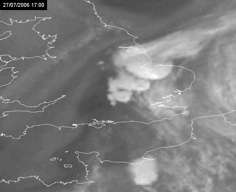
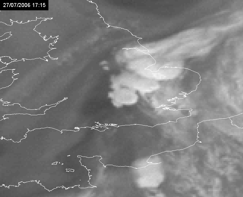
In the sequence of images below referring to the analyzed time period it is possible to note that:
- position of cell 2 (fully developed) at 17.00 UTC is over position of cell 1 (first stage) at 16.00 UTC
- position of cell 4 (fully developed) at 17.00 UTC is over position of cell 3 (first stage) at 16.00 UTC
|
27 July 2006/16.00 UTC - Meteosat 8 HRV image. Individual cells numbered from 1 to 4
|
27 July 2006/17.00 UTC Meteosat 8 HRV image. Individual cells numbered from 1 to 4
|
|
|
|
|
|
27 July 2006/18.00 UTC Meteosat 8 HRV image. Only cells 2 and 4 are identifiable.
|
|
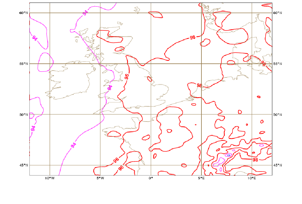
Vorticity Advection at 300hPa
Vorticity advection at 300 hPa has also been found to show areas of local maxima around the spot for successive convection. It should be noted, however, that these maxima may not be in a clear relation to an upper-level jet or strong tropopause anomalies, but rather related to weak tropopause anomalies (see similarities with the conceptual model Enhancement of convection by PV, Convective Cloud Features In Typical Synoptic Environments: Enhancement of convection by PV ). Again, like for specific humidity convergence, other local maxima may be present. Therefore, nowcasting will help finding the first convective bursts and check if there is or not stationarity of the systems.
|
27 July 2006/18.00 UTC - Vorticity Advection 300 hPa
|
27 July 2006/18.00 UTC - Meteosat 8 WV6.2 image
|
|
|
|
27 July 2006/09.00 UTC - Meteosat 8 WV6.2 image; 27 July 09.00 - 20.45 UTC quarter-hourly image loop
|
|
Instability (Boyden Index)
Finally one more obvious condition, which could even be firstly considered, is stability. In this case, the Boyden index is presented, whose threshold for risk of thunderstorm can be set to 95. Note, that one should not need to have the largest values in the area of train effect. In these instants, larger values are reached in Continental Europe, where convection also developed, but not so much fitting to train effect. The convective activity during the afternoon is shown with the deep convection RGB.
|
27 July 2006/12.00 UTC - Boyden Index
|
27 July 2006/18.00 UTC - Boyden Index
|
|
|
|
27 July 2006/15.15 UTC - Meteosat 8 Deep Convection RGB (WV6.2-WV7.3; IR3.9-IR10.8; NIR1.6-VIS0.6) image
|
27 July 2006/16.00 UTC - Meteosat 8 Deep Convection RGB (WV6.2-WV7.3; IR3.9-IR10.8; NIR1.6-VIS0.6) image
|
|
|
|
|
|
27 July 2006/17.00 UTC - Meteosat 8 Deep Convection RGB (WV6.2-WV7.3; IR3.9-IR10.8; NIR1.6-VIS0.6) image
|
27 July 2006/18.00 UTC - Meteosat 8 Deep Convection RGB (WV6.2-WV7.3; IR3.9-IR10.8; NIR1.6-VIS0.6) image
|
Instability together with the last two parameters (specific humidity convergence and vorticity advection) should be evaluated together, in a sense that areas where all the 3 parameters sum up should be followed with more attention in a smaller scale after a larger-scale analysis is provided by thickness (850-500 hPa) and wet bulb potential temperature at 850 hPa.
Low-Level Jet and Veering
As seen in the Meteorological Physical Background, the propagation of the convective system may or not be related to a LLJ. In the case where a train effect event is dynamically related to a LLJ, one operational challenge for a forecaster is to identify its existence, whether using model forecasts or observational data from radio soundings or radar. On one side, the model may not reproduce the LLJ and, on the other side, the LLJ position/intensity may not be observed due to a sparse resolution of radio sounding and radar networks for the analysis of this phenomenon.
For the analyzed case on 27 July 2006, the model does not detect any indication of a LLJ in the vicinity of the area of train effect (a LLJ was considered to have an intensity of 20kt or more in some layer above surface and below 850 hPa). Following the previous considerations, either the LLJ was not dynamically important or it was but it was not correctly modeled.
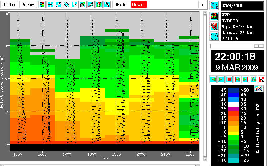
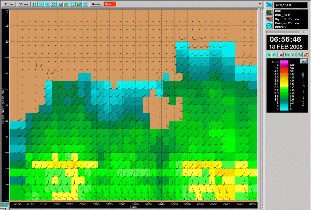
However, for the Lisbon case shown in the satellite image chapter, a LLJ was found both by model and radar in the vicinity of the affected areas. In the radar vertical profile sequence shown below, wind speeds of 35-40kt at a height of approximately 1000m were measured for several hours during the event, with a persistence veering of the wind from SE to SW in the first two km. This was also an indication of warm air advection in the lower levels and, as a consequence, increasing instability.
|
18 February 2008/01.00 - 07.00 UTC - Radar Coruche; Vertical Wind Profile (in kt) and Average Reflectivity in layers (in dBZ).
The radar station is located around 80 km ENE of Lisbon.
|
|
|
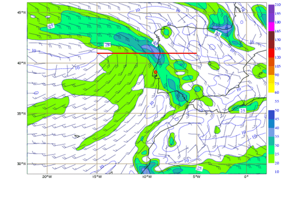
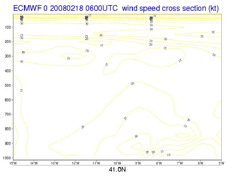
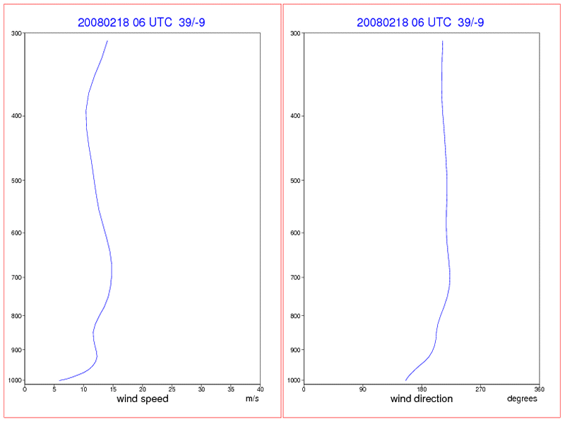
This observation somewhat agrees with model data as can been seen in ECMWF analysis at 06.00 UTC. A LLJ is depicted with its axis around 925 hPa and oriented from Cadiz gulf to the northwest of the Iberian Peninsula. The cross section along 41°N parallel finds the LLJ over Porto city. The vertical profile over Lisbon area shows a slight wind maximum around 940hPa and confirms the veering of the wind. Note that the vertical profile was obtained over the area of convective development, which is to the southwest of model LLJ and also not exactly over the radar location.
|
18 February 2008/06.00 UTC - Wind barbs and isotachs 925 hPa (red line for cross section and red circle for vertical profile
location)
|
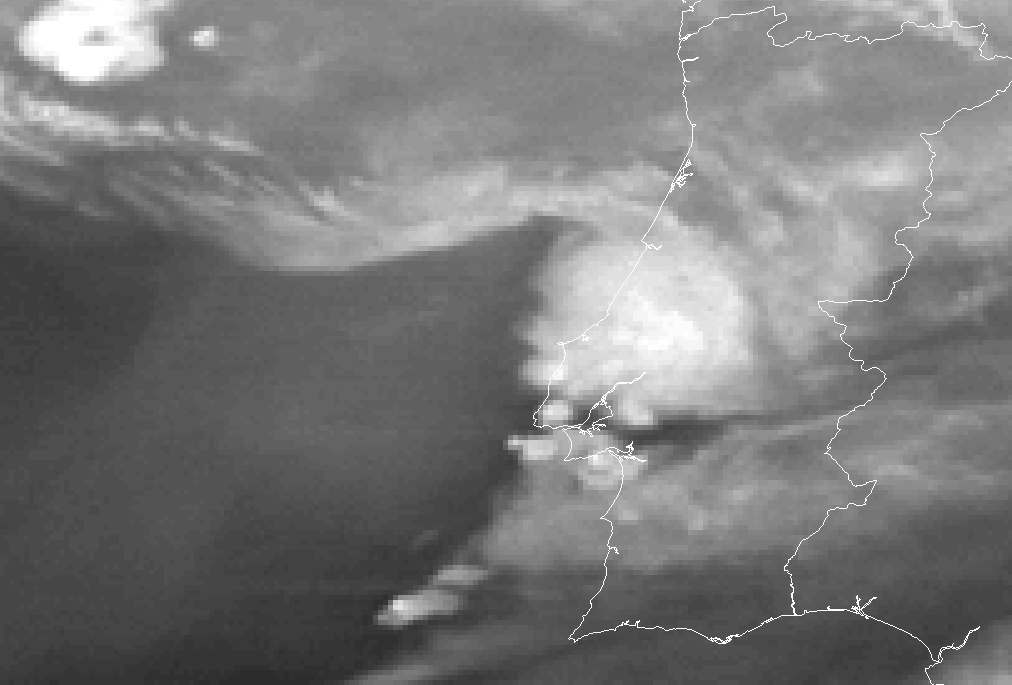
18 February 2008/06.00 UTC - Meteosat 9 WV image WV 6.2 image
|
|
|
|
|
|
18 February 2008/06.00 UTC - Vertical cross section; yellow: isotachs
|
18 February 2008/06.00 UTC - Vertical profile; left: wind speed; right: wind direction
|
Final Note
This Special Investigation started with a preliminary evaluation of around 100 cases of convective systems over Europe between 1992 and 2009 with both Meteosat first and second generation satellites. These cases were previously studied under the scope of EUMETSAT and EUMETRAIN activities. After excluding orographic induced convection, a total of 7 cases of clear visual train effect were explored in detail; 3 of these cases are presented here.
References
- AEMET, 1999: Modelos conceptuales a mesoscala. Sistemas Convectivos de Mesoscala. Biblioteca de Modulos TEMPO. Version 2.0. April (in spanish).
- COMET Activities at Saint Louis University - http://www.eas.slu.edu/Comet/precip.html
- CORFIDI S. F., MERRIT J. H. and FRITSCH J. M., 1996: Predicting the movement of Mesoscale Convective Complexes. Weather and Forecasting, 11, 41-46, March.
- CORFIDI S. F., 1998: Forecasting MCS mode and motion. 19th Conference Severe Local Storms, Minneapolis, MN.
- CORFIDI S. F., 2003: Cold Pools and MCS Propagation: Forecasting the Motion of Downwind-Developing MCSs. Weather and Forecasting, 18, 997-1017, December.
- DOSWELL III C. A., BROOKS H. E. and MADDOX R.A., 1996: Flash flood forecasting: An ingredients-based methodology. Weather and Forecasting, 11, 560-581, December.
- FUNK T. W., 1991: Forecasting Techniques Utilized by the Forecast Branch of the National Meteorological Center during a major convective rainfall event. Weather and Forecasting, 6, 548-564, December.
- HOUZE Jr R. A., SCHMID W., FOVELL R. G. and SCHIESSER H. H., 1993: Hailstorms in Switzerland: left movers, right movers, and false hooks. Mon. Wea. Rev., 121, 3345-3370, December.
- SAARIKALLE E., 2009: Heavy rain events in Finland 2000-2008. M.S. Thesis - Meteorology. University of Helsinki. Department of Physics.