Key Parameters
- Absolute topography at 500 and 1000 hPa:
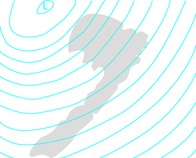
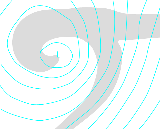
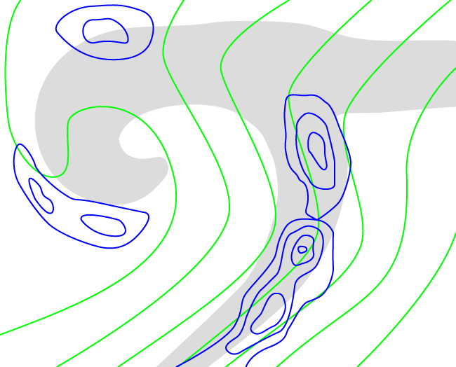
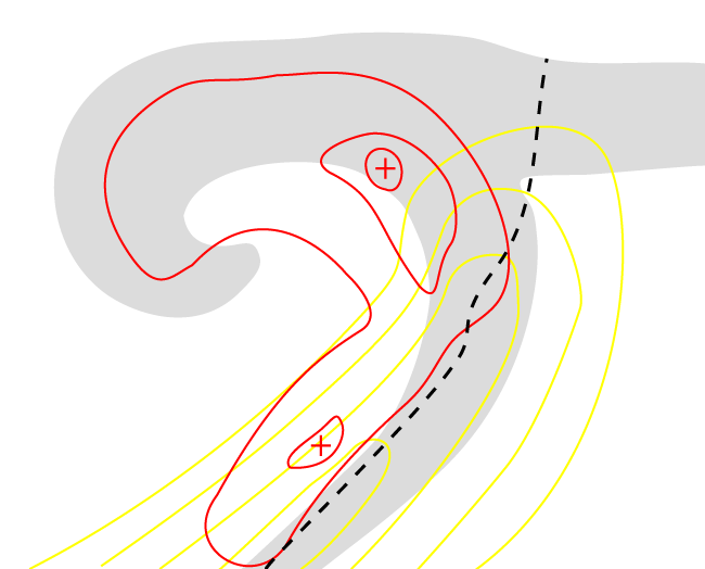
The absolute topography shows in the inital stage two upper level troughs: a synoptic scale trough which can be found at the rear of the cloud band of a Cold Front, and a secondary weaker trough where Comma - like cloudiness develops. During the stages of development this trough becomes more and more pronounced. In the maturing stage of the Cold Air Development often a low can be found in the centre of the cloud spiral.
The surface trough is rather weak in the initial stage and can be found at the leading edge of the Baroclinic Boundary. During development the trough intensifies, depending on the strength of the development. - Thermal front parameter:
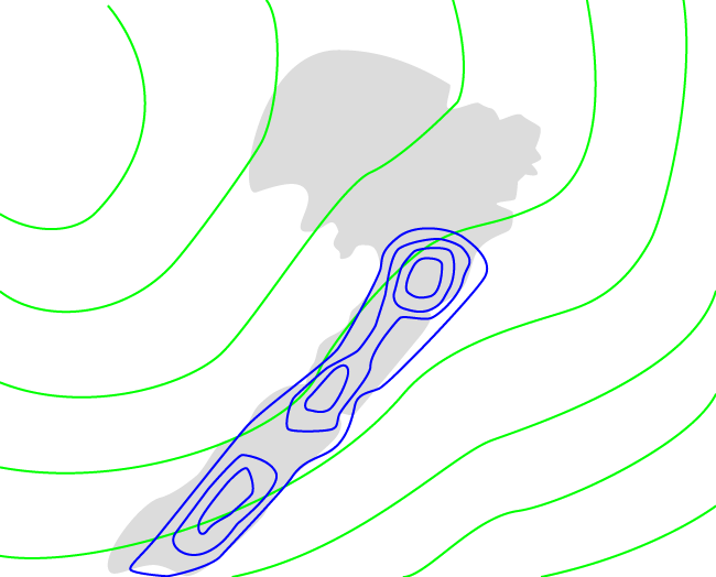
In some cases a thermal front parameter has developed which accompanies the head of the Comma. This branch of the front parameter is not the relevant feature in the Cold Air Development, but a branch of the thermal front parameter accompanying the intensifying Baroclinic Boundary. Very often a small indication of the thermal front parameter in this area can already be seen in the initial stage which then extends northward during the development. The existence of such a thermal front parameter in the initial stage confirms the existence of some baroclinicity, and its growth confirms the strengthening of this baroclinicity. - Equivalent thickness:
The equivalent thickness is characterized by a trough behind the cloud spiral indicating cold air.
The existence of a thermal front parameter, mentioned before, marks the biggest change of the thickness gradient, but isolines of thickness never show such pronounced gradients as observed with classical fronts. This is another indication that there is no big difference between the air masses in front of and behind the Cold Air Development (compare Meteorological physical background ). - Temperature advection:
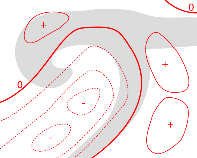
The main feature in the field of temperature advection is the pronounced CA maximum behind the cloud structure. There is some variability from case to case:- In some cases the whole cloud system is within CA during the whole development.
- In some cases very weak warm advection can be observed in front of the cloud system. The latter gives some indications for a Cold Air Development going on.
- Vorticity advection at 500 hPa and 300 hPa:
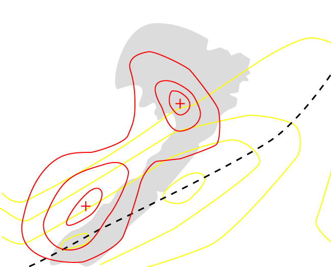
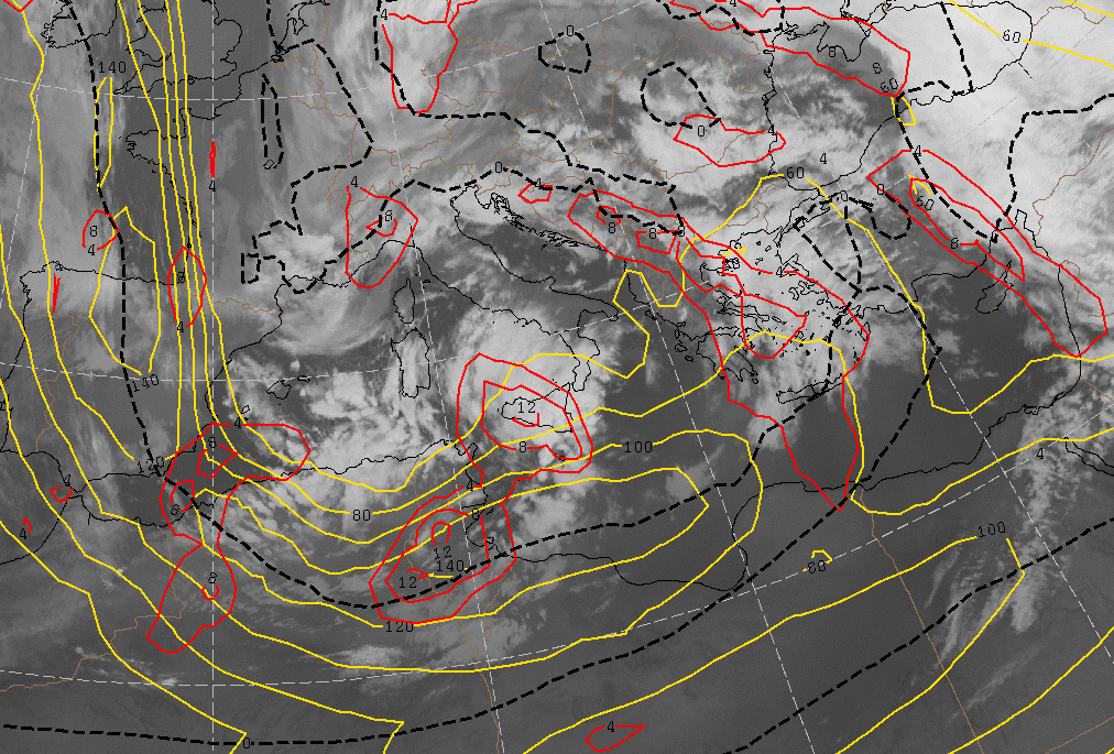
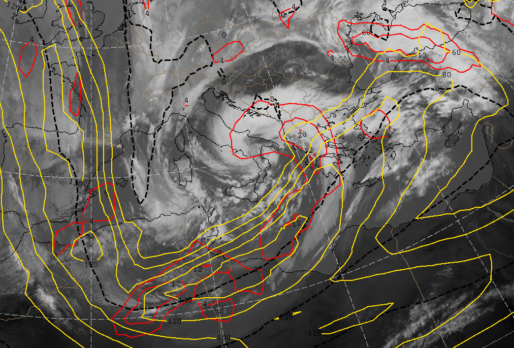
The vorticity advection shows at 500 as well as at 300 hPa a strong pronounced PVA maximum. Both trough and jet contribute to PVA, but especially at 300 hPa the PVA maximum is connected to the left exit region of a jet streak. - Isotachs at 300 hPa:
Mostly the Comma tail is situated within the left exit region of a jet streak.
|
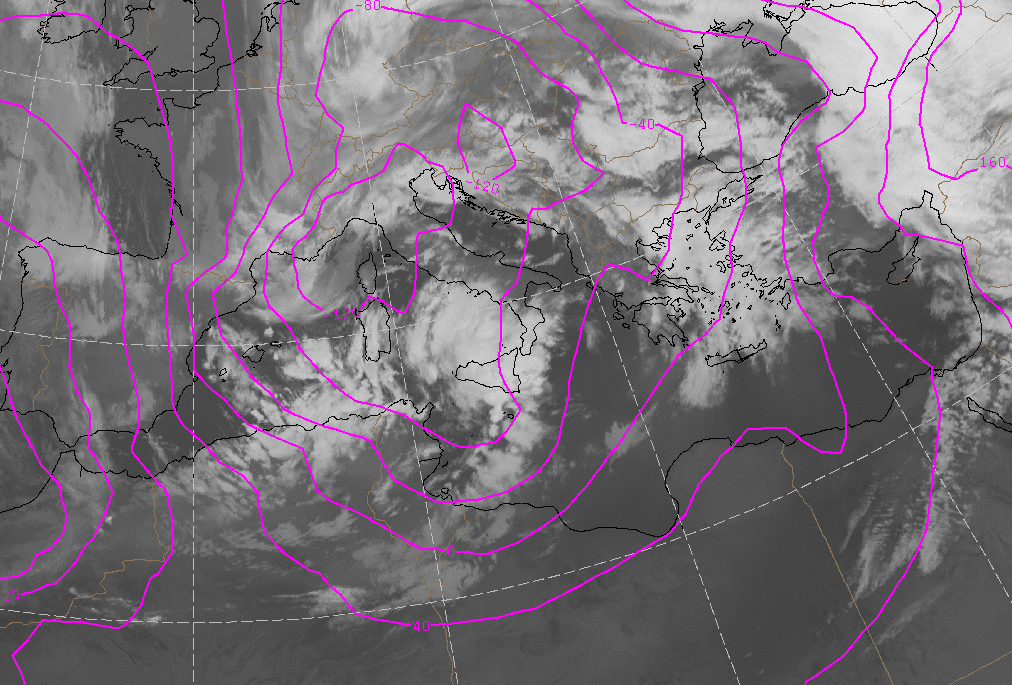
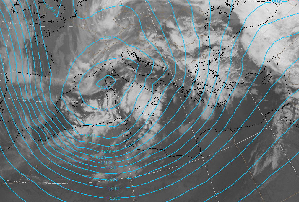
06 March 2009/00.00 UTC - Meteosat 9 IR10.8 image; magenta: height contours 1000 hPa
|
|
|
|
|
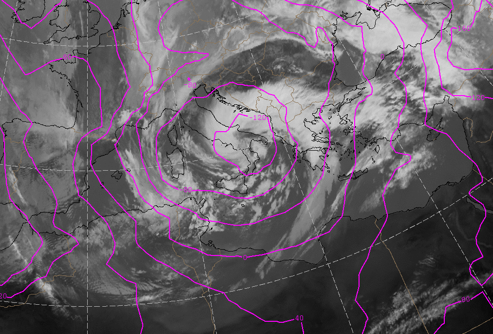
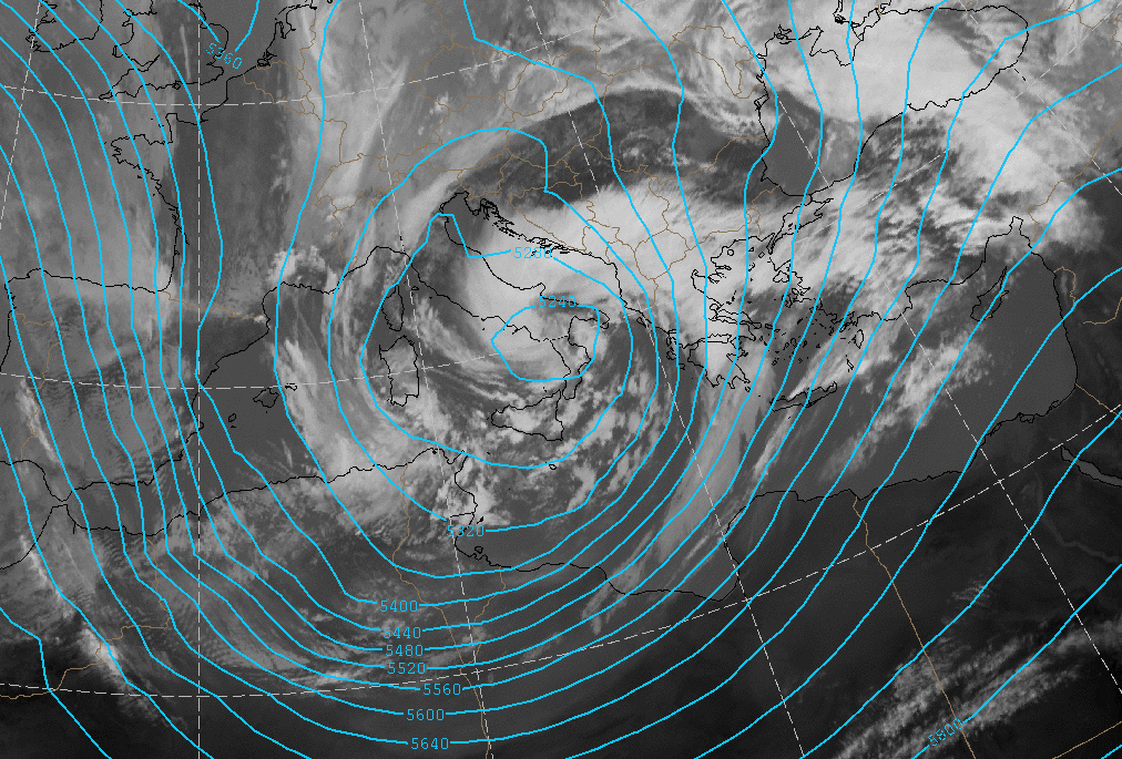
06 March 2009/12.00 UTC - Meteosat 9 IR10.8 image; magenta: height contours 1000 hPa
|
|
|
|
|
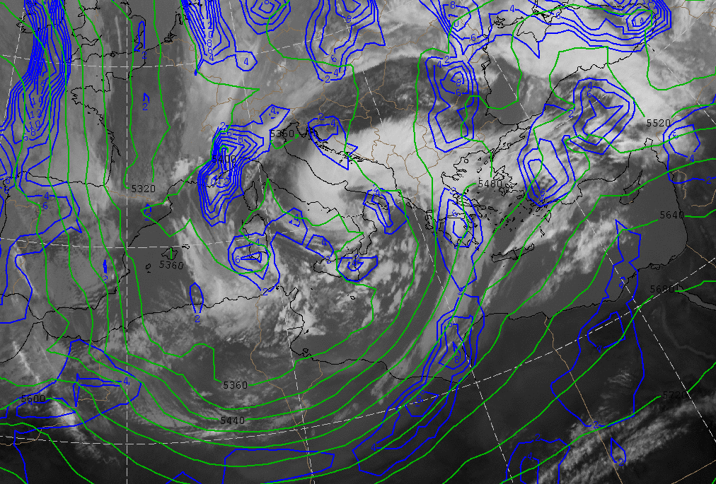
06 March 2009/00.00 UTC - Meteosat 9 IR10.8 image; green: height contours 500 hPa
|
|
|
|
|
06 March 2009/12.00 UTC - Meteosat 9 IR10.8 image; green: height contours 500 hPa
|
|
|
|
|
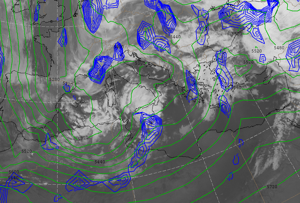
06 March 2009/00.00 UTC - Meteosat 9 IR10.8 image; blue: thermal front parameter 500/850 hPa, green: thickness 500/1000 hPa
|
|
|
|
|
06 March 2009/12.00 UTC - Meteosat 9 IR10.8 image; blue: thermal front parameter 850 hPa, green: thickness 500/1000 hPa
|
|
|
|
|
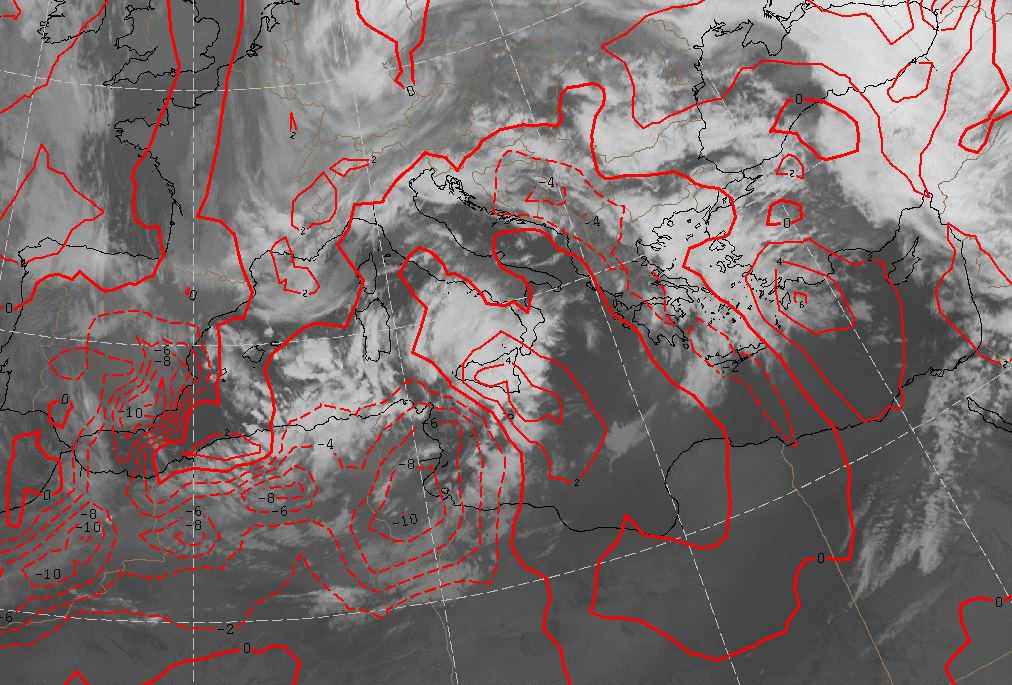
06 March 2009/00.00 UTC - Meteosat 9 IR10.8 image; red dashed: Cold Advection red straight Warrm Advection 500/1000 hPa
|
|

|
|
|
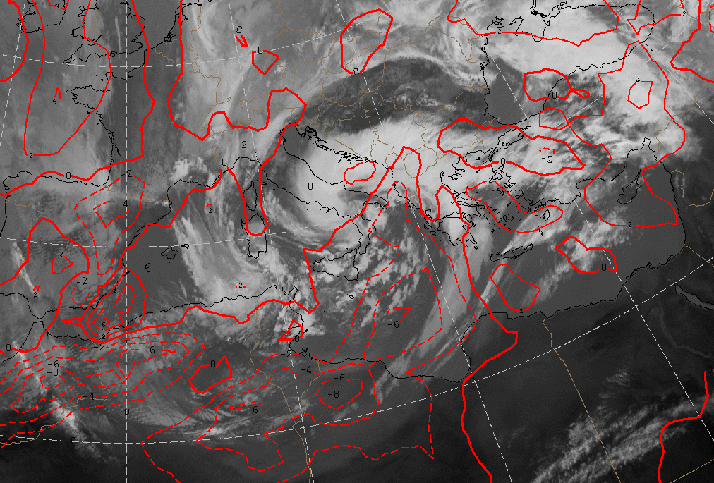
06 March 2009/12.00 UTC - Meteoasat 9 IR10.8 image; red dashed line: Cold Advection red line: Warrm Advection 500/1000 hPa
|
|
|
|
|
06 March 2009/00.00 UTC - Meteosat 9 IR10.8 image; yellow: isotachs 300 hPa; red : PVA 300 hPa; Black: Jet axis
|
|
|
|
|
06 March 2009/12.00 UTC - Meteosat 9 IR 10.8 image; Yellow: isotachs 300 hPa; red: PVA 300 hPa; Black: Jet axis
|
|
|
|