Cloud Structure In Satellite Images
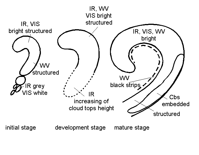
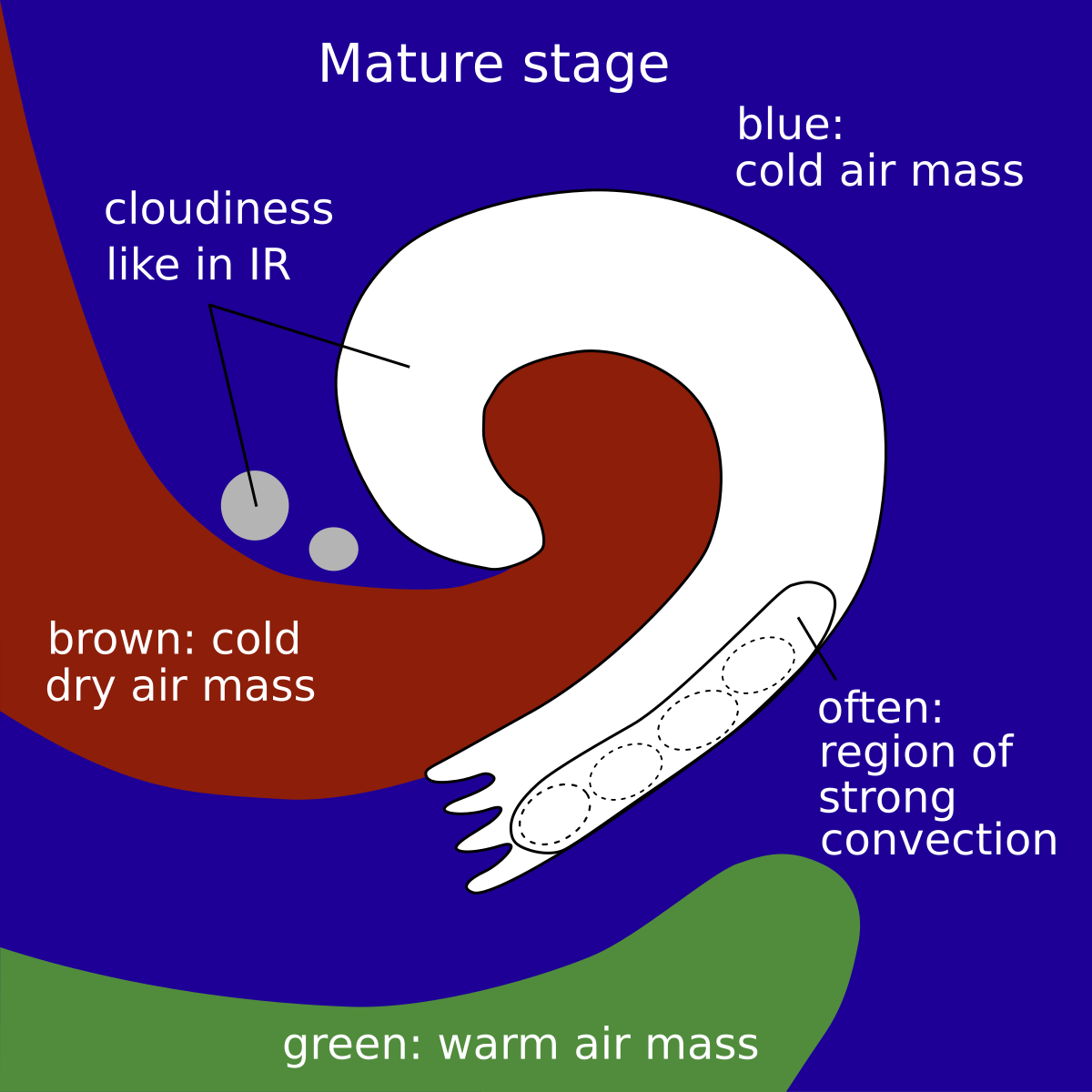
- The satellite image shows in the initial stage a cyclonically curved Comma feature (see Comma ) which is situated within the cold air mass behind a Cold Front (CF) in its initial stage; during the further development the Comma increases in size until in the mature stage when a synoptic scale spiral is reached.
- During the development of a CAD the cloud configuration at the rear side of the previous CF, the approach of the system is often so fast that the mature stage (the “Comma front”) is rather close to the front, leading to a double structure of frontal cloud bands.
Appearance in the basic channels:
In general, the cloud spiral in the IR and VIS images has a white and structured appearance, indicating multi-level cloudiness with embedded Cbs (see Meteorological physical background and Weather events).
In the initial stage, a southward continuation of the Comma Tail can be observed in the form of more or less continuous cloud patches in the lower level cloud field.
The WV image is characterized by grey to white pixel values, which correspond to those in the IR image. On the rear side of the Comma structure the WV image is characterized by a sharp gradient and a black stripe indicating dry air.
Particularly in the initial stages, the brightest grey shades can be observed within the Comma tail, which is situated within the area of the left exit region of a jet streak (see Front Intensification By Jet Crossing).
|
Appearance in the basic RGBs:
Airmass RGB:
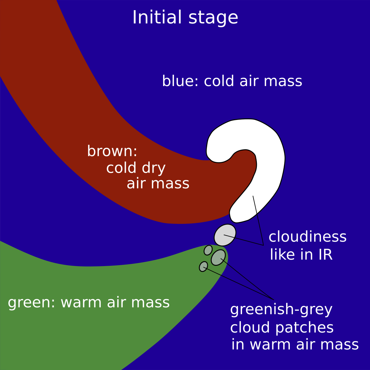
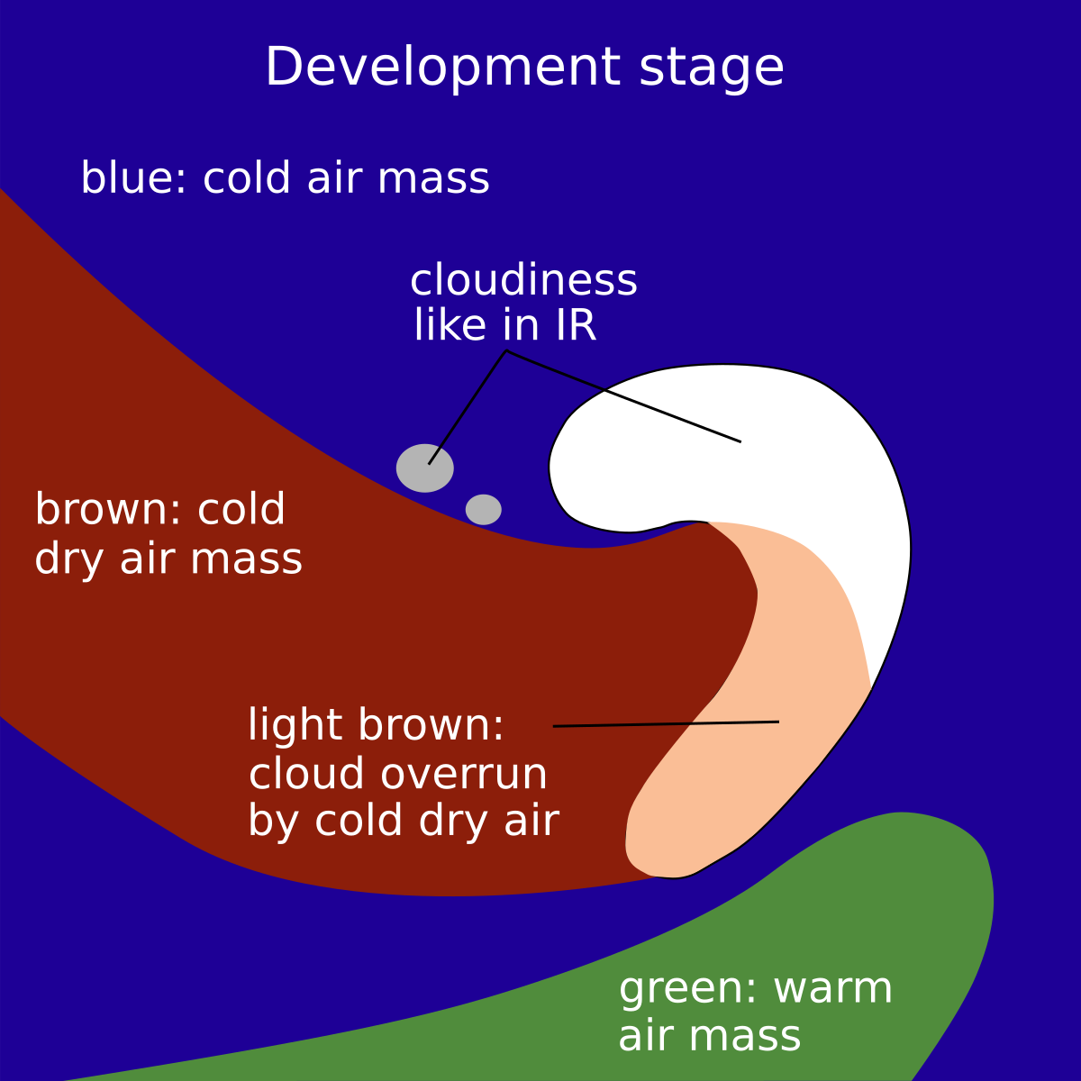
The Airmass RGB shows dark blue and brown colours at the rear side of the comma throughout its development, indicating that the whole CAD process takes place within cold and dry airmasses. The brownish colour is at the rear of the comma cloud feature and very often penetrates the cloud patches that form the continuation of the comma tail, as well as the developing cloud band, during the process. Sometimes, especially in the initial comma stages, these cloud patches have also some green colours ahead of them, representing rather warmer air masses.
The comma cloud looks very similar to the IR image in all stages, but os mostly overlaid by the brownish colour representing the penetrating dry air. This is especially true for the comma tail, which consists of low cloud.
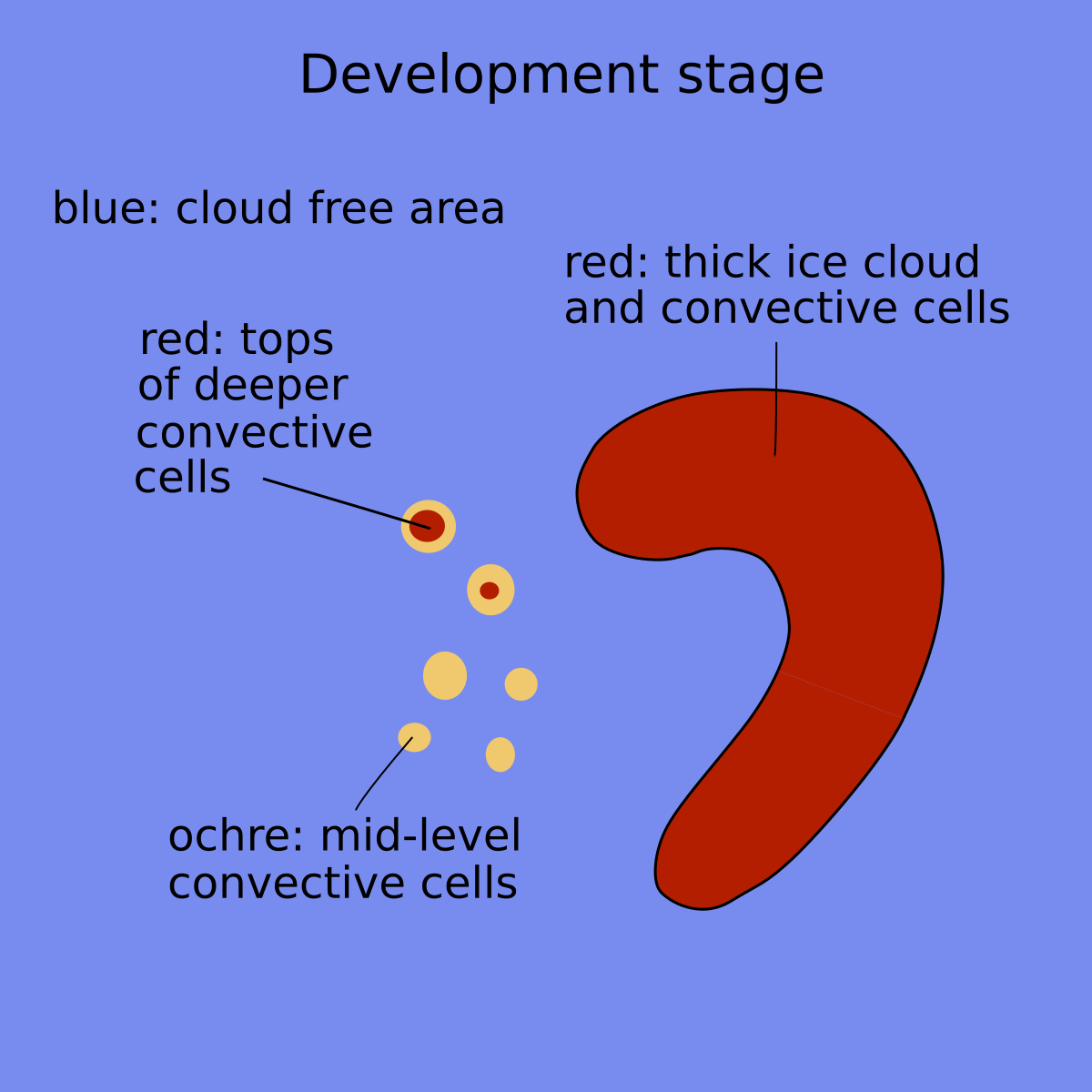
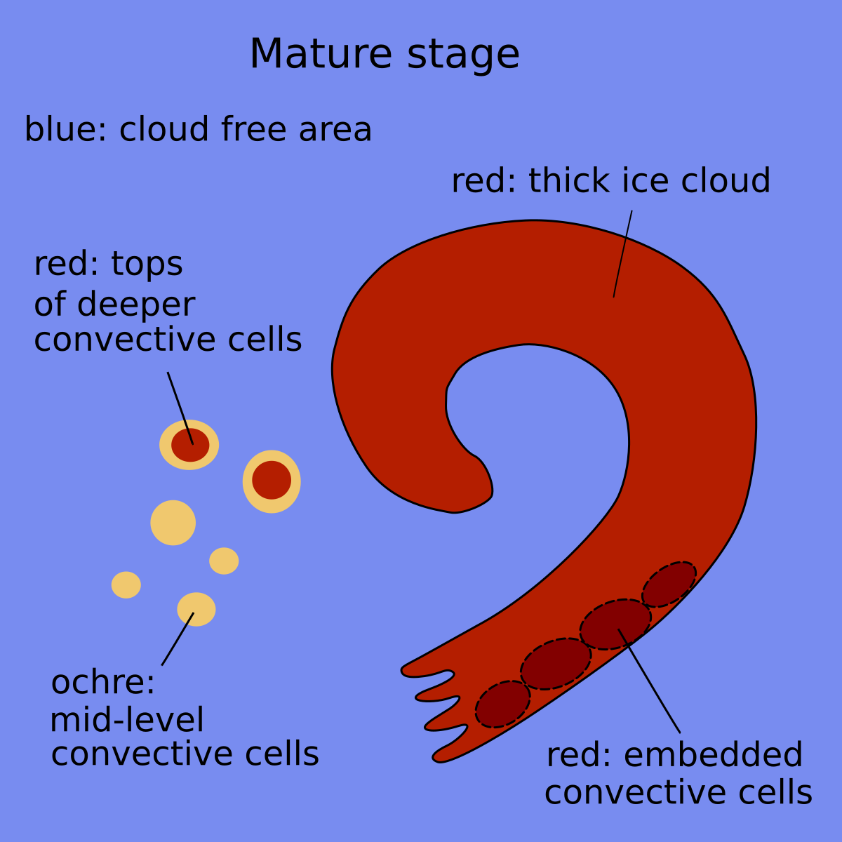
Dust RGB:
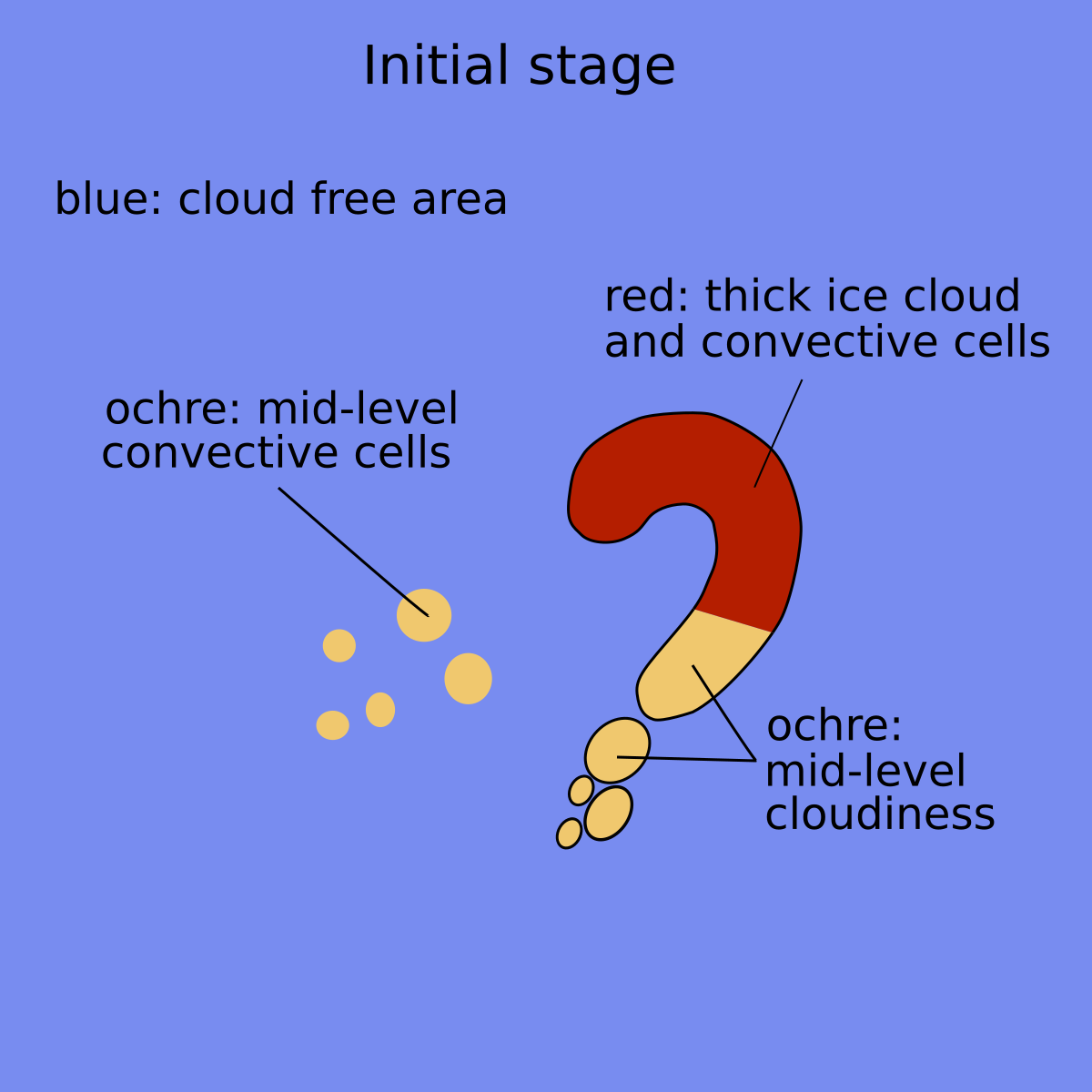
Unlike for other cloud configurations, the Dust RGB shows blue colours, representing a cloud-free surface, in the surroundings of the CAD cloud configurations. However, there are very often low cloud configurations too, which show up as ochre colours.
The comma cloud is dark red in every development stage, representing the thicker and the convective cloud parts, which are very often connected to the comma head, very often with and ochre areas, representing the lower cloud parts, in the comma tail. During the progress of a CAD development more red-brown colour can develop, especially in the tail area.
 |
 |
 |
 |
 |
 |
Schematics for basic RGBs for three stages of development.
Left: Airmass RGB; right: Dust RGB.
Example from 13 October 2019/ 06 - 18 UTC
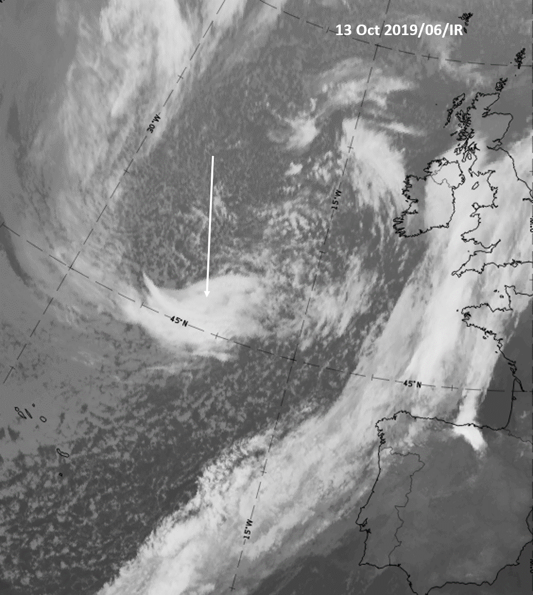
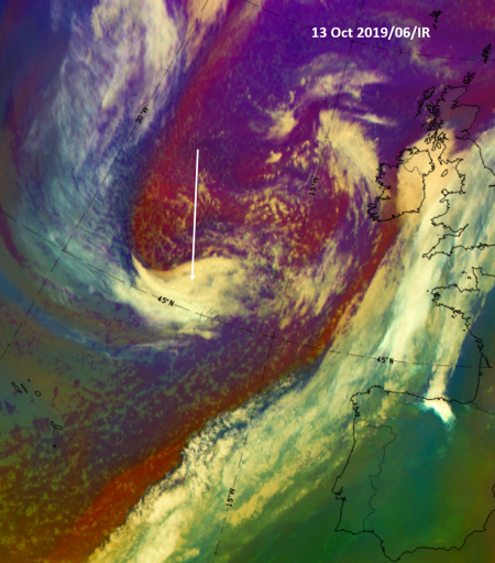
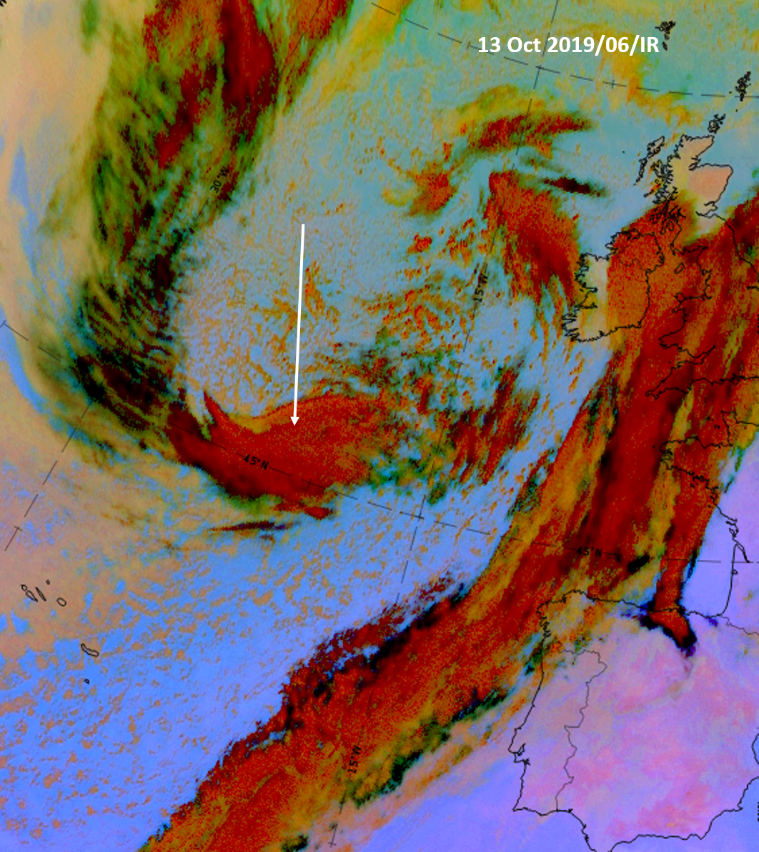
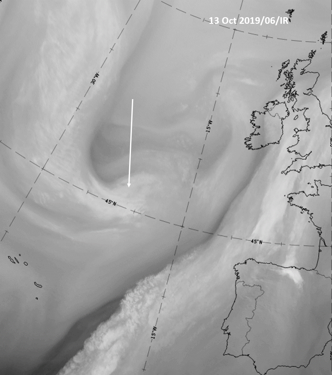
The Sequence of images below shows a CF cloud band extending from the southern parts of the Atlantic northward to the British Isles, which moves slowly eastward. In the trough of cold air at the rear, a comma configuration (indicated by the arrow) turns from east-west to north-south orientation, approaches the frontal cloud band and expands and intensifies distinctly.
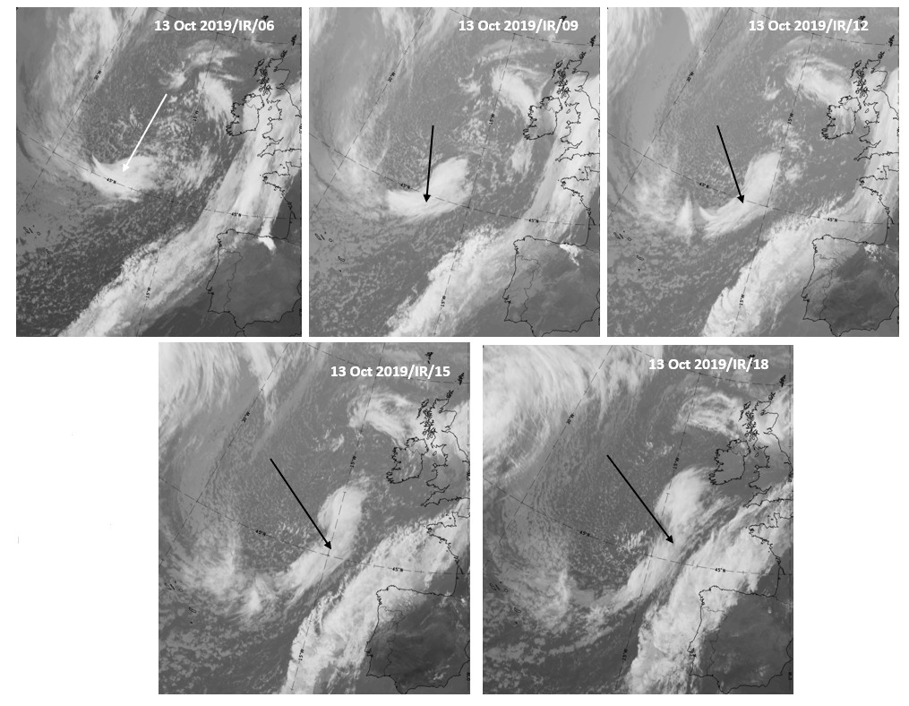
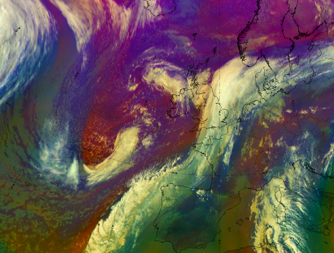
At 6 UTC on 13 October 2019 the basic satellite channels, the basic RGBs and the NWCSAF parameters show the initial stage of a CAD, the comma stage.
|
|

13 October 2019, 06UTC: 1st row: IR; 2nd row: WV (above) + Airmass RGB (below); 3rd row: Dust RGB + image gallery
*Note: click on the Dust RGB image to access image gallery (navigate using arrows on keyboard)
| IR | White and structured. |
| HRV | Not available at this time. |
| WV | Bright and structured with a distinct dark grey stripe along the rear edge approaching from the north. |
| Airmass RGB | Within blue and dark-brown airmasses indicating cold and cold -dry air; the dark grey stripe in the WV channel shows up as a brownish stripe from the north, bending along the rear side of the comma. The comma cloud is similar to that in the IR image but some structures are more distinct in this RGB: a brighter small stripe indicates the jet axis, there and the comma cloudiness to its north has a light brown shading which indicates penetrating dry air. |
| Dust RGB | Dark red and structured appearance indicating thick ice cloud. |
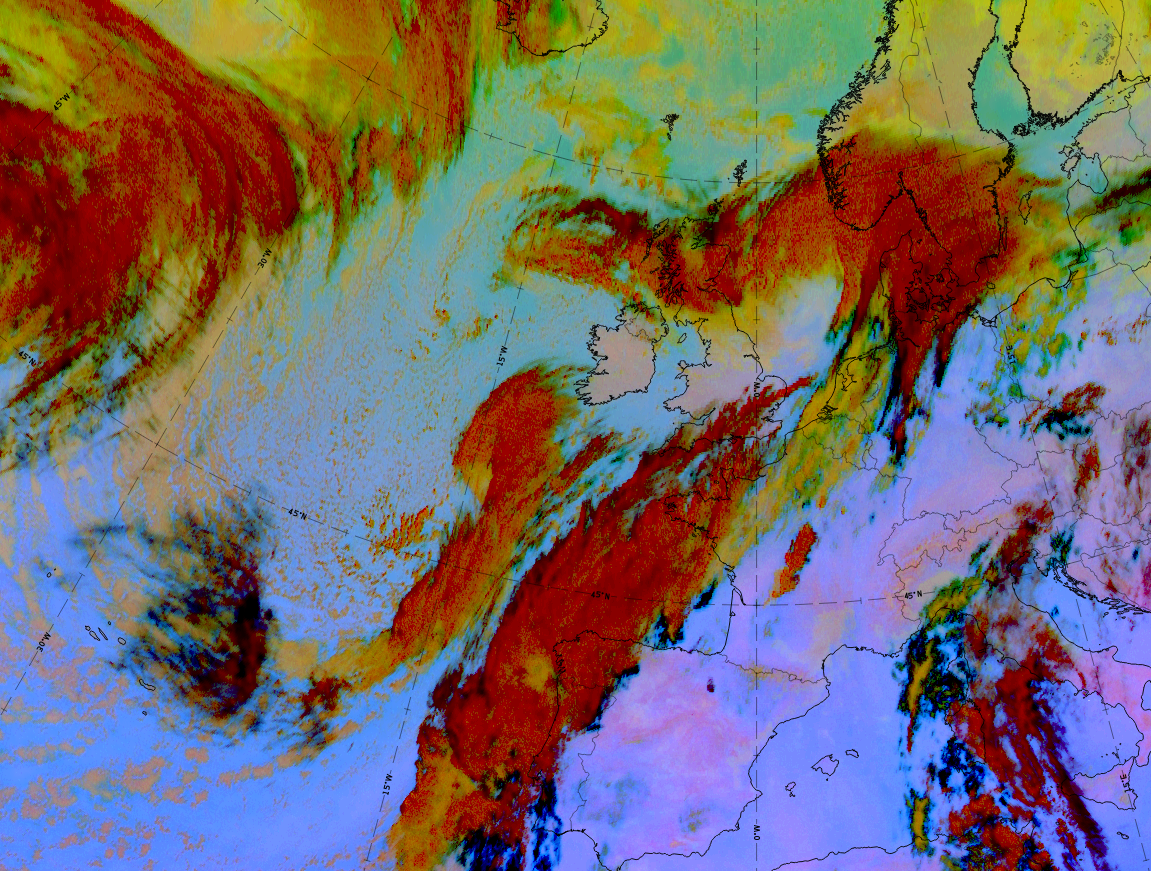
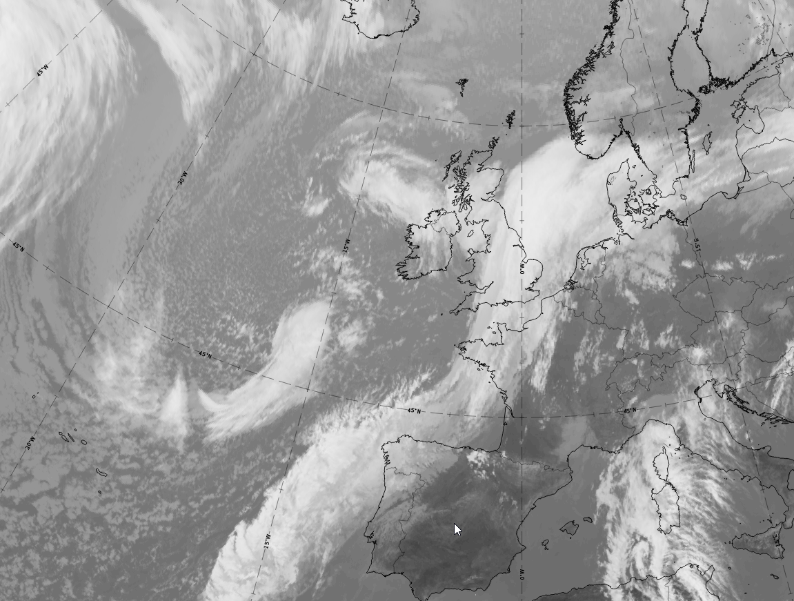
At 12 UTC on 13 October 2019 the comma has increased in size; this is an example of the Development stage.
|
|
|
|


13 October 2019, 12UTC: 1st row: IR (above) + HRV (below); 2nd row: WV (above) + Airmass RGB (below); 3rd row: Dust RGB + image gallery.
*Note: click on the Dust RGB image to access image gallery (navigate using arrows on keyboard)
| IR | White and structured; increased size; dark-grey continuation of the comma tail westward (better seen in HRV and Dust RGB). |
| HRV | Bright and structured; the continuation of comma tail westward is cellular. |
| WV | Bright and structured with a distinct dark grey stripe and area along the rear edge approaching from the north. |
| Airmass RGB | Within blue and dark-brown airmasses indicating cold and cold-dry air; the dark grey stripe in the WV channel shows up as a brownish stripe and area from the north, bending along the rear side of the comma. The comma cloud is similar to that in the IR image. |
| Dust RGB | Dark red and structured appearance indicating thick ice cloud in the comma head and tail; ochre colours at the leading edge of the comma and in the westward continuation of the comma tail; black stripes and fibrous areas indicate high translucent cloud. |
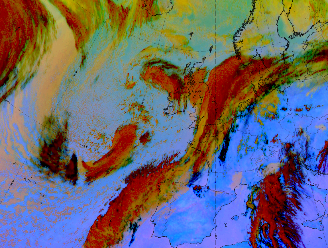
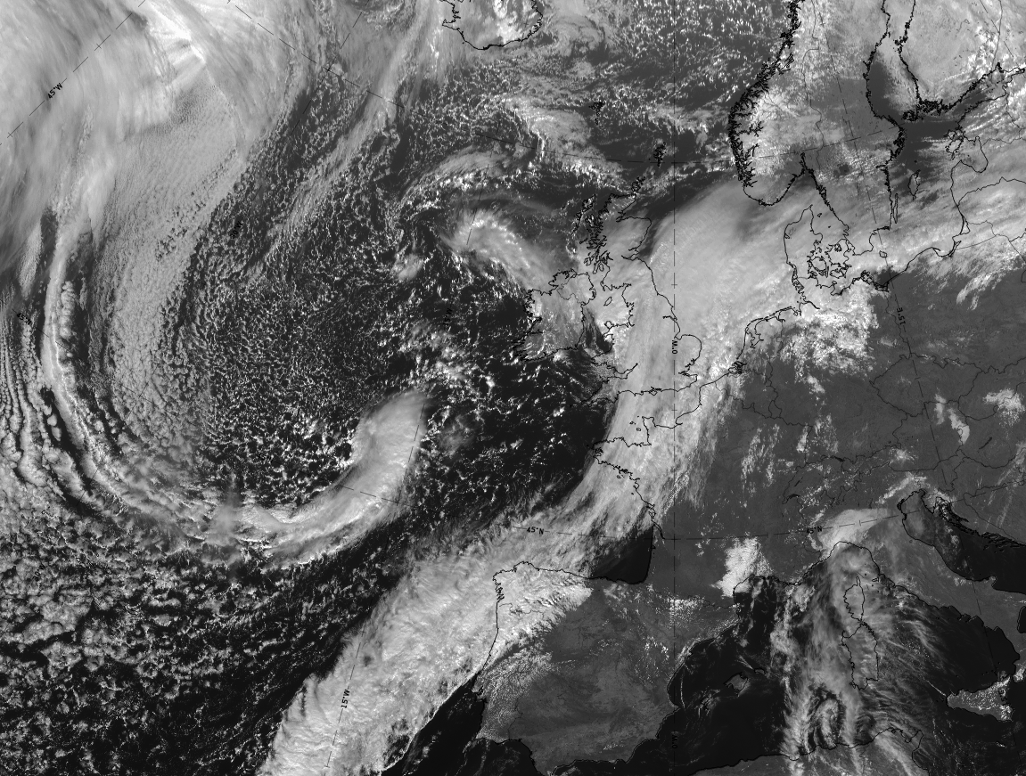
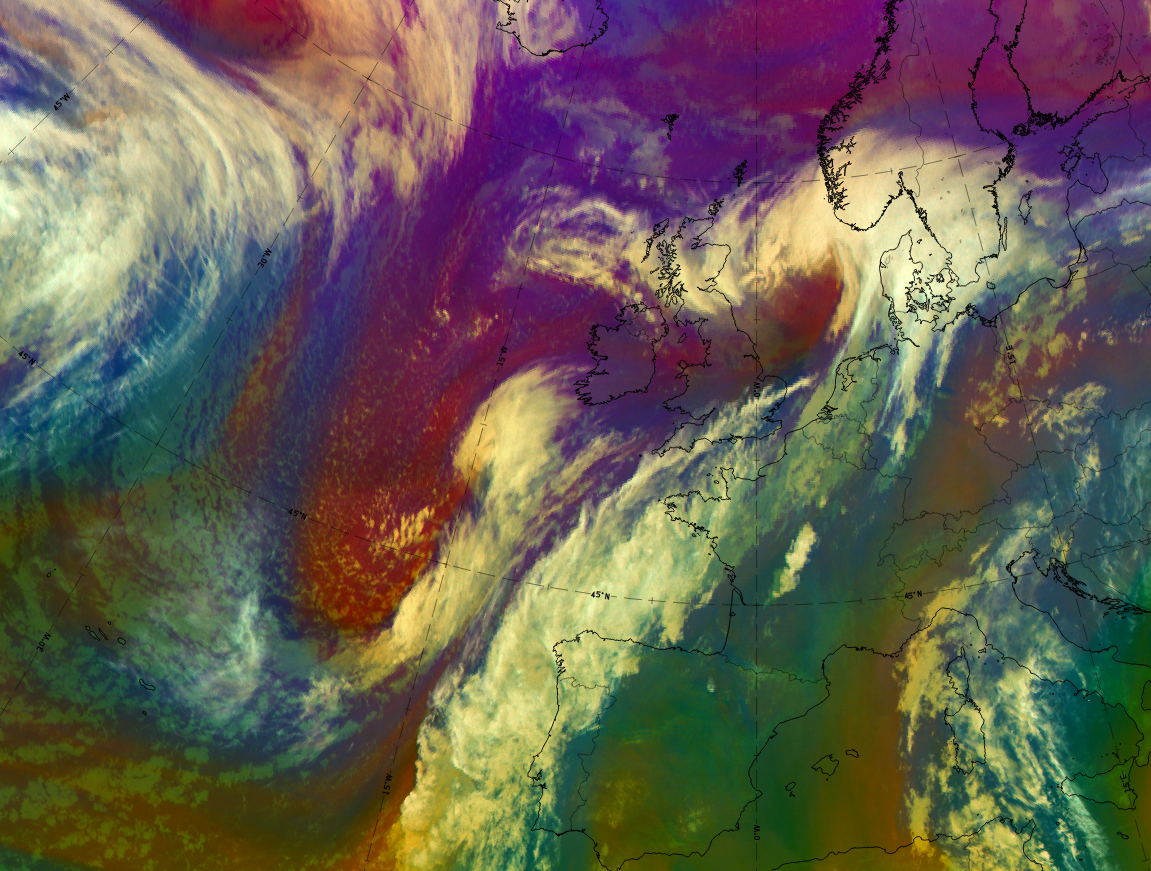
At 18 UTC on 13 October 2019 the comma has strongly expanded and intensified and is close to the eastern frontal cloud band. Because of its size and frontal characteristics, this is the mature stage of a CAD, the Comma front.
|
|

13 October 2019, 18UTC: 1st row: IR (above); 2nd row: WV (above) + Airmass RGB (below); 3rd row: Dust RGB + image gallery
*Note: click on the Dust RGB image to access image gallery (navigate using arrows on keyboard)
| IR | Strongly increased size; bright and structured; dark-grey continuation of the comma tail south- westward (better seen in HRV and Dust RGB). |
| HRV (from 15 UTC) | Bright and structured; the continuation of the comma tail westward is cellular. |
| WV | Bright and structured with a distinct dark grey stripe along the rear edge. |
| Airmass RGB | The dark-brown colours indicate cold/dry airmasses at the rear side; blue stripes indicating cold air to the west and southwest of the dry area. The comma cloud is similar to that in the IR image. |
| Dust RGB | Dark red and structured appearance indicating thick ice cloud in the comma head and tail; ochre colours at the leading edge of the comma and in the westward continuation of the comma tail, indicating mid-level cloud. |