Weather Events
| Parameter | Description |
| Precipitation |
|
| Temperature |
|
| Wind (incl. gusts) |
|
| Other relevant information |
|
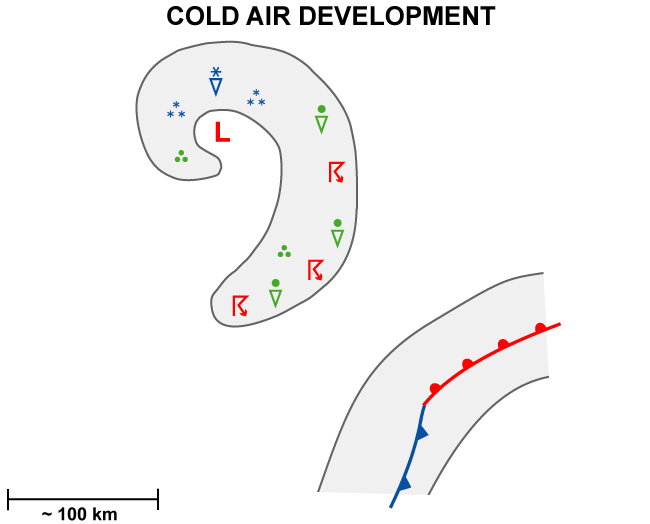
The weather events are well illustrated using data from 28 January 2020 at 12 UTC, which is the time of the end stage of a CAD extending from the west of Ireland eastward to central Europe. This case is accompanied by strong weather activity, even Cbs but no differentiation between the former comma tail and comma head.
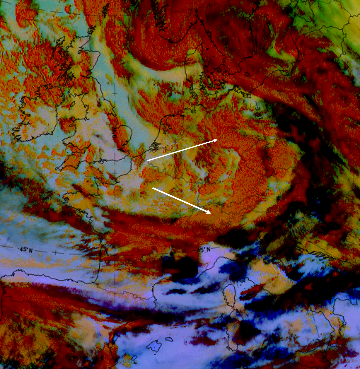
28 January, 12 UTC. Dust RGB; arrows indicate the cloudiness of the stage of the Cold Air development.
|
|
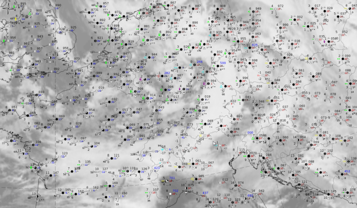
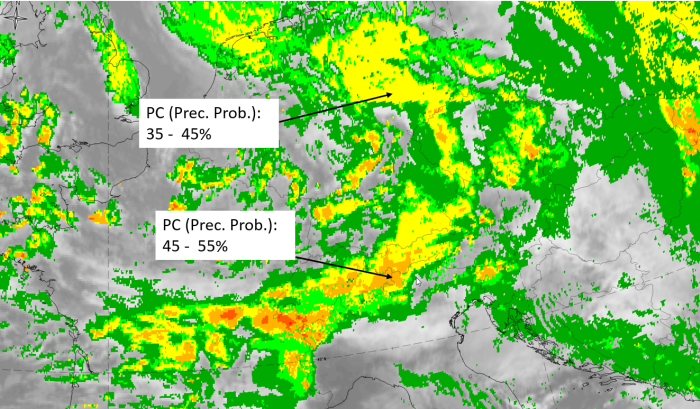
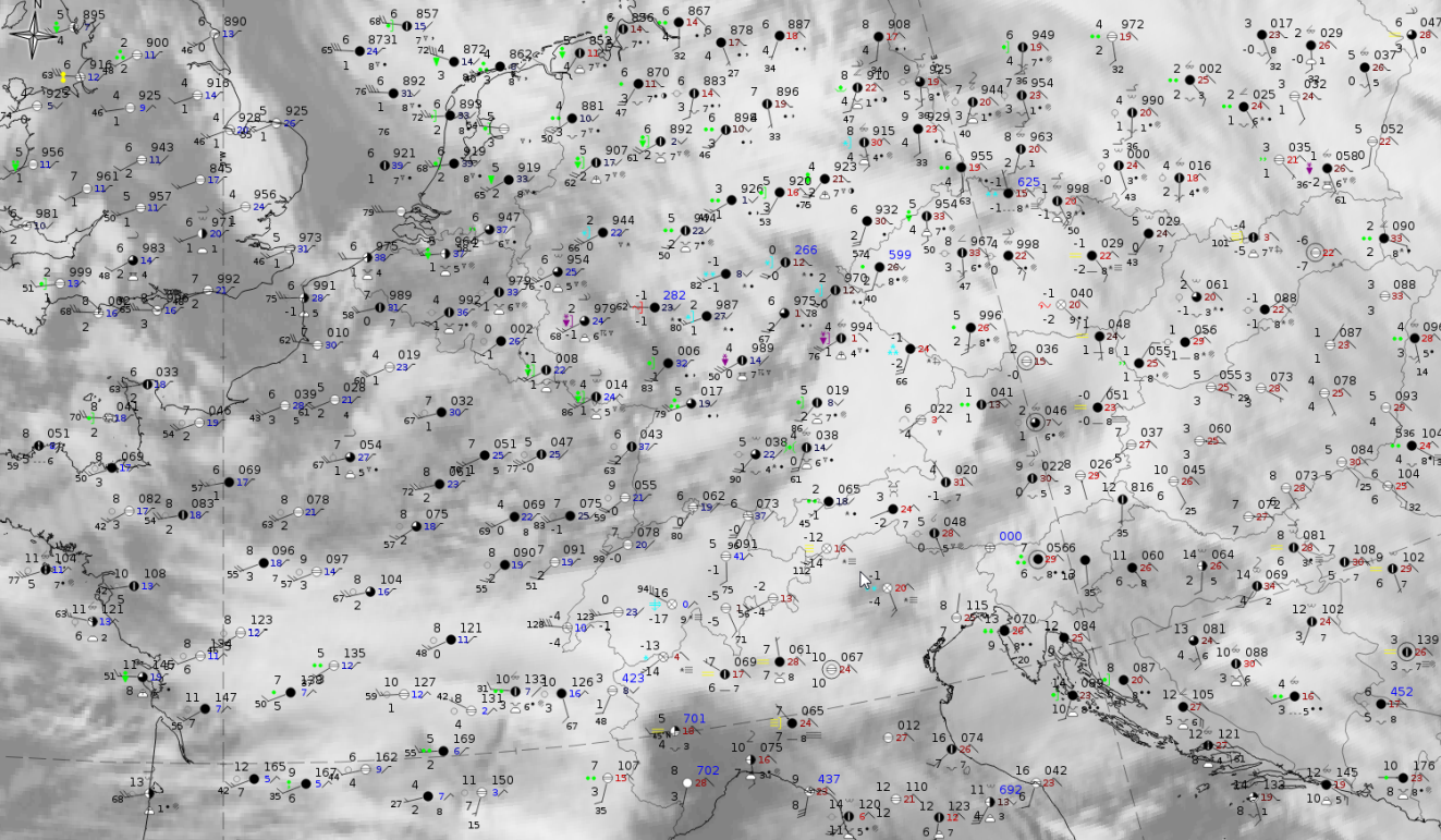
28 January 2019, 12UTC: IR + synoptic measurements (above) + probability of moderate rain (Precipitting clouds PC - NWCSAF).
Note: for a larger SYNOP image click this link.
All available synoptic stations in the comma front, in a spiral southward to the Alps in Austria, show heavy rain and some also Cbs. Conversely, the precipitation probability of moderate rain (PC) seems to underestimate the real rain: the probability is between 35 and 55 %. Higher values appear along the windward side of the Alps. From an evaluation of this NWCSAF product it can be said that it generally displays such behaviour, that rain is usually observed alongside smaller probabilities.
|
|
|
|
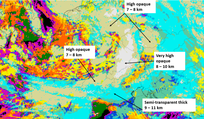
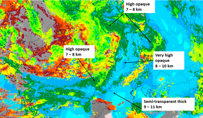
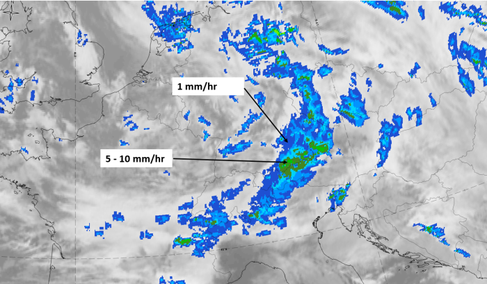
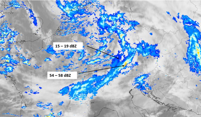
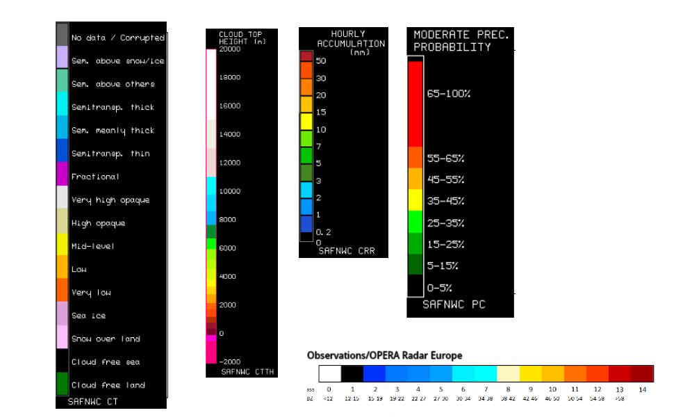
28 January 2020, 12 UTC, IR ; superimposed: 1st row: Cloud Type (CT NWCSAF) (above) + Cloud Top Height (CTTH - NWCSAF) (below); 2nd row: Convective Rainfall Rate (CRR NWCSAF) (above) + Radar intensities from Opera radar system (below)
For identifying values for Cloud type (CT), Cloud type height (CTTH), precipitating clouds (PC), and Opera radar for any pixel in the images look into the legends. (link)