Cloud Structure In Satellite Images
In this study about 30 cases of Back Bent Occlusions from different time periods were investigated.
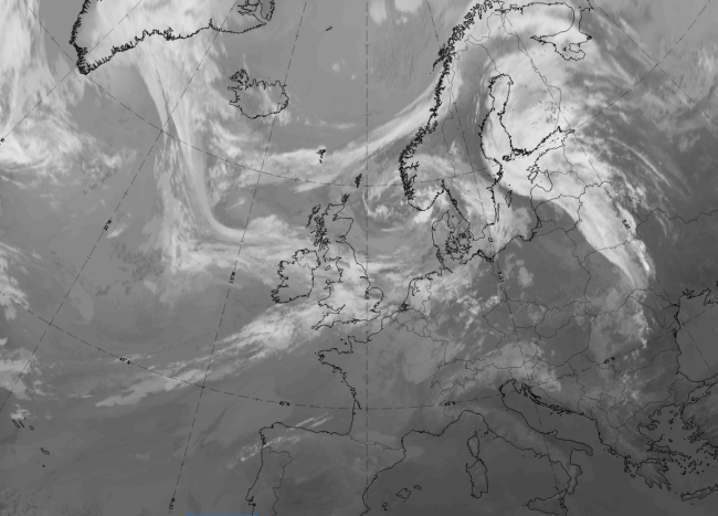
The most interesting information for a Back Bent Occlusion can be seen in the sequence of development stages. In the initial stage there is a quite straight or only slightly cyclonically curved occluded front. The occluded front stops moving, and after that the whole front or a part of it begins to move backwards. In most cases the occluded front is bent back by a cold advection originating from another low (usually an Upper Level Low; see Upper Level Low ) in a polar airmass.
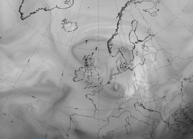
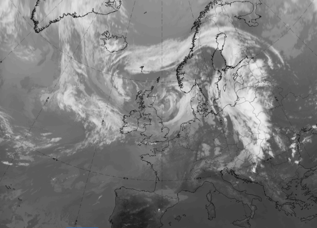
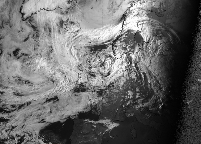
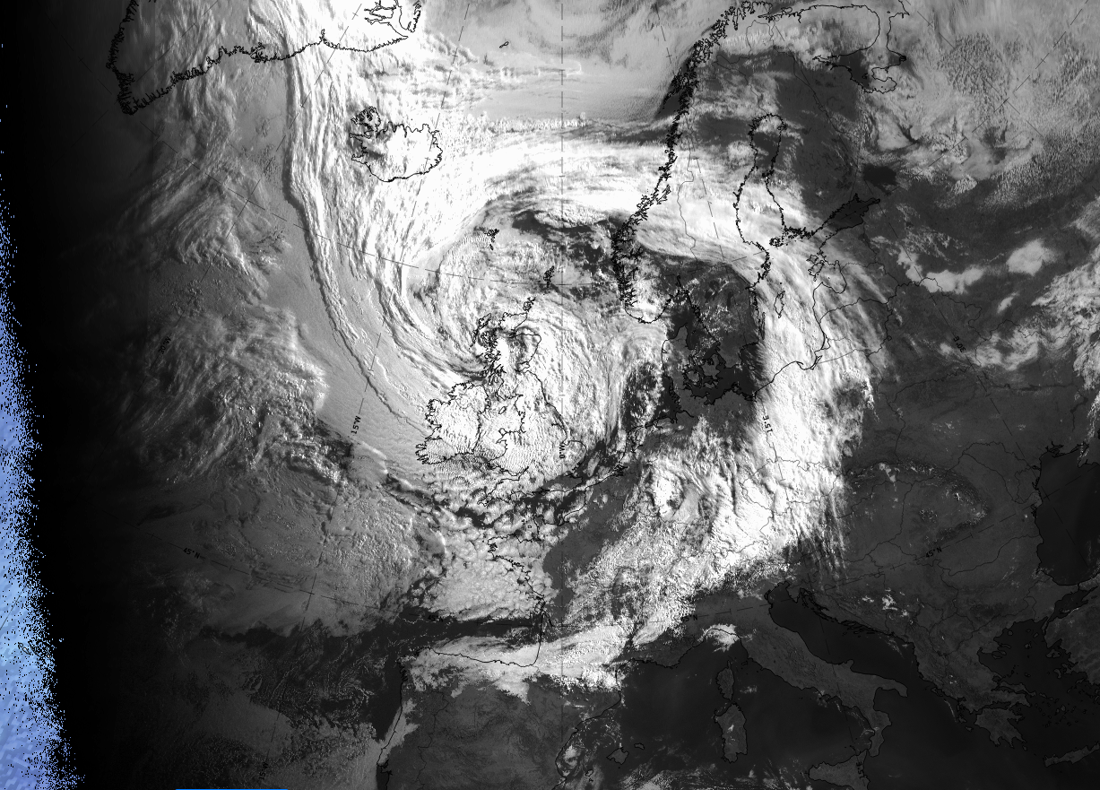
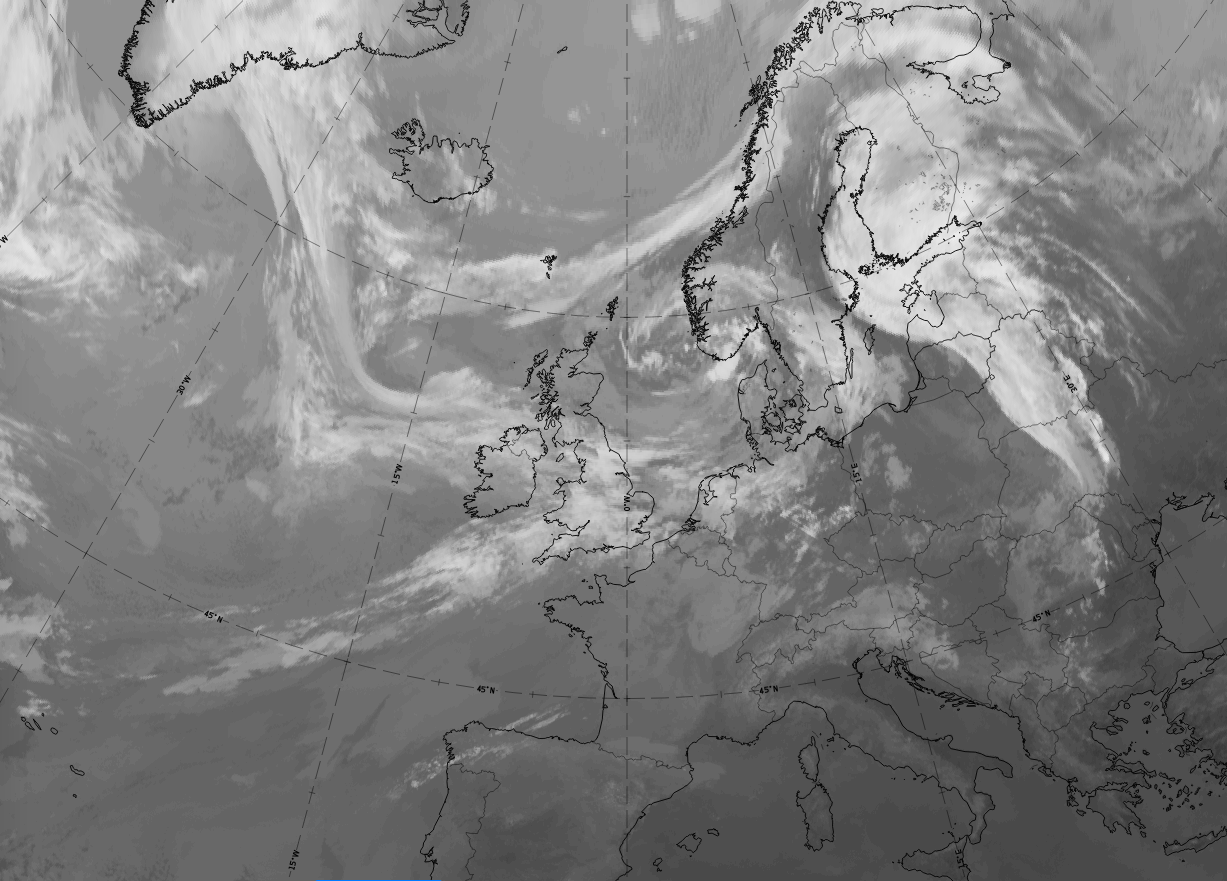
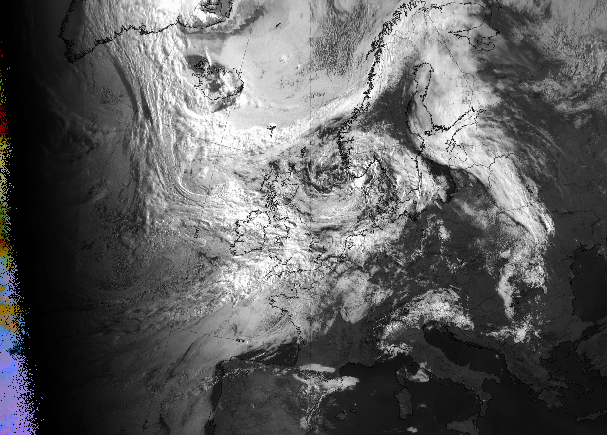
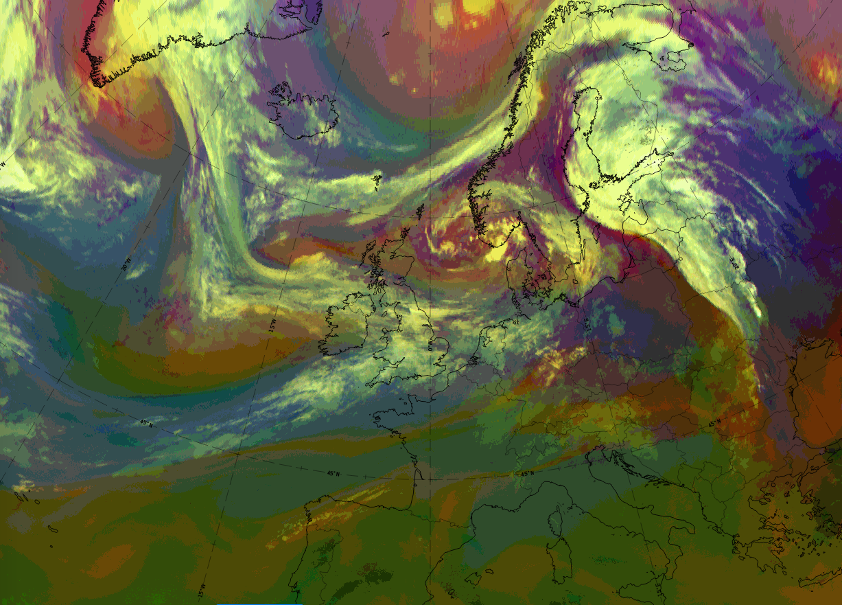
Such a development can be seen in this 3-hourly sequence of IR-images from 6 January 2020 at 12 UTC to 7 January 2020 at 03 UTC.
Legend: 6 January 2020 at 12 to 7 January 2020 at 03 UTC; three-hourly; IR-images.*Note: click on the image to access the image gallery (navigate using arrows on keyboard)
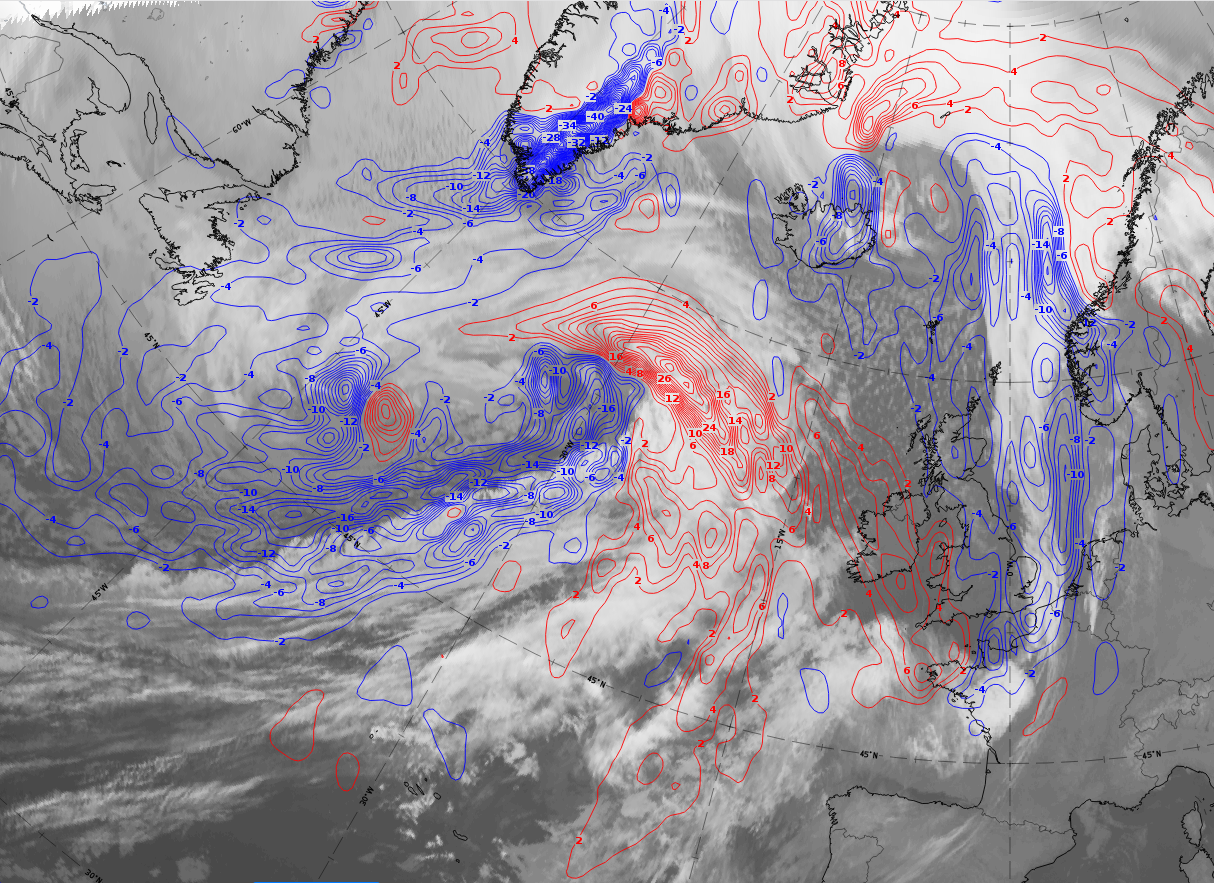
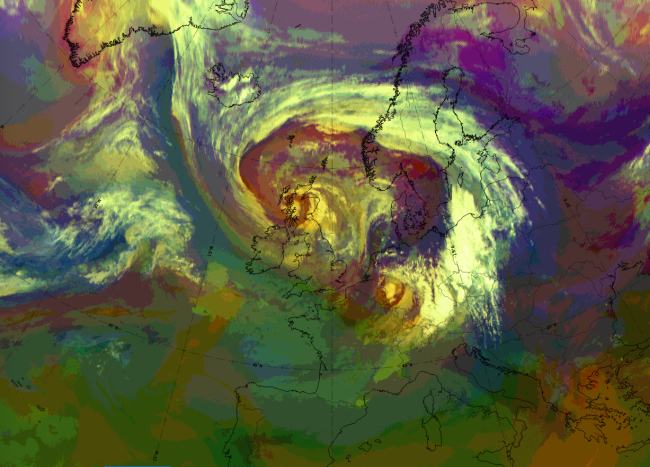
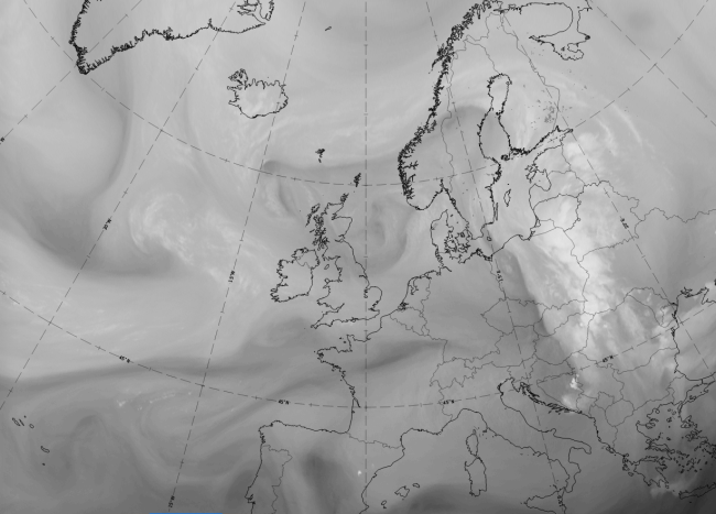
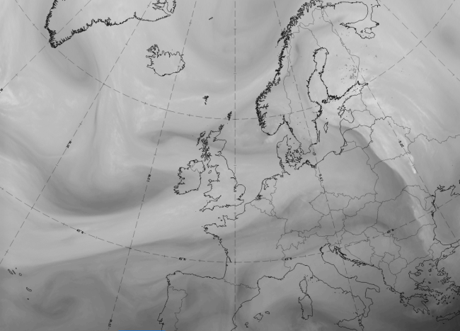
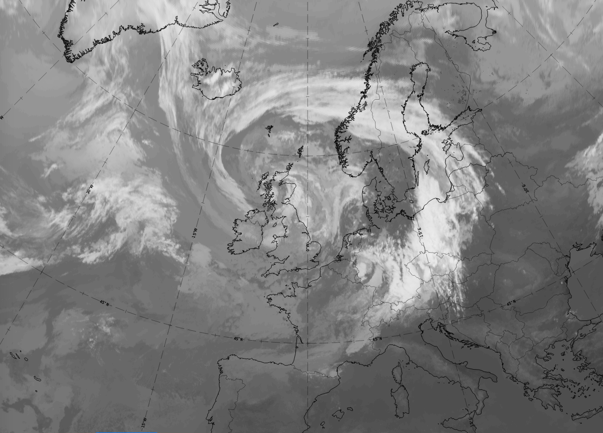
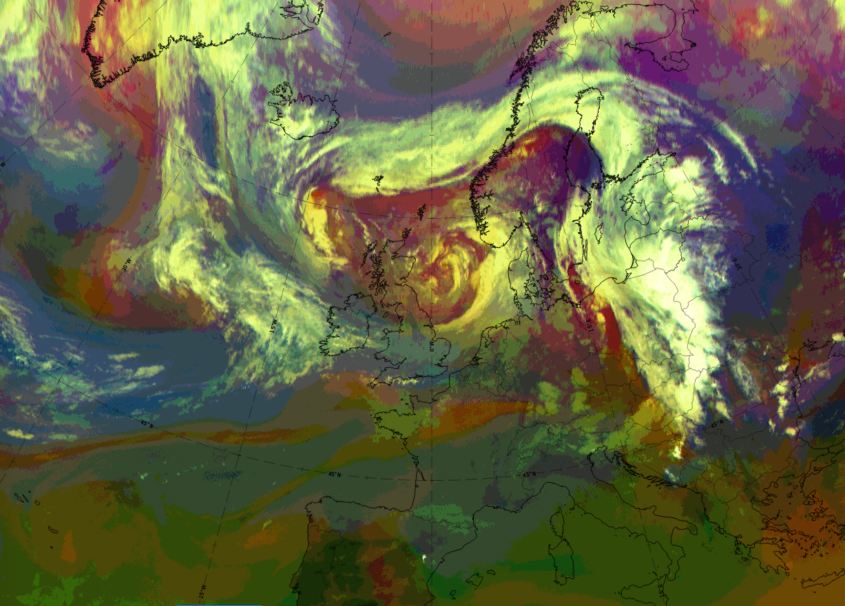
The low in upper levels north-east of the former occlusion cloud band and the connected cold air advection, on 6 January 2020 at 18 UTC, can be seen in the images below. Both are responsible for the change of an occlusion cloud band into a Back Bent Occlusion.
 |
Legend:
IR images from 6 January 2020 at 18 UTC; l: cyan: height contours 500 hPa; right: temperature advection at 700 hPa; red: warm advection, blue: cold advection.
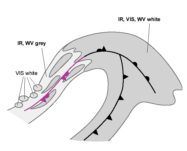
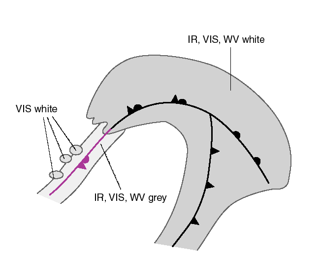
Appearance in the basic channels:
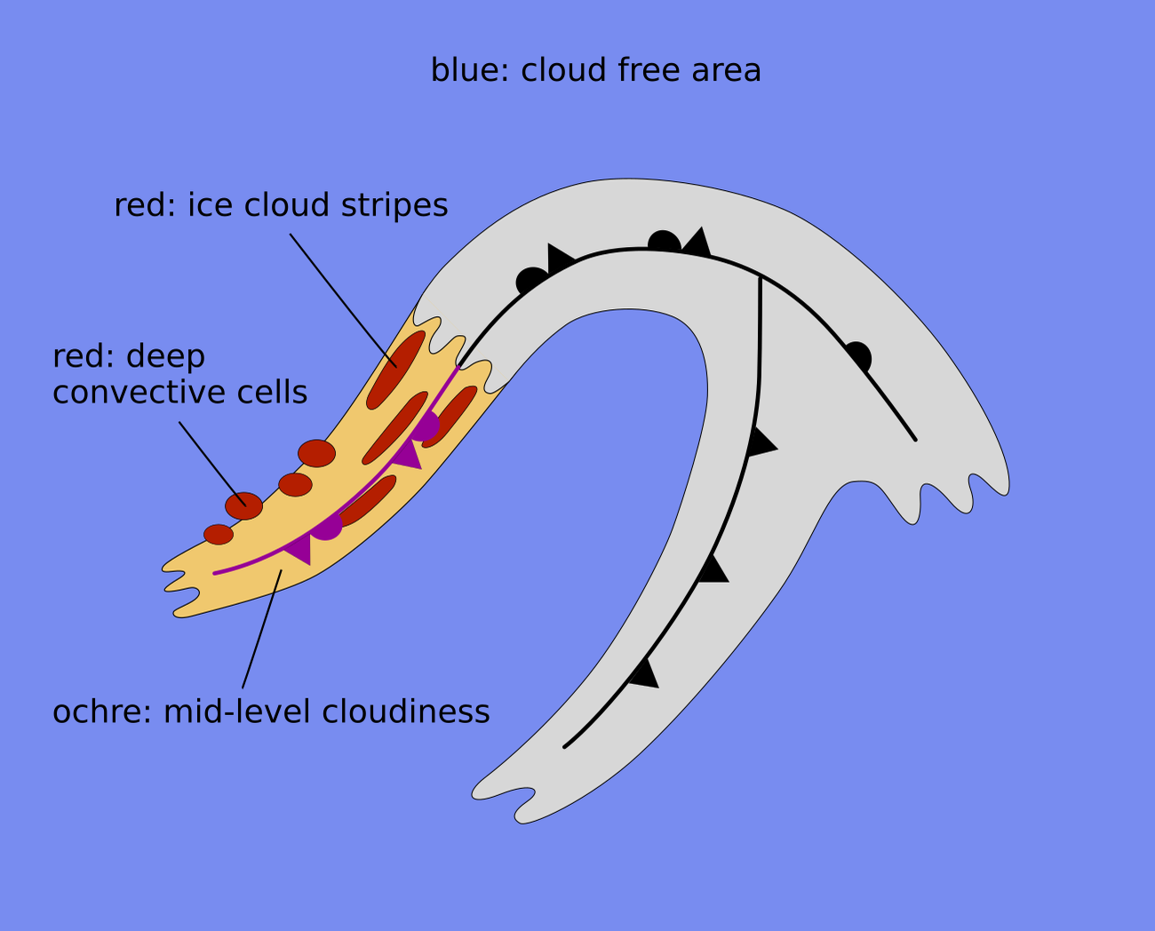
In most cases the cloud band related to the occluded front is long and broad, but there are also cases, especially in cold air masses, where the cloud band is short, narrow and somewhat inconspicuous in the satellite image
In most cases the IR and WV images of the cloud band related to the Back Bent Occlusion have grey colours, indicating rather lower cloud tops.
In the VIS images, white spots, lines and patches indicate thicker, higher-reaching clouds.
 |
 |
Appearance in the basic RGBs:
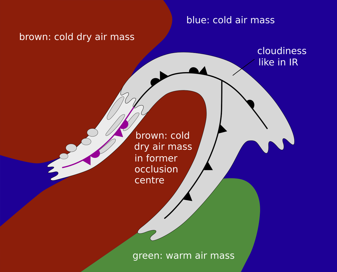
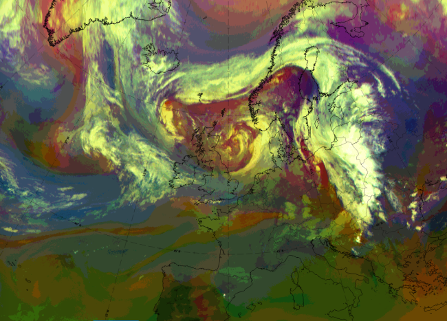
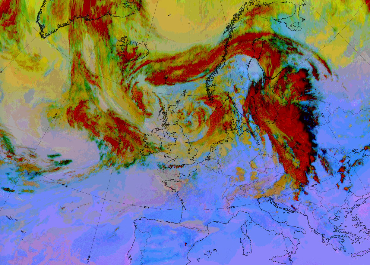
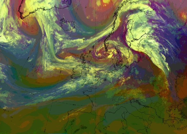
Airmass RGB
During the transition of the cloud band from an occlusion to a Back Bent Occlusion brown and dark-brown areas, representing cold and dry air, appear and intensify on both sides of the Back Bent Occlusion cloud band. This corresponds to the process of advection of cold air on the north, north-east side.
The cloud band looks very similar to that in the IR images.
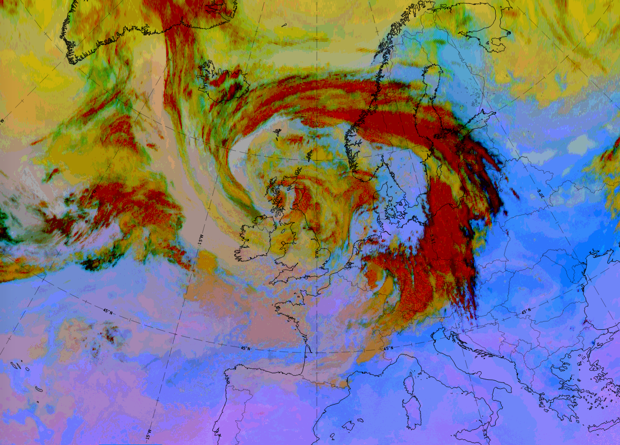
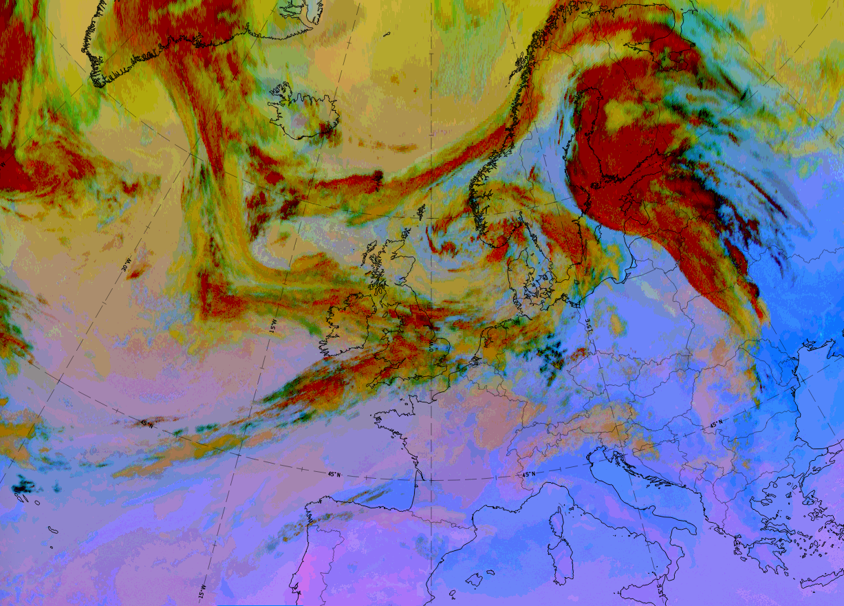
Dust RGB
Unlike other existing cloud configurations, the Back Bent Occlusion cloud band is embedded within blue colours, representing cloud-free regions, or, often in northern regions, green colours representing thin mid-level cloud.
The cloud band consists of ochre and dark-red areas, representing mid-level and thick cloud regions.
 |
 |
Legend: basic RGB schematics.
Left: Airmass RGB; right: Dust RGB.
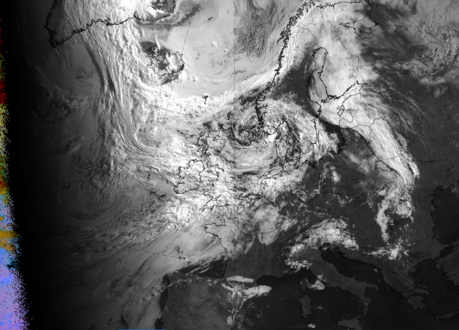
The case of 29 to 30 June 2020 shows the development of a Back Bent Occlusion in the Norwegian sea. All stages from occlusion, then transition, and finally a back-bent stage, can be recognised.
On 29 June 2020 at 06 UTC, a fully developed occlusion cloud spiral extends from mid-Sweden and Norway westward across the Norwegian sea and then southward to Ireland and Scotland.
|
|


|
|
29 June 2020 at 12 UTC: "occlusion stage".
1st row: IR (above) + HRV (below); 2nd row: WV (above) + Airmass RGB (below); 3rd row: Dust RGB + image gallery.
*Note: click on the image to access the image gallery (navigate using arrows on keyboard).
On 29 June 2020 at 18 UTC, the first signs of bending back can be observed.
|
|
|
|
29 June 2020 at 18 UTC: "transition stage".
1st row: IR (above) + HRV (below); 2nd row: WV (above) + Airmass RGB (below); 3rd row: Dust RGB + image gallery.
*Note: click on the image to access the image gallery (navigate using arrows on keyboard).
Finally, on 30 June 2020 at 06 UTC the occlusion is back-bent, showing the cyclonic curvature of a cold front.
|
|
|
|
30 June 2020 at 06 UTC: "Back Bent Occlusion".
1st row: IR (above) + HRV (below); 2nd row: WV (above) + Airmass RGB (below); 3rd row: Dust RGB + image gallery.
*Note: click on the image to access the image gallery (navigate using arrows on keyboard).
| IR | Grey and bright colours, representing at least partly thick cloud. |
| HRV | Bright colours representing partly thick cloud. |
| WV | Dark-grey and grey, representing high humidity in middle and some upper levels. |
| Airmass RGB | Dark brown colours in front of and behind the back-bent cloud band. On the south-eastern side this is the cold air in the original occlusion centre and on the north-western side this is the approaching cold air responsible for the change from occlusion to Back Bent Occlusion. |
| Dust RGB | Mostly dark red representing the thick ice cloud; the green colours to the north-west are mid-level thin cloud. |