Weather Events
South Africa mostly experiences only the tail or very edge of the cold front band and the weather associated with the passage of the cold front can vary greatly. Weather over the southern parts of South Africa can easily be very cold and cloudy with rain, while the north-eastern parts of South Africa experience dry and windy conditions which may lead to runaway fires. When the cold fronts are less intense, some cloudiness and a slight cooling of temperatures can be experienced without any rainfall.
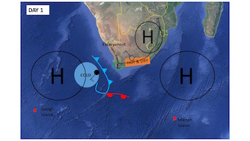
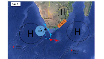
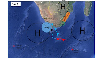
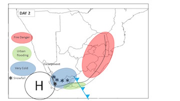
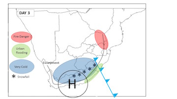
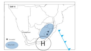
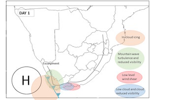
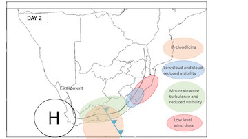
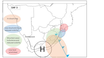
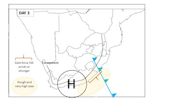
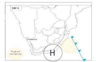
The following 4 images give a schematic view of the weather expected over a 4 day period with the passage of a cold front, including hazardous and non-hazardous conditions. On each image the escarpment (grey line), weather systems and dominant weather phenomena are depicted:
Weather Hazards
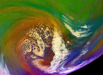
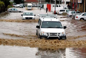
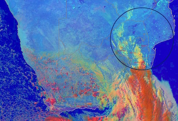
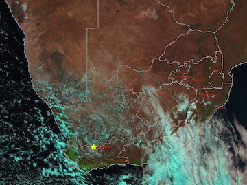
The following weather hazards/weather alerts are categorized according the threshold values used by the South African Weather Service (SAWS). Examples of each alert is given below. These include satellite imagery and a few photographs of the events and media reports where applicable. Please note that the satellite imagery is of different cases and that each satellite image is meant to represent the current location of the cold front over South Africa for the corresponding day highlighted for each schematic of an alert.
| Parameter | Description |
|---|---|
| Gale force winds or stronger | Average wind speed of more than 34kts or gusts in excess of 44ks (excluding Cape Point under shallow South-easterly conditions). |
| Heavy Rainfall | 50mm or more of rain in a 24hour period. |
| Heavy rain leading to Flash flooding | Any amount of rainfall that could lead to the flooding of small streams as guided by the South African Flash Flood guidance System (SAFFG) or the South African Regional Flash Flood Guidance System (SARFFG). |
| Localised Urban Flooding | Any amount of rain leading to the flooding of urban areas that could cause significant disruptions. |
| Snowfall and Disruptive Snowfalls | Sufficient snow to cause significant traffic danger and/or disruptions to mountain passes, major roads and/or highways and/or populated areas. |
| High Seas | Total wave height in excess of 6m |
| Very Cold Conditions | Maximum temperatures are not expected to exceed 10 °C. |
| Fire Danger | Fire Danger index reaches 75 or greater |
The above mentioned Weather Hazards are focused on Public Weather Based weather. The following schematics show the possible distribution of weather hazards for the Aviation community with the passage of a cold front.
Similarly to the Aviation based weather hazards above, the possible marine based weather hazards are given below:
