Weather Events
These weather events are mainly associated with enhanced deep convection activity along the eastern flank of the Bolivian High. More specifically, the following parameters are described as they occur in the northern Argentina.
| Parameter | Description |
|---|---|
| Precipitation |
|
| Temperature |
|
| Wind (incl. gust) |
|
| Other relevant information |
|
|
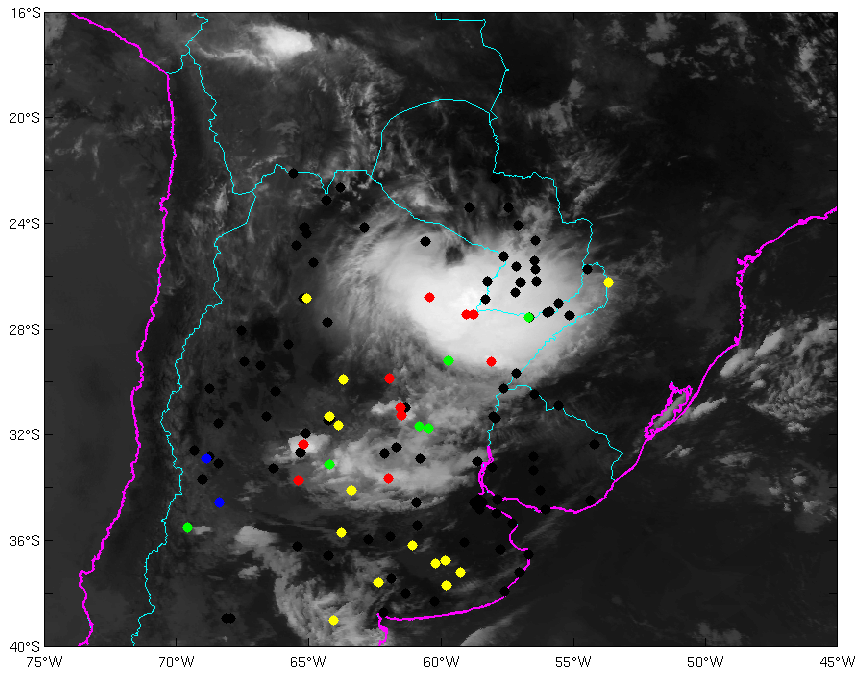
03 February 2015/12:00 UTC - GOES 13 IR 10.7 image; weather events (green: rain, blue: drizzle, red: thunderstorm, yellow: fog, brown: dust, black: no actual precipitation or present weather report)
|
03 February 2015/12:00 UTC - GOES 13 IR 10.7 image; cloud type observations from SYNOP reports (yellow dot: no present weather report).
|
|

|
|
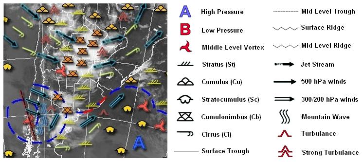
03 February 2015/06.00 UTC - GOES 13 IR 10.7 image; nephanalysis (generated by National Meteorological Service of Argentina)
|
|