Common Remarks
The Bolivian High is an upper-level (i.e. at 200 hPa level) anticyclone that dominates the South American atmospheric circulation in the summer. Its diagnosis and forecast are important for forecasting precipitation in South America, and especially so with the deep moist convection over northern Argentina.
|
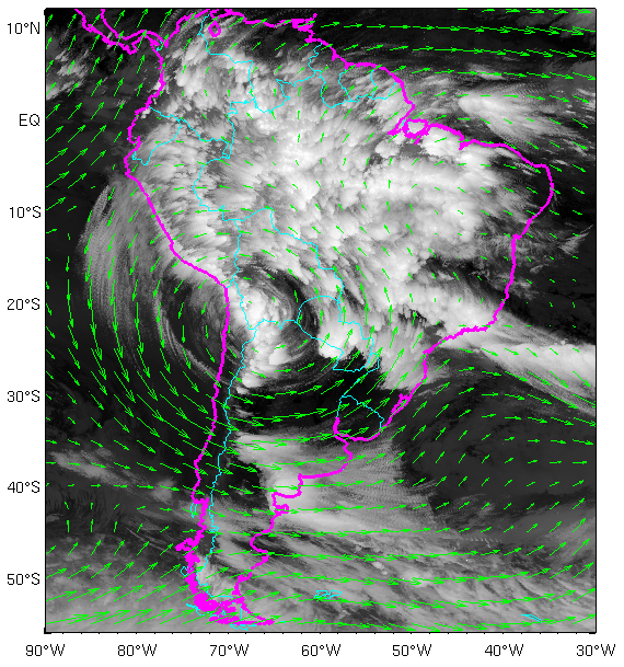
GOES 13 IR 10.7 Image composite for February 1, 2015; vectors: mean wind at 200 hPa.
|
 |
I. Appearance in Satellite Data
Learn about how to recognise and detect Bolivian High and its Relationship with Deep Convection over Northern Argentina in satellite images.
II. Meteorological Physical Background
Find out more about the meteorlogical and physical background of Bolivian High and its Relationship with Deep Convection over Northern Argentina
III. Key Parameters
Learn which key parameters to use for montoring Bolivian High and its Relationship with Deep Convection over Northern Argentina
IV. Typical Appearance In Vertical Cross Sections
Find out the typical appearance of Arctic Bolivian High and its Relationship with Deep Convection over Northern Argentina in vertical cross section
V. Weather Events
Explore the weather events associated with Bolivian High and its Relationship with Deep Convection over Northern Argentina
VI. References
Let these comprehensive documents in the references assist you in finding more about Bolivian High and its Relationship with Deep Convection over Northern Argentina