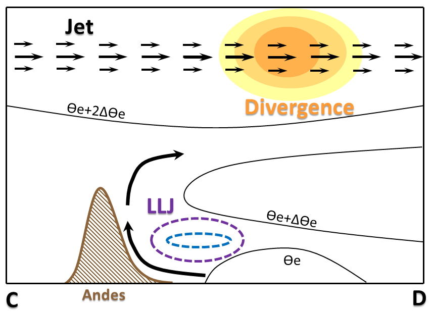
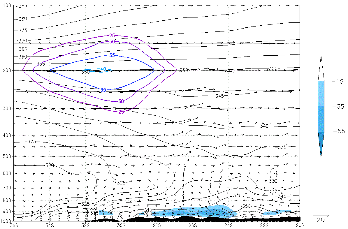
Typical Appearance In Vertical Cross Sections
- Wind: The upper level jet stream is observed east of the Andes at 200 hPa.
- Divergence: positive values at upper levels, east of the Andes, associated with the cyclonic curvature of the jet stream and the flow diffluence.
- Humidity convergence: maximum at low levels due to the deacceleration of the north wind.
- Equivalent potential temperature: light tightening of the isentropes showing the presence of a warm front.
|
Locations of the vertical cross sections
|
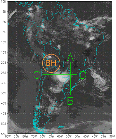
|
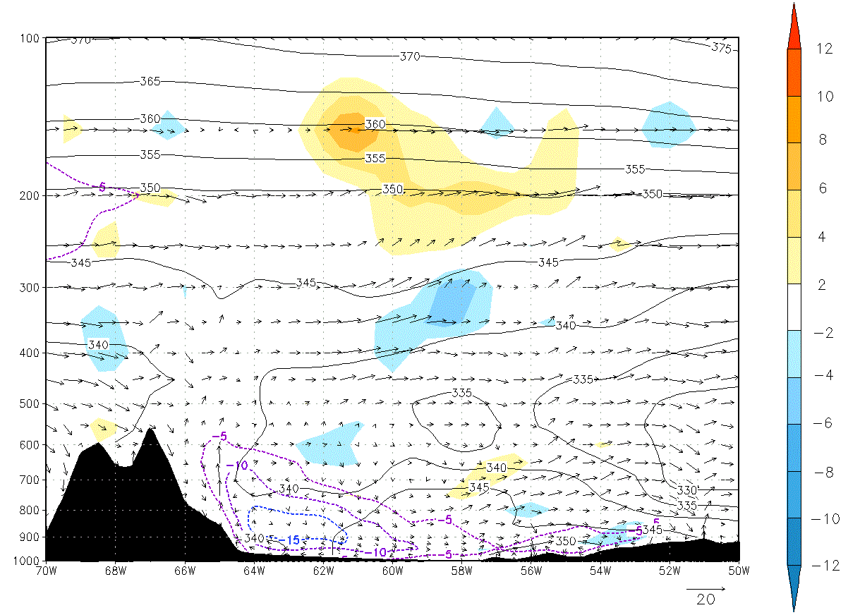
Zonal vertical cross section C - D
|
Lat 26°S: 03 February 2015/12:00 UTC. Shaded: divergence (10-5 s-1), black contours: equivalent potential temperature (K), dashed contours: meridional wind less than -5 m/s, arrows: zonal circulation.
|
|
|
|
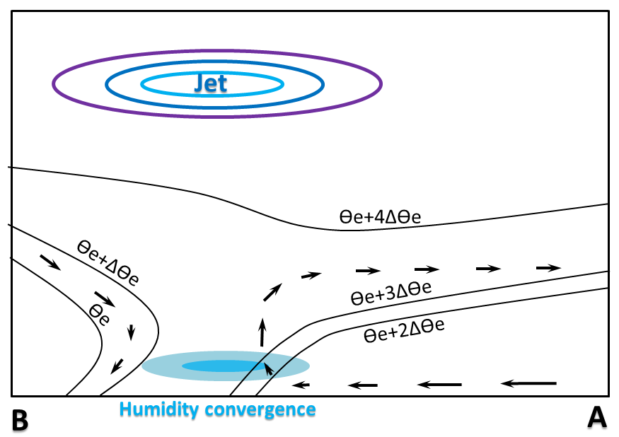
Meridional vertical cross section B - A
|
Lon 54°W: 03 February 2015/12:00 UTC. Shaded: humidity convergence (g kg-1 day-1), black contours: equivalent potential temperature (K), violet contours: zonal wind above 25 m/s, arrows: meridional circulation.
|
|
|
|