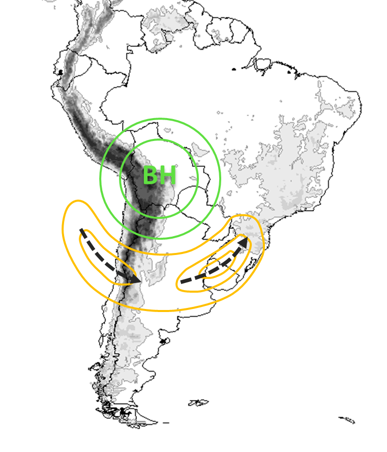
Key Parameters
Intensified upper level jet with anticyclonic curvature:
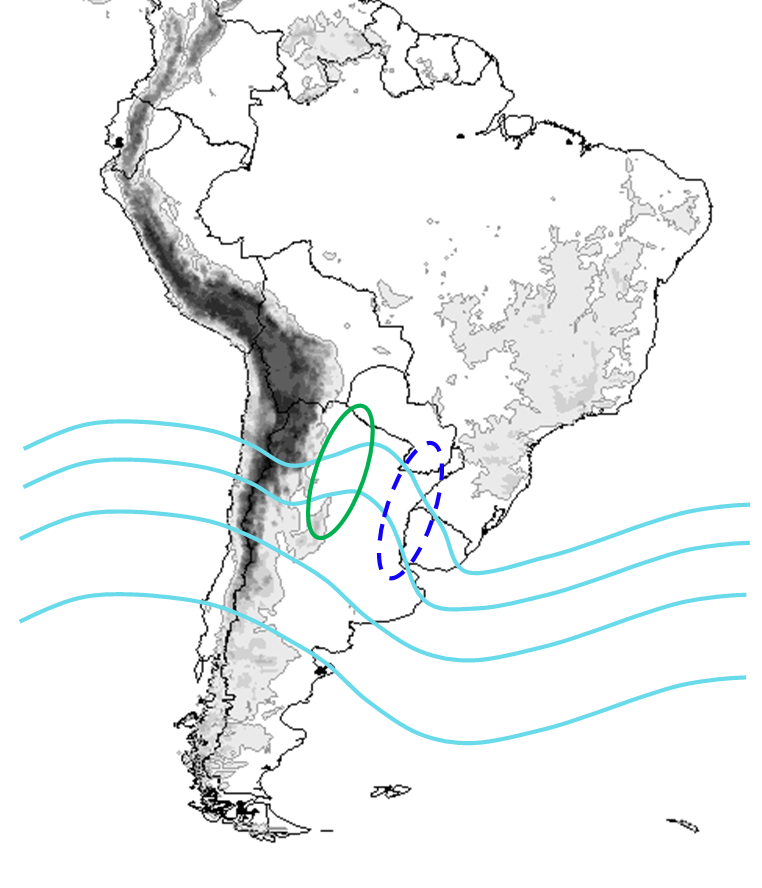
- Geopotential height at 200 hPa: closed circulation center located over Bolivia or north of Argentina (Bolivian High, BH).
- Isotachs at 200 hPa: upper level jet with anticyclonic curvature. Two jet streaks located to the south of the BH.
- Streamlines and divergence at 200 hPa: diffluent flow and maximum divergence on the southeast side of the BH.
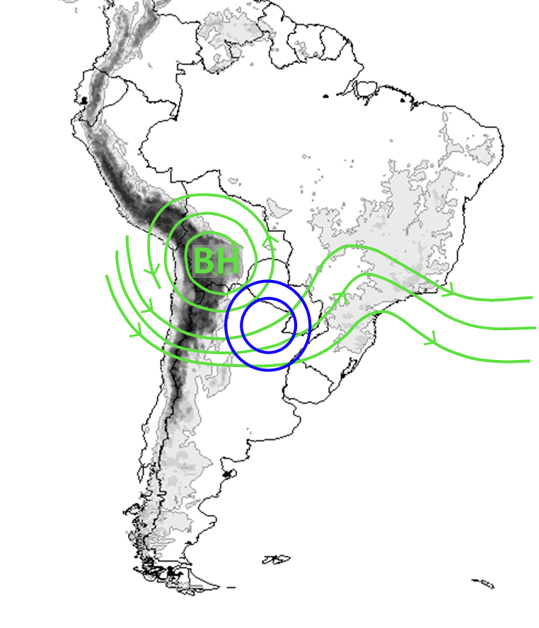
Interaction with mid-level short wave:
- Omega at 500 hPa: maximum upward movement southeast of the BH.
- Geopotential height at 500 hPa: short wave at mid-levels located south of the BH.
- Humidity convergence at 850 hPa: humidity convergence to the SE of the BH in the north of Argentina.
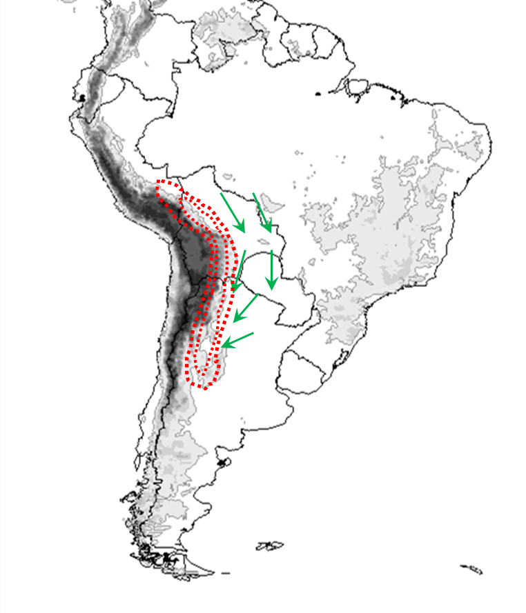
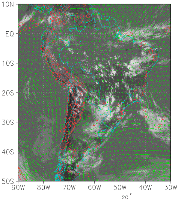
- Wind vector at 850 hPa: northerly meridional wind over the north of Paraguay and Argentina in connection with SALLJ.
Interaction with local forcings:
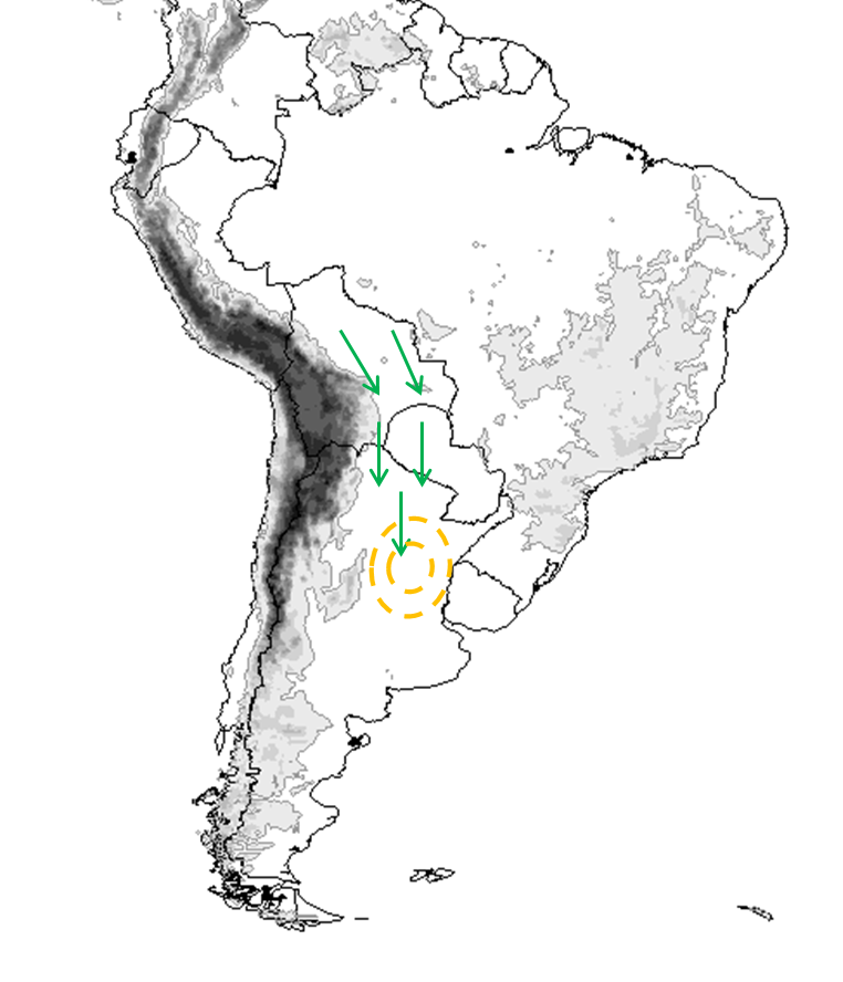
- Wind vector at 925 hPa: low level convergence along the Andes.
- Omega at 925 hPa: maximum upward movement on the eastern slopes of the Andes.
Note: These key parameters correspond to two different case studies.
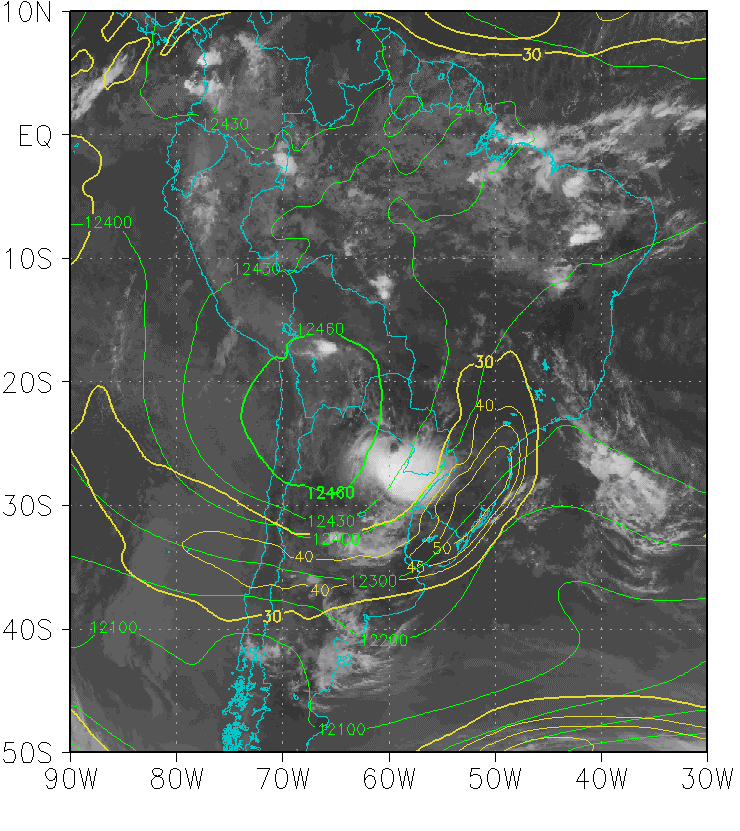
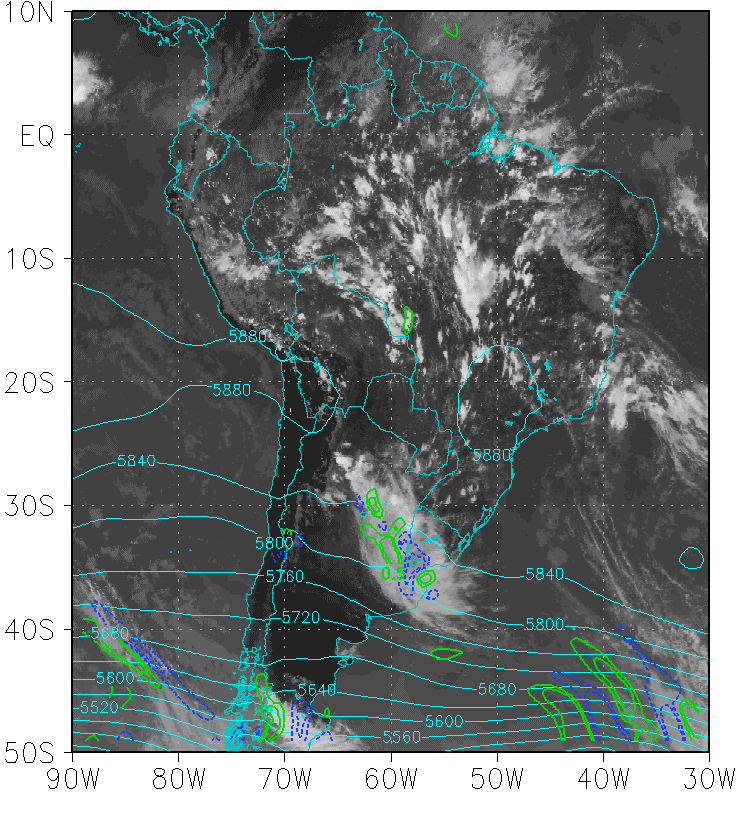
Geopotential height and isotachs at 200 hPa
|
03 February 2015/12:00 UTC - GOES 13 IR 10.7; green: geopotential height at 200 hPa, yellow: isotachs at 200 hPa
|
|
|
|
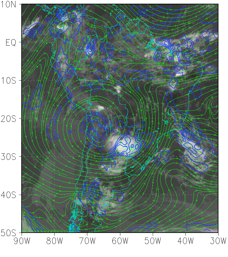
Streamlines and divergence at 200 hPa
|
03 February 2015/12:00 UTC - GOES 13 IR 10.7; green: streamlines at 200 hPa, blue: divergence at 200 hPa.
|
|
|
|
Geopotential height and vorticiy advection at 500 hPa
|
03 March 2015/18:00 UTC - GOES 13 IR 10.7; cyan: geopotential height at 500 hPa, blue: NVA at 500 hPa, green: PVA at 500 hPa.
|
|
|
|
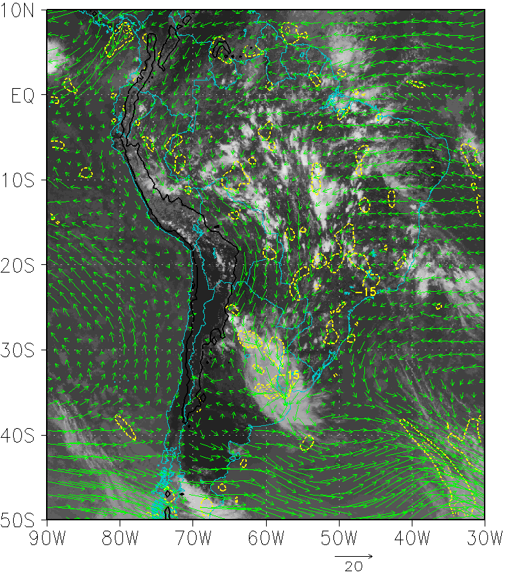
Humidity convergence and wind vector at 850 hPa
|
03 March 2015/18:00 UTC - GOES 13 IR 10.7; green vector: wind at 850 hPa, yellow: humidity convergence at 850 hPa.
|
|
|
|
Omega and wind vector at 925 hPa
|
03 February 2015/18:00 UTC - GOES 13 IR 10.7; green vector: wind at 925 hPa, red: omega at 925 hPa.
|
|
|
|