Appearance in Satellite Data
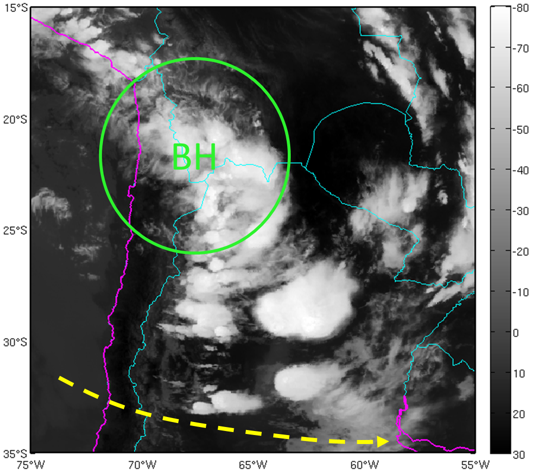
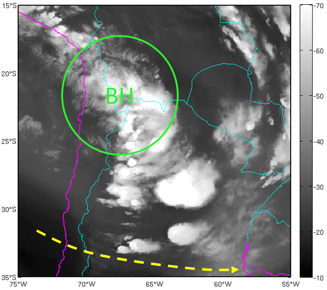
The presence of the Bolivian High (BH) and its position over the Bolivian Plateau influence the occurrence of different cloud types over the continent. In particular, this chapter refers to two cloud patterns observed in the satellite images at the southern flank of the Bolivian High:
-
Narrow cirrus cloud bands:
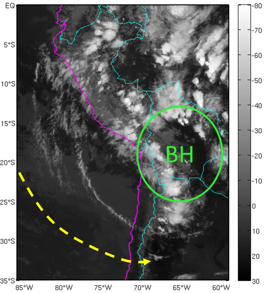
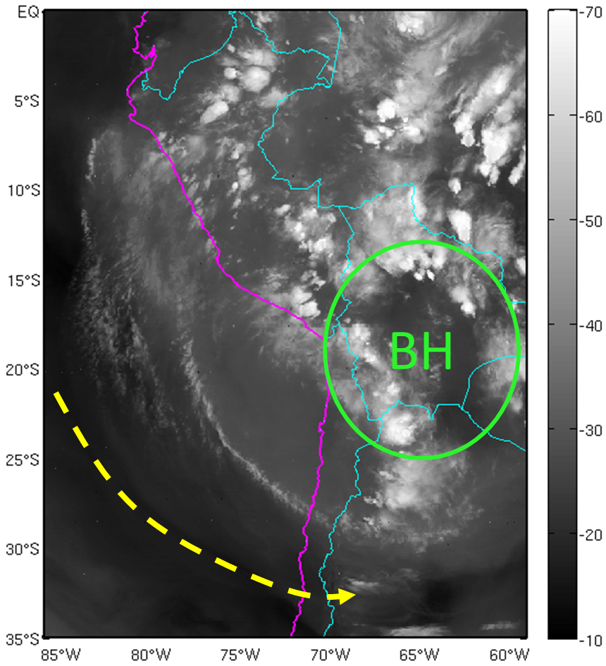
Cirrus clouds at high levels of the troposphere (300-200 hPa), entering the continent from the north of Chile, organized in narrow bands with anticyclonic curvature. Their orientation is generally parallel to the upper level wind and they are related to the presence of the subtropical jet stream in the polar sector of high level anticyclonic circulation. - Enhanced deep convection over northern Argentina:
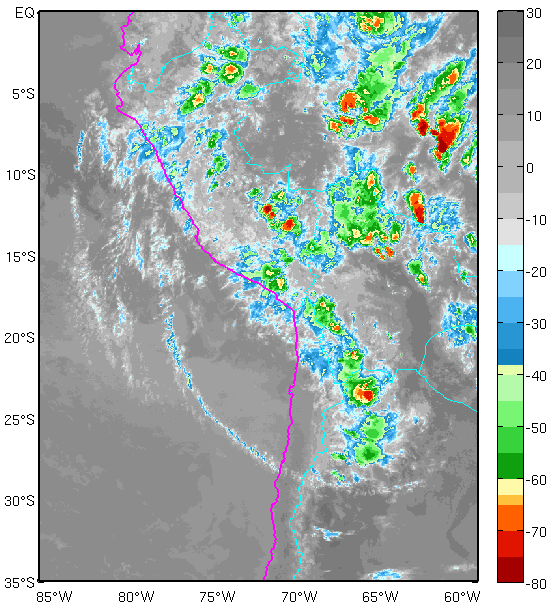
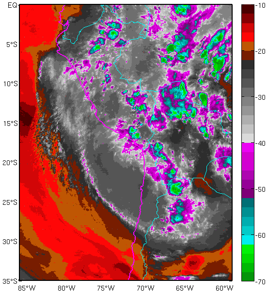
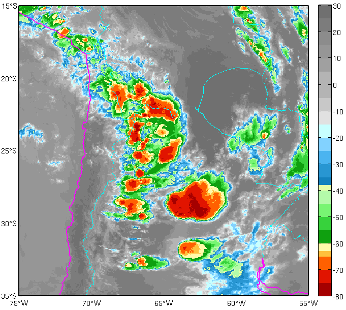
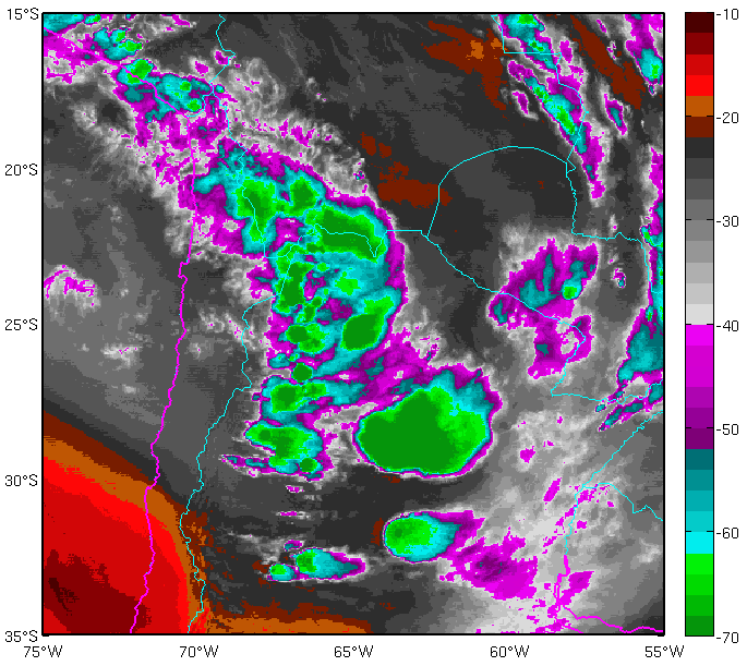
Cumulonimbus clouds with varying degrees of organization (isolated cells or clusters) form on the eastern lee of the Andes mountain range as a result of local circulations that develop during hours of maximum radiative heating. Deep convection is also enhanced over the plains of northeastern Argentina by the upper-level divergence of the BH.
1. Narrow cirrus cloud bands
|
01 February 2015/00.30 UTC - GOES 13 IR 10.7 image
|
01 February 2015/00.30 UTC - GOES 13 WV 6.75 Image
|
|
|
|
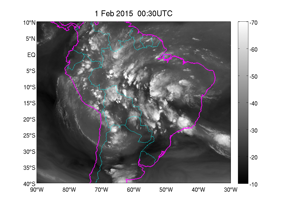
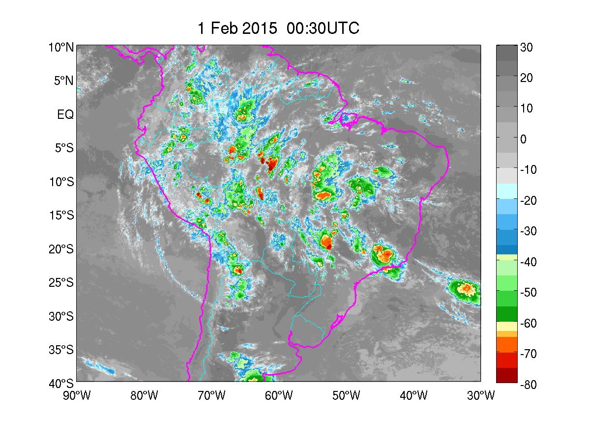
01 February 2015/00:30 UTC - GOES 13 IR 10.7 enhanced image
|
01 February 2015/00:30 UTC - GOES 13 WV 6.75 enhanced Image
|
|
|
2. Enhanced deep convection over northern Argentina
|
02 February 2015/22.30 UTC - GOES 13 IR 10.7 image
|
02 February 2015/22.30 UTC - GOES 13 WV 6.75 image
|
|
|
|
02 February 2015/22.30 UTC - GOES 13 IR 10.7 enhanced image
|
02 February 2015/22.30 UTC - GOES 13 WV 6.75 enhanced image
|
|
|
The following animation shows the upper level circulation and clouds associated with the BH during 1 February, 2015.
|
Press "Play Button" to see the loop; 1 February 2015 00:00-23:30 UTC. GOES 13 WV 6.75. |
|
Press "Play Button" to see the loop; 1 February 2015 00:00-23:30 UTC. GOES 13 IR 10.7. |