Cloud Structure In Satellite Images
The mountain waves that accompany Zonda events can be identified by certain distinct characteristics. These traits are commonly observed around the world in places where downslope windstorms develop.
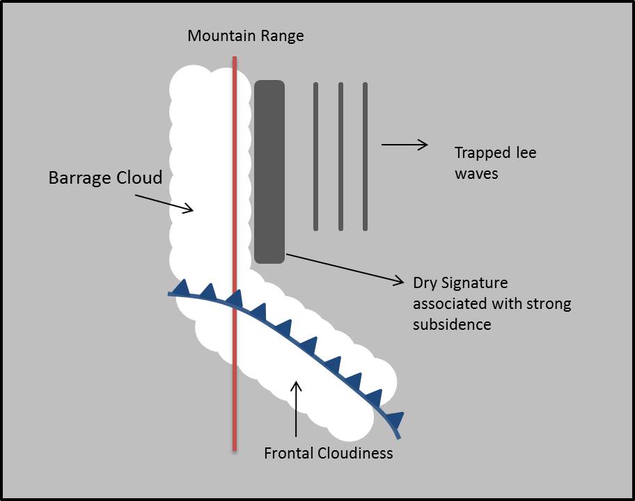
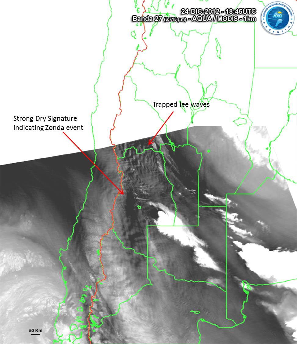
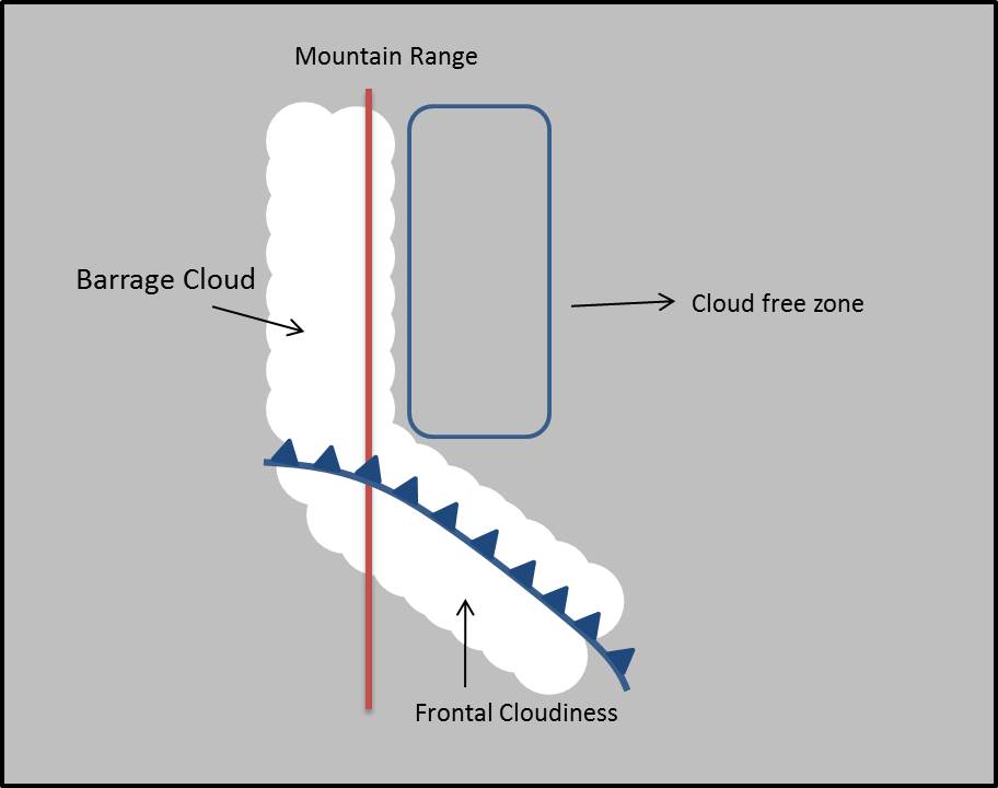
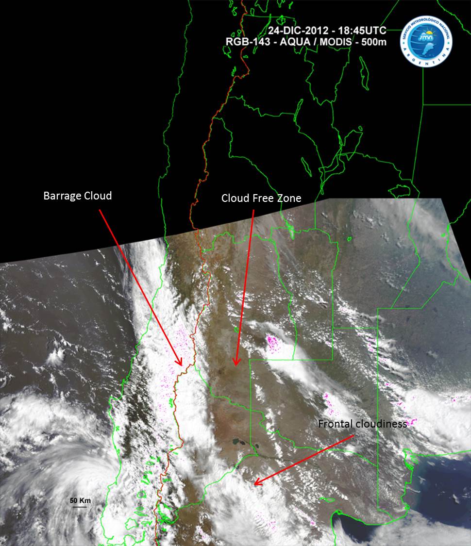
The most distinctive characteristic of this phenomenon is the presence of a very dry zone on the lee side of the mountain range, associated with sinking motion and adiabatic warming. This feature is usually clearly seen in water vapor imagery, while in infrared and visible images it only appears as a cloud-free zone. Forced ascent on the windward side generates an area of cloudiness over the mountain slope, the so-called 'barrage cloud'.
A series of trapped lee waves occasionally develop and spread east of the mountain range. This feature can be seen in the IR and VIS images only if there is enough humidity for the formation of clouds. These clouds typically form long, parallel bands. The descent region of these lee waves can be seen in WV imagery, even if there is no cloud formation. Dust lifted by wind is sometimes observed in visible imagery and RGB composites, indicating strong winds near the surface.
|
Schematic of water vapor satellite imagery during a Zonda event.
|
24 December 2012/18:45 UTC - AQUA/MODIS Band 27 (WV-6.715) image.
|
|
|
|
Schematic of the visible or true color satellite imagery during a Zonda event.
|
24 December 2012/18:45 UTC - AQUA/MODIS RGB 143 (true color) image.
|
|
|
GOES Imagery Examples
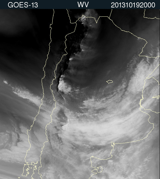
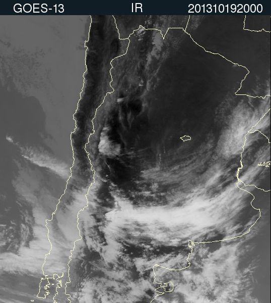
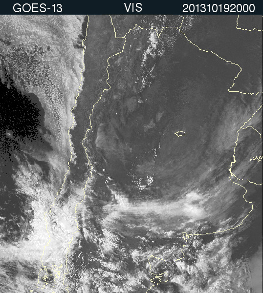
The following GOES 13 images show a Zonda event on 19-20 October 2013. This event was accompanied by wind gusts above 70 km/h, which resulted in fires and fallen trees in Mendoza and San Juan provinces.
|
19 October 2013/20.00 UTC - GOES 13 WV 6.5 image
|
19 October 2013/20.00 UTC - GOES 13 IR 10.7 image
|
|
|
|
19 October 2013/20.00 UTC - GOES 13 VIS 0.65 image
|
|
|

Press "Play Button" for 19 October 06 UTC to 20 October 23:30 UTC loop - GOES 13 WV 6.5 image |