5.7 - Scientific validation of LSA SAF products
Validation techniques are required to provide the confidence intervals that are mandatory for the users in a number of applications. LSA SAF products are validated through (LSA SAF VEGA Validation Report from 2017):
- Intercomparison with vegetation products derived from other satellite sensors (e.g., MERIS on ENVISAT, MODIS on EOS and VEGETATION on SPOT)
- Comparison with in situ measurements
1) Intercomparison with vegetation products derived from other satellite sensors
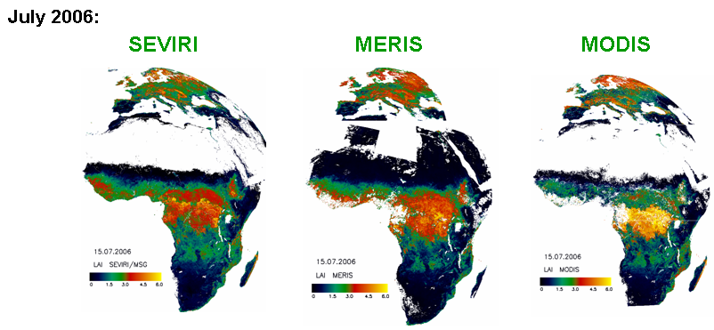
Next figures show composites of actual products for 2 distinctive months, July and November. As observed there is a high spatial consistency between LAI from SEVIRI/MSG, MERIS/ENVISAT and MODIS/TERRA. The latter overestimates LAI at equatorial Africa, when compared to those obtained from the remaining sensors. SEVIRI/MSG LAI presents less gaps in vegetated areas.

2) Comparison with in situ measurements
Next Figure shows the comparison between FVC, LAI and fAPAR products estimated from MSG measurements with in-situ based maps obtained within the framework of the VALERI (Validation of Land European Remote sensing Instruments) project.
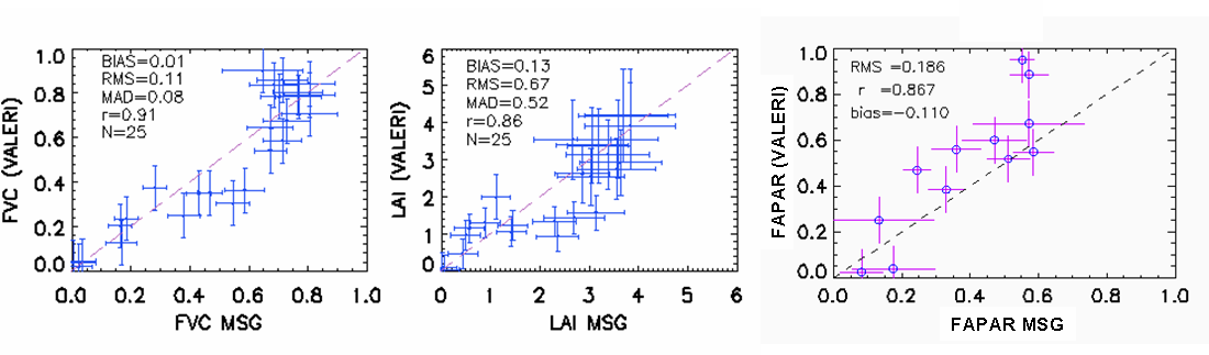
As shown in the figures above, LSA SAF products compare well with globally distributed VALERI* in-situ observations.
Further results on scientific validation of the LSA SAF vegetation products can be found on the LSA SAF VEGA Validation Report from 2017.