France 14th of May 2011
In this incidence severe icing was reported by pilots at Bordeaux Airport. Icing occurred around 07.45 UTC between FL070 and FL120; in this case the corresponding temperature range is 0…-10 °C.
The synoptic situation in an analysis by FMI shows that a cold front with a developing wave passed over Bordeaux during the day:
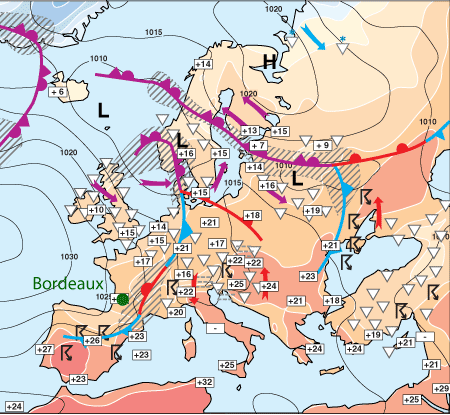
Fig. 5.19. Frontal analysis 14 May 2011 at 12 UTC by FMI.
The soundings show a typical frontal passage (wind shear around 700 hPa at 12UTC), with no actual hint of icing conditions. This is due to the fact that the passage happened fairly quickly around 07-08 UTC, while the soundings are from 00 and 12 UTC.
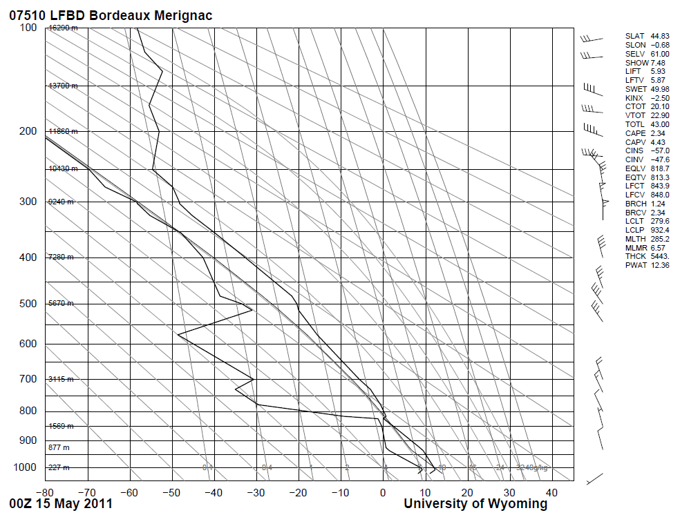
Fig. 5.20. Sounding from Bordeaux 14 May 2011 at 00 UTC
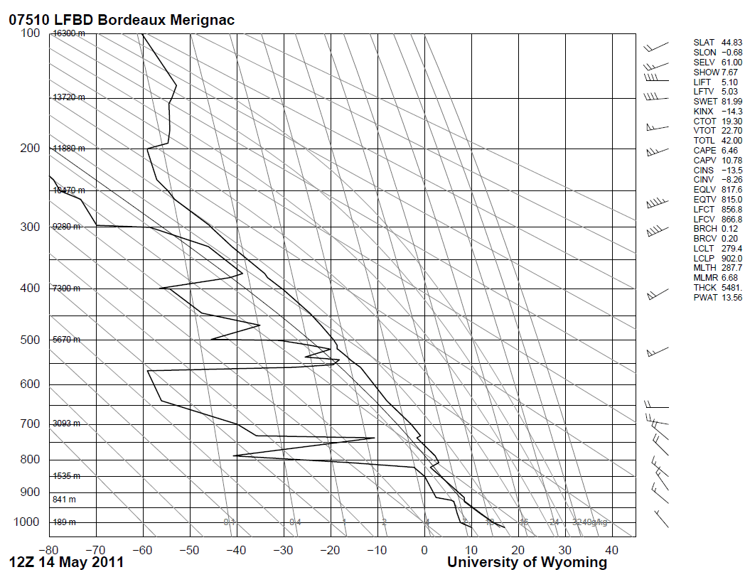
Fig. 5.21. Sounding from Bordeaux 14 May 2011 at 12 UTC
The satellite images, however, reveal the possible icing clouds. In the HRVFog combination the mid-level water clouds can be seen as light pinkish:
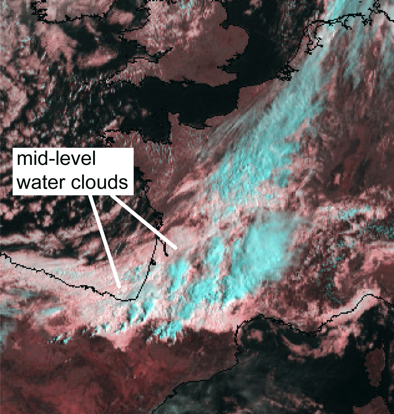
Fig. 5.22. HRVFog combination 14 May 2011 at 07.30 UTC.
In the 24h Microphysical combination the water clouds are orange:
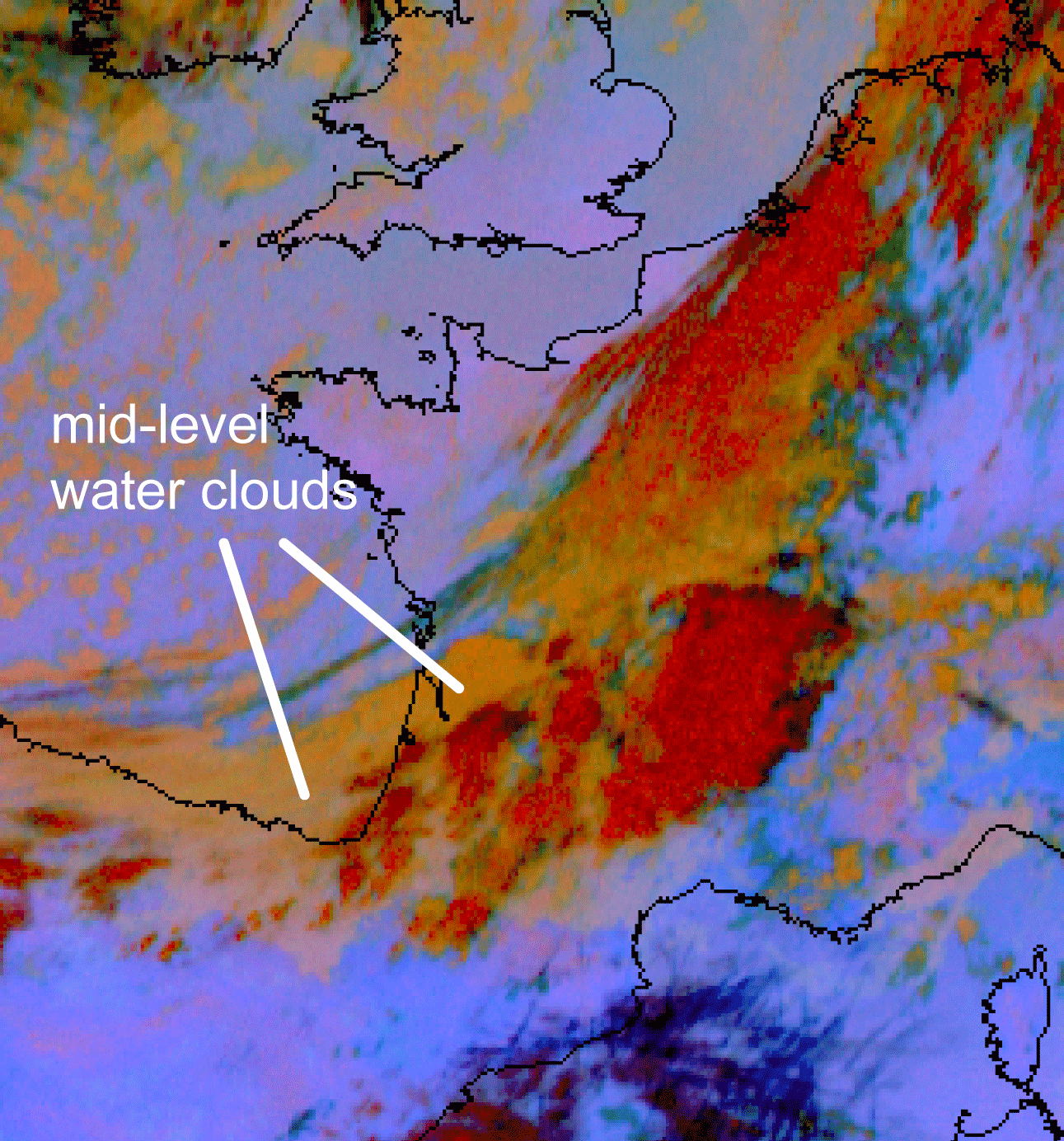
Fig. 5.23. 24hMicrophysical combination 14 May 2011 at 07.30 UTC
In Meteo France´s icing cloud product different meteosat images are converted into an interpretation where the possible icing clouds are revealed by excluding semi-transparent clouds, too cold or too warm clouds and ice-top clouds. The icing clouds appear red in the image:
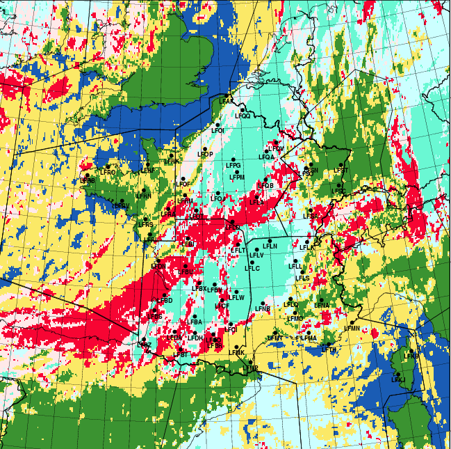
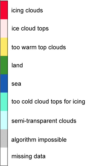
Fig. 5.24. ICLD product, 14 May 2011(by Christine Le Bot, Meteo France), with color scale
Another automatically interpreted product of Meteo France is the cloud top temperature, shown in Fig.5.25.b. The temperature scale is in Kelvin degrees. The icing clouds appear yellow-orange, which means temperature range 265…275 K or -8…+2 °C:
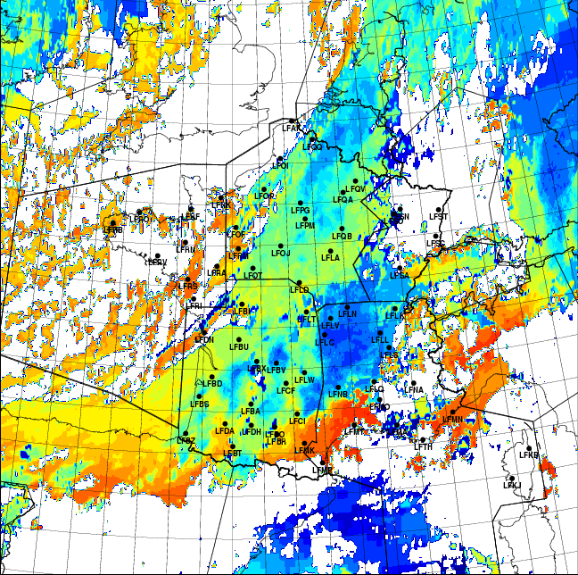
Fig. 5.25. TCLD product, 14 May 2011 (by Christine Le Bot, Meteo France), with color scale