Finland 10th of November 2010
In this case there was icing in connection with a warm occluded front over Middle Finland on the 10th of November 2010. There had been snowfall during the night, so the air was relatively free of aerosols. This situation favors the collision-coalescence process, which is precisely the way large supercooled water drops form.
Freezing rain and freezing drizzle were observed from 05.20 UTC on at Halli airport (EFHA). A report of moderate icing came from Kokkola airport (EFKK) at 07.35 UTC.
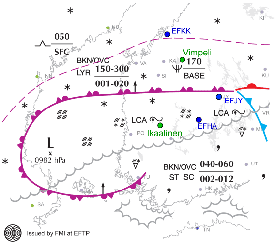
Fig. 5.1. Significant Weather Chart for Western Finland by FMI 10th Nov 2010 for 06 UTC. Airports are marked blue, radars green.
The sounding from Jyväskylä (near Halli) shows very clearly a thick stratiform water cloud from ground to 700 hPa. The temperature of this cloud varies between 0…-9 °C.
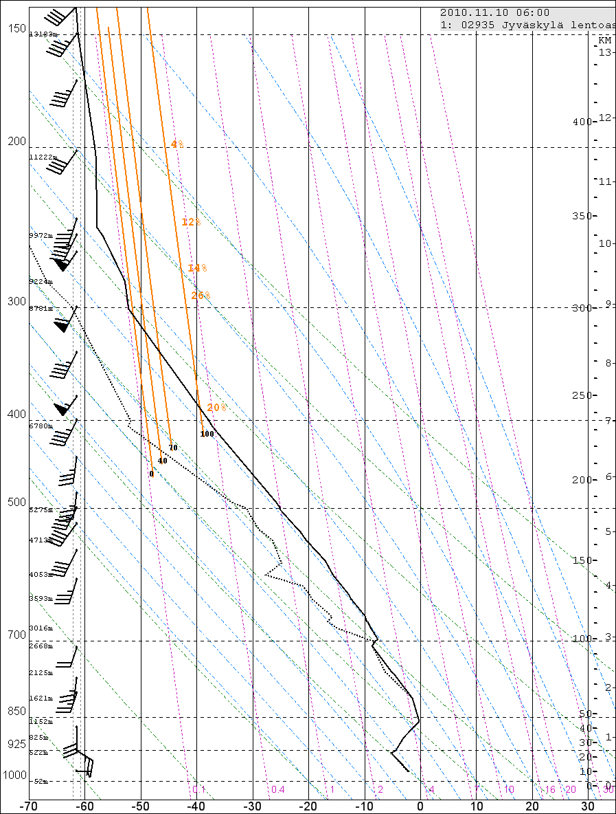
Fig. 5.2. Sounding from Jyväskylä 11th Nov 2010 at 06 UTC.
Satellite images
1. Meteosat, MSG instrument
The water clouds can be seen clearly in both combination images. In 24hMicrophysical they appear orangish yellow, in HRVFog light pink.
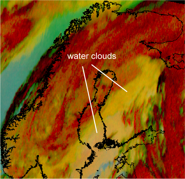
Fig. 5.3. 24hMicrophysical combination on 10th Nov 2010 at 07.30 UTC
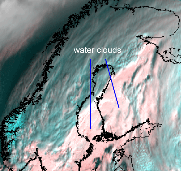
Fig.5.4. HRVFog combination on 10th Nov 2010 at 09.00 UTC
2. NOAA, AVHRR instrument
The 345 combination shows stratiform middle clouds reddish. The different shades of colour implies slightly different temperatures:
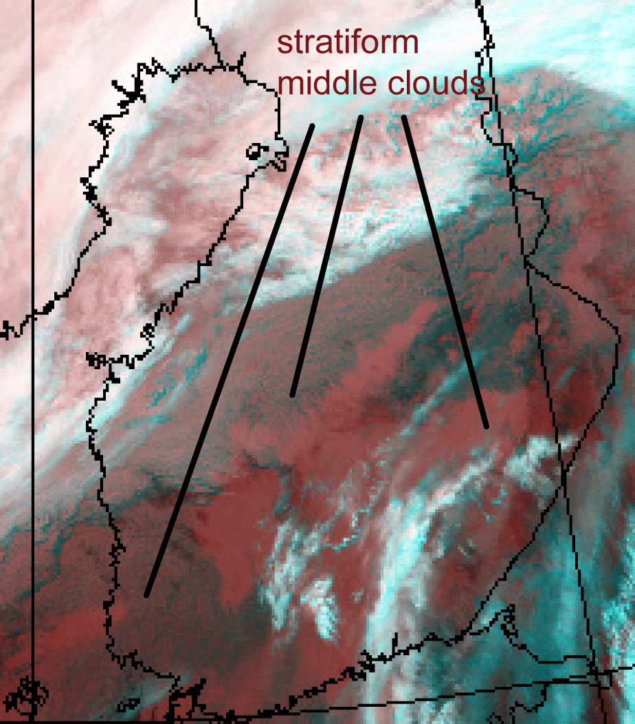
Fig.5.5. Combination 345 on 10th Nov 2010 at 07.10. UTC
In this case the daytime images do not add any information that is not already in 345 combination – and also, daylight is sparse here. But the IR image 12.0µm reveals further details: the water cloud in Southwestern Finland is warmer than the cloud over Middle Finland. This suggests that the most severe icing occurs in Middle Finland:
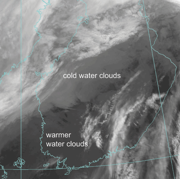
Fig.5.6. Channel 12.0 µm on 10th Nov 2010 at 07.10 UTC
Radar
Freezing rain was observed in EFHA at 05.20 UTC. The CAPPI image shows strong echoes just north of it:
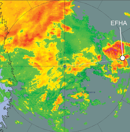
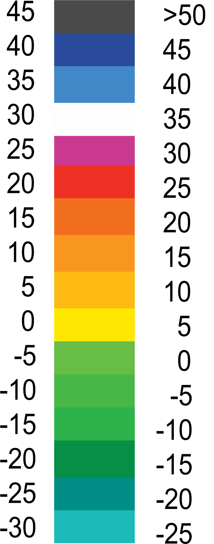
Fig. 5.7. CAPPI image 10 Nov 2010 at 05.30 UTC, from the Ikaalinen radar, with colors as a function of radar echoes/dBz
The hydrometeor classification product HCLASS shows wet snow in the same areas where the strongest echoes are:
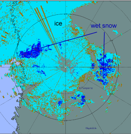
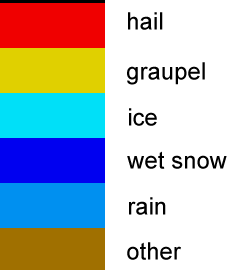
Fig.5.8. HCLASS product 10 Nov 2010 at 05.30 UTC from the Ikaalinen radar, with color scale
Moderate icing was reported in the vicinity of EFKK at 07.35 UTC. There are strong echoes in this area. The vertical cross section, taken along the black line, shows that the strongest echoes come mostly from under 1 km. From the sounding it can be seen that the temperature below 1 km is -2…-3°C, with water clouds.


Fig.5.9. CAPPI image 10 Nov 2010 at 05.20UTC from the Vimpeli radar, with colors as a function of radar echoes/dBz.
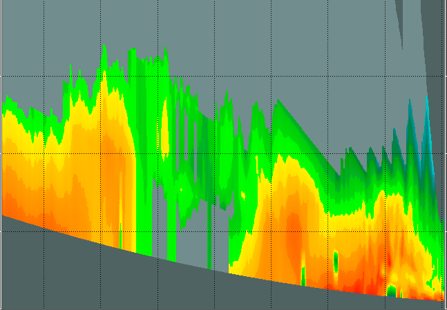
Fig.5.10. Vertical cross section radar image 10 Nov 2010 at 07.30UTC from the Vimpeli radar