Chapter V: Murcia radar
Table of Contents
- Chapter V: Murcia radar
- Murcia radar
Murcia radar
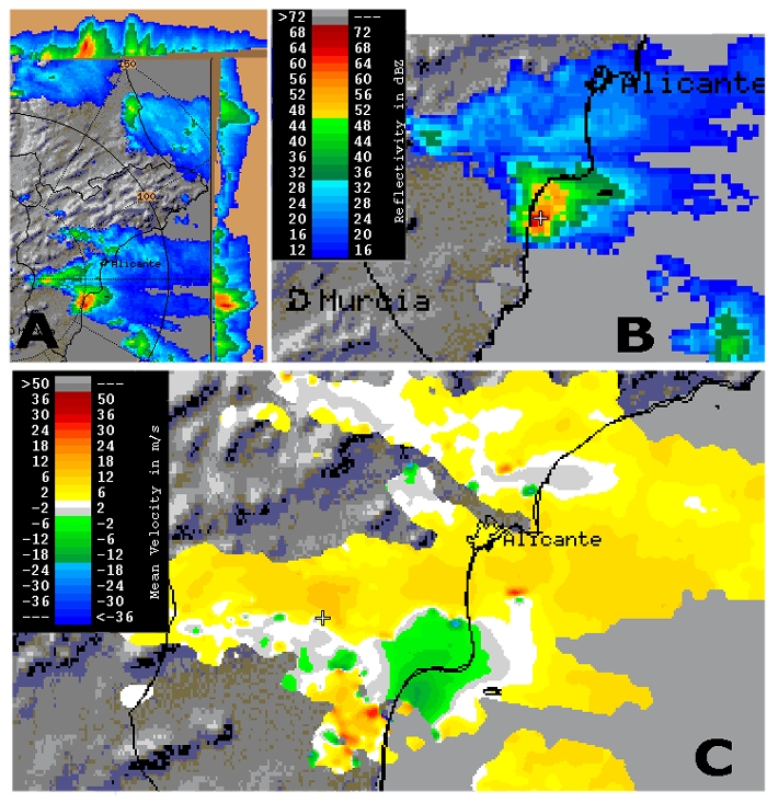
(Radar images below provided by Jose Antonio Quirantes, AEMET)
The image is a composition of three Murcia radar different products at about 17:20 UTC
- Max reflectivity plan view plus cross sections (N-S, and W-E) at 17:20 UTC
- CAPPI 5 km at 17:20 UTC
- PPI doppler retrieved radial velocity field, at 17:16 UTC
Questions:
- Find out what severe weather potential signals can be identify in this radar images
- Are there any mesocyclone signatures present?
- If so, can we estimate curvature vorticity associated? What about dynamic pressure perturbation?
Try to work out some rough numbers as estimates and compare them to their synoptic scale relatives