Chapter IV: Convective Parameters
Table of Contents
- Chapter IV: Convective Parameters
- Convective Parameters
Convective Parameters
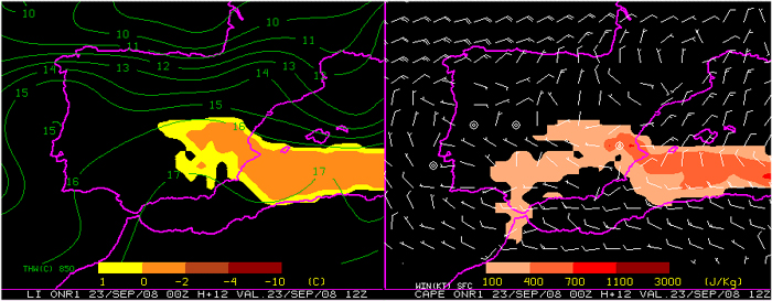
Several parameters for potential bouyancy at 500 mb (LI) and integrated (CAPE) were available at Spanish forecast offices. As an example, here is presented the 12 hours LI and CAPE forecast by 00 UTC high resolution HIRLAM model run (parcel lifted in computations: first 100 mb average). Also shown below, the surface wind field and 850 hpa wet bulb.
Also, for the same forecast period and model run, total precipitable water, 850 hpa moisture convergence, 500 hpa temperature and convective inhibition (again, first 100 mb average lifted parcel) are presented below.
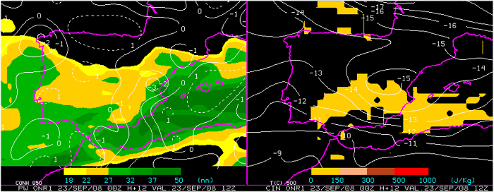
Questions:
- Thinking in terms of ingredients and without considering triggering mechanisms, according to HIRLAM forecasts, which area or areas should be the most favourable for convection to be focused at?
- A more philosophical question: Can we consider nowadays NWP models skill good enough when dealing with the task of forecasting convective parameters? is the local forecaster able to add value or improve these forecasts?
(my personal answer to this question is YES and the key factor for that added value to be placed on the forecast proccess scene is what we are doing here: TRAINING :-D)