Chapter IV: Satellite Images
Table of Contents
- Chapter IV: Satellite Images
- Satellite Images
Satellite Images
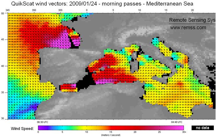
Sea surface wind observations derived from SeaWinds Scatterometer aboard the QuikSCAT are a good way to have a nice view of cyclone intensity distribution (for 24th morning passes in this case). In the image below, we can appreciate the very intense surface wind core, with values around or above 30 m/s, in the southern flank of the cyclone, as expected from the discussions in the physical background section. It is interesting to notice that, apart from the Atlantic, Klaus also had an important impact in the Western Mediterranean area, mainly in northeast Spain and southern France, but also, close to the northern African coast, and down-wind Gibraltar strait. For the night of day 23 the maximum winds areas should be displaced to the left, according to cyclone position.