The Cut-off Stage
Synoptic situation
|
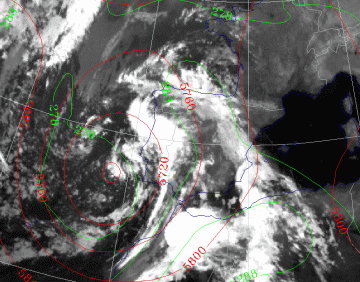
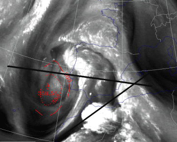
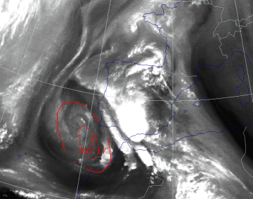
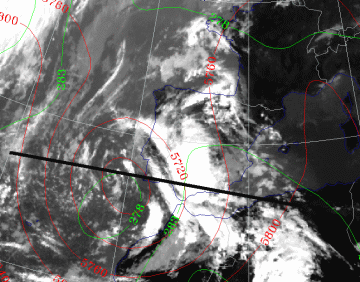
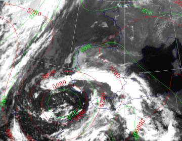
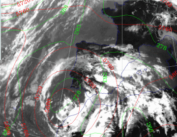
26 September 1997/23.00 UTC - Meteosat IR image; green: equivalent thickness 500/850 hPa, red: height contours 500 hPa
|
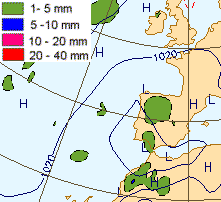
27 September 1997/00.00 UTC - Surface chart; accumulated precipitation 12.00 - 00.00 UTC
|
The depression over Morocco becomes a dominant feature in the surface chart in the area of the Upper Level Low. The centre of the ULL now lies off the coast of southeast Portugal. The numerical model also calculates precipitation, which coincides quite well with the structures seen in the satellite image. The temperature advection patterns are now not so pronounced, but there is still some cold advection to the west of, and some warm advection to the east of the ULL centre. The cloud configuration of the upper air feature (see part 3) has now moved towards Portugal. Over northern Morocco a extended CB cluster has formed which has some characteristics of an MCS, but the calculated amounts of precipitation in that area are not significant.
27 September 1997/00.00 UTC
Analysis of the system
|
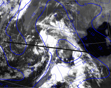
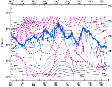
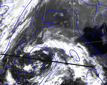
26 September 1997/23.00 UTC - Meteosat IR image; blue: thermal front parameter (TFP) 500/850 hPa; position of vertical cross section
indicated
|
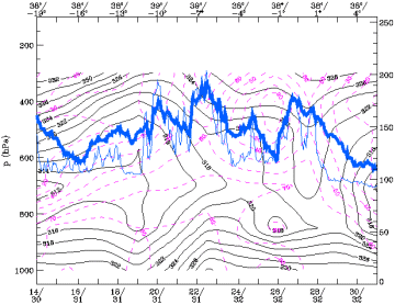
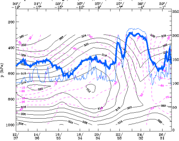
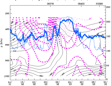
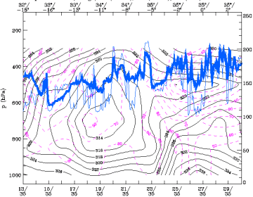
27 September 1997/00.00 UTC - Vertical cross section; black: isentropes (ThetaE), magenta: relative humidity, blue thin: IR pixel
values, blue thick: WV pixel values
|
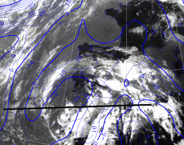
Two bands in the structure of TFP can be discriminated; one over Algeria and the eastern and northern part of Spain, and one over north Morocco
and Portugal. In the ThetaE pattern of the cross section the fronts are difficult to detect, but the humidity field is quite realistic when
comparing it with the pixel values of the satellite image.
The unstable layer over the main land of the peninsula is still present.
|
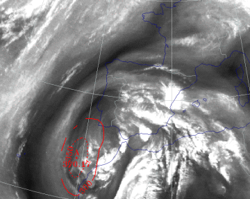
26 September 1997/23.00 UTC - Meteosat IR image; red: height of PV=2 units; position of vertical cross sections indicated
|
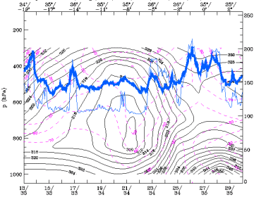
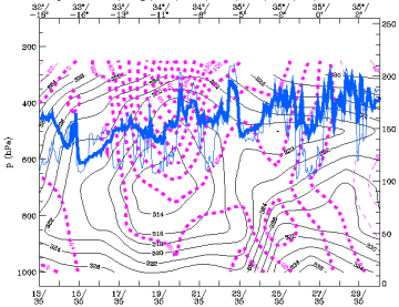
27 September 1997/00.00 UTC - Vertical cross section; black: isentropes (ThetaE), magenta: relative vorticity, blue thin: IR pixel
values, blue thick: WV pixel values
|
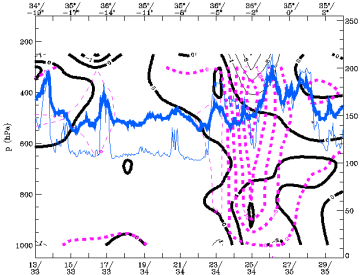
In the WV image the two cloud bands over the peninsula are very distinct, as is the CB cluster over northern Morocco. Dry air has spiralled
into the centre of the ULL and the height of the tropopause (height of the PV = 2 units) has lowered further in the last 12 hours with the
minimum in the centre of the ULL.
Vorticity in the centre has become stronger as it can be seen in the cross section along the 38° latitude.
|
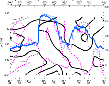
24 September 1997/12.00 UTC - Vertical cross section; black thin: divergence, black thick: convergence, magenta thick: vertical motion
(omega) - upward motion, magenta thin: vertical motion (omega) - downward motion, blue thin: IR pixel values, blue thick: WV pixel
values
|
|
In the area of the CB Cluster over Morocco strong negative values of divergence (i.e. convergence) are calculated at levels near the surface and, as a result, there is strong upward motion in the levels above.
27 September 1997/12.00 UTC
Analysis of the system
|
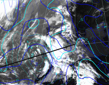
27 September 1997/12.00 UTC - Meteosat IR image; blue: thermal front parameter (TFP) 500/850 hPa, cyan: vorticity 500 hPa; position of
vertical cross section indicated
|
27 September 1997/12.00 UTC - Vertical cross section; black: isentropes (ThetaE), magenta: relative vorticity, blue thin: IR pixel
values, blue thick: WV pixel values
|
The two cloud bands with separate TFP maxima are still to be seen, but the front to the east is now dissipating. The MCS has moved to the southern part of Spain. The vorticity maximum of the ULL has shifted somewhat to the south. It is also very pronounced in the 500 hPa vorticity field and in the cross section.
|
27 September 1997/12.00 UTC - Meteosat IR image; red: height of PV=2 units
|
27 September 1997/12.00 UTC - Vertical cross section; black: isentropes (ThetaE), magenta: relative humidity, blue thin: IR pixel
values, blue thick: WV pixel values
|
The tropopause minimum is now situated south east of the spiral of moist air which indicates the centre of the ULL. The sharp edge seen in the
WV image to the rear of the MCS over south west Spain and Portugal is striking, indicating descending and drying air. In the cross section, low
relative humidity values are visible south west of the ULL centre. This is an indication of southward moving cold and dry air.
The instability of the airmas can still be observed in the lower levels in the ThetaE pattern.
|
27 September 1997/12.00 UTC - Meteosat IR image; green: equivalent thickness 500/850 hPa, red: height contours 500 hPa; position of
vertical cross section indicated
|
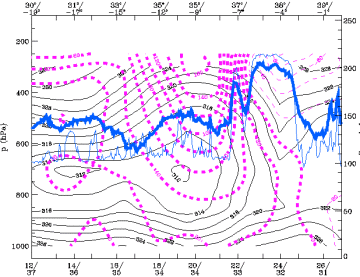
27 September 1997/12.00 UTC - Vertical cross section; black: isentropes (ThetaE), magenta: relative vorticity, blue thin: IR pixel
values, blue thick: WV pixel values
|
The low centre in the relative topography is ( just as the max of PV = 2 units) situated south of the ULL centre indicating the southward movement of the ULL. In the cross section the strong vorticity maximum is well presented. More to the east, above the MCS, strong negative values of vorticity are shown indicating anticyclonic outflow of the ascending air from lower levels.
28 September 1997/00.00 UTC
Analysis of the system
|
27 September 1997/23.00 UTC - Meteosat IR image; blue: thermal front parameter (TFP) 500/850 hPa; position of vertical cross section
indicated
|
28 September 1997/00.00 UTC - Vertical cross section; black: isentropes (ThetaE), magenta: relative humidity, blue thin: IR pixel
values, blue thick: WV pixel values
|
The cloud configuration forms a spiral structure but the TFP doesn't fit well with the image. The strong TFP over north-east Morocco and
southern Spain is also reflected in the cross section with a very strong horizontal gradient in the ThetaE near the surface over north Algeria.
Here there are characteristics of a Cold Front.
Ahead of this gradient zone the air is highly unstable up to 600 hPa.
|
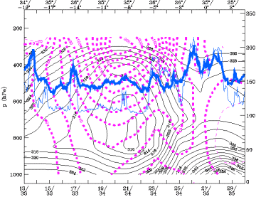
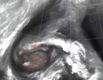
27 September 1997/23.00 UTC - Meteosat IR image; green: equivalent thickness 500/850 hPa, red: height contours 500 hPa
|
28 September 1997/00.00 UTC - Vertical cross section; black: isentropes (ThetaE), magenta: relative vorticity, blue thin: IR pixel
values, blue thick: WV pixel values
|
The coldest air has now moved around the ULL and the minimum of thickness values is located exactly in the centre of the low. Cold advection near the western part has stopped, but warm advection over Spain is continuing. The cross section shows the strong vorticity maximum in the centre of the low extending far down in the atmosphere.
|
27 September 1997/23.00 UTC - Meteosat IR image; red: height of PV=2 units
|
28 September 1997/00.00 UTC - Vertical cross section black thin: divergence, black thick: convergence, magenta thick: vertical motion
(omega) - upward motion, magenta thin: vertical motion (omega) - downward motion, blue thin: IR pixel values, blue thick: WV pixel
values
|
The height of the tropopause has reached its lowest values in the centre of the ULL. From now on the mature stage of the ULL is reached and the dissipation stage starts. Dry and moist air have spiralled around the centre, but generally, the area of the centre becomes increasingly moist. In the cross section strong upward motion is visible with some convergence in the coastal area of north-west Algeria; at levels above 400 hPa substantial divergence is present due to PVA in that region.
28 September 1997/12.00 UTC
|
28 September 1997/12.00 UTC - Meteosat IR image; blue: thermal front parameter (TFP) 500/850 hPa; position of vertical cross section
indicated
|
28 September 1997/12.00 UTC - Vertical cross section; black: isentropes (ThetaE), magenta: relative humidity, blue thin: IR pixel
values, blue thick: WV pixel values
|
The strongest TFP is now over Morocco, more to the west than 12 hours earlier. Cold air from the west meets warm air over northern Africa and
the horizontal gradient of the temperature in the lower levels is more or less stationary in the coastal areas. At higher levels the advection
of cold air is not so restrained (compare the cross sections of ThetaE of 28/00.00 UTC and 28/12.00 UTC).
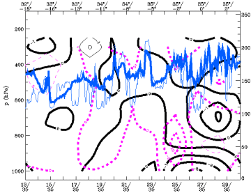
In the cross section a very dry layer is seen around 600 hPa in the eastern part of the cross section in an area with high cloud tops. The dry
layer lies above a very deep developed unstable layer which indicates strong potential instability. In the visible image (not shown) the
reflection of short wave (solar) radiation is less in that area indicating only a thin cirrus layer.
|
26 September 1997/12.00 UTC - Meteosat IR image; green: equivalent thickness 500/850 hPa, red: height contours 500 hPa
|
26 September 1997/12.00 UTC - Vertical cross section; black: isentropes (ThetaE), magenta: relative vorticity, blue thin: IR pixel
values, blue thick: WV pixel values
|
The centre of the ULL has moved further southward while the centre of the low in thickness remains at the same position. The low is slowly
filling with moist and less cold air.
Vorticity in the centre is still strong, but less than 12 hours earlier, as can be seen in the cross sections.
|
28 September 1997/12.00 UTC - Meteosat IR image; red: height of PV=2 units
|
28 September 1997/12.00 UTC - Vertical cross section black thin: divergence, black thick: convergence, magenta thick: vertical motion
(omega) - upward motion, magenta thin: vertical motion (omega) - downward motion, blue thin: IR pixel values, blue thick: WV pixel
values
|
The highest height values of IPV=2 units (tropopause) are still located in the centre of the Upper Level Low, but the tropopause is slightly higher than 12 hours earlier. In the cross section is clear that convergence in the baroclinic zone in the area of north-west Algeria causes upward motion. Combined with the potential instability it is an area which is highly susceptible for the development of CB clusters or MCSs
