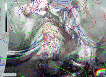
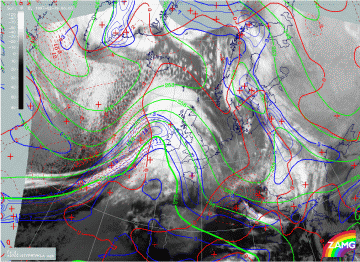
19 February 1997 - Key Parameters On Isobaric Surfaces For 06.00 UTC
|
19 February 1997/06.00 UTC - Meteosat IR image; blue: thermal front parameter (TFP) 500/850 hPa, green: equivalent thickness 500/850
hPa, red: temparature advection - WA 1000 hPa
|
19 February 1997/06.00 UTC - Meteosat IR image; blue: thermal front parameter (TFP) 500/850 hPa, green: equivalent thickness 500/850
hPa, red: temparature advection - CA 1000 hPa
|
The typical key parameters on isobaric surfaces: equivalent thickness, TFP and temperature advection (TA) are still very well-developed. The TFP is situated at the leading edge of the Cold Front cloud band and within the shield of the Warm Front; a zone of high thickness gradients accompanying the cloud bands is especially distinct in the warm front area. The amplitude of the thickness wave has increased, resulting in a pronounced ridge in the Warm Front and warm sector area, and a pronounced trough in the cold air area behind. Still very pronounced also is the WA maximum which covers the whole Warm Front Shield and a part of the cloud head (left image); intensive CA is connected with the Cold Front (right image).

