19 February 1997 - Overview Of Satellite Imagery For 00.00 UTC
|
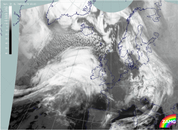
19 February 1997/00.00 UTC - Meteosat IR image
|
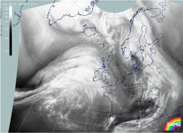
19 February 1997/00.00 UTC - Meteosat WV image
|
The images above show those cloud systems over the Atlantic which are involved in this case study. There is a pronounced frontal system with a rather small but structured Cold Front cloud band extending from the western edge of the panel (approximately 40N/36W) to the north-east (compare Conceptual Models: Cold Front and Conceptual Models: Cold Front in Cold Advection ) and a huge cloud shield typical for a Warm Front shield extending from the Atlantic (east of 20W) across Ireland and south-west England (compare Conceptual Models: Warm Front Shield ). In the WV image the wet air in the Warm Front Shield and the warm sector is even more impressive, as well as the Dark Stripe at the rear of the Cold Front cloud band representing very dry air. In both images vertical cross section lines are superimposed to indicate for both systems: Cold and Warm Front.
Besides the frontal cloud features an impressive cloud head can be recognized to the north, north-west of the line 44N/30W - 55N/15W. This cloud head suggests a Rapid Cyclogenesis but contains two substructures which deviate from the classical appearance of such a conceptual model. This will be discussed in detail in a separate chapter below (compare Diagnosis of Rapid Cyclogenesis and Upper Level Trough Feature - 19 February 1997/00.00 UTC).
The front diagnosis will be done by a combination of satellite images and relevant parameters on isobaric surfaces (compare Key parameters on isobaric surfaces for 00.00 UTC ) as well as by a combination of satellite signals with other synoptic data in the form of vertical cross sections (compare Use of vertical cross sections for 00.00 UTC ).

