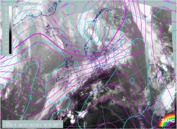
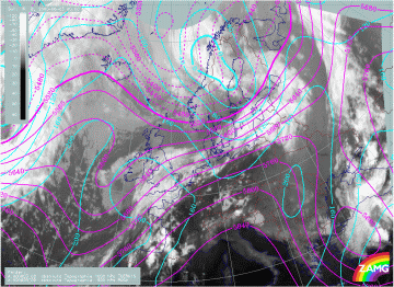
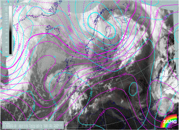
Absolute Topography at 500 hPa and 1000 hPa
The conceptual model "Front Decay" also shows up very well using some parameters on isobaric surfaces. These rather basic parameters are available from model fields, and can be used operationally.
Height contours at 500 hPa and 1000 hPa
An extended upper level trough and a narrow low level depression with its associated frontal system generally persist at all stages of the Front Decay of the 02/03 June 2000. The acute angle between isolines of surface low and Upper Level Low indicates cold advection to the rear of and over the cloud band at 02/18.00 UTC. The angle between the isolines of the 1000 hPa and the 500 hPa height contours is decreasing a little during the life cycle, indicating a decrease in the intensity of CA during the following stages. The upper level isolines indicate a strong jet streak parallel to the frontal cloud band.
|
02 June 2000/18.00 UTC - Meteosat IR image; magenta: height contours 1000 hPa, cyan: height contours 500 hPa
|
03 June 2000/00.00 UTC - Meteosat IR image; magenta: height contours 1000 hPa, cyan: height contours 500 hPa
|
|
03 June 2000/06.00 UTC - Meteosat IR image; magenta: height contours 1000 hPa, cyan: height contours 500 hPa
|
|


