Analysis of 28 October 2002
28 October 2002/00.00 UTC
|
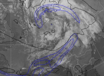
28 October 2002/00.00 UTC - Meteosat IR image; blue: thermal front parameter (TFP) 500/850 hPa, black: zero line of shear vorticity 300
hPa
|
|
The depression is filling up and the pressure in the centre of the low is 980 hPa, with the centre itself located above the Baltic Sea. Less structure is seen within the frontal cloudiness when compared to six hours earlier. The Cold Front is situated in an area stretching from the Baltic States via Hungary to Switzerland.
The thermal front parameter shows the existence of a Cold Front ahead of the frontal cloudiness. The zero line of shear vorticity now makes a sharper angle with the front. The front is still a Kata type.
|
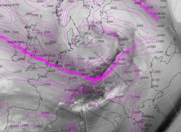
28 October 2002/00.00 UTC - Meteosat WV image; magenta: height of 2 units potential vorticity, position of vetical cross section
indicated
|
|
On 28 October at 00.00 UTC the Dark Stripe is only a thin black line, located directly behind the Cold Front. The height field of the tropopause shows a strong gradient from 10000 meters to 4500 meters. The gradient is now ahead of the Dark Stripe, in the more humid area.
|
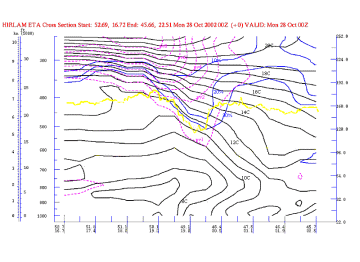
28 October 2002/00.00 UTC - Vertical cross section; black: isentropes (ThetaW), magenta: potential vorticity, blue: relative humidity,
yellow: WV pixel values
|
|
The vertical cross section above shows a Kata Cold Front. The potential vorticity has not changed very much when compared to 6 hours earlier. The very dry air no longer reaches so far down into the atmosphere.
|
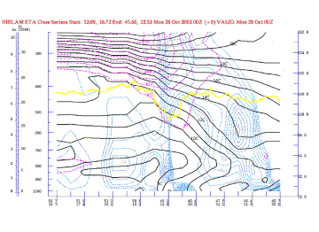
28 October 2002/00.00 UTC - Vertical cross section; black: isentropes (ThetaW), magenta: potential vorticity, blue: vertical motion
(omega) - upward motion, yellow: WV pixel values
|
|
In the vertical cross section above rising motion can be seen nearly everywhere, except for the surface Cold Front where the air is descending.
Weather events
|
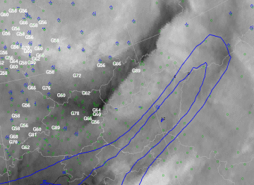
28 October 2002/00.00 UTC - Meteosat WV image; blue: thermal front parameter (TFP) 500/850 hPa, blue: weather events, white: wind gusts
> 55 kts 23.00 - 00.00 UTC
|
|
| Parameter | Description |
| Precipitation | The satellite image shows a convective structure of the cloudiness to the rear of the Cold Front. Some observations of rain in this area. |
| Wind (incl. gusts) | Very strong gusts are reported at several locations in the neighbourhood of the Dark Stripe, to the rear of the front in Slovakia and Austria, as well as near the curled Occlusion over the Czech republic and southern Germany. |
