Chapter IV: Precipitation forecasting
Table of Contents
- Chapter IV: Precipitation forecasting
- Precipitation forecasting
Precipitation forecasting
Operational 8km resolution hydrostatic ALADIN model forecast the existence of two cyclones quite satisfyingly.
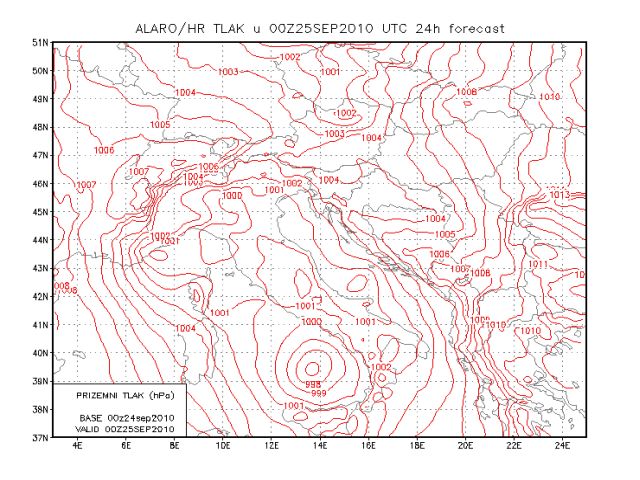
Figure 4.1: MSLP forecast by ALADIN/HR model valid at 00 UTC on 25 September 2010
Even though the precipitation maximum over the sea was forecast 3 hours too late, it was positioned quite well.
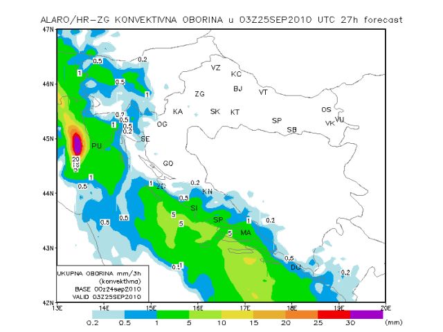
Figure 4.2: 3-hourly accumulated convective precipitation forecast by ALADIN/HR model valid at 03 UTC on 25 September 2010
Nevertheless, there was no indication of the secondary maximum over the Istrian land, which caused the flash-flood in question. The processes that lead to the development of the secondary rainfall maximum were further explored using the 2km resolution non-hydrostatic ALADIN model.
It can be noted that the precipitation is mostly convective, especially the inland maximum retrieved by the model at 2km resolution. Maximum over the sea corresponds nicely and is advected towards the east with the convergence line.
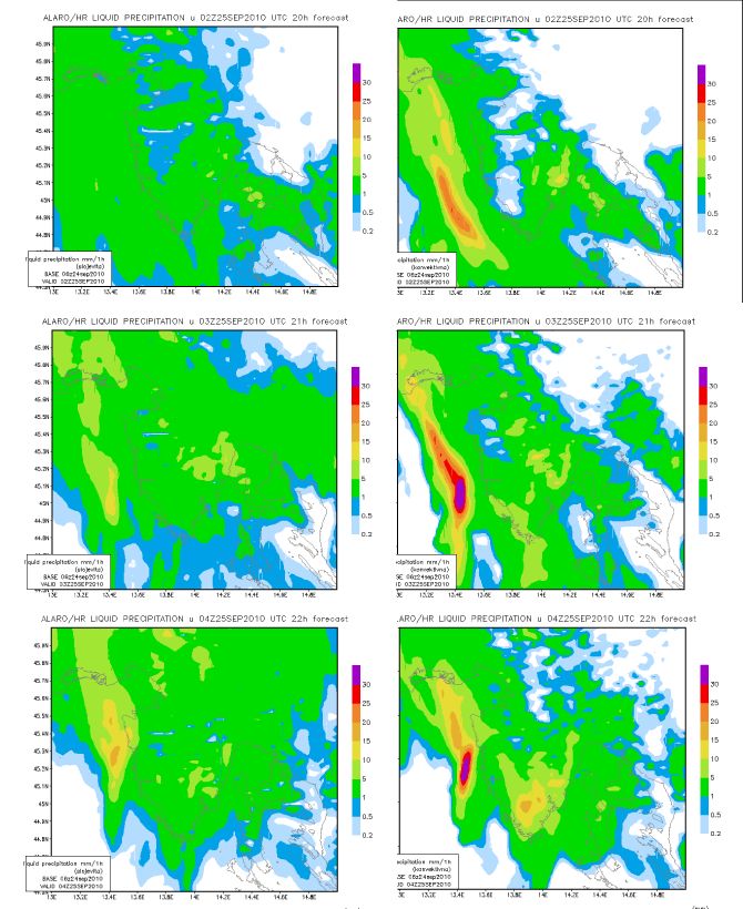
Figure 4.3: Hourly accumulated large-scale precipitation (left) forecast by ALADIN/HR model and convective precipitation (right) valid at 02 UTC (upper), 03 UTC (middle) and 04 UTC (lower) on 25 September 2010