Cloud Structure In Satellite Images
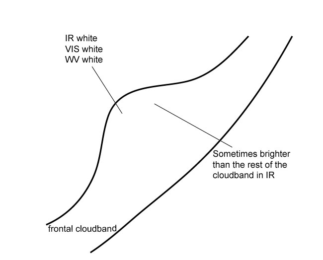
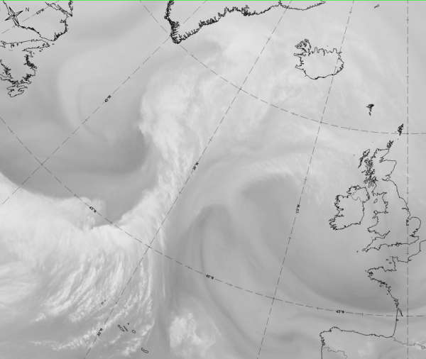
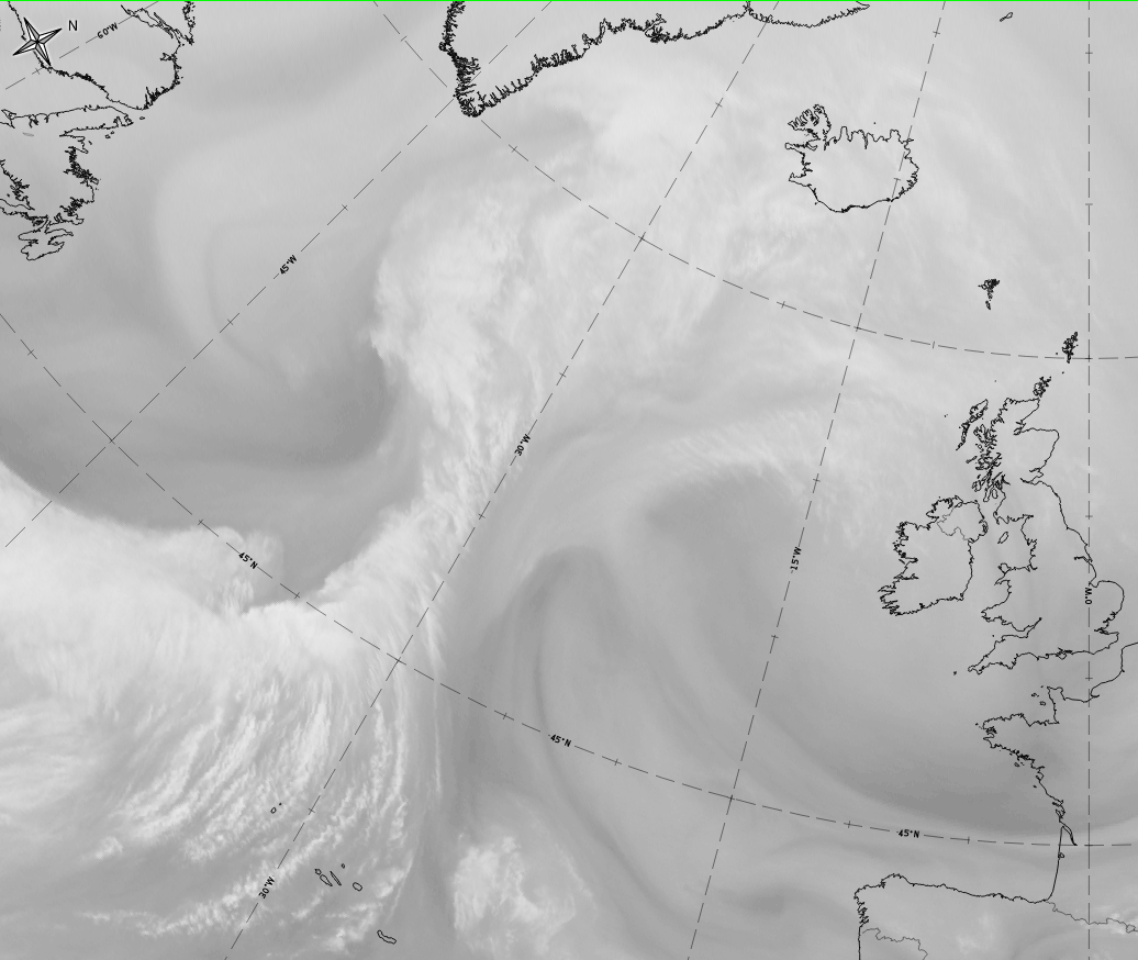
The satellite image shows a cloud bulge at the rear edge of the cloud band of a cold front;
Appearance in the basic channels:
- In the VIS and IR images the area of the cloud bulge is white, indicating thick and/or multi-level cloud;
- In the IR image the grey shades can be brighter than the rest of the cloud band;
- In the initial stage, the rearward cloud edge takes the form of an S-shape, which becomes more pronounced over time;
- At a later stage a cloud spiral develops from the cloud bulge:
- In some cases the spiral develops directly from the white cloud bulge (see Occlusion: Warm Conveyor Belt Type );
- In some cases the spiral develops as a low cloud, emerging beneath the higher cloud layers; in this case it seems that the two synoptic layers are decoupled (see Occlusion: Cold Conveyor Belt Type ).
Appearance in the basic RGBs:
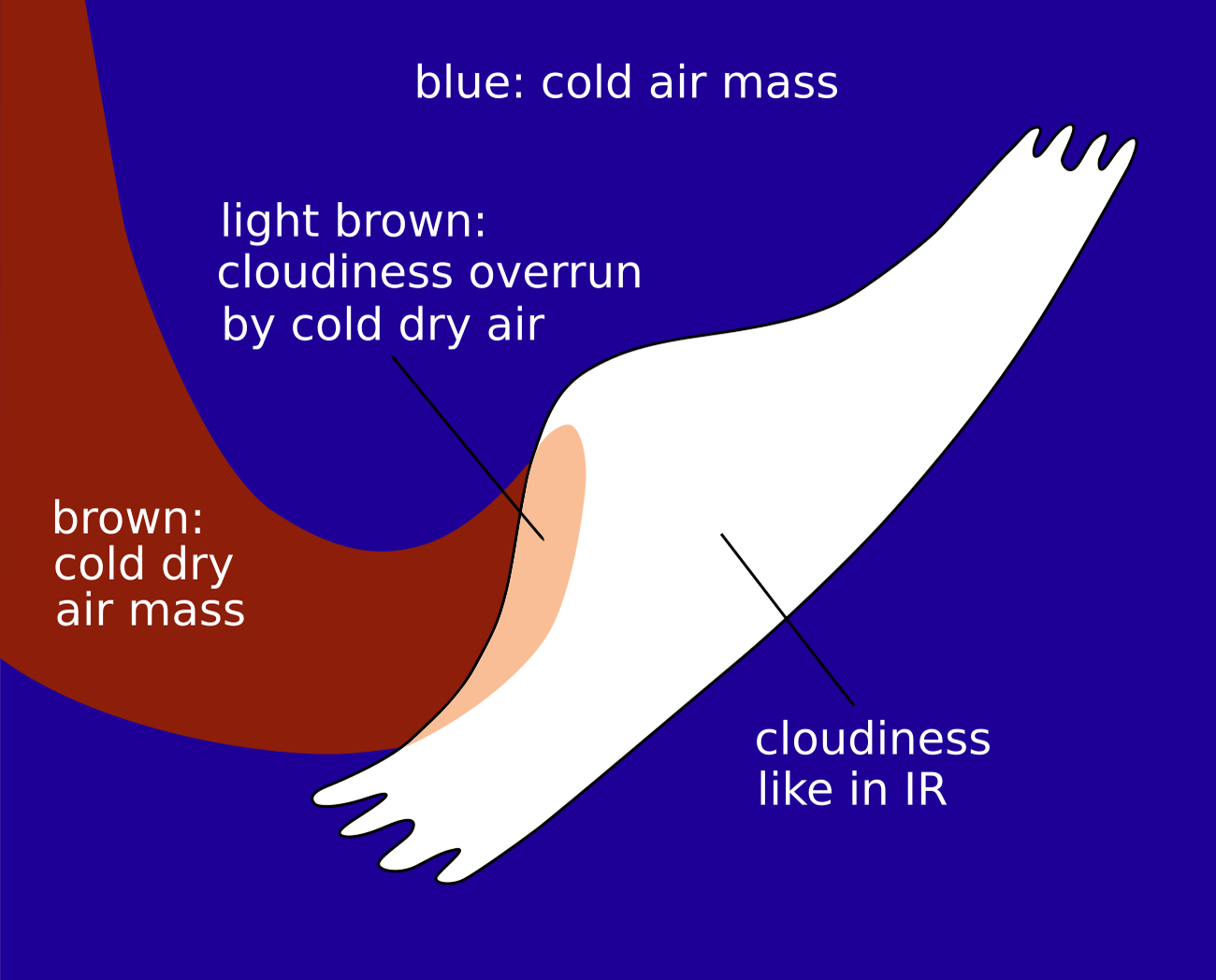
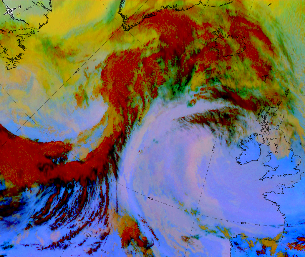
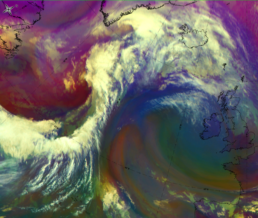
Airmass RGB
The protrusion of cold and dry air at the rearward side of a wave is indicative of the initial stages of cyclogenesis. Therefore, dark blue colours exist at the rear side. Depending on the stages of development, a brown stripe immediately behind the S-shape of the wave also exists.
The wave bulge cloud looks very similar to the IR image. Sometimes a brown-ish shadow above the wave bulge indicates overrunning dry air.
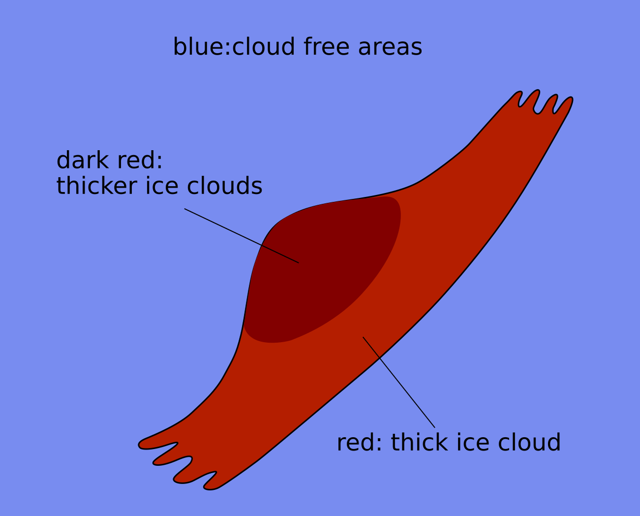
Dust RGB
Despite from other existing cloud configurations, the dust RGB shows blue to pinkish blue colours, representing cloud-free regions. There is often low-level cloud which shows up in ochre colours.
The wave cloud bulge consists of the dark red areas which are representing thick as well as the convective cloud regions. Very often it is more colour-intensive compared with the eastern part of the cold front band.
 |
 |
Legend: schematics for basic RGBs. Left: airmass RGB; right: dust RGB.
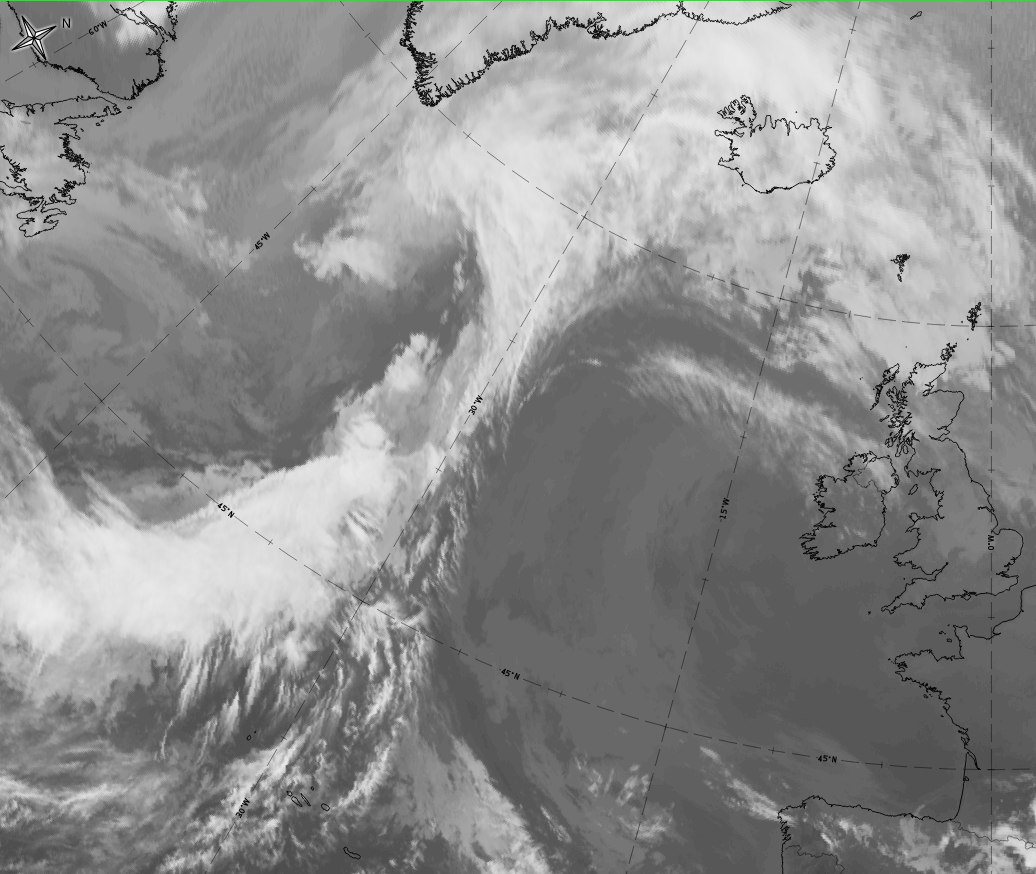
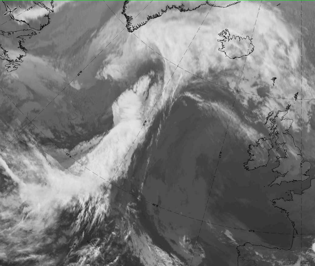
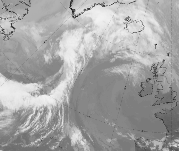
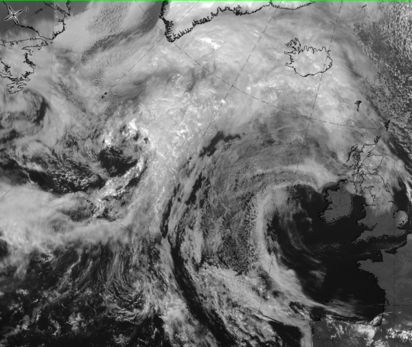
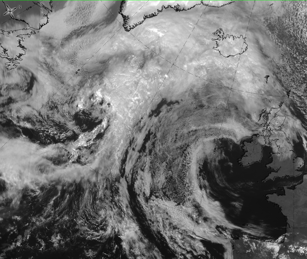
The case of 18 September 2019 at 12 UTC shows both: the development of a wave bulge into an occlusion cloud spiral, and the typical cloud appearance in the basic channels and basic RGBs.

|
|
|
|
Legend:
18 September 2019 from 12 to 21 UTC: Development from wave to occlusion stage
*Note: click on the image to access the image gallery (navigate using arrows on keyboard)
|
|
|
|

Legend: 18 September 2019 at 12UTC: 1st row: IR (above) + HRV (below); 2nd row: WV (above) + Airmass RGB (below); 3rd row: Dust RGB + image gallery.
*Note: click on the Dust RGB image to access image gallery (navigate using arrows on keyboard)
| IR | White and lumpy texture indicates cold cloud tops with convective characteristics. |
| HRV | White and lumpy texture indicates cold cloud tops with convective characteristics. |
| WV | White and lumpy texture; the dark stripe at the rear represents sinking dry air. |
| Airmass RGB | Clouds are similar to their appearance in IR; the dark brown area at the rear corresponds to the dark stripe in WV, indicating the dry sinking air at the rear of the wave. |
| Dust RGB | A dark red colour and a lumpy texture indicates thick ice cloud with convective characteristics. |