Weather Events
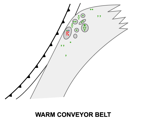
Usually the Warm Conveyor Belt clouds consists of only mid- and high-level clouds with very weak or no precipitation.
| Parameter | Description |
| Precipitation |
|
| Temperature |
|
| Wind (incl. gusts) |
|
| Other relevant information |
|
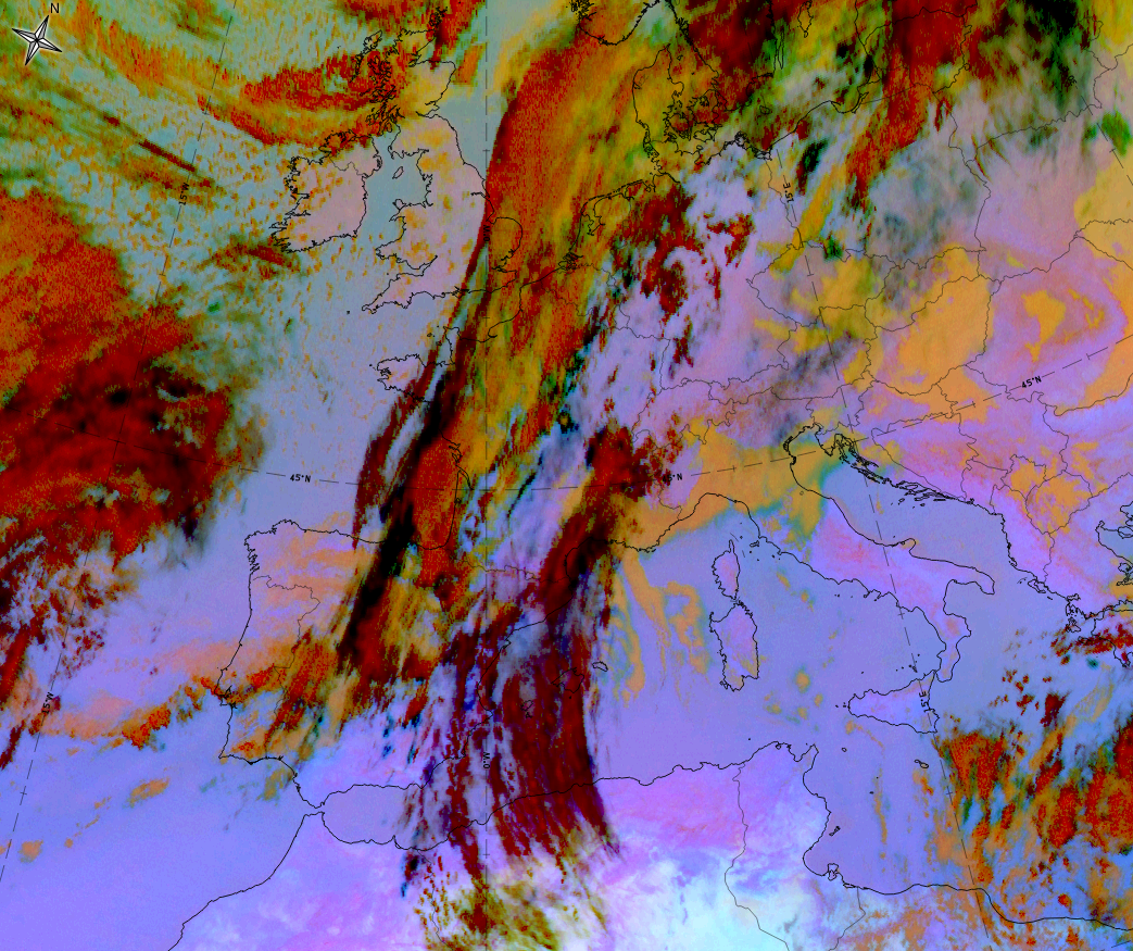
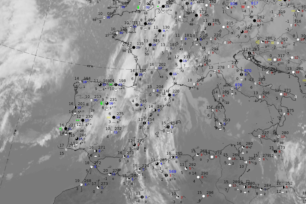
As an example, for the typical weather in a warm conveyor belt, the case of 15 January 2020 at 12 UTC is chosen. It shows a cold front cloud band from the Iberian Peninsula stretching northward into the North Sea. In front of it the clouds of a warm conveyor belt from Northern Africa across the Western Mediterranean into Southern France exist. As it is an example of a winter case, no thunderstorm reports are expected.
|
|
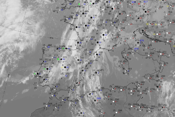
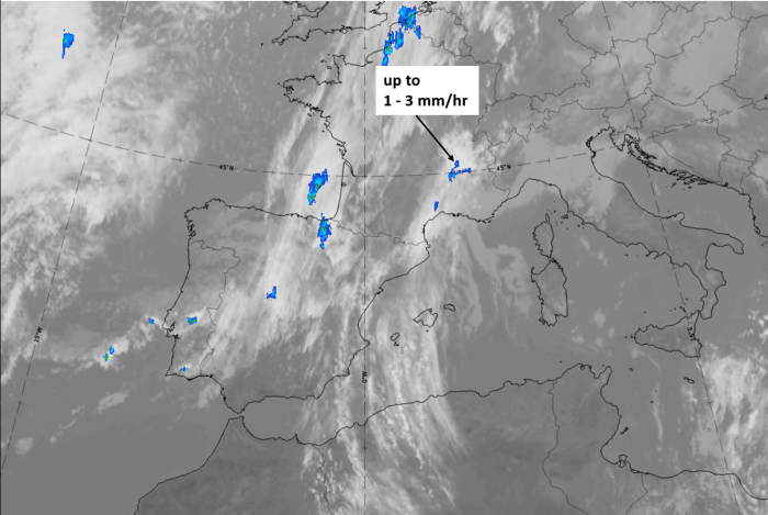
Legend: 15 January 2020 at 12UTC: IR + synoptic measurements (above) + probability of moderate rain (Precipitting clouds PC - NWCSAF).
Note: for a larger SYNOP image click this link.
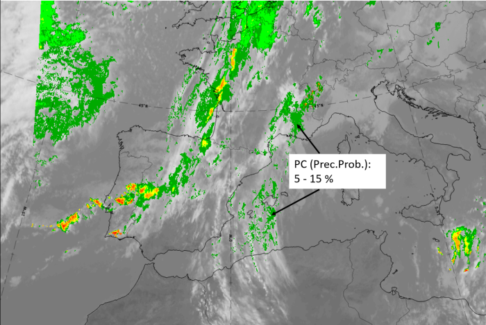
There are no precipitation reports within the warm conveyor belt cloudiness; it is mostly high cloud. Only in the northern part, which is over France, there are also mid-level clouds. Also, the precipitation probability computed from the NWCSAF is lower than 15 %.
|
|
|
|
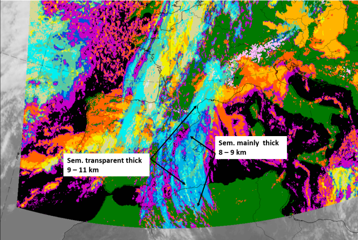
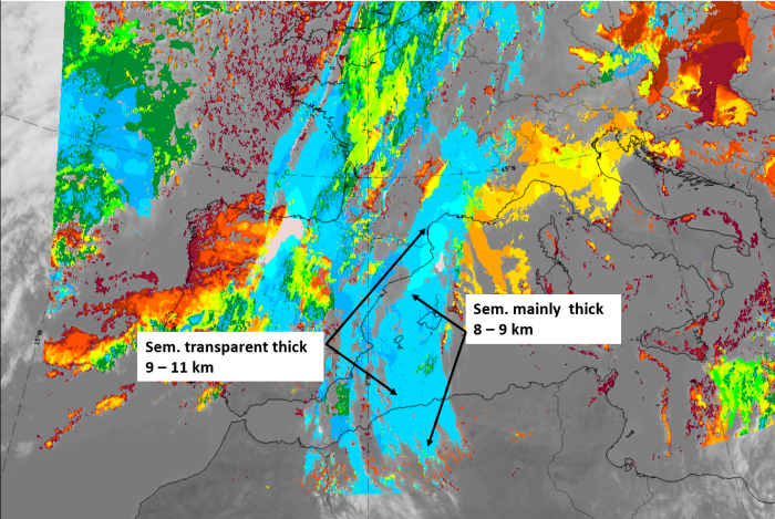
Legend:
15 January 2020 at 12 UTC, IR; superimposed:
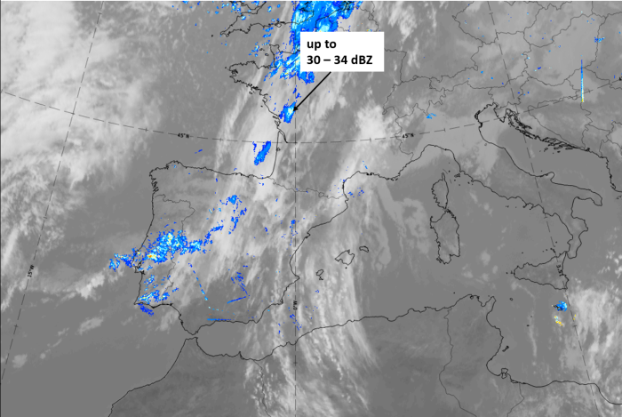
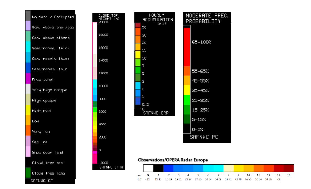
1st row: Cloud Type (CT NWCSAF) (above) + Cloud Top Height (CTTH - NWCSAF) (below); 2nd row: Convective Rainfall Rate (CRR NWCSAF) (above) + Radar intensities from Opera radar system (below).
For identifying values for Cloud type (CT), Cloud type height (CTTH), precipitating clouds (PC), and Opera radar for any pixel in the images look into the legends. (link).