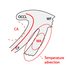
Key Parameters
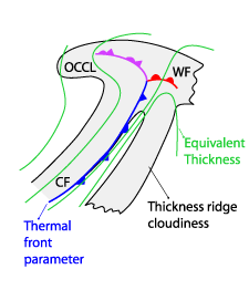
- Equivalent thickness and Thermal front parameter (TFP):
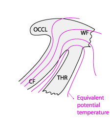
Within the ridge of the equivalent thickness (not accompanied by a TFP), the TFP zones are connected to the consecutive CF and the WF if existing. - Equivalent potential temperature at 850 hPa:
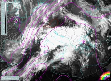
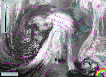
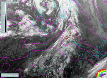
The thickness ridge cloud lies within a ridge or a maximum of the equivalent potential temperature at 850 hPa - Height Contours at 1000 hPa and 500 hPa:
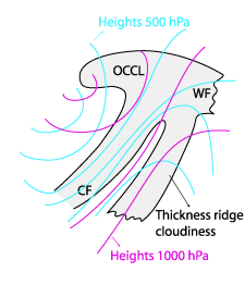
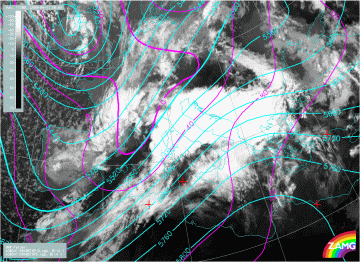
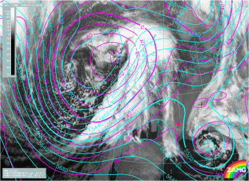
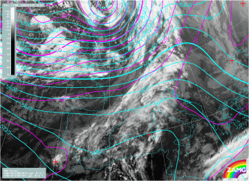
The Thickness Ridge Cloudiness is situated within the ridge of the 1000 hPa and the 500 hPa height, in front of a frontal system - Temperature advection (TA) at 700 hPa:
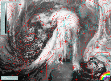
A distinct maximum of WA is superimposed upon the Thickness Ridge Cloudiness. - Showalter index:
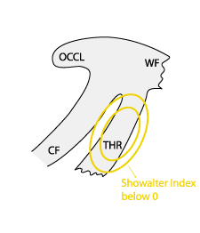
There is usually a stable stratification associated with Thickness Ridge Cloudiness, but during the summer season the area within the thickness ridge is often unstable.
Equivalent thickness and Thermal front parameter (TFP)
|
|
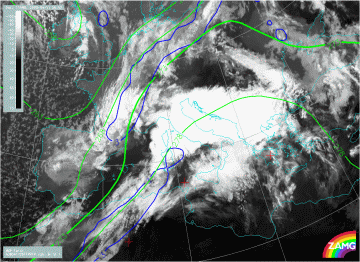
11 April 2008/06.00 UTC - Meteosat 9 IR10.8 image; blue: thermal front parameter (TFP), green: equivalent thickness 500/850 hPa
|
|
|
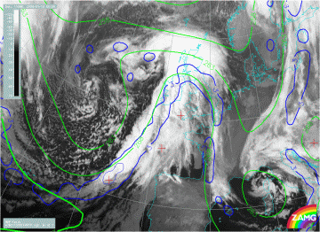
13 January 2008/00.00 UTC - Meteosat 9 IR10.8 image; blue: thermal front parameter (TFP), green: equivalent thickness 500/850 hPa
|
|
|
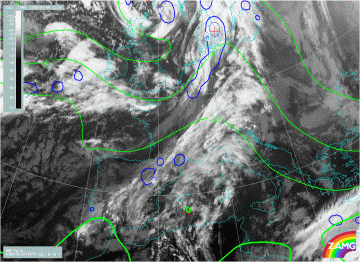
09 January 2008/12.00 UTC - Meteosat 9 IR10.8 image; blue: thermal front parameter (TFP), green: equivalent thickness 500/850 hPa
|
In all three cases THR Cloudiness is found within a ridge of equivalent thickness. In the 13th January case the equivalent thickness ridge is very pronounced and one can also nicely recognize Cold and Warm front Cloud bands. In 9th January case frontal cloudiness is very weak. The first example of 11th of April one can declare as "front-disconnected" type and the other ones as "front-connected" types but without intensive convection because these are winter cases.
|
|
11 April 2008/06.00 UTC - Meteosat 9 IR10.8 image; magenta: equivalent potential temperature 850 hPa
|
|
|
13 January 2008/00.00 UTC - Meteosat 9 IR10.8 image; magenta: equivalent potential temperature 850 hPa
|
|
|
09 January 2008/12.00 UTC - Meteosat 9 IR10.8 image; magenta: equivalent potential temperature 850 hPa
|
Height Contours at 1000 hPa and 500 hPa
|
|
11 April 2008/06.00 UTC - Meteosat 9 IR10.8 image; magenta: height contours 1000 hPa, cyan: height contours 500 hPa
|
|
|
13 January 2008/00.00 UTC - Meteosat 9 IR10.8 image; magenta: height contours 1000 hPa, cyan: height contours 500 hPa
|
|
|
09 January 2008/12.00 UTC - Meteosat 9 IR10.8 image; magenta: height contours 1000 hPa, cyan: height contours 500 hPa
|
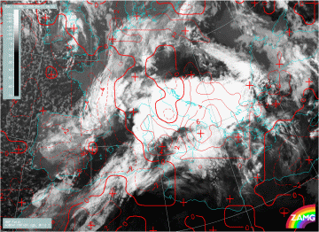
Temperature advection (TA) at 700 hPa
|
|
11 April 2008/06.00 UTC - Meteosat 9 IR10.8 image; red dashed: temperature advection - CA 700 hPa, red solid: temperature advection
- WA 700 hPa
|
|
|
13 January 2008/00.00 UTC - Meteosat 9 IR10.8 image; red dashed: temperature advection - CA 700 hPa, red solid: temperature advection - WA 700 hPa
|
|
|
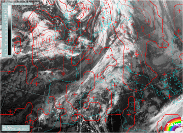
09 January 2008/12.00 UTC - Meteosat 9 IR10.8 image; red dashed: temperature advection - CA 700 hPa, red solid: temperature
advection - WA 700 hPa
|
Showalter index
|
|
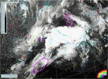
11 April 2008/06.00 UTC - Meteosat 9 IR10.8 image; yellow: Showalter index 500/850 hPa, purple Showalter index 500/850 hPa is 0.
|
|
|
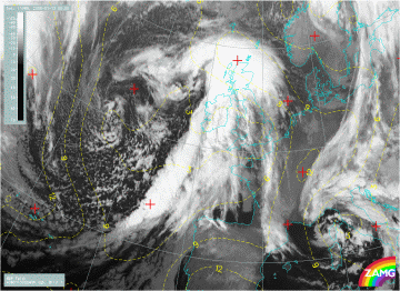
13 January 2008/00.00 UTC - Meteosat 9 IR10.8 image; yellow: Showalter index 500/850 hPa
|
|
|
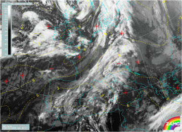
09 January 2008/12.00 UTC - Meteosat 9 IR10.8 image; yellow: Showalter index 500/850 hPa
|
Whereas in the first case the values of Showalter index are nicely related to the cloudiness within the Thickness Ridge, in the last two examples (winter cases) the values of Showalter index are lower than 3, but for the whole frontal region and not specifically for the THR clouds.
