Weather Events
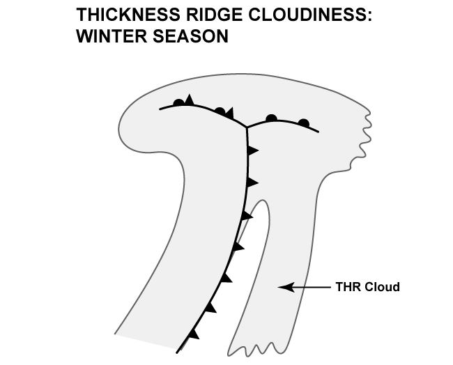
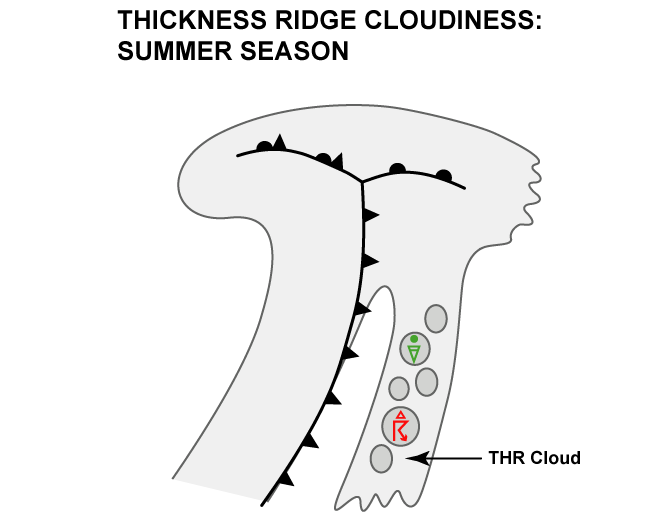
The Thickness Ridge cloud band is multi-layered and normally exists without significant precipitation except in cases with embedded convection.
| Parameter | Description |
| Precipitation |
|
| Temperature | Rising temperatures in the warm sector |
| Wind | Mostly weak winds with a southerly component |
| Other relevant information | Multi layered mid- and high-level clouds |
The case from 10 December 2019 at 12 UTC is a good example for a winter case with little to no convection at all.
|
|
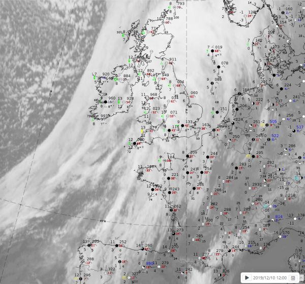
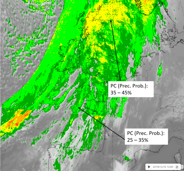
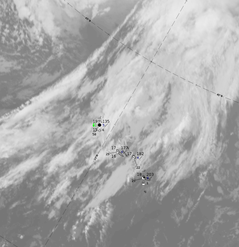
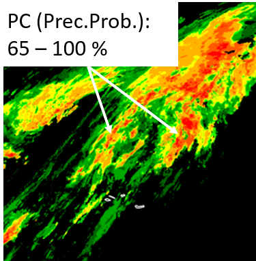
Legend: 10 December 2019 at 12UTC: IR + synoptic measurements (above) + probability of moderate rain (Precipitting clouds PC - NWCSAF).
Note: for a larger SYNOP image click this link.
In the case from 10 December 2019/12 UTC (left side), the synoptic observations do not report any precipitation in the southern half from Spain into the English Channel, where very low precipitation probabilities exist. In the northern half over the image, over the British Isles, there are some areas with higher probabilities of precipitation. This is in the northern region of the warm sector where cloud associated with the THR and the warm front are difficult to distinguish and delineate.
|
|
|
|
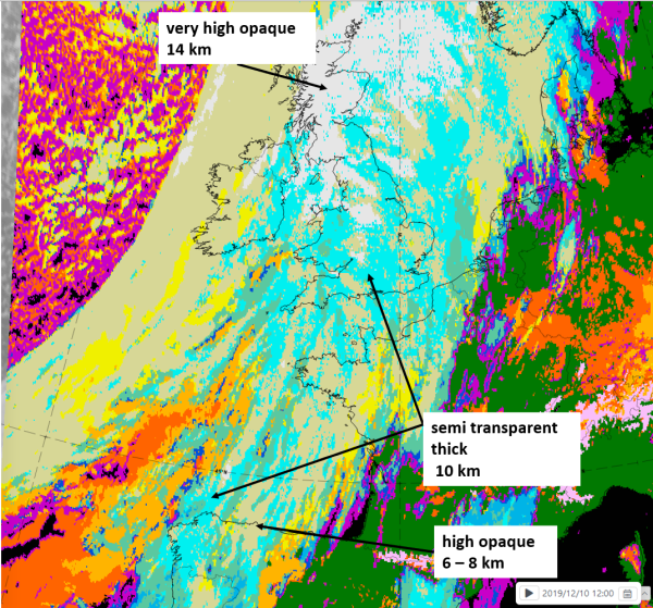
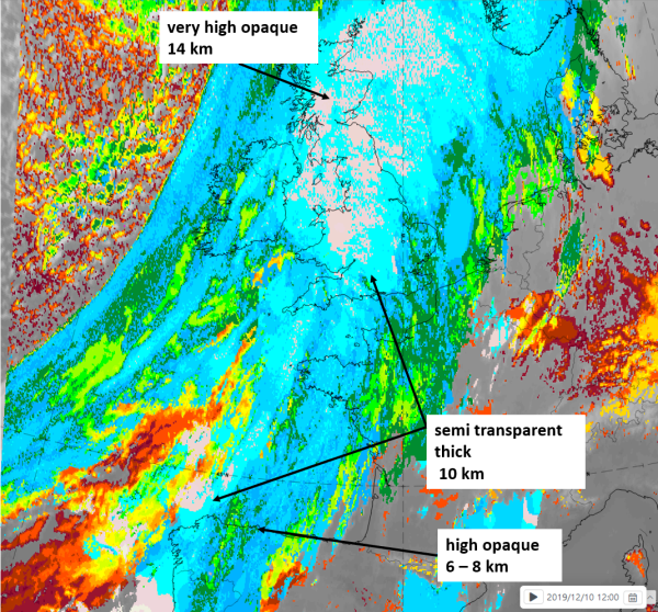
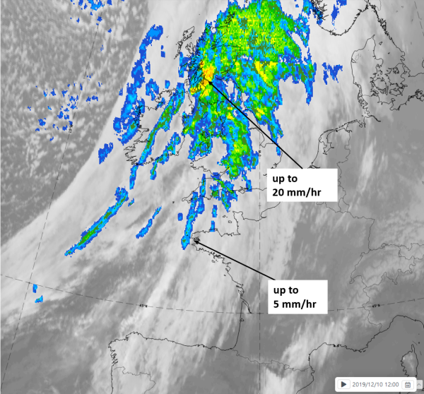
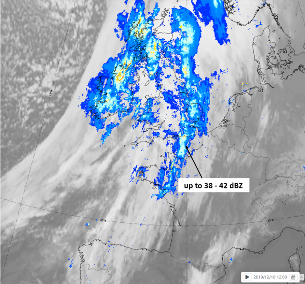
10 December 2019 at 12 UTC
1st row: Cloud Type (CT NWCSAF) (above) + Cloud Top Height (CTTH - NWCSAF) (below); 2nd row: Convective Rainfall Rate (CRR NWCSAF) (above) + Radar intensities from Opera radar system (below).
In the case of 18 April 2020 at 12 UTC THR cloudiness is over the Atlantic ahead of a weak cold frontal cloud band; although there are few ground observations, weather stations from the Azores Islands do indicate a situation more typical for the summer cases.
 |
 |
Legend: 18 April 2019 at 12UTC: l: IR and synoptic measurements; r: IR and precipitating cloud (probability of precipitation from NWCSAF)
For identifying values for Cloud type (CT), Cloud type height (CTTH), precipitating clouds (PC), and Opera radar for any pixel in the images look into the legends. (link).