Cloud Structure In Satellite Images
Thickness Ridge (THR) cloud is a system with the appearance of a band of cloud which can be found in the thickness ridge ahead of a frontal cloud band. It often contains convective clouds in the summer season. The clouds in the thickness ridge may be associated with the frontal system in its northern parts, or may be separate. No characteristic life cycle can be observed in the cloud features of a thickness ridge cloud system.
Basic channels:
- IR imagery:
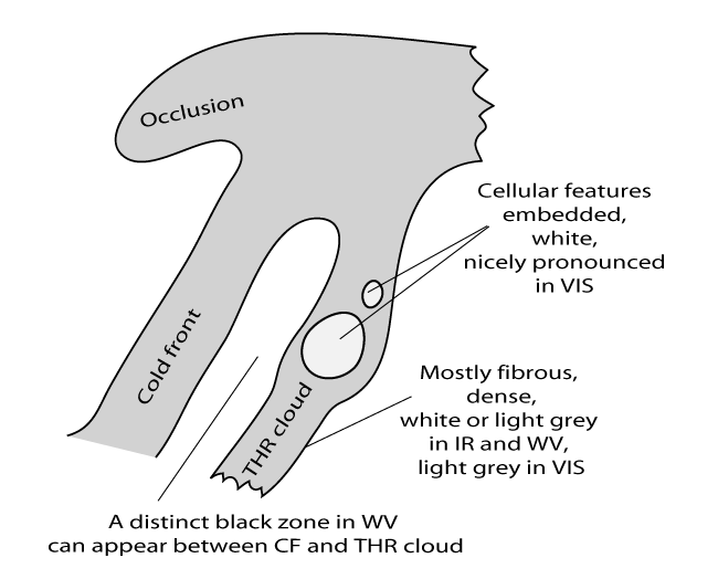
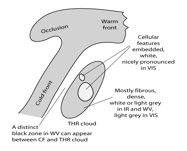
- Mostly fibrous and/or dense cloud, white or light grey;
- Cellular features within the cloud band, indicating embedded convection;
- WV imagery:
- The cloud features in the IR image can be seen as white features in an extended grey area;
- for some cases a distinct black zone appears between the frontal cloud band and the Thickness Ridge Cloud band.
- VIS imagery:
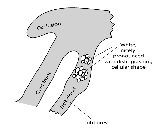
- The VIS image generally shows light grey shades, representing middle to high translucent clouds, with white spots indicating embedded convection cells.
RGBs:
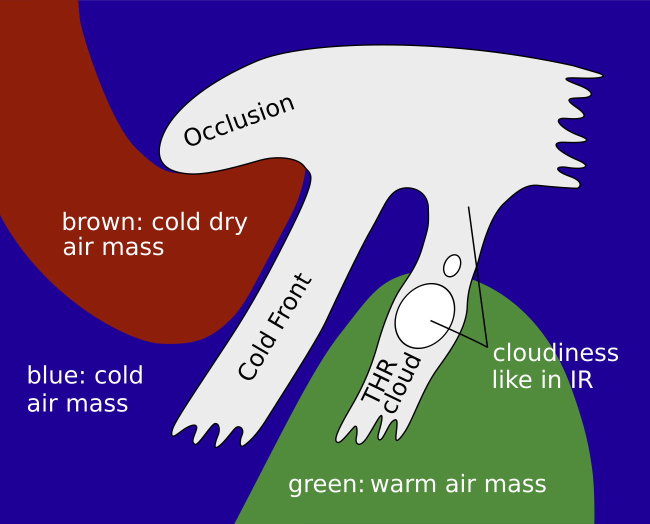
Airmass RGB:
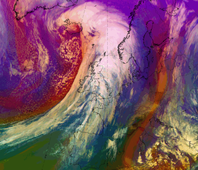
According to the location of the THR cloudiness ahead of a cold front cloud band, greenish colours indicate warm air masses in the southern and south-eastern parts of the cloud system. In front of the THR cloud usually blue to greenish colours indicate warm to cold airmasses which are governed by the different synoptic situations there.
The THR clouds have a similar appearance in the IR image.
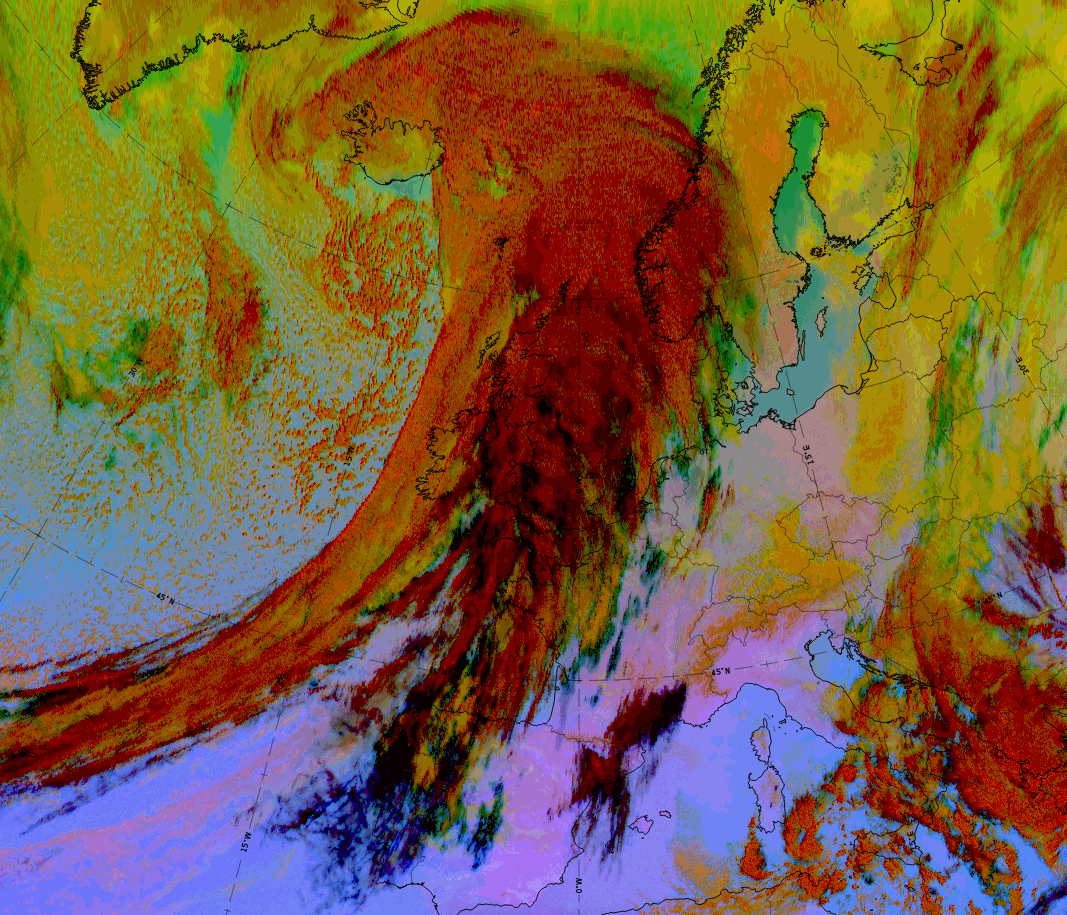
Dust RGB
Ahead of, and to the south of the THR cloud blue to pinkish blue colours appear where there are cloud free areas.
The THR cloud itself consists of a mixture of ochre, dark-red and black cloud areas and stripes. These features are dependent upon the thickness and the height of the cloud, from the mid-level up to the thicker ice cloud and finally up to the high-level cloud fibres.
 |
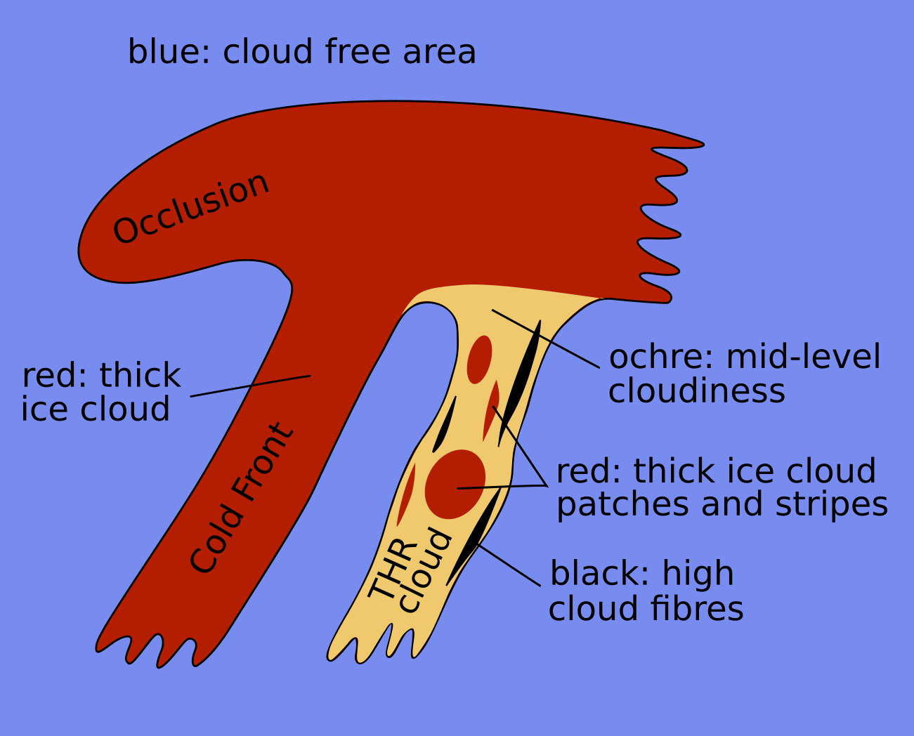 |
Legend: Schematics for basic RGBs, Left: airmass RGB; right: dust RGB
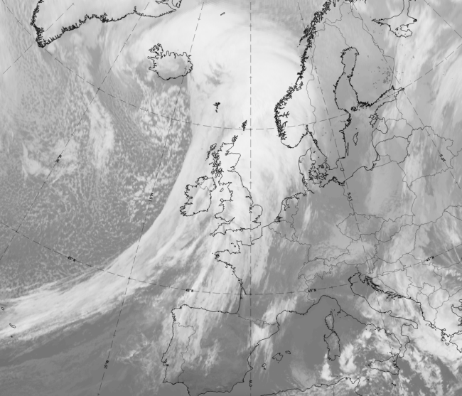
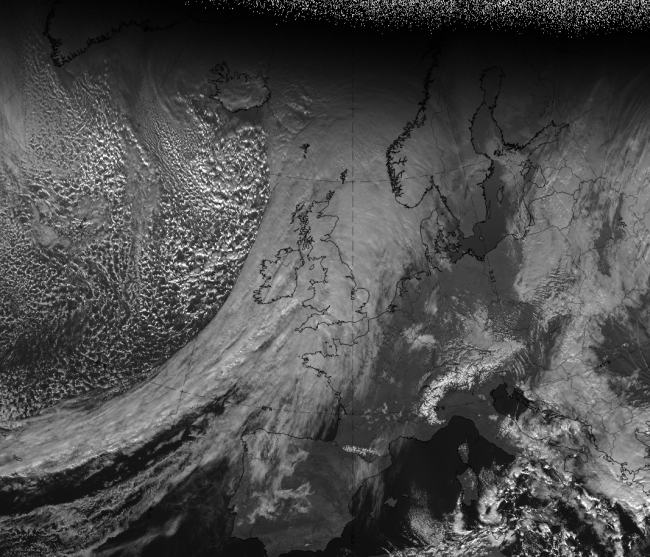
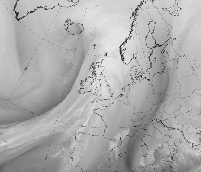
The case from 10 December 2019 at 12 UTC is a good example for a winter case over Western Europe. The THR cloudiness is in front of, and parallel to, the cloud band of the Cold Front and extends from the British Isles over western France to Northwestern Spain and Portugal. Its cloud fraction merges in the warm sector with the cloud fraction associated with the Warm Front shield.
|
|
|
|
10 December 2019 at 12UTC: 1st row: IR (above) + HRV (below); 2nd row: WV (above) + Airmass RGB (below); 3rd row: Dust RGB + image gallery.
*Note: click on the Dust RGB image to access image gallery (navigate using arrows on keyboard)
| IR | Bright and structured in patches and fibres. |
| HRV | Dark grey fibrous. |
| WV | Bright structures can be recognised within the grey shield of high WV content. |
| Airmass RGB | The cloud is similar to the appearance in the IR images, with blue colours representing the cold airmass - except in the southern regions where the cloud feature is overrun by green colours representing the warm air mass in the southern warm sector. |
| Dust RGB | Dark-red colours indicate thick ice cloud, black indicates high translucent cloud fibres and some ochre areas indicate the mid-level cloud below. |