Cloud Structure In Satellite Images
Stratocumulus sheets are shown in satellite images as separate cloud sheets, which vary in size from relatively small (around 10.000 - 50.000 km2) areas to extensive, synoptic scale features (up to and above 1.000.000 km2). Especially in higher latitudes Stratocumulus (hereby referred as Sc) Sheets have a relatively homogeneous appearance in IR channels of geostationary satellites. Polar orbiting satellites and the HRVis of MSG reveal a great deal of substructures (cellular-, roll- or ripple-like details) in the texture of the Sc Sheets.
The edges of Sc Sheets can be very sharp, but normally they are more ragged, especially when the cloud sheet starts to break up. The dissolving of even an extensive cloud sheet can happen very quickly (in hours), when radiative or turbulent mixing processes become favourable. Thinness of the Sc layer helps in rapid dissolving of the cloud layer over land. The Sc Sheet can also have a different appearance during the day than during the night. The underlying surface also has an effect on the appearance of cloud sheet; for example, over the ocean the clouds have a cellular-like appearance arising from spatially organized convection.
Appearance in METEOSAT SECOND GENERATION imagery
IR10.8 µm imagery:
- In the IR image the grey shades of the cloud shield are usually grey or dark grey indicating relatively low (warm) cloud tops.
- The appearance of Sc Sheets is smoother in IR than in VIS, which is due to the uniform cloud top height.
- The detection of cloud sheets using the IR image can sometimes be difficult if temperature difference between cloud tops and surface is small. Temperature difference can even be reversed, that is, cloud tops can show warmer temperature than surrounding cloud-free surface areas causing a black appearance of the cloud. This is especially the case in high latitudes during the cold season, when radiative cooling of surfaces beneath cloud-free areas can be remarkably strong.
HRVis, Vis0.6 and Vis0.8 µm imagery:
- In the HRVis, Vis0.6 m and Vis0.8 m images the clouds are of varying brightness indicating thickness differences of the cloud layer. The grey shades of the Sc Sheet vary usually between white to grey depending on the thickness of the cloud sheet and sun elevation.
- The cellular-like pattern is common for Sc Sheets (in contrast to Fog or Stratus shields, which have a flatter appearance).
WV6.2 and 7.3 µm imagery:
- In the WV channels the Sc Sheets are normally invisible, due to the limited vertical extent of Sc Sheets (usually only up to 1 - 2 km).
- WV imagery however, can indirectly be useful: the horizontal advection of upper-level moist air (although without associated clouds) over the Sc Sheets may change the radiation balance of clouds, further leading to dissolving of the cloud sheet.
RGB imagery
"Daytime Natural Colours":
The day natural colours RGB NIR1.6, Vis08, Vis06 µm can be used for low clouds (SC, St and Fog) but also for snow, dust and vegetation. This RGB is only used during daytime
- Sc cloudiness as whitish-pinkish.
- Ice clouds are cyan colored
- Vegetation is green.
"Nighttime Microphysical":
The "nighttime microphysical" imagery RGB 12.0 - 10.8, 10.8 - 3.9, 10.8 µm has only infrared channels. The 3.9 channel is used
as an infrared channel and this combination can only used during nighttime.
- The low level clouds are seen in these images as light yellowish/greenish
- High clouds are reddish with some yellow spots due to noise in the 3.9 channel
"Combination RGB imagery":
The combination RGB as the daytime RGB, (HRVis, NIR1.6 and IR10.8 µm) and the nighttime RGB (using channels 3.9, 10.8 and 12.0 µm)
greatly helps in identifying low level Sc Sheets.
- During daytime part of the RGB-images Sc Sheets are seen as .
- yellowish or yellowish-white clouds or
- Cloud tops with ice particles will appear as pinkish
- During nighttime RGB images Sc Sheets have a dark red appearance
In the schematic below the appearance in the different images are mentioned. This schematic is more or less corresponding to the satellite
images.
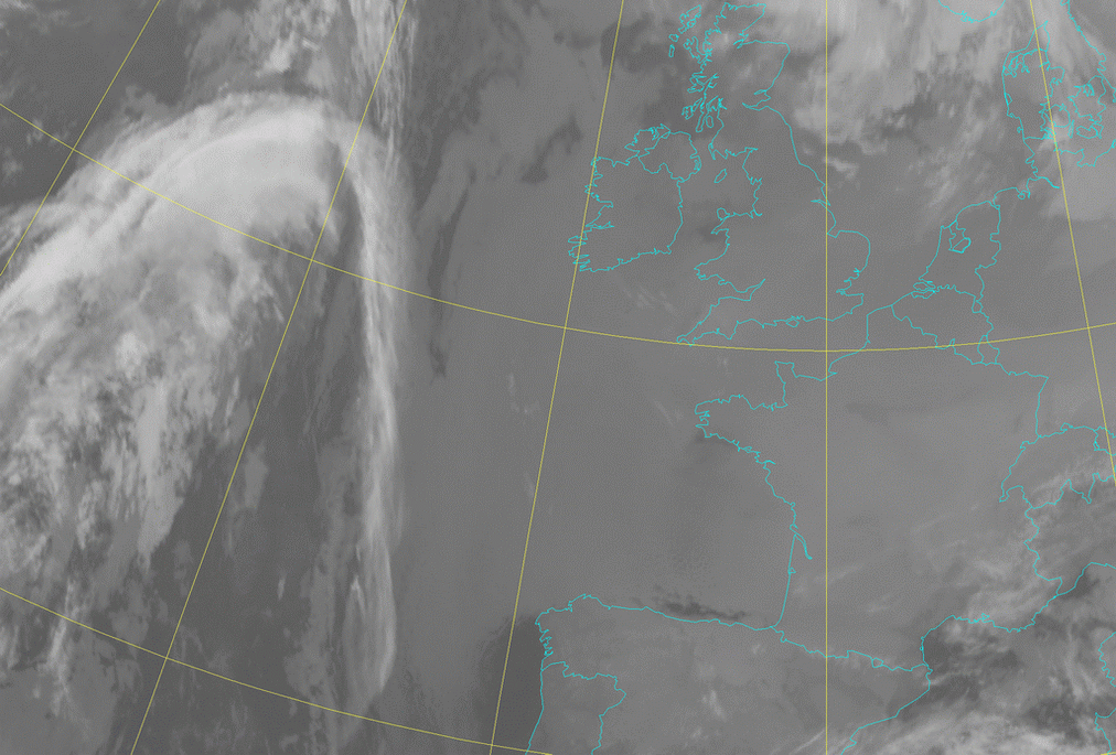
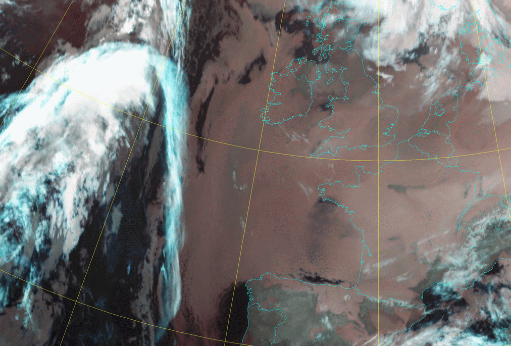
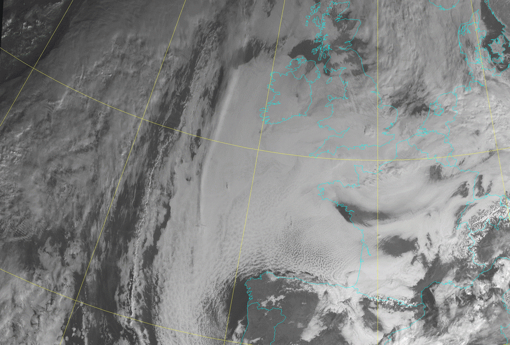
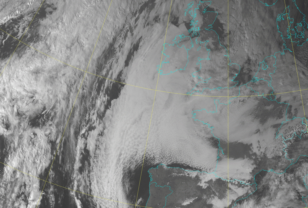
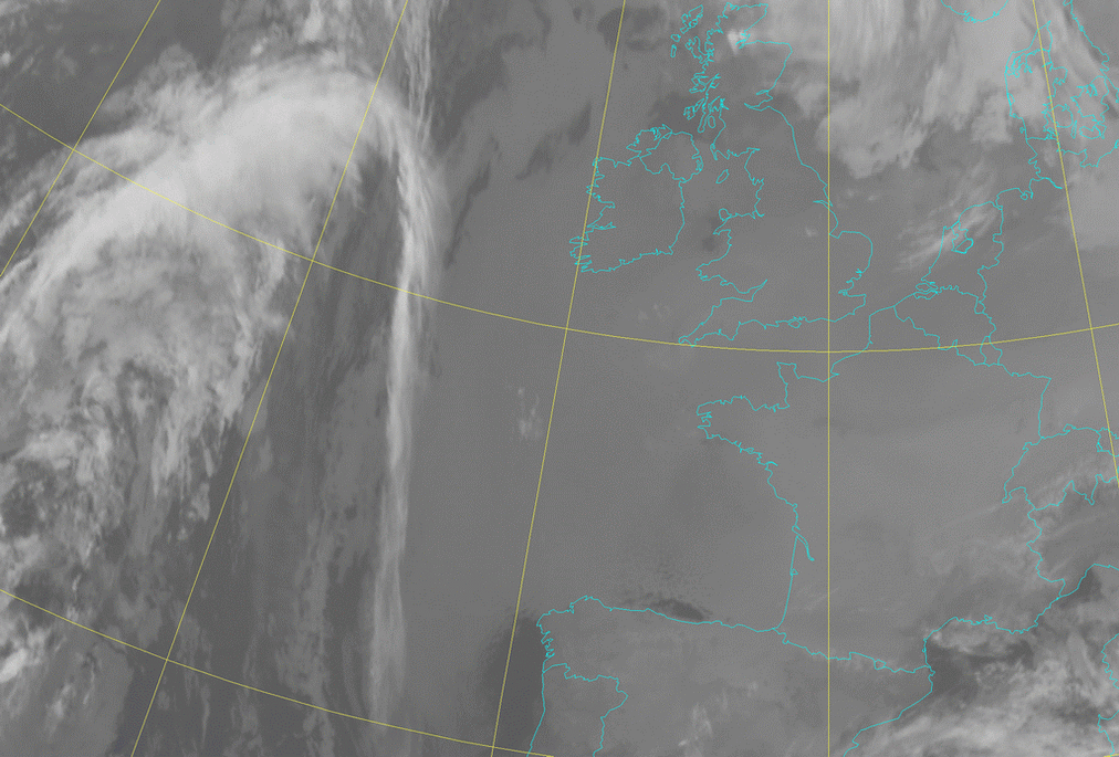
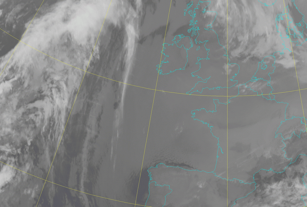
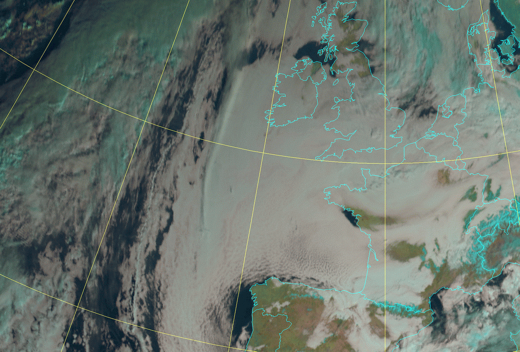
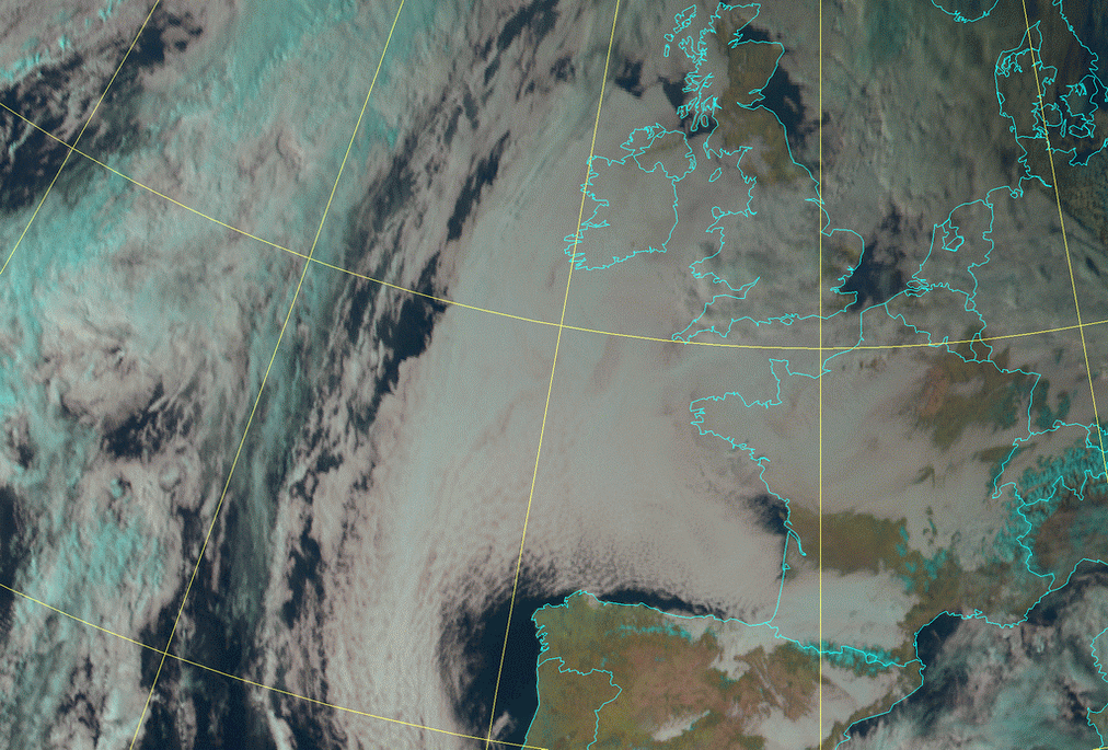
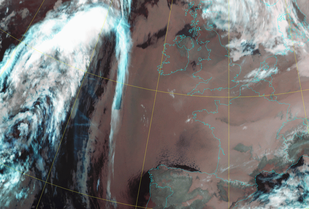
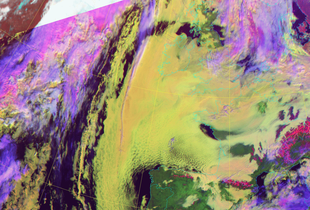
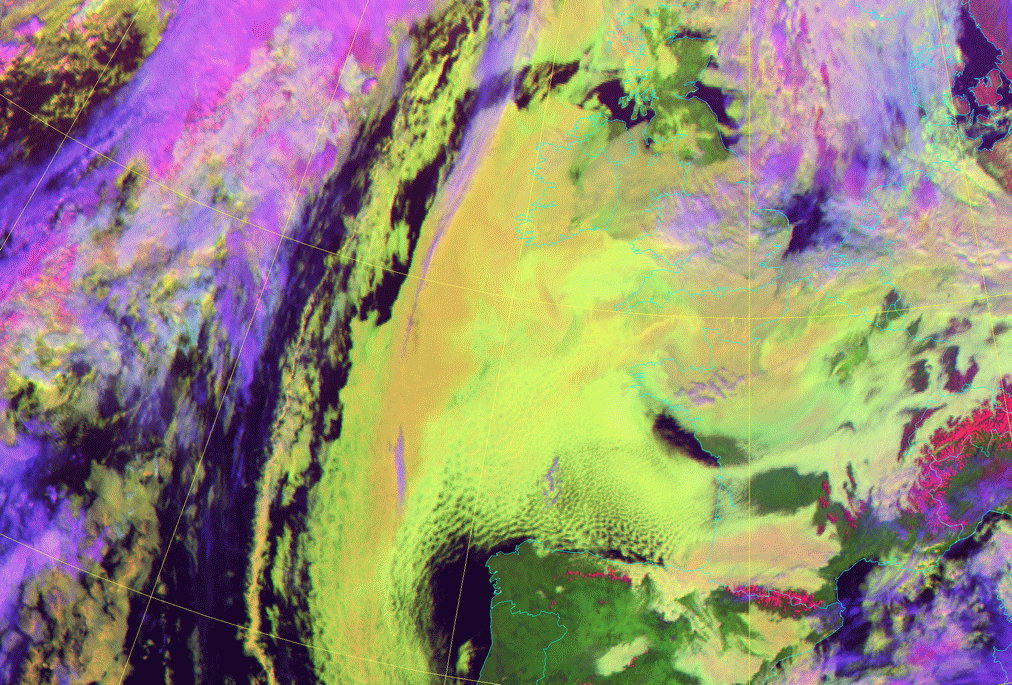
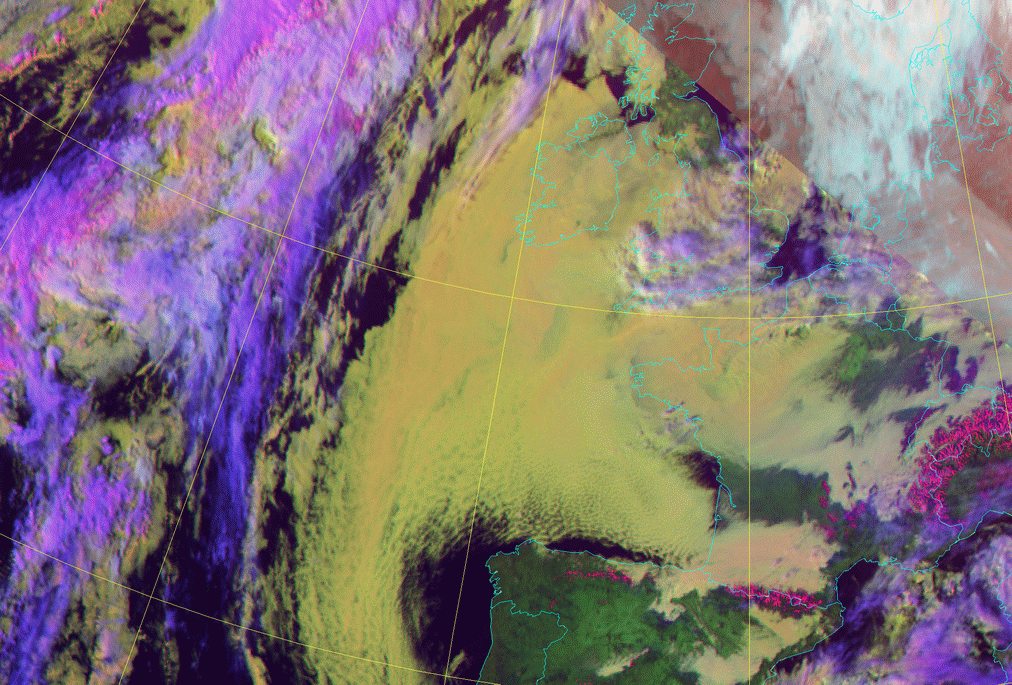
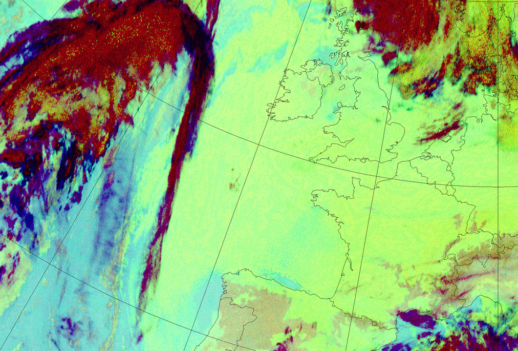
The synoptic situation is as follows: There is a rather extensive area of high pressure over Great Britain and part of the Atlantic with centre
above Ireland and above Sardinia a low can be found. Most cloudiness in the high pressure area belongs to a SC-sheet. Especially above the Bay
of Biscay the top of the cloudiness in HRVis and the daylight RGB images shows more structure. In nighttime imagery (single channels and RGB's)
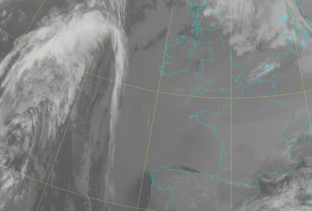
the clouds appear more smooth due to small differences in temperature.
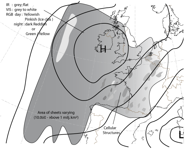
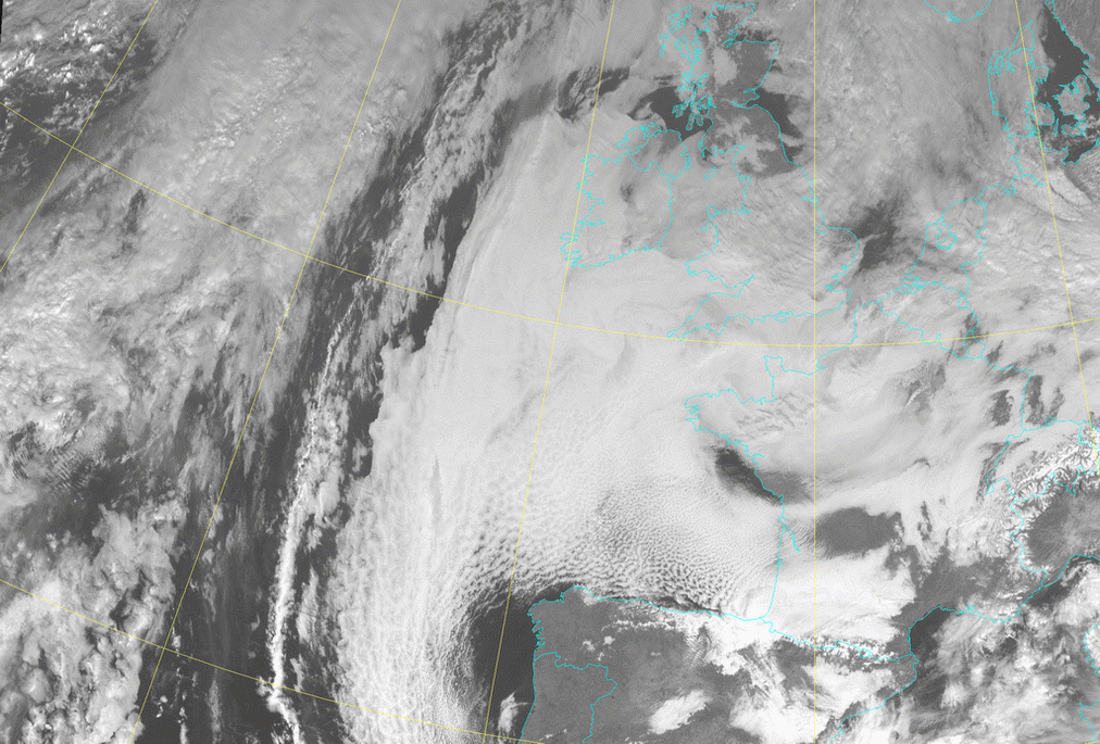
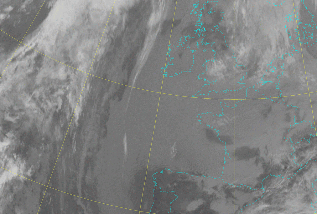
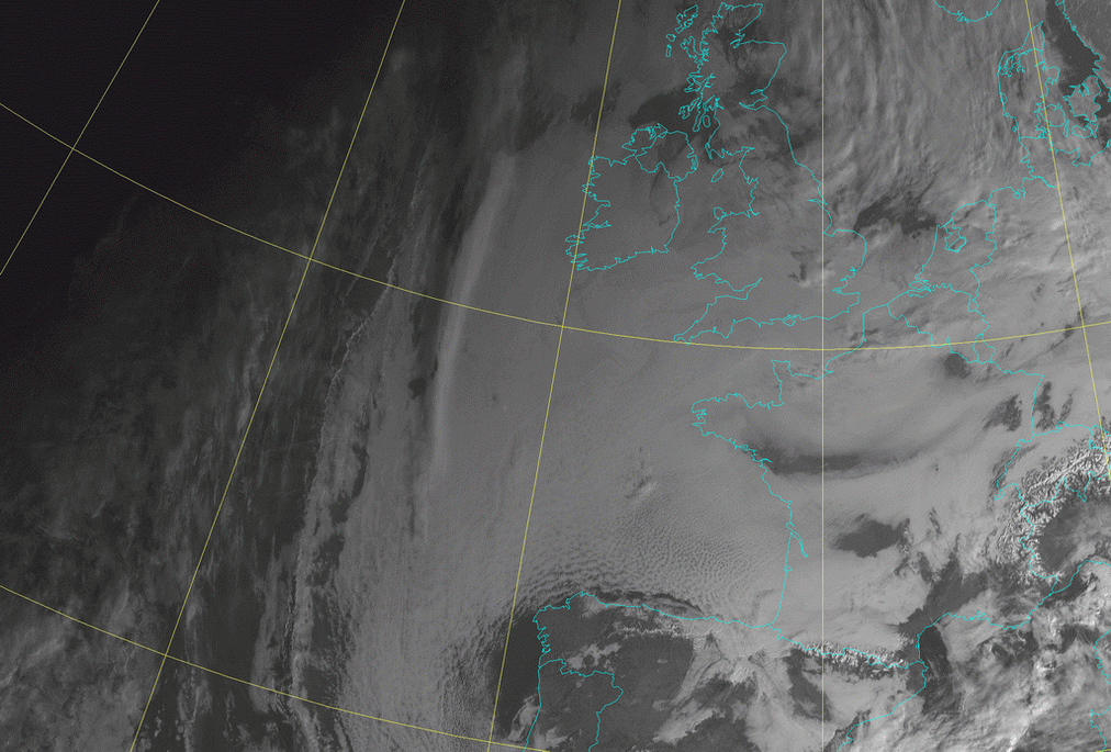
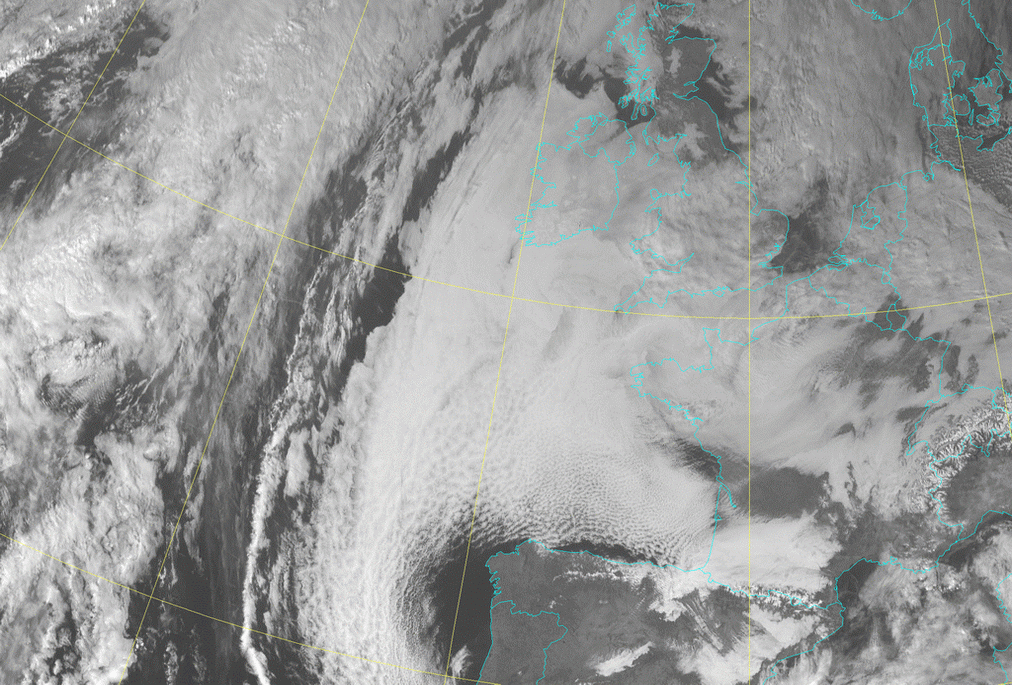
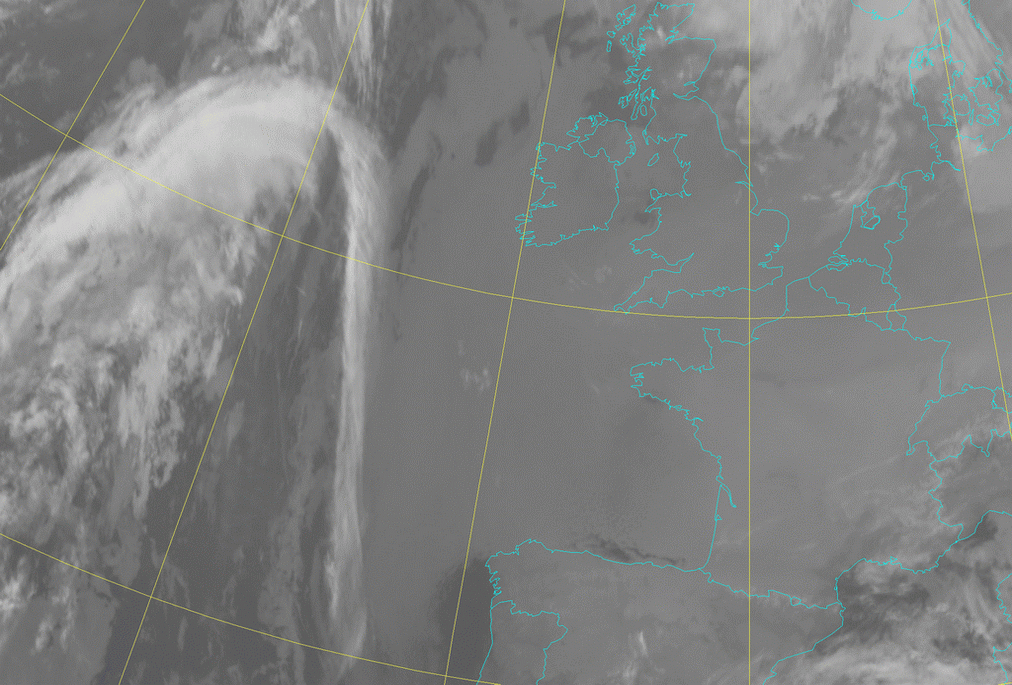
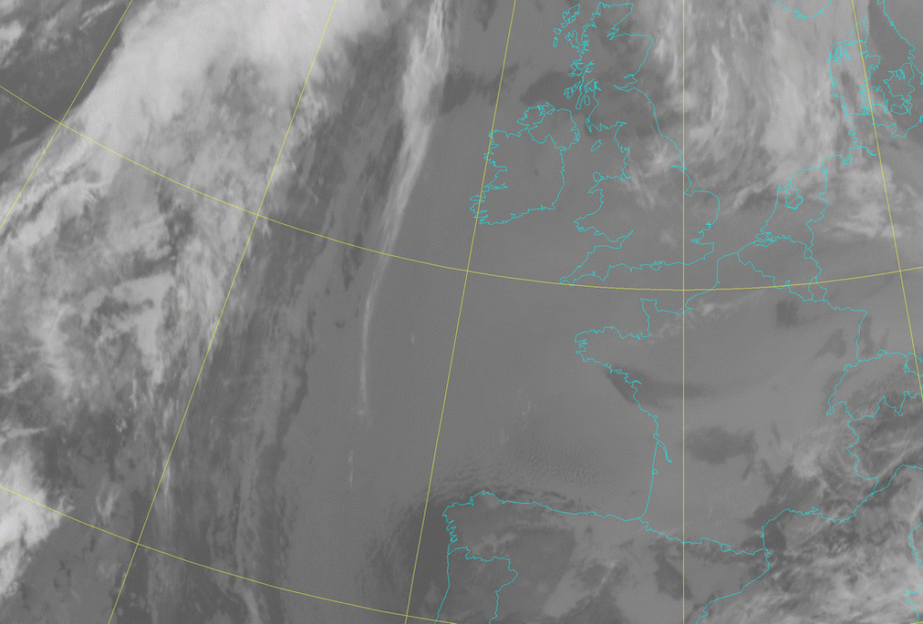
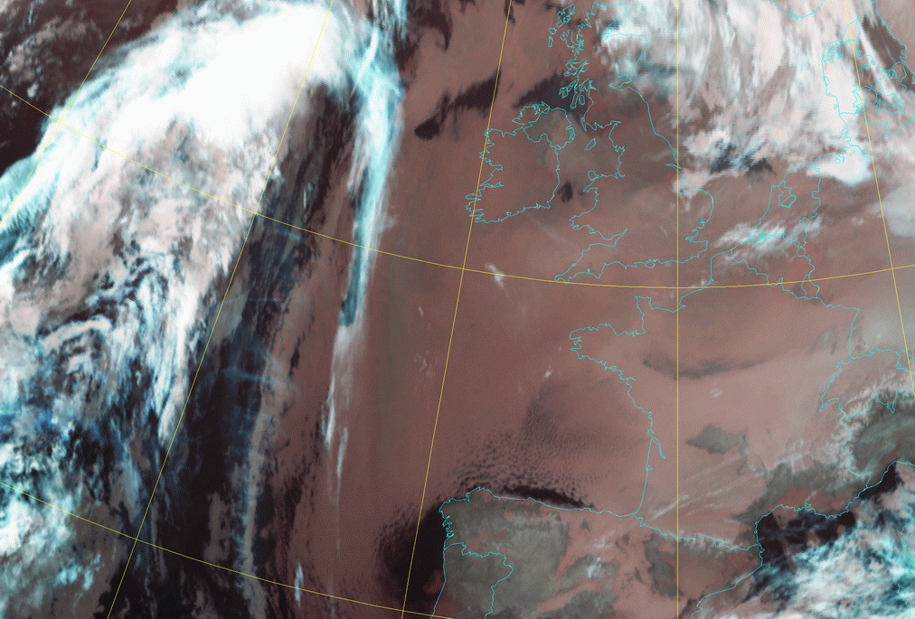
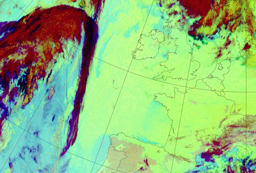
In the HRVis loop a line of high cloudiness in the west is slowly moving over the Sc Sheet. Above the Bay of Biscay and west of the coast of Portugal an easterly continental flow of relative drier air is partly dissolving the Sc cloudiness and this thinning of the clouds is seen as more structures in the clouds. In the IR loop the smooth appearance of the clouds is the most important difference with the visible loop. Of course, partly the higher accuracy of the HRVis-sensor has something to do with it, but the small temperature differences of the cloud tops is the most important reason.
|
04 February 2006/12.00 UTC - Meteosat 9 HRVis image
|
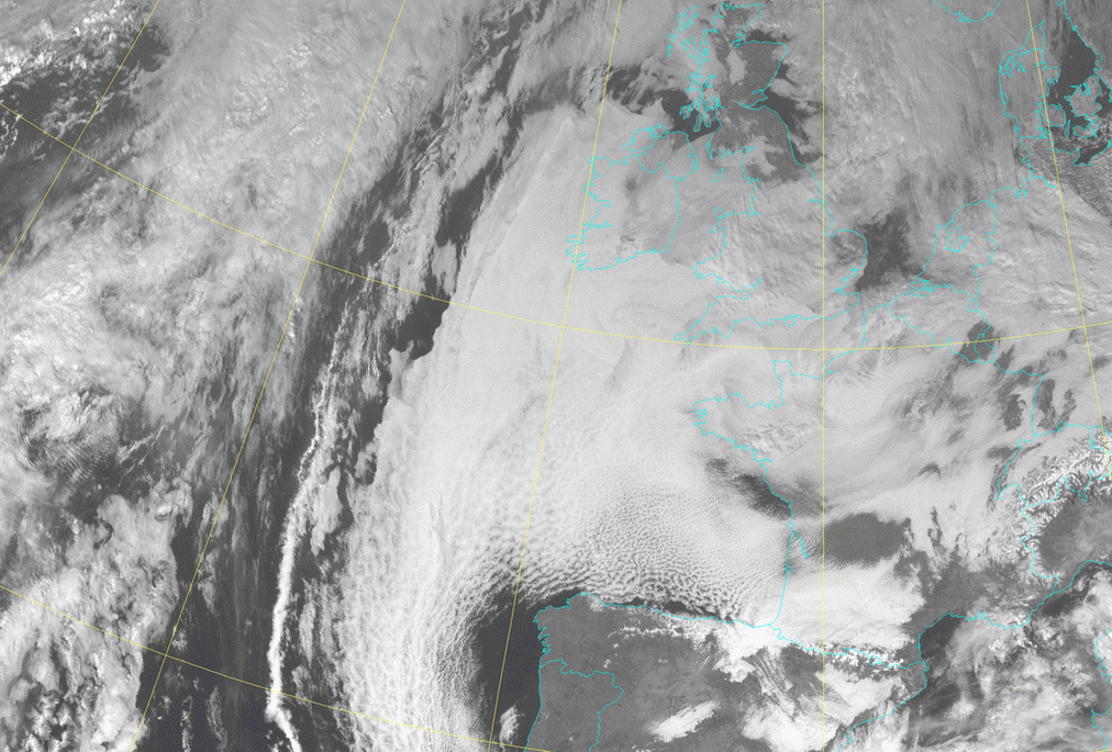
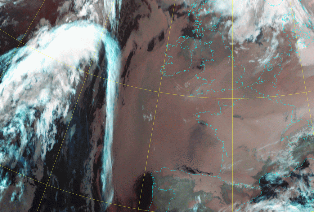
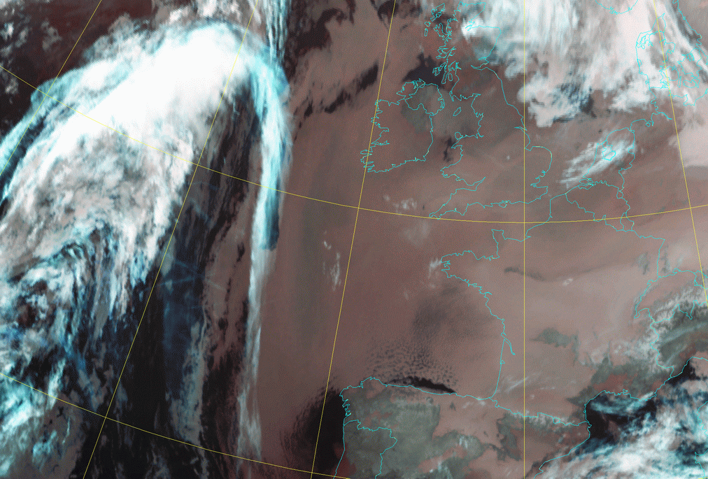
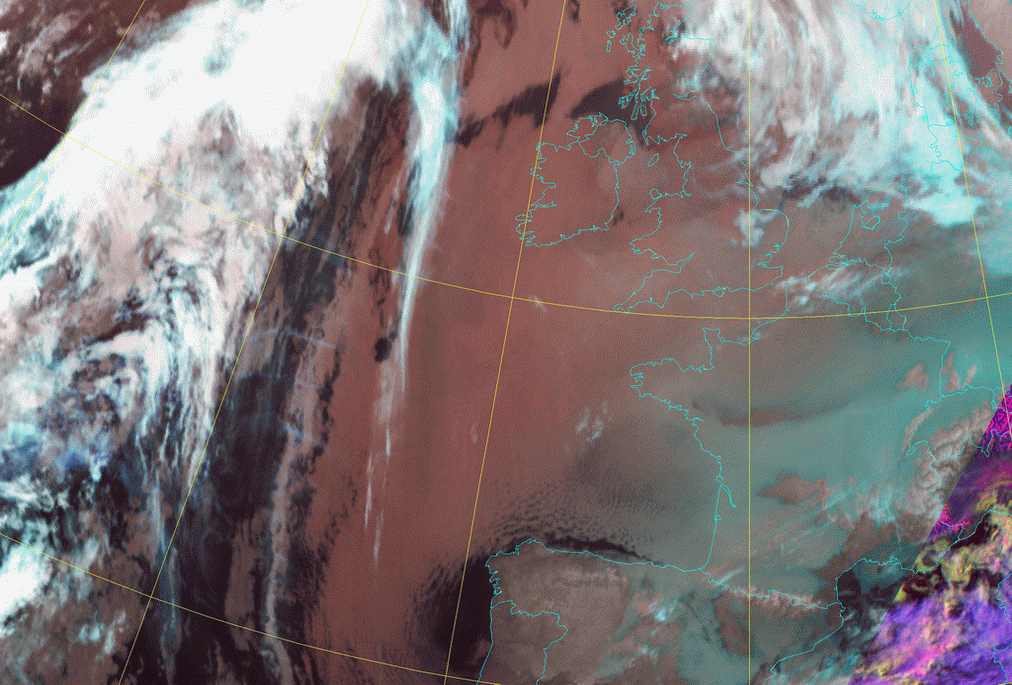
04 February 2006/12.00 UTC - Meteosat 9 IR 10.8 image
|
|
|
|
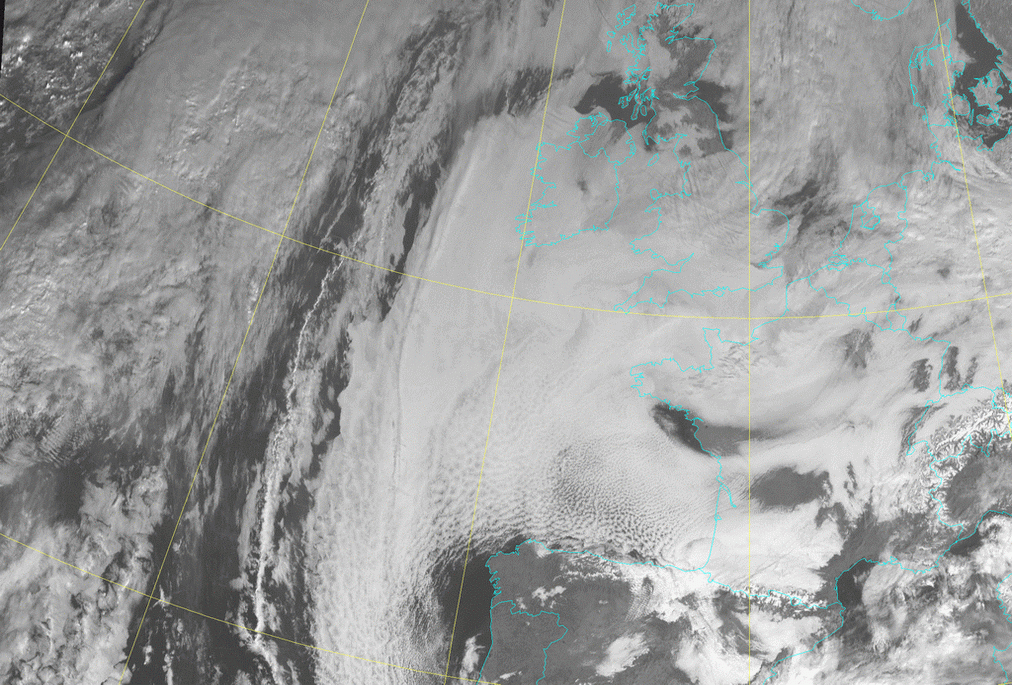
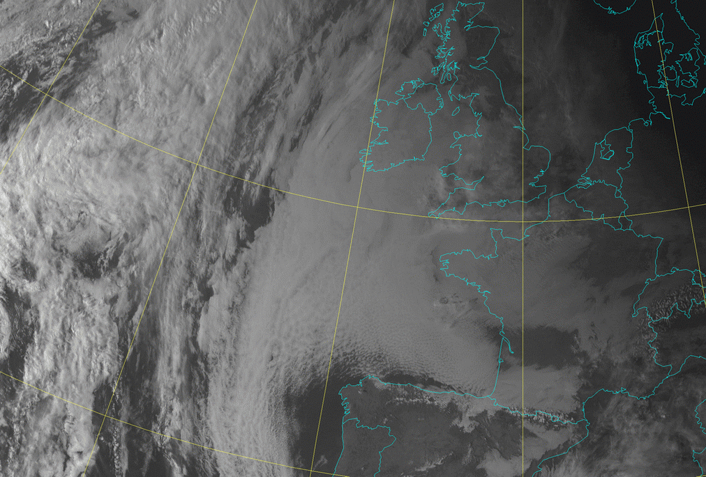
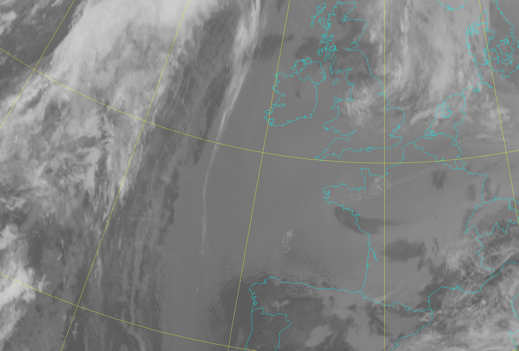
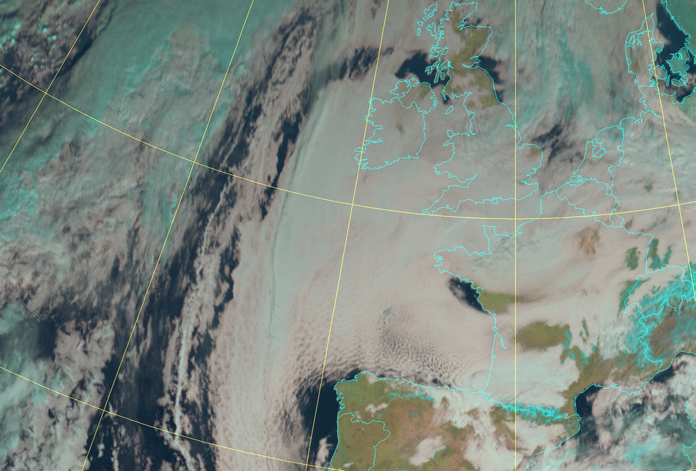
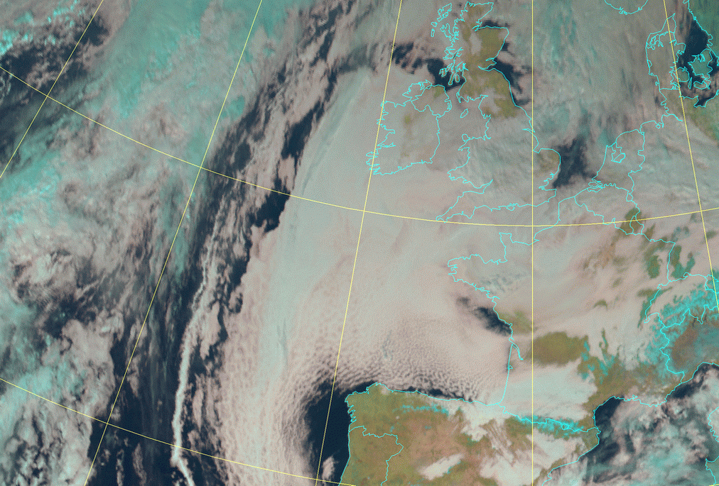
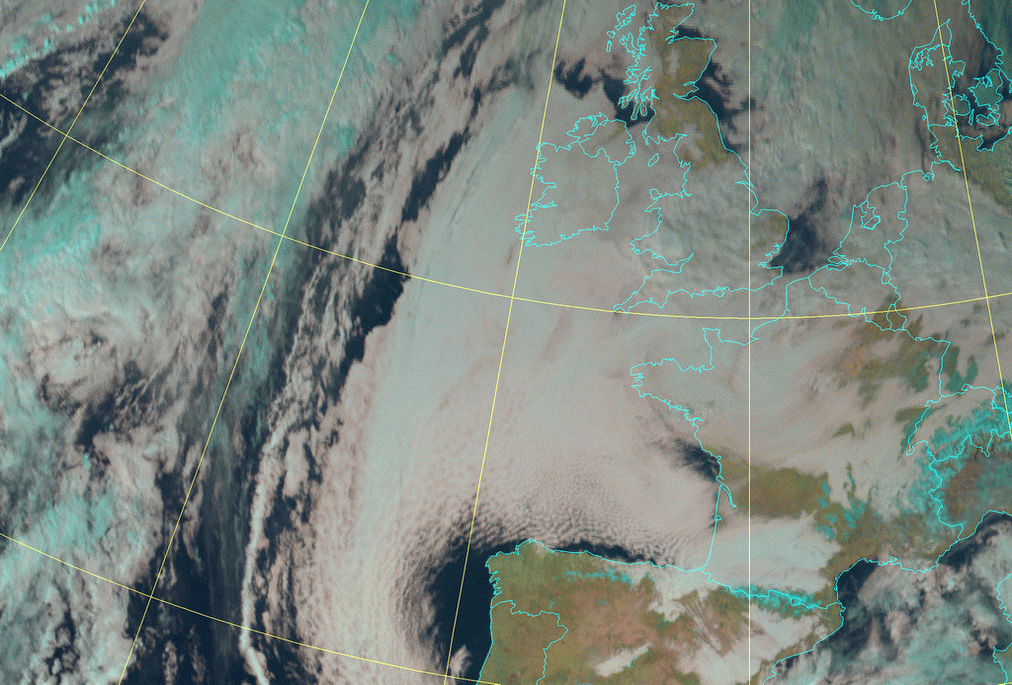
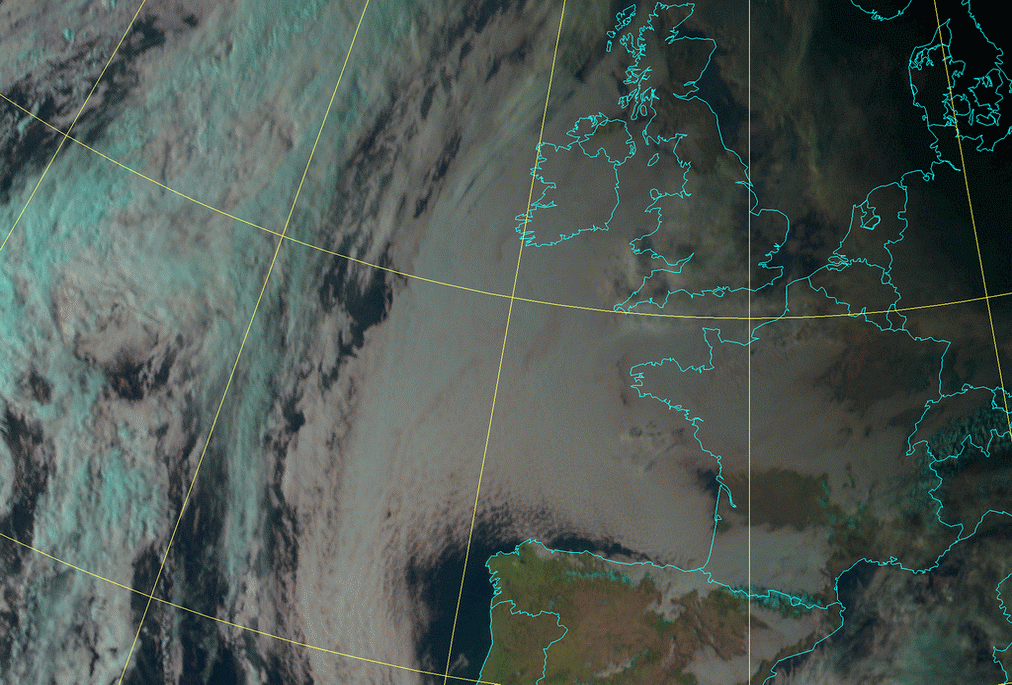
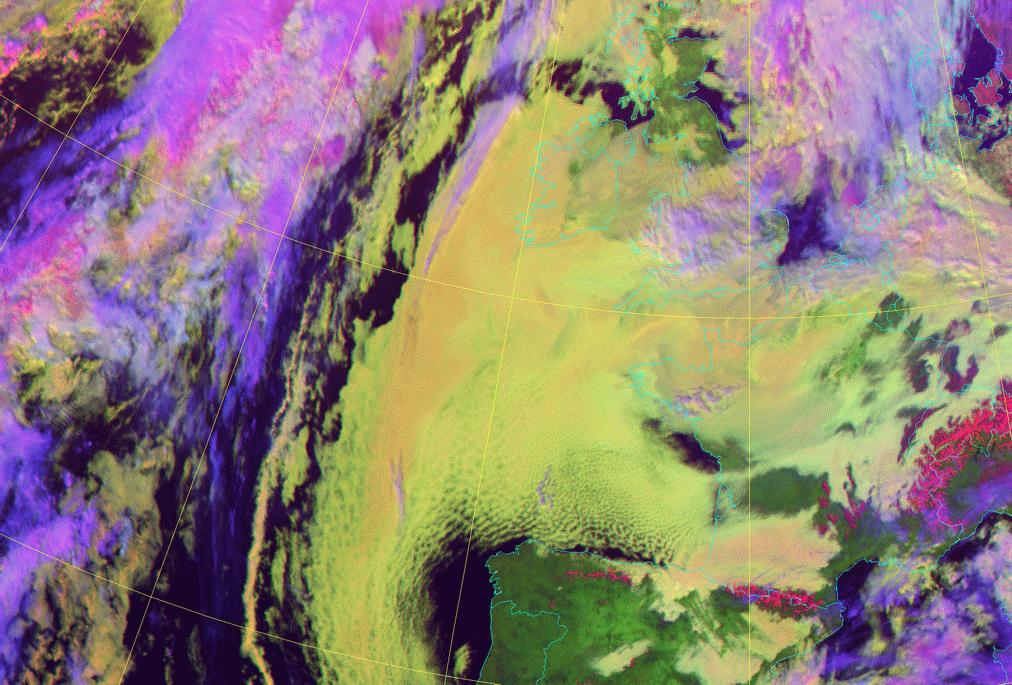
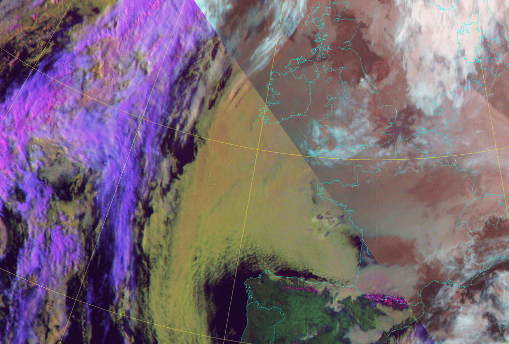
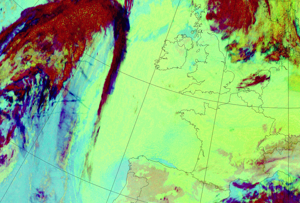
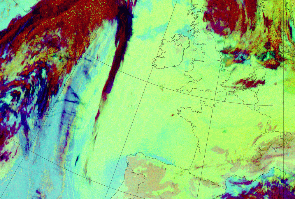
04 February 2006/08.00 UTC - Meteosat 9 HRVis image; 04 February 2006/08.00 - 04 February 2006/17.00 UTC hourly image loop
|
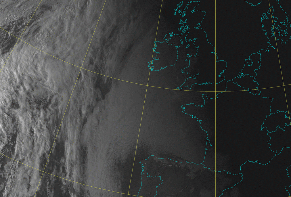
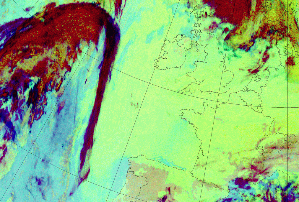
04 February 2006/02.00 UTC - Meteosat 9 IR 10.8 image; 04 February 2006/02.00 - 04 February 2006/12.00 UTC hourly image loop
|
|
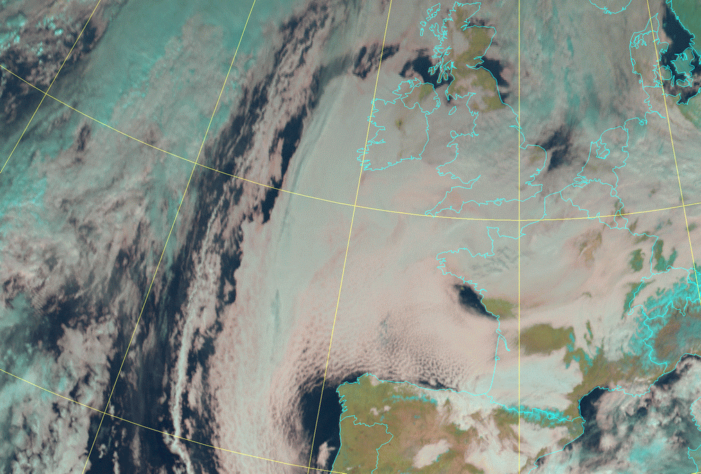
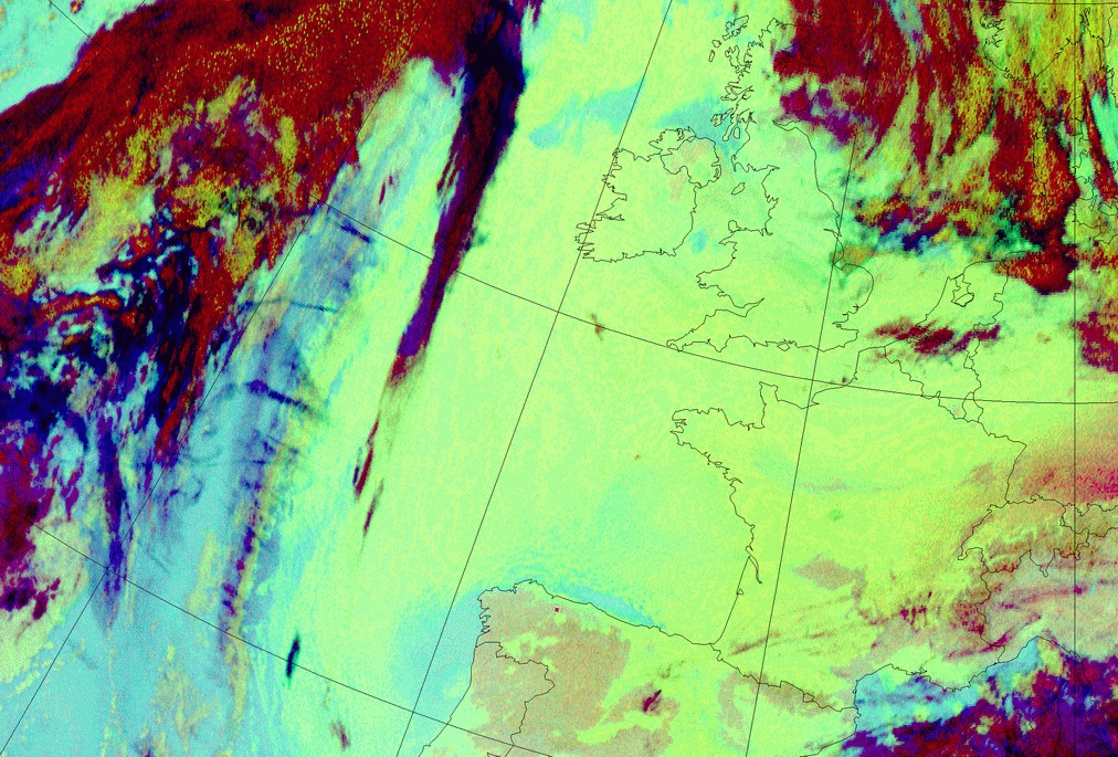
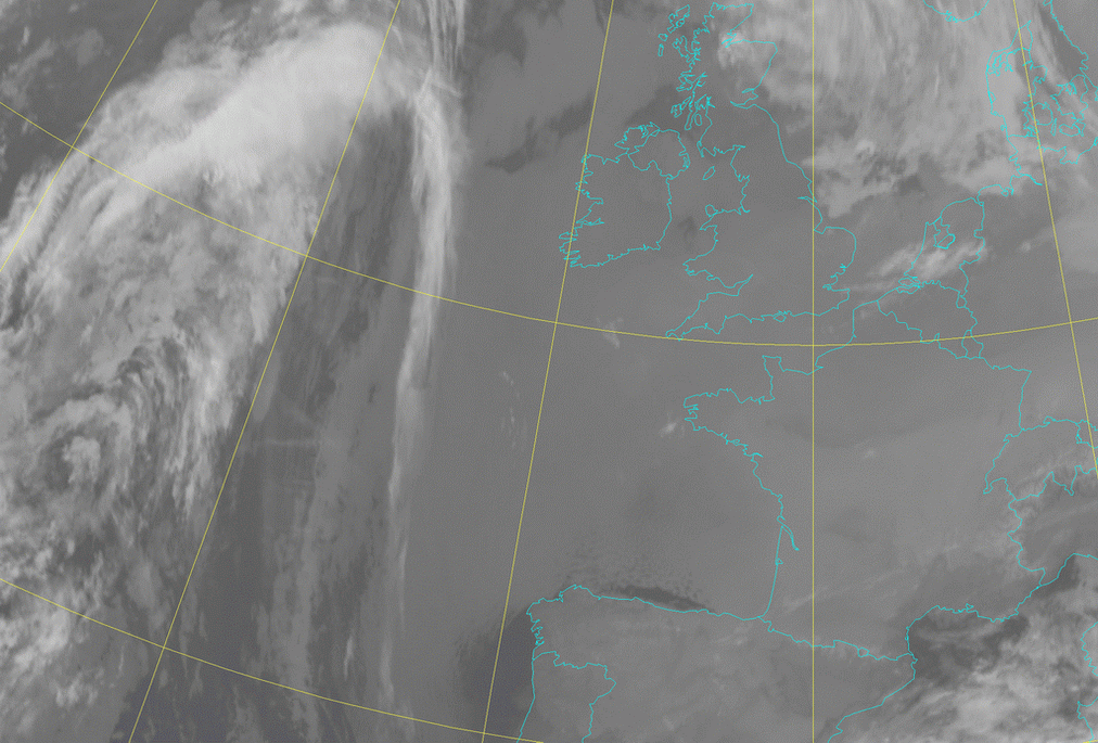
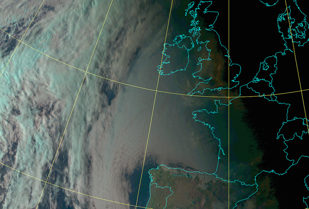
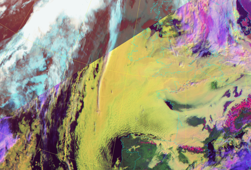
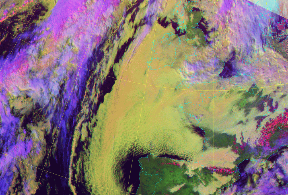
04 February 2006/12.00 UTC - Meteosat 9 (1.6;0.8;0.6) RGB image
|
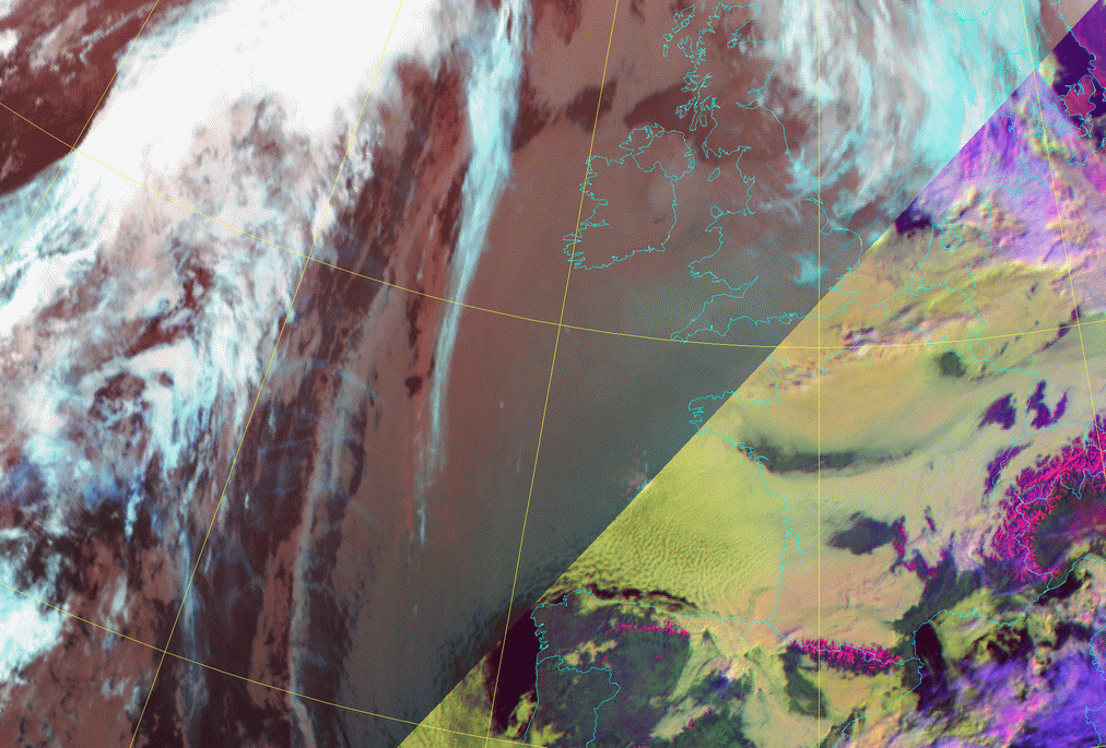
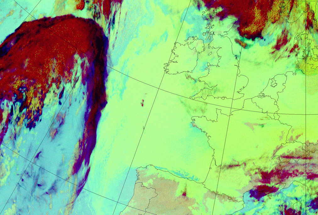
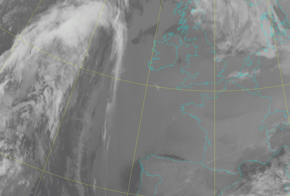
04 February 2006/09.00 UTC - Meteosat 9 (3.9;10.8;12.0 and HRVis;1.6;10.8) Combi-RGB image
|
|
|
|
04 February 2006/08.00 UTC - Meteosat 9 (1.6;0.8;0.6) RGB image; 04 February 2006/08.00 - 04 February 2006/17.00 UTC hourly image
loop
|
04 February 2006/02.00 UTC - Meteosat 9 (3.9;10.8;12.0 and HRVis;1.6;10.8) Combi-RGB image; 04 February 2006/02.00 - 04 February
2006/16.00 UTC hourly image loop
|
The left-hand side loop shows the whitish SC Sheets with a line of superimposed high cloudiness (Cyan) in the west. The second loop (right-hand side) shows the combination of low clouds during darkness (reddish) and yellowish during daytime. The daytime images show more structures due to the fact that the HRVis has a higher resolution and the differences in albedo are also significant. The pinkish colour during daytime means that the SC cloud tops, at least partly, consist of ice particles.
|
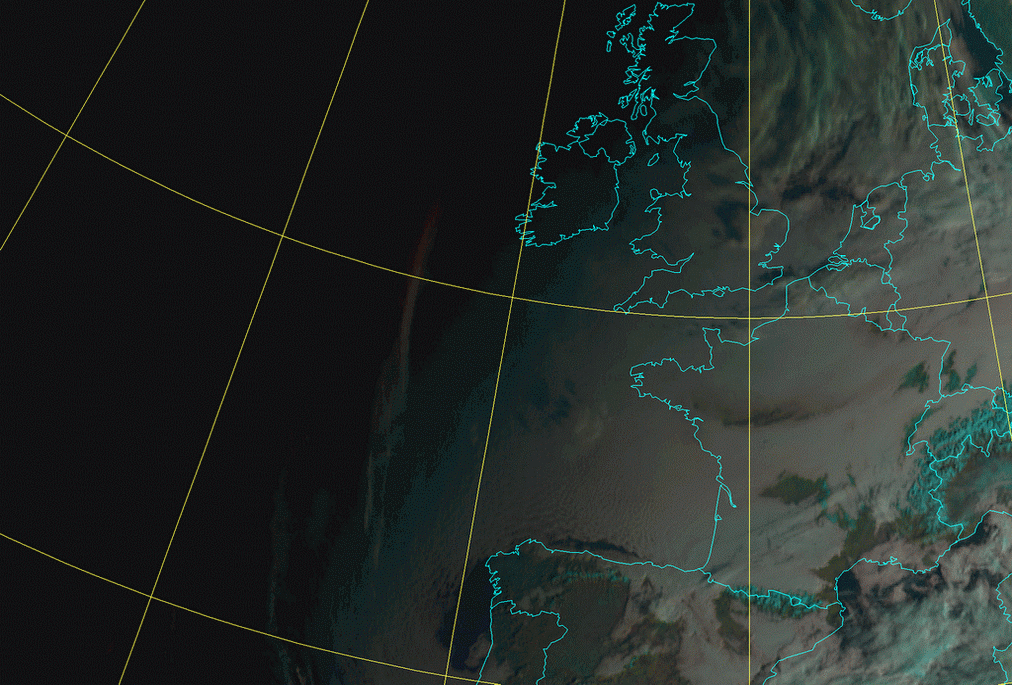
04 February 2006/00.00 UTC - Meteosat 9 Night Microphysics RGB image; 04 February 2006/00.00 - 04 February 2006/07.00 UTC hourly
image loop
|
04 February 2006/07.00 UTC - Meteosat 9 Night Microphysics RGB image
|
|
In the Night Microphysics RGB a greenish area of low clouds especially above sea is seen. In the right-hand image loop a band of high cloudiness (reddish) is superimposed over the west part of the area and is slowly moving to the east and is opaque to the clouds below.
Appearance in AVHRR imagery
- AVHRR imagery can reveal some detailed structure of stratocumulus clouds. Texture within the cloud top, e.g. cellular patterns, waves and ripples, etc., are easy to detect with combined images NOAA 124 and NOAA 345, however, even the individual channels show these small-scale patterns quite well, especially at low sun angles (shadows enhance contrasts between cloud elements).
- Cloud streets within stratocumulus are also often easy to detect in AVHRR imagery.
- During daytime combined image NOAA 124 shows Sc Sheets in yellow or light yellow colours. This combination sometimes also helps in differentiating between stratus and stratocumulus, as stratus clouds are deeper yellow, even brownish yellow (compare Fog and Stratus - Cloud structure in satellite images ).
- During nighttime the difficulties in differentiation between cloudy and cloud-free areas become evident, if the cloud-top temperatures are about the same as the surface temperature on surrounding cloud-free regions. In nighttime NOAA 345 combined images Sc Sheets have a dark red appearance. Differences between the colour in Stratus and stratocumulus are small, but stratocumulus tops, being warmer, have a slightly lighter red appearance compared to stratus clouds.
- Diurnal variations in cloud top structure can easily be seen in AVHRR imagery (see previous example). This applies mostly to summertime cases; during wintertime continental stratocumulus tops have a flatter appearance, both day and night.
|
12 May 1998/11.07 UTC - NOAA Ch2 image
|
12 May 1998/11.07 UTC - NOAA Ch4 image
|
|
|
|
|
|
12 May 1998/11.07 UTC - NOAA RGB image (Channel 1, 2 and 4)
|
12 May 1998/12.00 UTC - radio sounding Jokioinen
|
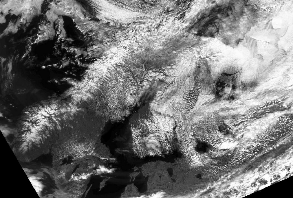
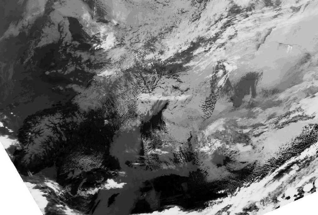
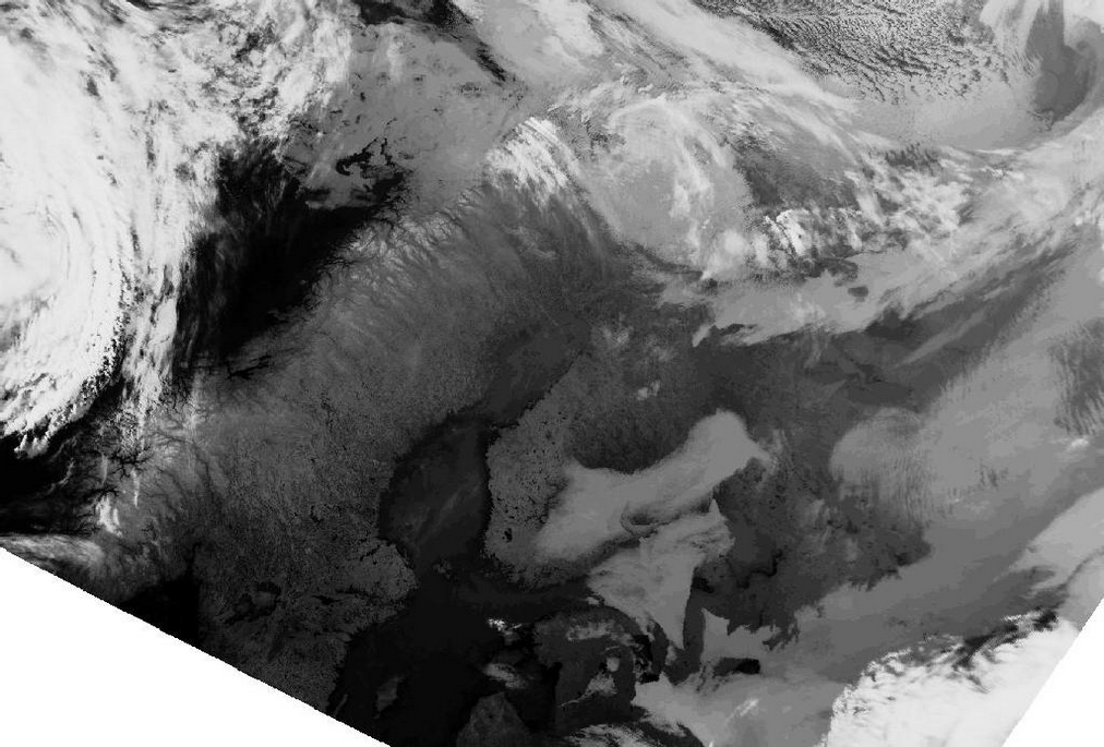
The images show extensive Sc Sheets over eastern and northern Finland.
There is also some mid-level cloudiness, which can be seen as colder patches in the IR image ( above right image top; Ch4). The appearance of the Sc Sheets in the IR image is quite homogeneous indicating uniform cloud top temperatures.
The VIS image ( above left image top; Ch2) shows more details. The brightness of the clouds varies remarkably. A cellular appearance is
apparent in the VIS image, which is a typical feature for daytime stratocumulus over land.
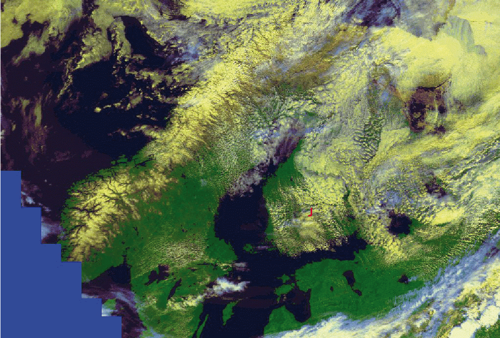
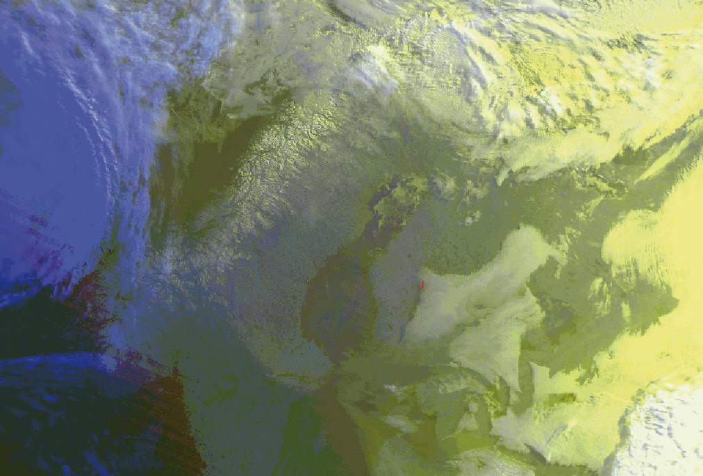
In the RGB image ( above left image bottom) the Stratocumulus is clearly yellowish in colour. The detection of small-scale features, such as
the Cloud Streets in southern Finland, is also easy with the help of this kind of imagery.
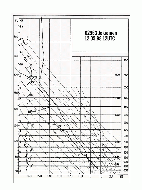
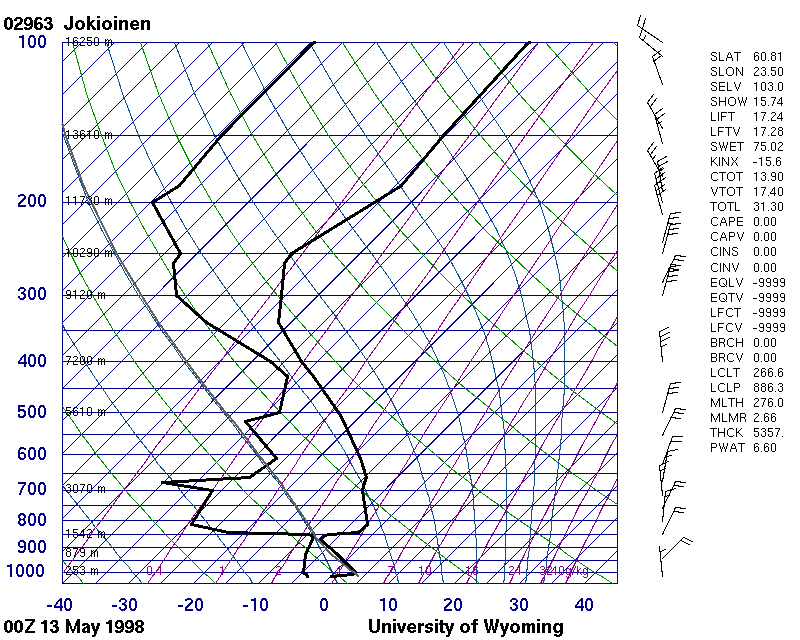
The sounding of Jokioinen (denoted with J in RGB image) (above right image bottom) shows the vertical structure of the atmosphere within the
Stratocumulus area. The thickness of the Sc clouds is approximately 300 meters. The temperature inversion is quite weak at this stage.>
|
13 May 1998/02.40 UTC - NOAA Ch2 image
|
13 May 1998/02.40 UTC - NOAA Ch4 image
|
|
|
|
|
|
13 May 1998/02.40 UTC - NOAA RGB image (channel 1, 2 and 4)
|
13 May 1998/00.00 UTC - radio sounding Jokioinen
|
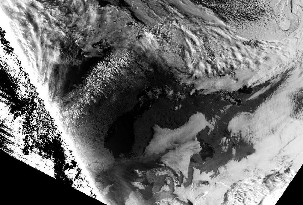
The early morning images of 13 May 1998 show further development of the cloud sheet. Separate Sc Sheets can be found over southern Finland,
Karelia and Estonia. Cloud tops have now a much flatter appearance compared to the daytime images, and cellular features have totally vanished
during the night. The edges of the Sc Sheet are also quite sharp.
The corresponding sounding for Jokioinen at 00.00 UTC is also shown (above bottom right image). It shows that Stratocumulus has become quite
thin, with its vertical extent of 100 - 300 meters, and temperature inversion just above the cloud sheet has increased significantly. Dry
subsiding air above the Sc Sheet is dissipating the sheet, which totally dissolves within only a few hours.
Especially during wintertime the Polar orbiting imagery has great advantages above the Meteosat-images. Due to the higher pixel resolution of
the AVHRR-imager the lack of enough sunlight is partly compensating Therefore an other example of SC-sheets in the northern latitudes is
quite good seen in the images below.
|
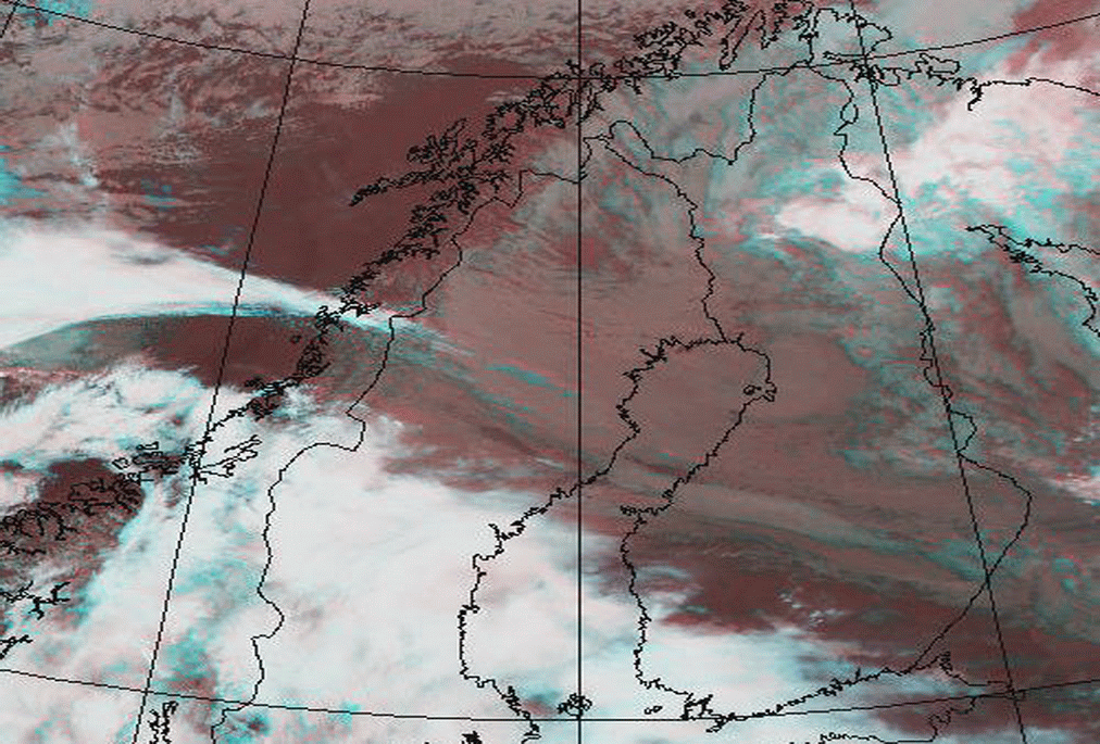
02 October 1999/13.44 UTC - NOAA RGB image (Channel 1, 2 and 4)
|
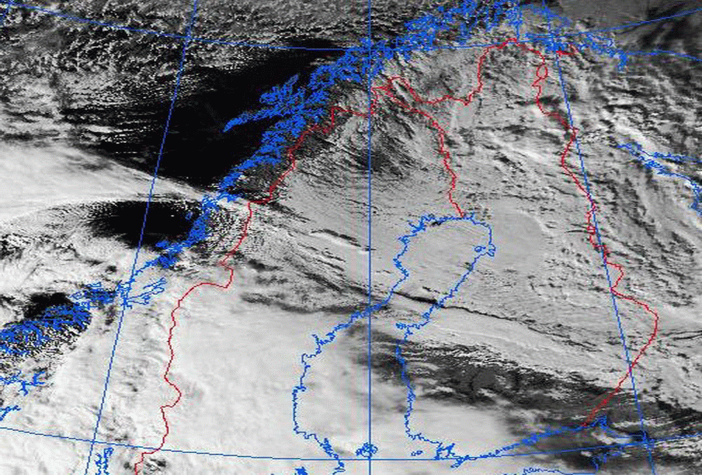
02 October 1999/13.44 UTC - NOAA RGB image (Channel 3, 4 and 5)
|
|
|
|
|
|
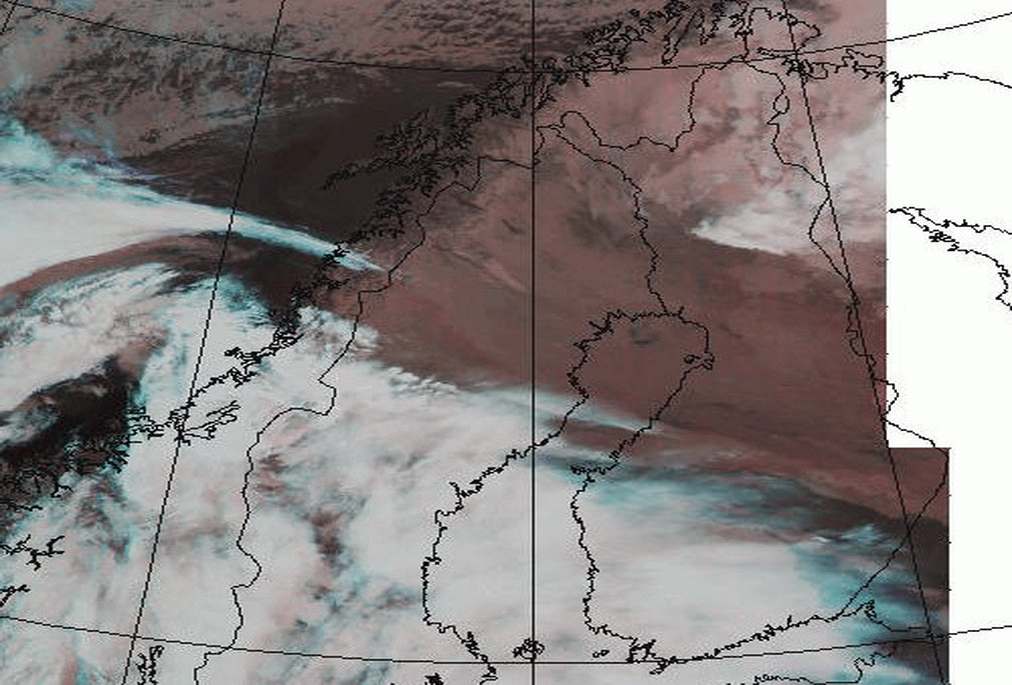
02 October 1999/13.44 UTC - NOAA Ch2 image
|
02 October 1999/16.04 UTC - NOAA RGB image (Channel 3, 4 and 5)
|
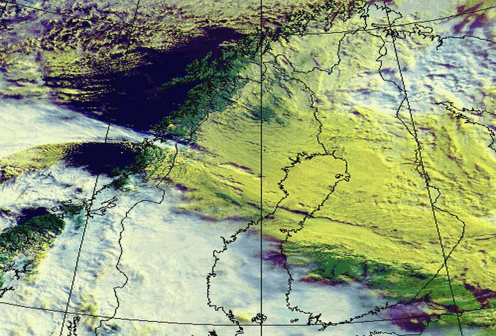
The satellite images show an extensive Sc Sheet over Northern Scandinavia. Due to low sun elevation the varying texture within the cloud top is easily seen in visible 0,8 µm (Channel 2) image. Combined image NOAA 124 shows the Sc Sheet in a light yellow colour, while combined image NOAA 345 shows the cloud sheet in light reddish colours. The night-time NOAA 345 image (bottom left) is included for comparison.