Table of Contents
Cloud Structure In Satellite Images
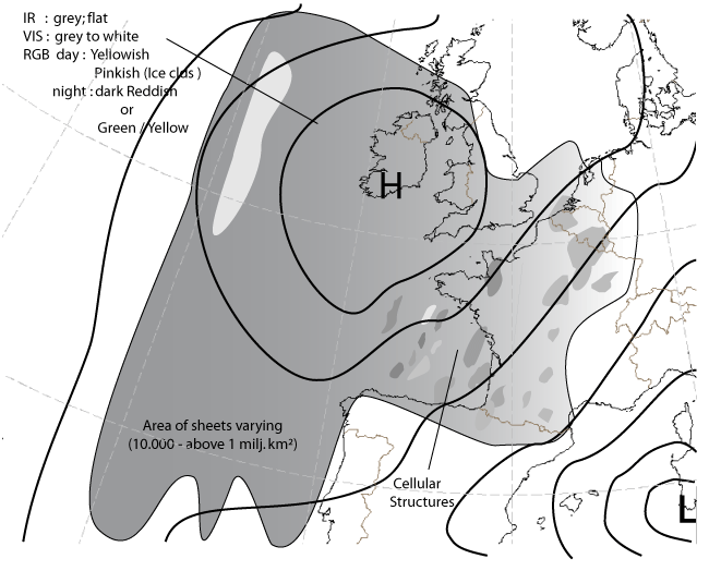
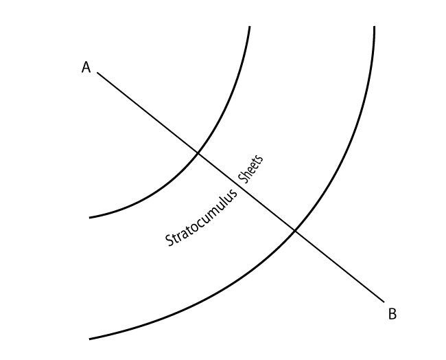
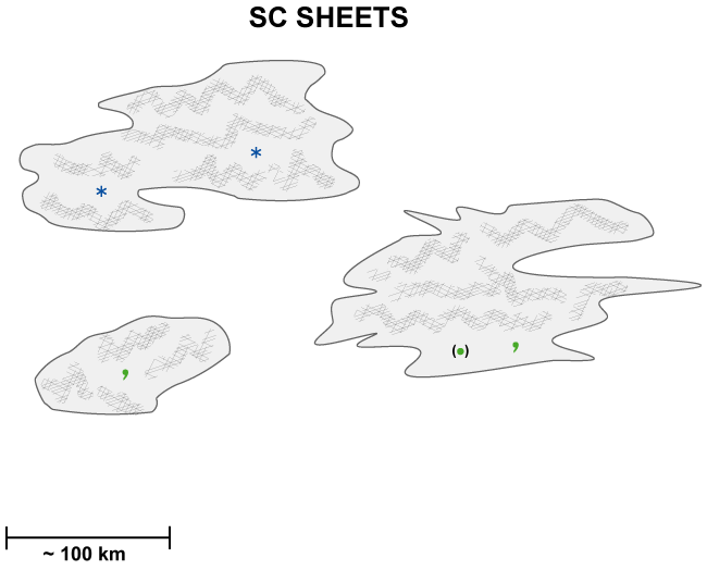
Stratocumulus sheets are shown in satellite images as separate cloud sheets, which vary in size from relatively small (around 10.000 - 50.000 km2) areas to extensive, synoptic scale features (up to and above 1.000.000 km2). Especially in higher latitudes Stratocumulus (hereby referred as Sc) Sheets have a relatively homogeneous appearance in IR channels of geostationary satellites. Polar orbiting satellites and the HRVis of MSG reveal a great deal of substructures (cellular-, roll- or ripple-like details) in the texture of the Sc Sheets.
The edges of Sc Sheets can be very sharp, but normally they are more ragged, especially when the cloud sheet starts to break up. The dissolving of even an extensive cloud sheet can happen very quickly (in hours), when radiative or turbulent mixing processes become favourable. Thinness of the Sc layer helps in rapid dissolving of the cloud layer over land. The Sc Sheet can also have a different appearance during the day than during the night. The underlying surface also has an effect on the appearance of cloud sheet; for example, over the ocean the clouds have a cellular-like appearance arising from spatially organized convection.
Appearance in METEOSAT SECOND GENERATION imagery
IR10.8 µm imagery:
- In the IR image the grey shades of the cloud shield are usually grey or dark grey indicating relatively low (warm) cloud tops.
- The appearance of Sc Sheets is smoother in IR than in VIS, which is due to the uniform cloud top height.
- The detection of cloud sheets using the IR image can sometimes be difficult if temperature difference between cloud tops and surface is small. Temperature difference can even be reversed, that is, cloud tops can show warmer temperature than surrounding cloud-free surface areas causing a black appearance of the cloud. This is especially the case in high latitudes during the cold season, when radiative cooling of surfaces beneath cloud-free areas can be remarkably strong.
HRVis, Vis0.6 and Vis0.8 µm imagery:
- In the HRVis, Vis0.6 m and Vis0.8 m images the clouds are of varying brightness indicating thickness differences of the cloud layer. The grey shades of the Sc Sheet vary usually between white to grey depending on the thickness of the cloud sheet and sun elevation.
- The cellular-like pattern is common for Sc Sheets (in contrast to Fog or Stratus shields, which have a flatter appearance).
WV6.2 and 7.3 µm imagery:
- In the WV channels the Sc Sheets are normally invisible, due to the limited vertical extent of Sc Sheets (usually only up to 1 - 2 km).
- WV imagery however, can indirectly be useful: the horizontal advection of upper-level moist air (although without associated clouds) over the Sc Sheets may change the radiation balance of clouds, further leading to dissolving of the cloud sheet.
RGB imagery
"Daytime Natural Colours":
The day natural colours RGB NIR1.6, Vis08, Vis06 µm can be used for low clouds (SC, St and Fog) but also for snow, dust and vegetation. This RGB is only used during daytime
- Sc cloudiness as whitish-pinkish.
- Ice clouds are cyan colored
- Vegetation is green.
"Nighttime Microphysical":
The "nighttime microphysical" imagery RGB 12.0 - 10.8, 10.8 - 3.9, 10.8 µm has only infrared channels. The 3.9 channel is used
as an infrared channel and this combination can only used during nighttime.
- The low level clouds are seen in these images as light yellowish/greenish
- High clouds are reddish with some yellow spots due to noise in the 3.9 channel
"Combination RGB imagery":
The combination RGB as the daytime RGB, (HRVis, NIR1.6 and IR10.8 µm) and the nighttime RGB (using channels 3.9, 10.8 and 12.0 µm)
greatly helps in identifying low level Sc Sheets.
- During daytime part of the RGB-images Sc Sheets are seen as .
- yellowish or yellowish-white clouds or
- Cloud tops with ice particles will appear as pinkish
- During nighttime RGB images Sc Sheets have a dark red appearance
In the schematic below the appearance in the different images are mentioned. This schematic is more or less corresponding to the satellite
images.
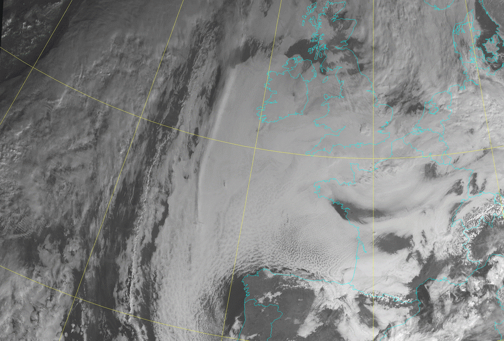
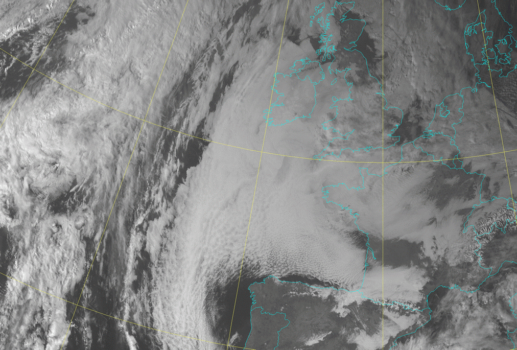
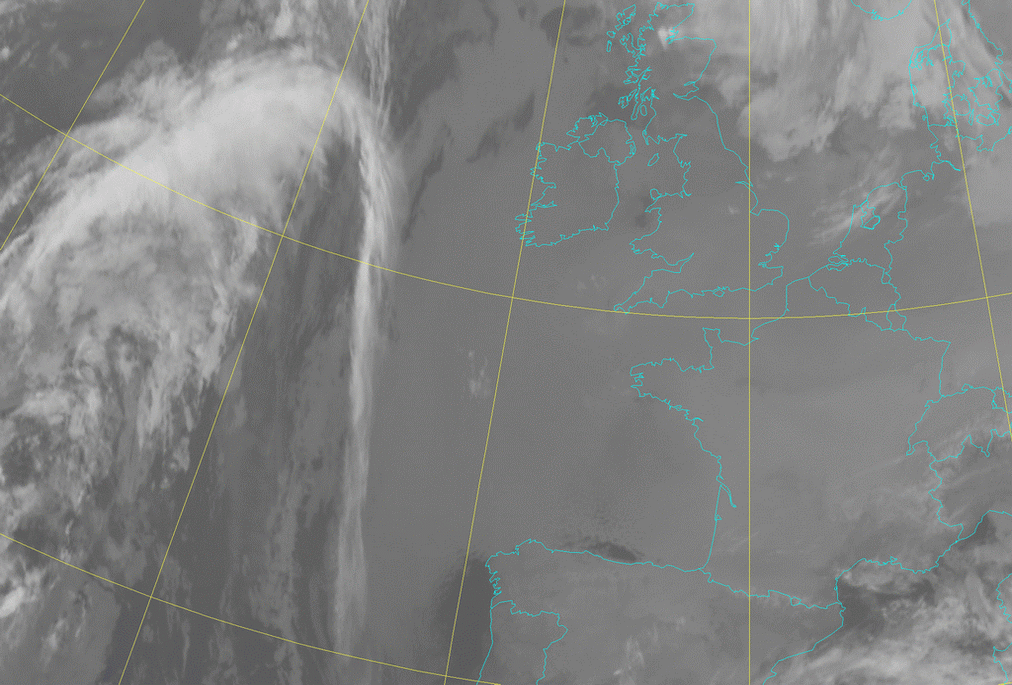
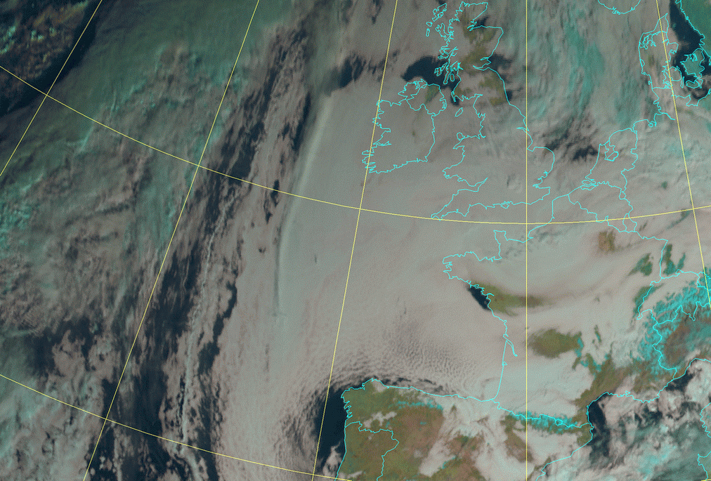
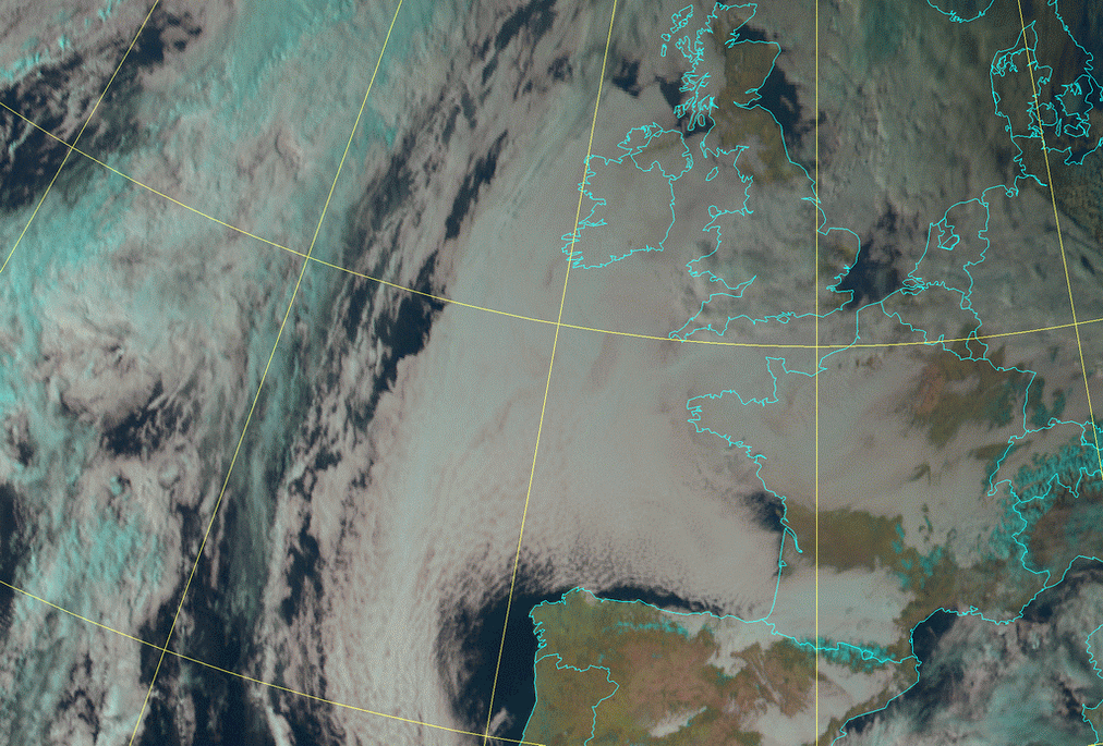
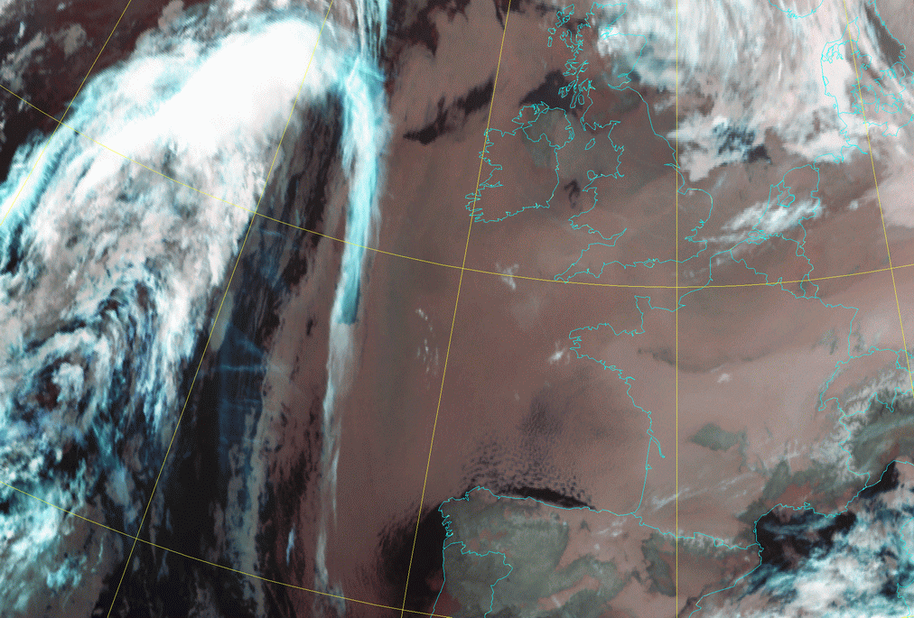
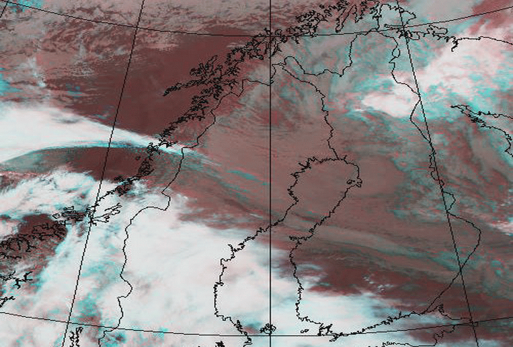
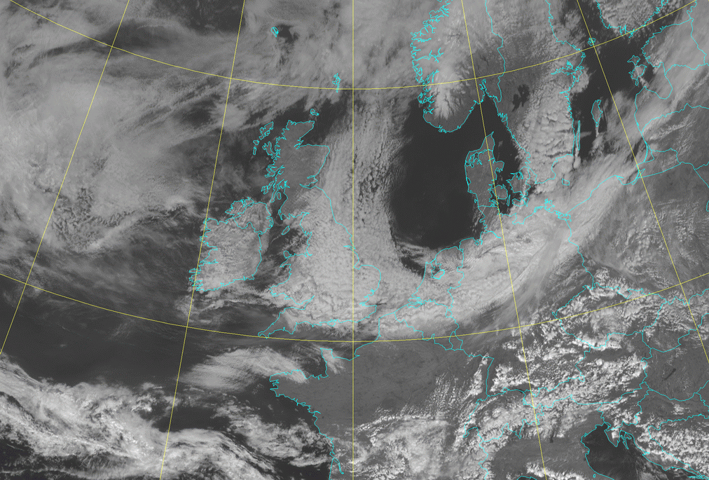
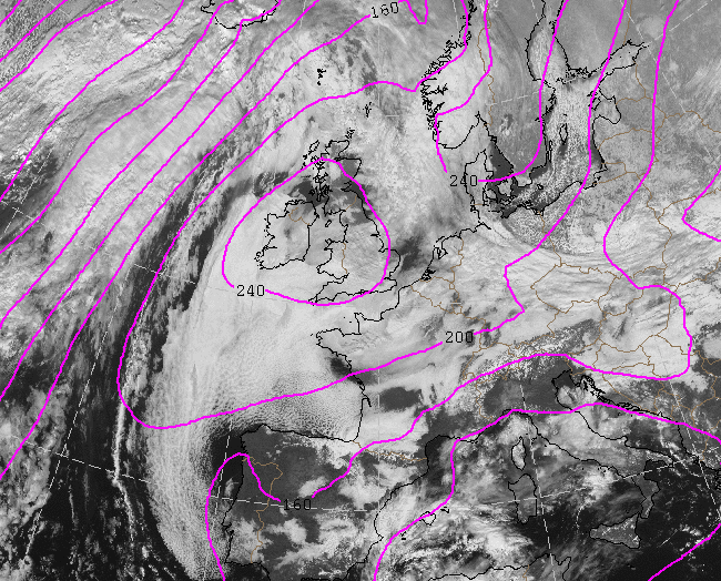
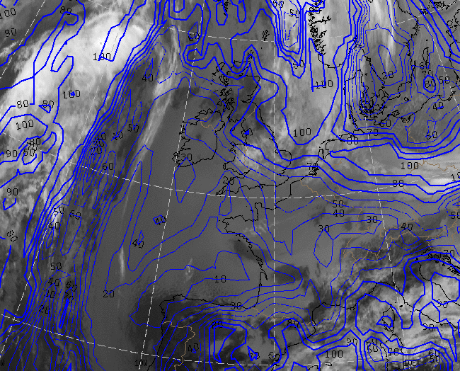
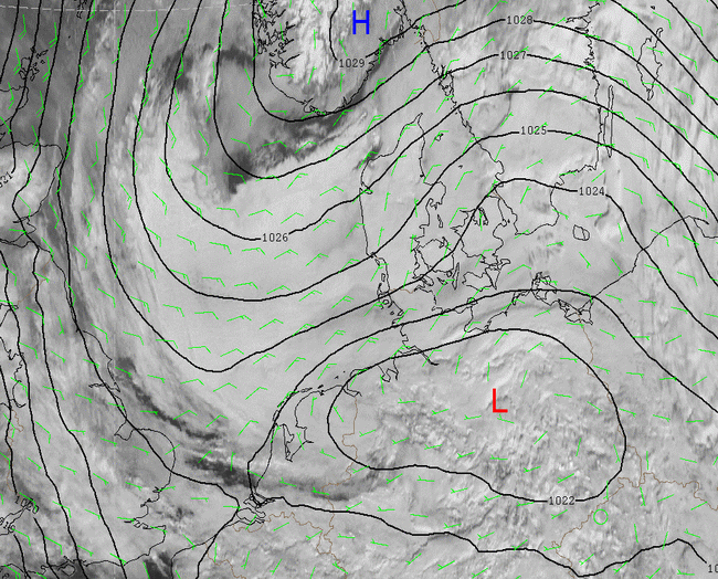
The synoptic situation is as follows: There is a rather extensive area of high pressure over Great Britain and part of the Atlantic with centre
above Ireland and above Sardinia a low can be found. Most cloudiness in the high pressure area belongs to a SC-sheet. Especially above the Bay
of Biscay the top of the cloudiness in HRVis and the daylight RGB images shows more structure. In nighttime imagery (single channels and RGB's)
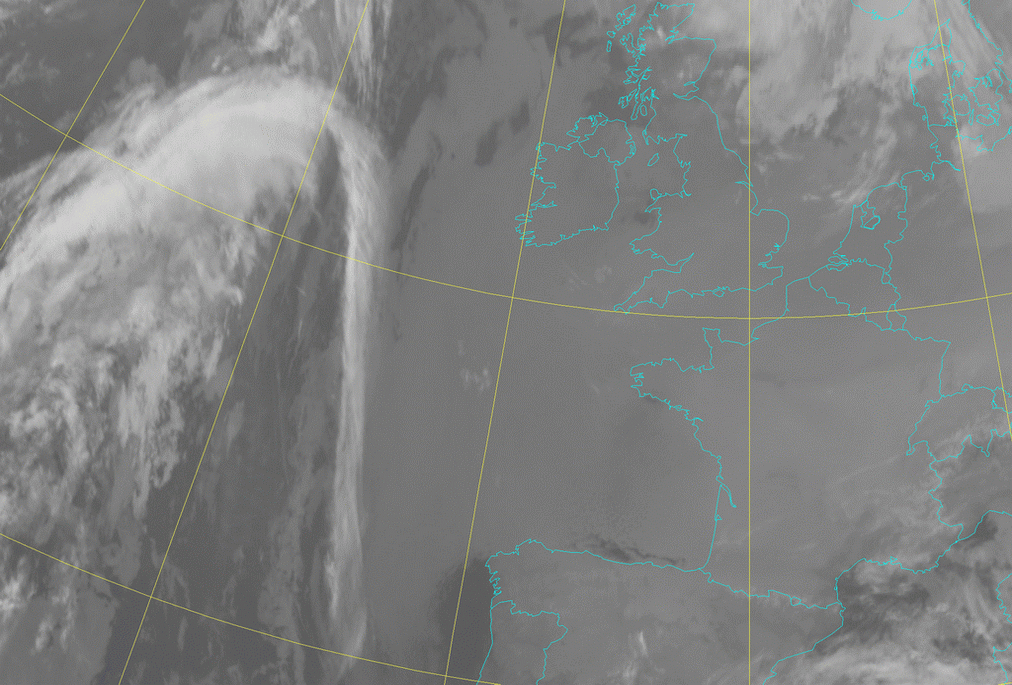
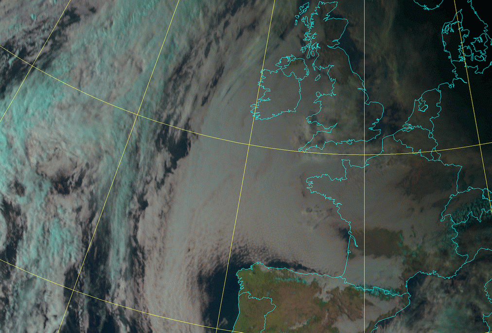
the clouds appear more smooth due to small differences in temperature.
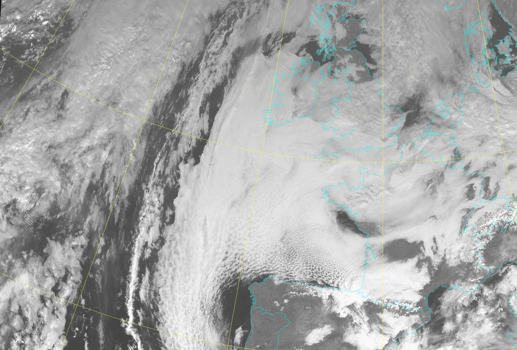
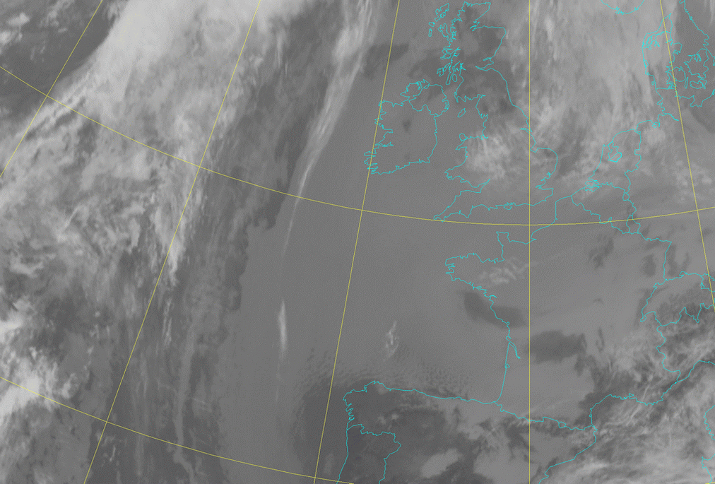
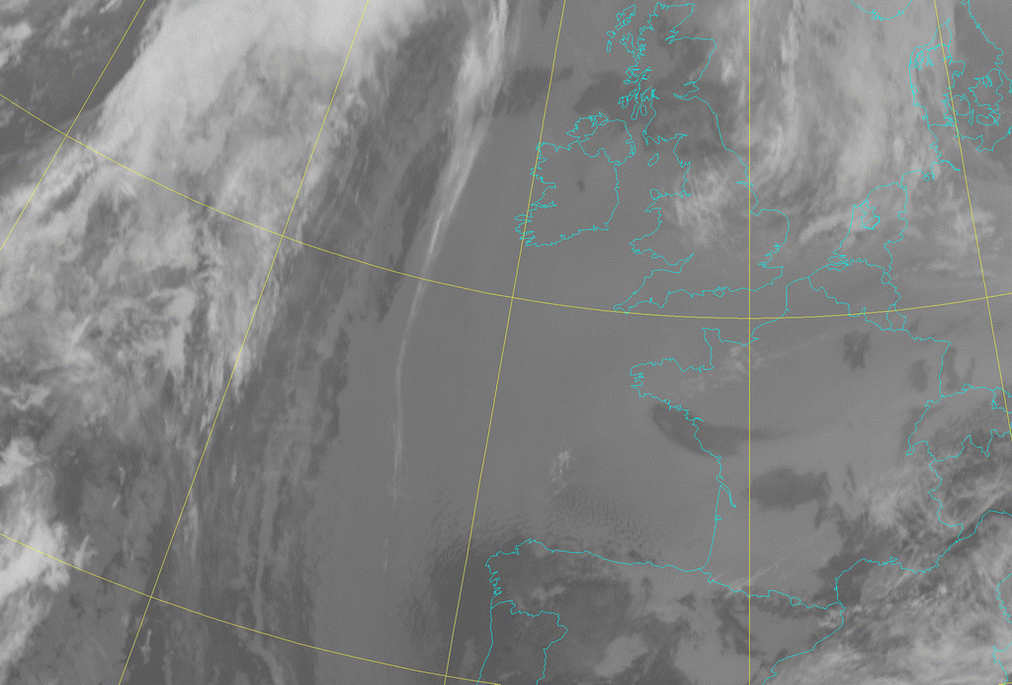
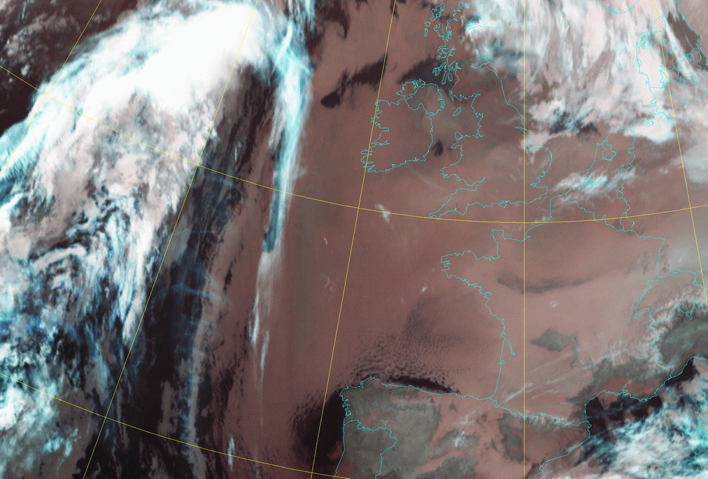
In the HRVis loop a line of high cloudiness in the west is slowly moving over the Sc Sheet. Above the Bay of Biscay and west of the coast of Portugal an easterly continental flow of relative drier air is partly dissolving the Sc cloudiness and this thinning of the clouds is seen as more structures in the clouds. In the IR loop the smooth appearance of the clouds is the most important difference with the visible loop. Of course, partly the higher accuracy of the HRVis-sensor has something to do with it, but the small temperature differences of the cloud tops is the most important reason.
|
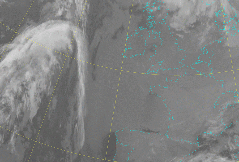
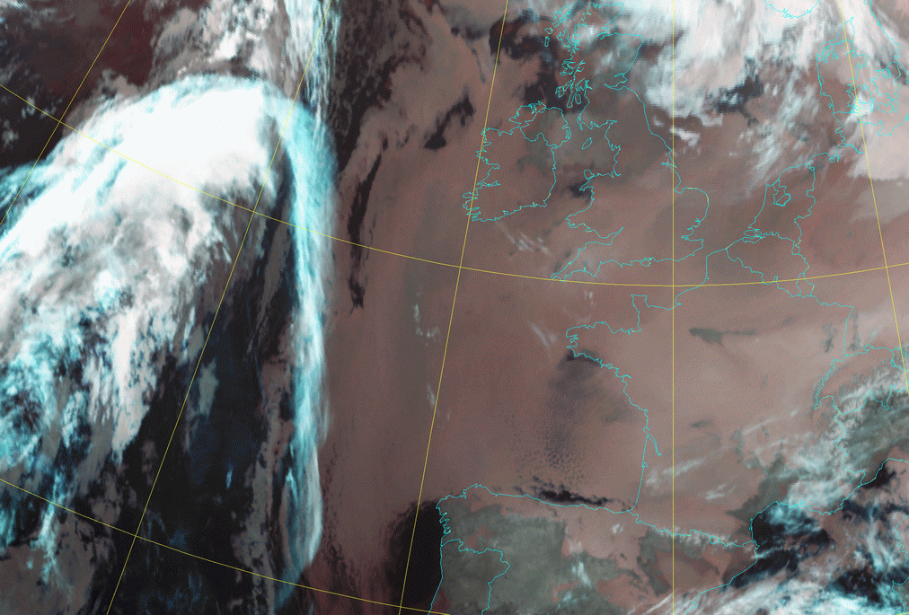
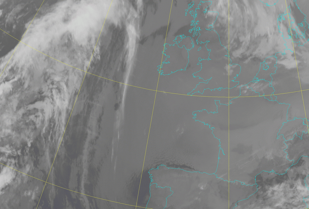
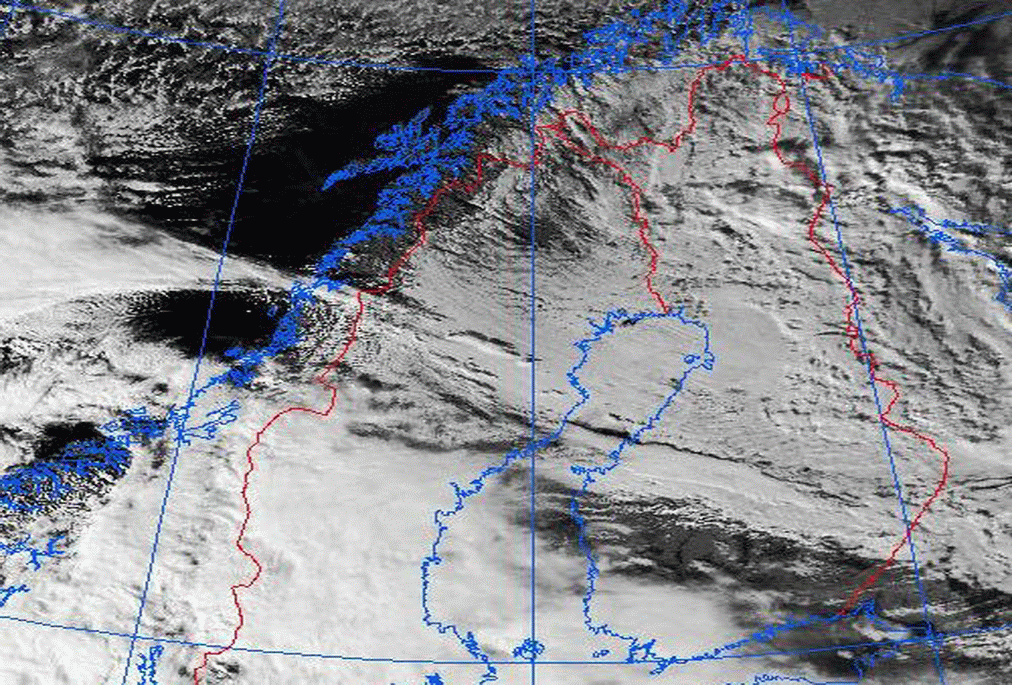
04 February 2006/12.00 UTC - Meteosat 9 HRVis image
|
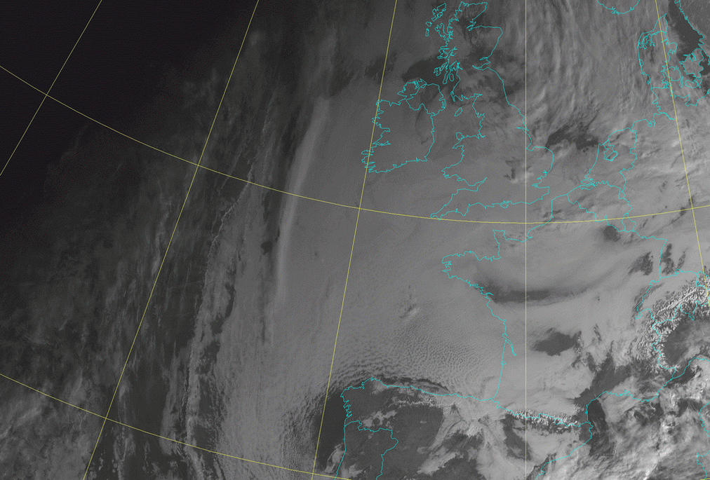
04 February 2006/12.00 UTC - Meteosat 9 IR 10.8 image
|
|
|
|
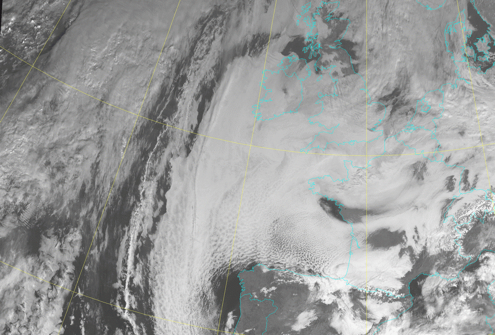
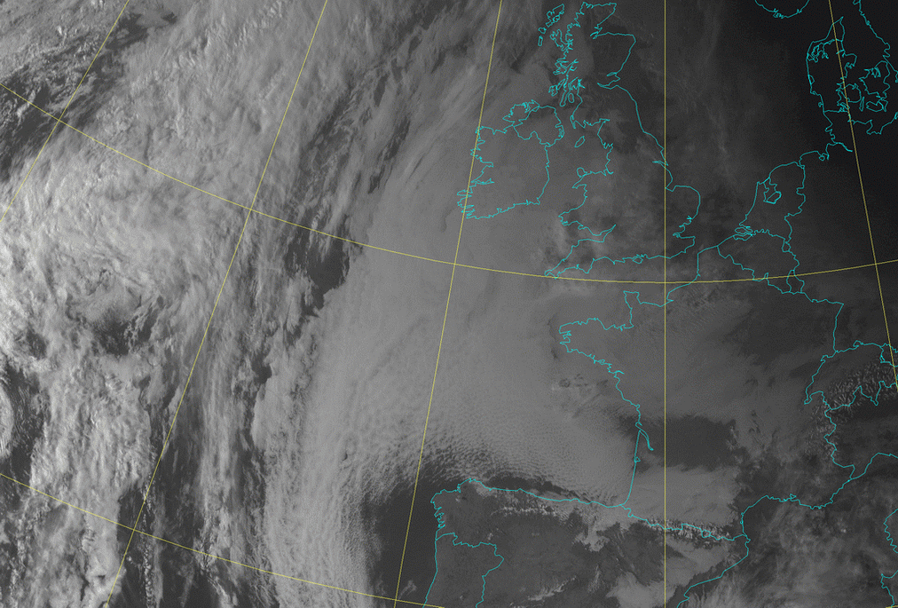
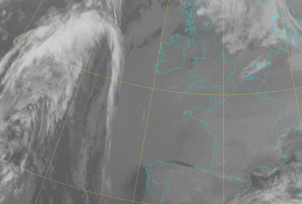
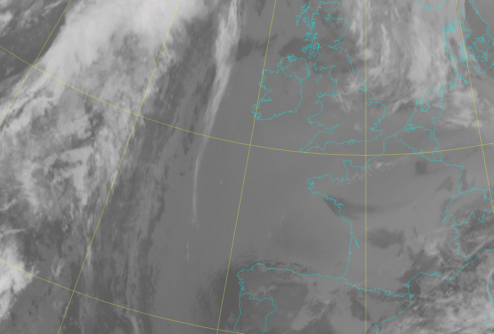
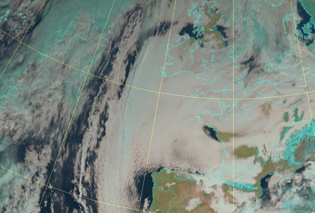
04 February 2006/08.00 UTC - Meteosat 9 HRVis image; 04 February 2006/08.00 - 04 February 2006/17.00 UTC hourly image loop
|
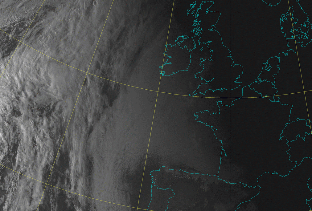
04 February 2006/02.00 UTC - Meteosat 9 IR 10.8 image; 04 February 2006/02.00 - 04 February 2006/12.00 UTC hourly image loop
|
|
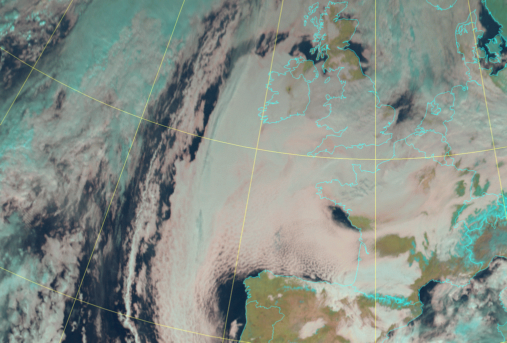
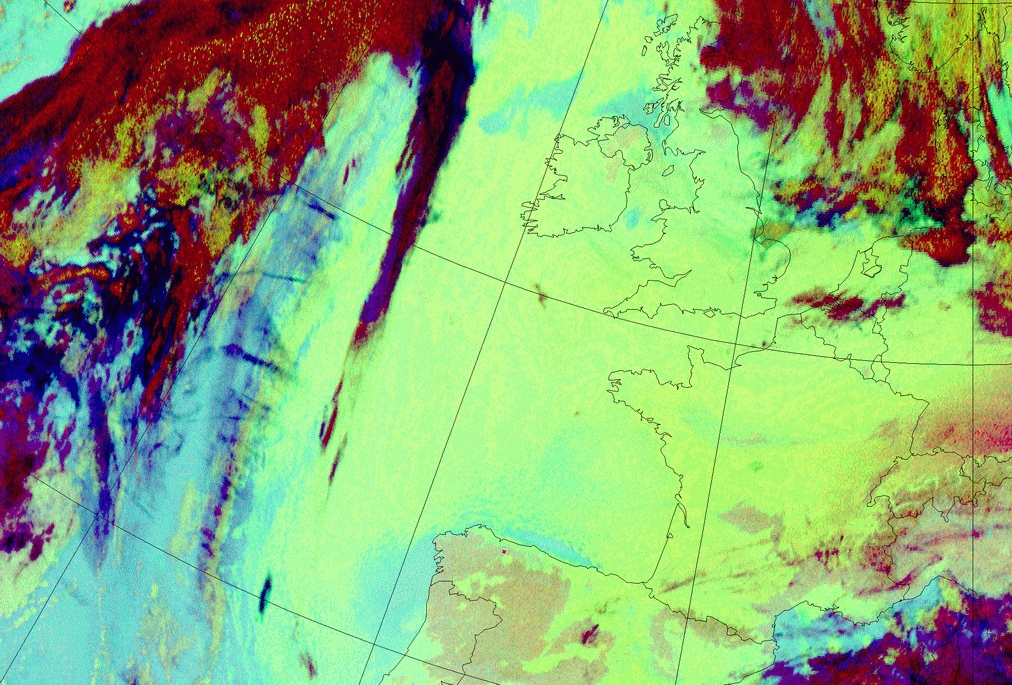
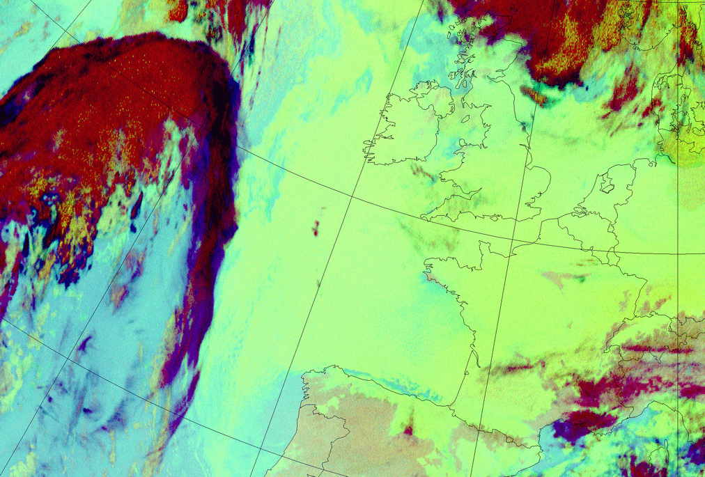
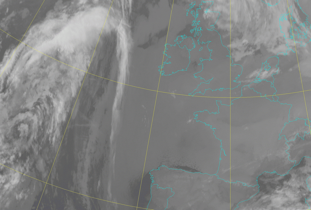
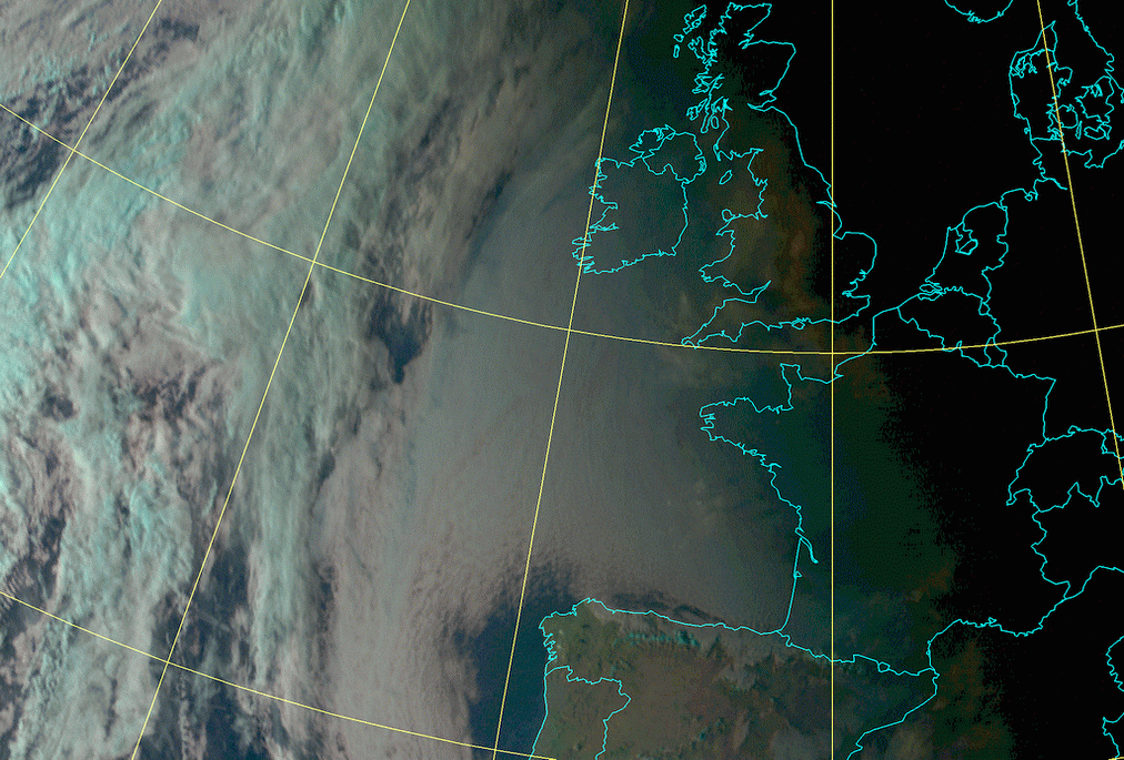
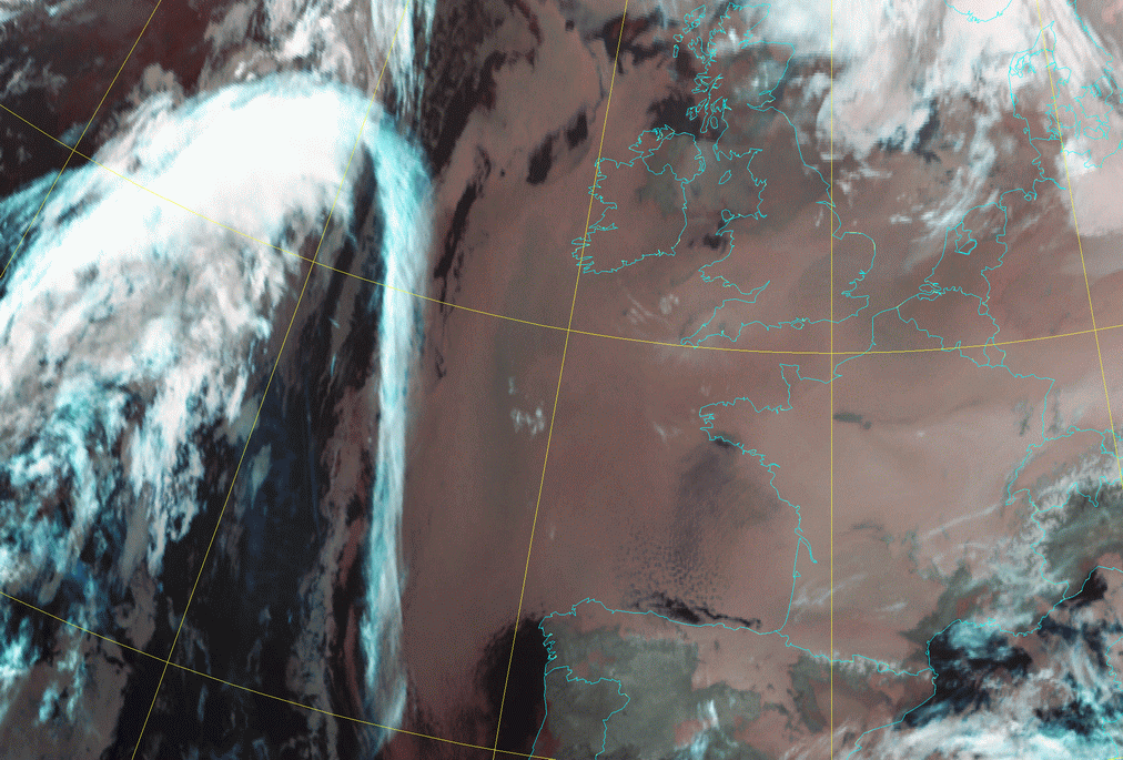
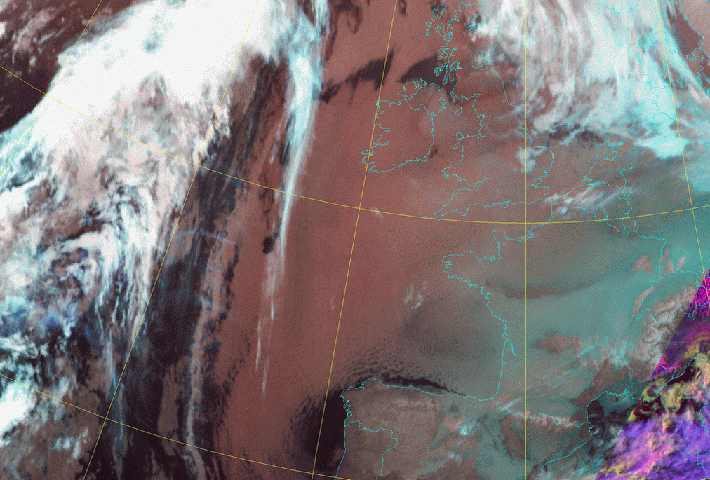
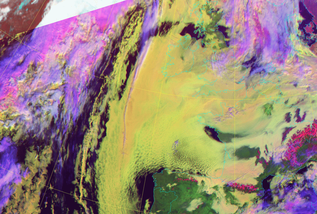
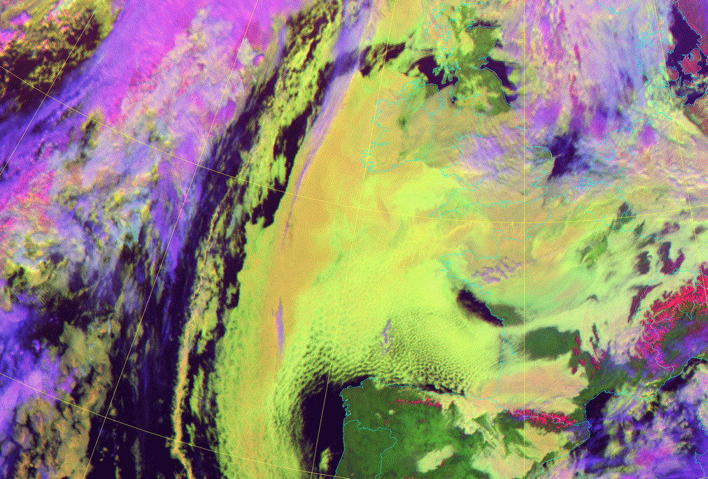
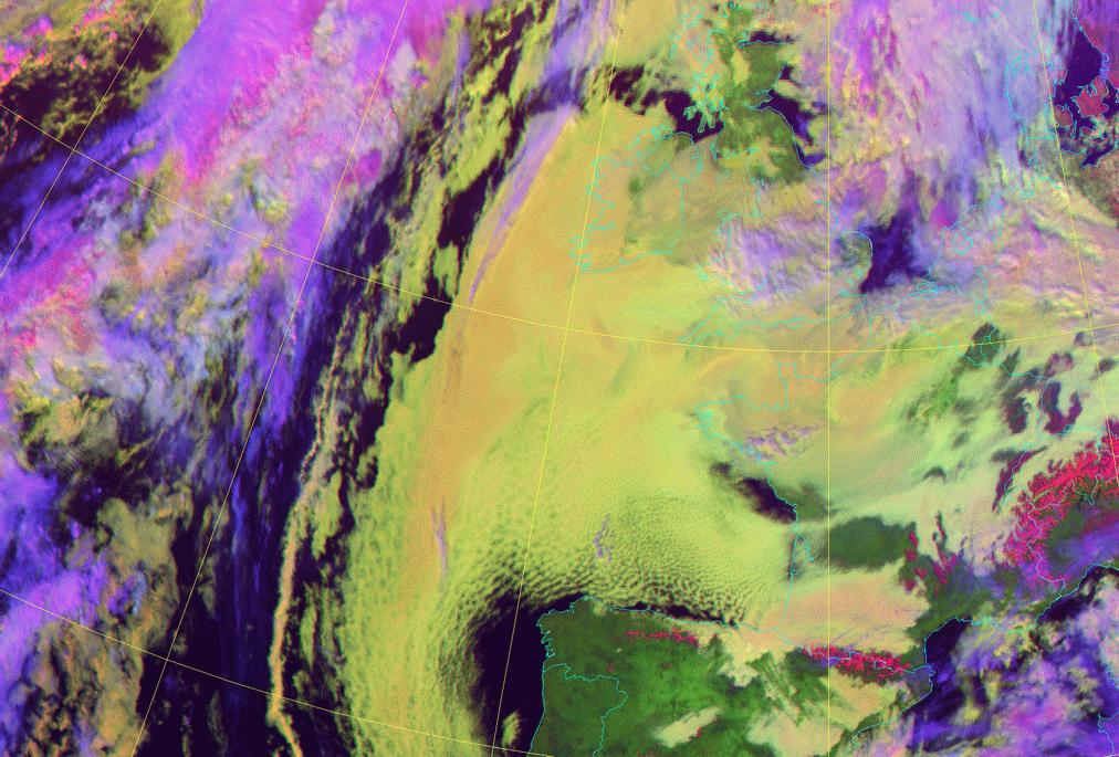
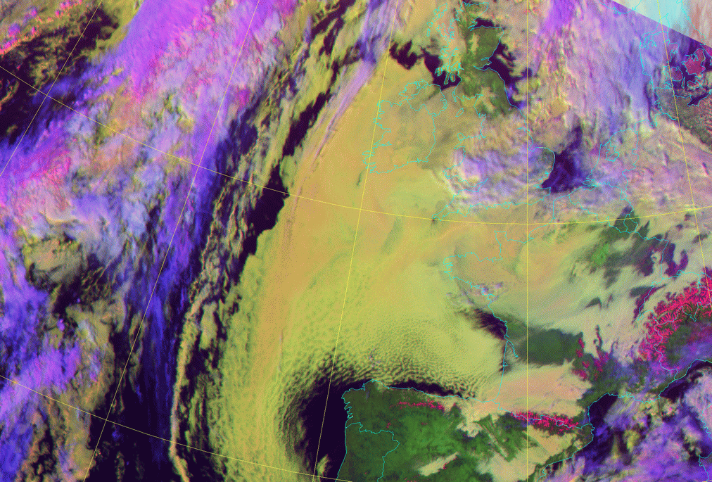
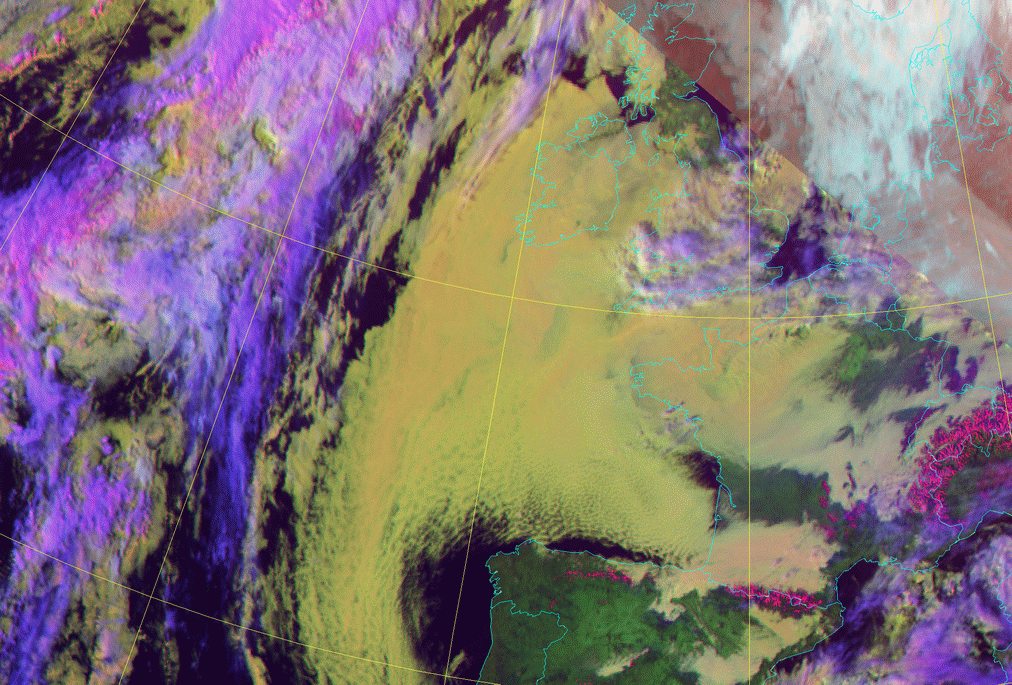
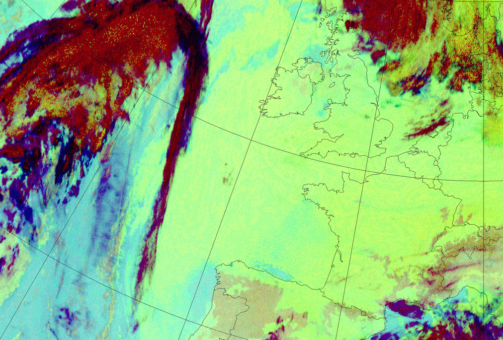
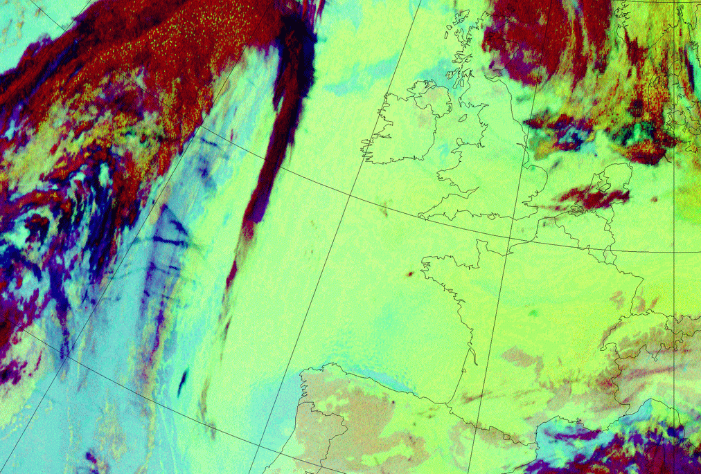
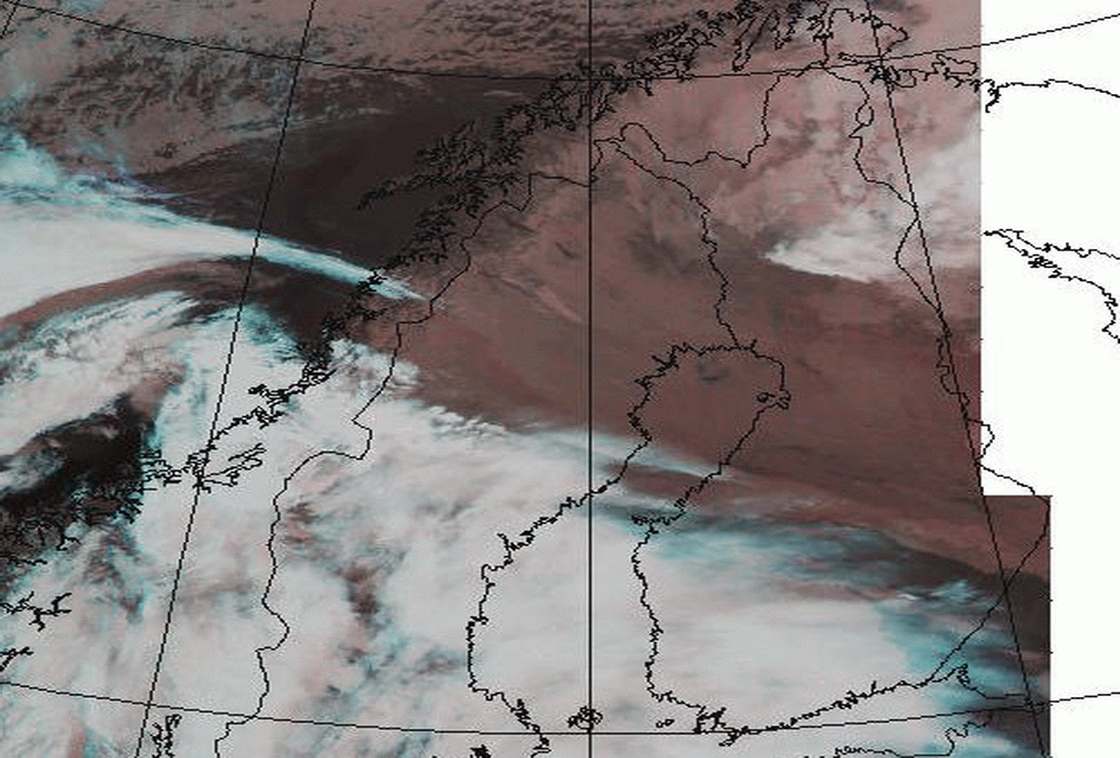
04 February 2006/12.00 UTC - Meteosat 9 (1.6;0.8;0.6) RGB image
|
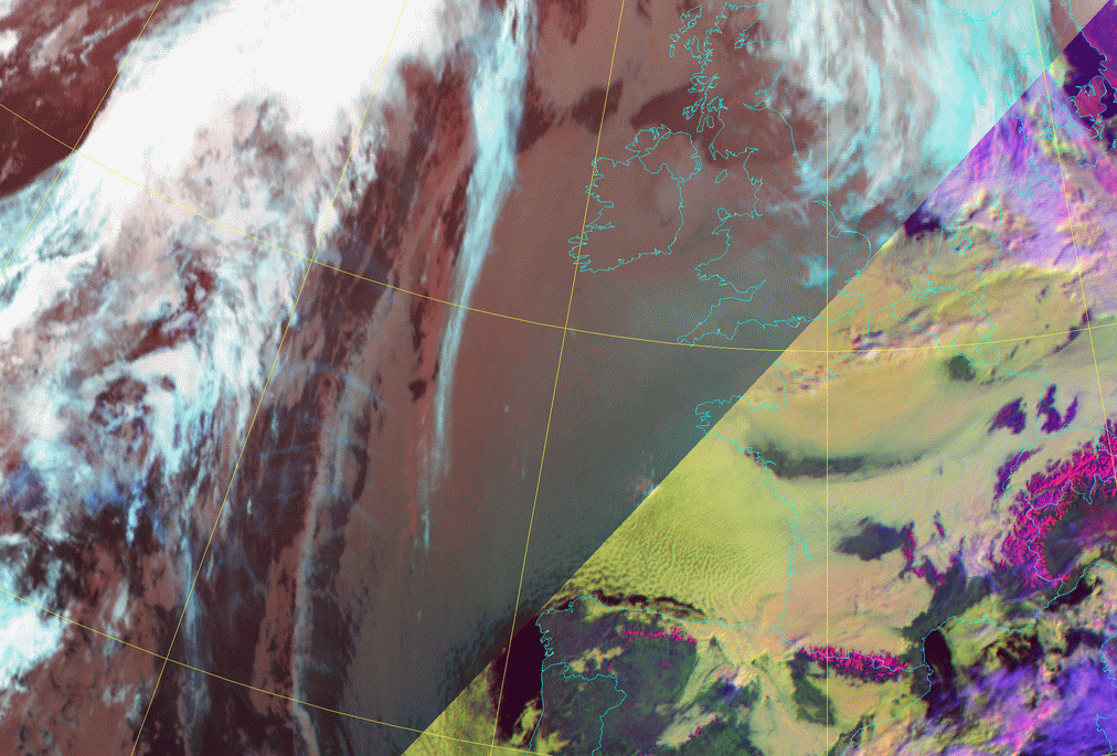
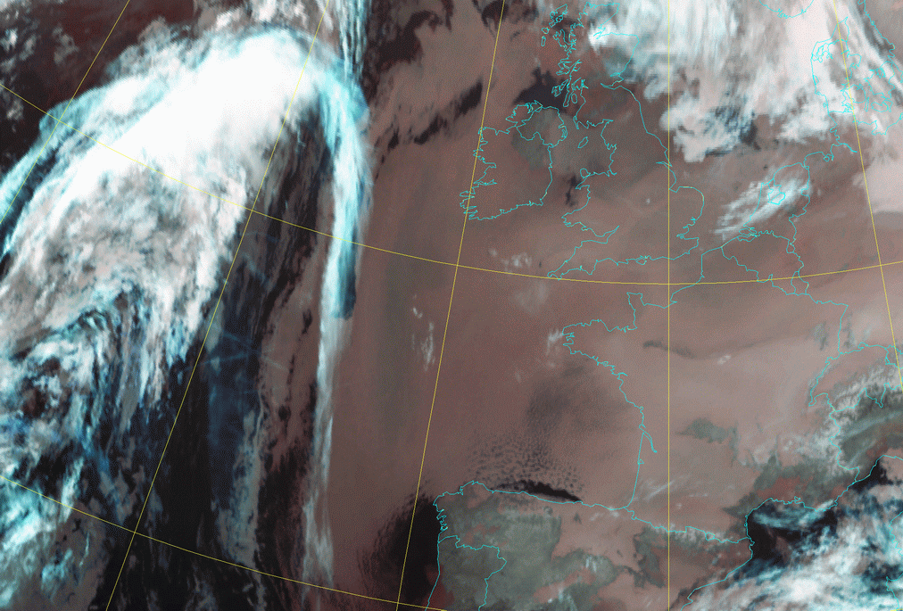
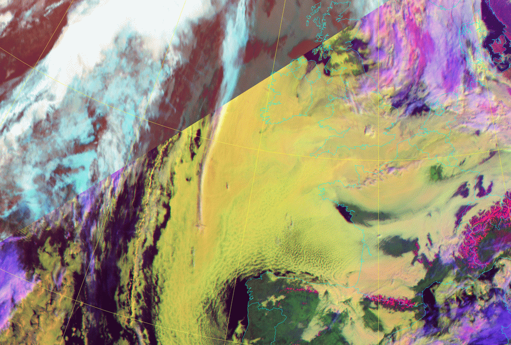
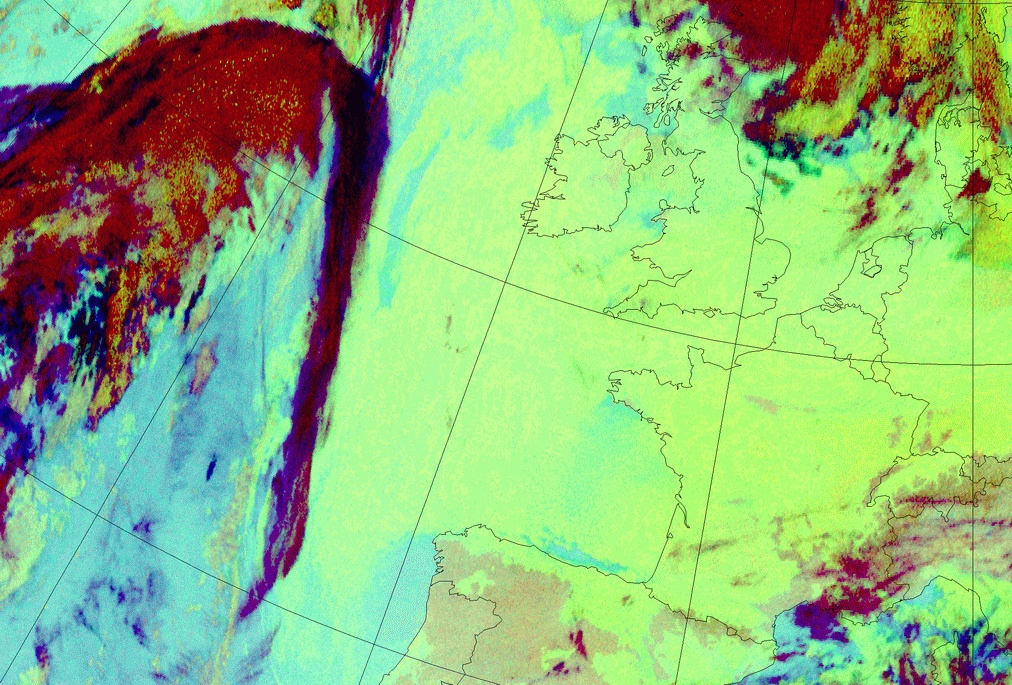
04 February 2006/09.00 UTC - Meteosat 9 (3.9;10.8;12.0 and HRVis;1.6;10.8) Combi-RGB image
|
|
|
|
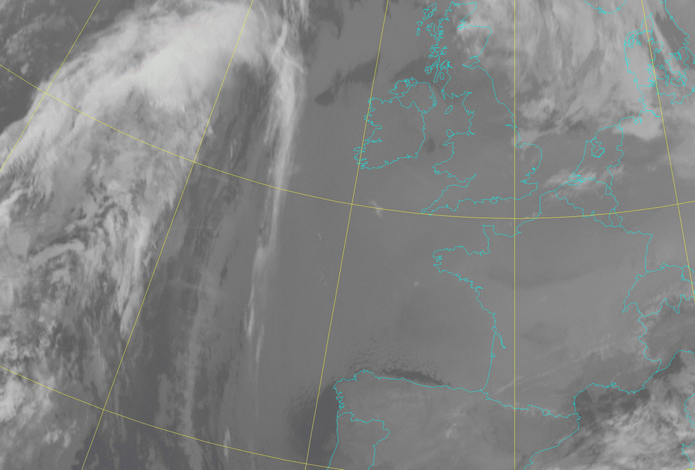
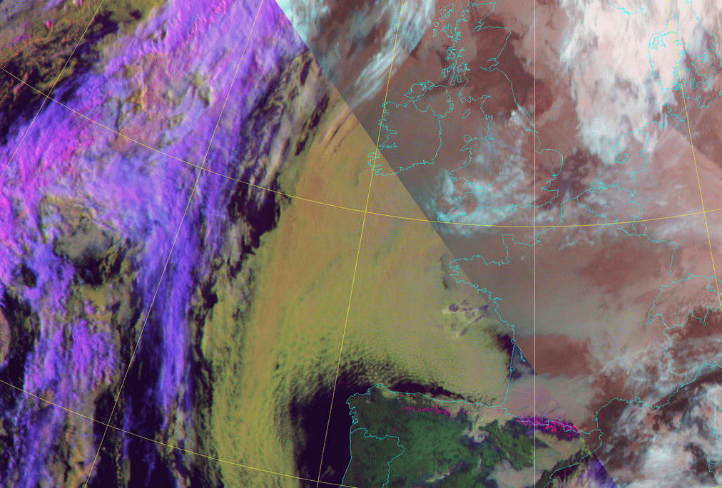
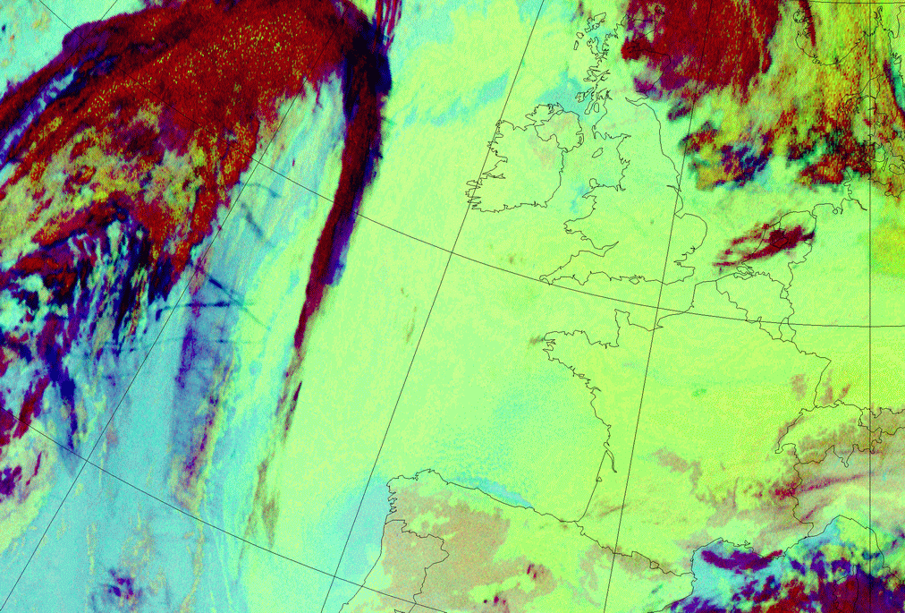
04 February 2006/08.00 UTC - Meteosat 9 (1.6;0.8;0.6) RGB image; 04 February 2006/08.00 - 04 February 2006/17.00 UTC hourly image
loop
|
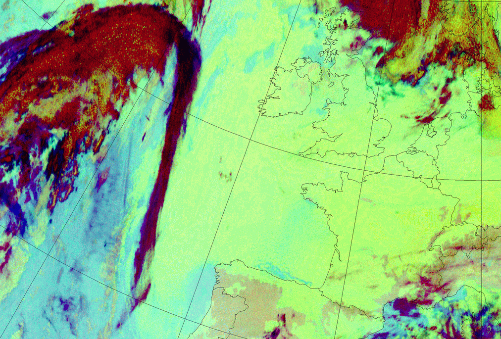
04 February 2006/02.00 UTC - Meteosat 9 (3.9;10.8;12.0 and HRVis;1.6;10.8) Combi-RGB image; 04 February 2006/02.00 - 04 February
2006/16.00 UTC hourly image loop
|
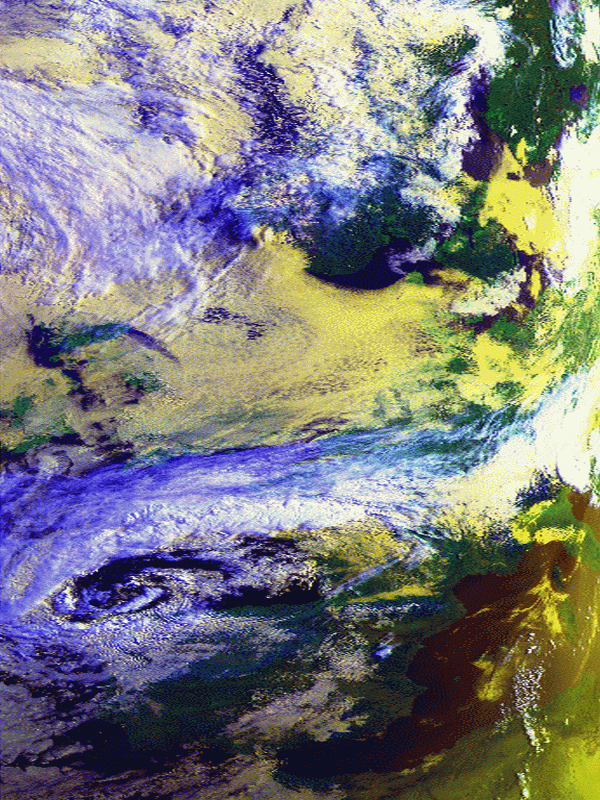
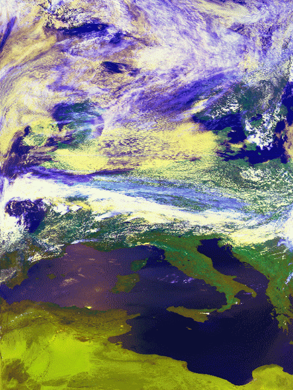
The left-hand side loop shows the whitish SC Sheets with a line of superimposed high cloudiness (Cyan) in the west. The second loop (right-hand side) shows the combination of low clouds during darkness (reddish) and yellowish during daytime. The daytime images show more structures due to the fact that the HRVis has a higher resolution and the differences in albedo are also significant. The pinkish colour during daytime means that the SC cloud tops, at least partly, consist of ice particles.
|
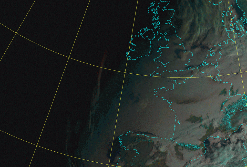
04 February 2006/00.00 UTC - Meteosat 9 Night Microphysics RGB image; 04 February 2006/00.00 - 04 February 2006/07.00 UTC hourly
image loop
|
04 February 2006/07.00 UTC - Meteosat 9 Night Microphysics RGB image
|
|
In the Night Microphysics RGB a greenish area of low clouds especially above sea is seen. In the right-hand image loop a band of high cloudiness (reddish) is superimposed over the west part of the area and is slowly moving to the east and is opaque to the clouds below.
Appearance in AVHRR imagery
- AVHRR imagery can reveal some detailed structure of stratocumulus clouds. Texture within the cloud top, e.g. cellular patterns, waves and ripples, etc., are easy to detect with combined images NOAA 124 and NOAA 345, however, even the individual channels show these small-scale patterns quite well, especially at low sun angles (shadows enhance contrasts between cloud elements).
- Cloud streets within stratocumulus are also often easy to detect in AVHRR imagery.
- During daytime combined image NOAA 124 shows Sc Sheets in yellow or light yellow colours. This combination sometimes also helps in differentiating between stratus and stratocumulus, as stratus clouds are deeper yellow, even brownish yellow (compare Fog and Stratus - Cloud structure in satellite images ).
- During nighttime the difficulties in differentiation between cloudy and cloud-free areas become evident, if the cloud-top temperatures are about the same as the surface temperature on surrounding cloud-free regions. In nighttime NOAA 345 combined images Sc Sheets have a dark red appearance. Differences between the colour in Stratus and stratocumulus are small, but stratocumulus tops, being warmer, have a slightly lighter red appearance compared to stratus clouds.
- Diurnal variations in cloud top structure can easily be seen in AVHRR imagery (see previous example). This applies mostly to summertime cases; during wintertime continental stratocumulus tops have a flatter appearance, both day and night.
|
12 May 1998/11.07 UTC - NOAA Ch2 image
|
12 May 1998/11.07 UTC - NOAA Ch4 image
|
|
|
|
|
|
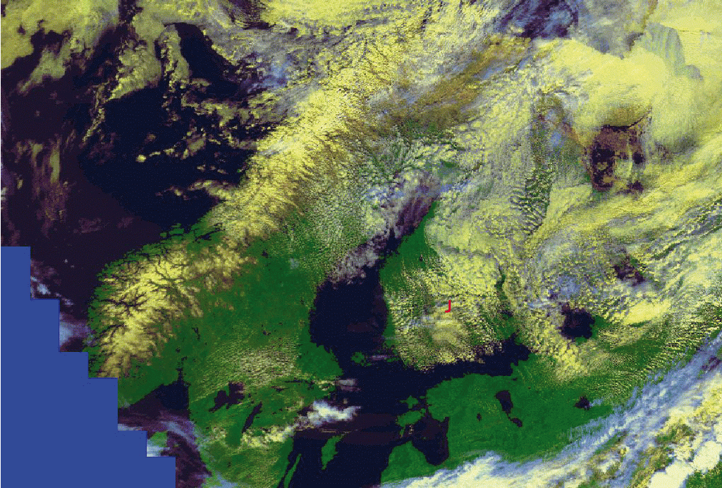
12 May 1998/11.07 UTC - NOAA RGB image (Channel 1, 2 and 4)
|
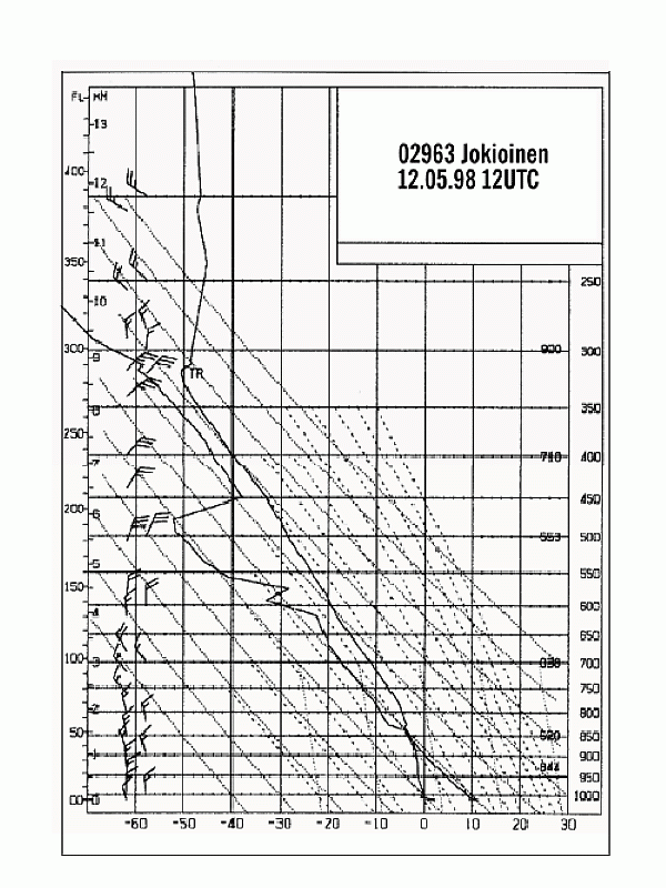
12 May 1998/12.00 UTC - radio sounding Jokioinen
|
The images show extensive Sc Sheets over eastern and northern Finland.
There is also some mid-level cloudiness, which can be seen as colder patches in the IR image ( above right image top; Ch4). The appearance of the Sc Sheets in the IR image is quite homogeneous indicating uniform cloud top temperatures.
The VIS image ( above left image top; Ch2) shows more details. The brightness of the clouds varies remarkably. A cellular appearance is
apparent in the VIS image, which is a typical feature for daytime stratocumulus over land.
In the RGB image ( above left image bottom) the Stratocumulus is clearly yellowish in colour. The detection of small-scale features, such as
the Cloud Streets in southern Finland, is also easy with the help of this kind of imagery.
The sounding of Jokioinen (denoted with J in RGB image) (above right image bottom) shows the vertical structure of the atmosphere within the
Stratocumulus area. The thickness of the Sc clouds is approximately 300 meters. The temperature inversion is quite weak at this stage.>
|
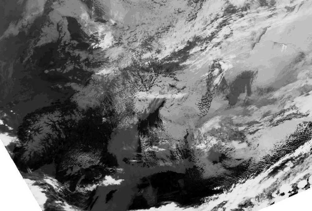
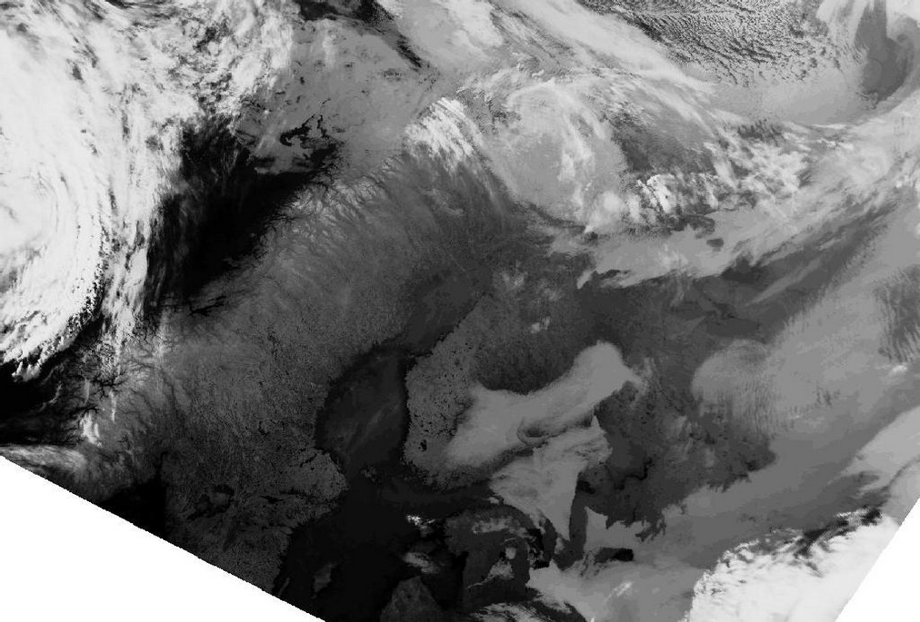
13 May 1998/02.40 UTC - NOAA Ch2 image
|
13 May 1998/02.40 UTC - NOAA Ch4 image
|
|
|
|
|
|
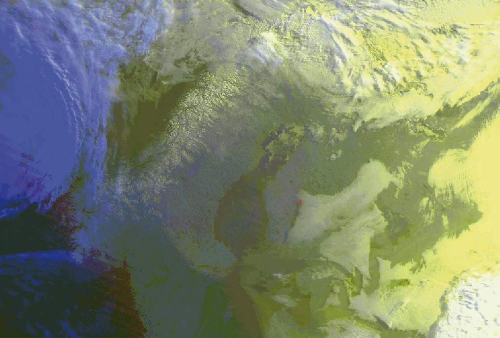
13 May 1998/02.40 UTC - NOAA RGB image (channel 1, 2 and 4)
|
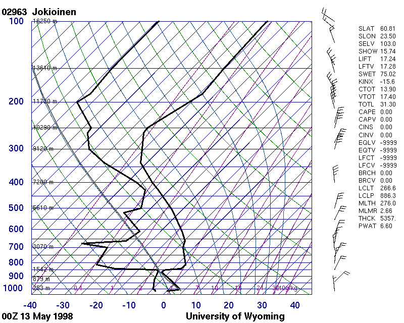
13 May 1998/00.00 UTC - radio sounding Jokioinen
|
The early morning images of 13 May 1998 show further development of the cloud sheet. Separate Sc Sheets can be found over southern Finland,
Karelia and Estonia. Cloud tops have now a much flatter appearance compared to the daytime images, and cellular features have totally vanished
during the night. The edges of the Sc Sheet are also quite sharp.
The corresponding sounding for Jokioinen at 00.00 UTC is also shown (above bottom right image). It shows that Stratocumulus has become quite
thin, with its vertical extent of 100 - 300 meters, and temperature inversion just above the cloud sheet has increased significantly. Dry
subsiding air above the Sc Sheet is dissipating the sheet, which totally dissolves within only a few hours.
Especially during wintertime the Polar orbiting imagery has great advantages above the Meteosat-images. Due to the higher pixel resolution of
the AVHRR-imager the lack of enough sunlight is partly compensating Therefore an other example of SC-sheets in the northern latitudes is
quite good seen in the images below.
|
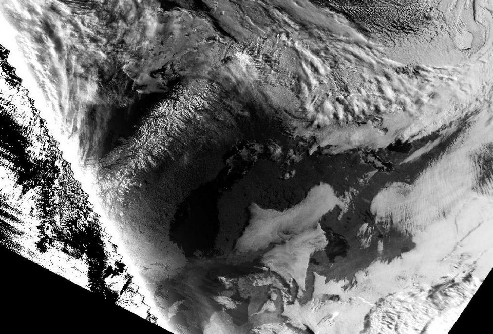
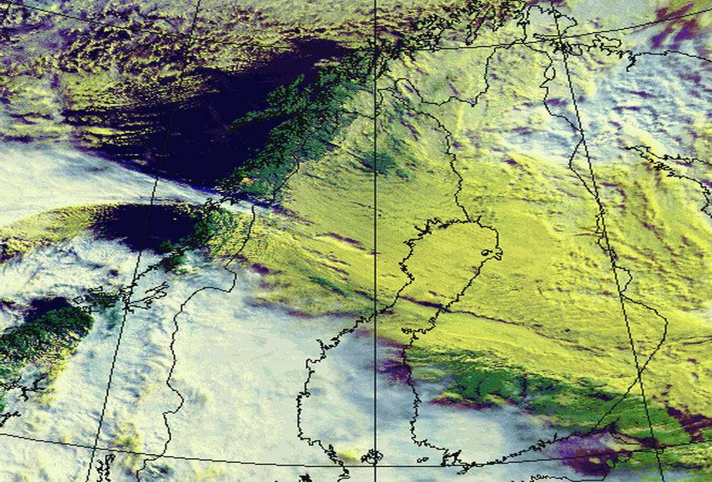
02 October 1999/13.44 UTC - NOAA RGB image (Channel 1, 2 and 4)
|
02 October 1999/13.44 UTC - NOAA RGB image (Channel 3, 4 and 5)
|
|
|
|
|
|
02 October 1999/13.44 UTC - NOAA Ch2 image
|
02 October 1999/16.04 UTC - NOAA RGB image (Channel 3, 4 and 5)
|
The satellite images show an extensive Sc Sheet over Northern Scandinavia. Due to low sun elevation the varying texture within the cloud top is easily seen in visible 0,8 µm (Channel 2) image. Combined image NOAA 124 shows the Sc Sheet in a light yellow colour, while combined image NOAA 345 shows the cloud sheet in light reddish colours. The night-time NOAA 345 image (bottom left) is included for comparison.
Meteorological Physical Background
The formation of stratocumulus depends on variable scales of physical factors:
- Synoptic scale flow and the properties advected by the air streams, e.g. moisture content, have an effect on formation of the cloud layer. Large-scale divergence in the lower troposphere in the vicinity of anticyclones produces subsidence. The air warms adiabatically and a persistent subsidence inversion may form on top of the boundary layer (BL). When the BL moistens or cools, the likelihood of stratocumulus clouds increases.
- On the other hand the development of Sc Sheets is controlled by small-scale factors in the atmosphere, such as turbulent mixing in cloud. Turbulence transports heat and moisture upwards and hence forms the mixed layer.
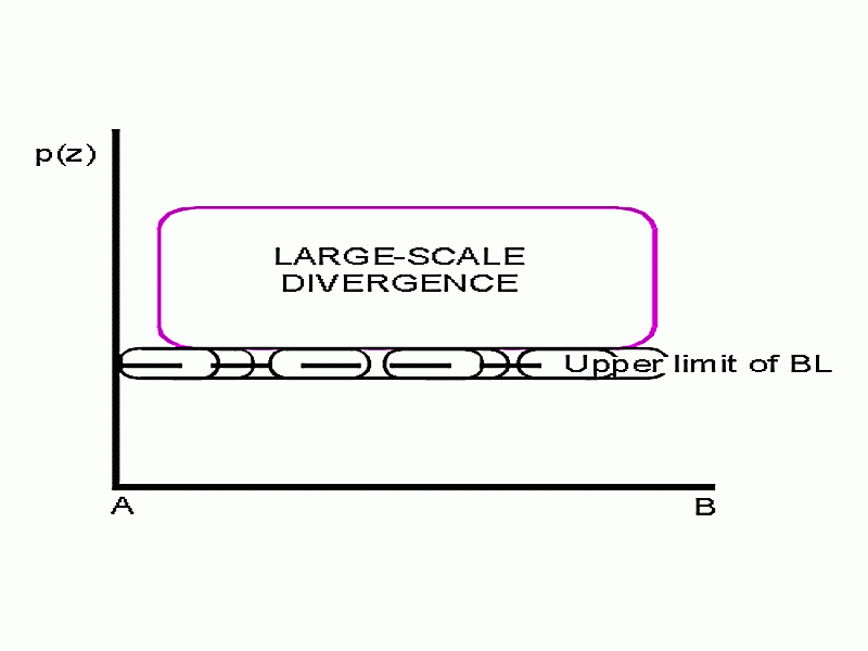
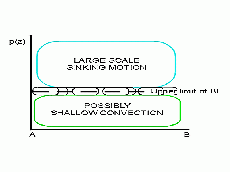
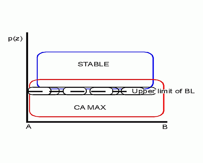
Schematically the vertical structure of stratocumulus-topped BL can be described as follows:
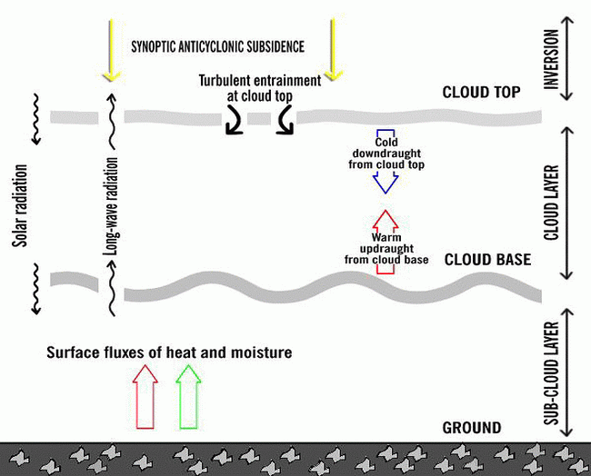
The image visualizes the complex interaction between the synoptic scale and small-scale factors controlling the formation, persistence and finally the dissolution of stratocumulus. From the synoptic-scale point of view there has to be a reasonably stable layer above boundary layer. This can be produced by - as mentioned earlier - large-scale subsidence. However, the stable layer can also develop when cold air flows in a shallow layer near the ground. This is often the case in northern latitudes close to the sea, where the advection of moist and cool air beneath warmer air produces a significant temperature inversion. Moisture near ground level is necessary for the formation of cloudiness. Moderate to strong winds are also necessary for mixing of the air.
The mixing processes in a cloud layer are most important. Mixing processes are generated primarily by seven different mechanisms, which either support or dissolve the Sc Sheets. According to Stull (1991) they can be listed as follows:
- Post-cold frontal low convection.
- Low convection generated by differential cold advection. This occurs when more cold air is advected into an area aloft than is advected at lower levels. Such destabilization can occur even when the surface is cooler than the overlying air.
- Shear-generated mechanical turbulence associated with strong winds in BL can also cause sufficient mixing to maintain stratocumulus.
- Outgoing long wave radiation from cloud tops produces sinking air parcels, which mix the air in BL.
- Cloud base radiative heating is a much weaker process than cloud top radiative cooling, but as it destabilizes the cloud layer and/or stabilizes the subcloud layer, the effect can be a decoupling of the mixed layer.
- Cloud layer shear generates mechanical turbulence and mixing.
- Entrainment instability is a mechanism that enforces the pre-existing entrainment of dry air from above the cloud into the cloud. The effect of this is drying and warming of BL, rising of the cloud base and finally break-up of the cloud deck.
Radiative processes above, within and below the cloud sheet are important factors in stratocumulus development. Short-wave solar radiation as well as long-wave IR radiation from the surface generate convective instability, which in turn is released as turbulent eddies. Hence the radiative processes and turbulence are closely connected.
The vertical structure
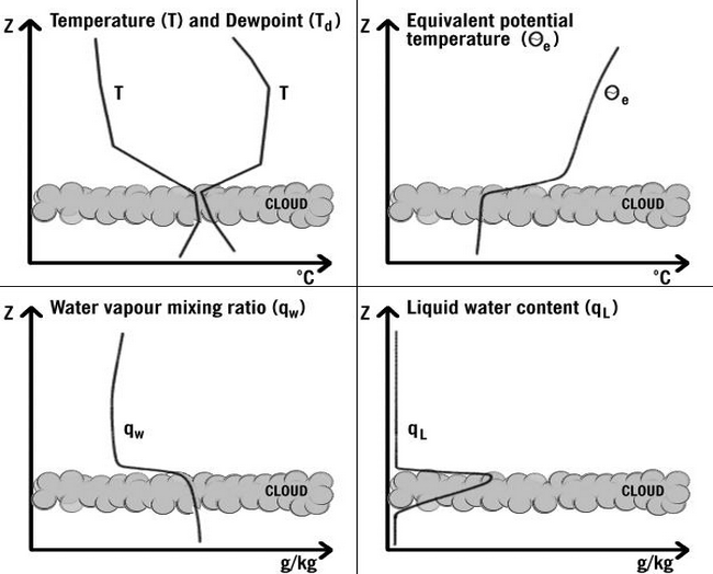
The typical vertical structure of stratocumulus-topped BL shows significant temperature inversion just above the cloud top. Dew point depression is quite large above the cloud layer due to subsidence, typically increasing in time while subsidence goes on (see Cloud structure in satellite images ). Equivalent potential temperature as well as water vapour mixing ratio are constant with height, supporting the view that stratocumulus clouds are embedded in a mixed layer. Liquid water content increases with height above cloud base.
Favourable climatological and synoptic environments
Sc clouds are a common cloud type both in northern latitudes as well as mid-latitudes. They are most often observed over cool waters throughout the year but also over land areas, especially in winter. A good seasonal example can be taken from Finland: in southern Finland Sc cloudiness is observed most often during the period from September to December (35 - 50% of the time there are Sc clouds in the sky). The minimum likelihood for Sc clouds is during the period from May to August (10 - 20% probability for Sc cloudiness). Overcast skies (7 - 8 oktas) with Sc cloudiness are observed quite often (20 - 30% of the time) between late autumn and early winter, while in late summer widespread Sc cloudiness is virtually absent in southern Finland.
Large-scale anticyclones represent one kind of favourable environment for Sc Sheets to form and develop, as the associated subsidence produces large-scale adiabatic warming and hence significant temperature inversions above the boundary layer. Climatologically, the most common (at least, most often referred to in meteorological literature) locations for extensive Sc Sheets are relatively cool waters such as the North Sea (see below) or the areas over cool oceanic currents adjacent to the North American west coast, where they have a quasi-permanent character. Sc Sheets in connection with high pressure ridges between frontal systems have a more transient character.
Over land Sc Sheets often form during the cool season either near the centre of high pressure (however, stratus formation is more likely there due to weak mechanical turbulence) or on the cool (eastern) side of it, where fresh and moist air flows in a shallow layer southwards (see cloud structure in satellite image ). An example of favourable locations for Sc can be found in eastern parts of Finland and adjacent land areas over Russia: cold, shallow and relatively moist north-easterly - northerly air streams east of an anticyclone cntered over, say, Scandinavia or the Norwegian Sea often cause an extensive Sc layer to form.
Sc Sheet formation is also often observed after a cold front passage as well as on the rear side of the low pressure. Cool air flow with reasonable wind shear, stable stratification and a large amount of moisture (not necessarily because of advection of moisture from the sea, but by evaporation of rain and from wet ground) form a suitable condition for Sc formation.
Sea areas are an example of a moisture source, which in synoptically favourable (anticyclonic) environments can produce long-lasting Sc Sheets. If the anticyclone is stationary causing steady wind conditions within the cloud sheet, the Sc Sheet can last even for several days without breaking up.
There are also other typical occasions when Sc cloudiness is reported. An example of this is the Sc cloudiness formed in summertime evenings by spreading of cumulus clouds. Sc clouds produced this way will not typically last for a long time. However, they can be seen even in satellite images (best in visible channel) as convective cellular daytime cumulus cloudiness turning into night-time Sc cloudiness with a smoother texture.
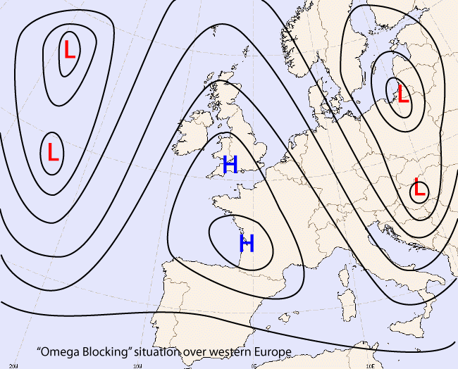
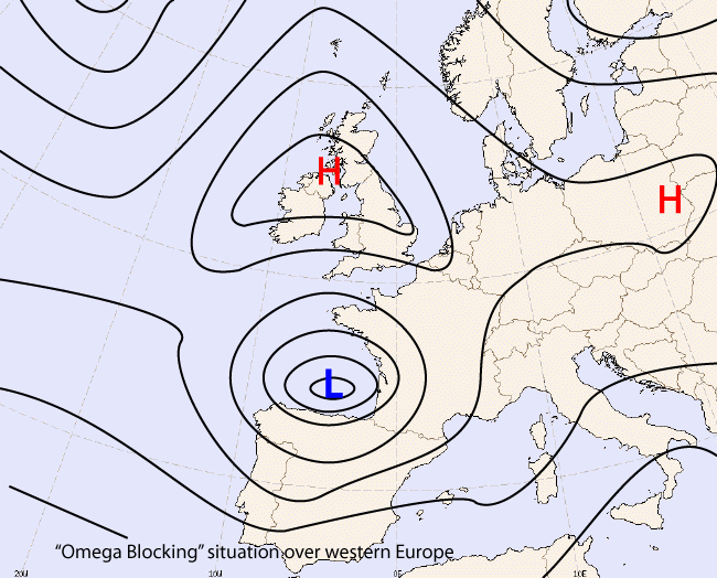
North Sea Stratocumulus: synoptical description
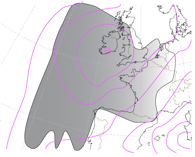
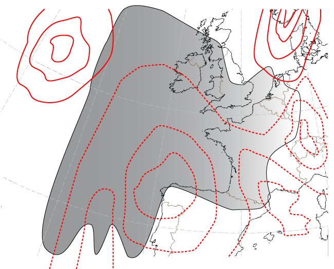
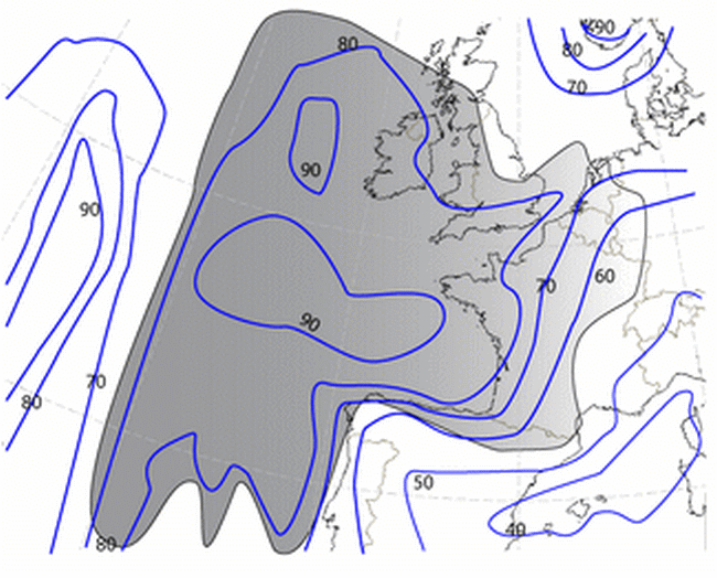
To get extensive sheets of stratocumulus over the North Sea without any cloudiness above, there should be an anticyclone over Great Britain. Crucial for the Sc Sheets is a temperature inversion and the presence of sufficient moisture along with some updraft to form cloudiness (unstable air in surface layer). With a north-westerly flow these Sc Sheets will penetrate the Netherlands. Mostly the high pressure over England is a blocking high of one of the following types:
- either a diffluent blocking, when there is a corresponding low south of England;
- an omega blocking, when there is a low west of Ireland and a low over central Europe.
|
Example of omega blocking
|
Example of diffluent blocking situation
|
|
|
The fetch over sea is one of the key parameters for cloudiness. Sometimes these Sc will exist for days. Other key parameters for maintaining or dissipate the cloudiness are insulation, change in wind direction, wind shear just above and just beneath the inversion.
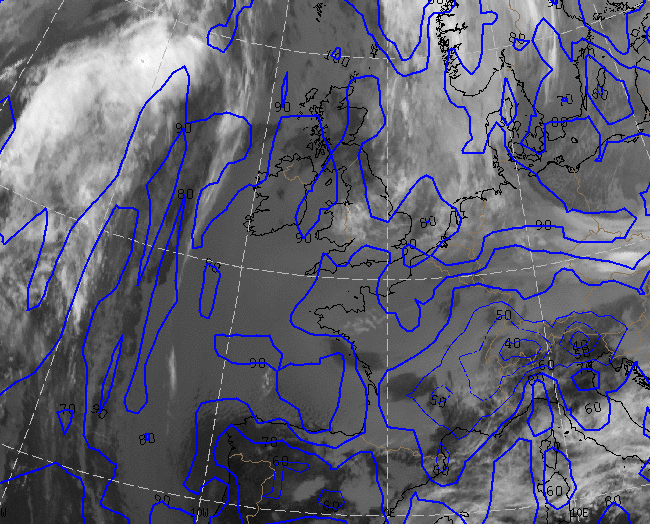
In HRVis_image of 06 June 2007 12.00 UTC there is an extensive high pressure area over the British Isles and Ireland. At the east flank of this high Sc Sheet is seen over west part of the North Sea and East coast of England. At central North Sea ULL cloudiness is superimposed over Sc-cloudiness. Also seen is the Sc Sheet above the Bay of Biscay.
|
06 June 2007/12.00 UTC - Meteosat 8 HRVis image
|
03 April 2007/12.00 UTC - Meteosat 8 HRVis image
|
|
|
Another example of North Sea Sc Sheets is the HRVis image of the Meteosat8 of 03 April 2007. High pressure west of Ireland and a complex low above Iberian Peninsula is causing a northwesterly flow over the North Sea.
Also in the combination RGB of the AVHRR imagery of NOAA the Sc Sheets above the North Sea are quite remarkable. Especially the structure of the cloud tops are well seen in these yellow areas above the whole North Sea.
|
02 July 1997/13.26 UTC - NOAA RGB image (channel 1, 2 and 4)
|
02 July 1997/06.29 UTC - NOAA RGB image (channel 1, 2, and 4)
|
|
|
Typical life cycle of Sc Sheet
Sc clouds - when the environments are favourable - have a tendency to spread beneath the limiting temperature inversion and later have a large horizontal extent. This can sometimes be seen also in satellite imagery as rapid spreading and coalescence of initially smaller-scale cloud elements. The remarkable differences, both in radiation and turbulence factors, between the adjacent cloudy and cloud-free areas have an effect on the horizontal spreading of the Sc Sheet. Typically during the daytime (especially during summer months) the sun heats the lowest layers of cloud-free areas, the result being only fair-weather cumulus cloudiness. The solar radiation can even affect the edges of Sc Sheet and slow down its spreading. Hence the initially cloud-free areas close to the Sc Sheet can stay cloud-free all day. This feature can often be seen in Finland in connection with summertime outbreaks of cold air from the White Sea: the Sc Sheet is at first rapidly advected to eastern Finland and Karelia. However, later during the day the edges of the cloud start to erode and further movement of the sheet stops, as solar radiation dries and warms up the cool boundary layer ahead of the cloud sheet.
The most permanent and extensive Sc Sheets form, as previously mentioned, mostly in connection with cool and moist air streams. As Sc Sheets often form in the vicinity of anticyclones, their movement can be slow. If strong upward motions generated by fronts, depressions, etc. are absent, the development of the Sc Sheet is driven mainly by slower processes, such as large-scale subsidence. Thus, the appearance of the Sc Sheet can be identifiable for a longer period. In some cases an individual Sc Sheet can last days without significant change. Entrainment instability at the cloud top is needed for breaking up this kind of quasi-permanent cloud sheet. The more the cloud sheet breaks up, the more solar radiation penetrates it, hence generating a positive feedback for the continuing dispersal of cloud, given sufficiently low humidity of boundary layer air.
Key Parameters
- Height contours at 1000 hPa
- Subsidence:
- Divergence (lower troposphere). For detection of large-scale subsidence.
- Vertical wind speed
- Temperature advection:
Cold advection (lower troposphere). For detection of areas with shallow cold advection. - Low-level humidity:
Moisture in boundary layer is needed for development and maintenance of stratocumulus. - Middle-level humidity:
Low values of humidity in layers above BL indicate subsidence. - Temperature inversion height
- Temperature inversion strength
- Sea temperature
- Difference of sea temperature and dew point of air at surface
- Surface wind (direction/speed)
Absolute topography at 1000 hPa
|
|
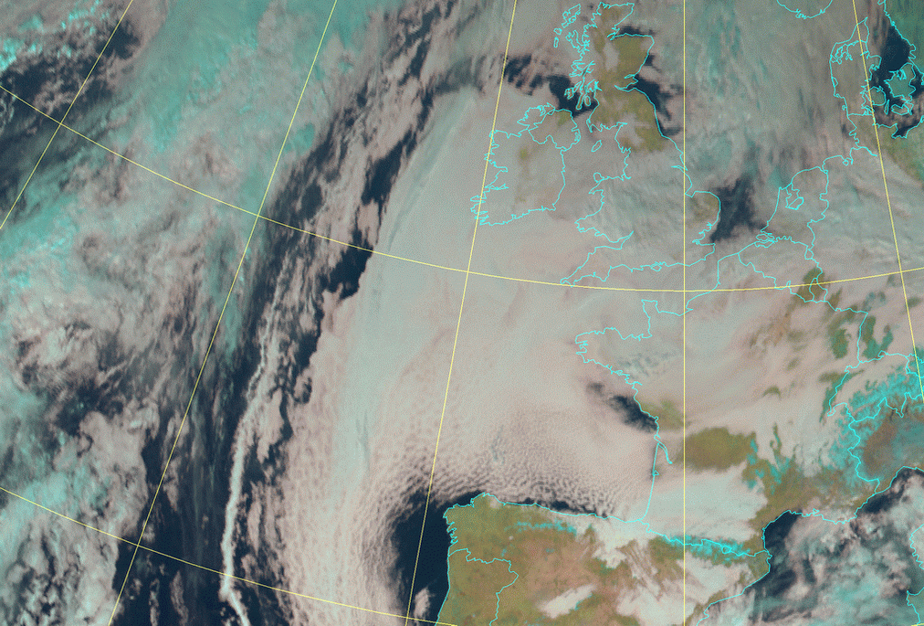
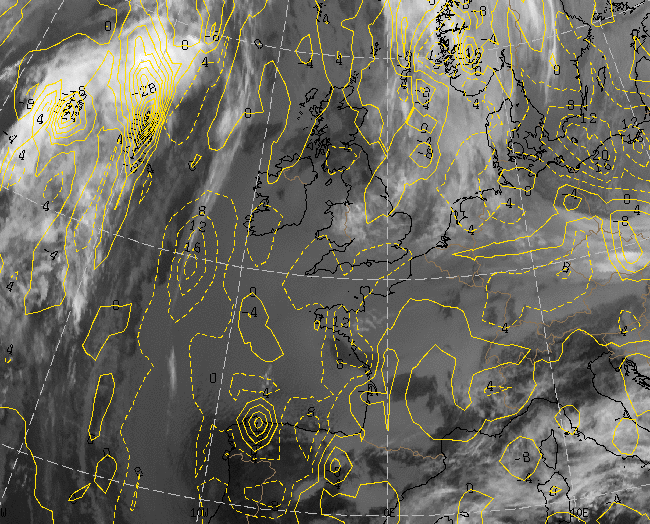
04 February 2006/12.00 UTC - Meteosat HRVis image; magenta: height contours 1000 hPa
|
|
|
Especially in an extensive area of high pressure (see image: above Ireland and Bay of Biscay) or in a ridge of high pressure (west of coast of Portugal) SC sheets can be found.
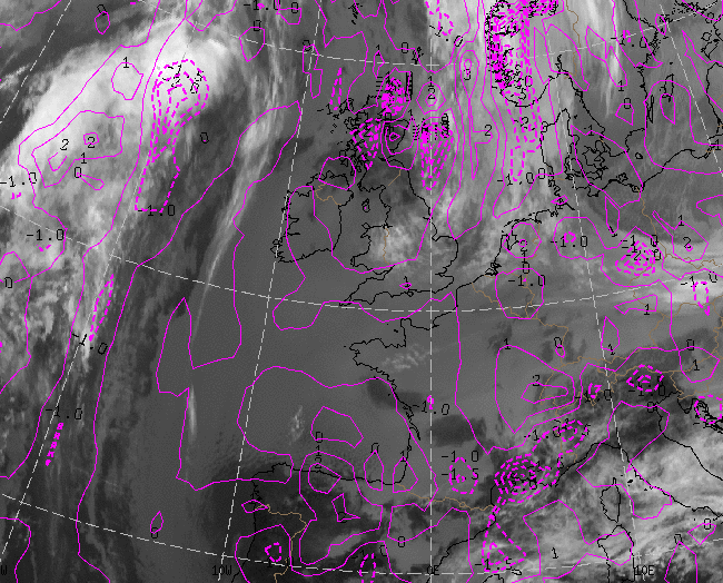
Divergence
|
|
04 February 2006/12.00 UTC - Meteosat 10.8 image; magenta solid: divergence 850 hPa, magenta dashed: convergence 850 hPa
|
|
|
Divergence at 850 hPa is indicative for subsidence in high pressure area.
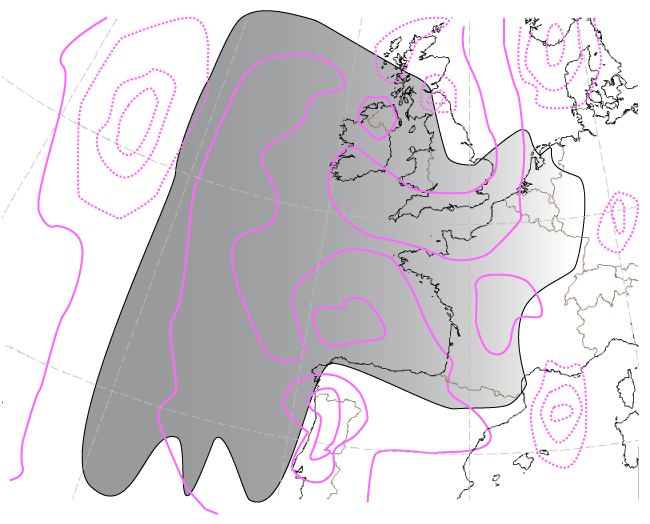
Vertical Velocity (850 hPa)
|
|
04 February 2006/12.00 UTC - Meteosat 10.8 image; yellow dashed: vertical downwards velocity 850 hPa, yellow solid: vertical
upwards velocity 850 hPa
|
|
|
Downward motion at 850 hPa is showing subsidence and is causing an subsidence-inversion beneath moist is trapped and causing Sc clouds.
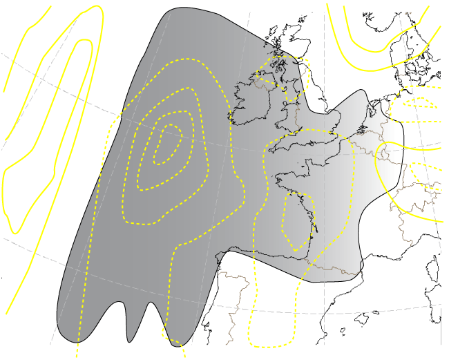
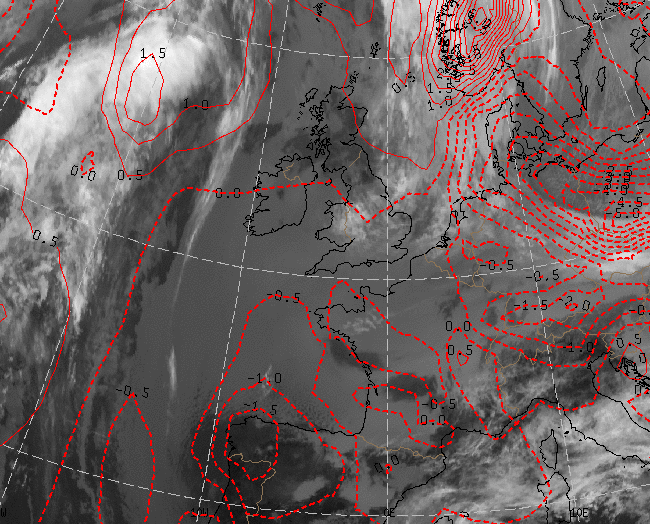
Temperature Advection
|
|
04 February 2006/12.00 UTC - Meteosat 10.8 image; red dashed: temperature advection - CA, red solid: temperature advection - WA
|
|
|
Cold Advection in lower levels is cooling the atmosphere and with moist advection is causing cloud development under an inversion.
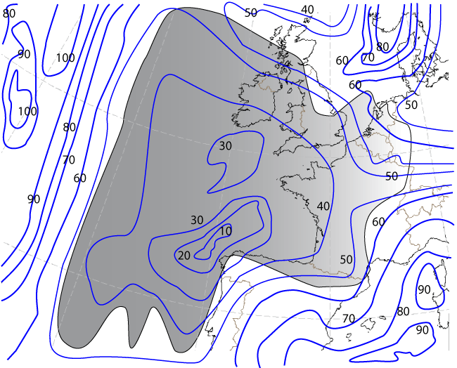
Relative Humidity at 850 and 1000 hPa
|
|
04 February 2006/12.00 UTC - Meteosat 10.8 image; blue: relative humidity 850 hPa
|
|
|
|
|
|
|
04 February 2006/12.00 UTC - Meteosat 10.8 image; blue: relative humidity 1000 hPa
|
Dry air above and moist air below the inversion is indicative for Sc Sheets.
|
|
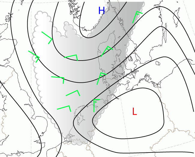
19 January 2010/12.00 UTC - HRVis Surface winds (flags in green) and surface isobars (black)
|
|
|
Wind speed at the surface under the subsidence inversion is in this case of 19 Jan 2010, and quite often in other situations, about 10-15 kts.
|
|
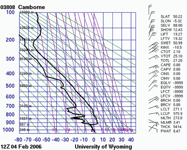
04 February 2006/12.00 UTC - Radio Sounding Camborne
|
|
|
Strong subsidence inversion is shown in the Stüve Sounding diagram of 04 February 2006. Quite clear is seen that moist (SC cloudiness) is trapped under this inversion.
Typical Appearance In Vertical Cross Sections
The dynamics of Sc Sheets differ almost totally from the other conceptual models described in this manual. The absence of traditional aspects, such as PVA, has an appreciable effect on the use of cross sections. Large-scale subsidence and low-level divergence have a destructive effect on baroclinity, at least above the boundary layer. Most of the dynamical processes take place in the lowest 1 - 2 kilometres, the processes themselves being largely radiative or turbulent on the small scale rather than baroclinic on the synoptic scale.
|
|
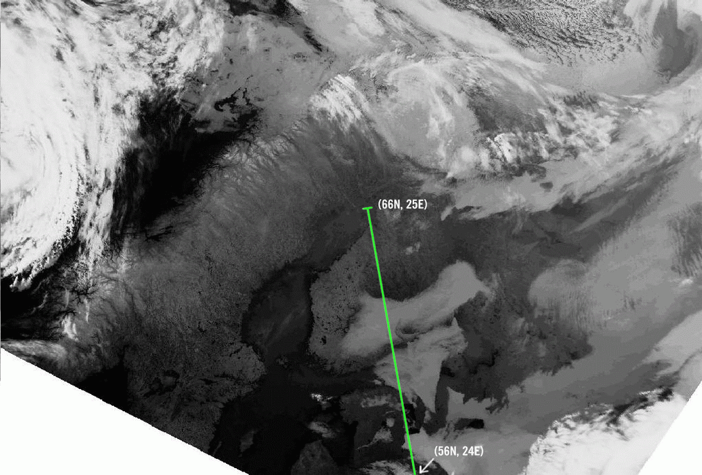
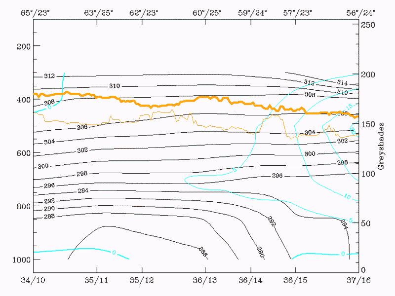
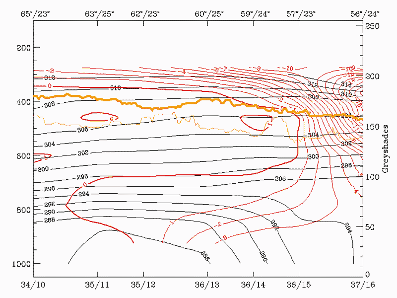
13 May 1998/02.40 UTC - Meteosat IR image; position of vertical cross section indicated
|
|
|
|
|
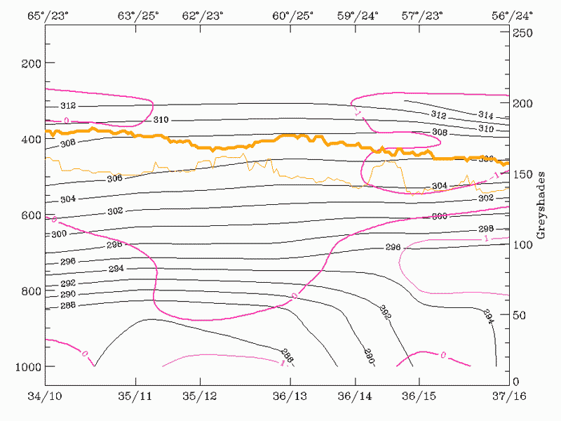
13 May 1998/00.00 UTC - Vertical cross section; black: isentropes (ThetaE), magenta thin: divergence, magenta thick: divergence,
orange thin: IR pixel values, orange thick: WV pixel values
|
|
|
|
|
13 May 1998/00.00 UTC - vertical cross section; black: isentropes (ThetaE), cyan thick: vertical motion (omega) - upward motion,
cyan thin: vertical motion (omega) - downward motion, orange thin: IR pixel values, orange thick: WV pixel values
|
|
|
|
|
13 May 1998/00.00 UTC - Vertical cross section; black: isentropes (ThetaE), red thick: temperature advection - WA, red thin:
temperature advection - CA, orange thin: IR pixel values, orange thick: WV pixel values
|
|
|
The cross sections illustrate the same Nordic Sc Sheet example that was discussed in the chapter on cloud structure in satellite image (see Cloud structure in satellite image ). The cross section covers northern Finland to Latvia, roughly across the area where Sc Sheets were visible in the satellite image.
The divergence field gives very little information, divergence values over the area being negligible.
Almost the same applies to the omega field, even though there are weak positive values over the stratocumulus area, maybe indicating subsidence.
Temperature advection shows more clearly signs for cold advection in low layers (below 700 hPa) with maximum cold advection within the boundary layer. Shallow cold advection results in temperature sounding presented earlier (see Cloud structure in satellite image ).
Weather Events
In the case of no orography, cloudiness in middle and high levels dominates with slight to moderate rain or drizzle
| Parameter | Description |
| Precipitation |
|
| Temperature |
|
| Wind (incl. gusts) |
|
| Other relevant information |
|
|
|
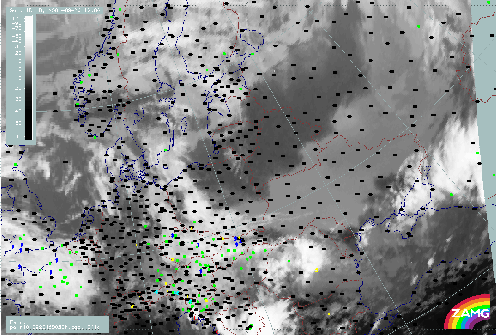
26 September 2001/12.00 UTC - Meteosat IR image; weather events (green: rain and showers, blue: drizzle, cyan: snow, red:
thunderstorm, black: no precipitation)
|
|
|
Example above shows an extensive Sc Sheet north of the Black Sea. No precipitation is observed within the cloud area.
References
General Meteorology and Basics
- STULL, R. B. (1988): Boundary Layer Meteorology. Kluwer Academic Publishers
General Satellite Meteorology
- BADER M. J., FORBES G. S., GRANT J. R., LILLEY R. B. E. and WATERS A. J. (1995): Images in weather forecasting - A practical guide for interpreting satellite and radar imagery; Cambridge University Press
- KARLSSON, K.- G. (1997): Remote Sensing in Meteorology. Swedish Meteorological and Hydrological Institute
Specific Satellite Meteorology
- BENNETS A., MCCALLUM E., NICHOLLS S. and GRANT J.R (1986): Stratocumulus. An introductory account; Met. Mag., Vol. 115, p. 65 - 76
- DUYNKERE P. G. and DRIEDONKS A. G. M. (1987): A model for Turbulent Structure of the Stratocumulus-topped atmospheric Boundary Layer; J. Atmos. Sci., Vol. 44, p. 43 - 64
- NICHOLLS, S. , LEIGHTON, C. (1986): An observational study of the structure of stratiform cloud sheets. Part I: Structure; Quart. J. Roy. Meteor. Soc., Vol. 112, p. 431 - 460