Meteorological Physical Background
The formation of a Secondary Low within an Occluded Front has three prerequisites:
- A distinct maximum of vorticity both shear and curvature components are usually present)
- There is a jet streak on the cyclonic side of the occluded front and parallel to it
- Wind velocities in the jet streak are at least 50 m/s
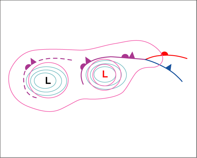
A Secondary Low often forms (in 65% of the cases) within a Neutral Occlusion, that is, the Occlusion is neither warm nor cold (compare Occlusion: Cold Conveyor Belt Type - Meteorological physical background ). In this type a strong jet runs over the Occlusion point. The low forms usually between the Occlusion point and the midpoint of the occluded Front.
Nearly all Secondary Lows form in systems over the sea during the winter season. This follows from the fact that the basic westerly flow is stronger during the winter, and the deepening of a low is easier over the relatively warm water.
Although the secondary lows are associated with strong jets, the processes in the left exit region are involved in less than half of the cases. But if the left exit region is favourably situated in the vicinity of the occluded front, it can enhance the development, as in the case on 07 February 2002.
In the process of the secondary low development there is temporarily a back bent part in the occluded Front. The situation, however, is different from the conceptual model Back - Bent Occlusion (see Back - Bent Occlusion - Meteorological physical background ).
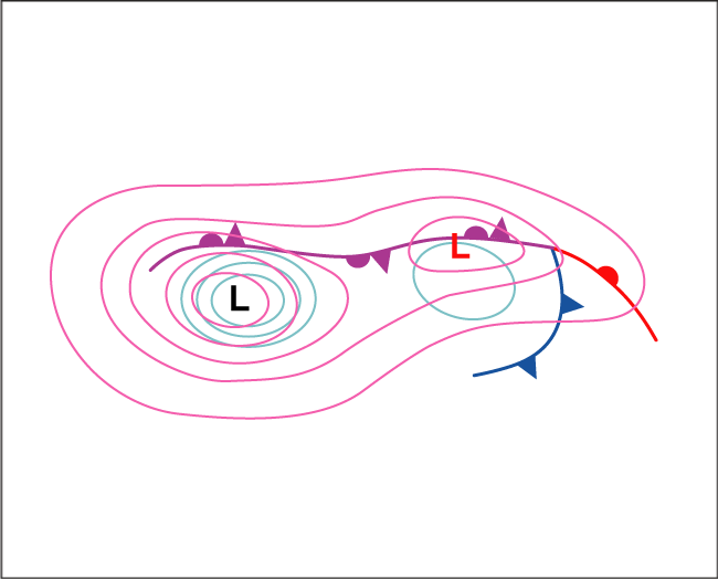
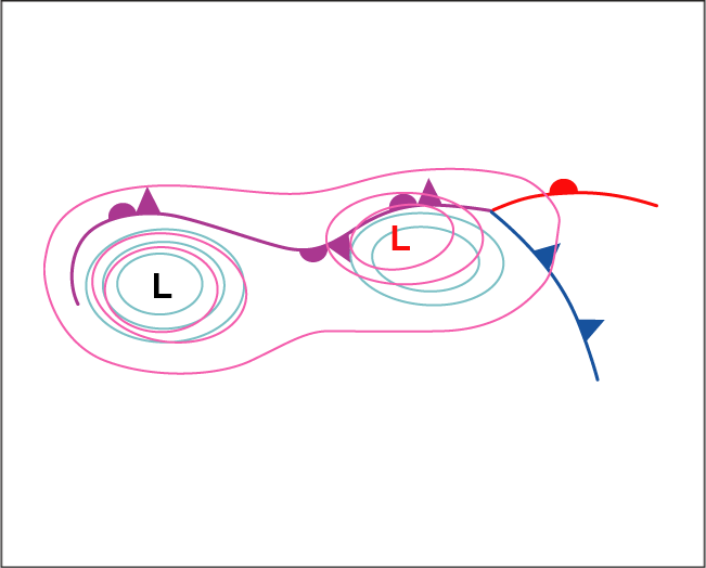
Three stages can be distinguished in the development of a Secondary Low within an occluded front:
- Initial stage A Secondary Low begins to deepen within the occluded front in the area of a local vorticity maximum. The part of the front around the low has a Wave - like structure for a short time (compare Wave ). This Wave does not amplify, however, but turns into an Occlusion spiral.
- Developing stage Whilst the original low fills up, the secondary deepens. At this stage the occluded front with the Secondary Low still moves forward.
- Mature stage The occluded front splits into two parts that spiral around their respective lows. The movement of the Secondary Low slows and it begins to fill up.
The case of 17 of April 2008:
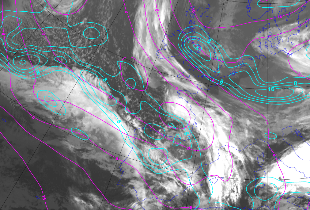
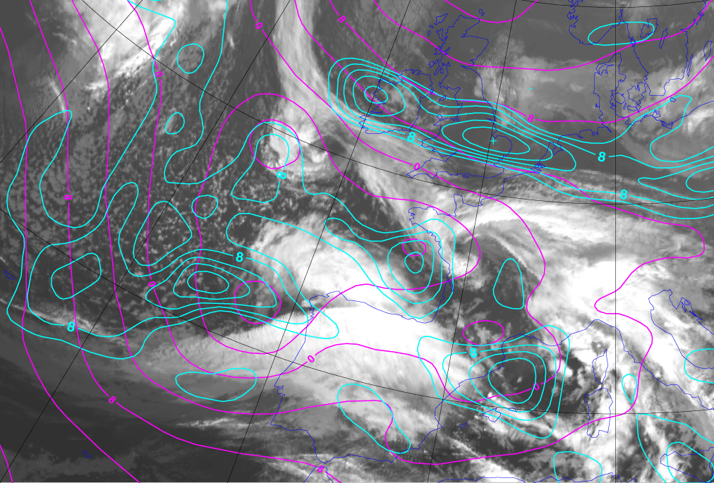
Below, initial stage at 00.00 UTC: There is an area of a local vorticity maximum and thick frontal cloudiness west of France, where the Secondary Low begins to deepen.
|
17 April 2008/06.00 UTC - Meteosat 9 IR image; magenta: height contours 1000 hPa, cyan: relative vorticity 500 hPa
|
|
|
|
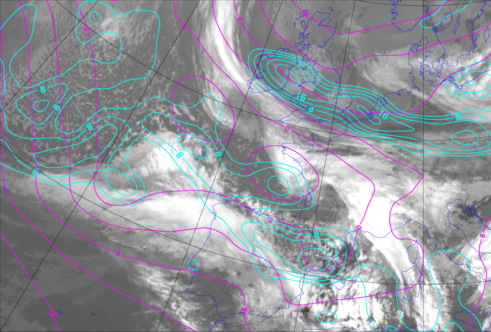
Below, developing stage at 12.00 UTC: A deep low pressure centre lies over the Bay of Biscay.
|
17 April 2008/12.00 UTC - Meteosat 9 IR image; magenta: height contours 1000 hPa, cyan: relative vorticity 500 hPa
|
|
|
|
Below, mature stage on 17 April 2008 at 18.00 UTC: The Secondary Low is over Brittany.
|
17 April 2008/18.00 UTC - Meteosat 9 IR image; magenta: height contours 1000 hPa, cyan: relative vorticity 500 hPa
|
|
|
|