Weather Events
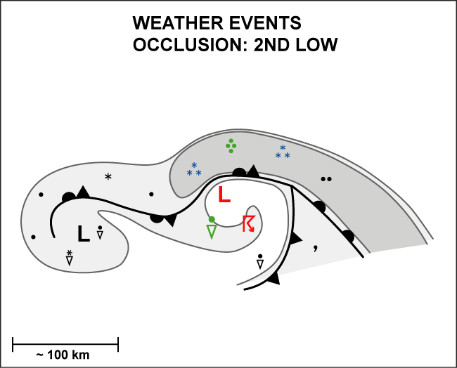
The Secondary Low Centre within an occluded front is accompanied by rain, showers and possibly thunder.
| Parameter | Description |
| Precipitation |
|
| Temperature |
|
| Wind (incl. gusts) |
|
| Other relevant information |
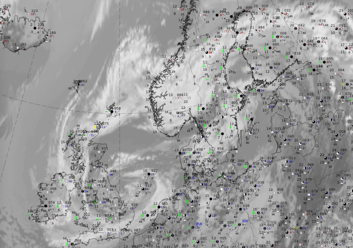
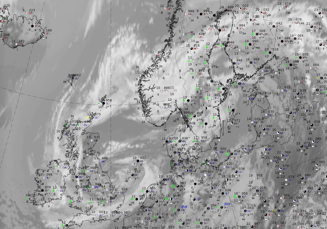
A case on 6 June 2019 at 12 UTC demonstrates the weather features.
|
|
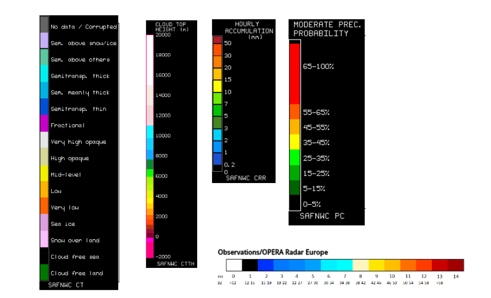
Legend:
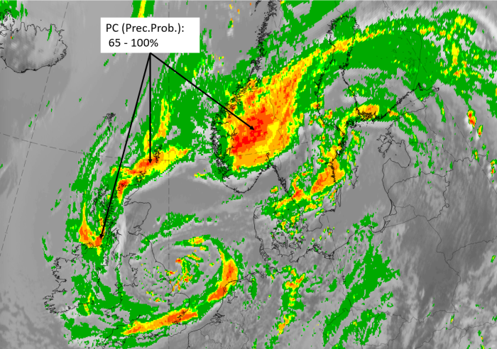
27 September 2019, 12UTC: IR + synoptic measurements (above) + probability of moderate rain (Precipitting clouds PC - NWCSAF).
Note: for a larger SYNOP image click this link.
Synoptic observations of rain and showers occur in the whole band and spiral system but the intensity is clearly higher in the cloud of the Secondary Low system than in that of the older primary low. The precipitation probabilities computed by the NWCSAF are very high in both regions (up to 100%). However, this parameter shows wide areas of these high probabilities in the secondary cloud spiral, with only a few spots in the primary cloud spiral.
|
|
|
|
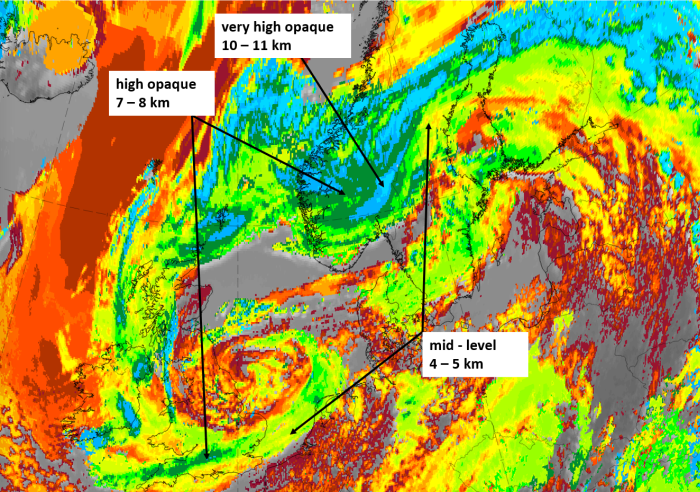
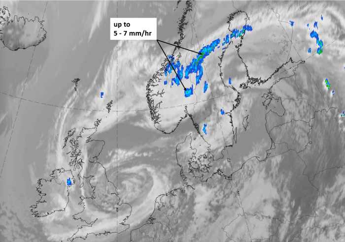
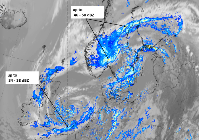
Legend:
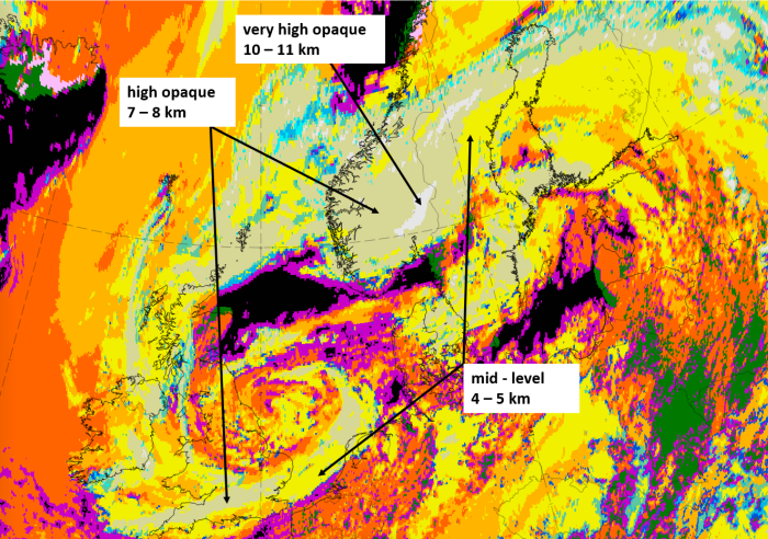
6 June 2020, 12 UTC; IR, with the following fields superimposed:
1st row: Cloud Type (CT NWCSAF) (above) + Cloud Top Height (CTTH - NWCSAF) (below); 2nd row: Convective Rainfall Rate (CRR NWCSAF) (above) + Radar intensities from Opera radar system (below).
For identifying values for Cloud type (CT), Cloud type height (CTTH), precipitating clouds (PC), and Opera radar for any pixel in the images look into the legends. (link)