Cloud Structure In Satellite Images
Secondary Lows appear as a cloud vortex within the frontal cloud band. In this study 23 cases of Secondary Lows within an occluded front were investigated.
The formation of a Secondary Low can be seen in a series of satellite images:
- Initially the cloud thickens, and the whole front seems to be undulating.
- In the development stage, a cloud vortex appears, rotating cyclonically around the Secondary Low.
- In the mature stage there are two separate cloud spirals curling around the lows.
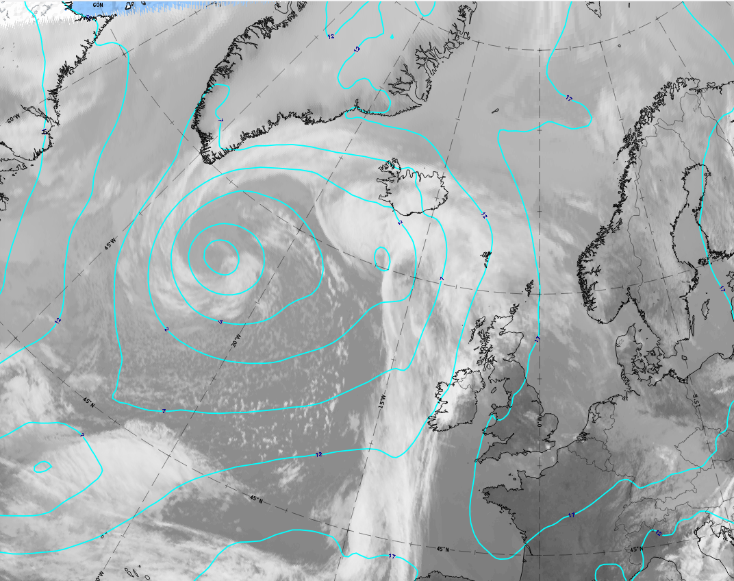
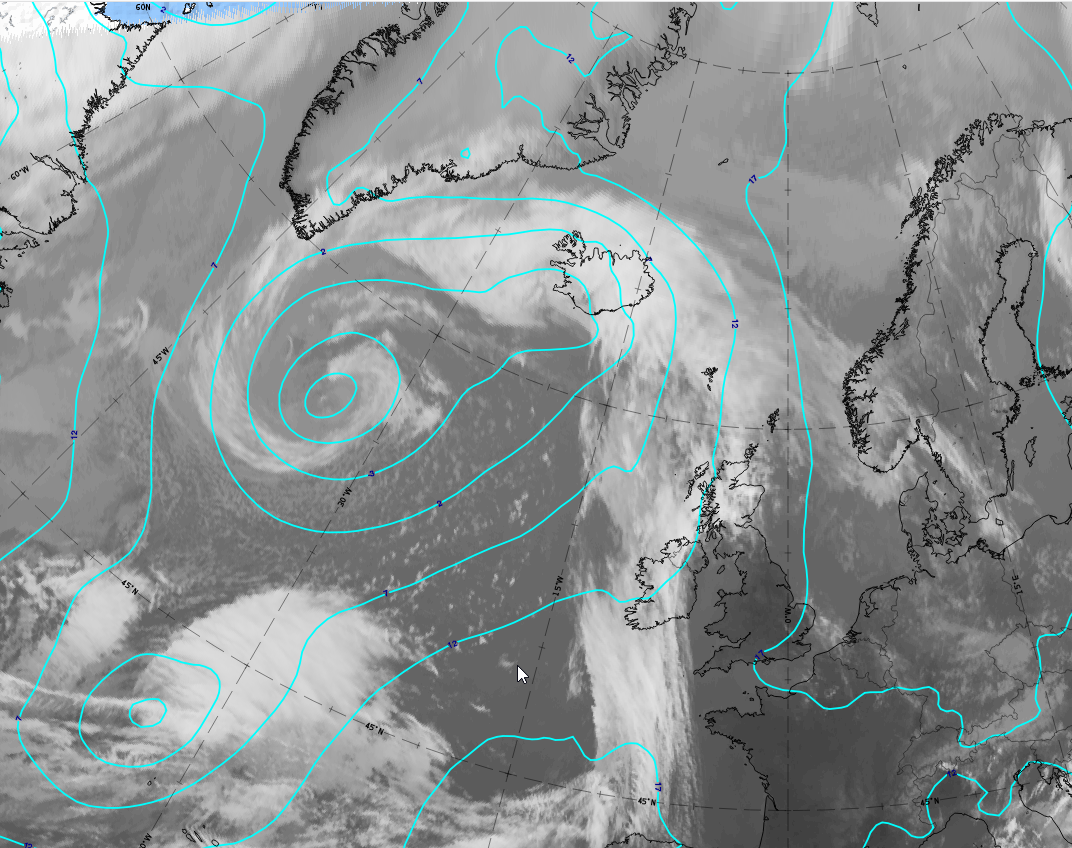
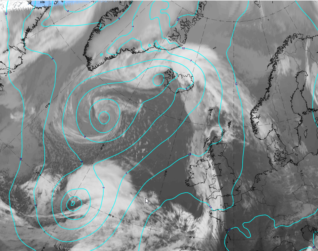
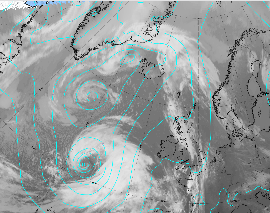
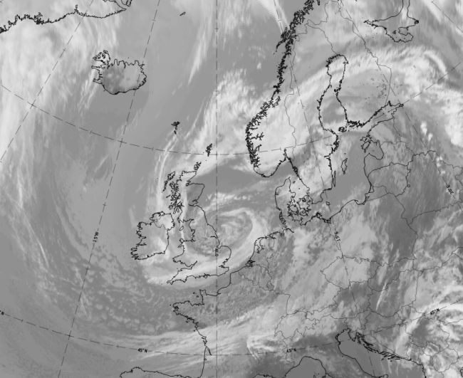
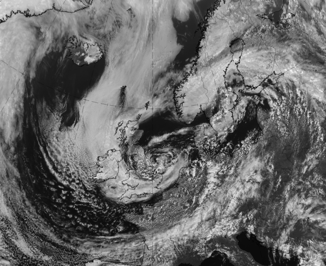
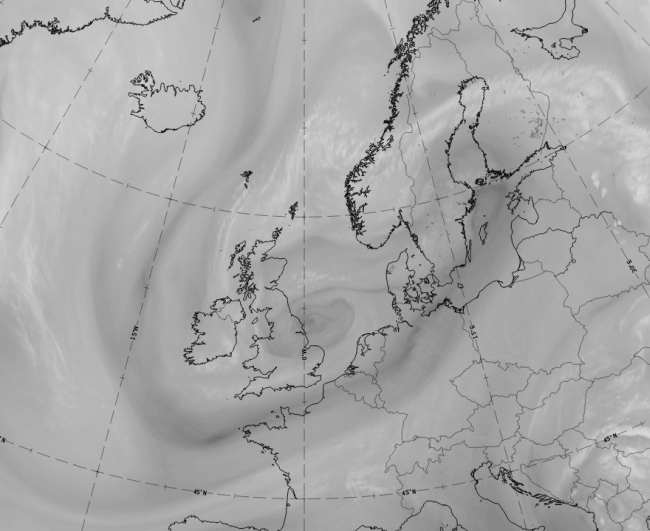
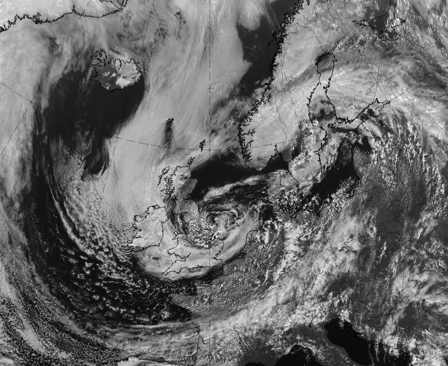
The case of 20 May 2020 includes at 12 UTC a cloud spiral belonging to a large surface low south of Greenland, as well as an area of thicker cloud south-west of Iceland that is connected to a weak surface low. During the next 6 hours a weak spiral structure develops there, which intensifies during the next 12 hours until 6 UTC on 21 May 2020. The mature stage, with two spirals, can be seen from 00 UTC on 21 May 2020 onwards.
 |
 |
 |
 |
Legend:
20 - 21 May 2020: 6 hourly sequence of IR images from 12 UTC on 20 May to 06 UTC on 21 May. Contour lines at 1000 hPa are superimposed in cyan.
*Note: click on the image to access the image gallery (navigate using arrows on keyboard).
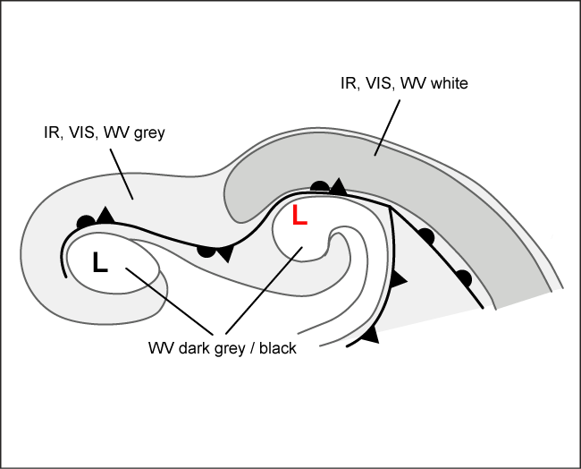
Appearance in the basic channels:
- Visible images are rarely useful, because Secondary Lows within occluded fronts develop mostly over the Northern Atlantic during the winter season, and the daylight time is short. However, if available, the visible or HRV images appear very white in the vicinity of the strengthening second low. During later stages, the old low which is decaying, becomes greyer in the VIS image.
- In infrared images a white to light grey multi-layered cloud spiral develops
- In water vapour images a white to light grey cloud spiral develops around the Secondary Low. Additionally, there is usually a Dark Eye over it, and a Dark Stripe behind the Cold Front and ahead of the Occluded Front.
Appearance in the basic RGBs:
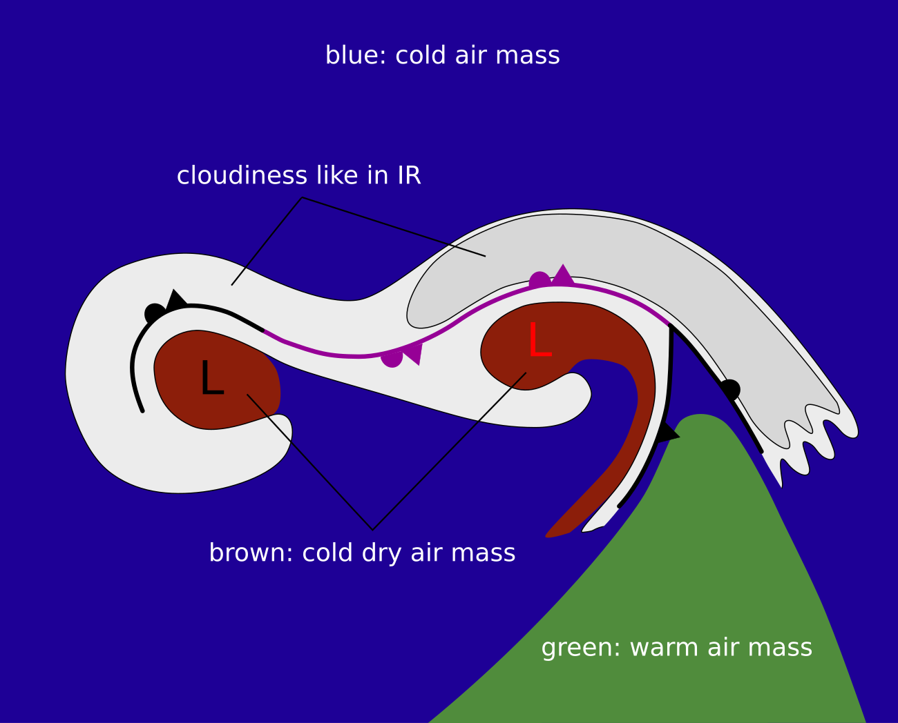
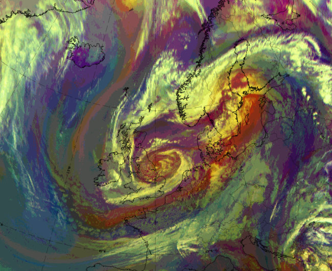
Airmass RGB
The mostly elongated occlusion cloud band, as well as the two embedded cloud spirals, are within an area of blue and dark brown colours, indicating cold and dry airmasses. The cold airmasses in blue are more to the north and north-west of the occlusion cloud system, while the centres of the spirals appear in the dark brown colours of cold and dry air. In most cases the second occlusion spiral centre has more intensive bright colours while the dark brown colour in the primary spiral centre, which is older and filling up, is less intensive. Greenish colours indicate warmer air masses more to the south of the cloud systems.
The cloud bands and spirals look similar to those in the IR image.
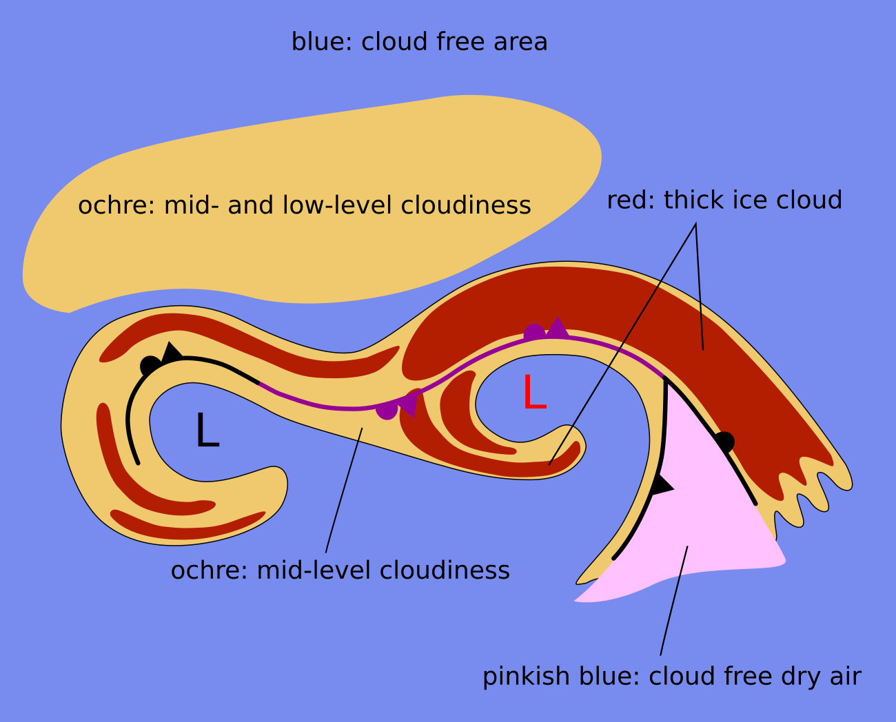
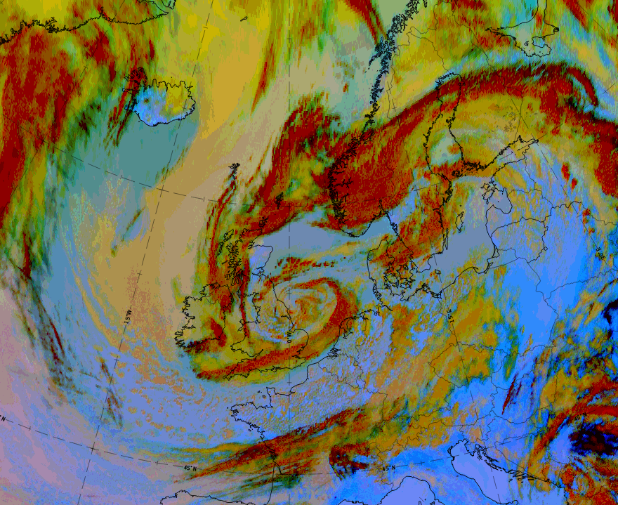
Dust RGB
Cloud systems of an occlusion cloud band and embedded spirals are surrounded by blue colours, where the air is cloud-free. In more northern latitudes there are many ochre-coloured areas, indicating low- to mid-level cloud.
The clouds of this system appear in ochre to dark red colours. Usually, the cloud belonging to the second low is dark red indicating thick ice cloud, there while the primary older cloud spiral looks more ochre with dark red cloud fibres above. It consists mostly of mid-level clouds with remnants of thick ice cloud above.
 |
 |
Legend: basic RGB Schematics.
Left: Airmass RGB; right: Dust RGB.
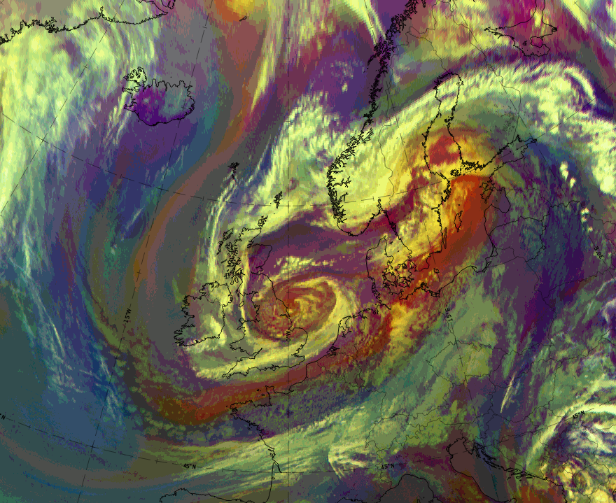
In the case of 6 June 2020 at 12 UTC, the cloud band of an occlusion extends from central Finland across mid-Scandinavia where the spiral of the second low has formed, and further west- and south-westward to the British Isles and into the North Sea where the centre of the primary low spiral is centred.
|
|
|
|
6 June 2020, 12 UTC: 1st row: IR (above) + HRV (below); 2nd row: WV (above) + Airmass RGB (below); 3rd row: Dust RGB + image gallery.
*Note: click on the image to access the image gallery (navigate using arrows on keyboard)
| IR | Bright white within the whole cloud band and the spirals. More fibrous texture in the primary cloud spiral. |
| HRV | Bright white, especially in the eastern part and the secondary cloud spiral. Grey areas in between the two spirals. |
| WV | Dark grey areas in the centres of the two cloud spirals, indicating the sinking dry air. |
| Airmass RGB | Dark brown areas in the centres of the two cloud spirals. More distinct colours in the centre of the Secondary Low; a mixture of dark blue and dark brown colours within the centre of the primary low. This illustrates the life cycle of the two lows, with a developing and a decaying stage |
| Dust RGB | Dark red colours within both cloud spirals. More extended bright areas in the cloud of the Secondary Low, but more fibres in the primary low. Ochre colours indicate the mid-level cloud. |